Items Similar to Original Antique Ptolemaic Map of the Region of Thailand and Malaysia
Want more images or videos?
Request additional images or videos from the seller
1 of 6
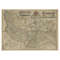
Original Antique Ptolemaic Map of the Region of Thailand and Malaysia
About the Item
Antique map titled 'Tabula Asiae XI'. Based on the interpretations of Solinus and Munster, this Ptolemaic map covers the region roughly of Thailand and Malaysia. An oddly shaped (Malaysian?) peninsula lies to the east of the Ganges River, then the China Sea (Sinus Magnus) and another landmass lies to the east of that. This depiction embodies the legacy of Ptolemy's idea of a landlocked Indian Ocean.
This map originates from 'Geografia Di Clavdio Tolomeo Alessandrino, Tradotta di Greco nell'Idioma Volgare Italiano Da Girolamo Rvscelli, Et hora nuouamente ampliata Da Gioseffo Rosaccio ... Et vna Geografia vniuersale del medesimo, seperata da quella di Tolomeo ... Et vna breue Descrittione di tutta la Terra, distinta in quattro Libri (..)', Appresso gli Heredi di Melchior Sessa, 1599.
- Dimensions:Height: 9.53 in (24.2 cm)Width: 13.71 in (34.8 cm)Depth: 0.02 in (0.5 mm)
- Materials and Techniques:
- Period:
- Date of Manufacture:1599
- Condition:Wear consistent with age and use. General age-related toning, original folding line. Minor wear and soiling. Later hand coloring. Italian text on verso. Please study image carefully.
- Seller Location:Langweer, NL
- Reference Number:
About the Seller
5.0
Platinum Seller
These expertly vetted sellers are 1stDibs' most experienced sellers and are rated highest by our customers.
Established in 2009
1stDibs seller since 2017
1,928 sales on 1stDibs
Typical response time: <1 hour
- ShippingRetrieving quote...Ships From: Langweer, Netherlands
- Return PolicyA return for this item may be initiated within 14 days of delivery.
More From This SellerView All
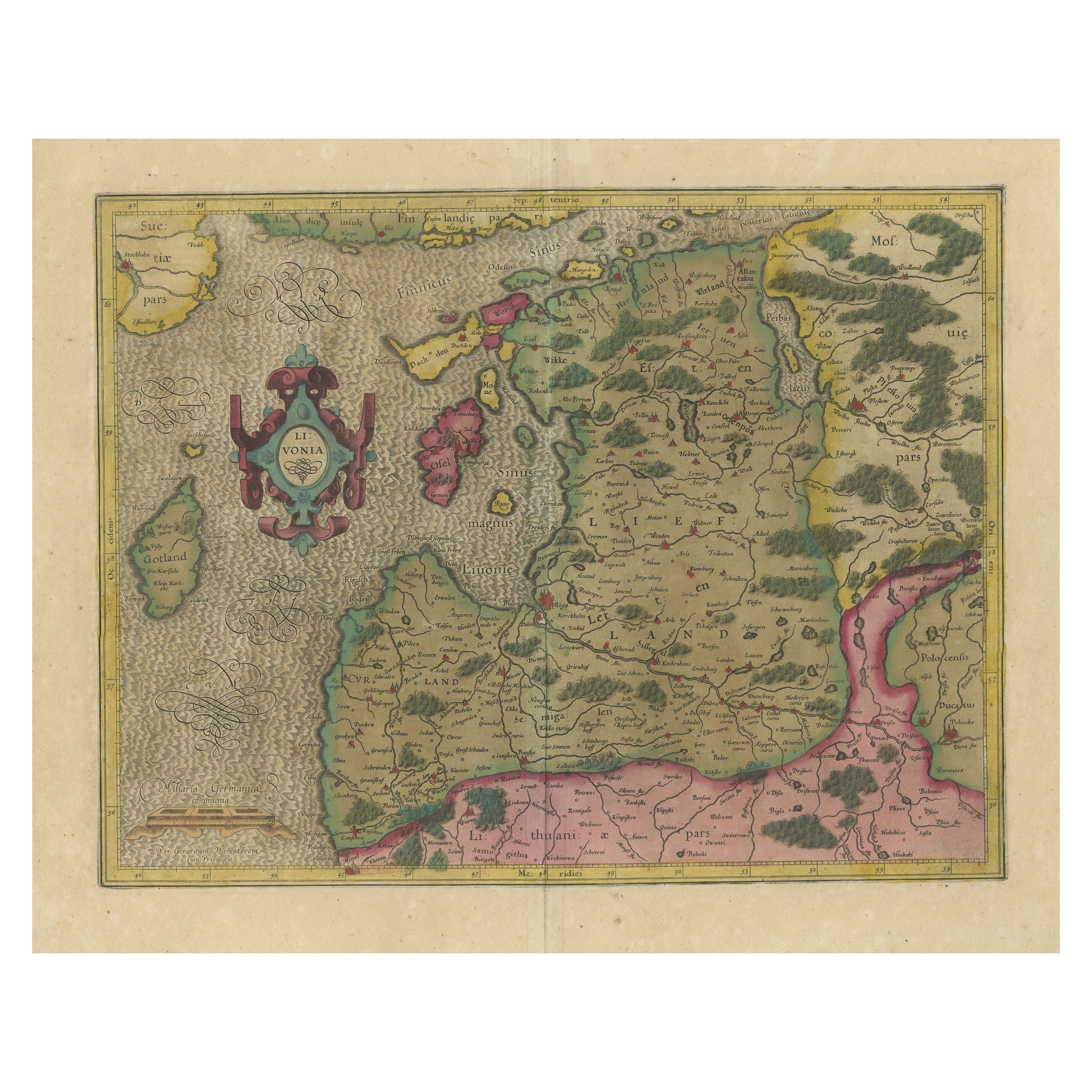
- Original Antique Map of the Northern Baltic RegionLocated in Langweer, NLTitle: "Livonia: Antique Map of the Northern Baltic Region" Description: This antique map, titled "Livonia," is a detailed representation of the northern Baltic region. Centered on ...Category
Antique Early 17th Century Maps
MaterialsPaper
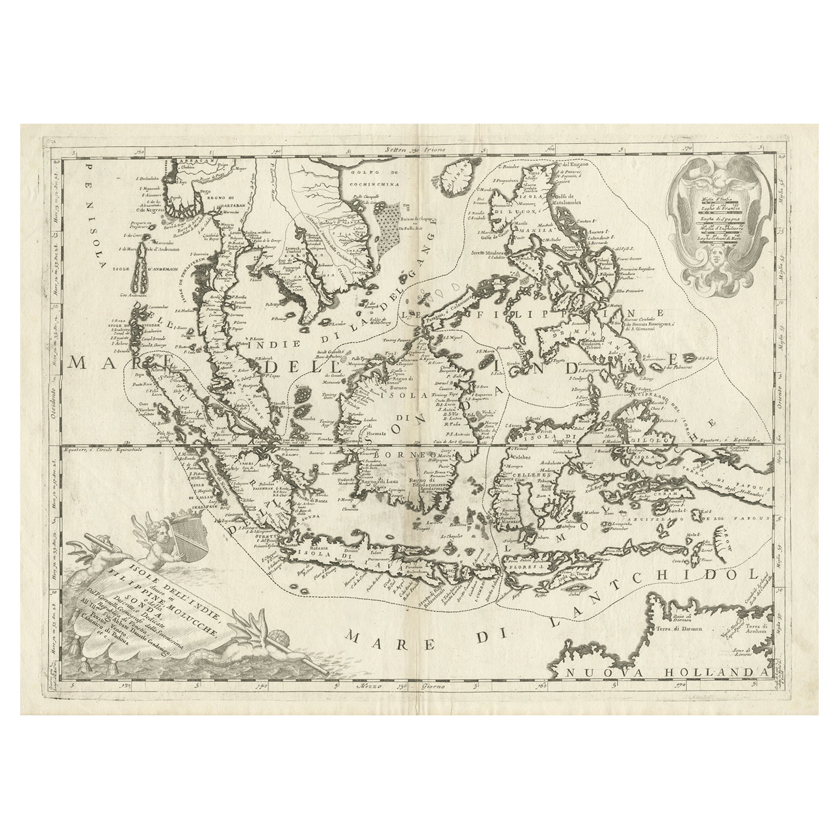
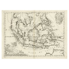
- Original Antique Map of the Philippines, Malaysia, Indonesia, Singapore, c.1690Located in Langweer, NLAntique map titled 'Isole dell' Indie, diuise in Filippine, Molucche e della Sonda'. Old map of the Philippines, Malaysia, Indonesia, Singapore, Northern Australia and contiguous i...Category
Antique 1690s Maps
MaterialsPaper
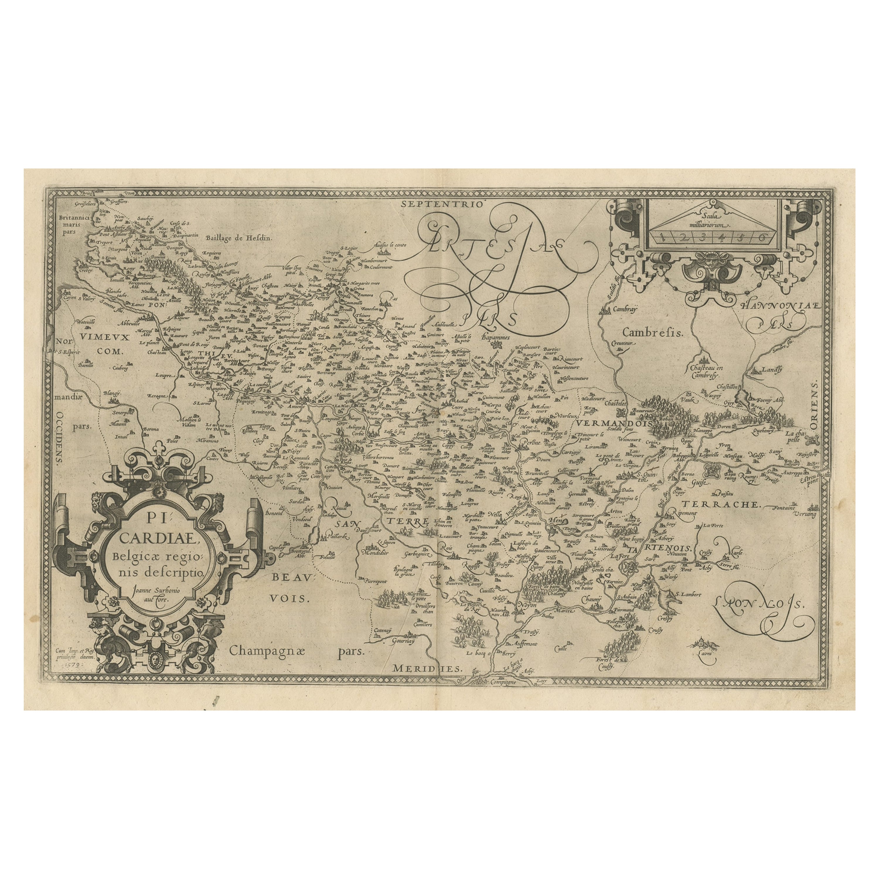
- Original Antique Map of the Region of Picardy, France, ca.1602Located in Langweer, NLAntique map titled 'Picardiae Belgicae regionis descriptio'. Original antique map of the region of Picardy, France. Superb example of the decorative style of Ortelius and filled ...Category
Antique Early 1600s Maps
MaterialsPaper
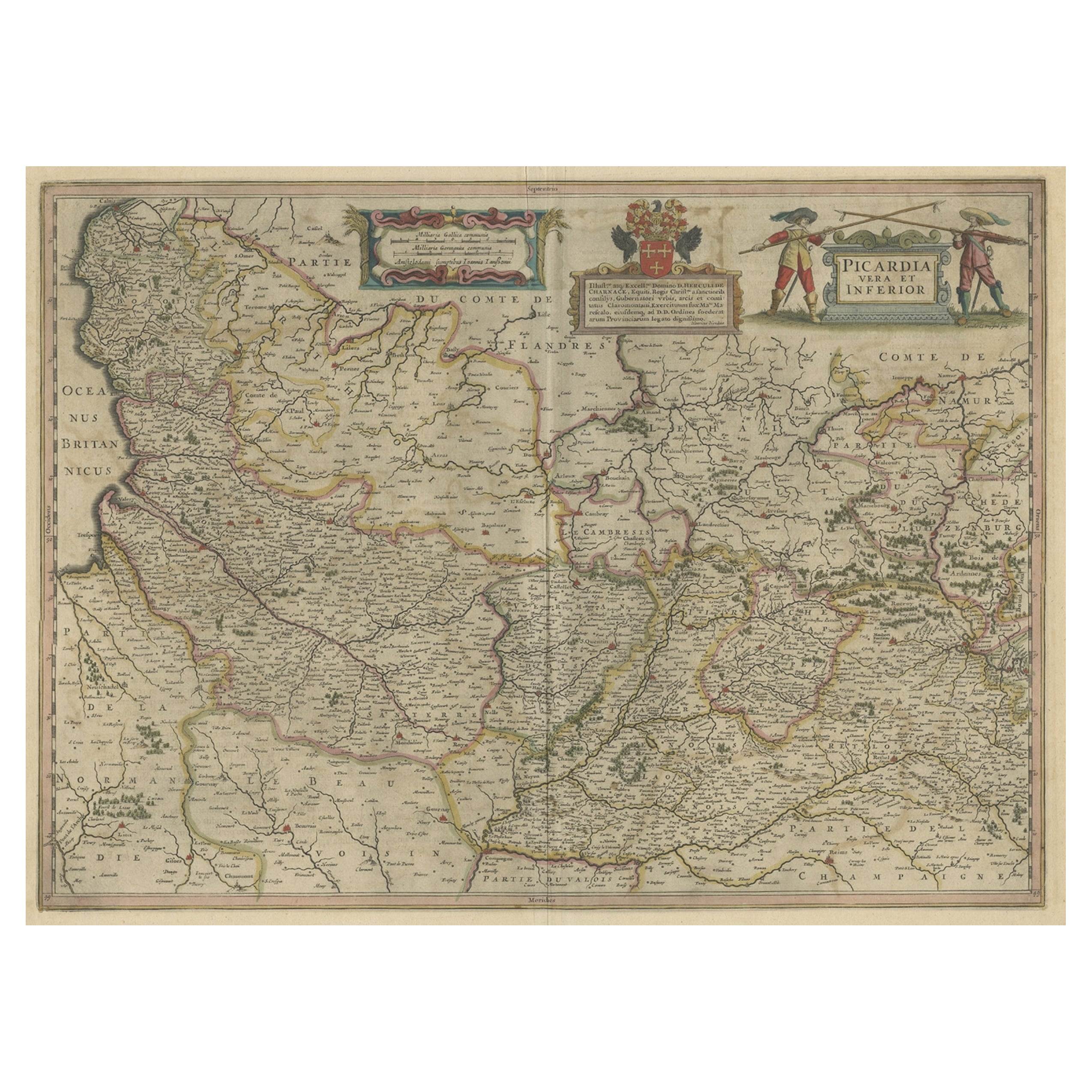
- Detailed Original Antique Map of the Picardy Region of France, 1657Located in Langweer, NLAntique map of France titled 'Picardia vera et inferior'. Detailed map of the Picardy region of France. This map originates from 'Atlas Novus, Sive Theatrum Orbis Orbis Terrarum:...Category
Antique 1650s Maps
MaterialsPaper
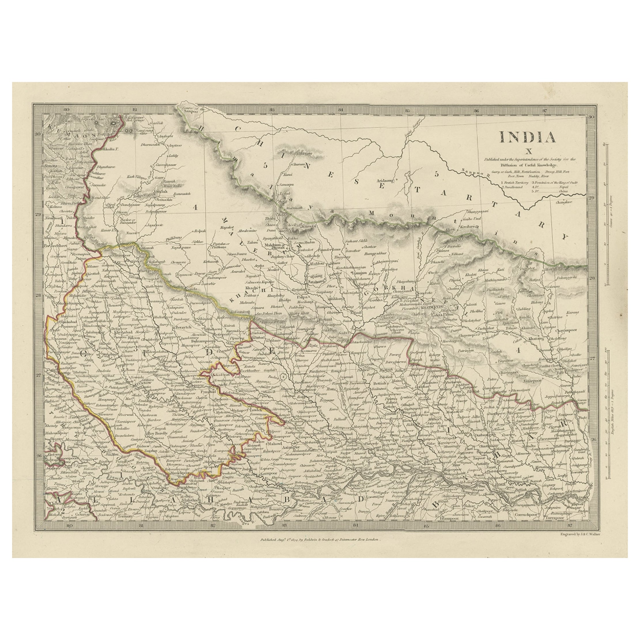
- Original Antique Map of Part of the Bahar Region (India), 1834Located in Langweer, NLAntique map titled 'India X'. Old steel engraved map of part of the Bahar region, it also shows part of Nepal. Artists and Engravers: Engraved by J. & C. Walker. Published under th...Category
Antique 19th Century Maps
MaterialsPaper
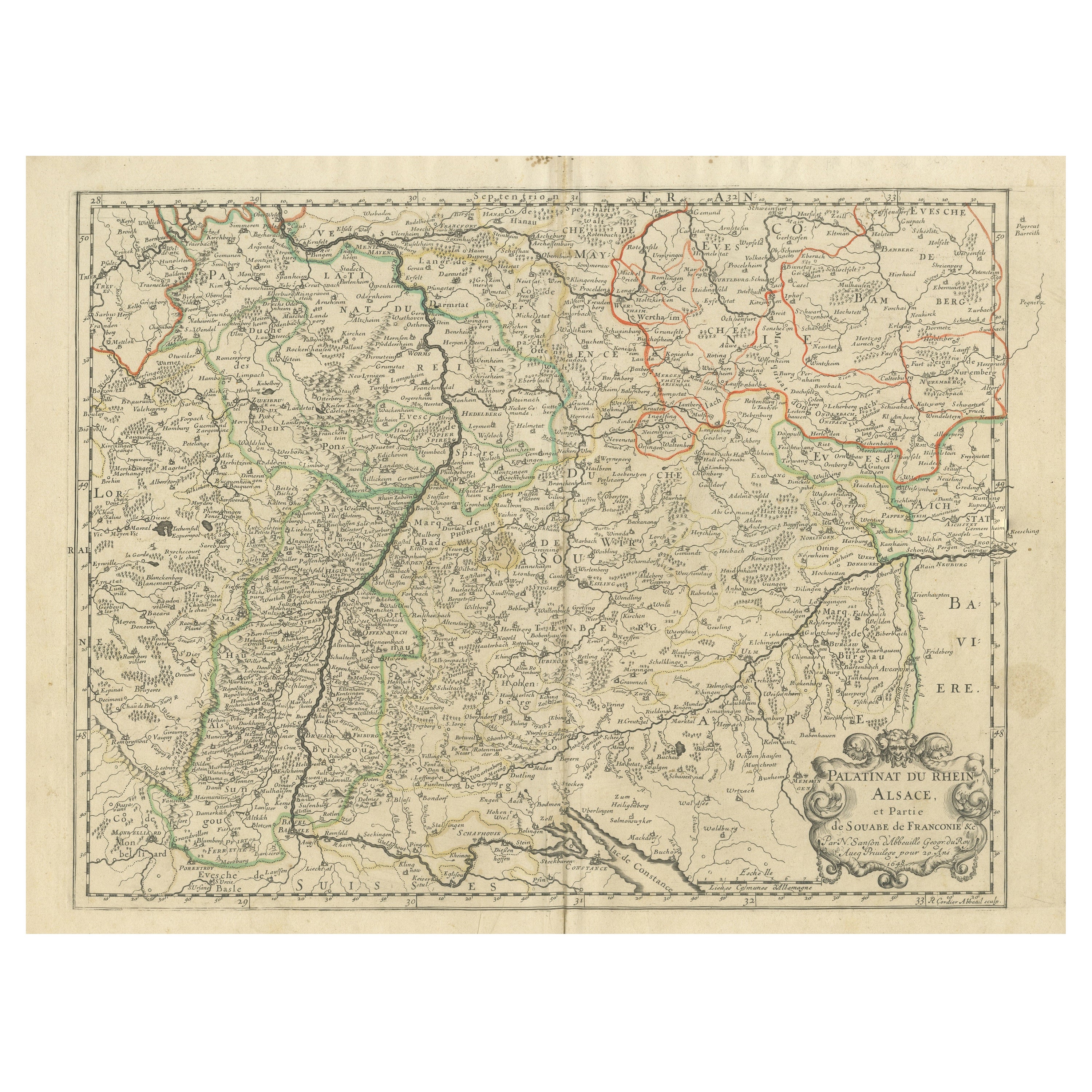
- Antique Map of the Rhineland and Alsace Region with Original Hand ColoringLocated in Langweer, NLAntique map titled 'Palitinat du Rhein, Alsace, et partie de Souabe de Franconie (..)'. Double-page engraved map of the Rhineland and Alsace with original/contemporary hand coloring....Category
Antique Mid-17th Century Maps
MaterialsPaper


You May Also Like
- Original Antique Map of Italy. C.1780Located in St Annes, LancashireGreat map of Italy Copper-plate engraving Published C.1780 Unframed.Category
Antique Early 1800s English Georgian Maps
MaterialsPaper

- Original Antique Map of Asia. C.1780Located in St Annes, LancashireGreat map of Asia Copper-plate engraving Published C.1780 Two small worm holes to right side of map Unframed.Category
Antique Early 1800s English Georgian Maps
MaterialsPaper

- Original Antique Map of India. C.1780Located in St Annes, LancashireGreat map of India Copper-plate engraving Published C.1780 Three small worm holes to right side of map and one bottom left corner Unframed.Category
Antique Early 1800s English Georgian Maps
MaterialsPaper

- Original Antique Map of The World by Thomas Clerk, 1817Located in St Annes, LancashireGreat map of The Eastern and Western Hemispheres On 2 sheets Copper-plate engraving Drawn and engraved by Thomas Clerk, Edinburgh. Published by Mackenzie And Dent, 1817 ...Category
Antique 1810s English Maps
MaterialsPaper
- The Normandy Region of France: A 17th C. Hand-colored Map by Sanson and JaillotBy Nicolas SansonLocated in Alamo, CAThis large hand-colored map entitled "Le Duché et Gouvernement de Normandie divisée en Haute et Basse Normandie en divers Pays; et par evêchez, avec le Gouvernement General du Havre ...Category
Antique 1690s French Maps
MaterialsPaper
- Original Antique Map of Spain and Portugal, circa 1790Located in St Annes, LancashireSuper map of Spain and Portugal Copper plate engraving by A. Bell Published, circa 1790. Unframed.Category
Antique 1790s English Other Maps
MaterialsPaper


Recently Viewed
View AllMore Ways To Browse
Antique Legacy
East Indian Antique
Legacy Antiques
Antique Chinese 16th
16th Century Chinese Antiques
Antique Furniture Malaysia
Malaysian Antique Furniture
Malaysian Antique
Thailand Map
Tolomeo Used
Ptolemy Map
Indian Ocean Antique Map
Malaysian Map
Antique Chinese Furniture Malaysia
Antique Map Of Thailand
Antique Thailand Map
Malaysia Map
Antique Map Munster