Indian Ocean Antique Map

to
15
52
24
48
34
21
14
12
11
7
7
7
6
4
4
3
3
3
3
3
2
2
2
2
1
1
1
1
1
1
1
1
1
3
2
1
1
1
Sort By
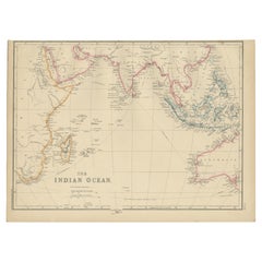
Antique Map of the Indian Ocean by W. G. Blackie, 1859
Located in Langweer, NL
Antique map titled 'The Indian Ocean'. Original antique map of the Indian Ocean. This map
Category

Mid-19th Century Indian Ocean Antique Map

Materials

Paper

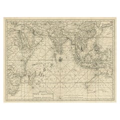
Antique Map of South East Asia, Australia and the Indian Ocean, 1726
By F. Valentijn
Located in Langweer, NL
Asia and the Indian Ocean. The map features a fine depiction of the outlines of the western two-thirds
Category

Mid-18th Century Dutch Indian Ocean Antique Map

Materials

Paper

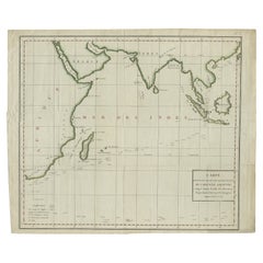
Antique Map of Southeast Asia and the Indian Ocean by Valentijn, 1726
By Thomas Kitchin
Located in Langweer, NL
and the Indian Ocean. The map features a fine depiction of the outlines of the western two-thirds of
Category

18th Century Indian Ocean Antique Map

Materials

Paper

Old Map of Indian Ocean & Sumatra, Java, Borneo, India, Arabia, Africa, c.1783
Located in Langweer, NL
map depicting the Indian Ocean and surroundings including Sumatra, Java, Borneo, India, Arabia, Africa
Category

1780s Indian Ocean Antique Map

Materials

Paper

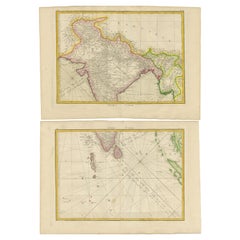
Charting the Course of Empire: Bonne's 1770 Masterpiece Maps of the Indian Ocean
Located in Langweer, NL
of land and sea across the Indian subcontinent and its surrounding waters. These are not mere maps
Category

1770s Indian Ocean Antique Map

Materials

Paper

Antique Map of Southern Asia, the East Indies and the Indian Ocean, ca.1840
Located in Langweer, NL
Original antique map of Southern Asia, the East Indies and the Indian Ocean. Also shows part of
Category

1840s Indian Ocean Antique Map

Materials

Paper

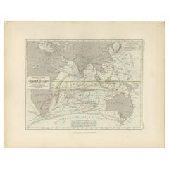
Antique Physical Chart of the Indian Ocean by Johnston '1850'
Located in Langweer, NL
Antique map titled 'Physical Chart of the Indian Ocean showing the temperature of the water
Category

Mid-19th Century Indian Ocean Antique Map

Materials

Paper

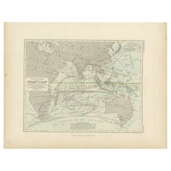
Antique Physical Chart of the Indian Ocean by Johnston, 1850
Located in Langweer, NL
Antique map titled 'Physical Chart of the Indian Ocean'. This map shows the temperature of the
Category

19th Century Indian Ocean Antique Map

Materials

Paper

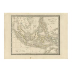
Antique Map of the East Indies by Wyld '1845'
Located in Langweer, NL
Antique map titled 'Archipelago of the Indian Ocean'. Original antique map of the East Indies. This
Category

Mid-19th Century Indian Ocean Antique Map

Materials

Paper

Antique Map of the East Indies by Wyld '1845'
H 10.24 in W 14.18 in D 0.02 in
Antique Map of the East Indies by Moll '1745'
Located in Langweer, NL
, Moluca and Sunda Islands'. Detailed map of the Indian Ocean, Southeast Asia, China, Formosa, the
Category

Mid-18th Century Indian Ocean Antique Map

Materials

Paper

Antique Map of the East Indies by Moll '1745'
H 13.98 in W 16.93 in D 0.02 in
Antique Map of Bourbon, or Reunion, Colony of France
Located in Langweer, NL
one of France's few remaining colonies in the Indian Ocean. Reunion is known for its striking natural
Category

Mid-19th Century Indian Ocean Antique Map

Materials

Paper

Antique Map of the Empire of the Great Mogul
Located in Langweer, NL
beasts, including lions, tigers and elephants roam the interior, while a ship sails in the Indian Ocean
Category

Late 17th Century Indian Ocean Antique Map

Materials

Paper

Antique Map of the Empire of the Great Mogul
H 22.17 in W 25.79 in D 0.2 in
Antique Map of Southeast Asia by Walker, c.1845
Located in Langweer, NL
regions. Also depicts a large part of the Indian Ocean. Artists and Engravers: Engraved by J. & C. Walker
Category

19th Century Indian Ocean Antique Map

Materials

Paper

Antique Map of Southern Asia by Walker, c.1840
Located in Langweer, NL
"Original antique map of Southern Asia, the East Indies and the Indian Ocean. Also shows part of
Category

19th Century Indian Ocean Antique Map

Materials

Paper

Antique Map of Bourbon/Reunion 'France' by V. Levasseur, 1854
By Victor Levasseur
Located in Langweer, NL
colonies in the Indian Ocean. Reunion is known for its striking natural beauty and marvelous beaches. The
Category

Mid-19th Century Indian Ocean Antique Map

Materials

Paper

Antique Map of the Middle East with a Large Arabia, 1799
Located in Langweer, NL
Arabia, extending from the Black Sea to the Indian Ocean and from the Red Sea to Persia and Iraq. Small
Category

Late 18th Century Indian Ocean Antique Map

Materials

Paper

Antique Map of the Middle East with a Large Arabia, 1799
Free Shipping
H 11.03 in W 15.63 in D 0.02 in
New Map of North America from the Latest Discoveries, 1763
Located in Philadelphia, PA
A fine antique 18th century map of the North American seaboard. Entitled "A New Map of North
Category

Mid-18th Century English Georgian Indian Ocean Antique Map

Materials

Paper

Original Antique Ptolemaic Map of the Region of Thailand and Malaysia
Located in Langweer, NL
the east of that. This depiction embodies the legacy of Ptolemy's idea of a landlocked Indian Ocean
Category

16th Century Indian Ocean Antique Map

Materials

Paper

Beautiful Antique Map of Madagascar, The Comoros Islands & Reunion Island, 1667
Located in Langweer, NL
representing some natives, a compass rose and a vessel in the Indian Ocean. Artists and engravers: Pierre
Category

1660s Indian Ocean Antique Map

Materials

Paper

Antique Map of the Island Anjouan by Van Schley, c.1750
Located in Langweer, NL
Anjouan, part of the Comoros in the Indian Ocean by Nicolas Bellin. Source unknown, to be determined
Category

18th Century Indian Ocean Antique Map

Materials

Paper

Antique Map of the Middle East by Brion de la Tour '1772'
Located in Langweer, NL
, extending to the Red Sea, Egypt, the Eastern Mediterranean, Black Sea, Caspian Sea and the Indian Ocean
Category

Late 18th Century Indian Ocean Antique Map

Materials

Paper

Antique Map of Anjouan or Ndzuani, Island of The Comoros, 1748
Located in Langweer, NL
Ndzuwani or Nzwani, or, historically, as Johanna, an autonomous island in the Indian Ocean that forms part
Category

18th Century Indian Ocean Antique Map

Materials

Paper

Antique Map of the Bay of Bengal Printed for Robert Sayer, 1787
Located in Langweer, NL
the Bay of Bengal. The Bay of Bengal is the northeastern part of the Indian Ocean, bounded on the west
Category

Late 18th Century Indian Ocean Antique Map

Materials

Paper

Detailed Original Antique Map of the Turkish Empire with Arabia, 1778
Located in Langweer, NL
, Usbekistan, The Indian Ocean, Saudi Arabia, Egypt and the Red Sea. Large decorative cartouche. Didier
Category

1770s Indian Ocean Antique Map

Materials

Paper

Antique Map of Anjouan or Ndzuani Island, Part of The Comoros, 1749
Located in Langweer, NL
the Indian Ocean that forms part of the Union of the Comoros. This map originates from 'Historische
Category

18th Century Indian Ocean Antique Map

Materials

Paper

Antique Map of Africa with a Decorative Dedication to the Dauphin, 1717
Located in Langweer, NL
characteristic thickened west coast. Unusual islands appear in the Atlantic and Indian Oceans including a
Category

18th Century Indian Ocean Antique Map

Materials

Paper

Antique Map of Asia, Showing Tradewinds, Silke Route Cities Etc, c.1780
Located in Langweer, NL
the tradewinds in the Pacific and Indian Oceans as well as numerous Silk Route cities in Central Asia
Category

18th Century Indian Ocean Antique Map

Materials

Paper

1863 "Lloyd's New Map of the United States, the Canadas, and New Brunswick"
Located in Colorado Springs, CO
, "Indian Territory," and Texas. The southern continuation of Florida is shown in an inset map along the
Category

1860s American Indian Ocean Antique Map

Materials

Linen, Wood, Paper

Antique Map of Southern Asia with India, the Maldives, Ceylon and Arabia, c.1700
Located in Langweer, NL
Siam, Mataban, Pegu, and, to the north, Grant Thibet. Beautiful antique map of the Indian Ocean
Category

Early 18th Century Indian Ocean Antique Map

Materials

Paper

Wonderful Small Map of the Coasts of Arabia, Persia and Western India, ca. 1710
Located in Langweer, NL
Indian Ocean is filled with a lovely title cartouche that features European merchants trading with Arabs
Category

Early 18th Century European Indian Ocean Antique Map

Materials

Paper

Antique Map of Mozambique and Cape of Good Hope with Kingdom Monomotapa, 1780
Located in Langweer, NL
Malawi appears with no defined northern terminus. Offshore Madagascar and the many Indian Ocean islands
Category

18th Century Indian Ocean Antique Map

Materials

Paper

Old Map of Ancient Times covering Egypt Towards Arabia and India to Java, c.1660
Located in Langweer, NL
nunc vero ab abrah ortelio ex eodem delineatus'. Map of the Indian Ocean, or Erythraean Sea, as it was
Category

1660s Indian Ocean Antique Map

Materials

Paper

1879 "United States of America, Western Part" by O. J. Stuart
Located in Colorado Springs, CO
This colorful original map, titled “United States of America, Western Part,” was issued in Volume
Category

1870s American Indian Ocean Antique Map

Materials

Paper

Colonial Crossroads: Angola and Mozambique in 1903
Located in Langweer, NL
significance dating back to the era of Arab trade in the Indian Ocean. Both countries have complex histories
Category

Early 1900s Indian Ocean Antique Map

Materials

Paper

Colonial Crossroads: Angola and Mozambique in 1903
Free Shipping
H 14.77 in W 20.08 in D 0 in
Antique Engraving of the Island Nzwani or Anzuany of the Comoros Islands, 1726
Located in Langweer, NL
Anjouan: It is an autonomous volcanic island in the Comoro Islands in the southwestern Indian Ocean, part
Category

1720s Indian Ocean Antique Map

Materials

Paper

Antique Chart of the Straits of Makassar, Indonesia with Borneo and Celebes-1820
Located in Langweer, NL
Good Hope, Isle of France, Indian Ocean, Bay of Bengal, East Indies, China, New Holland &c." These
Category

1820s Indian Ocean Antique Map

Materials

Paper

Print of Commander Laplace Received by a Cochinchinese Mandarin, c.1830
Located in Langweer, NL
thoroughly explore the Indian Ocean and the route to the Indies via the Strait of Malacca, between Sumatra
Category

1830s Indian Ocean Antique Map

Materials

Paper

Map Tabula Asiae IX Pakistan Afghanistan Iran Indian Ocean
Located in Florham Park, NJ
edition. The work was illustrated with 64 double page engraved maps. Twenty-seven were Ptolemaic and
Category

16th Century Realist Indian Ocean Antique Map

Materials

Copper

Antique Map of Kerguelens Island Coast in the Indian Ocean by Cook, 1785
By James Cook
Located in Langweer, NL
Antique print titled 'Kerguelen's Land (..)'. Antique map of Kerguelens island coast, known today
Category

18th Century Indian Ocean Antique Map

Materials

Paper

Antique Print of Amsterdam Island in the Indian Ocean by Valentijn, 1726
Located in Langweer, NL
boats and peoples of Amsterdam Island in the Indian Ocean. Dutch (V.O.C.) sailing ships and various
Category

18th Century Indian Ocean Antique Map

Materials

Paper

Cemetery on Amsterdam Island, French Territory in the Indian Ocean, ca.1785
Located in Langweer, NL
on Amsterdam Island, a small French territory in the southern Indian Ocean. Originates from 'Reizen
Category

1780s Indian Ocean Antique Map

Materials

Paper

Map of the World: An Original 18th Century Hand-colored Map by E. Bowen
Located in Alamo, CA
, Pacific, and Indian Oceans. The map is laid out according to the Mercator projection, a type of
Category

Mid-18th Century Old Masters Indian Ocean Antique Map

Materials

Engraving

Map of the East Indies: An Original 18th Century Hand-colored Map by E. Bowen
Located in Alamo, CA
features the monthly direction of the trade winds in the Indian Ocean, the Bay of Bengal and South China
Category

Mid-18th Century Old Masters Indian Ocean Antique Map

Materials

Engraving

Persiae, Armeniae, Natoliae et Arabiae Descriptio per Frederick deWit 1666 map
Located in Paonia, CO
Indian Ocean. Unlike in many antique maps of the area, a great amount of geographic information is shown
Category

1660s Realist Indian Ocean Antique Map

Materials

Engraving

Persia & Afghanistan: A Framed Hand-colored 17th Century Map by John Cary
By John Cary
Located in Alamo, CA
and the northern portion of the Indian Ocean. Portions of modern-day Saudia Arabia, Qatar and Pakistan
Category

Early 19th Century Old Masters Indian Ocean Antique Map

Materials

Engraving

Le Coste Nord Ovest Dell' America E Nord Est Dell' Asia Delineate Sulle Ultime O
Located in Bristol, CT
left depicts four American Indians and a baby. This is perhaps the most beautiful of the many maps
Category

1790s Indian Ocean Antique Map

Materials

Paper

Pocket Globe, Nicholas Lane, London, post 1779
By Nicholas Lane
Located in Milano, IT
. In the South China Sea and the Indian Ocean, the directions of the monsoons are indicated. The Great
Category

1780s English Other Indian Ocean Antique Map

Materials

Leather, Wood, Paper

Wonderful and extremely rare Dutch pocketglobe
By Dementz Family DEUR Art Company
Located in ZWIJNDRECHT, NL
Indian Ocean: I. Deur Fecit. There are only three recorded examples of Johannes Deur’s pocket globes
Category

Early 18th Century Dutch Dutch Colonial Indian Ocean Antique Map

Materials

Hardwood, Paper

Wonderful and extremely rare Dutch pocketglobe
Free Shipping
H 2.5 in Dm 2.5 in
English Pocket Globe, London, Circa 1775-1798
By Herman Moll
Located in Milano, IT
and yellow. It shows: the Cook routes; a wind rose in the Southern Indian Ocean; Antarctica without
Category

Late 18th Century English George III Indian Ocean Antique Map

Materials

Shagreen, Paper

'Camp Red River Hunters' original lithograph by John Mix Stanley
By John Mix Stanley
Located in Milwaukee, WI
: to produce topographical maps, to document flora and fauna, and to document natural resources to
Category

1850s Romantic Indian Ocean Antique Map

Materials

Lithograph

'Distribution of Goods to the Assiniboines' original John Mix Stanley lithograph
By John Mix Stanley
Located in Milwaukee, WI
: to produce topographical maps, to document flora and fauna, and to document natural resources to
Category

1850s Romantic Indian Ocean Antique Map

Materials

Lithograph

'Distribution of Goods to the Gros Ventres' lithograph by John Mix Stanley
By John Mix Stanley
Located in Milwaukee, WI
: to produce topographical maps, to document flora and fauna, and to document natural resources to
Category

1850s Romantic Indian Ocean Antique Map

Materials

Lithograph

Art Deco Fortune Magazine Cover October 1938
Located in Dallas, TX
assistant Antonio M. Ruiz. The set of murals featured oversized, “illustrated maps entitled: The Fauna and
Category

Early 20th Century American Art Deco Indian Ocean Antique Map

Materials

Paper

The 1564 Medici Danti Map of California
By Fra Egnazio Danti
Located in New York, NY
were to be placed large hand-painted maps specially commissioned to document and illustrate the current
Category

17th Century Old Masters Indian Ocean Antique Map

Materials

Canvas, Paper, Ink, Watercolor, Gouache, Pen

Oost Indien Wassende-Graade Paskaart
By Johannes van Keulen
Located in La Jolla, CA
A hugely desirable map for Western Australia, Southeast Asia and the Indian Ocean generally. This
Category

1690s Dutch Baroque Indian Ocean Antique Map

Materials

Paper

Oost Indien Wassende-Graade Paskaart
H 24 in W 31.5 in D 1 in
1842 Map of Lewis and Clark's Expedition of North America
Located in Colorado Springs, CO
Yellowstone River. Indian tribes, forts, rivers, and creeks are located on the map, including “Monnels Ft
Category

1840s American Indian Ocean Antique Map

Materials

Paper

Antique Map of the East Indies by De Wit, 1662
By Frederick de Wit
Located in Langweer, NL
, extending from China and the Philippines in the east, to the Indian Ocean in the west. This map served as
Category

17th Century Indian Ocean Antique Map

Materials

Paper

New Map of North America with West India Islands, circa 1794
Located in Colorado Springs, CO
. Offsetting in the ocean, and in western portion opposite cartouche. A beautiful and scarce map published near
Category

1790s British Indian Ocean Antique Map

1856 Hanging "Map of the United States from the Latest Authorities"
Located in Colorado Springs, CO
1856. As the title suggests, the map covers the United States from the Atlantic Ocean, west to
Category

1850s American Indian Ocean Antique Map

Materials

Linen, Wood, Paper

Very Old Engraving of Casablanca (Anfa), Azemmour (Azamor) and Diu, 1574
Located in Langweer, NL
city. Diu is an island at the entrance to the Gulf of Cambay in the Indian Ocean. Controlling it was
Category

16th Century Indian Ocean Antique Map

Materials

Paper

  • 1
Get Updated with New Arrivals
Save "Indian Ocean Antique Map", and we’ll notify you when there are new listings in this category.

Indian Ocean Antique Map For Sale on 1stDibs

At 1stDibs, there are many versions of the ideal indian ocean antique map for your home. A indian ocean antique map — often made from paper, animal skin and glass — can elevate any home. You’ve searched high and low for the perfect indian ocean antique map — we have versions that date back to the 18th Century alongside those produced as recently as the 20th Century are available. A indian ocean antique map, designed in the Georgian, Art Deco or neoclassical style, is generally a popular piece of furniture. Emanuel Bowen, F. Valentijn and Herman Moll each produced at least one beautiful indian ocean antique map that is worth considering.

How Much is an Indian Ocean Antique Map?

A indian ocean antique map can differ in price owing to various characteristics — the average selling price 1stDibs is $619, while the lowest priced sells for $79 and the highest can go for as much as $135,000.

Read More

Pamela Shamshiri Shares the Secrets behind Her First-Ever Book and Its Effortlessly Cool Interiors

The sought-after designer worked with the team at Hoffman Creative to produce a monograph that beautifully showcases some of Studio Shamshiri's most inspiring projects.

Moroccan Artworks and Objects Take Center Stage in an Extraordinary Villa in Tangier

Italian writer and collector Umberto Pasti opens the doors to his remarkable cave of wonders in North Africa.

Montecito Has Drawn Royalty and Celebrities, and These Homes Are Proof of Its Allure

Hollywood A-listers, ex-pat aristocrats and art collectors and style setters of all stripes appreciate the allure of the coastal California hamlet — much on our minds after recent winter floods.

Whaam! Blam! Pow! — a New Book on Pop Art Packs a Punch

Publishing house Assouline and writer Julie Belcove have teamed up to trace the history of the genre, from Roy Lichtenstein, Andy Warhol and Yayoi Kusama to Mickalene Thomas and Jeff Koons.

The Sparkling Legacy of Tiffany & Co. Explained, One Jewel at a Time

A gorgeous new book celebrates — and memorializes — the iconic jeweler’s rich heritage.

What Makes a Gem-Encrusted Chess Set Worth $4 Million?

The world’s most opulent chess set, weighing in at 513 carats, is literally fit for a king and queen.

Tauba Auerbach’s Geometric Pop-Up Book Is Mighty Rare, Thanks to a Hurricane

This sculptural art book has an epic backstory of its own.

Step inside the Storied Mansions of Palm Beach’s Most Effervescent Architect

From Spanish-style courtyards to fanciful fountains, these acclaimed structures abound in surprising and elegant details.