Items Similar to Wonderful Small Map of the Coasts of Arabia, Persia and Western India, ca. 1710

Want more images or videos?
Request additional images or videos from the seller
1 of 6
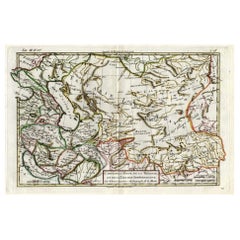
Wonderful Small Map of the Coasts of Arabia, Persia and Western India, ca. 1710
About the Item
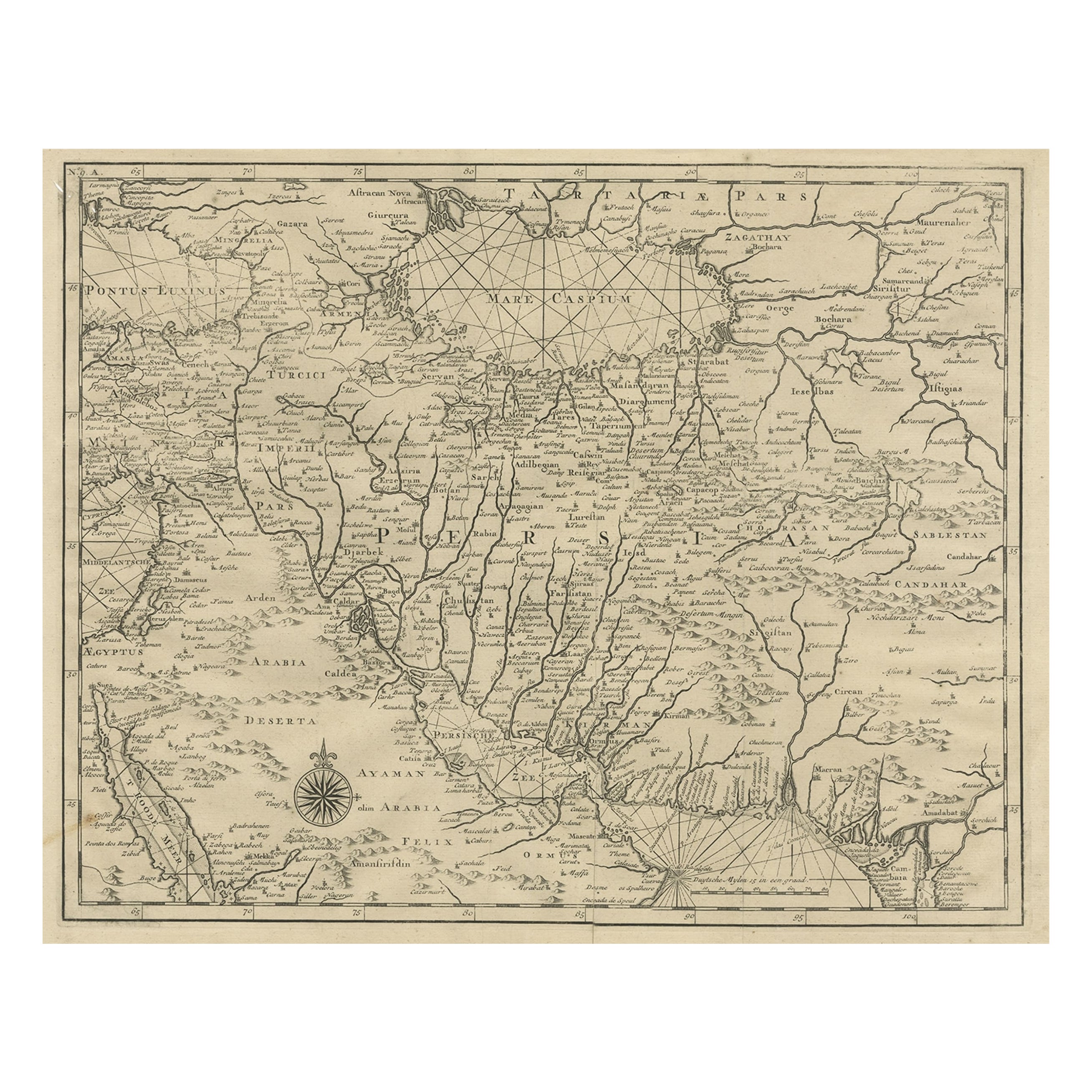
Wonderful small map covering the coasts of Arabia, Persia and western India. It illustrates the voyages of Duarte de Menezes, who became the Viceroy of Portuguese India. Van der Aa's maps were typical of much cartography of the time, in which more attention was paid to the decorative elements than the geographical accuracy. The Red Sea is distorted and given an arched shape, and many towns are misplaced. The Indian Ocean is filled with a lovely title cartouche that features European merchants trading with Arabs.
The titled map, “De Kusten van Arabie, het Roode Meer en Persize Zee...” created by Pieter van der Aa circa 1710, illustrates Arabia, the Red Sea, and the Persian Gulf, along with regions of Southern Asia. Enhanced with hand-coloring, the map measures approximately 8.9 x 5.9 inches (22.6 x 15 cm).
This particular impression boasts a large fleur-de-lis coat of arms watermark, indicating the high quality of the paper. While minor soil is evident in the margins, the map itself remains in very fine condition, presenting a clear and well-preserved portrayal of the depicted regions. Such historical maps offer valuable insights into the geographical understanding of Arabia and adjacent areas during the early 18th century, reflecting cartographic knowledge and perceptions of that era.
- Dimensions:Height: 5.9 in (14.99 cm)Width: 8.9 in (22.61 cm)Depth: 0.002 in (0.06 mm)
- Materials and Techniques:
- Place of Origin:
- Period:
- Date of Manufacture:1710
- Condition:A nice impression with a large fleur-de-lis coat of arms watermark and minor soil in margins, else very fine.
- Seller Location:Langweer, NL
- Reference Number:
About the Seller
5.0
Platinum Seller
These expertly vetted sellers are 1stDibs' most experienced sellers and are rated highest by our customers.
Established in 2009
1stDibs seller since 2017
1,932 sales on 1stDibs
Typical response time: <1 hour
- ShippingRetrieving quote...Ships From: Langweer, Netherlands
- Return PolicyA return for this item may be initiated within 14 days of delivery.
More From This SellerView All
- Antique Map of the Coast of France, 1710By Jacobus HarrewijnLocated in Langweer, NLAntique map titled 'Les Embouchures de la Somme et de Bresle'. Map of the coast of Northern France showing the estuaries of the Somme and the Bresle. This map is part of a serie of...Category
Antique Early 18th Century Maps
MaterialsPaper

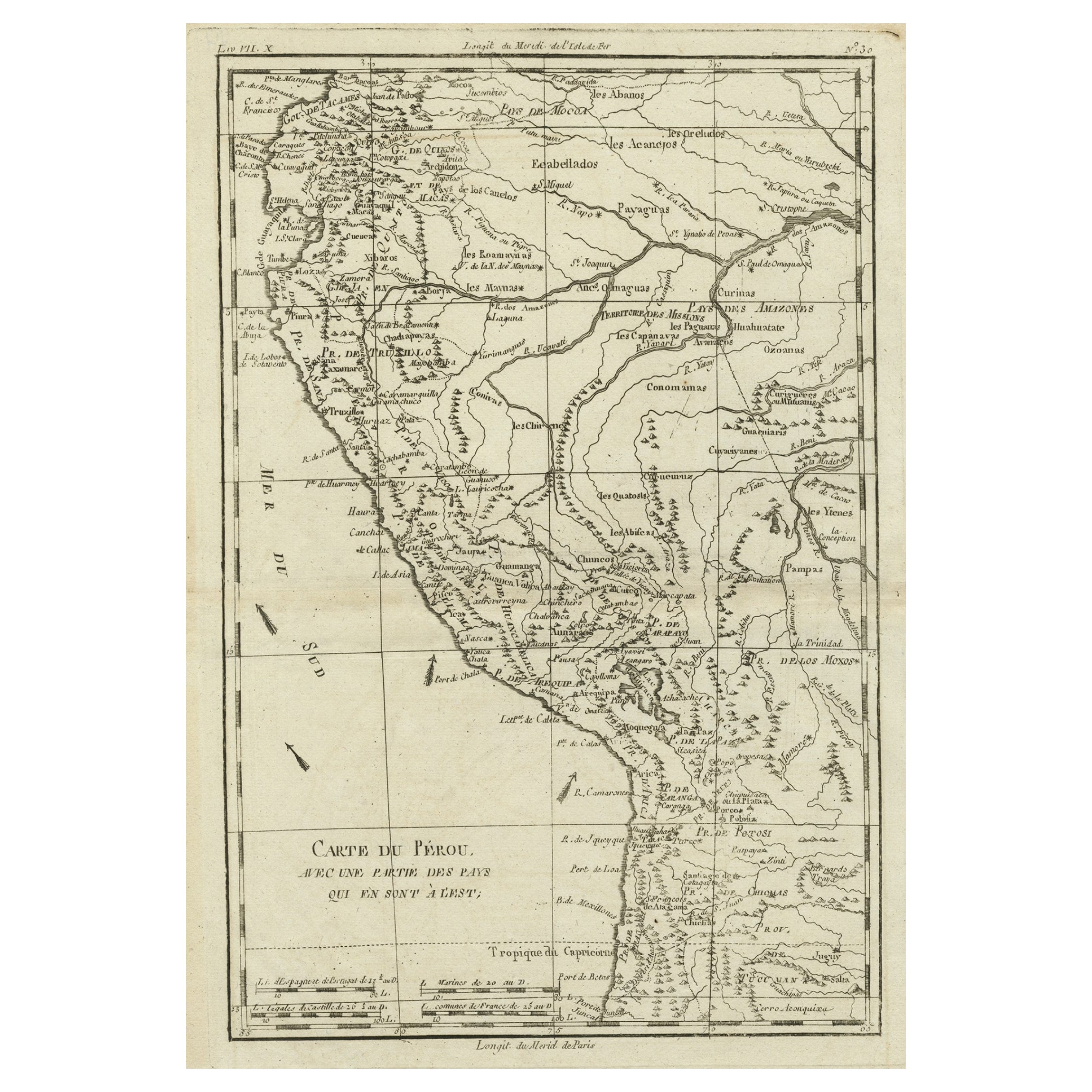
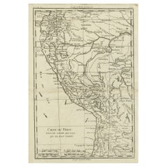
- Map of the Western Coast of South America from Ecuador into Chili, ca.1780Located in Langweer, NLAntique map titled 'Carte du Perou avec une partie des pays qui en sont a l'est.' Map of the western coast of South America extending from Ecuador, through Peru and present-day B...Category
Antique 1780s Maps
MaterialsPaper
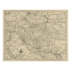
- Rare Antique Map of Persia, Incl the Caspian Sea and the Arabian Peninsula, 1726Located in Langweer, NLRare untitled antique map of Persia. It covers from the Gulf of Suez eastward to Ahmedabad (Amadabad) in modern day western India. This map, centered on Persia, includes the Caspian Sea and part of the Arabian Peninsula...Category
Antique 1720s Maps
MaterialsPaper
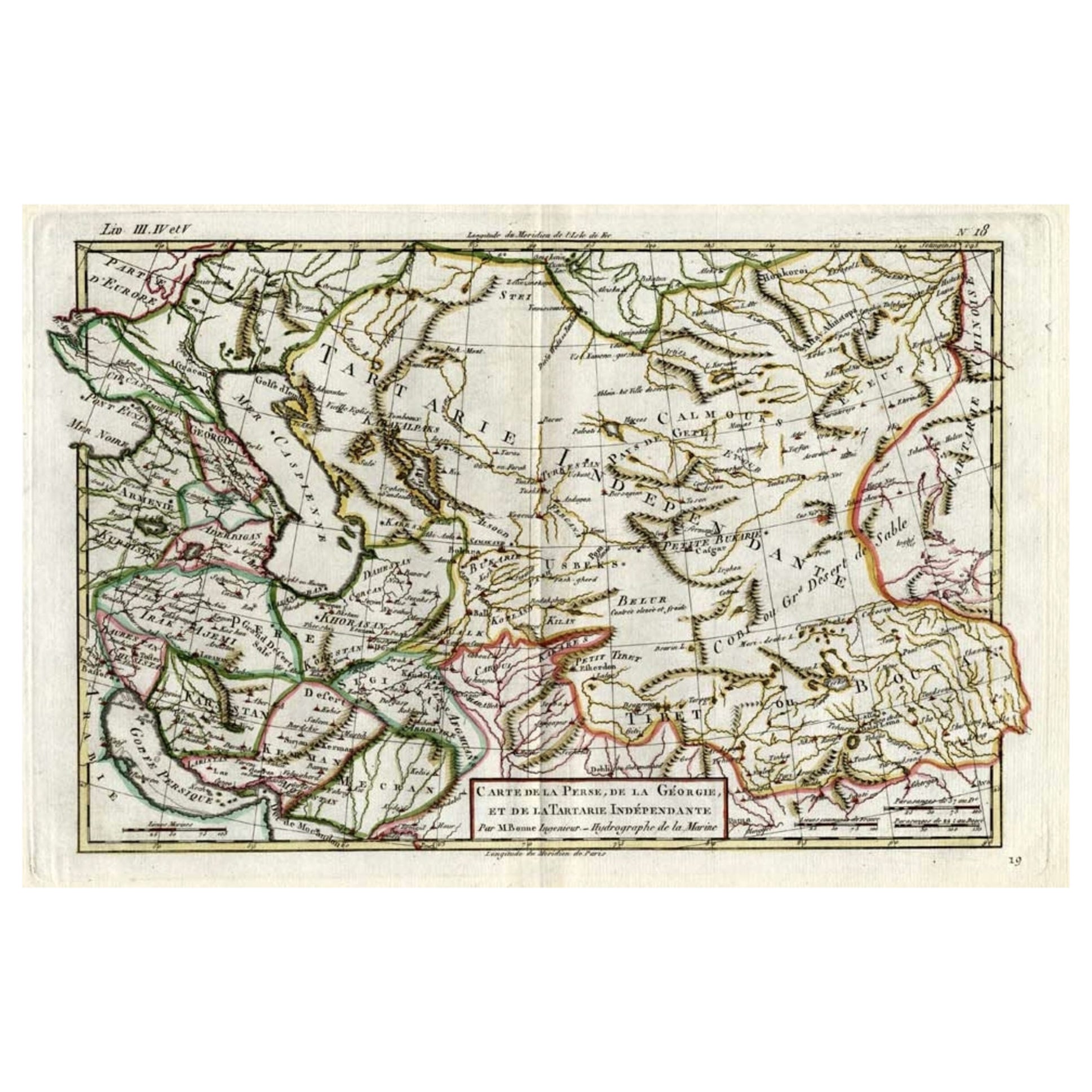
- Antique Map of Persia, Georgia and Kazakhstan, ca.1780Located in Langweer, NLAntique map titled 'Carte de la Perse, de la Georgie, et de la Tartarie Independante'. Map of Persia, Georgia and Kazakhstan. This map shows current days Georgia, Iran, Irak, Kaz...Category
Antique 1780s Maps
MaterialsPaper
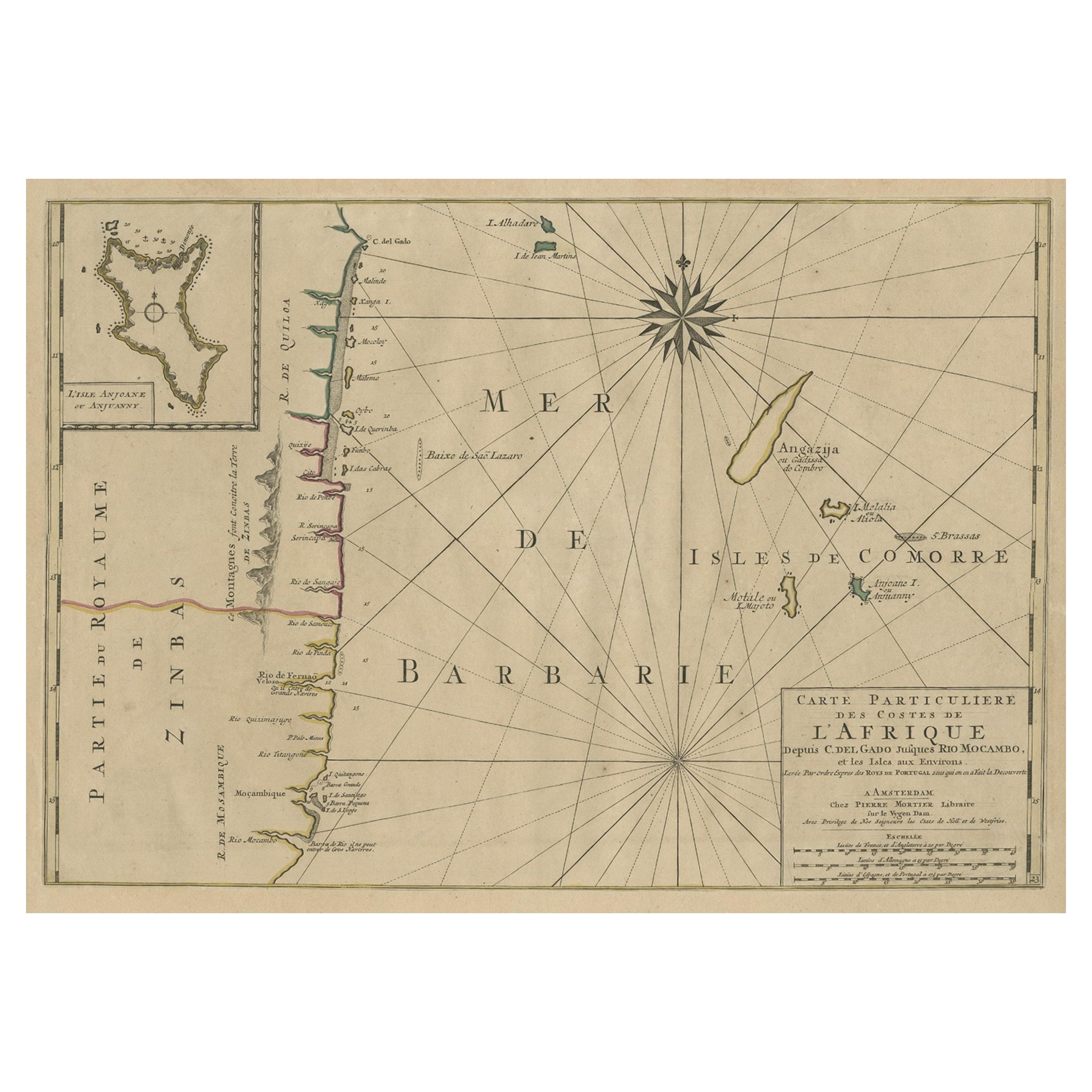
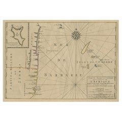
- Map of the Mozambique and Tanzania Coast & Inset Map of Anjouan Island, ca.1700Located in Langweer, NLAntique map titled 'Carte particuliere des Costes de l'Afrique'. Depicts the coasts of Mozambique and Tanzania. With an inset map of Anjouan Island. Artists and engravers: Pub...Category
Antique Early 1700s Maps
MaterialsPaper
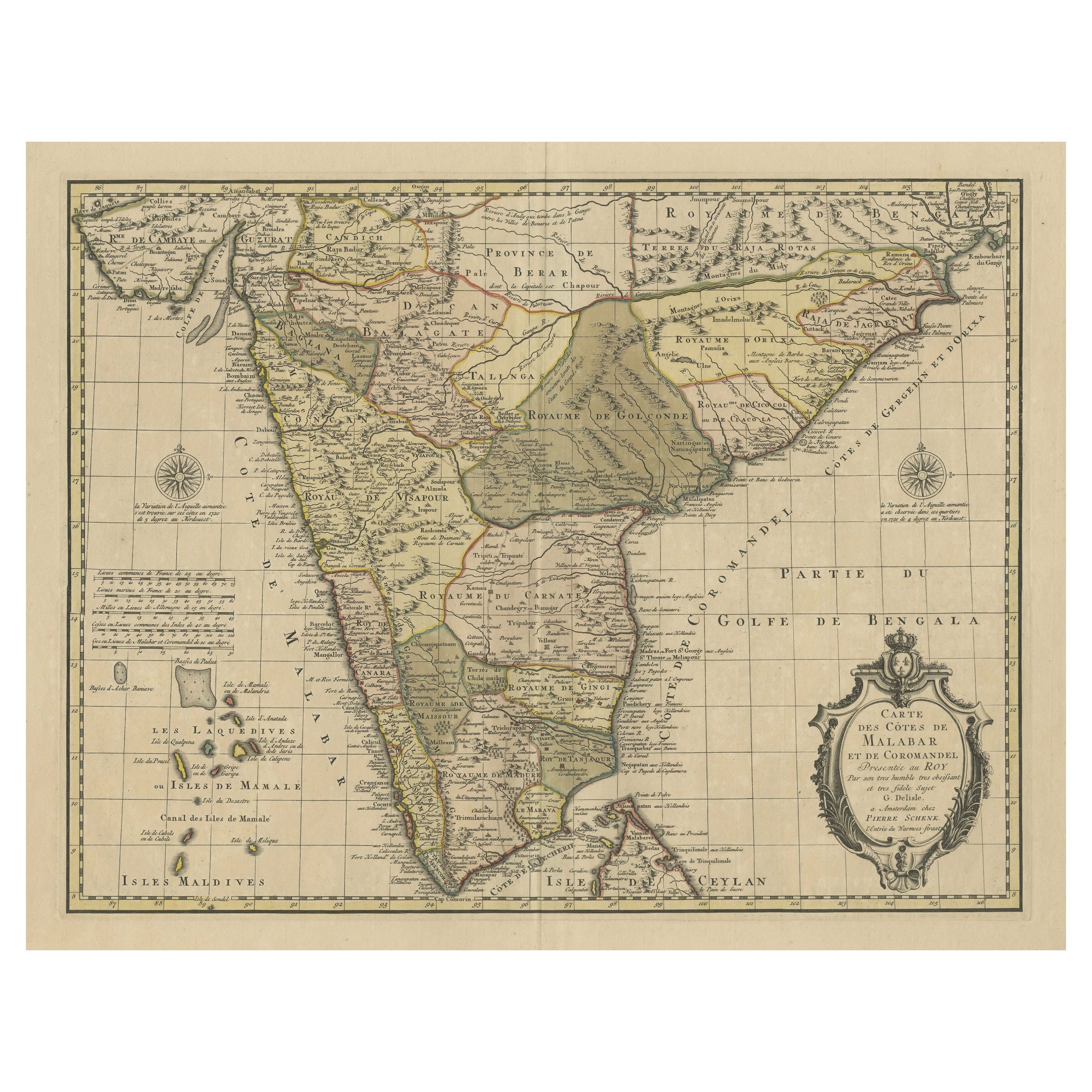
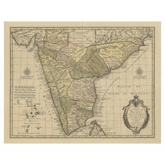
- Detailed Decorative Antique Map of the Coast of Malabar and Coromandel, IndiaLocated in Langweer, NLAntique map titled 'Carte des Côtes de Malabar et de Coromandel'. Finely engraved map of the southern part of India, first issued in 1723 by acclaimed French mapmaker Guillaume De L’...Category
Antique Mid-18th Century Maps
MaterialsPaper
You May Also Like
- Original Antique Map of India. C.1780Located in St Annes, LancashireGreat map of India Copper-plate engraving Published C.1780 Three small worm holes to right side of map and one bottom left corner Unframed.Category
Antique Early 1800s English Georgian Maps
MaterialsPaper

- Map of the Republic of GenoaLocated in New York, NYFramed antique hand-coloured map of the Republic of Genoa including the duchies of Mantua, Modena, and Parma. Europe, late 18th century. Dimension: 25...Category
Antique Late 18th Century European Maps
- Map "Estuary- Mouth of the Thames"Located in Alessandria, PiemonteST/426 - Antique French Map of the estuary of the Thames, map dated 1769 - "Mape of the entrance of the Thames. Designed by filing of Navy cards fo...Category
Antique Mid-18th Century French Other Prints
MaterialsPaper
- Italy, Sicily, Sardinia, Corsica and Dalmatian Coast: A 17th Century Dutch MapBy Theodorus DanckertsLocated in Alamo, CAThis hand colored 17th century Dutch map entitled "Novissima et Accuratissima totius Italiae Corsicae et Sardiniae Descriptio" by Theodore Danckerts depicts the Italian Peninsula in ...Category
Antique Late 17th Century Dutch Maps
MaterialsPaper
- West Coast of Africa, Guinea & Sierra Leone: An 18th Century Map by BellinBy Jacques-Nicolas BellinLocated in Alamo, CAJacques Bellin's copper-plate map entitled "Partie de la Coste de Guinee Dupuis la Riviere de Sierra Leona Jusquau Cap das Palmas", depicting the coast of Guinea and Sierra Leone in ...Category
Antique Mid-18th Century French Maps
MaterialsPaper
- American Western Movie Lithograph "The Treasure of the Sierra Madre", SignedLocated in Miami, FLA very nice Hollywood movie original lithograph for the film The Treasure of the Sierra Madre, directed by John Huston. Starring Humphrey Bogart, Walter H...Category
Early 20th Century American Prints
MaterialsPaper