Items Similar to Persiae, Armeniae, Natoliae et Arabiae Descriptio per Frederick deWit 1666 map
Want more images or videos?
Request additional images or videos from the seller
1 of 8
Frederick DeWit Persiae, Armeniae, Natoliae et Arabiae Descriptio per Frederick deWit 1666 map1666
1666
About the Item
Map of Persiae, Armeniae, Natoliae et Arabiae Descriptio per F de Wit 1688 engraving from: Atlas Contractus Orbis Terrarum Praecipuas ac Novissimas Complectens Tabulas. Amsterdam, N. Visscher, 1656-77. (Koeman III, Vis5-8) This highly decorative map of the Middle East is by the Dutch engraver, publisher, and map seller Frederick de Wit (1629 or 1630-1706). It was published in Amsterdam in about 1666. The map covers the regions from present-day Turkey and Egypt to Afghanistan and the Arabian Peninsula, the Red Sea, the Nile River, Cyprus, Asia Minor, the Gulf of Aden, Armenia, the Caspian Sea, and the Indian Ocean. Unlike in many antique maps of the area, a great amount of geographic information is shown throughout the Arabian Peninsula, including the locations of cities, towns, rivers, and mountain ranges. The details in this map can be attributed to Nicolas Sanson’s map of 1654, called Carte des Trois Arabies, which is widely regarded as one of the largest-scale and most detailed maps of the region of its day. The decorative title cartouche features several exotic figures and animals and a merchant ship with its boat. De Wit was born in Gouda and moved to Amsterdam, where he maintained his shop on the Kalverstraat. His works included sea and world atlases, wall maps, and town books containing plans of Dutch and European cities. Some time after 1674 he acquired the copper plates of town books by Johannes Janssonius and Joan Blaeu. In 1688, he obtained from the States General, the Dutch government of the day, the privilege to publish his maps. De Wit’s maps were in demand throughout Europe and were sold until 1763 by the firm of Johannes Covens and Corneille Mortier.
- Creator:Frederick DeWit (1630 - 1706, Dutch)
- Creation Year:1666
- Dimensions:Height: 20 in (50.8 cm)Width: 23.25 in (59.06 cm)
- More Editions & Sizes:n/a/Price: $1,850
- Medium:
- Movement & Style:
- Period:1660-1669
- Condition:
- Gallery Location:Paonia, CO
- Reference Number:1stDibs: LU780312905542
About the Seller
4.9
Vetted Seller
These experienced sellers undergo a comprehensive evaluation by our team of in-house experts.
Established in 1978
1stDibs seller since 2017
104 sales on 1stDibs
Typical response time: 9 hours
- ShippingRetrieving quote...Ships From: Paonia, CO
- Return PolicyA return for this item may be initiated within 7 days of delivery.
More From This SellerView All
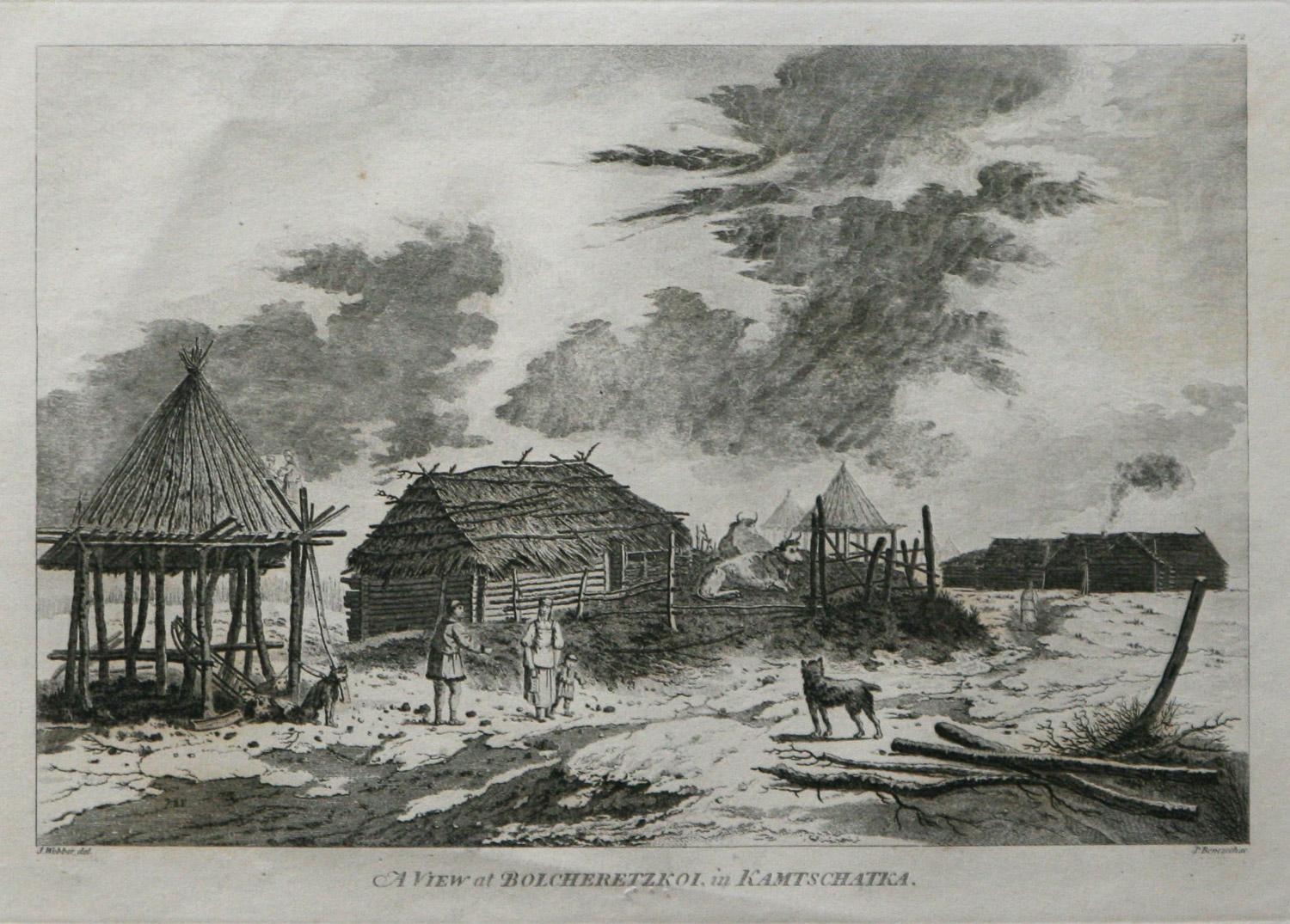
- A View at Bolcheretzko (Russia) 1784 Captains Cook Final Voyage by John WebberBy John WebberLocated in Paonia, COA View at Bolcheretzko (Russia) is from the 1784 First Edition Atlas Accompanying Capt. James Cook and King; Third and Final Voyage of Captain James Cook.John Webber (1752-1793) was ...Category
1780s Realist Landscape Prints
MaterialsEngraving
- Bird's Eye View of Glascow 1888 original wood engraving from The GraphicLocated in Paonia, COBird’s Eye View of Glascow original 1888 wood engraving is from The Graphic by H.W. Brewer who was well known for his aerial views of topographical panoramas. He was also the fa...Category
1880s Realist Landscape Prints
MaterialsWoodcut
- New York, Columbia University Color Etching by Luigi KasimirBy Luigi KasimirLocated in Paonia, COThe famous Austrian artist, Luigi Kasimir ( 1881- 1962 ) studied at the Vienna Academy of Art. He went on to develop the technique of color etching using multiple plates to creat a finished etching in color. Previously a colored etching had to have the color applied by hand. Kasimir was a very prolific artist famous for his scenes of Vienna...Category
1940s Realist Landscape Prints
MaterialsEtching
- AYX Map of Aix en Provence, France by J. Blaeu 17th c.By Joan (Johannes) BlaeuLocated in Paonia, CODetailed plan of Aix en Provence, in France. This print is a hand -colored double sheet engraving by the famous cartographer Joan (Johannes) Blaeu ( 1596 - 1673 ). The left side ...Category
Late 17th Century Other Art Style Landscape Prints
MaterialsEngraving
- Map of the County of Buckingham From an Actual SurveyLocated in Paonia, COCartographers Christopher (1786-1855) and John (1791-1867) Greenwood were surveyors from Yorkshire, who undertook an ambitious project to produce a series of large-scale maps of the counties of England, Wales and Scotland.The maps represent a remarkable and impressive surveying achievement forming an important record of the counties depicted. In the years 1817-1832 the Greenwood brothers published the Atlas of The Counties of England from an Actual Survey. This Atlas was finely drafted and engraved and decorated with large vignettes of prominent buildings of the county. This map of Buckingham County is beautifully hand colored and is in very good condition. There is a vignette of Stowe House...Category
19th Century Other Art Style More Prints
MaterialsEngraving
- England Map of the County of Southampton from an Actual SurveyLocated in Paonia, COCartographers Christopher (1786-1855) and John (1791-1867) Greenwood were surveyors from Yorkshire, who undertook an ambitious project to produce a series of large-scale maps of the counties of England, Wales and Scotland.The maps represent a remarkable and impressive surveying achievement forming an important record of the counties depicted. In the years 1817-1832 the Greenwood brothers published the Atlas of The Counties of England from an Actual Survey. This Atlas was finely drafted and engraved and decorated with large vignettes of prominent buildings of the county. This map of Southampton County is beautifully hand colored and is in very good condition. There is a vignette of Winchester Cathedral...Category
19th Century Other Art Style Landscape Prints
MaterialsEngraving


You May Also Like
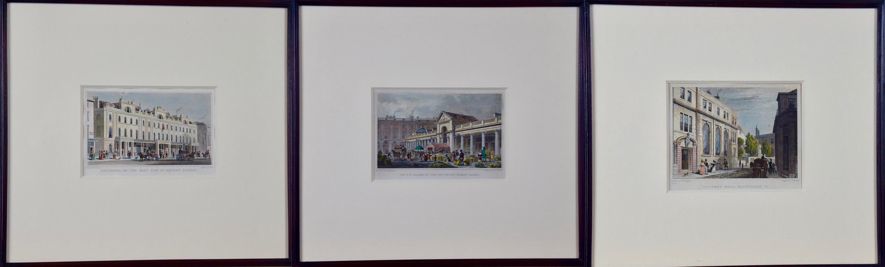
- Three 19th C. Hand Colored Engravings of London Architecture by T. ShepherdBy Thomas Hosmer ShepherdLocated in Alamo, CAA set of three hand-colored engravings from "Metropolitan Improvements; or London in the Nineteenth Century", published in London, England in 1828. The scenes were drawn by Thomas Ho...Category
1820s Realist Landscape Prints
MaterialsEngraving
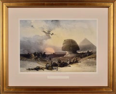
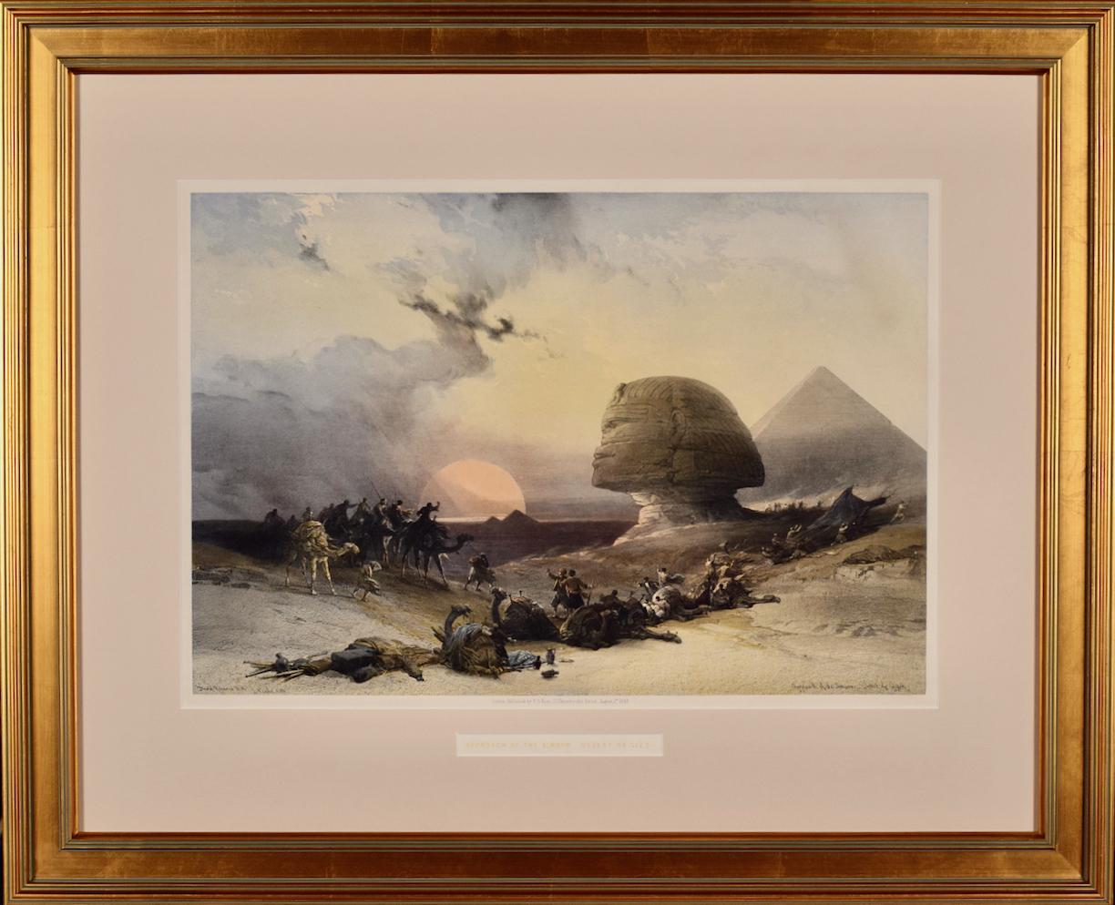
- Approach of the Simoon, Desert of Gizeh: 19th C. Hand-colored Roberts LithographBy David RobertsLocated in Alamo, CAThis is an original 19th century hand-colored lithograph entitled "Approach of the Simoon, Desert of Gizeh" by David Roberts, from his Egypt and Nubia volumes of the large folio edition, published in London by F. G. Moon in 1849. The lithographs were prepared by Louis Haghe (1806-1885) from drawings and paintings by Roberts. The resultant large folio editions of 'The Holy Land' and 'Egypt & Nubia' are considered the greatest lithographically illustrated works issued in the 19th century. This is the most famous and collectible of David Roberts' works, entitled "Approach of the Simoon, Desert of Gizeh". The scene captures the dramatic moment when a fierce sandstorm, known as a simoon, approaches a caravan traveling through the desert of Gizeh in Egypt. The scene is filled with swirling clouds of sand, which obscure the figures of the travelers and their camels. The sky is dark and ominous, with lightning bolts striking the ground in the distance. The figures in the foreground appear to be huddling together for protection, while one man in the center struggles to keep his turban from being blown away. Roberts' lithograph is particularly striking for its attention to detail and its use of light and shadow to create a sense of depth and atmosphere. The figures and camels in the foreground are rendered with great precision, while the distant landscape and stormy sky are suggested with broad, sweeping strokes. Overall, "Approach of the Simoon, Desert of Gizeh" is a powerful and evocative image of the harsh realities of life in the desert, and a testament to David Roberts' skill as an artist. This is the most well known and sought-after of all Roberts prints, as well as the most difficult to find and hence most expensive. This hand-colored lithograph is printed on wove paper with wide margins. The print is in excellent condition. It is presented in a gold-colored wood frame with a tan mat. It is glazed with UV conservation glass. All framing materials used are archival museum quality. The frame measures 23.75" high and 29" wide. There are two additional iconic David Roberts hand-colored lithographs for sale on 1stdibs that are matted and framed in identical styles, although slightly different sizes. They are scenes of Petra and the Citadel of Cairo. They can be viewed by typing their reference #'s, LU1173211969422 and LU1173211970142, into the 1stdibs search field or typing Timeless Intaglio in the search field and tapping on the drop down name to be taken to our storefront. Two or all three of these pieces would make for a striking display grouping. A discount is available for the purchase of multiple pieces. David Roberts (1796-1864) was a Scottish painter who specialized in landscapes, architectural subjects, and scenes from the Middle East and Europe. Born in Edinburgh, Roberts began his career at age ten as an apprentice to a house painter and eventually became a scene painter for theater companies in Edinburgh and London. In the 1820s, J. M. W. Turner recognized his artistic talent and encouraged him to become a full-time artist. He began to focus on painting landscapes and architecture. In 1838 he traveled to Egypt and soon after to the Holy Land, concluding in Jerusalem. Roberts' travels in the Middle East had a profound impact on his art, and he produced a series of highly detailed and realistic paintings and sketches of the region's famous ruins and other landmarks, including the Pyramids of Giza, the Sphinx, the Temple of Abu Simbel...Category
Mid-19th Century Realist Landscape Prints
MaterialsLithograph
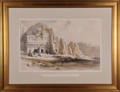
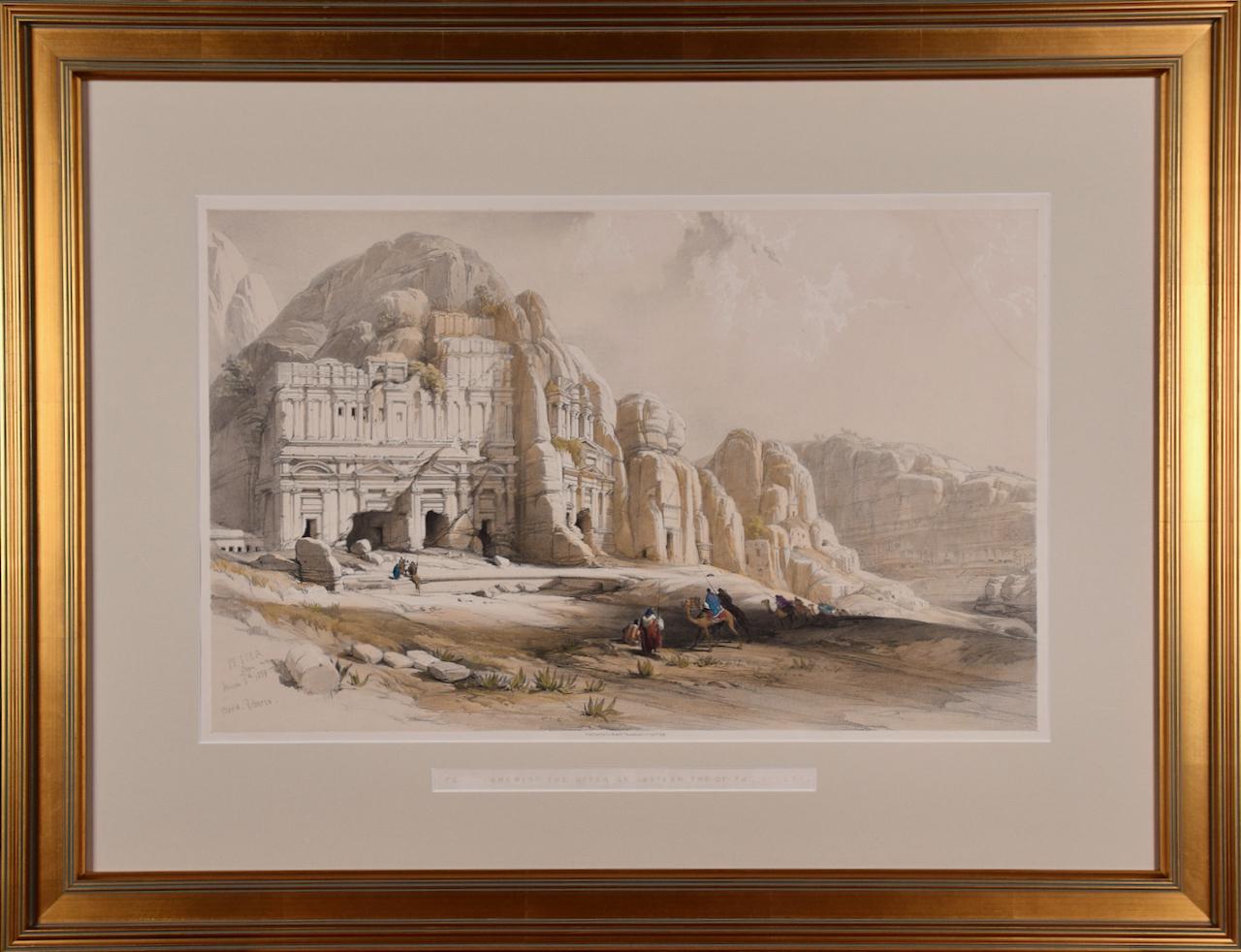
- Petra, The Upper or Eastern Valley: 19th C. Hand-colored Roberts LithographBy David RobertsLocated in Alamo, CAThis is an original 19th century hand-colored lithograph entitled "Petra, Shewing the Upper or Eastern End of the Valley" by David Roberts, from his Egypt, The Holy Land and Nubia volumes of the large folio edition, published in London by F. G. Moon in 1842. The lithographs were prepared by Louis Haghe (1806-1885) from drawings and paintings by Roberts. The resultant large folio editions of 'The Holy Land' and 'Egypt & Nubia' are considered the greatest lithographically illustrated works issued in the 19th century. This is one of Roberts' most famous and collectible works. The scene captures a view of the magnificent ruins of Petra in what is Jordan today, as it appeared on March 8, 1839, on the day of Roberts' visit. Multiple Arab men are approaching Petra; some on foot and others riding camels. They are dressed in their colorful local costumes. Roberts' signature and hand written date are reproduced in the plate on the left. This hand-colored lithograph is printed on wove paper with wide margins. There is some loss of color in the text in the title and a faint dark curvilinear area in the upper right. The print is otherwise in very good condition. It is presented in a gold-colored wood frame with a tan mat. It is glazed with UV protected conservation glass. All framing materials used are archival museum quality. The frame measures 23.5" high and 30.5" wide. There are two additional iconic David Roberts hand-colored lithographs for sale on 1stdibs that are matted and framed in identical styles, although slightly different sizes. They are scenes of Approach of Simoon, Desert of Gizeh and the Citadel of Cairo. They can be viewed by typing their reference #'s, LU1173211955452 and LU1173211970142, into the 1stdibs search field or typing Timeless Intaglio in the search field and tapping on the drop down name to be taken to our storefront. Two or all three of these pieces would make for a striking display grouping. A discount is available for the purchase of multiple pieces. David Roberts (1796-1864) was a Scottish painter who specialized in landscapes, architectural subjects, and scenes from the Middle East and Europe. Born in Edinburgh, Roberts began his career at age ten as an apprentice to a house painter and eventually became a scene painter for theater companies in Edinburgh and London. In the 1820s, J. M. W. Turner recognized his artistic talent and encouraged him to become a full-time artist. He began to focus on painting landscapes and architecture. In 1838 he traveled to Egypt and soon after to the Holy Land, concluding in Jerusalem. Roberts' travels in the Middle East had a profound impact on his art, and he produced a series of highly detailed and realistic paintings and sketches of the region's famous ruins and other landmarks, including the Pyramids of Giza, the Sphinx, the Temple of Abu Simbel...Category
Mid-19th Century Realist Landscape Prints
MaterialsLithograph
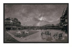
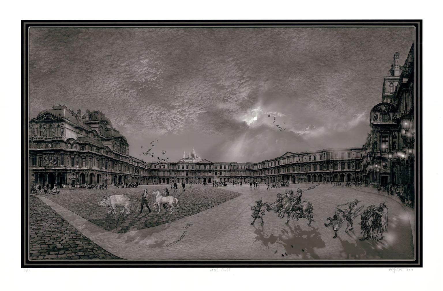
- After HoursBy Peter MiltonLocated in New York, NY“AFTER HOURS” was created by the contemporary artist Peter Milton in 2019. This graphic depicting a scene outside of the Louvre in Paris was drawn on a spec...Category
21st Century and Contemporary Realist Landscape Prints
MaterialsDigital
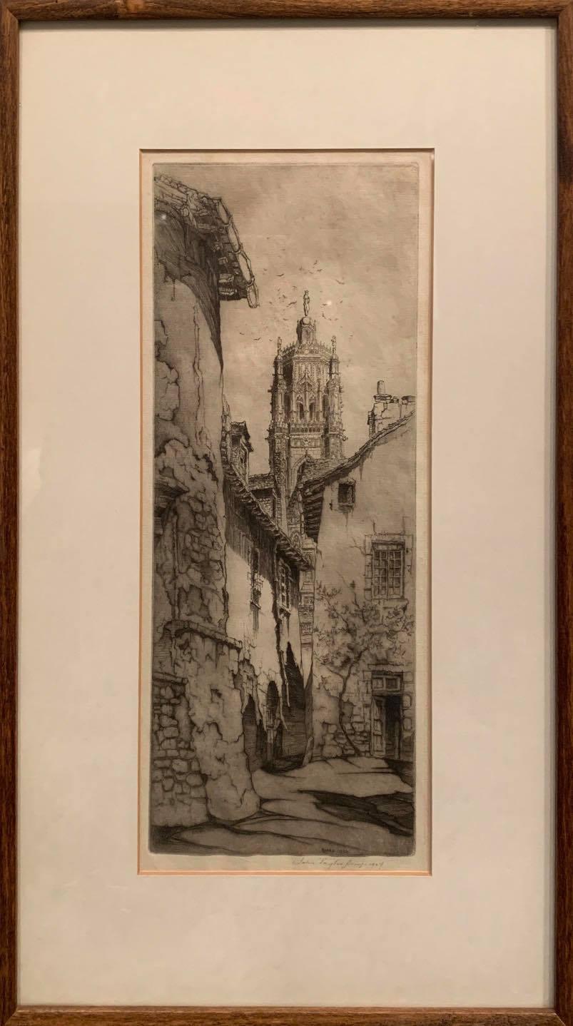
- Black and White Etching -- RodezBy John Taylor ArmsLocated in Troy, NYThis detailed etching depicts Notre Dame in France. The foreground shows an alleyway, with cracking and peeling buildings, plants climbing the walls, and a shifting stone road. Each ...Category
1920s Realist Landscape Prints
MaterialsEtching, Paper
- HARBINGER OF SPRING Signed Lithograph, Farm House Landscape Blue Sky White BarnBy Mel HunterLocated in Union City, NJHARBINGER OF SPRING is an original limited edition, hand drawn lithograph(not a photo reproduction or digital print) by the American artist/illustrator Mel Hunter, printed using hand...Category
1970s Realist Landscape Prints
MaterialsLithograph