Antique Navigation Charts
4
to
5
33
19
27
23
17
8
8
8
7
6
6
4
4
3
3
3
3
2
2
2
2
2
1
1
1
1
1
1
1
1
1
1
1
1
Sort By
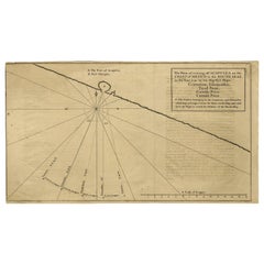
Navigational Chart of Mexico's Coast, with Acapulco and Port Marquis, 1748
Located in Langweer, NL
Prize.' -
A navigational chart of the coast of Mexico, with the harbours Acapulco and Port Marquis
Category
1740s Antique Navigation Charts
Materials
Paper
H 9.81 in W 17.52 in D 0.01 in
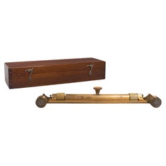
Antique Rolling Parallel Rule, English, Brass, Scientific Instrument, Edwardian
Located in Hele, Devon, GB
period to draw parallel lines upon navigation charts
Smooth action to rollers, with bi-directional
Category
Early 20th Century British Antique Navigation Charts
Materials
Brass
H 2.56 in W 13 in D 4.14 in
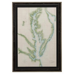
1856 U.S. Coast Survey Map of Chesapeake Bay and Delaware Bay
Located in Colorado Springs, CO
response to a need for accurate navigational charts of the new nation's coasts and harbors. Today, the
Category
1850s American Antique Navigation Charts
Materials
Paper
Early 19th Century Portrait of Naval Captain William Compton Bolton
Located in Nantucket, MA
navigational chart, leaning against the taffrail on the quarterdeck of his ship; there are other ships seen on
Category
1830s American Federal Antique Navigation Charts
Materials
Canvas
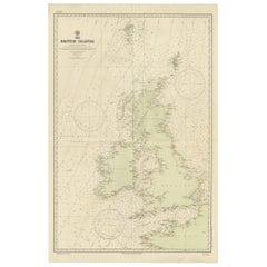
Large Sea Chart of the British Islands, 1918
Located in Langweer, NL
Office, the chart is designed with a focus on maritime navigation, including details like sea routes
Category
1910s Antique Navigation Charts
Materials
Paper
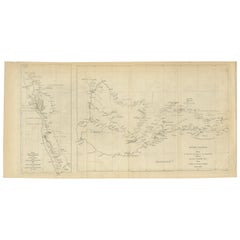
Charting the West: Surveyor General Roe’s Western Australian Expedition , 1852
Located in Langweer, NL
expeditions were pivotal in charting unknown territories and fostering a deeper understanding of the
Category
1850s Antique Navigation Charts
Materials
Paper
Free Shipping
H 8.47 in W 16.93 in D 0 in
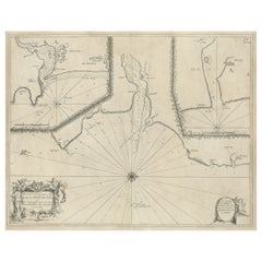
Antique Chart of Dundee, Aberdeen and Montrose in Scotland, C.1774
By Captain Greenvile Collins
Located in Langweer, NL
Antique map titled 'To the Honble the Magistrates of the Citty of Aberdeene'. Sea chart of Tay
Category
18th Century Antique Navigation Charts
Materials
Paper
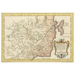
Charting Eastern Tartary: An 18th-Century Jesuit and English Collaboration, 1757
Located in Langweer, NL
suggests the importance of waterways for navigation, trade, and transportation in the region.
4
Category
Mid-18th Century Antique Navigation Charts
Materials
Paper
Free Shipping
H 9.34 in W 13.12 in D 0.02 in
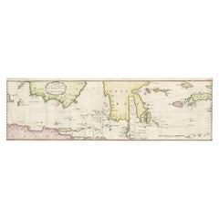
Rare Chart of Indonesia Including Borneo, Java, Celebes, Ceram and More, 1779
Located in Langweer, NL
Antique map titled 'Carte de la Navigation de Batavia a Amboina'.
Rare chart of Indonesia
Category
1770s Antique Navigation Charts
Materials
Paper
H 9.06 in W 29.34 in D 0 in
Antique Chart of The Spanish Coastline from Bilbao Eastwards, C.1720
Located in Langweer, NL
Antique map titled 'A Chart of the Sea Coasts Biscay and Gallicia Between Cape Machicaca and Cape
Category
18th Century Antique Navigation Charts
Materials
Paper
Large Antique Sea Chart of the South-Eastern Coast of Sumatra, Indonesia
Located in Langweer, NL
islands in the Detroit Sound. The handsome chart provides detailed navigational information, including the
Category
Late 18th Century Antique Navigation Charts
Materials
Paper
H 30.2 in W 20.87 in D 0.02 in
Antique Chart of the Straits of Makassar, Indonesia with Borneo and Celebes-1820
Located in Langweer, NL
hydrographer, chart publisher and author of navigation textbooks and pilots (sailing directions). The first
Category
1820s Antique Navigation Charts
Materials
Paper
H 37.8 in W 25.99 in D 0 in
Charting the Course of Empire: Bonne's 1770 Masterpiece Maps of the Indian Ocean
Located in Langweer, NL
, study, or office.
Let the "Charting the Course of Empire" collection transport you to an age where the
Category
1770s Antique Navigation Charts
Materials
Paper
Free Shipping
H 14.18 in W 20.28 in D 0 in
Antique Sea Chart of the coasts of Denmark and Sweden by C.A. Berey, 1720
Located in Langweer, NL
and Sjaelland, Denmark. The chart is filled with navigational details and topographical information
Category
Early 18th Century Antique Navigation Charts
Materials
Paper
Free Shipping
H 25.79 in W 37.01 in D 0.02 in
Rare Old English Sea Chart of Part of Indonesia with Java, Madura and Bali, 1711
Located in Langweer, NL
Bally.'
Rare early example of this working English Sea Chart of part of Indonesia with Java, Madura
Category
1710s Antique Navigation Charts
Materials
Paper
H 17.72 in W 21.78 in D 0 in
Large Antique Plan of St. Philiou Bay or Sant Feliu Catalonia Spain, circa 1746
Located in Langweer, NL
This antique map is a black and white harbor chart, specifically a port plan of St. Philiou, which
Category
Mid-18th Century Antique Navigation Charts
Materials
Paper
Free Shipping
H 13.59 in W 20.75 in D 0.02 in
1726 Valentyn's Map of Bali and Lombok, Original Engraving
Located in Langweer, NL
This antique map is a detailed 18th-century chart of the island of Bali, one of the many islands of
Category
Early 18th Century Antique Navigation Charts
Materials
Paper
Map of Vusihyen, Hu Chew Fu and Hou-Tcheou-Fou, Historical Chinese Cities, 1754
Located in Langweer, NL
forefront of maritime charting and exploration. The detail and accuracy of Bellin's maps reflected not only
Category
1750s Antique Navigation Charts
Materials
Paper
H 9.97 in W 7.05 in D 0 in
Title: Mid-19th Century Map of Australasia by Carl Flemming - 1855
Located in Langweer, NL
crafted diagrams and charts. These likely represent the comparative lengths of rivers and mountain
Category
1850s Antique Navigation Charts
Materials
Paper
No Reserve
H 14.06 in W 17.52 in D 0 in
Indiarum Occidentalium Tractus Littorales cum Insulis Caribicis / Pascaert van W
By Louis Renard
Located in New York, NY
19 x 22 " (48.3 x 55.9 cm) plus margins.
A beautifully engraved Dutch sea chart. Shown is the
Category
18th Century Other Art Style Antique Navigation Charts
Materials
Engraving
Rare Antique English SeaChart of Bali, Lombok, Floris, Borneo, Celebes etc, 1711
Located in Langweer, NL
example of this working English Sea Chart of part of Indonesia, extending from the Northwest corner of
Category
1710s Antique Navigation Charts
Materials
Paper
H 19.1 in W 22.84 in D 0 in
Large Antique Map of Guadeloupe and Antigua with Adjacent Isles, 19th Century
Located in Langweer, NL
the period, known for producing accurate and detailed charts for navigation and general education
Category
Early 19th Century Antique Navigation Charts
Materials
Paper
No Reserve
H 21.07 in W 29.34 in D 0 in
Territories of Antiquity: The Northern Division of Syria, A Detailed 1882 Map
Located in Langweer, NL
features such as mountain ranges and valleys depicted using hachures. The map meticulously charts cities
Category
1880s Antique Navigation Charts
Materials
Paper
H 14.97 in W 11.03 in D 0 in
Hell Gate / Oyster Bay and Huntington / Huntington Bay
Located in New York, NY
published according to Act of Parliament Novr. 19th, 1778.
This chart is from the "Atlantic Neptune" by
Category
18th Century Naturalistic Antique Navigation Charts
Materials
Engraving, Aquatint
Antique Print of the Malabar Coast of India showing the VOC establishments, 1726
Located in Langweer, NL
(publisher)
MALABAR COAST
Sea chart of the Malabar Coast, also known as the Pepper Coast, in southwestern
Category
1720s Antique Navigation Charts
Materials
Paper
H 13.39 in W 16.74 in D 0 in
Oriental Realms: A Detailed Map of Persia, Afghanistan, and Beloochistan, 1882
Located in Langweer, NL
carefully charted, serving as vital lifelines for the communities they support. The map also traces the
Category
1880s Antique Navigation Charts
Materials
Paper
No Reserve
H 14.97 in W 22.45 in D 0 in
Original Antique Map of the West Indies by J. Arrowsmith, 1842
Located in Langweer, NL
details not only make it a navigational piece but also a work of art. Notable for its comprehensive
Category
Early 19th Century Antique Navigation Charts
Materials
Paper
No Reserve
H 20.87 in W 27.17 in D 0 in
Map of the World: An Original 18th Century Hand-colored Map by E. Bowen
Located in Alamo, CA
This is an original 18th century hand-colored map entitled "A New & Correct Chart of All The Known
Category
Mid-18th Century Old Masters Antique Navigation Charts
Materials
Engraving
Rare Authentic Engraved Map of Large Part of Indonesia by Stavorinus, 1779
Located in Langweer, NL
Antique map titled 'Carte de la Navigation de Batavia a Amboina'. Rare chart of Indonesia including
Category
18th Century Antique Navigation Charts
Materials
Paper
H 29.34 in W 9.06 in D 0 in
Antique Map of the Low Countries by Brué, 1822
Located in Langweer, NL
the Pacific (1800-1804). After his sea service, Brué applied his navigation and charting skills to
Category
19th Century Antique Navigation Charts
Materials
Paper
'Ginette', French Art Deco Portrait
By Charles Picart le Doux
Located in Cotignac, FR
quickly transformed into a museum, exhibiting books, nautical charts, model boats, nets, out of order
Category
Early 20th Century Art Deco Antique Navigation Charts
Materials
Canvas, Oil
Navigational chart of the river Suratte by Valentijn - Engraving - 18th Century
Located in Zeeland, Noord-Brabant
navigational chart shows the Suratte River. Suratte or Soeratte was a famous trading city on the north coast of
Category
1720s Contemporary Antique Navigation Charts
Materials
Engraving
Ambon, Maluku Islands and Boero by Valentijn - Engraving - 18th Century
Located in Zeeland, Noord-Brabant
.' - Scarce set of 2 original fitting antique maps/navigational charts of the island of Ambon, Maluku Islands
Category
1720s Contemporary Antique Navigation Charts
Materials
Engraving
Extremely Rare 1695 Hand-Colored Map on Vellum
By Willem Blaeu
Located in La Jolla, CA
was the first general chart of American waters that was actually useful for navigation.
This
Category
1690s Dutch Northern Renaissance Antique Navigation Charts
Materials
Paper
The River of Thames from London to the Buoy of the Noure.
Located in Zeeland, Noord-Brabant
.
Engraving on hand laid (verge) paper.
Published by Richard Mount, London. The chart was publshed in 'Great
Category
17th Century Antique Navigation Charts
Materials
Engraving
A New Gradually Encreasing Compass-Map.
Located in Zeeland, Noord-Brabant
the business, which not only published charts but also books on every aspect of geography, navigation
Category
1690s Antique Navigation Charts
Materials
Engraving
Rare 1710 Hand-Colored Map of Europe
By Frederick de Wit
Located in La Jolla, CA
Previously unknown proof state of De Wit's important sea chart of Europe, likely printed between
Category
1710s Dutch Northern Renaissance Antique Navigation Charts
Materials
Paper
Eldridge Chart of Nantucket Sound – West, circa 1920
Located in Nantucket, MA
Eldridge chart of Nantucket Sound – West, circa 1920, a scarce navigational chart showing the
Category
Early 20th Century American Other Antique Navigation Charts
Materials
Paper
Eldridge Chart of Nantucket Sound – East, circa 1920
Located in Nantucket, MA
Eldridge chart of Nantucket Sound – East, circa 1920, a scarce navigational chart showing the
Category
1920s American Other Antique Navigation Charts
Materials
Paper
Set of Three Mid 19th Century Charts of the California Coast
Located in Stamford, CT
Set of three mid-19th century maritime charts of the California coast from the famous U.S. Coast
Category
1850s American Antique Navigation Charts
Materials
Paper
Mid-19th Century Set of Three Charts of the West Coast
Located in Stamford, CT
Set of three mid-19th century maritime charts of the west coast of the United States from the
Category
1850s American Antique Navigation Charts
Materials
Paper
Roggeveen's Hand Colored Chart of Cape Cod and the Islands, 1675
By Arent Roggeveen
Located in Nantucket, MA
Roggeveen, published in circa 1675, an extremely rare first edition chart printed on paper with original
Category
1670s Dutch Other Antique Navigation Charts
Materials
Paper
French Early 20th Century Armillary Sphere on Column Pedestal
Located in Baton Rouge, LA
charting stars as an early directional means has forever tied the armillary to the sea and navigation in
Category
Early 20th Century French Antique Navigation Charts
Materials
Cast Stone, Brass, Copper
One-Hand Divider Made of Brass and Steel English Manufacture of the Early 1900s
Located in Milan, IT
distances at sea on the charts during navigation.
The ring shape of the upper part is used to hold and
Category
Early 1900s British Antique Navigation Charts
Materials
Brass, Steel
H 0.4 in W 7.88 in D 2.56 in
Early 1900's Ship's Navigational Chart Magnifying Glass
Located in Nantucket, MA
A ship's magnifying glass used to read navigational charts aboard ship. Made of iron with the
Category
Early 20th Century Industrial Antique Navigation Charts
Materials
Iron
Original Antique Map of the Persian Gulf
Located in Langweer, NL
the northwest to past the Strait of Hormuz in the southeast. The map is primarily a navigational chart
Category
Late 18th Century Antique Navigation Charts
Materials
Paper
Chesapeake Bay and Delaware Bay Map, Antique Maritime Map, circa 1851
Located in Colorado Springs, CO
navigational charts of the new nation's coasts and harbors. The U.S.C.S. devised a labor-intensive
Category
1850s American Antique Navigation Charts
Materials
Paper
Spice Epicenter: Engraving of The Banda Islands in the Age of Exploration, 1753
Located in Langweer, NL
. Isles de Banda / Eylanden van Banda. Van der Schley based this chart on one contained in 'Het tvveede
Category
1750s Antique Navigation Charts
Materials
Paper
H 11.03 in W 11.62 in D 0 in
1821 H/C Engraved Map MAPPE-MONDE EN DEUX HÉMISPHÈRES Adrien-Hubert Brué
Located in Gallatin, TN
service, Brué applied his navigation and charting skills to creating finely-crafted maps, which were
Category
19th Century Antique Navigation Charts
Materials
Engraving
1825 Engraved H/C Map CARTE DE L'AMERIQUE SEPTENTRIONALE Adrien-Hubert Brué
Located in Gallatin, TN
-1804). After his sea service, Brué applied his navigation and charting skills to creating finely
Category
19th Century Antique Navigation Charts
Materials
Engraving
Cathedral in Aguas Calientes, Mexico
By William Henry Jackson
Located in New York, NY
. Cavalry) were annual multidisciplinary expeditions meant to chart the largely-unexplored west, observe
Category
19th Century Antique Navigation Charts
Cathedral in Aguas Calientes, Mexico
By William Henry Jackson
Located in New York, NY
. Cavalry) were annual multidisciplinary expeditions meant to chart the largely-unexplored west, observe
Category
19th Century Antique Navigation Charts
Get Updated with New Arrivals
Save "Antique Navigation Charts", and we’ll notify you when there are new listings in this category.
Antique Navigation Charts For Sale on 1stDibs
An assortment of antique navigation charts is available at 1stDibs. The range of distinct antique navigation charts — often made from paper, brass and metal — can elevate any home. Antique navigation charts have long been popular, with older editions for sale from the 18th Century and newer versions made as recently as the 20th Century. Captain Greenvile Collins produced beautiful antique navigation charts that are worth considering.
How Much are Antique Navigation Charts?
Prices for antique navigation charts can differ depending upon size, time period and other attributes — at 1stDibs, antique navigation charts begin at $152 and can go as high as $11,500, while the average can fetch as much as $1,082.
More Ways To Browse
San Pablo Bay
Bermuda Map
Floris Antiques
Iceland Map
Map Manila
Antique Parallel Rule
Antique Nautical Books
George William Allen
J D Oriental
Antique Stereoscope
Samuel Pepys
Antique Maps Norfolk
Antique Map Norfolk
Whitehall Palace
Palace Of Whitehall
Antique Map Copenhagen
Antique Spiegel Furniture
Mammoth Lakes
