Items Similar to Rare Antique English SeaChart of Bali, Lombok, Floris, Borneo, Celebes etc, 1711

Want more images or videos?
Request additional images or videos from the seller
1 of 5
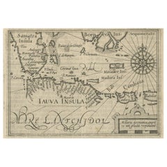
Rare Antique English SeaChart of Bali, Lombok, Floris, Borneo, Celebes etc, 1711
About the Item
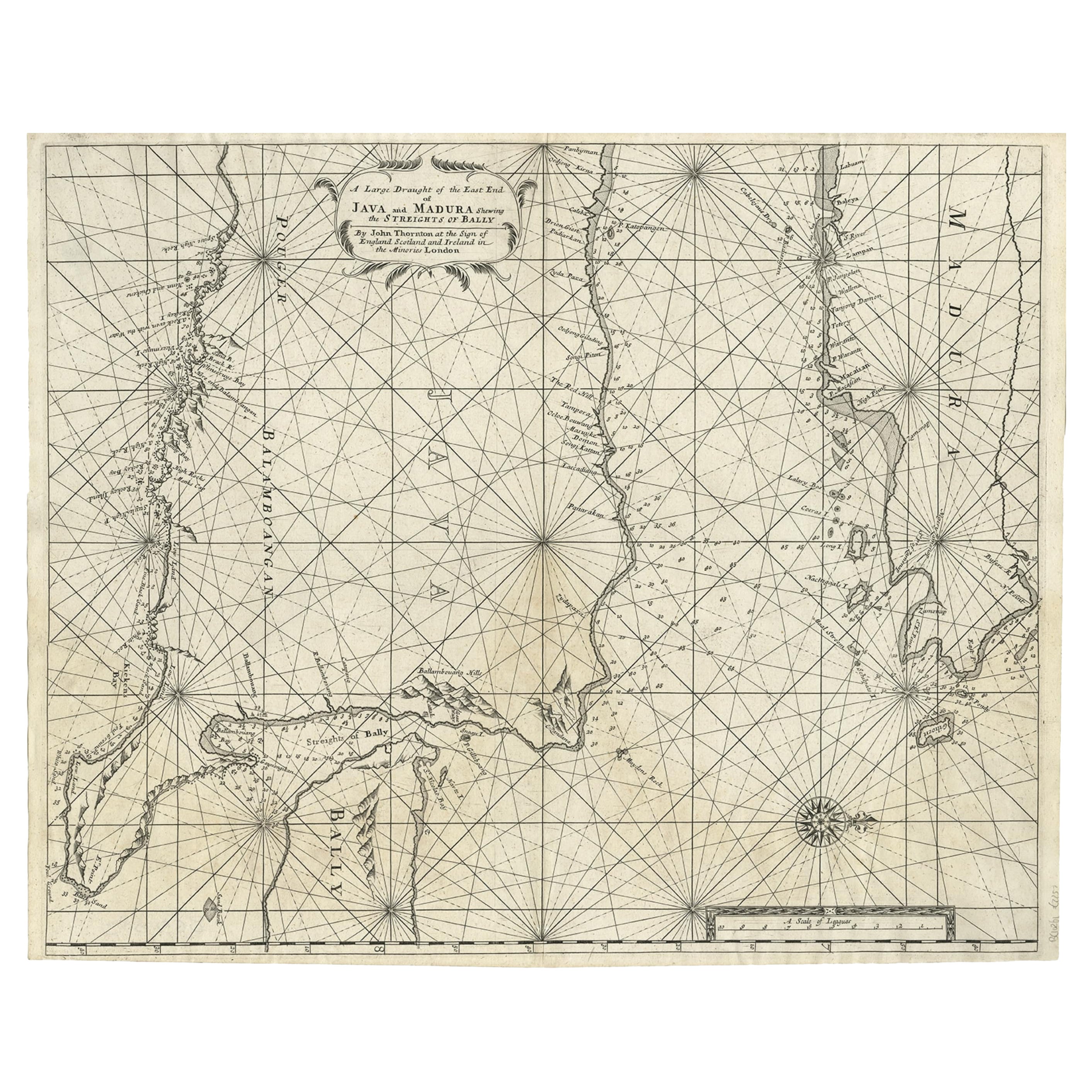
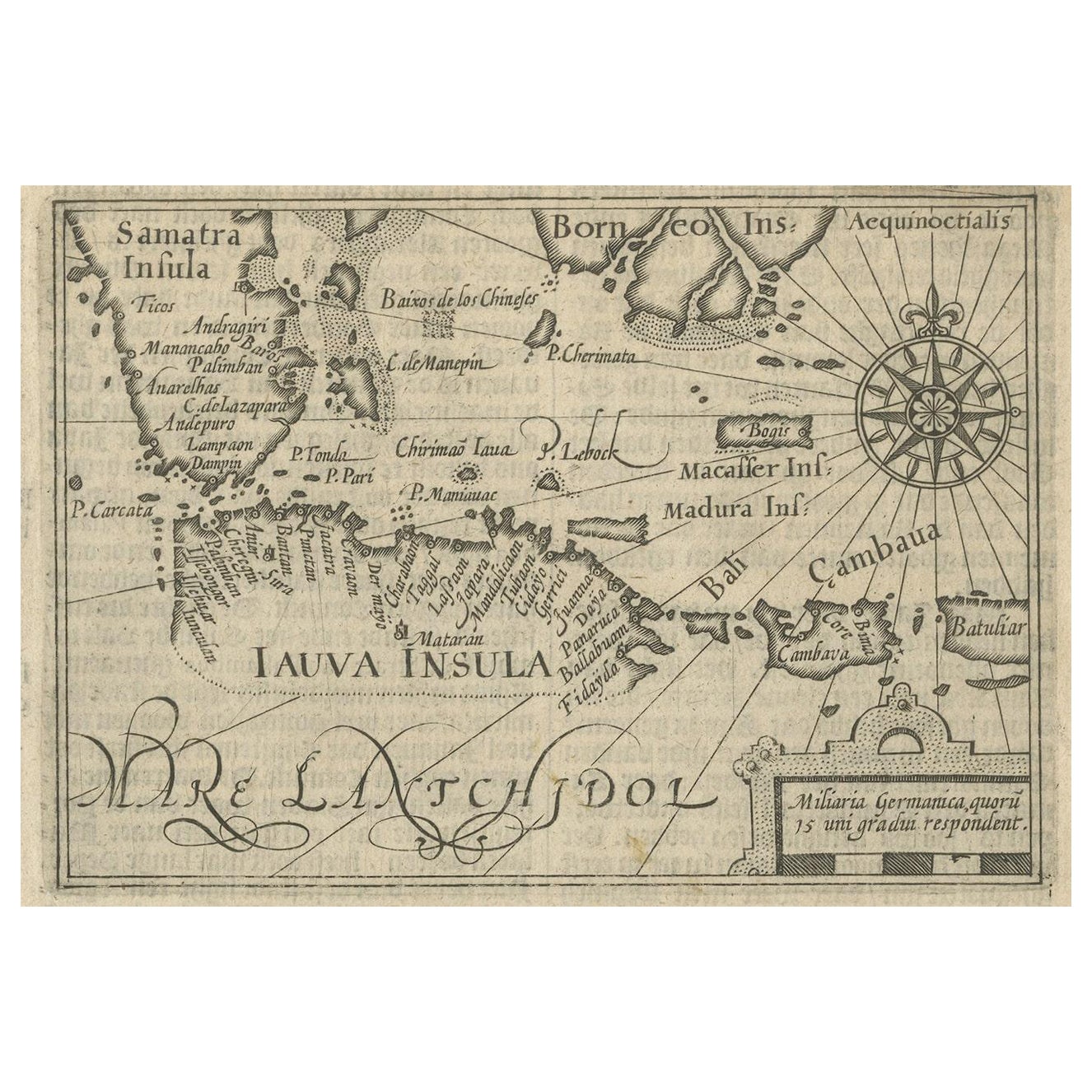
Antique map titled 'A Large Draught from Benjar on the Island of Borneo To Macasser on the Island of Celebes Shewing the Streight of Bally with the Islands to the Eastward thereof.'
Rare early example of this working English Sea Chart of part of Indonesia, extending from the Northwest corner of Borneo near Banjarmasin, to Java and Bali in the Southwest, "t Land van Floris" in the southeast, and Celebes in the northeast. The chart includes extensive soundings, rhumblines and a compass rose. Thornton's chart depicts the Java Sea, in the heart of the Indonesian Archipelago. By the 18th century this area was well-known to mariners, having been extensively explored first by the Portuguese and later by agents of the Dutch East India Company. East Java is depicted in the lower left corner, and further east are the islands of Bali and Lombok. Following the chain are the islands of Flores and Sumbawa. Kalimantan and Borneo are depicted in the upper right of the map, and on the far right side is Celebes, on which the handsome title cartouche is featured. The sea is elegantly traversed by rhumb lines that radiate from compass roses. Source unknown, to be determined.
Artists and Engravers: Made by an anonymous engraver after 'Samuel Thornton'. In 1671, the London cartographer John Seller (fl.1664-97) commenced work on The English Pilot , a work that intended to challenge Dutch hegemony in the sea atlas market. Intended to be published in four books covering different regions of the globe, Seller published an uncompleted book on 'Oriental navigation' in 1675. Unable to continue this Herculean endeavour, Seller sold his rights to John Thornton, the official hydrographer to the English East India Company. Thornton took up the project with great fervour, publishing his first editions in 1689. Thornton did not publish his first edition of the Third Book, detailing navigation in the East Indies, until 1703. While Thornton largely based his charts on those of earlier Dutch cartographers, most notably those found in Pieter Goos' Zee-Spiegel and Lucas Janz Waghenaer's Mariner's Mirror, The English Pilot proved to be enormously popular. When John Thornton died in 1708, his brother Samuel took over the business and added to and modified existing charts. All four books were produced in editions until the 1760s. The Third Book ran into twelve editions up to 1761. The project succeeded in giving the English dominance in the sea chart market as the eighteenth-century progressed.
Condition: Good, given age. Margins with a few small tears and some spots, all outside image area. Original middle fold as issued. General age-related toning and/or occasional minor defects from handling. Please study image carefully.
- Dimensions:Height: 19.1 in (48.5 cm)Width: 22.84 in (58 cm)Depth: 0 in (0.02 mm)
- Materials and Techniques:
- Period:1710-1719
- Date of Manufacture:1711
- Condition:Wear consistent with age and use.
- Seller Location:Langweer, NL
- Reference Number:
About the Seller
5.0
Platinum Seller
These expertly vetted sellers are 1stDibs' most experienced sellers and are rated highest by our customers.
Established in 2009
1stDibs seller since 2017
1,922 sales on 1stDibs
Typical response time: <1 hour
- ShippingRetrieving quote...Ships From: Langweer, Netherlands
- Return PolicyA return for this item may be initiated within 14 days of delivery.
More From This SellerView All
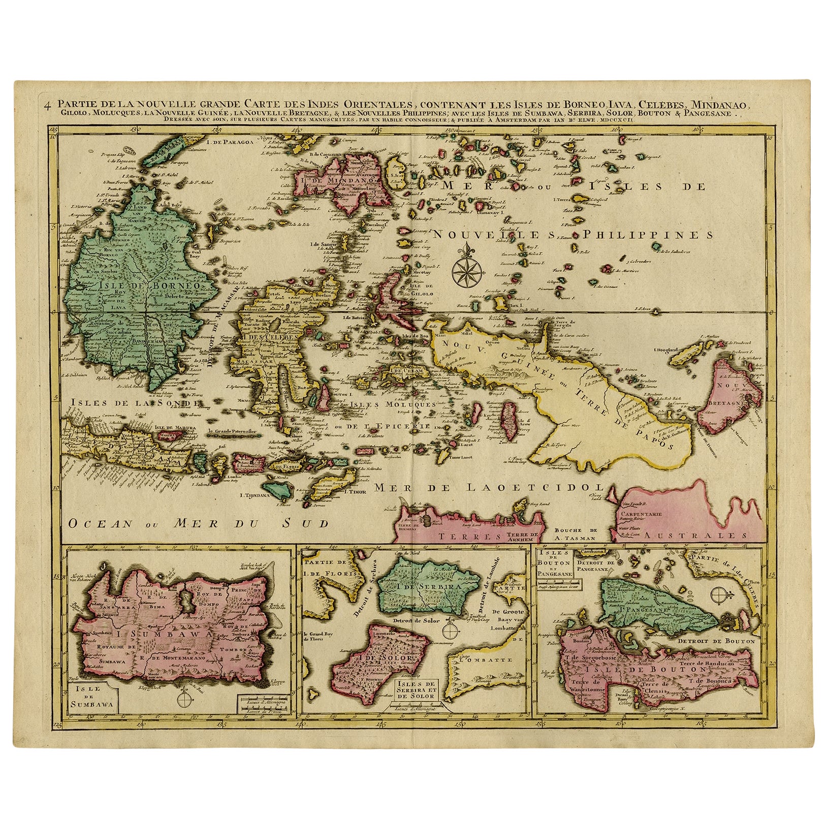
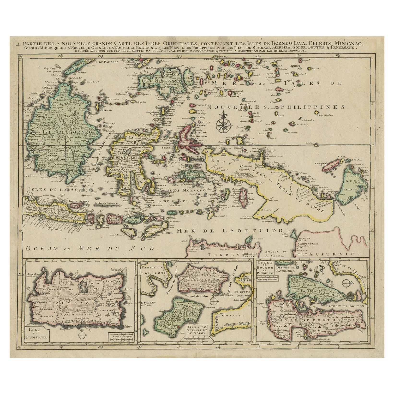
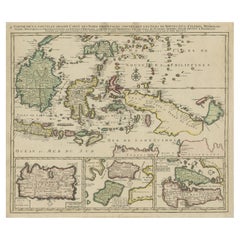
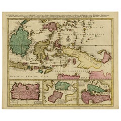
- Old Map of the East Indonesian Islands Borneo, Celebes, New Guinea, Bali, 1792Located in Langweer, NLAntique map titled 'Partie de la Nouvelle Grande Carte des Indes Orientales, contenant les Isles de Borneo, Iava, Celebes, Mindanao (..)'. Detailed map of the Indonesian islands ...Category
Antique 1790s Maps
MaterialsPaper
- Rare Old English Sea Chart of Part of Indonesia with Java, Madura and Bali, 1711Located in Langweer, NLAntique map titled 'A Large Draught of the East End of Java and Madura shewing the Streights of Bally.' Rare early example of this working English Sea Chart of part of Indonesia ...Category
Antique 1710s Maps
MaterialsPaper
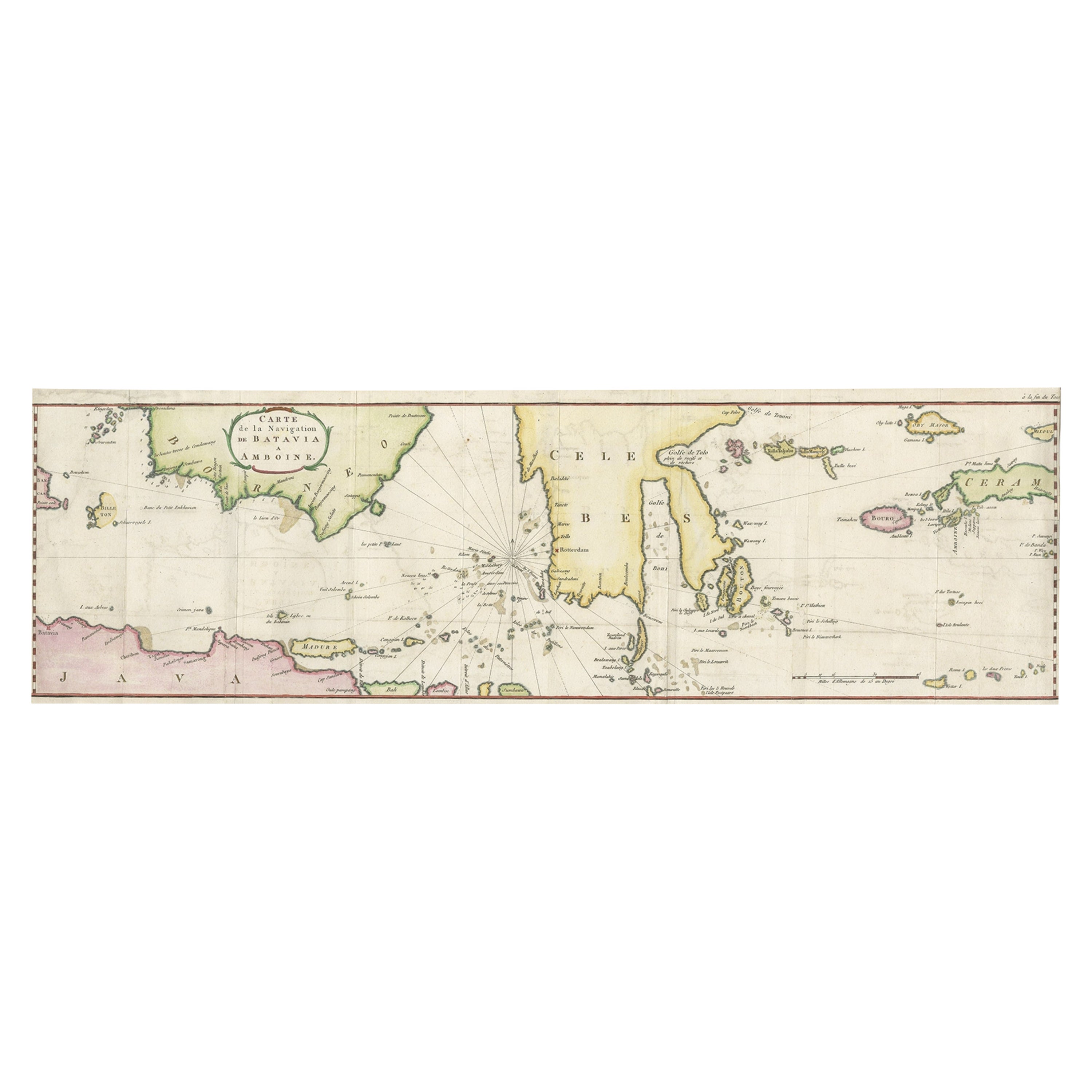
- Rare Chart of Indonesia Including Borneo, Java, Celebes, Ceram and More, 1779Located in Langweer, NLAntique map titled 'Carte de la Navigation de Batavia a Amboina'. Rare chart of Indonesia including Borneo, Java, Celebes, Ceram and more. This map originates from 'Voyage par le Cap...Category
Antique 1770s Maps
MaterialsPaper
- Rare Small Map of Sumatra, Java, Borneo, Macassar, Madura, Bali, 1614Located in Langweer, NLOne of the first maps of the Indonesia islands of Java, Bali, Sumbawa etc. in early days of the Dutch Indies. Also showing Banten, Jakarta (Jacatra), Indr...Category
Antique Early 17th Century Maps
MaterialsPaper
- Old Map of Indonesian Islands Borneo, Celebes, New Guinea & New Britain, 1792Located in Langweer, NLAntique map titled 'Partie de la Nouvelle Grande Carte des Indes Orientales, contenant les Isles de Borneo, Iava, Celebes, Mindanao (..)'. Detailed map of the Indonesian islands Bo...Category
Antique 1790s Maps
MaterialsPaper
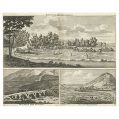
- Rare Antique Engraving with Three Unique Views of Iran, 1711Located in Langweer, NLAntique print titled 'Karavane by het dorp Coraming - Brug over de rivier Kiesilosan - Het Dorp 't Sargabrand'. Old print with three views, two of which unidentified villages in Iran, and a bridge over the Kiesilosan river. This print originates from 'Cornelis de Bruins...Category
Antique 18th Century Prints
MaterialsPaper
You May Also Like
- Catalogue of Engraved Views, Plans, Etc., Of New York City, 1st EdLocated in valatie, NYA catalogue of engraved views, plans, etc., Of New York City, (The Collection of Percy R. Pyne II). Privately Printed by The De Vinne Press, New York, 1912. Limited to 100 copies. Gr...Category
Early 20th Century American Books
MaterialsPaper
- Prussia, Poland, N. Germany, Etc: A Hand-colored 17th Century Map by JanssoniusBy Johannes JanssoniusLocated in Alamo, CAThis is an attractive hand-colored copperplate engraved 17th century map of Prussia entitled "Prussia Accurate Descripta a Gasparo Henneberg Erlichensi", published in Amsterdam by Joannes Janssonius in 1664. This very detailed map from the golden age of Dutch cartography includes present-day Poland, Latvia, Lithuania, Estonia and portions of Germany. This highly detailed map is embellished by three ornate pink, red, mint green and gold...Category
Antique Mid-17th Century Dutch Maps
MaterialsPaper
- Original Antique English County Map, Hampshire, J & C Walker, 1851Located in St Annes, LancashireGreat map of Hampshire Original colour By J & C Walker Published by Longman, Rees, Orme, Brown & Co. 1851 Unframed.Category
Antique 1850s English Other Maps
MaterialsPaper
- Original Antique English County Map, Berkshire. J & C Walker, 1851Located in St Annes, LancashireGreat map of Berkshire Original colour By J & C Walker Published by Longman, Rees, Orme, Brown & Co. 1851 Unframed.Category
Antique 1850s English Other Maps
MaterialsPaper
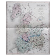
- Original Antique English County Map, Lancashire, J & C Walker, 1851Located in St Annes, LancashireGreat map of Lancashire Original colour By J & C Walker Published by Longman, Rees, Orme, Brown & Co. 1851 Unframed.Category
Antique 1850s English Other Maps
MaterialsPaper
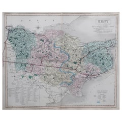
- Original Antique English County Map, Kent. J & C Walker, 1851Located in St Annes, LancashireGreat map of Kent Original colour By J & C Walker Published by Longman, Rees, Orme, Brown & Co. 1851 Unframed.Category
Antique 1850s English Other Maps
MaterialsPaper


Recently Viewed
View AllMore Ways To Browse
Antique Etc
Toner Chart
Small Collectible Mirrors
Antique Furniture East London
Southwest Antique
English Small Mirror
Dutch Sellers
Furniture From Bali
Southwest Antique Furniture
Compass Rose
Antique Folding Mirror
Antique Book Sellers
Antique Engraved Heart
Oriental Antiques Collectables
Mirror With Folding Sides
Rare Compass
Large English Mirror Antique
Antique Compass Rose