Items Similar to Large Antique Plan of St. Philiou Bay or Sant Feliu Catalonia Spain, circa 1746


Want more images or videos?
Request additional images or videos from the seller
1 of 6
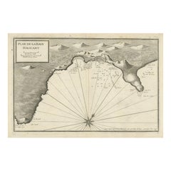
Large Antique Plan of St. Philiou Bay or Sant Feliu Catalonia Spain, circa 1746
About the Item
This antique map is a black and white harbor chart, specifically a port plan of St. Philiou, which is likely associated with Sant Feliu, Spain. This historical cartographic piece originates from the scarce atlas 'Recueil de Plusiers Plans des Ports et Rades et de Quelque Cartes Particulieres de la Mer Méditerranée' created by Jacques Ayrouard. The atlas was published around 1746.
It presents a detailed and precise portrayal of the harbor and its surroundings, showcasing navigational elements and geographical features relevant to Sant Feliu, offering a practical resource for sailors, navigators, or merchants of the time. These antique harbor charts and port plans, though scarce, are valuable historical artifacts providing insight into maritime navigation, coastal geography, and the significance of ports in historical trade and exploration within the Mediterranean region.
Sant Feliu de Guíxols is a municipality in the comarca of the Baix Empordà in Catalonia, Spain. It is situated on the Costa Brava and is now an important port and tourist centre.
- Dimensions:Height: 13.59 in (34.5 cm)Width: 20.75 in (52.7 cm)Depth: 0.02 in (0.5 mm)
- Materials and Techniques:Paper,Engraved
- Period:
- Date of Manufacture:c.1746
- Condition:General age-related toning. Original folding line. Minor wear and soiling, blank verso. Please study image carefully.
- Seller Location:Langweer, NL
- Reference Number:
About the Seller
5.0
Platinum Seller
These expertly vetted sellers are 1stDibs' most experienced sellers and are rated highest by our customers.
Established in 2009
1stDibs seller since 2017
1,933 sales on 1stDibs
Typical response time: <1 hour
- ShippingRetrieving quote...Ships From: Langweer, Netherlands
- Return PolicyA return for this item may be initiated within 14 days of delivery.
More From This SellerView All
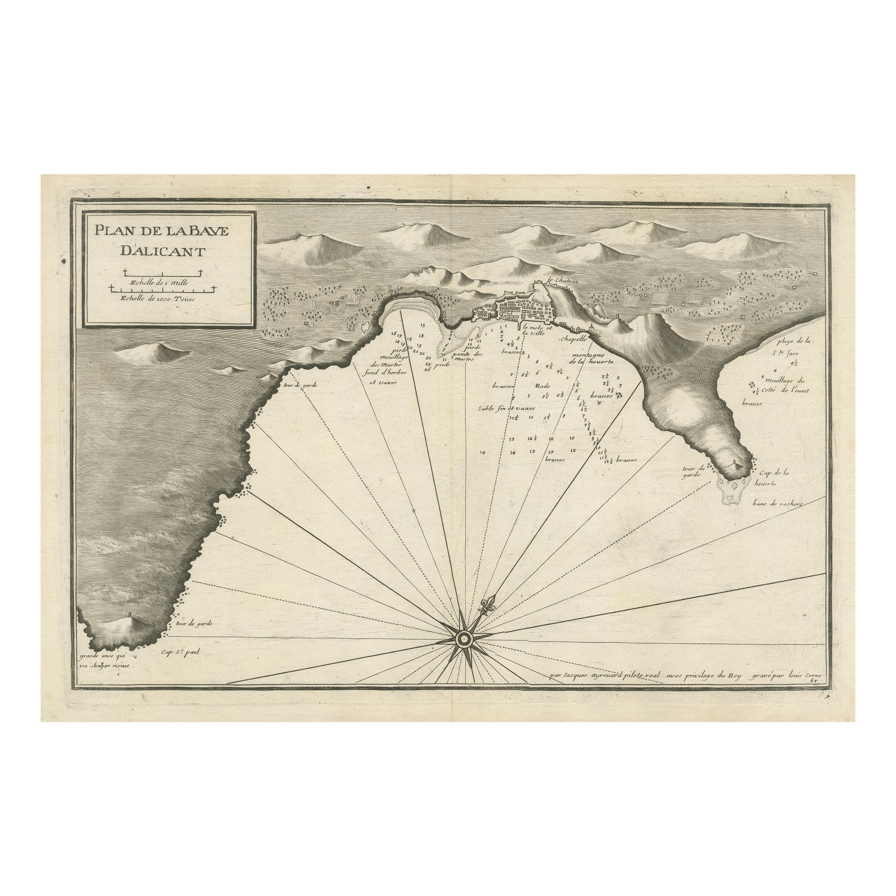
- Antique Plan of Alicante Bay, SpainLocated in Langweer, NLAntique map titled 'Plan de la Baye d'Alicant'. Black and white harbor chart /port plan of Alicante Bay, Spain. This map originates from the scarce atlas 'Recueil de Plusiers Plans d...Category
Antique Mid-18th Century Maps
MaterialsPaper
- Antique Map of Catalonia by Blaeu, circa 1650Located in Langweer, NLAntique map titled 'Catalonia'. Antique map of Catalonia, extending from C. De Romani on the Northern Coast to Alfachs and Panicola in Valencia on the southern end of the coast and s...Category
Antique Mid-17th Century Maps
MaterialsPaper
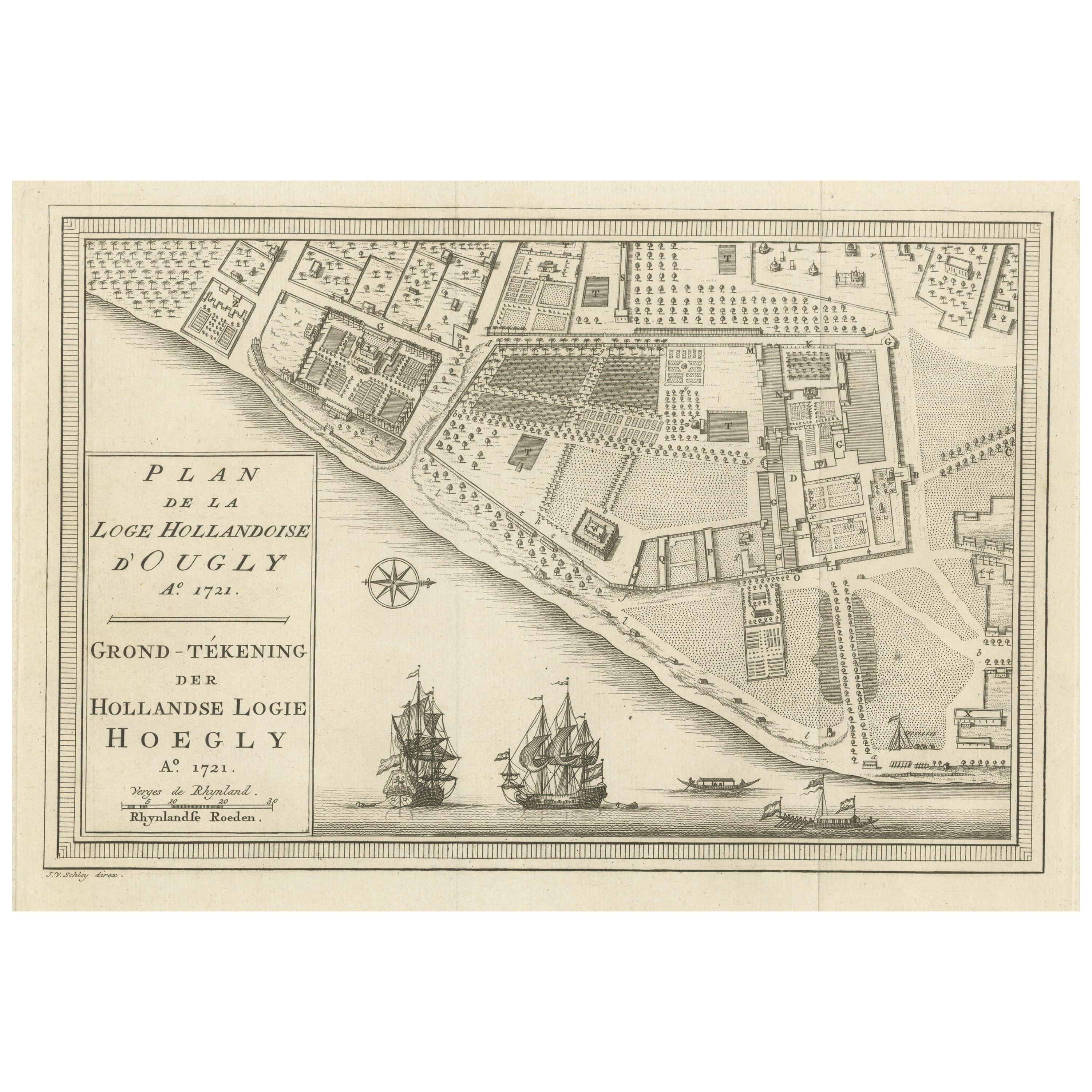
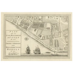
- Original Antique Plan of the Dutch Settlement at Chinsura-Hooghly, India, 1746Located in Langweer, NLAntique print, titled: 'Plan de la Loge Hollandoise d'Ougly'. A plan of the Dutch settlement at Chinsura-Hooghly, India. This print originates from Prevost's 'Histoire Generale d...Category
Antique 1740s Maps
MaterialsPaper
- Antique Plan of Batavia in the Dutch East Indies or Indonesia, circa 1695Located in Langweer, NLAntique print titled 'Plan de Batavia'. Plan of Batavia, Jakarta, Indonesia. Oriented with north to the lower right by a simple compass rose. French title and key cartouche in drape form. Artists and Engravers: Nicolas de Fer...Category
Antique 17th Century Maps
MaterialsPaper
- Antique Map of Oberlausitz by Homann Erben, '1746'Located in Langweer, NLAntique map titled 'Geographische Verzeichnung des Budissinischen Creises (..) - Carte du Cercle de Budissin (..)'. Copper engraved map of Oberlausitz, a historical region of Saxony ...Category
Antique Mid-18th Century Maps
MaterialsPaper
- Antique Print of Tokyo Bay 'or Edo Bay', Located in Southern Kantō, Japan, 1856Located in Langweer, NLAntique print titled 'To-Ri-Ga-Sa-Ki, Yedo Bay'. View of Tokyo Bay (or Edo Bay), a bay located in the southern Kanto region of Japan, and spans the coasts of Tokyo, Kanagawa Prefectu...Category
Antique 1850s Maps
MaterialsPaper

You May Also Like
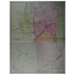
- Large Original Antique City Plan of Minneapolis and St Paul, USA, circa 1900By Rand McNally & Co.Located in St Annes, LancashireFabulous colorful map of Minneapolis and St Paul, Minnesota. Original color By Rand, McNally & Co. Published, circa 1900 Unframed Free shipping.Category
Antique Early 1900s American Maps
MaterialsPaper
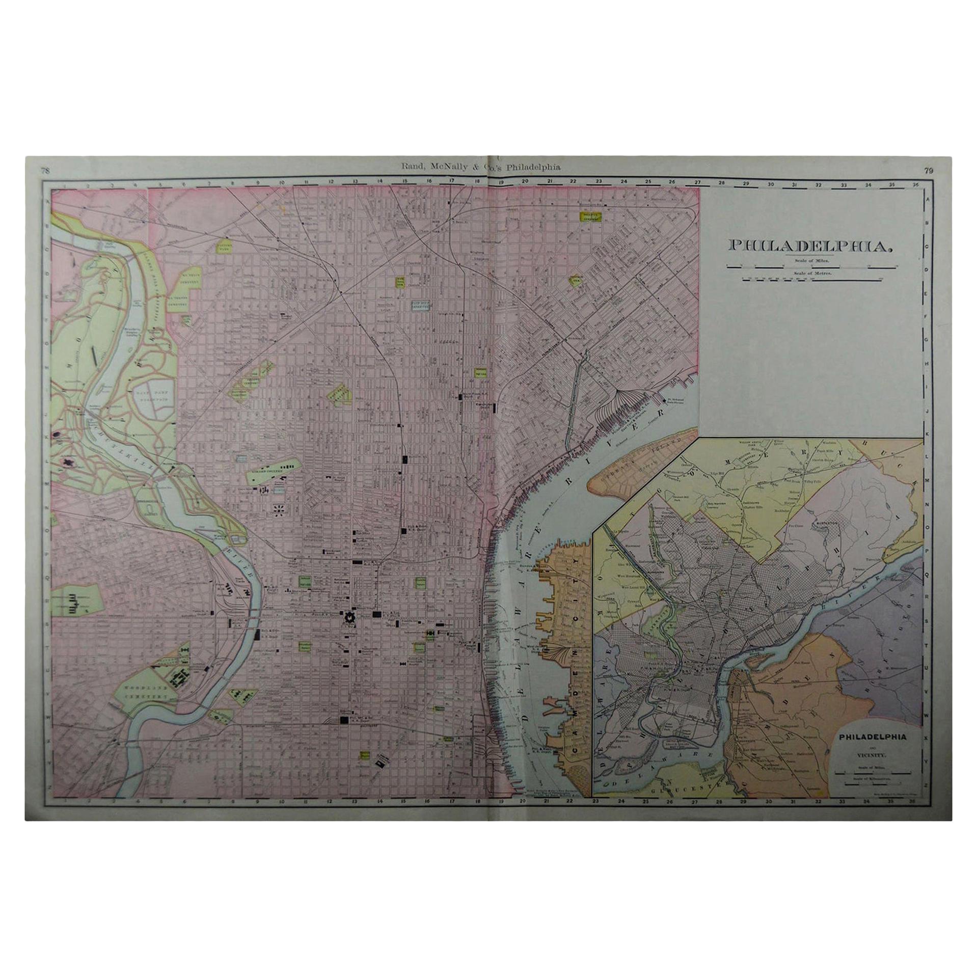
- Large Original Antique City Plan of Philadelphia, USA, circa 1900By Rand McNally & Co.Located in St Annes, LancashireFabulous colorful map of Philadelphia Original color By Rand, McNally & Co. Published, circa 1900. Unframed Free shipping.Category
Antique Early 1900s American Maps
MaterialsPaper
- Large Original Antique City Plan of Montreal, Canada, circa 1900By Rand McNally & Co.Located in St Annes, LancashireFabulous colorful map of Montreal Original color By Rand, McNally & Co. Published, circa 1900 Unframed Free shipping.Category
Antique Early 1900s American Maps
MaterialsPaper
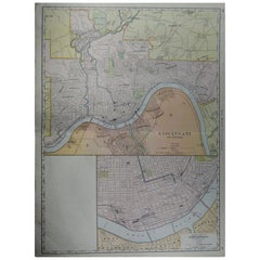
- Large Original Antique City Plan of Cincinnati, USA, circa 1900By Rand McNally & Co.Located in St Annes, LancashireFabulous colorful map of Cincinnati, Ohio. Original color By Rand, McNally & Co. Published, circa 1900 Unframed Free shipping.Category
Antique Early 1900s American Maps
MaterialsPaper
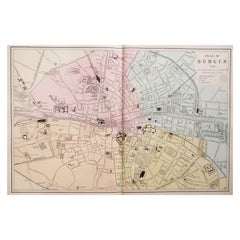
- Large Original Antique City Plan of Dublin, Ireland, circa 1880Located in St Annes, LancashireGreat city plan of Dublin Published circa 1880 Unframed Free shipping. .Category
Antique 1880s Scottish Maps
MaterialsPaper
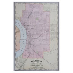
- Original Antique City Plan of St Joseph, Missouri, USA, 1894By Rand McNally & Co.Located in St Annes, LancashireFabulous colorful map of St Joseph Original color By Rand, McNally & Co. Published, 1894 Unframed Free shipping.Category
Antique 1890s American Maps
MaterialsPaper


Recently Viewed
View AllMore Ways To Browse
Old Chinese Map
Map Of Louisiana
Papua New Guinea Antique Map
Map Of The Bahamas
Antique Map Tuscany
Antique Maps Surrey
Richmond Map
Charlotte Reine
Republic Of Texas Map
Antique Map Bahamas
Antique Maps Of Puerto Rico
Cheshire Antique Map
Map Of Washington Dc
Washington Dc Map
Antique Map Of New Hampshire
Auge En Pierre
Buenos Ayres
Map Lebanon