Items Similar to Antique Plan of Batavia in the Dutch East Indies or Indonesia, circa 1695
Want more images or videos?
Request additional images or videos from the seller
1 of 6
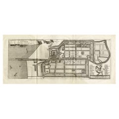
Antique Plan of Batavia in the Dutch East Indies or Indonesia, circa 1695
About the Item
Antique print titled 'Plan de Batavia'. Plan of Batavia, Jakarta, Indonesia. Oriented with north to the lower right by a simple compass rose. French title and key cartouche in drape form.
Artists and Engravers: Nicolas de Fer (1646 – 25 October 1720) was a French cartographer and geographer. He also was an engraver and publisher. His works focused more on quantity than quality, there were often geographical errors, and they were more artistic than accurate.
Condition: Good, age-related toning. Minor wear, blank verso. Please study image carefully.
Date: circa 1695
Overall size: 32.5 x 22 cm.
Image size: 29 x 16 cm.
We sell original antique maps to collectors, historians, educators and interior decorators all over the world. Our collection includes a wide range of authentic antique maps from the 16th to the 20th centuries. Buying and collecting antique maps is a tradition that goes back hundreds of years. Antique maps have proved a richly rewarding investment over the past decade, thanks to a growing appreciation of their unique historical appeal. Today the decorative qualities of antique maps are widely recognized by interior designers who appreciate their beauty and design flexibility. Depending on the individual map, presentation, and context, a rare or antique map can be modern, traditional, abstract, figurative, serious or whimsical. We offer a wide range of authentic antique maps for any budget.
- Dimensions:Height: 8.67 in (22 cm)Width: 12.8 in (32.5 cm)Depth: 0 in (0.01 mm)
- Materials and Techniques:
- Period:
- Date of Manufacture:c.1695
- Condition:Condition: Good, age-related toning. Minor wear, blank verso. Please study image carefully.
- Seller Location:Langweer, NL
- Reference Number:
About the Seller
5.0
Platinum Seller
These expertly vetted sellers are 1stDibs' most experienced sellers and are rated highest by our customers.
Established in 2009
1stDibs seller since 2017
1,919 sales on 1stDibs
Typical response time: <1 hour
- ShippingRetrieving quote...Ships From: Langweer, Netherlands
- Return PolicyA return for this item may be initiated within 14 days of delivery.
More From This SellerView All
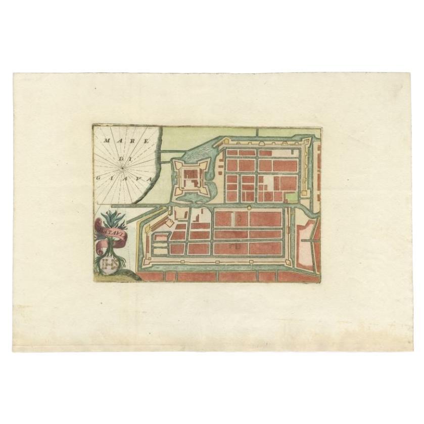
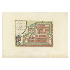
- Antique Plan of Batavia in the Dutch East Indies or Nowadays Jakarta, IndonesiaLocated in Langweer, NLRare plan of Batavia titled 'Batavia'. With 'IHS' monogram, symbolizing Jesus Christ. Source unknown, to be determined. Artists and Enrgavers: Anonymous. Condition: Very good,...Category
Antique 18th Century Maps
MaterialsPaper
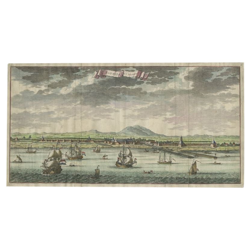
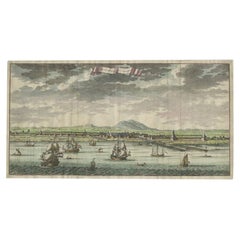
- Antique Print of Batavia, Capital of the Dutch East Indies or Indonesia, '1726'Located in Langweer, NLAntique print Indonesia titled 'Batavia in 't Verschiet'. Large panoramic view on Batavia, present day Jakarta, Indonesia. Originates from 'Oud en Nieuw Oost-Indiën (..)' by François...Category
Antique 18th Century Prints
MaterialsPaper
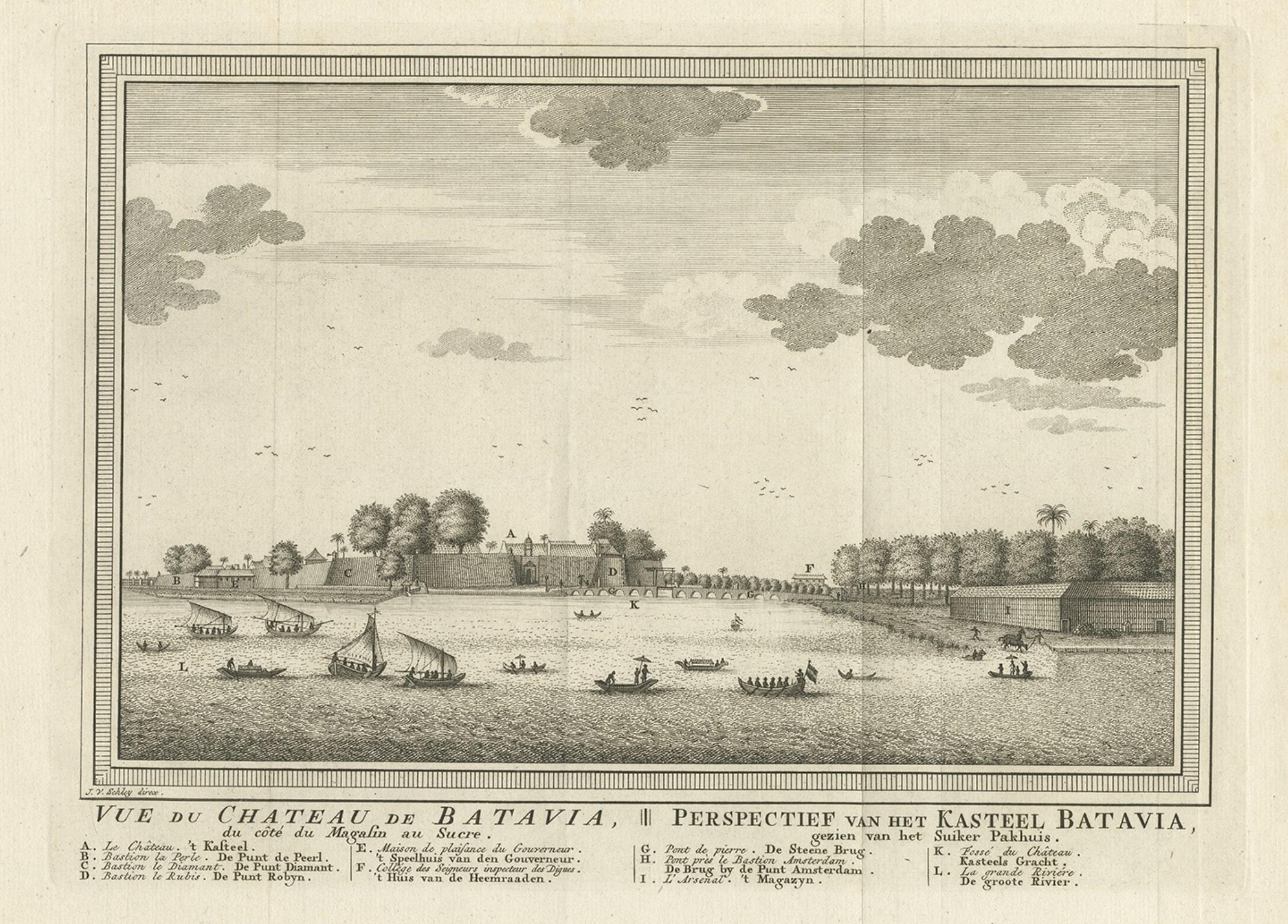
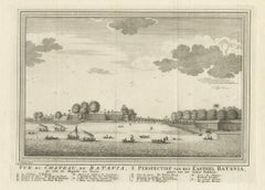
- Antique Print of Capital Batavia in the Dutch East Indies 'Indonesia', C.1752Located in Langweer, NLAntique print Indonesia titled 'Vue Du Chateau De Batavia - Perspectief van het kasteel Batavia'. View of the Castle of Batavia, seen from the sugar warehouse. Originates from Antoin...Category
Antique 18th Century Prints
MaterialsPaper
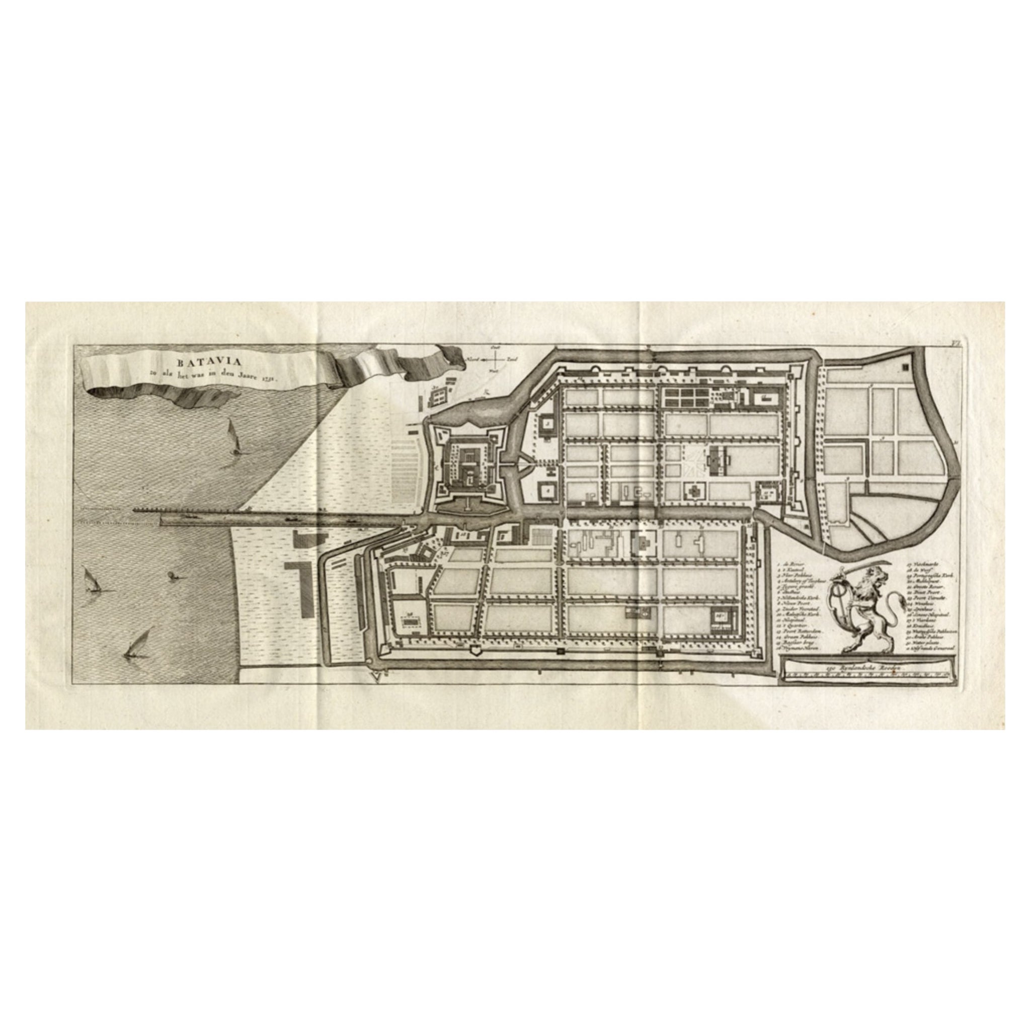
- Antique Map of Batavia 'Jakarta, Indonesia', the Dutch East-Indies, 1782Located in Langweer, NLAntique map titled 'Batavia zo als het was in den Jaare 1731.' (Batavia as it was in the year 1731.) Map of the city of Batavia (Jakarta) in Indonesia. With legend and scale. This pr...Category
Antique 18th Century Maps
MaterialsPaper
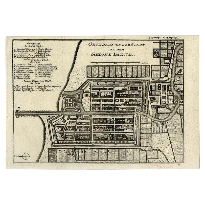
- Antique Plan of Batavia and the Castle in the Dutch East Indies, 1763Located in Langweer, NLAntique map titled 'Grundriss von der Stadt und dem Schlosse Batavia.' Plan of the city and the castle of Batavia in the Dutch East Indies / Indonesia. From 'Algemeine Welthistorie (...Category
Antique 18th Century Maps
MaterialsPaper
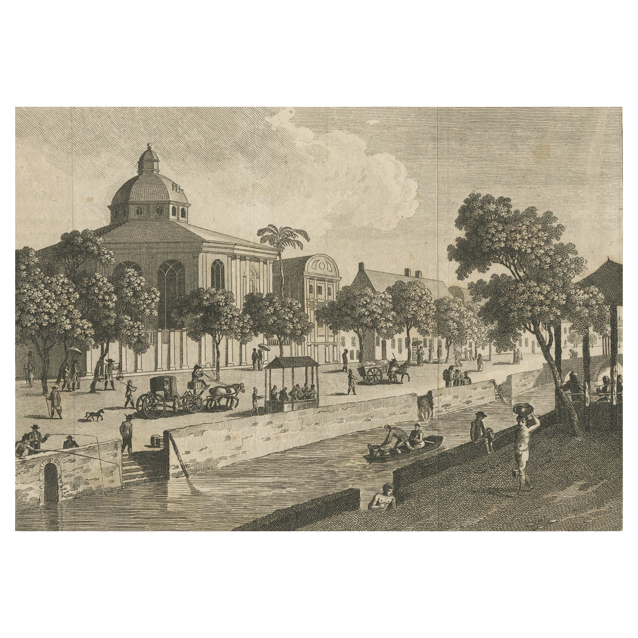
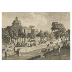
- Antique Print of Batavia, Capital of the Dutch East Indies 'Indonesia', c.1820Located in Langweer, NLAntique print titled 'Ansicht einer Strasse in Batavia'. Old print with a view on a street in Batavia (Jakarta), Indonesia. Source unknown, to be determined. Artists and Engraver...Category
Antique 19th Century Prints
MaterialsPaper

You May Also Like
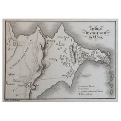
- Original Antique Plan of The Battle of Abukir, Napoleon Bonaparte. Circa 1850Located in St Annes, LancashireGreat battle plan of The Battle of Abukir Drawn by A.M Perrot Steel engraving by Tardieu with original hand colour Unframed. The size given is the paper sizeCategory
Antique 1850s French Maps
MaterialsPaper
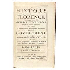
- The Works of the Famous Nicolas Machiavelli - SECOND EDITION - 1695Located in Hillsborough, NJAUTHOR: MACHIAVELLI, Nicolas TITLE: The Works of the Famous Nicolas Machiavel, Citizen and Secretary of Florence. Written originaIly [sic] in Italian, and from thence newly and fait...Category
Antique 1690s British Books
MaterialsLeather
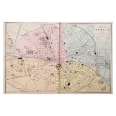
- Large Original Antique City Plan of Dublin, Ireland, circa 1880Located in St Annes, LancashireGreat city plan of Dublin Published circa 1880 Unframed Free shipping. .Category
Antique 1880s Scottish Maps
MaterialsPaper
- Large Original Antique City Plan of Philadelphia, USA, circa 1900By Rand McNally & Co.Located in St Annes, LancashireFabulous colorful map of Philadelphia Original color By Rand, McNally & Co. Published, circa 1900. Unframed Free shipping.Category
Antique Early 1900s American Maps
MaterialsPaper
- Large Original Antique City Plan of Montreal, Canada, circa 1900By Rand McNally & Co.Located in St Annes, LancashireFabulous colorful map of Montreal Original color By Rand, McNally & Co. Published, circa 1900 Unframed Free shipping.Category
Antique Early 1900s American Maps
MaterialsPaper
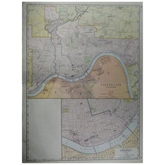
- Large Original Antique City Plan of Cincinnati, USA, circa 1900By Rand McNally & Co.Located in St Annes, LancashireFabulous colorful map of Cincinnati, Ohio. Original color By Rand, McNally & Co. Published, circa 1900 Unframed Free shipping.Category
Antique Early 1900s American Maps
MaterialsPaper


Recently Viewed
View AllMore Ways To Browse
Antique Map Argentina
Antique Map Of Argentina
John Acton
William Acton
Antique Map Norfolk
Antique Map Of Colombia
Antique Maps Hampshire
Antique Maps Norfolk
Colombia Map Antique
Durham Antique Map
Mozambique Antique Map
Nottinghamshire Antique Map
Patagonia Map
Antique Furniture Queensland
Gabon Antique Map
Minnesota Map
Moravia Map
Alabama Map