Items Similar to Charting the West: Surveyor General Roe’s Western Australian Expedition , 1852

Want more images or videos?
Request additional images or videos from the seller
1 of 10
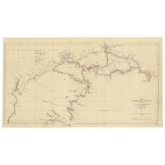
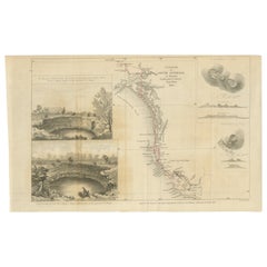
Charting the West: Surveyor General Roe’s Western Australian Expedition , 1852
About the Item
This map is a historical document, focused on Western Australia. It illustrates the route of an expedition under Surveyor General Roe from Perth to Russell Range during 1848 and 1849.
The 1848-1849 expedition of John Septimus Roe to the Russell Ranges stands as a significant chapter in the exploration history of Western Australia. Roe, serving as the first Surveyor General of Western Australia—a role he held for an impressive 43 years—undertook this journey as one of his major exploratory endeavors. His expeditions were pivotal in charting unknown territories and fostering a deeper understanding of the Australian landscape.
During his tenure, Roe was responsible for mentoring future explorers and is often described as the 'Father of Australian Explorers'. His meticulous field notes and sketches from his various expeditions provide a detailed and accurate record of the land as it was during the first contact by European settlers. His observations covered a wide range of aspects, from the landscapes and water sources to the flora and fauna, as well as interactions with Indigenous peoples and their place names.
The expedition to the Russell Ranges was one of Roe's four major explorations, with the others occurring in 1835 to King George Sound, in 1836 to Wongan Hills, and in 1847 to Champion Bay and Hutt River. The complete record of his exploratory work was compiled and published in 2014, ensuring that his contributions to Australian exploration are preserved and accessible for future generations. This comprehensive collection not only includes Roe's field reports but is also enhanced with expert analysis of the region's plant and animal species, and insights into the navigation and surveying techniques of the time.
Roe's work was instrumental in mapping the Australian frontier and his legacies in navigation and exploration continue to be celebrated in Western Australian history.
- Dimensions:Height: 8.47 in (21.5 cm)Width: 16.93 in (43 cm)Depth: 0 in (0.02 mm)
- Materials and Techniques:
- Period:
- Date of Manufacture:1852
- Condition:Good. Thin paper with vertical folds as issued. Light creasing in lower right corner. A light brownish hue, mainly around the edges, adding to its patina. Study the images carefully.
- Seller Location:Langweer, NL
- Reference Number:
About the Seller
5.0
Platinum Seller
These expertly vetted sellers are 1stDibs' most experienced sellers and are rated highest by our customers.
Established in 2009
1stDibs seller since 2017
1,922 sales on 1stDibs
Typical response time: <1 hour
- ShippingRetrieving quote...Ships From: Langweer, Netherlands
- Return PolicyA return for this item may be initiated within 14 days of delivery.
More From This SellerView All
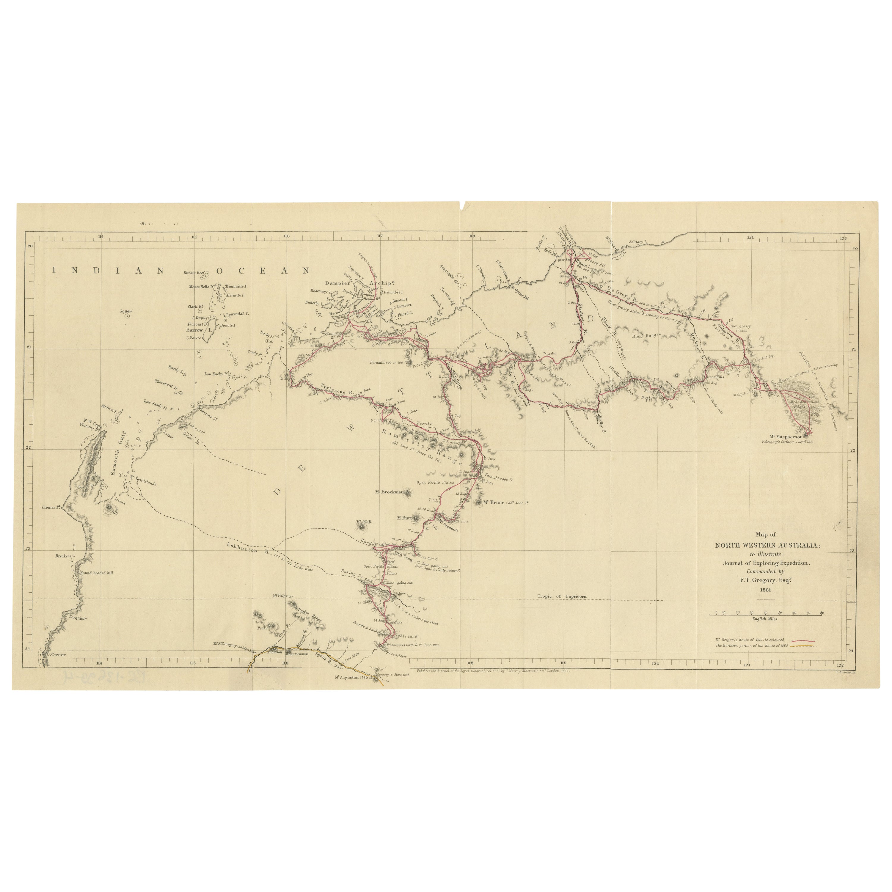
- Gregory's 1861 Expedition into the North West of Australia, 1862Located in Langweer, NLThe map represents the route taken during F.T. Gregory's 1861 North West Australian Expedition. This exploration was a significant journey that took place over the Pilbara region,...Category
Antique 1860s Prints
MaterialsPaper
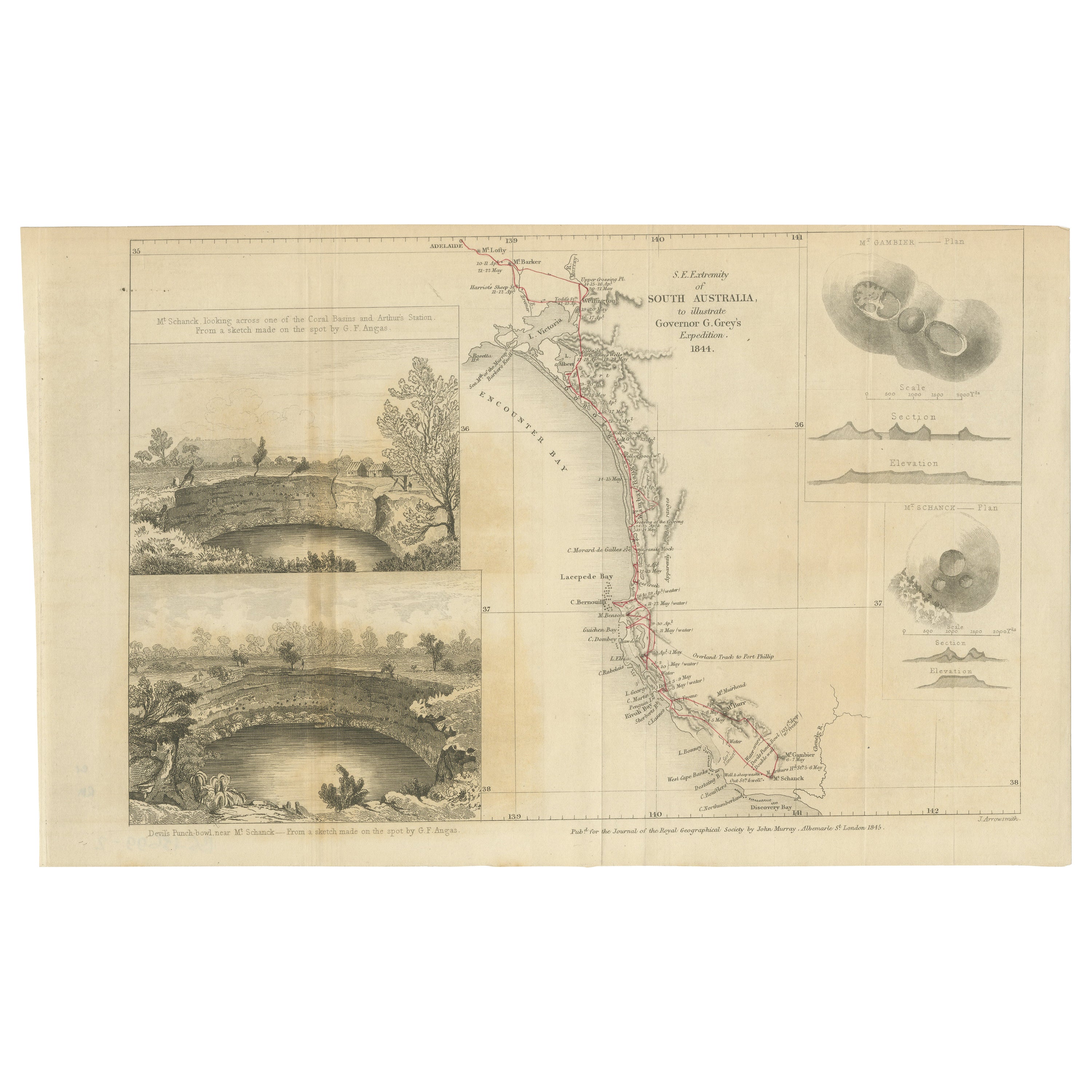
- Traversing the Volcanic Frontier: A South Australian Expedition of 1844Located in Langweer, NLThis is a historical document and part of a map and illustration from an expedition. The text indicates it is from South Australia to illustrate Governor G. Grey's Expedition in 1841...Category
Antique 1840s Prints
MaterialsPaper
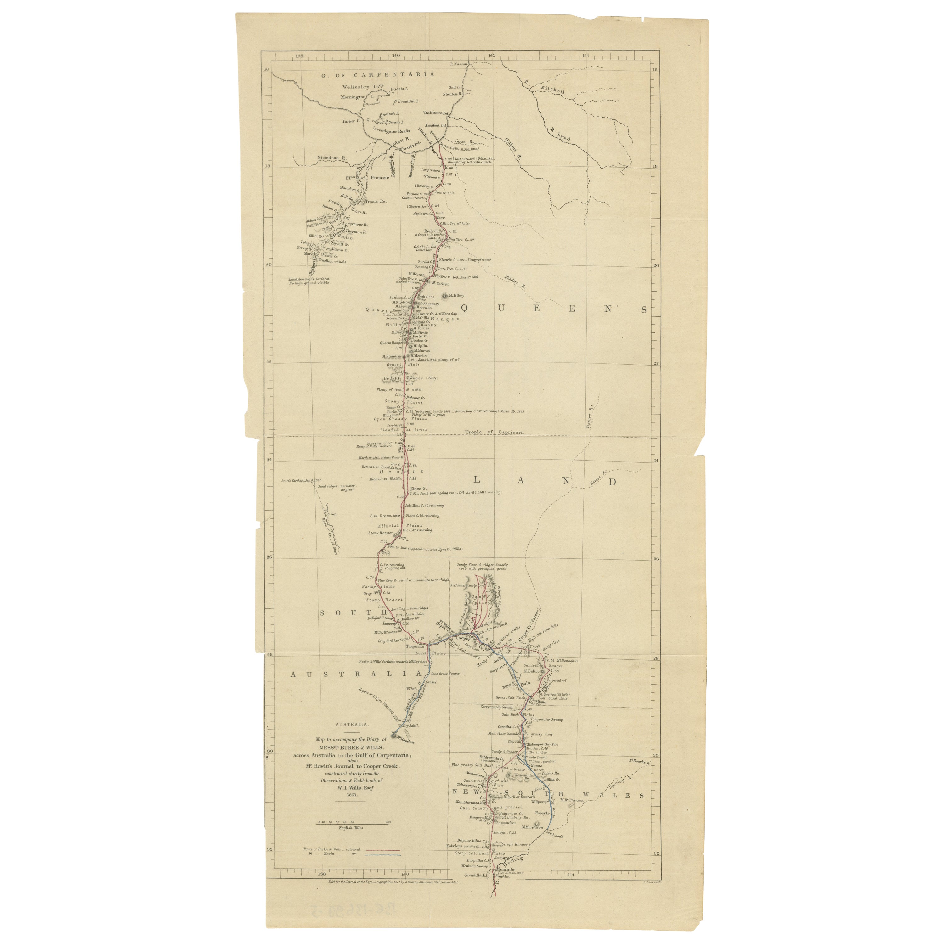
- The Fateful Track of The Burke and Wills Expedition in Australia's Outback, 1862Located in Langweer, NLThe map depicts the route of the Burke and Wills expedition, one of the most famous and tragic explorations in Australian history. This journey was the first to cross the Australian ...Category
Antique 1860s Prints
MaterialsPaper
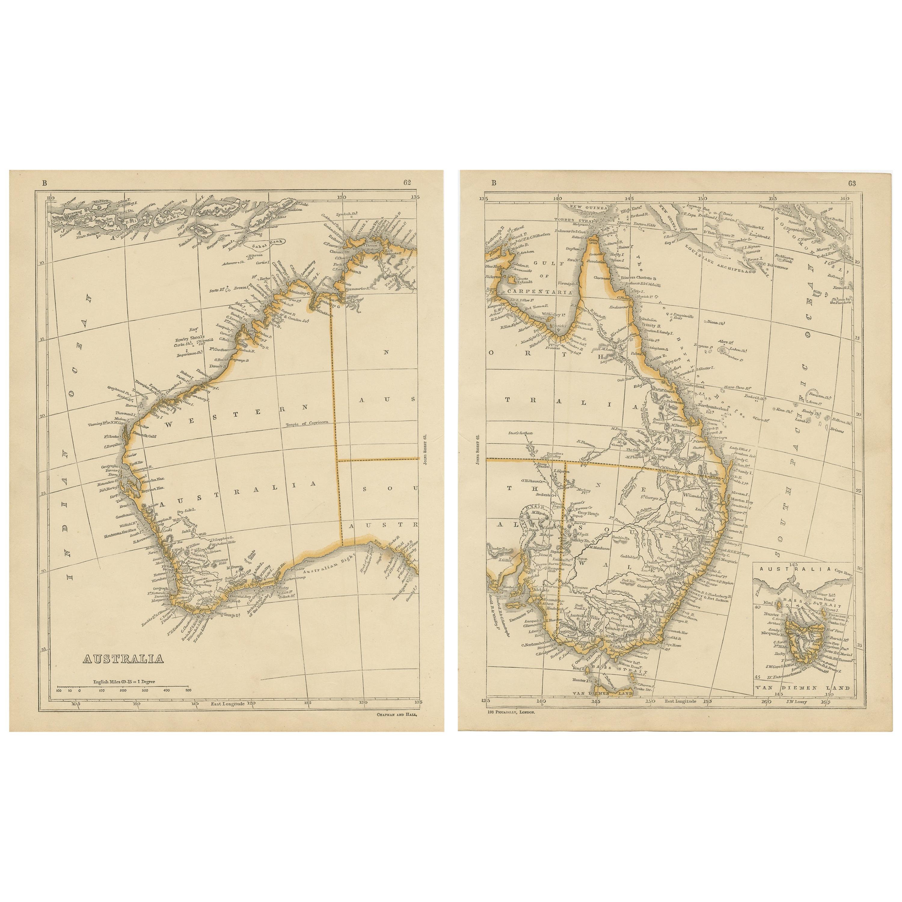
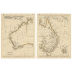
- Antique Map of Australia by Lowry, 1852Located in Langweer, NLAntique map titled 'Australia'. Two individual sheets of Australia. This map originates from 'Lowry's table Atlas constructed and engraved from the most recent authorities' by J.W. L...Category
Antique Mid-19th Century Maps
MaterialsPaper
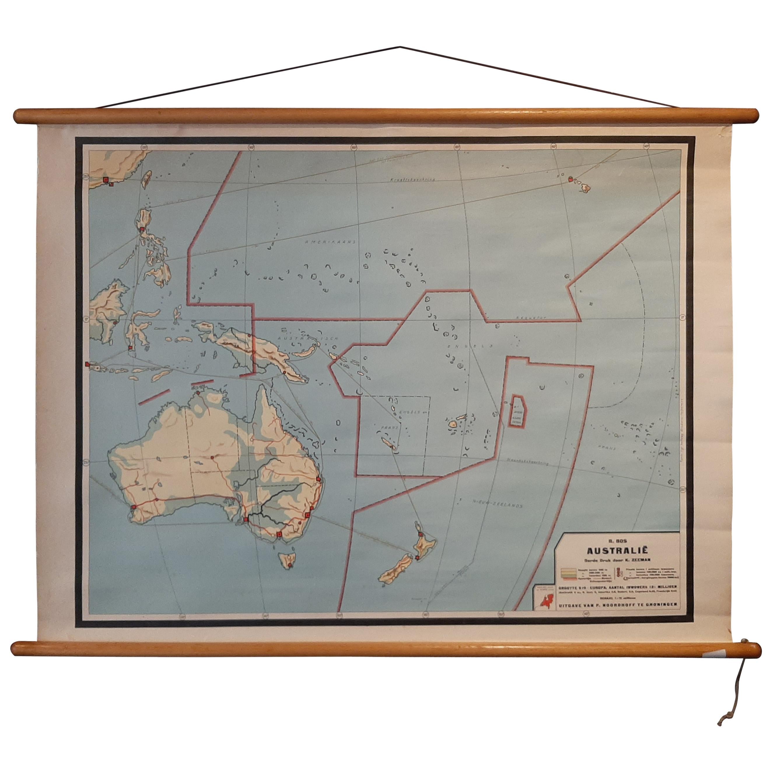
- Vintage Wall Chart of Australia, 1949Located in Langweer, NLVintage wall chart of Australia and surroundings. Published by R. Bos and K. Zeeman, 1949.Category
Mid-20th Century Prints
MaterialsPaper
- Antique Map of the West Indies and Central America by Lowry '1852'Located in Langweer, NLAntique map titled 'West Indies and Central America'. Original map of the West Indies and Central America. This map originates from 'Lowry's Table Atlas constructed and engraved from...Category
Antique Mid-19th Century Maps
MaterialsPaper


You May Also Like
- "The Death of General Wolfe", Etching after Benjamin West, laid on vellumBy Benjamin WestLocated in Norwich, GBEtching on laid paper laid down on vellum, around 1789. Etching after Benjamin West's 1770 painting "The Death of General Wolfe" commemorating the Bat...Category
Antique 1780s Canadian Georgian Prints
MaterialsPaper
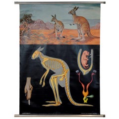
- Jung Koch Quentell Vintage Mural Wall Chart Kangaroo Australian LandscapeLocated in Berghuelen, DEA fantastic cottagecore rollable wall chart by famous Jung Koch Quentell showing the profil of the lovely kangaroo. The chart is published by Lehrmittelverlag Hagemann, Duesseldorf. ...Category
Mid-20th Century German Country Prints
MaterialsMetal
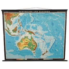
- Vintage Mural Map Rollable Wall Chart Poster Australia New Zealand IndonesiaLocated in Berghuelen, DEVintage Mural Map Rollable Wall Chart Poster Australia New Zealand Indonesia The vintage pull-down map shows Australia and Oceania, published by Haack-Painke Justus Perthes Darmstadt. Colorful print on paper reinforced with canvas. This wallchart is a wonderful holiday memory decoration item. Measurements: Width 122 cm (48.03 inch) Height 100 cm (39.37 inch) The measurements shown refer just to the canvas and do not include the poles. Background information on the history of school wall charts: The idea to upgrade every day school life by using pictures was supported in the late 18th century by Johann Bernhard Basedow. In 1774 he published a four-volume book "Elementarwerk" which combined pictures, text and information with merely hundred copperplates. Modern printing methods enabled the spread from rich private schools to rural grade schools...Category
Vintage 1970s German Country Posters
MaterialsCanvas, Wood, Paper
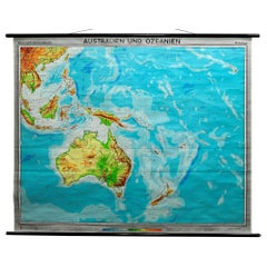
- Australia and Oceania Vintage Art Map Poster Rollable Wall Chart MuralLocated in Berghuelen, DEAustralia and Oceania Vintage Art Map Poster Rollable Wall Chart Mural The classical geographical wall chart shows a map of Australia and Oceania – physical view. Used as teaching Material in German schools. Colorful print on paper reinforced with canvas. Published by Westermann. This wallchart is a wonderful holiday memory decoration item. Measurements: Width 209 cm (82.28 inch) Height 170 cm (66.93 inch) The measurements shown refer just to the canvas and do not include the poles. Background information on the history of school wall charts: The idea to upgrade every day school life by using pictures was supported in the late 18th century by Johann Bernhard Basedow. In 1774 he published a four-volume book "Elementarwerk" which combined pictures, text and information with merely hundred copperplates. Modern printing methods enabled the spread from rich private schools to rural grade schools...Category
Vintage 1970s German Country Posters
MaterialsCanvas, Wood, Paper
- Map Mural Rollable Poster Vintage Wall Chart Australia New Zealand PolynesiaLocated in Berghuelen, DEMap Mural Rollable Poster Vintage Wall Chart Australia New Zealand Polynesia A beautiful vintage school map illustrating the popular region of Aust...Category
Vintage 1970s German Country Posters
MaterialsCanvas, Wood, Paper
- Blue Mountains Ropeway New South Wales Australia Cottagecore Vinteage Wall ChartLocated in Berghuelen, DEA fantastic vintage pull-down wall chart presenting the lovely ropeway in the blue mountains in New South Wales, Australia. Used as teaching material in German schools. Published by ...Category
Vintage 1970s German Country Prints
MaterialsCanvas, Wood, Paper