Items Similar to Traversing the Volcanic Frontier: A South Australian Expedition of 1844
Want more images or videos?
Request additional images or videos from the seller
1 of 9
Traversing the Volcanic Frontier: A South Australian Expedition of 1844
About the Item
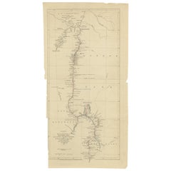
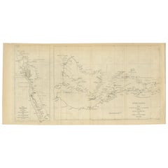
This is a historical document and part of a map and illustration from an expedition. The text indicates it is from South Australia to illustrate Governor G. Grey's Expedition in 1841. It includes detailed sketches of landscapes and geological formations, such as Mount Schank and Devil's Punchbowl near Mount Schank, based on sketches by G.F. Angas.
The map portion outlines a specific route with geographical names and landmarks, which are marked along the path of the expedition. On the right side of the document, there are detailed plans and sections of Mount Gambier and Mount Schank, showing their elevation and geological structure.
Such documents are valuable for understanding the history of exploration, geology, and cartography in Australia, particularly in the mid-19th century. Governor George Grey's expeditions were significant in the early European exploration of Australia, and the illustrations by George French Angas, a notable painter and lithographer, add a visual understanding of the terrain and significant natural landmarks they encountered.
Governor George Grey's expeditions, particularly the one illustrated here, were part of his broader exploratory work in Australia. Before his 1844 expedition in South Australia, Grey had undertaken significant explorations in Western Australia between 1837 and 1840. During these earlier expeditions, he traversed regions of Australia that were previously unexplored by Europeans, with the hope of discovering major rivers or inlets and assessing the land for its potential for colonization.
In the 1844 expedition in South Australia, Grey explored the southeastern extremity of the region, detailing his route along the coast from Encounter Bay to Discovery Bay, near Adelaide. The maps and illustrations created during this expedition, such as this one, included notations of significant geographical features, watering spots, and the routes taken. This particular expedition seemed to focus on areas with volcanic activity, as indicated by the detailed plans and elevations of Mount Schanck and Mount Gambier, as well as the sketches of the Devil's Punchbowl, which Grey described as filled with freshwater and nearly unfathomable.
Grey's expeditions contributed significantly to the understanding of the Australian landscape, especially in regions that were poorly documented at the time. His work helped to lay the groundwork for future settlement and development in these areas.
.
- Dimensions:Height: 8.39 in (21.3 cm)Width: 13.51 in (34.3 cm)Depth: 0 in (0.02 mm)
- Materials and Techniques:
- Period:
- Date of Manufacture:1844
- Condition:Good. Light paper with folds as issued. One fold supported by archival tape. Minor browning, especially around the edges and in the two images. Tight margin in the top and some creasing. Study the images carefully.
- Seller Location:Langweer, NL
- Reference Number:
About the Seller
5.0
Platinum Seller
These expertly vetted sellers are 1stDibs' most experienced sellers and are rated highest by our customers.
Established in 2009
1stDibs seller since 2017
1,922 sales on 1stDibs
Typical response time: <1 hour
- ShippingRetrieving quote...Ships From: Langweer, Netherlands
- Return PolicyA return for this item may be initiated within 14 days of delivery.
More From This SellerView All
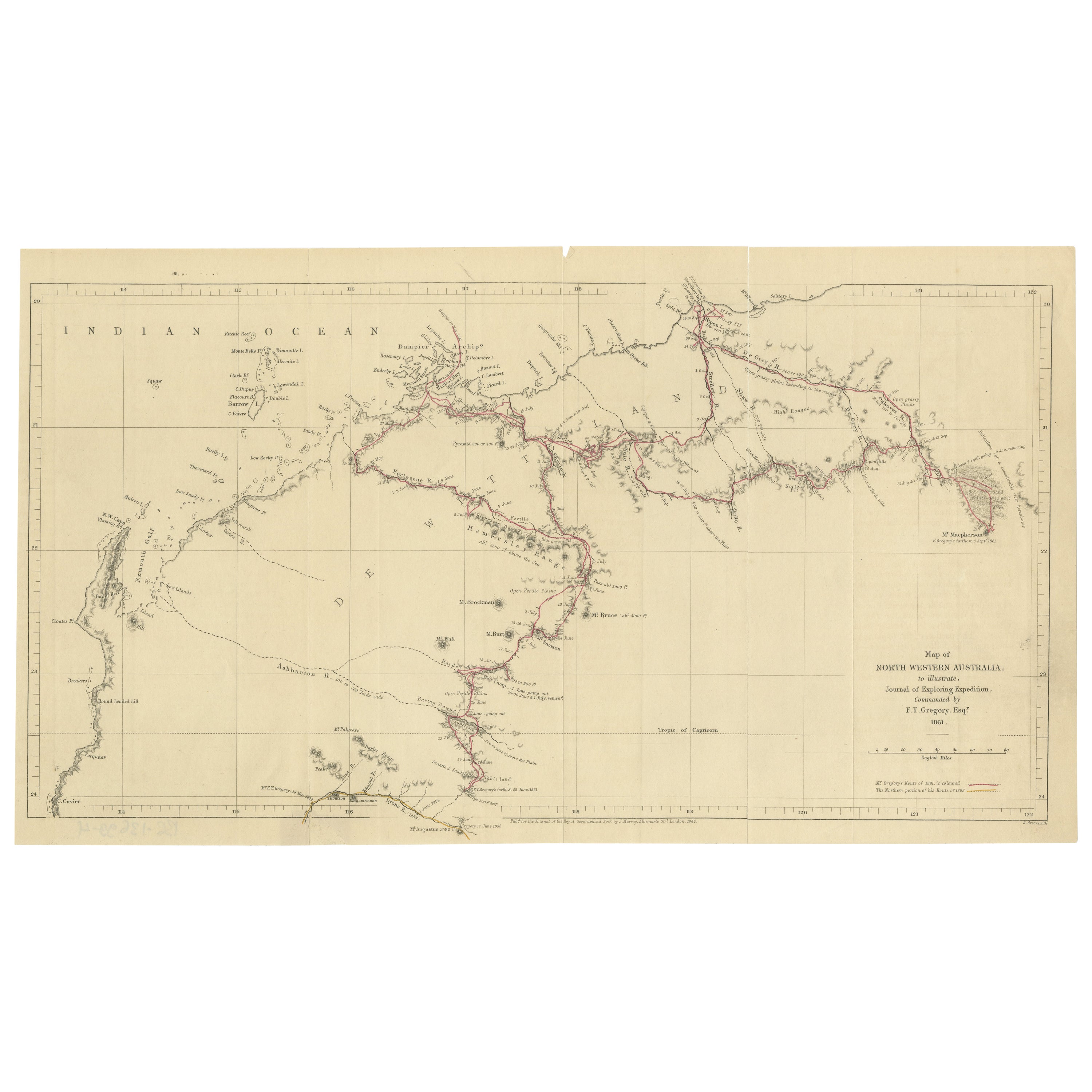
- Gregory's 1861 Expedition into the North West of Australia, 1862Located in Langweer, NLThe map represents the route taken during F.T. Gregory's 1861 North West Australian Expedition. This exploration was a significant journey that took place over the Pilbara region,...Category
Antique 1860s Prints
MaterialsPaper
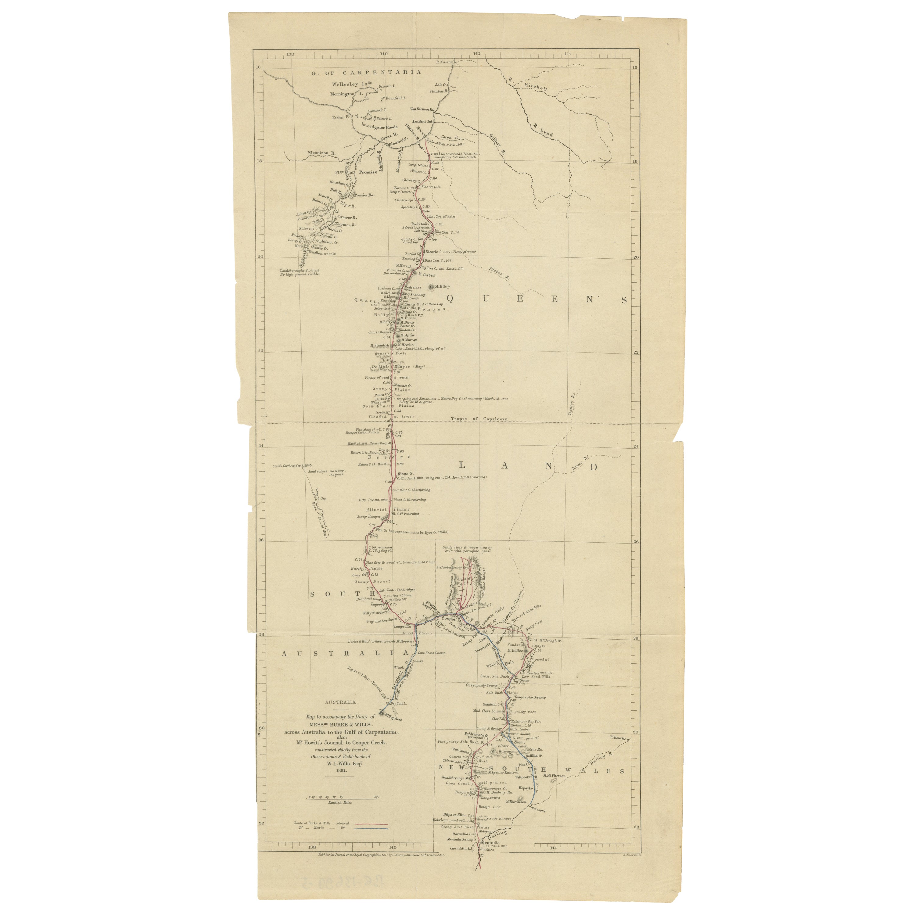
- The Fateful Track of The Burke and Wills Expedition in Australia's Outback, 1862Located in Langweer, NLThe map depicts the route of the Burke and Wills expedition, one of the most famous and tragic explorations in Australian history. This journey was the first to cross the Australian ...Category
Antique 1860s Prints
MaterialsPaper
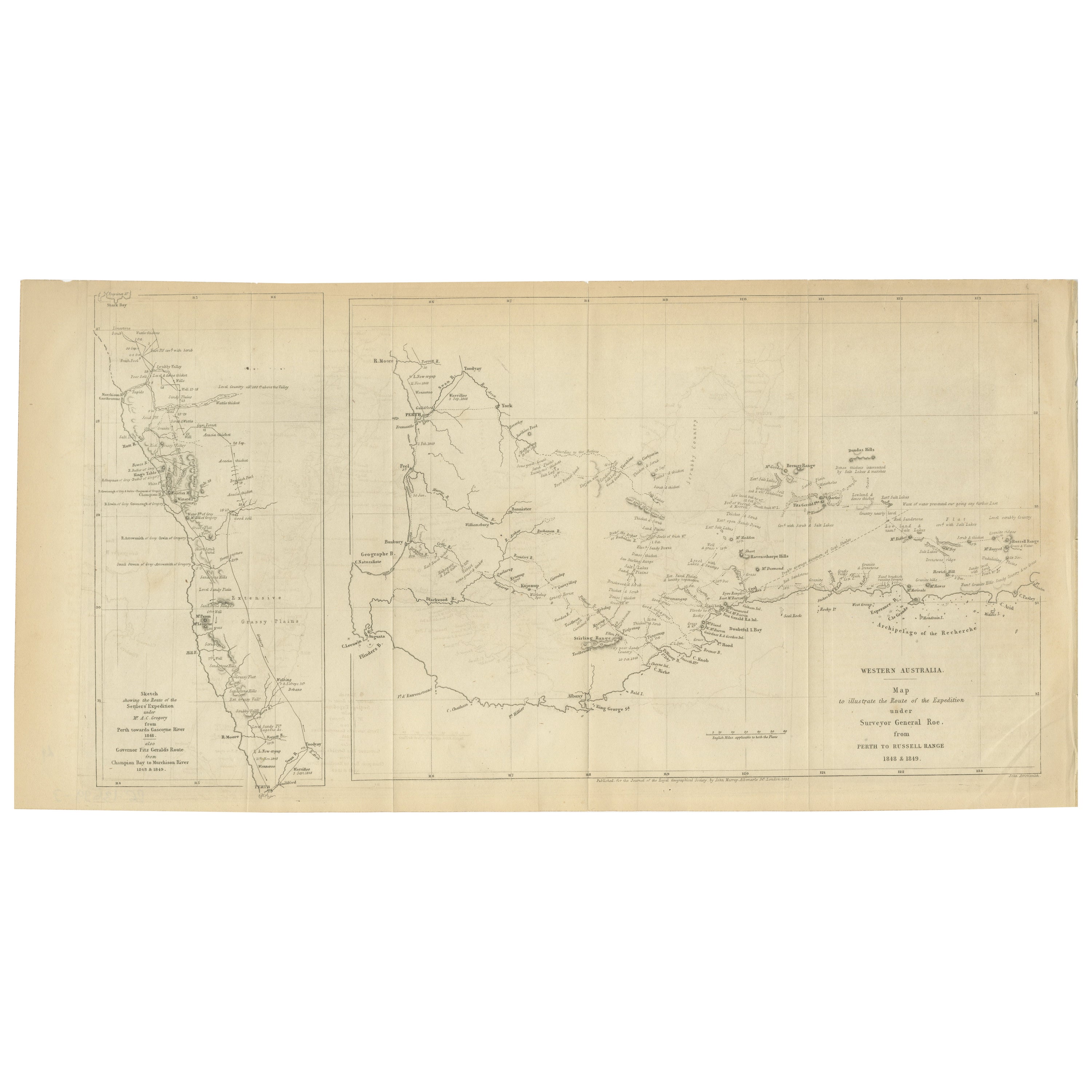
- Charting the West: Surveyor General Roe’s Western Australian Expedition , 1852Located in Langweer, NLThis map is a historical document, focused on Western Australia. It illustrates the route of an expedition under Surveyor General Roe from Perth to Russell Range during 1848 and 1849...Category
Antique 1850s Prints
MaterialsPaper
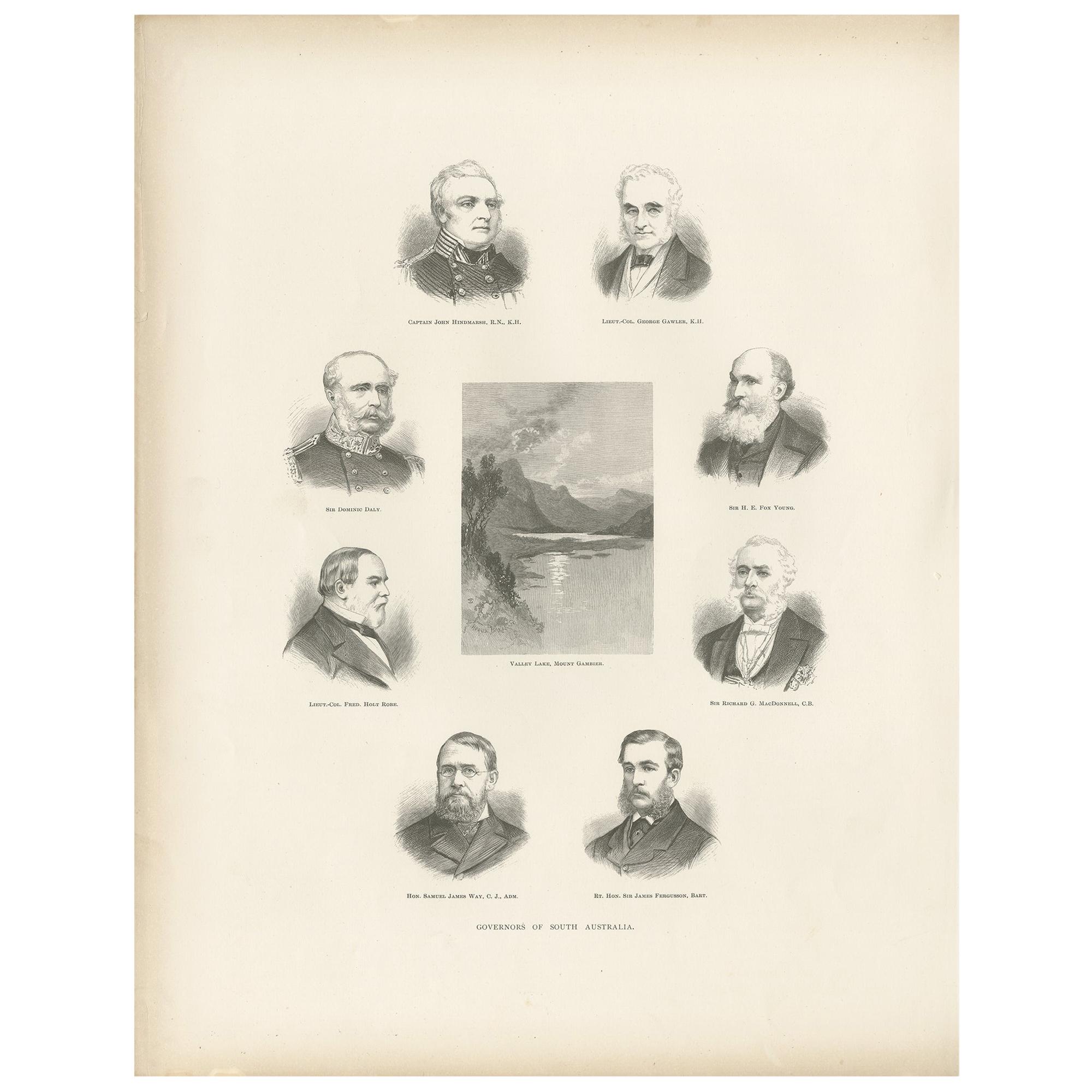
- Antique Print of the Governors of South Australia '1888'Located in Langweer, NLAntique print titled 'Governors of South Australia'. Shows; Captain John Hindmarsh. R.N., K.H; Lieut.-Col George Gawler, K.H; Sir Dominic Daly; Sir H.E. Fox Young; Lieut.-Col. Fred. Holt Robe; Sir Richard G. MacDonnell, C.B; Valley Lake, Mount Gambier; Hon. Samuel James Way...Category
Antique Late 19th Century Prints
MaterialsPaper
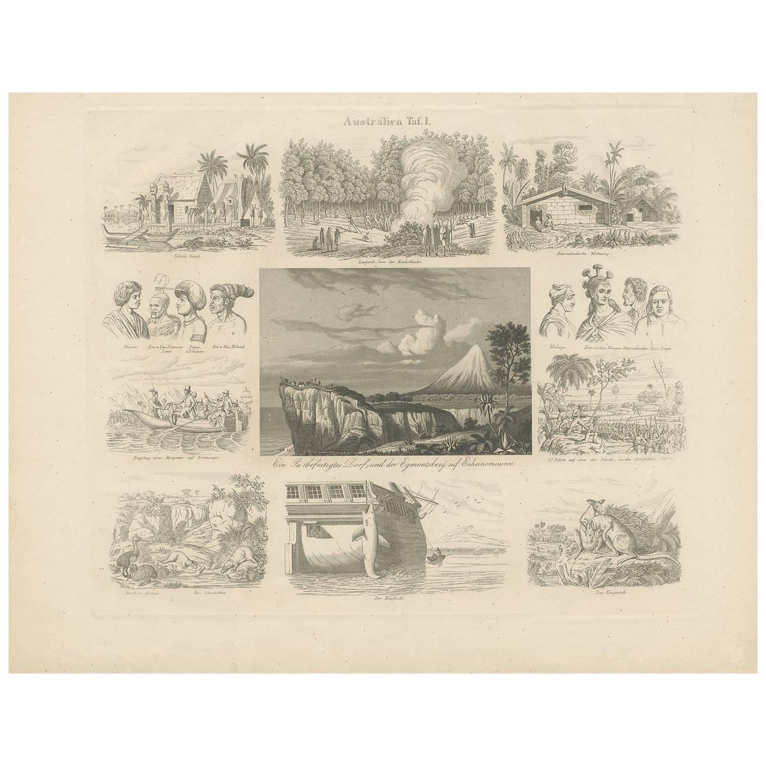
- Antique Print with Views of Australia I by Rosmäsler, circa 1844Located in Langweer, NLAntique print with 11 scenes of Australia. Depicting for example a Kangaroo, a Temple various other animals and many more. This print originates from 'Album für Freunde der Länder un...Category
Antique Mid-19th Century Prints
MaterialsPaper
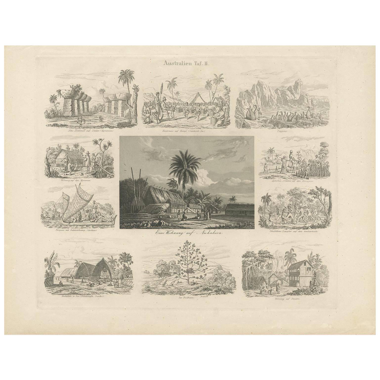
- Antique Print with Views of Australia (II) by Rosmäsler, circa 1844Located in Langweer, NLAntique print with 11 scenes of Australia. Depicting for example a house in Nukahiwa, Pinguïns and many more. This print originates from 'Album für Freunde der Länder und Völkerkunde...Category
Antique Mid-19th Century Prints
MaterialsPaper

You May Also Like
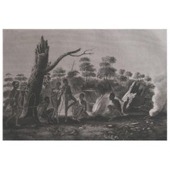
- Original Antique Ethnographical Print, Figures, New South Wales, Australia, 1809Located in St Annes, LancashireWonderful ethnographical print. A copper-plate engraving after Lesieur Published by Sherwood, Neely & Jones. Dated 1809 Unframed.Category
Antique Early 1800s English Folk Art Prints
MaterialsPaper
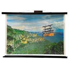
- Blue Mountains Ropeway New South Wales Australia Cottagecore Vinteage Wall ChartLocated in Berghuelen, DEA fantastic vintage pull-down wall chart presenting the lovely ropeway in the blue mountains in New South Wales, Australia. Used as teaching material in German schools. Published by ...Category
Vintage 1970s German Country Prints
MaterialsCanvas, Wood, Paper
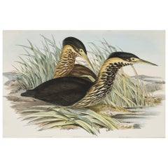
- John Gould Lithograph from 'Birds of Australia'By John GouldLocated in Petworth, West SussexJohn Gould (English, 1804-1881), 'Ardetta Flavicollis', Australian Bittern, from 'Birds of Australia’, hand colored lithograph, published 1840-1848, framed.Category
Antique Mid-19th Century British Prints
MaterialsPaper
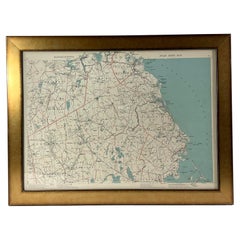
- 1891 Map of South Shore of BostonLocated in Norwell, MAOriginal 1891 map showing Cohasset, Scituate, Marshfield, Duxbury, Kingston, Norwell, Hanover, Hingham, Hull, Holbrook, Weymouth, Hanson, Pembroke, etc. Framed with glass. Circa 1891.Category
Antique 1890s North American Prints
MaterialsPaper
- 1844 French Antique Nautical Portolano of Golfe De St. Drely by Antoine RouxBy Antoine RouxLocated in Milan, ITAntique portolano, nautical map of Golfe De St. Drely engraved on a copper plate by Antoine Roux, Marseille France 1844, from his work Recueil des principaux plans des ports et de Ra...Category
Antique 1840s French Nautical Objects
MaterialsPaper
- George Washington by Henry Sadd, Antique Engraving, circa 1844Located in Colorado Springs, COThis is an 1844 engraving of President George Washington. The print was issued by G. Stuart in Albion, New York and engraved by H. S. Sadd. This standing portrait shows President George Washington in front of neoclassical columns. In his right hand, he holds a dress sword...Category
Antique 1840s American Prints
MaterialsPaper