Nautical Charts
148
3
2
to
9
79
69
153
151
152
8
5
3
2
2
1
52
31
65
5
19
34
7
10
4
19
10
3
3
2
1
88
41
39
32
23
52
27
26
18
16
13
2
2
1
1
Sort By
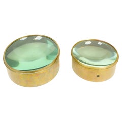
Antique Nautical Chart Brass Magnifiers
Located in New York, NY
Each with domed glass set within a brass surround. Of large size.
Dimensions:
One: Height: 4 x Diameter: 8.5 inchesThe Other: Height: 4.5 x Diameter: 11 inches
Category
Early 20th Century Nautical Objects
Materials
Brass
19th Century Nautical Chart of Martinique
Located in Norwell, MA
Original map of Martinique from 1887 with chartered waters around the island. Prepared from a French survey, completed in 1825, showing town, ports, rivers and tributaries. Published...
Category
Antique 19th Century Nautical Objects
Facsimile with 30 VOC Nautical Charts, the Treasure of Corpus Christi
Located in Langweer, NL
Facsimile with 30 large format VOC nautical charts in limited and numbered edition. Sjoerd de Meer
Category
21st Century and Contemporary Books
Materials
Paper
H 27.17 in W 19.69 in D 0.79 in
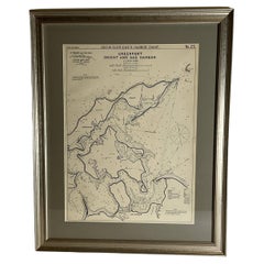
Sag Harbor Nautical Chart
Located in Norwell, MA
Marine chart of Greenport, Orient, and Sag Harbor New York published by George Eldridge in 1901
Category
Antique Early 1900s Prints
Materials
Paper
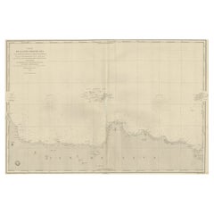
Early French Nautical Chart of the Northern Coast of of Java, Indonesia, C.1850
Located in Langweer, NL
Antique map titled Carte de la côte Nord de Java.
Early French nautical chart of the northern
Category
Antique 1850s Maps
Materials
Paper
H 26.38 in W 38.59 in D 0 in
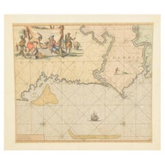
Original Hand-Coloured Nautical Chart of West-Africa, c.1680
Located in Langweer, NL
NIEUWE PASKAERT VAN DE KUST VAN GENEHOA (Senegal) alsmede een gedeelte van Gambia beginnende an C. Blanco tot C. Verde (...). Amsterdam, Johannus van Keulen, c. 1680.
Large folio...
Category
Antique 17th Century Maps
Materials
Paper
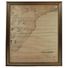
Imray Ocean Chart of the Coast of Brazil 1876
Located in Norwell, MA
Imray & Son 1876 Nautical chart of the Coast of Brazil between Cape Frio and the River Plate
Category
Antique 1870s Nautical Objects
Materials
Paper
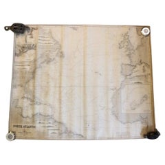
Original Imray & Son Chart of North Atlantic, 1876
Located in Norwell, MA
Nautical chart of the North Atlantic showing the Eastern United States coast, Caribbean Islands
Category
Antique 1870s Nautical Objects
Materials
Paper
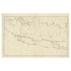
Large Chart of the island and sea of Java, Indonesia
Located in Langweer, NL
Java, Indonesia. Beautiful nautical chart, published 1863 in Spain.
Category
Antique Mid-19th Century Maps
Materials
Paper
1865 Chart of the Islands of Madeira
Located in Norwell, MA
and 102 Minories 1865. Awesome nautical chart. Matted and framed.
Weight: 14 lbs.
Overall Dimensions
Category
Antique 1860s European Maps
Materials
Paper
Antique Map of the British Islands to the White Sea by J. Imray
Located in Langweer, NL
Antique large nautical chart of the British Islands to the White Sea. With insets of Veshnyak
Category
Antique Late 19th Century Maps
Materials
Paper
Chart of the East Coast of England
Located in Norwell, MA
Chart of the East Coast of England, from Dungeness to Flamborough, including the entrances to the
Category
Antique 1840s English Nautical Objects
Materials
Paper
Chart of Japan by James Imray and Son
Located in Norwell, MA
Chart of southern Japan compiled by James F. Imray and published in 1870. The chart captures the
Category
Antique 1870s English Nautical Objects
Materials
Paper
Mariners Chart of Gloucester and Rockport by George Eldridge 1910
Located in Norwell, MA
Nautical chart showing the harbor and local water. The chart display depths buoys, lighthouses, etc
Category
Vintage 1910s North American Prints
Materials
Paper
Mariners Chart of Marion Massachussets by George Eldridge 1901
Located in Norwell, MA
Nautical chart showing the harbor and local waters of Marion Harbor., The chart displays depth
Category
Antique Early 1900s North American Prints
Materials
Paper
Early Chart Identifying British Spice Trading Colony of Bencoolen, Sumatra, 1797
Located in Langweer, NL
Antique map titled 'A Chart of the West Coast of Sumatra'.
Early nautical chart identifying the
Category
Antique 1790s Maps
Materials
Paper
H 22.64 in W 27.96 in D 0 in
Chart of West Coast of South America by James Imray and Son
Located in Norwell, MA
Chart of West Coast of South America compiled by James F. Imray and published in 1880. The chart
Category
Antique 1880s English Nautical Objects
Materials
Paper
Mariners Chart of Fishers Island Sound by George Eldridge 1901
Located in Norwell, MA
Nautical Chart showing the harbor and local waters of fishers island sound. The chart displays
Category
Antique Early 1900s North American Prints
Materials
Paper
Mariners charts of Massachusett Long Island by George Eldridge 1901
Located in Norwell, MA
Nautical Chart showing the harbor and local waters of the Little Neck Bay, Manhasset and Hempstead
Category
Antique Early 1900s North American Prints
Materials
Paper
Long Island Chart from 1828
Located in Norwell, MA
Rare original chart of Long Island Sound by E + G Blunt of New York, 179 Water St. "Surveyed in the
Category
Antique 1830s Nautical Objects
Materials
Paper
1898 Chart of Boston Bay
Located in Norwell, MA
Original 1898 chart showing Massachusetts Bay with the coast from Cape Ann to Cape Cod. This is a
Category
Antique 1890s Nautical Objects
Materials
Paper
Scarce U.S. Coast Survey Map Depicting Entrance to San Francisco Bay Dated 1856
Located in San Francisco, CA
A fine example of the 1856 U.S. Coast lithographic survey nautical chart of the entrance to San
Category
Antique Mid-19th Century American Maps
Materials
Paper
H 28 in W 46 in D 1.5 in
Mariners Chart of Quicks Hole and Tarpaulin Cove by George Eldridge 1901
Located in Norwell, MA
Nautical chart showing the harbor and local waters of Naushon Island Quick Holes. The chart display
Category
Antique Early 1900s North American Maps
Materials
Paper
Mariners Chart of Westport Mass and Narraganset Pier by George Eldridge 1901
Located in Norwell, MA
Original Nautical chart showing the harbor and local waters of Westport Mass, Narraganset Pier R.I
Category
Antique Early 1900s North American Prints
Materials
Paper
Brass Chart Divider-Replicate of One Recovered From Wreck
Located in Den Haag, NL
CHART DIVIDER-REPLICATE OF ONE RECOVERED FROM WRECK OF HMS ASSOCIATION, 1697-1707. Very good
Category
Vintage 1970s English Edwardian Nautical Objects
Materials
Brass
Marina Gutierrez 2007 "En Aqua Memoriam 1"
Located in Palm Springs, CA
back & forth and a translucent plexiglass rear wall show the currents of nautical charts.
Category
Early 2000s American Animal Sculptures
Materials
Aluminum, Other
Old Original Engraving of Prussia on the Southeast Coast of the Baltic Sea, 1632
Located in Langweer, NL
innovation that is still employed in nautical charts.
Condition:
Good, general age-related toning. Minor
Category
Antique 1630s Maps
Materials
Paper
H 8.47 in W 11.03 in D 0 in
21st Century Sagres Sideboard Veneered Poplar Wood Root Translucent Varnish
Located in RIO TINTO, PT
latitude lines of nautical charts, added to this sideboard's design, symbolize ages of trials and errors of
Category
21st Century and Contemporary Portuguese Sideboards
Materials
Brass, Gold Leaf
H 35.44 in W 73.23 in D 19.69 in
United State Navy Ships Binnacle Compass
Located in Norwell, MA
. Mounted to a thick wood base. Chart tube to rear as complete as they come.
Weight: 308 LBS
Overall
Category
Vintage 1940s North American Nautical Objects
Materials
Brass
Edwardian Oak Cased Barograph by Negretti & Zambra, London
By Negretti & Zambra
Located in Norwich, GB
and central chart drawer.
Seven vacuum chambers linking the recording arm to the eight day movement
Category
Vintage 1910s English Edwardian Nautical Objects
Materials
Brass
Charting Eastern Tartary: An 18th-Century Jesuit and English Collaboration, 1757
Located in Langweer, NL
Hydrographe at the French Dépôt des cartes et plans de la Marine resulted in hundreds of high quality nautical
Category
Antique Mid-18th Century Maps
Materials
Paper
Free Shipping
H 9.34 in W 13.12 in D 0.02 in
Antique Map of Hangzhou, Capital of the Province of Zheijang, China, c.1750
Located in Langweer, NL
des cartes et plans de la Marine resulted in hundreds of high quality nautical charts of practically
Category
Antique 1750s Maps
Materials
Paper
H 10.63 in W 7.88 in D 0 in
Fort Hollandois De Paliacate Nommé Le Fort De Gueldre, Bellin, 1751
Located in Langweer, NL
quality nautical charts of practically everywhere in the world. A true child of the Enlightenment Era
Category
Antique 18th Century Prints
Materials
Paper
Antique Map of Sumatra by Bellin, 1764
Located in Langweer, NL
high quality nautical charts of practically everywhere in the world. A true child of the Enlightenment
Category
Antique 18th Century Maps
Materials
Paper
Antique Map of the Bukhari and Surroundings by Bellin, 1749
Located in Langweer, NL
quality nautical charts of practically everywhere in the world. A true child of the Enlightenment Era
Category
Antique 18th Century Maps
Materials
Paper
1797 Tardieu Map of Southeast Asia: The Malay Archipelago and Beyond
Located in Langweer, NL
era
- Nautical chart
Category
Antique 1790s Maps
Materials
Paper
Free Shipping
H 25.2 in W 19.1 in D 0 in
Original Antique Map of the Maluku Islands or Moluccas, Indonesia
Located in Langweer, NL
des cartes et plans de la Marine resulted in hundreds of high quality nautical charts of practically
Category
Antique Mid-18th Century Maps
Materials
Paper
Antique Map of the Maluku Islands or Moluccas, Indonesia
Located in Langweer, NL
des cartes et plans de la Marine resulted in hundreds of high quality nautical charts of practically
Category
Antique Mid-18th Century Maps
Materials
Paper
Antique Map of Hangzhou, Capital of the Province of Zheijang, China, 1748
Located in Langweer, NL
la Marine resulted in hundreds of high quality nautical charts of practically everywhere in the world
Category
Antique 1740s Maps
Materials
Paper
Antique Map of Northern China and Eastern Russia by Bellin, 1757
Located in Langweer, NL
la Marine resulted in hundreds of high quality nautical charts of practically everywhere in the world
Category
Antique 18th Century Maps
Materials
Paper
Antique Map of Northern China and Eastern Russia by Bellin, 1754
Located in Langweer, NL
resulted in hundreds of high quality nautical charts of practically everywhere in the world. A true child
Category
Antique 18th Century Maps
Materials
Paper
Original Antique Map of the Empire of Japan, Centered on the Bay of Osaka, c1752
Located in Langweer, NL
at the French Dépôt des cartes et plans de la Marine resulted in hundreds of high quality nautical
Category
Antique 1750s Maps
Materials
Paper
H 10.63 in W 15.36 in D 0 in
Old Map of The Kurile Islands, from Hokkaido, Japan to Kamchatka, Russia, c.1750
Located in Langweer, NL
resulted in hundreds of high quality nautical charts of practically everywhere in the world. A true child
Category
Antique 1750s Maps
Materials
Paper
Free Shipping
H 10.67 in W 11.89 in D 0 in
Antique Map Centered on Turkestan, Including the Black and Caspian Seas, 1749
Located in Langweer, NL
et plans de la Marine resulted in hundreds of high quality nautical charts of practically everywhere
Category
Antique 18th Century Maps
Materials
Paper
H 9.97 in W 14.69 in D 0 in
Antique Map of the Pacific Ocean by Anson, 1765
Located in Langweer, NL
oceaan (..)'. Nautical chart of the Pacific Ocean depicting the trade routes used by Spanish Galleons
Category
Antique 18th Century Maps
Materials
Paper
Old Map of Turkmenistan, Uzbekistan, Afghanistan, Tajikistan, Kyrgyzstan, 1757
Located in Langweer, NL
hundreds of high quality nautical charts of practically everywhere in the world. A true child of the
Category
Antique 1750s Maps
Materials
Paper
H 9.06 in W 13.78 in D 0 in
Original Antique Map of Tartary 'Northern China & Far Eastern Russia', 1757
Located in Langweer, NL
la Marine resulted in hundreds of high quality nautical charts of practically everywhere in the world
Category
Antique 1750s Maps
Materials
Paper
H 9.61 in W 13.47 in D 0 in
Old Print of Fort James on Kunta Kinteh Island on the Gambia River, Africa, 1746
Located in Langweer, NL
la Marine resulted in hundreds of high quality nautical charts of practically everywhere in the world
Category
Antique 1740s Maps
Materials
Paper
H 10.08 in W 7.88 in D 0 in
Nice Antique Map of the Empire of Japan. Centered on the Bay of Osaka, ca.1752
Located in Langweer, NL
French Dépôt des cartes et plans de la Marine resulted in hundreds of high quality nautical charts of
Category
Antique 1750s Maps
Materials
Paper
H 9.45 in W 13.78 in D 0 in
Antique Map of Northern China and Far Eastern Russia Around the Amur River, 1754
Located in Langweer, NL
quality nautical charts of practically everywhere in the world. A true child of the Enlightenment Era
Category
Antique 1750s Maps
Materials
Paper
H 10.63 in W 15.16 in D 0 in
Mariner's Chart Poster
Located in Hamilton, Ontario
Mariner's chart poster (nautical).
Category
20th Century Posters
Antique Map of the Coast of China by Bellin, 1752
By Jacques-Nicolas Bellin
Located in Langweer, NL
resulted in hundreds of high quality nautical charts of practically everywhere in the world. A true child
Category
Antique 18th Century Maps
Materials
Paper
Antique Map of the Coast of Southern Brazil by Bellin, c.1755
By Jacques-Nicolas Bellin
Located in Langweer, NL
la Marine resulted in hundreds of high quality nautical charts of practically everywhere in the world
Category
Antique 18th Century Maps
Materials
Paper
1856 U.S. Coast Survey Map of Chesapeake Bay and Delaware Bay
Located in Colorado Springs, CO
Presented is U.S. Coast Survey nautical chart or maritime map of Chesapeake Bay and Delaware Bay
Category
Antique 1850s American Maps
Materials
Paper
Antique Map of the Tunquin River and Bay, Siam, 1757
Located in Langweer, NL
des cartes et plans de la Marine resulted in hundreds of high quality nautical charts of practically
Category
Antique 18th Century Maps
Materials
Paper
Antique Colored Engraving of Madras 'Chennai' and Fort St. George in India, 1751
By Jacques-Nicolas Bellin
Located in Langweer, NL
la Marine resulted in hundreds of high quality nautical charts of practically everywhere in the world
Category
Antique 18th Century Prints
Materials
Paper
H 11.03 in W 16.93 in D 0 in
Antique Map of the City of Hangzhou by Bellin, 1748
By Jacques-Nicolas Bellin
Located in Langweer, NL
la Marine resulted in hundreds of high quality nautical charts of practically everywhere in the world
Category
Antique 18th Century Maps
Materials
Paper
Antique Map of Anjouan or Ndzuani, Island of The Comoros, 1748
Located in Langweer, NL
des cartes et plans de la Marine resulted in hundreds of high quality nautical charts of practically
Category
Antique 18th Century Maps
Materials
Paper
Antique Map of Two Cities in the Province of Shanxi or Chensi, China, 1748
By Jacques-Nicolas Bellin
Located in Langweer, NL
la Marine resulted in hundreds of high quality nautical charts of practically everywhere in the world
Category
Antique 18th Century Maps
Materials
Paper
H 10.24 in W 15.36 in D 0 in
Antique Map of Saldanha Bay 'Near Cape Town, South Africa' by Bellin, 1750
By Jacques-Nicolas Bellin
Located in Langweer, NL
Hydrographe at the French Dépôt des cartes et plans de la Marine resulted in hundreds of high quality nautical
Category
Antique 18th Century Maps
Materials
Paper
H 8.86 in W 11.42 in D 0.01 in
- 1
Get Updated with New Arrivals
Save "Nautical Charts", and we’ll notify you when there are new listings in this category.
Nautical Charts For Sale on 1stDibs
There is a range of nautical charts for sale on 1stDibs. Frequently made of paper, metal and brass, all nautical charts available were constructed with great care. Nautical charts have long been popular, with older editions for sale from the 19th Century and newer versions made as recently as the 21st Century. Industrial and Victorian nautical charts are consistently popular styles. Many nautical charts are appealing in their simplicity, but W.H. Harling Ltd. produced popular nautical charts that are worth a look.
How Much are Nautical Charts?
Nautical charts can differ in price owing to various characteristics — the average selling price at 1stDibs is $711, while the lowest priced sells for $265 and the highest can go for as much as $5,795.
More Ways To Browse
Minimalist Outdoor Chair
Asian Server
Minimalist Outdoor Seating
Antique Metal Wall Cabinet
Medieval Fire
Space Age Trolley
Chinese 18th Wood Cabinet
De Macassar
214 Modern Vintage
Vintage Galvanized Cans
Vintage Galvanized Can
Antique Copper Cabinet Handles
19 Century Furniture Colonial
Vintage Glasses Madrid
Antique Plantation
Antique Plantation Furniture
Dutch Colonial Indonesian
Indonesian Dutch Colonial
