Items Similar to Early Chart Identifying British Spice Trading Colony of Bencoolen, Sumatra, 1797


Want more images or videos?
Request additional images or videos from the seller
1 of 5
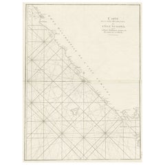
Early Chart Identifying British Spice Trading Colony of Bencoolen, Sumatra, 1797
About the Item
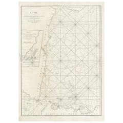
Antique map titled 'A Chart of the West Coast of Sumatra'.
Early nautical chart identifying the British spice trading colony of Bencoolen and Fort Marlborough, Sumatra. The map is divided into three sections, the left hand side being a general nautical chart of the approaches to Bencoolen and Fort Marlborough, the right hand plans are details of Rat Island and Poolo Bay. Bencoolen (Bengkulu) was established as a pepper-trading center by the British East India Company in 1685. By the time this map was drawn Bencoolen has been renamed 'Old Bencoolen,' being superseded in 1714 by Fort Marlborough just to the south. The map offers considerable detail on the approaches to Bencoolen for which Rat Island (top right submap) is an important marker, as well as a staging post were vessels could dry anchor and dry nets. Poolo Bay (Pulau Bay) (bottom right submap), some seven miles south of Fort Marlborough, was at the time an excellent harbor and anchorage.
Laurie and Whittle prepared this chart for their 1799 issue of the East-India Pilot. Though most charts in the East-India Pilot were derived from earlier maps prepared for Jean-Baptiste d'Apres de Mannevillette's 1745 Neptune Oriental, this particular chart is a new production unique to Laurie and Whittle.
Artists and Engravers: Laurie and Whittle (fl. 1794 - 1858) were London, England, based map and atlas publishers active in the late 18th and early 19th century
Condition: Good, general age-related toning. Minor wear and a few tears in the margins. Please study image carefully.
- Dimensions:Height: 22.64 in (57.5 cm)Width: 27.96 in (71 cm)Depth: 0 in (0.02 mm)
- Materials and Techniques:
- Period:1790-1799
- Date of Manufacture:1797
- Condition:Wear consistent with age and use. Minor fading.
- Seller Location:Langweer, NL
- Reference Number:
About the Seller
5.0
Platinum Seller
These expertly vetted sellers are 1stDibs' most experienced sellers and are rated highest by our customers.
Established in 2009
1stDibs seller since 2017
1,928 sales on 1stDibs
Typical response time: <1 hour
- ShippingRetrieving quote...Ships From: Langweer, Netherlands
- Return PolicyA return for this item may be initiated within 14 days of delivery.
More From This SellerView All
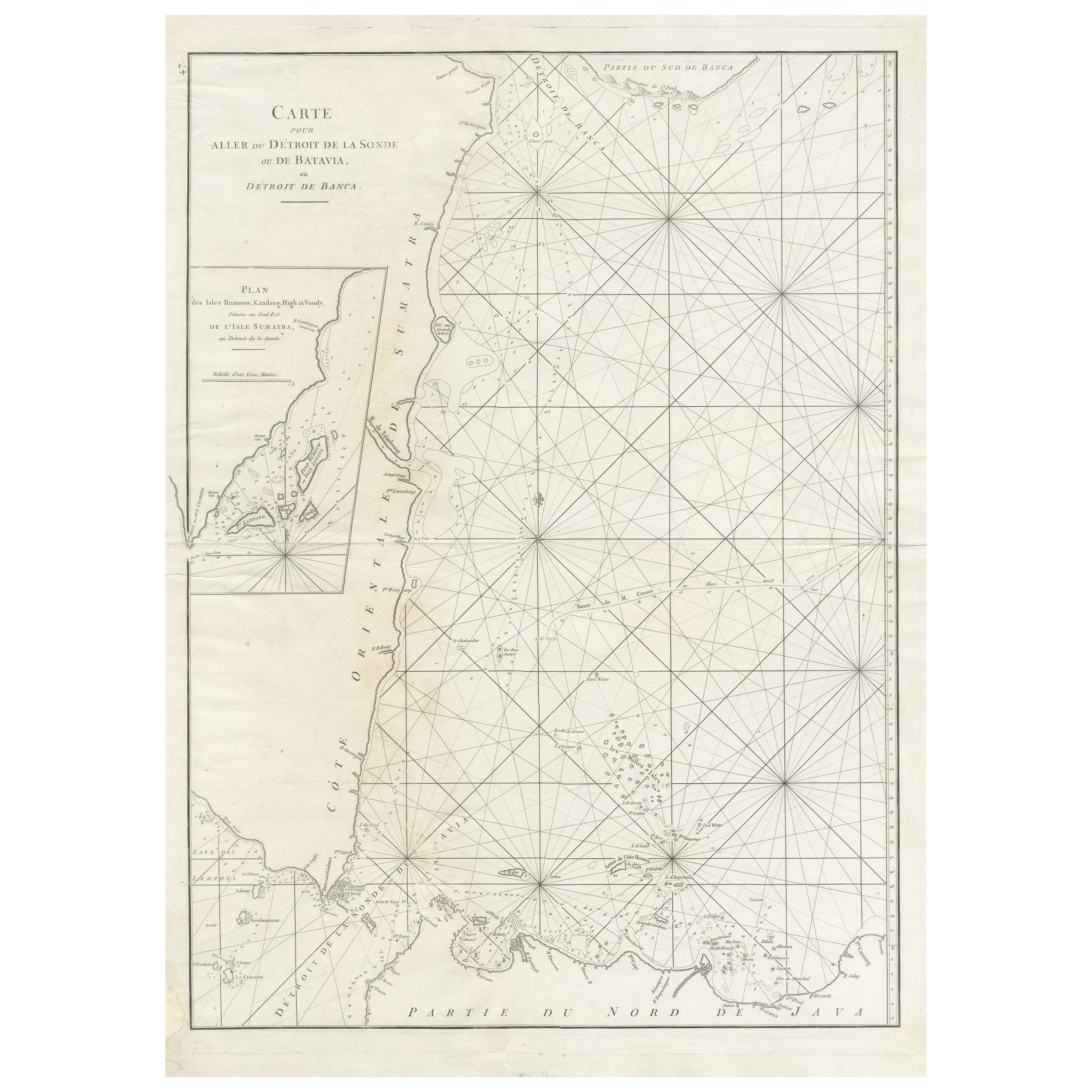
- Large Antique Sea Chart of the South-Eastern Coast of Sumatra, IndonesiaLocated in Langweer, NLAntique map titled 'Carte pour aller du Détroit de la Sonde ou de Batavia, au Détroit de Banca'. This uncommon sea chart shows northern Java and eastern Sumatra along with an inset of the small islands in the Detroit Sound. The handsome chart provides detailed navigational information, including the route of Julien Crozet in April 1772, who led a French expedition to the South Pacific after the voyage's commander, Marion De Fresne, and 26 crew members were killed (and allegedly eaten) by a Maori tribe in the Bay of Islands off the coast of New Zealand. With title upper left corner and small inset map of the small isles nearby the south-eastern coast of Sumatra. J. B. d'Apres de Mannevillette, from his atlas "Neptune orientale". French sailor...Category
Antique Late 18th Century Maps
MaterialsPaper
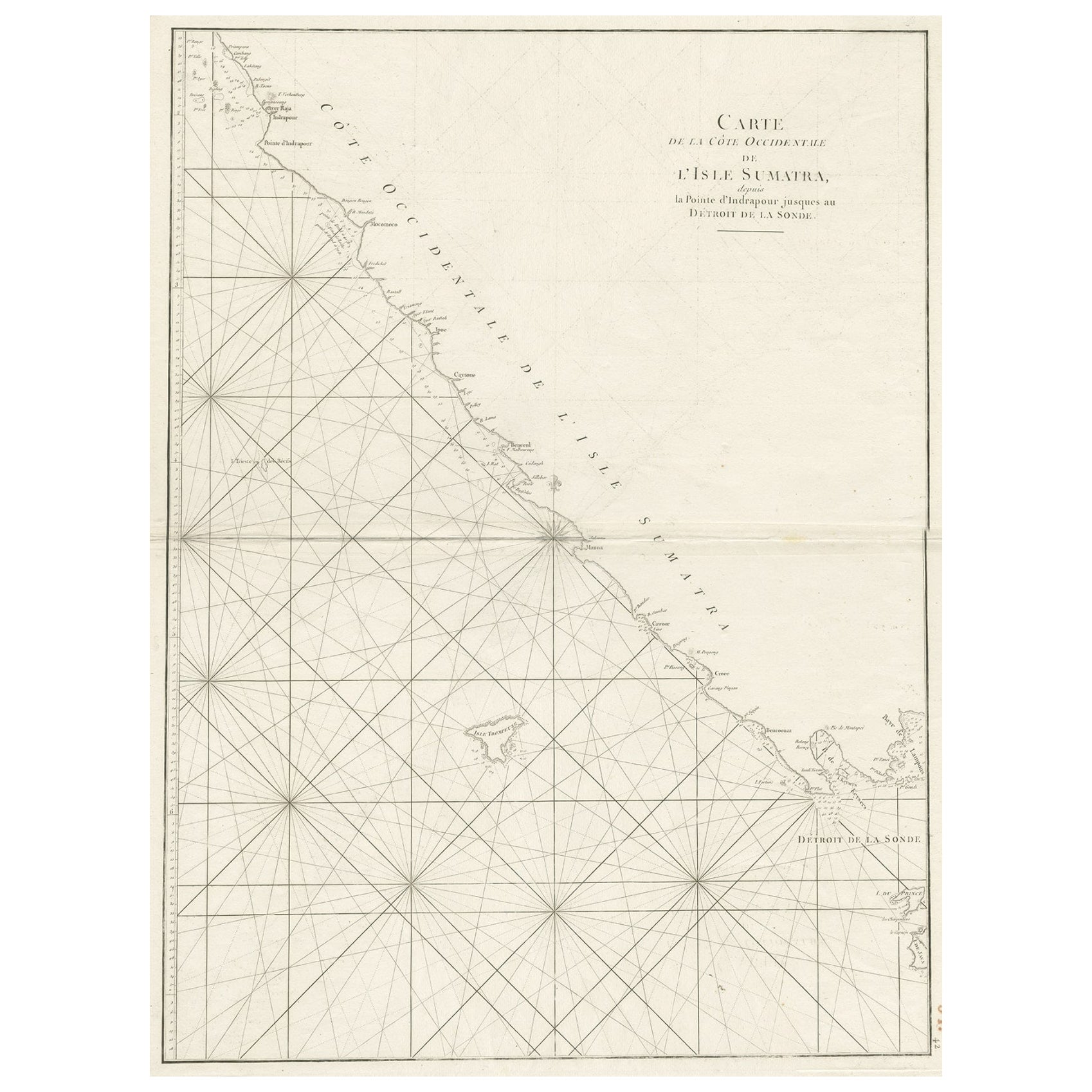
- Sea Chart of Part of the Southwestern Coast of Sumatra & Nias, Indonesia, C1775Located in Langweer, NLAntique map titled 'Carte de la Côte Occidentale de l'Isle Sumatra'. Sea chart of the part of the south-western coast of Sumatra with the Nassau (Nias) and Fortune isles. Artists ...Category
Antique 1770s Maps
MaterialsPaper
- Antique Chart of the Banda Islands or The Spice Islands, Indonesia, 1726Located in Langweer, NLAntique map titled 'Nieuwe Caart der Eylanden van Banda'. Beautiful chart of the Banda Islands including Banda Api, Banda Neira, Banda Besar, Pulau Hatta (Rosengain), Pulau Ai an...Category
Antique 1720s Maps
MaterialsPaper
- Large Sea Chart of the British Islands, 1918Located in Langweer, NLAntique map titled 'The British Islands'. Large sea chart of the British Islands. It shows Ireland, Scotland, England, the Shetland Islands and part of Fra...Category
Vintage 1910s Maps
MaterialsPaper
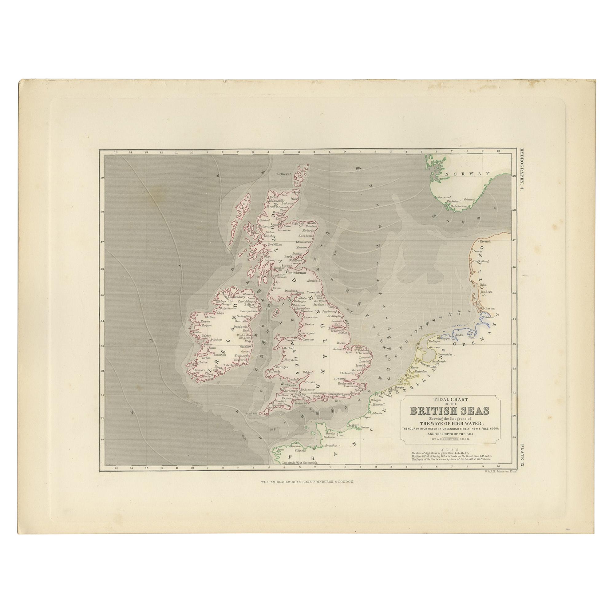
- Antique Tidal Chart of the British Seas by Johnston, '1850'Located in Langweer, NLAntique map titled 'Tidal Chart of the British Seas showing the progress of the wave of high water'. Original antique tidal chart of the British Seas. This map originates from 'The P...Category
Antique Mid-19th Century Maps
MaterialsPaper
- Antique Map of Sumatra, Indonesia 'c.1780'Located in Langweer, NLAntique map titled 'Neue Karte von der Insel Sumatra'. Extremely rare map of Sumatra, Indonesia. Published circa 1780.Category
Antique Late 18th Century Maps
MaterialsPaper


You May Also Like
- Genito-Urinary Anatomical Chart Fritz FrohseBy Nystrom / Frohse Art, Fritz FrohseLocated in Philadelphia, PAGenito-Urinary Anatomical Chart by Fritz Frohse. Dated 1922. Paper mounted on canvas. Shows wear but still presents very well!Category
Vintage 1920s German American Classical Prints
MaterialsCanvas, Paper
- Foldable Anatomical Wall Chart Depicting Human MusculatureLocated in Berghuelen, DEA rare 19th century anatomical wall chart depicting human musculature and internal organs. With removable multicolored human organs like lung, heart, l...Category
Early 20th Century German Victorian Prints
MaterialsPaper
- Baines Football Trade Card, Newcastle, Well CentredLocated in Oxfordshire, GBBaines Football Trade Card, Newcastle. Well Centred. A rare circular football trade card in the shape of a leather football ball. Made by the toy shop owner from Bradford, John Baines. Baines went on to produce not only football cards...Category
Vintage 1920s British Sporting Art Sports Equipment and Memorabilia
MaterialsPaper
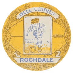
- Baines Football Trade Card, Rochdale. Well CentredLocated in Oxfordshire, GBBaines football trade card, Rochdale. Well Centred. A rare circular football trade card in the shape of a leather football ball. Made by the toy shop owner from Bradford, John Baine...Category
Early 20th Century British Sporting Art Sports Equipment and Memorabilia
MaterialsPaper
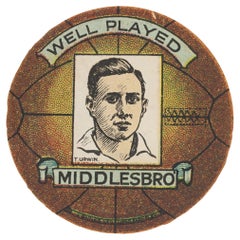
- Baines Football Trade Card, Middlesbro, Well PlayedLocated in Oxfordshire, GBBaines football trade card, Middlesbro. Well Played. A rare circular football trade card in the shape of a leather football ball. Made by the toy shop owner from Bradford, John Bain...Category
Early 20th Century British Sporting Art Sports Equipment and Memorabilia
MaterialsPaper
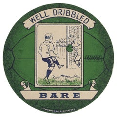
- Baines Football Trade Card, Bare, Well DribbledLocated in Oxfordshire, GBBaines football trade card, bare. Well dribbled. A rare circular football trade card in the shape of a leather football ball. Made by the toy shop owner from Bradford, John Baines. Baines went on to produce not only football cards...Category
Early 20th Century British Sporting Art Sports Equipment and Memorabilia
MaterialsPaper

Recently Viewed
View AllMore Ways To Browse
East India
Antique Furniture Identifier
Toner Chart
Early 18th Century New England
Antique Charts
Antique Chart
Furniture From British India
Antique Spices
Antique Furniture East London
Antique Center Islands
British India Antique
Hand Drawn Map
Oriental Antiques Collectables
New England Map
New England Maps
Antique Furniture Marlborough
New England 1790
British East India