Items Similar to Old Print of Fort James on Kunta Kinteh Island on the Gambia River, Africa, 1746

Want more images or videos?
Request additional images or videos from the seller
1 of 5
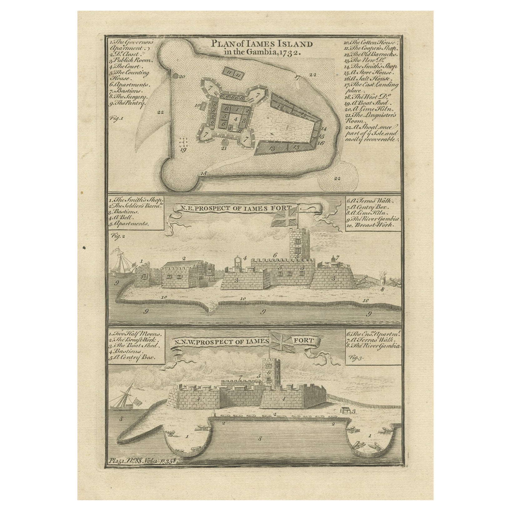
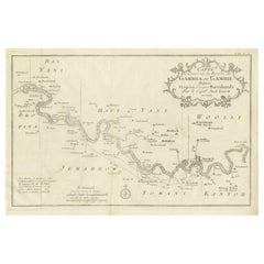
Old Print of Fort James on Kunta Kinteh Island on the Gambia River, Africa, 1746
About the Item
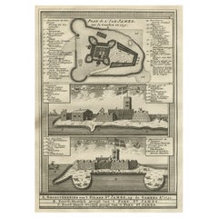
Antique print titled 'Plan de l’lle James sur la Gambra en 1732, Vue de Fort James du côte du Nord-Est, Vue de Fort James du côte de N.N. Ouest'.
Old print of Kunta Kinteh Island on the Gambia River in 1732, view of Fort James from the north east and a view of Fort James from the NNW. Made by Bellin for 'l'Histoire Generale des Voyages', by Antoine François Prévost (the Abbé Prévost).
Artists and Engravers: Jacques-Nicolas Bellin (1703 - 1772) was one of the most important cartographers of the 18th century. With a career spanning some 50 years, Bellin is best understood as geographe de cabinet and transitional mapmaker spanning the gap between 18th and early 19th century cartographic styles. His long career as Hydrographer and Ingénieur Hydrographe at the French Dépôt des cartes et plans de la Marine resulted in hundreds of high quality nautical charts of practically everywhere in the world. A true child of the Enlightenment Era, Bellin's work focuses on function and accuracy tending in the process to be less decorative than the earlier 17th and 18th century cartographic work. Unlike many of his contemporaries, Bellin was always careful to cite his references and his scholarly corpus consists of over 1400 articles on geography prepared for Diderot's Encyclopedie. Bellin, despite his extraordinary success, may not have enjoyed his work, which is described as "long, unpleasant, and hard." In addition to numerous maps and charts published during his lifetime, many of Bellin's maps were updated (or not) and published posthumously. He was succeeded as Ingénieur Hydrographe by his student, also a prolific and influential cartographer, Rigobert Bonne.
Condition: Very good, general age-related toning. Please study image carefully.
- Dimensions:Height: 10.08 in (25.6 cm)Width: 7.88 in (20 cm)Depth: 0 in (0.02 mm)
- Materials and Techniques:
- Period:1740-1749
- Date of Manufacture:1746
- Condition:
- Seller Location:Langweer, NL
- Reference Number:
About the Seller
5.0
Platinum Seller
These expertly vetted sellers are 1stDibs' most experienced sellers and are rated highest by our customers.
Established in 2009
1stDibs seller since 2017
1,928 sales on 1stDibs
Typical response time: <1 hour
- ShippingRetrieving quote...Ships From: Langweer, Netherlands
- Return PolicyA return for this item may be initiated within 14 days of delivery.
More From This SellerView All
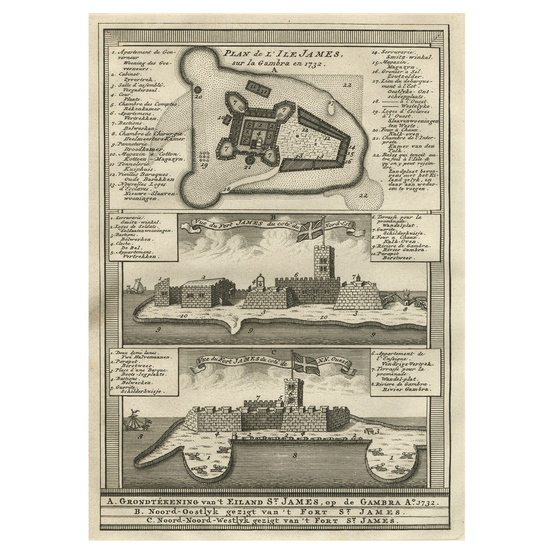
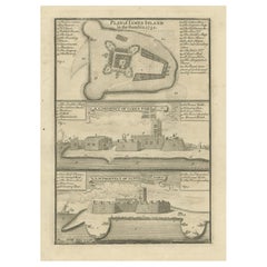
- Antique Print with a Plan of Kunta Kinteh Island and views of Fort James, GambiaLocated in Langweer, NLAntique print titled 'Plan of Iames Island in the Gambia - N.E. Prospect of Iames Fort - N.N.W. Prospect of Iames Fort'. Print with a plan of Kunta Kinteh I...Category
Antique Mid-18th Century Prints
MaterialsPaper
- Old Copperplate Engraving of Fort St. James on the Gambra River, Africa, c.1760Located in Langweer, NLPlan de l’Isle James sur la Gambra en 1732 (…). Copperplate engraving/etching on Hand laid (Verge) paper. Sheet size: 19,7 x 26,7 cm. Image size: 13,8 x 19,8 cm. From vol. 3 o...Category
Antique 1760s Maps
MaterialsPaper
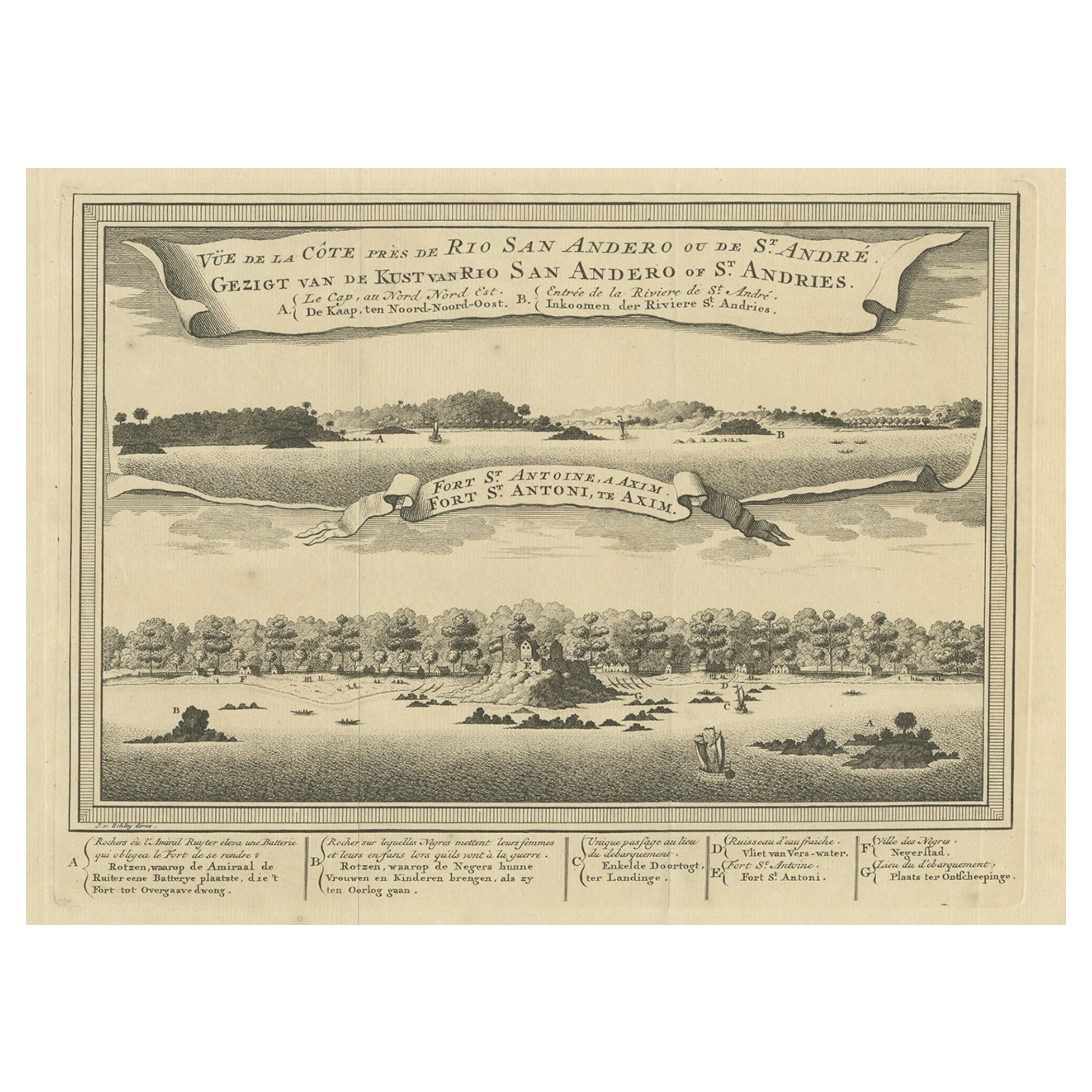
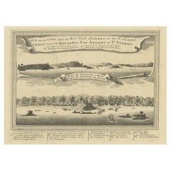
- Antique Print of a Fort on the Ivory Coast and Axim, Africa, 1748By Jakob van der SchleyLocated in Langweer, NLAntique print titled 'Vue de la Cote pres de Rio San Andero - Gezigt van de Kust van Rio San Andero' and 'Fort St. Antoine a Axim - Fort St. Antoni, te Axim'. View of the Ivory coast...Category
Antique 18th Century Prints
MaterialsPaper
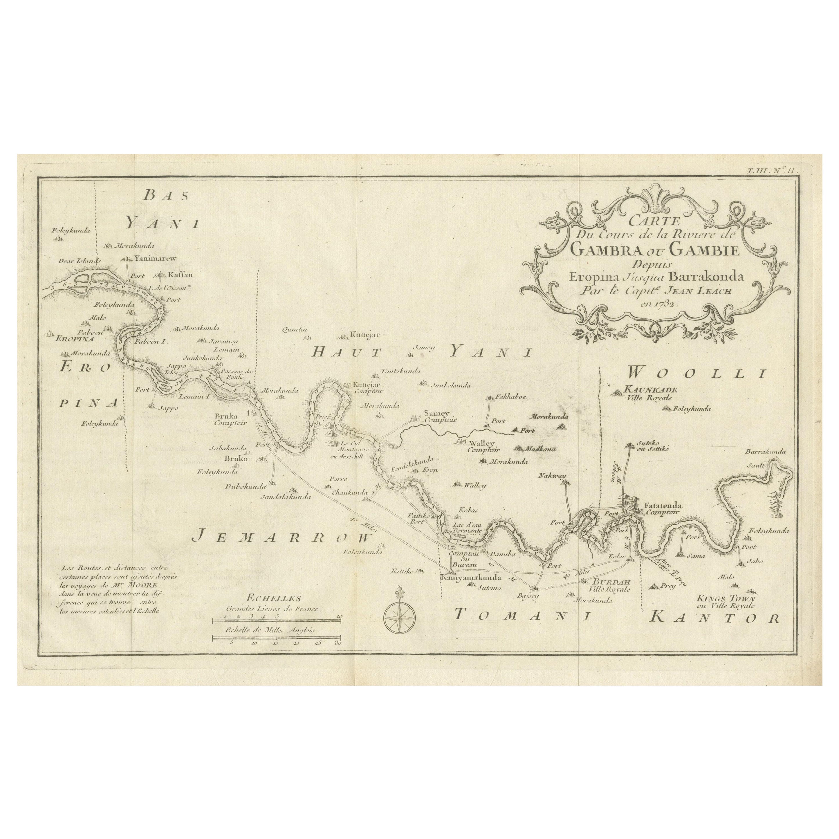
- Antique Map of Gambia, West AfricaLocated in Langweer, NLAntique map titled 'Carte du Cours de la Riviere de Gambra ou Gambie (..)'. Detailed map of Gambia, West Africa, surrounded by Senegal with decorative title based on information supp...Category
Antique Mid-18th Century Maps
MaterialsPaper
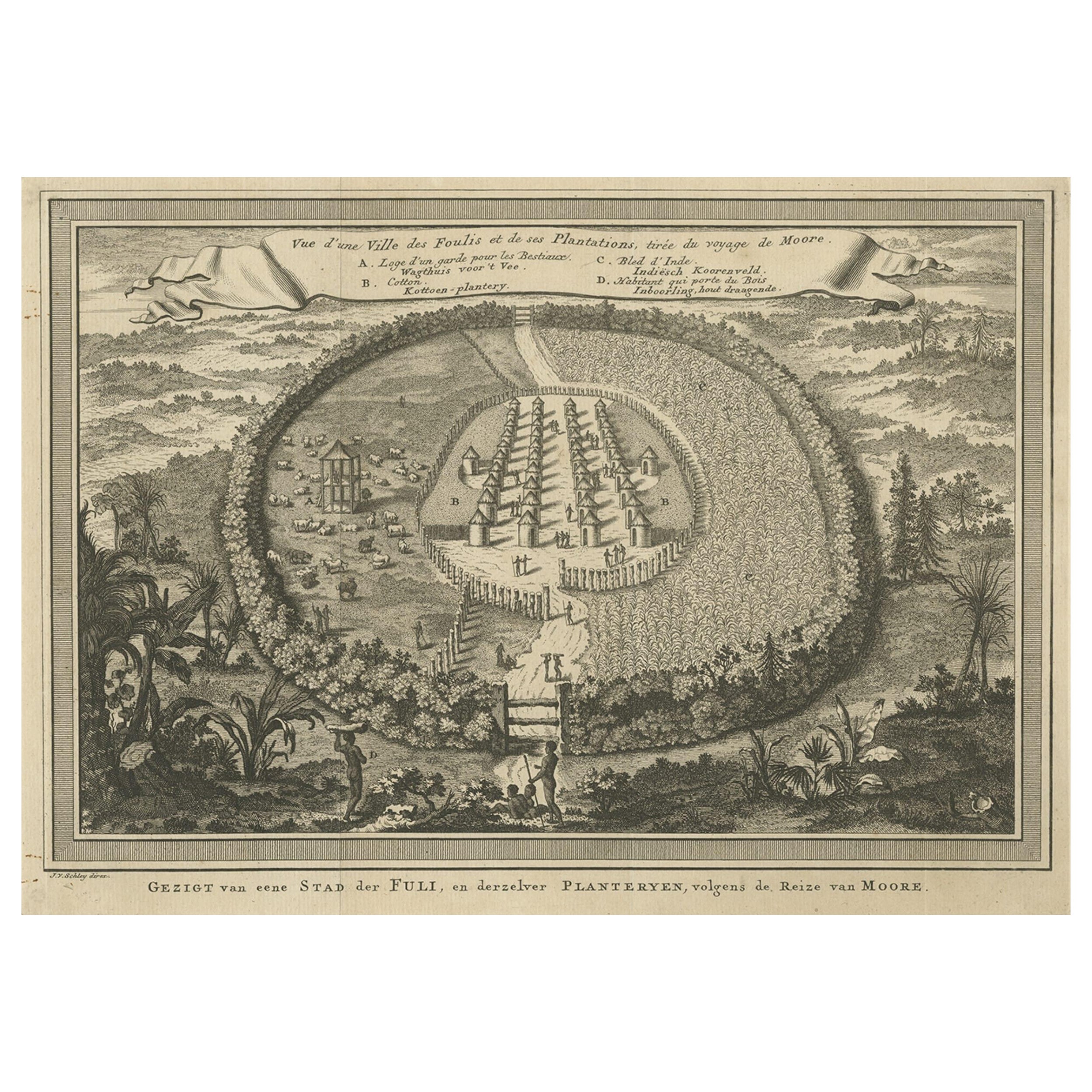
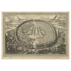
- Old Town View of the Fula Tribe and Its Cotton Plantations, Gambia, Africa, 1748Located in Langweer, NLAntique print titled 'Vue d'une Ville des Foulis et de ses Plantations - Gezigt van eene Stad der Fuli, en derzelver Planteryen'. View of a town of the Fula people and its cotton pla...Category
Antique 1740s Maps
MaterialsPaper
- Original Antique Map of the Cape Verde Islands, 1746Located in Langweer, NLAntique map titled 'Carte Des Isles Du Cap Verd.' Original antique map of the Cape Verde Islands. Decorative cartouche and compass rose. Extends from Isle d...Category
Antique 18th Century Maps
MaterialsPaper

You May Also Like
- Old Nautical Print Depicting the Bombardment of Cadiz by the French Navy 1823Located in Milan, ITPrint by engraving on copper plate of the first half of the 19th century, depicting the bombardment of Cadiz by the French Navy, 23 September 1823. The print is signed peint par Crep...Category
Antique 1830s French Nautical Objects
MaterialsPaper
- Lithographic print on paper, depicting the atlas of the hand, France 1850 ca.Located in Milan, ITAn anatomical lithographic print on paper, depicting the anatomical atlas of the hand. Black lacquered fir wood frame with golden ramin wood batting. N. H. Ja...Category
Antique Mid-19th Century French Prints
MaterialsGlass, Wood, Paper
- Lithographic print on paper depicting the muscular system of a neck, France 1850Located in Milan, ITAn anatomical lithographic print on paper, depicting a cross section of the muscular system of the neck. Black lacquered fir wood frame with golden ramin wood batting...Category
Antique Mid-19th Century French Prints
MaterialsGlass, Wood, Paper
- Engraving on Copper Print from the Volume Navigazione Nautical Subject 1790Located in Milan, ITPrint by engraving on copper plate Tav III TIX fig. 17-22 from the volume Navigazione; with frame 28 x 33. Some calculations are depicted. Very good condition. Shipping is insured by...Category
Antique 1790s Italian Nautical Objects
MaterialsPaper
- Hand-Colored 18th Century Homann Map of Denmark and Islands in the Baltic SeaBy Johann Baptist HomannLocated in Alamo, CAAn 18th century copper plate hand-colored map entitled "Insulae Danicae in Mari Balthico Sitae utpote Zeelandia, Fionia, Langelandia, Lalandia, Falstria, Fembria Mona" created by Joh...Category
Antique Early 18th Century German Maps
MaterialsPaper


Recently Viewed
View AllMore Ways To Browse
French Antique Island
Used Office Furniture Long Island
Long Island Artists
19th Century Africa Collectibles
Long Island Map
Map Of Long Island
Maps Of Long Island
La Marine Antique
Antique Style Trolley
Antique Print Cabinet
Map Cabinet
Long Island Cabinet
18th Century French Child Furniture
Antique Plan Cabinet
James River Furniture
North Africa Map
Antique Corpus
Des Cartes