Items Similar to Old Town View of the Fula Tribe and Its Cotton Plantations, Gambia, Africa, 1748
Want more images or videos?
Request additional images or videos from the seller
Old Town View of the Fula Tribe and Its Cotton Plantations, Gambia, Africa, 1748
About the Item
Antique print titled 'Vue d'une Ville des Foulis et de ses Plantations - Gezigt van eene Stad der Fuli, en derzelver Planteryen'. View of a town of the Fula people and its cotton plantations. This print originates from 'Historische beschryving der reizen, of Nieuwe en volkoome verzameling van de aller-waardigste en zeldsaamste Zee- en Landtogten' by P. de Hondt.
Artists and Engravers: Engraved by Jakob van der Schley (Amsterdam 1715-1779), a Dutch draughtsman and engraver. He studied under Bernard Picart and became heavily influenced by his style.
Condition:
Good, age-related toning, Original folding lines, blank verso. Please study image carefully.
- Dimensions:Height: 10.24 in (26 cm)Width: 13.78 in (35 cm)Depth: 0 in (0.02 mm)
- Materials and Techniques:
- Period:1740-1749
- Date of Manufacture:1748
- Condition:
- Seller Location:Langweer, NL
- Reference Number:
About the Seller
5.0
Platinum Seller
These expertly vetted sellers are 1stDibs' most experienced sellers and are rated highest by our customers.
Established in 2009
1stDibs seller since 2017
1,950 sales on 1stDibs
Typical response time: <1 hour
- ShippingRetrieving quote...Ships From: Langweer, Netherlands
- Return PolicyA return for this item may be initiated within 14 days of delivery.
More From This SellerView All
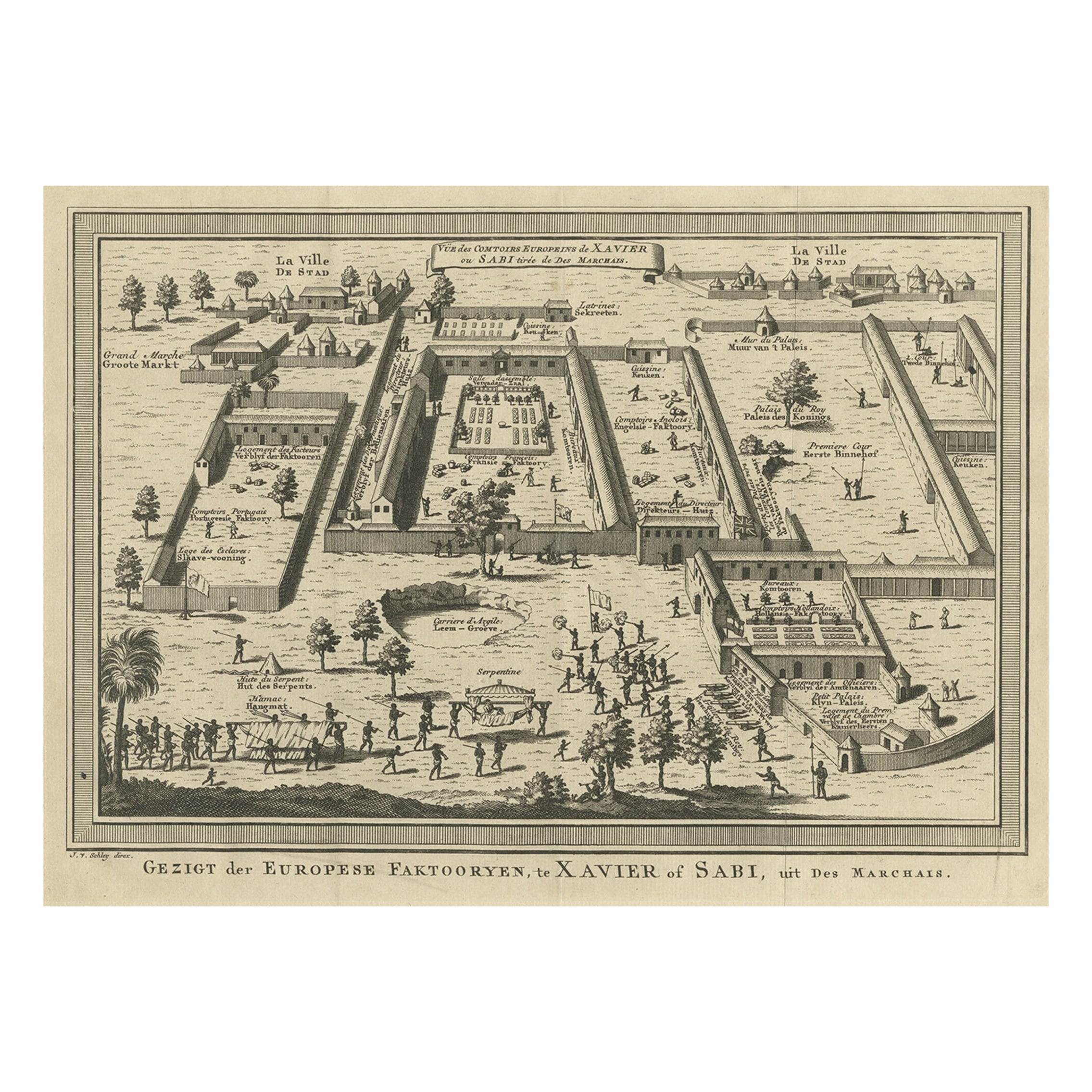
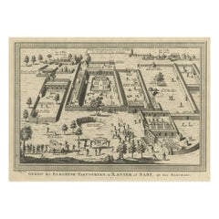
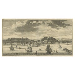
- Old Bird's Eye View of the European Trading Posts at Sabi, Benin, Africa, 1748Located in Langweer, NLAntique print titled 'Vue des comtoirs Europeins de Xavier ou Sabi (..) - Gezigt der Europese Faktooryen, te Xavier of Sabi (..)'. Bird's eye view of the European trading posts a...Category
Antique 1740s Maps
MaterialsPaper
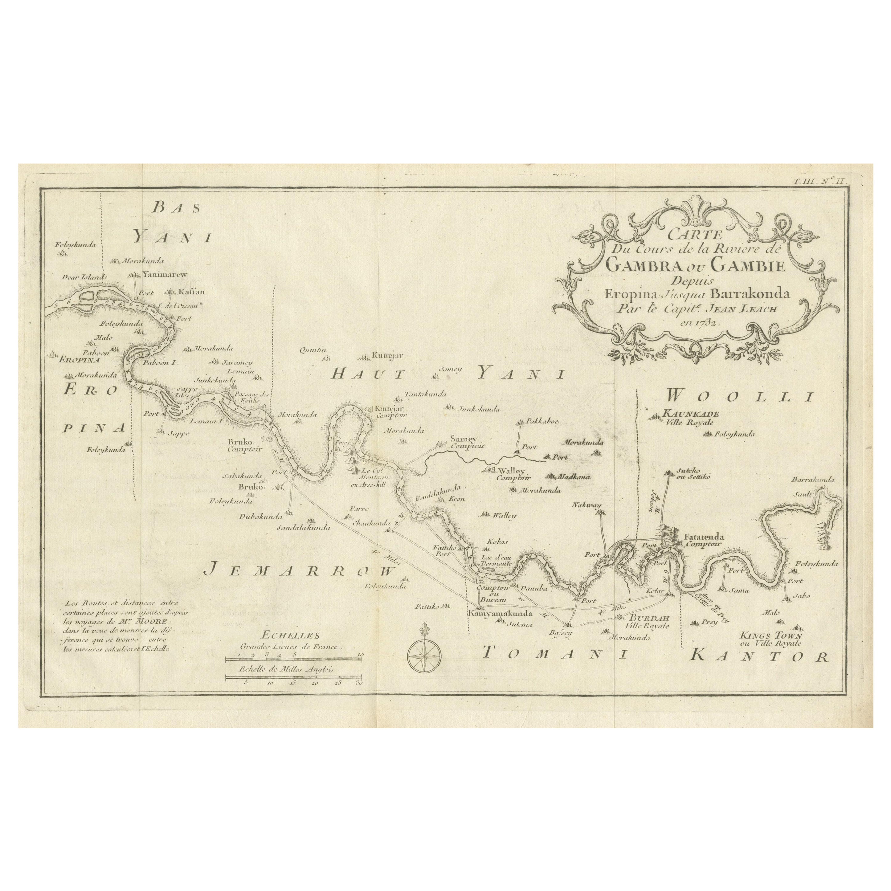
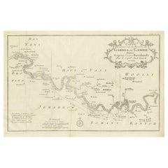
- Antique Map of Gambia, West AfricaLocated in Langweer, NLAntique map titled 'Carte du Cours de la Riviere de Gambra ou Gambie (..)'. Detailed map of Gambia, West Africa, surrounded by Senegal with decorative title based on information supp...Category
Antique Mid-18th Century Maps
MaterialsPaper
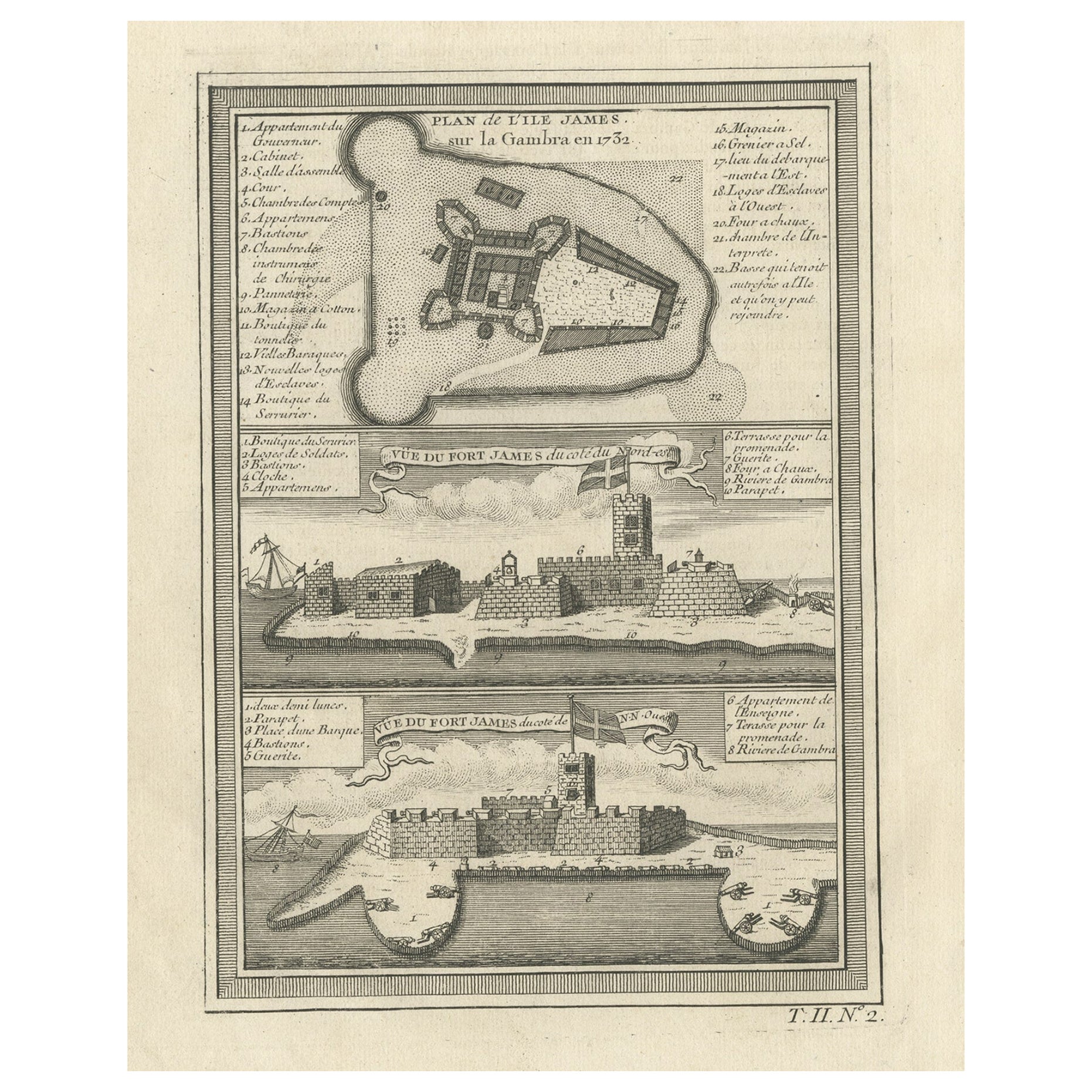
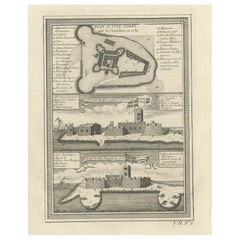
- Old Print of Fort James on Kunta Kinteh Island on the Gambia River, Africa, 1746Located in Langweer, NLAntique print titled 'Plan de l’lle James sur la Gambra en 1732, Vue de Fort James du côte du Nord-Est, Vue de Fort James du côte de N.N. Ouest'. Old print of Kunta Kinteh Island on the Gambia...Category
Antique 1740s Maps
MaterialsPaper
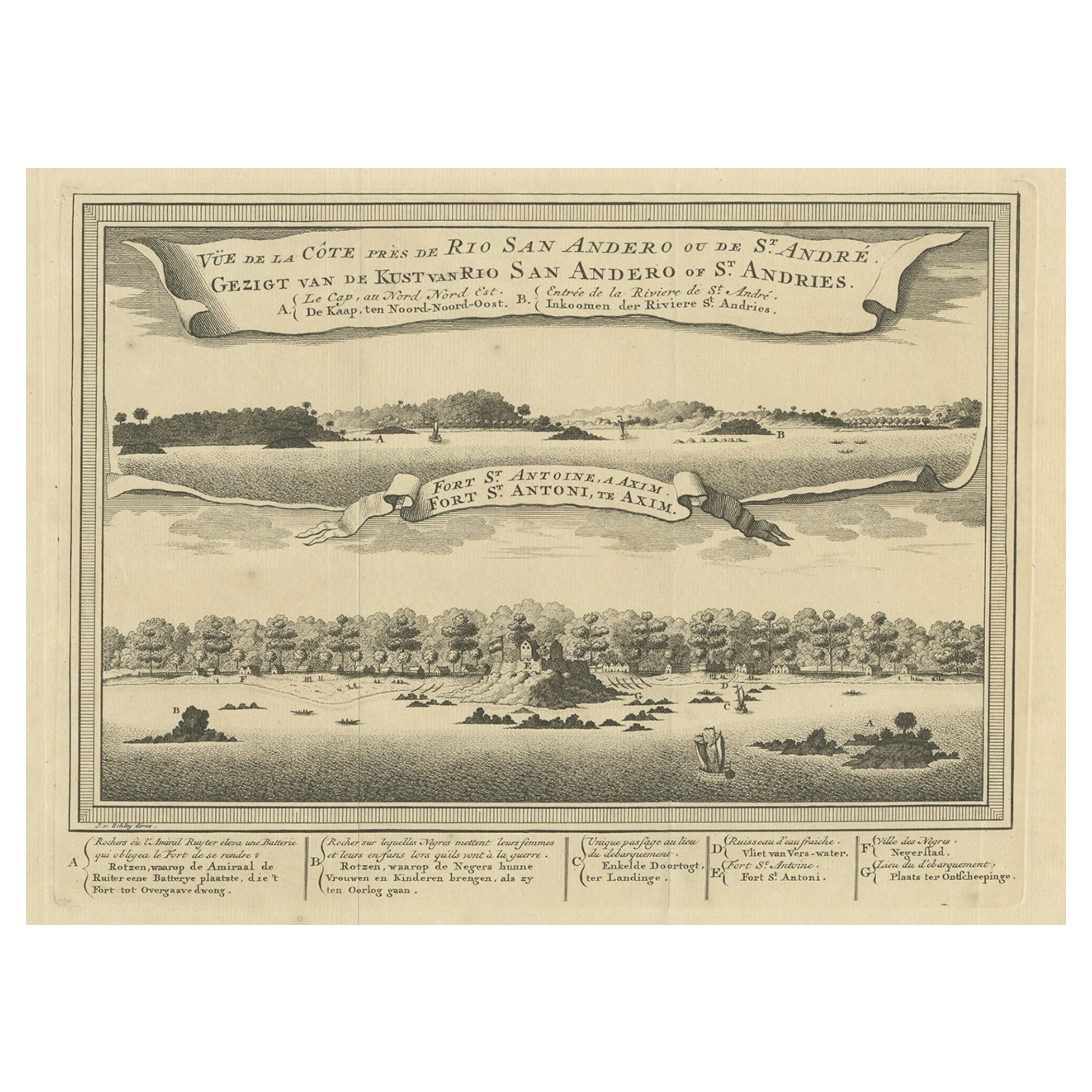
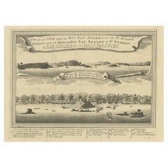
- Antique Print of a Fort on the Ivory Coast and Axim, Africa, 1748By Jakob van der SchleyLocated in Langweer, NLAntique print titled 'Vue de la Cote pres de Rio San Andero - Gezigt van de Kust van Rio San Andero' and 'Fort St. Antoine a Axim - Fort St. Antoni, te Axim'. View of the Ivory coast...Category
Antique 18th Century Prints
MaterialsPaper
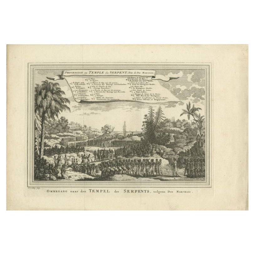
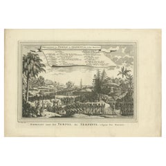
- Antique Print of the Temple of Pythons, Ouidah, Benin, Africa, 1748By Jakob van der SchleyLocated in Langweer, NLAntique print titled 'Procession au Temple du Serpent - Ommegang naar den Tempel des Serpents'. Print of the procession at the Temple of Pythons, Ouidah. This print originates from 'Historische beschryving der reizen, of Nieuwe en volkoome verzameling van de aller-waardigste en zeldsaamste Zee- en Landtogten' by P. de Hondt. The Temple of Pythons is a site of historical and modern symbolism and spiritual practice in Ouidah, Benin. The snakes are a major totem for followers of Vodun, a religion practiced by groups of people within West and Central African nations such as Ghana, Togo, and Benin. Vodun became somewhat widespread in southern regions of the New World as a result of the African diaspora. It became the inspiration for other religions such as Louisiana Voodoo and Haitian Vodou...Category
Antique 18th Century Prints
MaterialsPaper
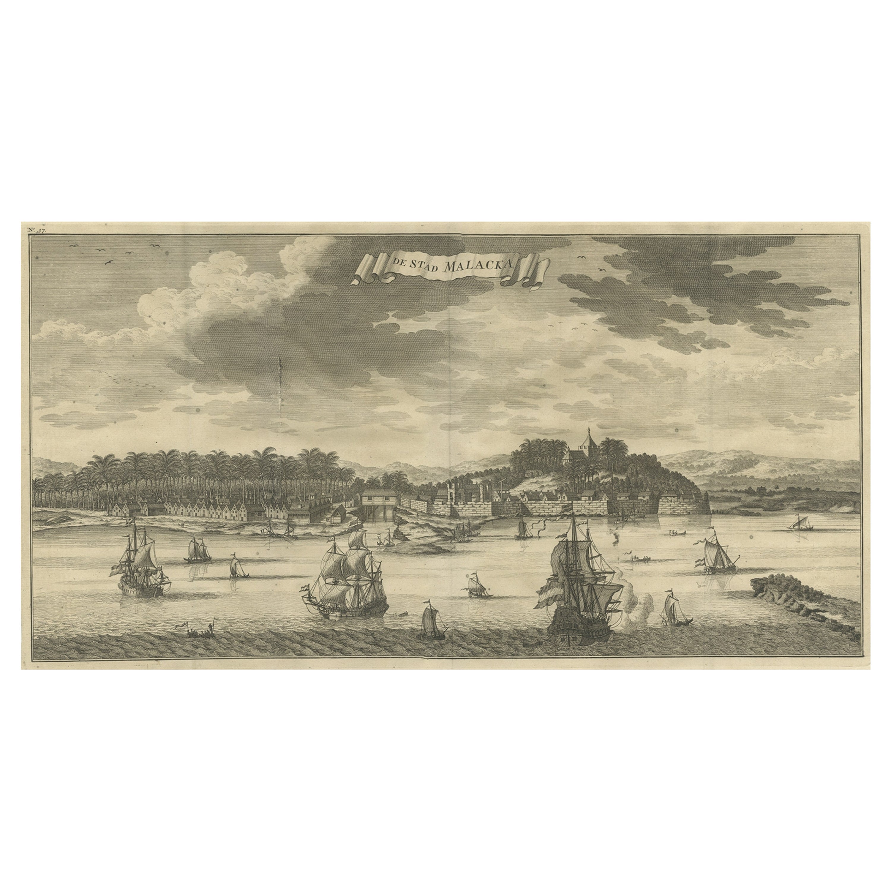
- Antique Panoramic View of the Town of Malacca, Malaysia, 1726Located in Langweer, NLAntique print Malaysia titled 'De Stad Malacka'. Decorative panoramic view of the town of Malacca with European vessels in the foreground. The old C...Category
Antique 1720s Maps
MaterialsPaper
You May Also Like
- More Massachusetts Towns, Illustrated with Wood Engravings of 53 Mass. TownsLocated in valatie, NYMore Massachusetts Towns, illustrated with wood engravings of fifty-three Massachusetts Towns, drawn in 1840 by J. W. Barber. Commentary by Ivan Sandrof, and a special foreword by Mr...Category
Vintage 1960s American Books
MaterialsPaper
- Vintage "View of the Center of Paris Taken from the Air" Lithograph MapLocated in San Diego, CAA very stylish "View of the Center of Paris Taken from the Air" lithograph map published by the Paris Ministry of Tourism, circa early 1950s. The piece measures 27" x 43" and shows...Category
20th Century French Mid-Century Modern Prints
MaterialsPaper
- Old Nautical Print Depicting the Bombardment of Cadiz by the French Navy 1823Located in Milan, ITPrint by engraving on copper plate of the first half of the 19th century, depicting the bombardment of Cadiz by the French Navy, 23 September 1823. The print is signed peint par Crep...Category
Antique 1830s French Nautical Objects
MaterialsPaper
- N.E. View of the United States Capitol, Washington, DC Antique Proof Print 1858Located in Colorado Springs, COThis engraved print shows a view of the United States Capitol Building, in Washington, D.C. The print depicts the neoclassical building from the northeast orientation, with a bustling street scene in front. The steel engraving is a proof printing, drawn and engraved by Henry Sartain and published in 1858. Plans began in May 1854 to build a new cast-iron dome for the United States Capitol. The then-architect of the Capitol Thomas Walter and his team were sold on the aesthetics of a new dome, as well as the utility of a fire-proof one. A year later, on March 3, 1855, President Franklin Pierce...Category
Antique 1850s American Prints
MaterialsPaper
- Old Nautical Map of CorsicaLocated in Alessandria, PiemonteST/556/1 - Old map of Corsica isle, surveyed by Captain Hell, of the French Royal Navy in 1824, engraved and published on 1874, with additions and corre...Category
Antique Early 19th Century English Other Prints
MaterialsPaper
- Old Horizontal Map of EnglandBy TassoLocated in Alessandria, PiemonteST/520 - Old rare Italian map of England, dated 1826-1827 - by Girolamo Tasso, editor in Venise, for the atlas of M.r Le-Sage.Category
Antique Early 19th Century Italian Other Prints
MaterialsPaper


Recently Viewed
View AllMore Ways To Browse
Plantation Furniture
Plantation Style
Antique Town Maps
Plantation Style Furniture
African P
African Printed Cotton
Antique Plantation Furniture
Antique Plantation
Dutch Plantation
Van Der Zee
Gambia Antique Map
Antique Furniture East London
Antique Eastern European Furniture
Vintage Map Of The United States
Antique House Plans
Antique Metal Window
Antique Metal Windows
Antique Furniture Rollers