Items Similar to Antique Panoramic View of the Town of Malacca, Malaysia, 1726
Want more images or videos?
Request additional images or videos from the seller
1 of 7
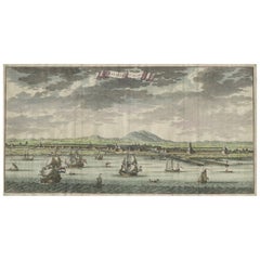
Antique Panoramic View of the Town of Malacca, Malaysia, 1726
About the Item
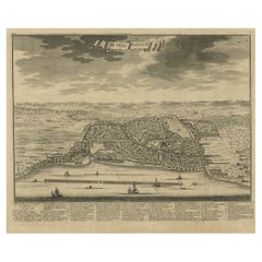
Antique print Malaysia titled 'De Stad Malacka'.
Decorative panoramic view of the town of Malacca with European vessels in the foreground. The old Church of St. Paul's on the hill in the fortified old town to the right of the river is clearly apparent as are the remnants of Albuquerque's original fortress 'O Formosa' the prominent North Tower dilapidated and still clearly bearing the scars of the Dutch assault in 1641. The covered wooden bridge on high stilts over the River Malacca joins the fortified old town to the Chinese market, visible in the left foreground and the Muslim mosque, whose tower is just visible behind, along with the Chinese temple beyond and the crowded buildings of native settlement. Dutch galleons and smaller skiffs and boats fill the seas in the foreground. This print originates from 'Oud en Nieuw Oost-Indiën' by F. Valentijn.
Artists and Engravers: François Valentijn (1666-1727), a missionary, worked at Amboina from 1684 to 1694 and 1705 to 1713 and travelled extensively in the VOC's lands.
- Dimensions:Height: 13.39 in (34 cm)Width: 21.26 in (54 cm)Depth: 0 in (0.02 mm)
- Materials and Techniques:
- Period:1720-1729
- Date of Manufacture:1726
- Condition:Wear consistent with age and use. Condition: Good, general age-related toning and some foxing. Please study image carefully.
- Seller Location:Langweer, NL
- Reference Number:
About the Seller
5.0
Platinum Seller
These expertly vetted sellers are 1stDibs' most experienced sellers and are rated highest by our customers.
Established in 2009
1stDibs seller since 2017
1,933 sales on 1stDibs
Typical response time: <1 hour
- ShippingRetrieving quote...Ships From: Langweer, Netherlands
- Return PolicyA return for this item may be initiated within 14 days of delivery.
More From This SellerView All
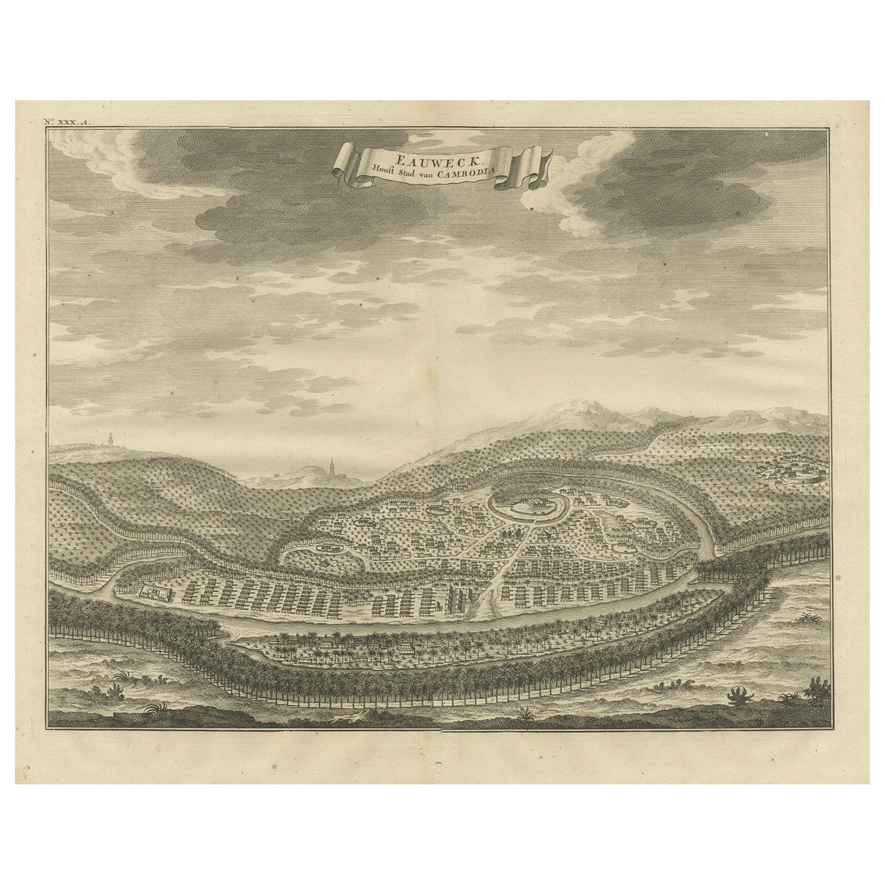
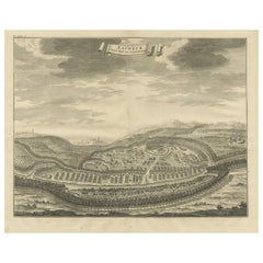
- Panoramic Engraved View of the Town of Longvek 'or Lavek' in Cambodia, ca.1726Located in Langweer, NLDescription: Antique print titled 'Eauweck, Hooft Stad van Cambodia'. Decorative panoramic view of the town of Longvek (or Lavek) in Cambodia. It was the second capital city during t...Category
Antique 1720s Prints
MaterialsPaper
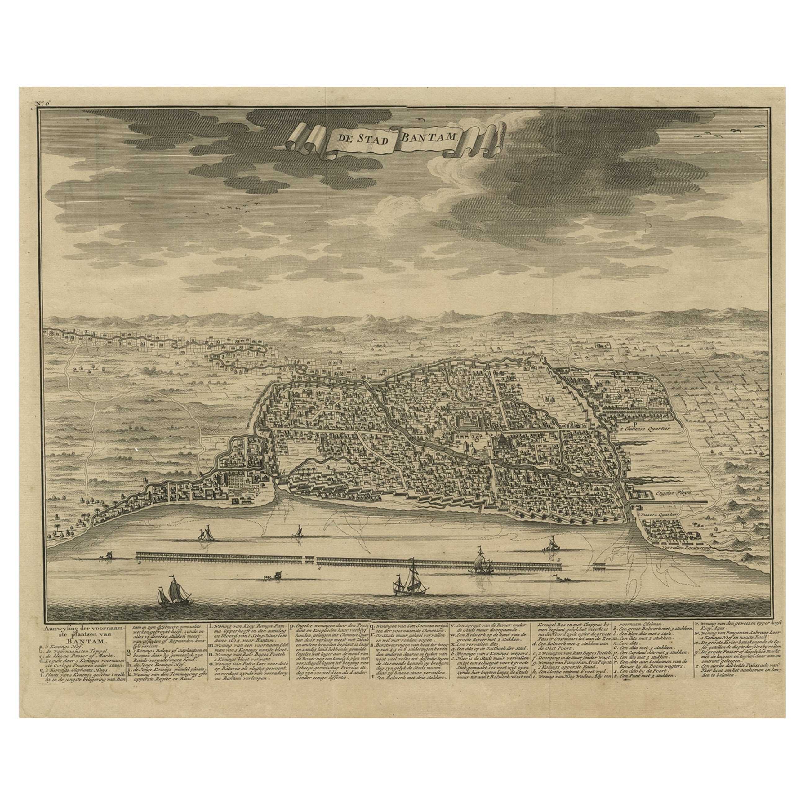
- Decorative View of the Indonesian Town of Bantam 'Banten', Java, 1726Located in Langweer, NLDecorative town-view of the town of Bantam (Banten). In lower margin key a-z to the principal places in town. The Banten Sultanate was founded in the 16th century and centred in ...Category
Antique 1720s Maps
MaterialsPaper
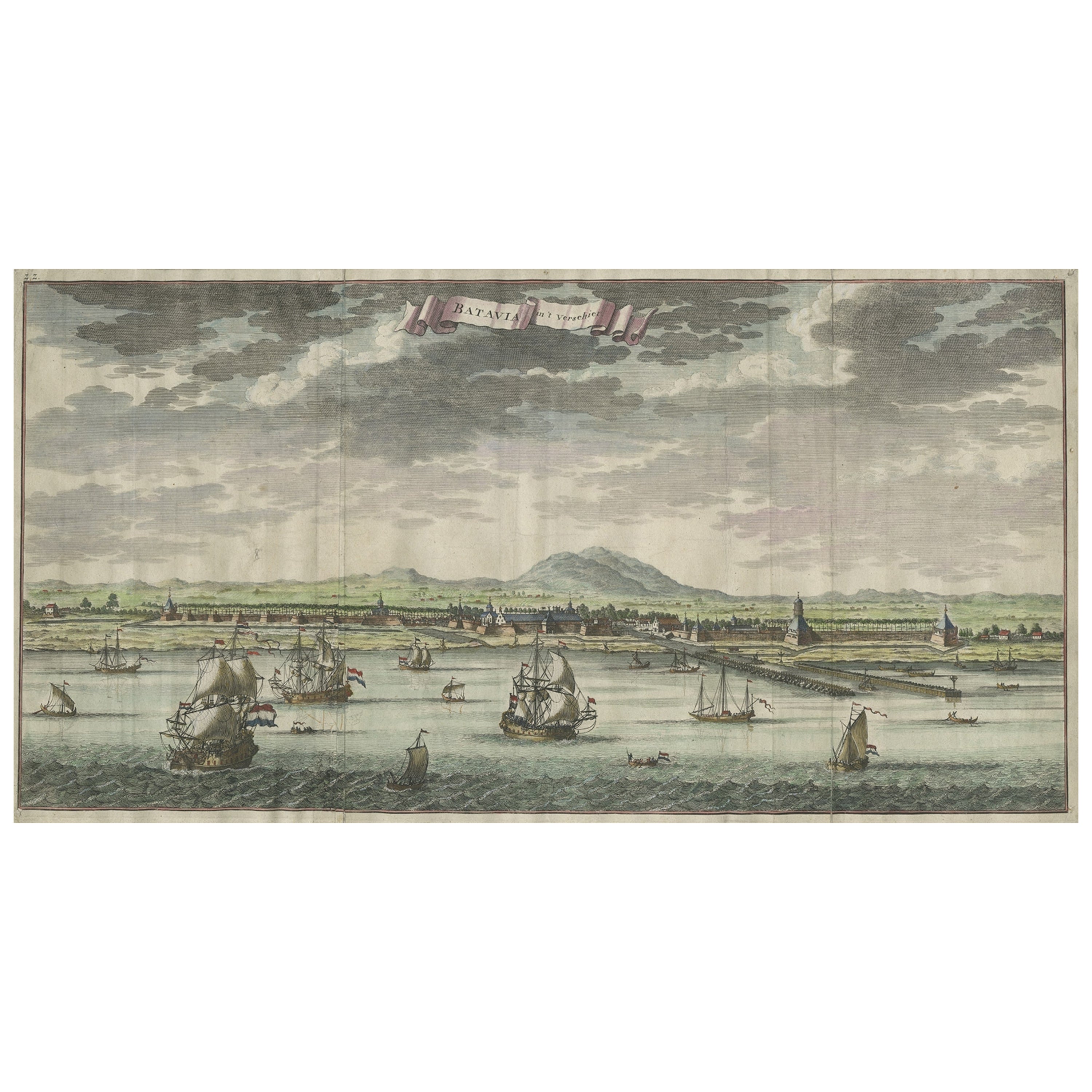
- Large Antique Panoramic View on Batavia, Present Day Jakarta, Indonesia, 1726Located in Langweer, NLAntique print Indonesia titled 'Batavia in 't Verschiet'. Large panoramic view on Batavia, present day Jakarta, Indonesia. Originates from 'Oud en Nieuw Oost-Indiën (..)' by Fran...Category
Antique 1720s Prints
MaterialsPaper
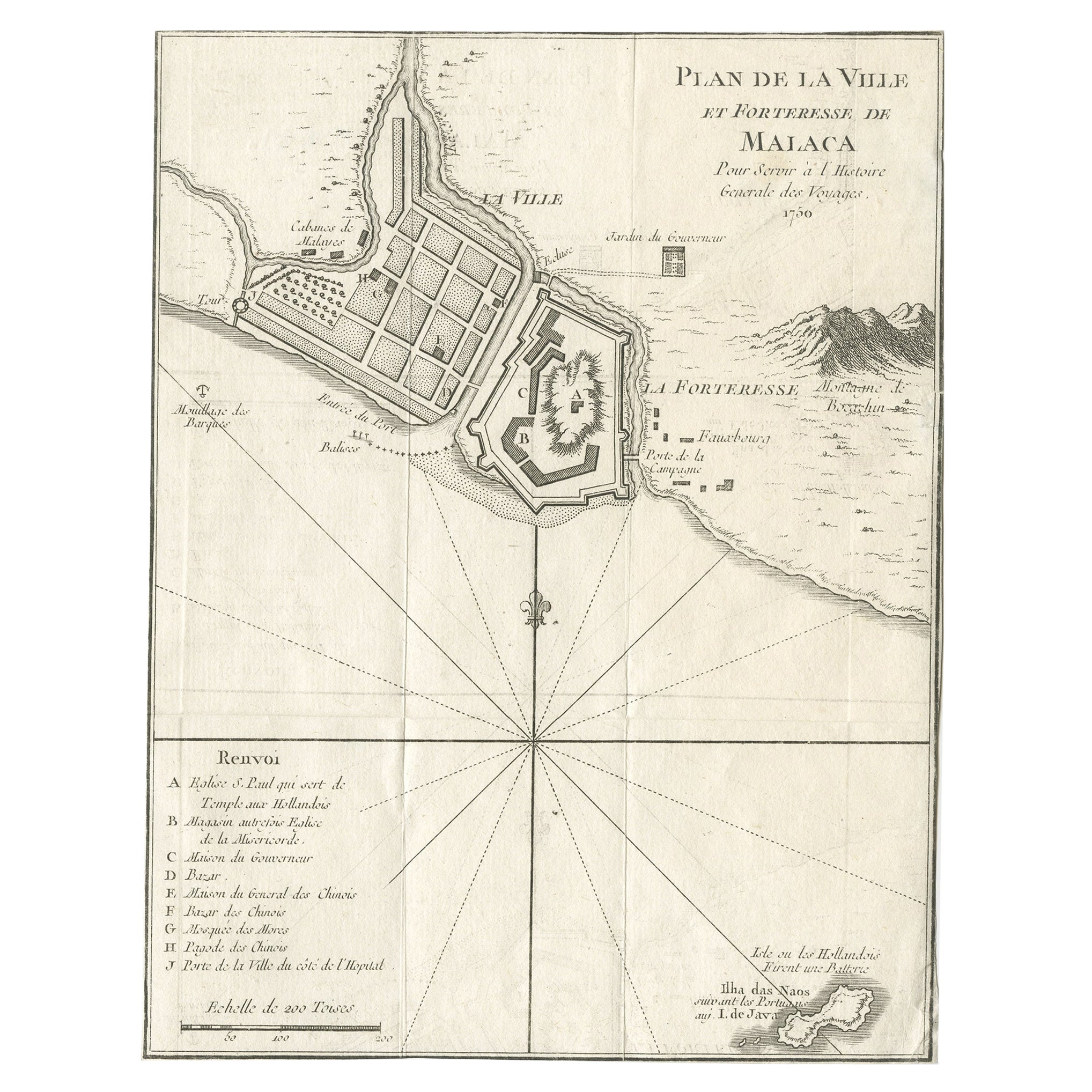
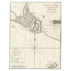
- Detailed Original Antique Plan of the City and Fort of Malacca, Malaysia, 1764Located in Langweer, NLDescription: Antique map titled 'Plan de la Ville et Forteresse de Malaca'. Detailed plan of the city and fort of Malacca on the southern Malay Peninsula, commanding the strategic st...Category
Antique 1760s Maps
MaterialsPaper
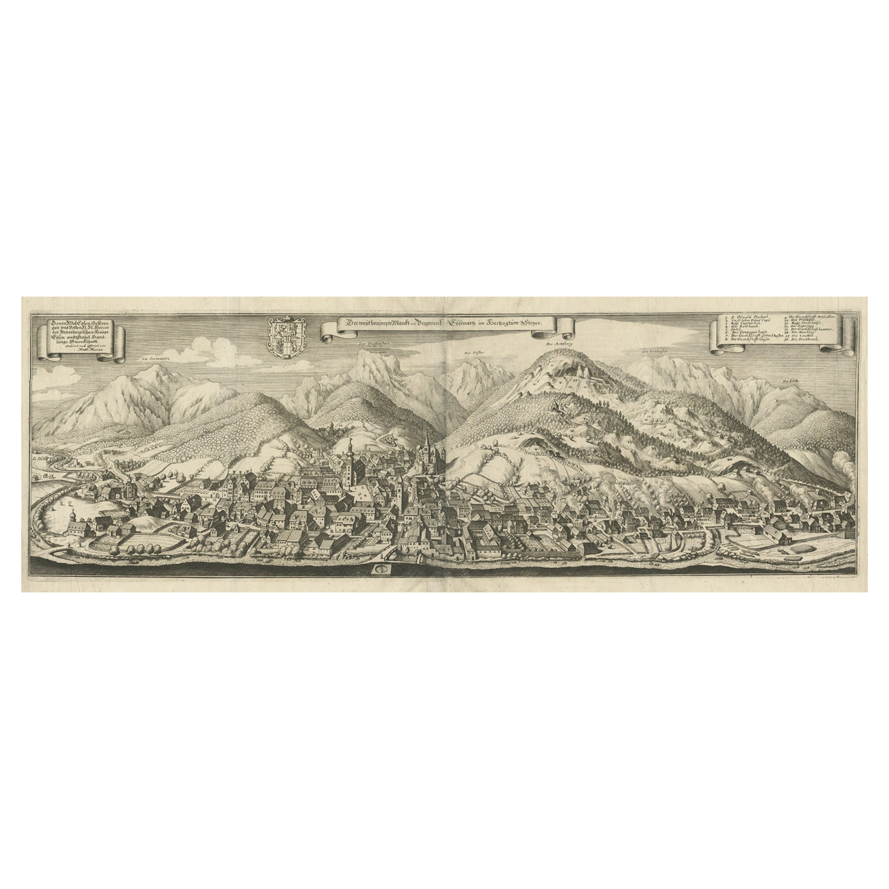
- Large Panoramic View of Eisenerz, an Old Mining Town in Styria, Austria, c.1650Located in Langweer, NLDescription: Antique print titled 'Der weyt berümpte Marckt und Bergwerck Eysenärtz im Hertzogtum Steyer'. Large panoramic view of Eisenerz, an old mining town in the Austrian st...Category
Antique 1650s Maps
MaterialsPaper
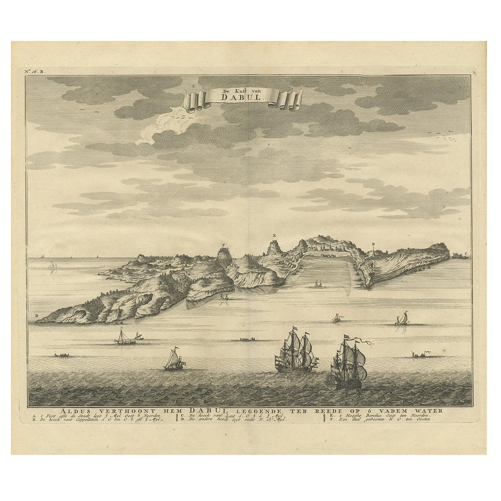
- Antique Print of the Coast of Dabhol 'India', 1726By F. ValentijnLocated in Langweer, NLAntique print titled 'De Kust van Dabul'. Antique print of the coastline near Dabhol in India. This print originates from 'Oud en Nieuw Oost-Indiën' by F. Valentijn.Category
Antique Early 18th Century Dutch Prints
MaterialsPaper
You May Also Like
- Alpine Ski Photograph, 'Panoramic View', Taken from Original 1930s PhotographLocated in Oxfordshire, GBVintage, antique Alpine Ski photograph. 'Panoramic View', a new mounted black and white photographic image after an original 1930s skiing photograph. Black and white alpine photos are the perfect addition to any home or ski lodge, so please do check out our other ski photos...Category
Vintage 1930s English Sporting Art Sports Equipment and Memorabilia
MaterialsPaper
- N.E. View of the United States Capitol, Washington, DC Antique Proof Print 1858Located in Colorado Springs, COThis engraved print shows a view of the United States Capitol Building, in Washington, D.C. The print depicts the neoclassical building from the northeast orientation, with a bustling street scene in front. The steel engraving is a proof printing, drawn and engraved by Henry Sartain and published in 1858. Plans began in May 1854 to build a new cast-iron dome for the United States Capitol. The then-architect of the Capitol Thomas Walter and his team were sold on the aesthetics of a new dome, as well as the utility of a fire-proof one. A year later, on March 3, 1855, President Franklin Pierce...Category
Antique 1850s American Prints
MaterialsPaper
- Vintage "View of the Center of Paris Taken from the Air" Lithograph MapLocated in San Diego, CAA very stylish "View of the Center of Paris Taken from the Air" lithograph map published by the Paris Ministry of Tourism, circa early 1950s. The piece measures 27" x 43" and shows...Category
20th Century French Mid-Century Modern Prints
MaterialsPaper
- More Massachusetts Towns, Illustrated with Wood Engravings of 53 Mass. TownsLocated in valatie, NYMore Massachusetts Towns, illustrated with wood engravings of fifty-three Massachusetts Towns, drawn in 1840 by J. W. Barber. Commentary by Ivan Sandrof, and a special foreword by Mr...Category
Vintage 1960s American Books
MaterialsPaper
- Antique 18th Century Map of the Province of Pensilvania 'Pennsylvania State'Located in Philadelphia, PAA fine antique of the colony of Pennsylvania. Noted at the top of the sheet as a 'Map of the province of Pensilvania'. This undated and anonymous map is thought to be from the Gentleman's Magazine, London, circa 1775, although the general appearance could date it to the 1760's. The southern boundary reflects the Mason-Dixon survey (1768), the western boundary is placed just west of Pittsburgh, and the northern boundary is not marked. The map has a number of reference points that likely refer to companion text and appear to be connected to boundaries. The western and southern boundaries are marked Q, R, S, for example. A diagonal line runs from the Susquehanna R to the Lake Erie P. A broken line marked by many letters A, B, N, O, etc., appears in the east. There are no latitude or longitude markings, blank verso. Framed in a shaped contemporary gilt wooden frame and matted under a cream colored matte. Bearing an old Graham Arader Gallery...Category
Antique 18th Century British American Colonial Maps
MaterialsPaper
- Goodyear Panoramic Factory Print with Gouache by Woodbury & Co, Worcester MALocated in Milford, NHA finely detailed panoramic ink print with gouache of the Goodyear factory in the early 20th century done by Woodbury & Co, of Worcester, Massachusetts. This company was known for th...Category
20th Century American Prints
MaterialsPaper


Recently Viewed
View AllMore Ways To Browse
Boat Collectables
Antique Church Collectibles
Old Chinese Wooden
Antique Furniture St Paul
Old Maps Of Europe
Old Europe Map
Antique Wooden Temple
The Galleon
Antique Wooden Boats
Antique Wooden Vessels
Antique Mosque
Voc Antique
Antique Malaysia
Dutch Voc
Malaysian Antique Furniture
Antique Furniture Malaysia
Antique Wooden Boat
Fortress Antiques