Items Similar to Antique Map of the British Islands to the White Sea by J. Imray


Want more images or videos?
Request additional images or videos from the seller
1 of 6
Antique Map of the British Islands to the White Sea by J. Imray
About the Item
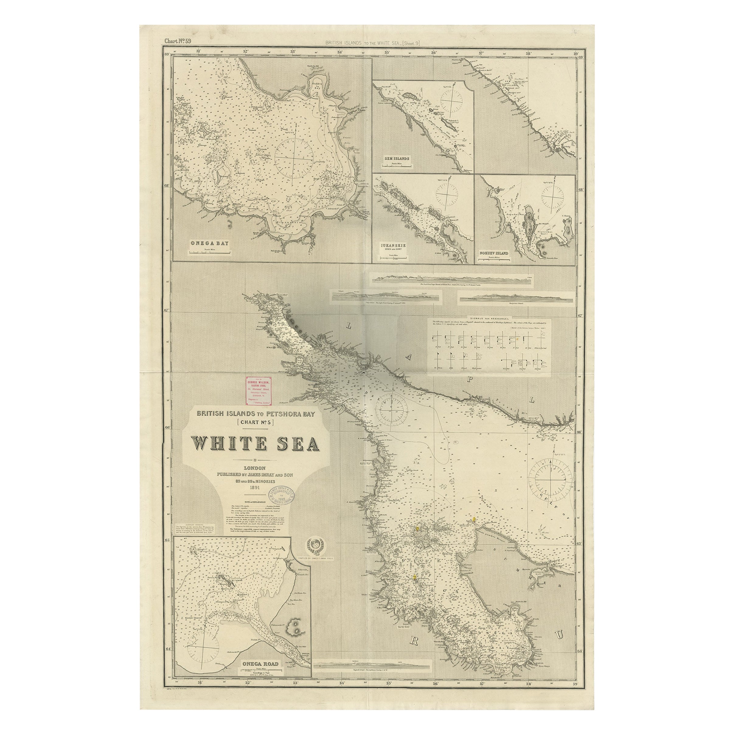
Antique large nautical chart of the British Islands to the White Sea. With insets of Veshnyak Channel, Sosnovets and the Bay of Arkhangel. Published by James Irmay and Son, circa 1875.
- Dimensions:Height: 41.74 in (106 cm)Width: 27.76 in (70.5 cm)Depth: 0.02 in (0.5 mm)
- Materials and Techniques:
- Period:
- Date of Manufacture:circa 1875
- Condition:Please study image carefully.
- Seller Location:Langweer, NL
- Reference Number:
About the Seller
5.0
Platinum Seller
These expertly vetted sellers are 1stDibs' most experienced sellers and are rated highest by our customers.
Established in 2009
1stDibs seller since 2017
1,946 sales on 1stDibs
Typical response time: <1 hour
- ShippingRetrieving quote...Ships From: Langweer, Netherlands
- Return PolicyA return for this item may be initiated within 14 days of delivery.
More From This SellerView All
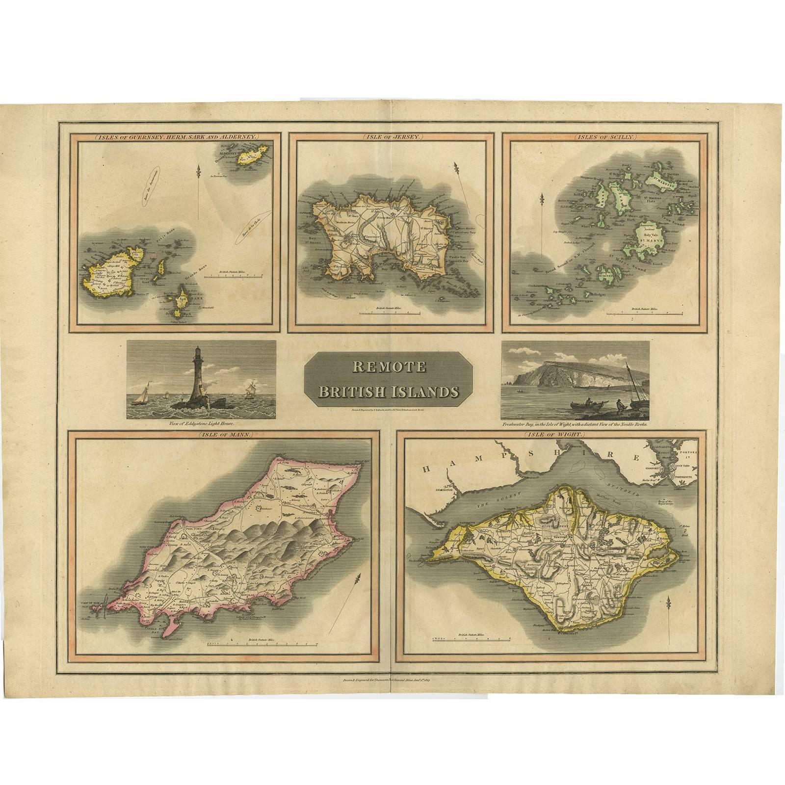
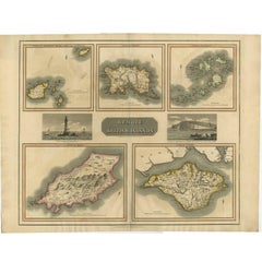
- Antique Map of the British Islands by J. Thomson, 1817Located in Langweer, NLGroup of 5 maps of the Channel Islands, Scilly, Jersey, the Isle of Mann and the Isle of Wight. Engraved views of the Eddystone Lighthouse and Freshwater Bay on the Isle of Wight, wi...Category
Antique Early 19th Century Maps
MaterialsPaper
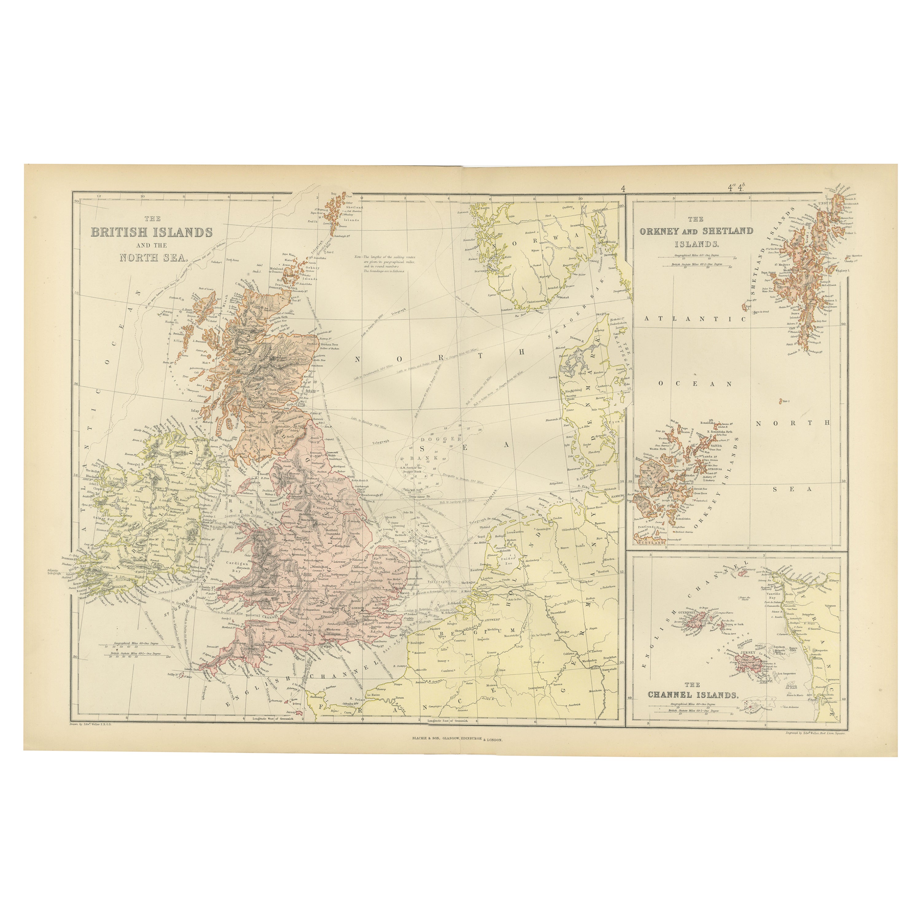
- Colorful Detailed Antique Map of The British Islands and `The North Sea, 1882Located in Langweer, NLDiscover 'The British Islands and The North Sea' Map with Insets of Orkney, Shetland, and Channel Islands! This captivating original antique map offers a detailed view of the British...Category
Antique 1880s Maps
MaterialsPaper
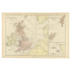
- Uncommon, Large Map of the British Islands to Petshora Bay, 1891Located in Langweer, NLAntique map titled 'British Islands to Petshora Bay - White Sea'. Uncommon, large map of the British Islands to Petshora Bay. It shows the White Sea and inse...Category
Antique 1890s Maps
MaterialsPaper
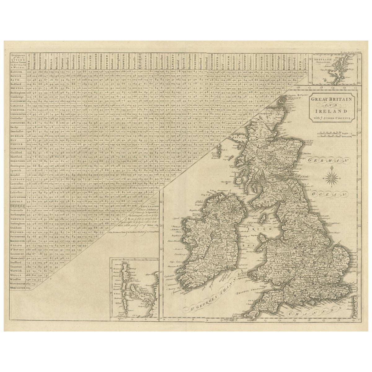
- Antique Map of the British Isles, Insets of the Shetland Islands and HebridesLocated in Langweer, NLAntique map titled 'Great Britain and Ireland with ye Judges Circuits'. A scarce map of the British Isles, with inset maps of the Shetland Islands and The Hebrides. Large triangular ...Category
Antique Late 18th Century Maps
MaterialsPaper
- Large Sea Chart of the British Islands, 1918Located in Langweer, NLAntique map titled 'The British Islands'. Large sea chart of the British Islands. It shows Ireland, Scotland, England, the Shetland Islands and part of Fra...Category
Vintage 1910s Maps
MaterialsPaper
- Antique Map of the Islands Within the Queen Charlotte's IslandsLocated in Langweer, NLAntique map titled 'Cote Septentrional de la plus grande des Isles de la Reine Charlotte (..)'. Map and coastal view of the islands within the Queen Charlotte's Islands (Santa Cruz I...Category
Antique Late 18th Century Maps
MaterialsPaper


You May Also Like
- Large Original Vintage Map of British Island Possessions, circa 1920Located in St Annes, LancashireGreat map of British Island Possessions Original color. Good condition Published by Alexander Gross Unframed.Category
Vintage 1920s English Maps
MaterialsPaper
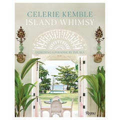
- Island Whimsy Designing a Paradise by the SeaBy Rizzoli International PublicationsLocated in New York, NYAuthor Celerie Kemble A house by the sea should be a house of dreams. Where windows and doors are thrown open to the ocean, and gusts of cool, salty air turn us all into kids again--buoyant and joyful. Spending childhood days on the beach and in the magical, romantic chaos of her family's rambling house internationally renowned interior designer Celerie Kemble has a deep-rooted connection to the sun and surf. However, in the summer of 2004, Kemble laid eyes on a wild swath of jungle in the Dominican Republic next to minty-blue water and an endless stretch of golden sand, she fell madly in love. Over many years, she designed a home away from home there, an island retreat--a clubhouse and a grouping of family homes and guesthouses--suffused with light and air, full of indoor and outdoor rooms for relaxation. In her latest book, Island Whimsy, Kemble recounts the deeply personal and creative journey of designing Playa Grande and bringing this labor of love to life. The chapters of this book are organized around the different ways Kemble sought to braid her family's story into the larger landscape of Playa Grande and to provide inspiration, joy, and respite to all who come. "Fantasy" looks at the way she used whimsical, dreamlike elements--from the latticework cabanas by the pool to the lamb statues...Category
21st Century and Contemporary North American Books
MaterialsPaper
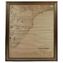
- Imray Ocean Chart of the Coast of Brazil 1876Located in Norwell, MAImray & Son 1876 Nautical chart of the Coast of Brazil between Cape Frio and the River Plate. Nicely framed. Overall Dimensions: 46" H x 56" W.Category
Antique 1870s Nautical Objects
MaterialsPaper
- 1854 Map of Massachusetts, Connecticut and Rhode Island, Antique Wall MapLocated in Colorado Springs, COThis striking wall map was published in 1854 by Ensign, Bridgman & Fanning and has both full original hand-coloring and original hardware. This impression is both informative and highly decorative. The states are divided into counties, outlined in red, green, and black, and subdivided into towns. Roads, canals, and railroad lines are prominently depicted, although they are not all labeled. The mapmakers also marked lighthouses, banks, churches, and prominent buildings, with a key at right. The map is an informative and comprehensive overview of the infrastructural development of New England prior to the Civil War. Physical geographies depicted include elevation, conveyed with hachure marks, rivers and lakes. The impression features an inset map of Boston...Category
Antique 19th Century American Maps
MaterialsPaper
- Antique Paterson's Guide to Britain, English, Maps, Georgian, Published 1811Located in Hele, Devon, GBThis is an antique copy of Paterson's New and Accurate guide to Direct & Principal Crossroads. An English, bound book of maps and descriptive tables, published in English by Longman,...Category
Antique Early 19th Century British Georgian Books
MaterialsPaper
- Hand-Colored 18th Century Homann Map of Denmark and Islands in the Baltic SeaBy Johann Baptist HomannLocated in Alamo, CAAn 18th century copper plate hand-colored map entitled "Insulae Danicae in Mari Balthico Sitae utpote Zeelandia, Fionia, Langelandia, Lalandia, Falstria, Fembria Mona" created by Joh...Category
Antique Early 18th Century German Maps
MaterialsPaper


Recently Viewed
View AllMore Ways To Browse
Antique Nautical Maps
Antique Nautical Map
Sea Chart Map
Antique Nautical Charts
Map Nautical Chart
Old Antique Compass
Map New Holland
Vienna Map
Map Of Vienna
Map Monde Antique
Arabian Map
Arabia Map
Egyptian Authentic Furniture
Middle East Map
Visscher Amsterdam
Columbia Antiques
Antique Fireplaces And Ranges
Historic Antique Maps