Map Nautical Chart
to
9
72
44
71
59
27
23
15
13
12
12
12
9
7
6
5
4
4
3
3
2
2
2
2
2
2
2
1
1
1
1
1
1
1
1
1
1
1
20
12
5
2
2
Sort By
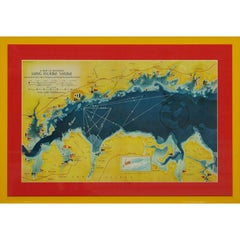
A Map Of Western Long Island Sound Showing Yacht Clubs, Aids To Navigation...
Located in Bristol, CT
Classic color map/ nautical chart (by Nolf Klep '39) of the North Shore of Long Island Sound
for
Category
1930s More Prints
Materials
Paper
19th Century Nautical Chart of Martinique
Located in Norwell, MA
Original map of Martinique from 1887 with chartered waters around the island. Prepared from a
Category
Antique 19th Century Nautical Objects
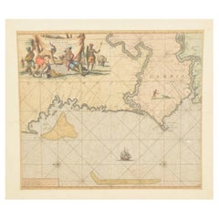
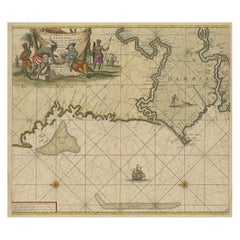
Original Hand-Coloured Nautical Chart of West-Africa, c.1680
Located in Langweer, NL
. Blanco tot C. Verde (...). Amsterdam, Johannus van Keulen, c. 1680.
Large folio coloured map in passe
Category
Antique 17th Century Maps
Materials
Paper
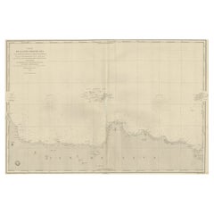
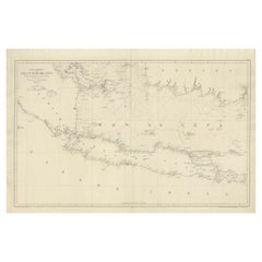
Early French Nautical Chart of the Northern Coast of of Java, Indonesia, C.1850
Located in Langweer, NL
Antique map titled Carte de la côte Nord de Java.
Early French nautical chart of the northern
Category
Antique 1850s Maps
Materials
Paper
H 26.38 in W 38.59 in D 0 in
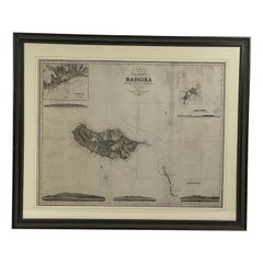
1865 Chart of the Islands of Madeira
Located in Norwell, MA
and 102 Minories 1865. Awesome nautical chart. Matted and framed.
Weight: 14 lbs.
Overall Dimensions
Category
Antique 1860s European Maps
Materials
Paper
Antique Sea Chart of the Western Coast of Africa
Located in Langweer, NL
Antique map titled 'Nieuwe Paskaert van de Kust van Genehoa (..)'. This attractive sea chart covers
Category
Antique Late 17th Century Maps
Materials
Paper
Large Chart of the island and sea of Java, Indonesia
Located in Langweer, NL
Antique map titled 'Carte Esférica de la Isla Y Mar de Java'. Large chart of the island and sea of
Category
Antique Mid-19th Century Maps
Materials
Paper
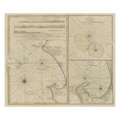
Early Chart Identifying British Spice Trading Colony of Bencoolen, Sumatra, 1797
Located in Langweer, NL
Antique map titled 'A Chart of the West Coast of Sumatra'.
Early nautical chart identifying the
Category
Antique 1790s Maps
Materials
Paper
H 22.64 in W 27.96 in D 0 in
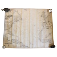
Original Imray & Son Chart of North Atlantic, 1876
Located in Norwell, MA
Nautical chart of the North Atlantic showing the Eastern United States coast, Caribbean Islands
Category
Antique 1870s Nautical Objects
Materials
Paper
Charting Eastern Tartary: An 18th-Century Jesuit and English Collaboration, 1757
Located in Langweer, NL
described as "long, unpleasant, and hard." In addition to numerous maps and charts published during his
Category
Antique Mid-18th Century Maps
Materials
Paper
Free Shipping
H 9.34 in W 13.12 in D 0.02 in
Antique Map of Sumatra by Bellin, 1764
Located in Langweer, NL
high quality nautical charts of practically everywhere in the world. A true child of the Enlightenment
Category
Antique 18th Century Maps
Materials
Paper
Antique Chart of The Spanish Coastline from Bilbao Eastwards, C.1720
Located in Langweer, NL
Antique map titled 'A Chart of the Sea Coasts Biscay and Gallicia Between Cape Machicaca and Cape
Category
Antique 18th Century Maps
Materials
Paper
Mariners Chart of Quicks Hole and Tarpaulin Cove by George Eldridge 1901
Located in Norwell, MA
Nautical chart showing the harbor and local waters of Naushon Island Quick Holes. The chart display
Category
Antique Early 1900s North American Maps
Materials
Paper
Old Decorative & Highly Detailed Sea Chart of the North Dutch-German Coast, 1681
Located in Langweer, NL
Antique map titled 'Paskaart van een gedeelte van Vriesland, Groeninger, en Emderland. Met zyn
Category
Antique 1680s Maps
Materials
Paper
H 21.38 in W 23.82 in D 0 in
Antique Map of the Maluku Islands or Moluccas, Indonesia
Located in Langweer, NL
des cartes et plans de la Marine resulted in hundreds of high quality nautical charts of practically
Category
Antique Mid-18th Century Maps
Materials
Paper
Antique Map of the Pacific Ocean by Anson, 1765
Located in Langweer, NL
oceaan (..)'. Nautical chart of the Pacific Ocean depicting the trade routes used by Spanish Galleons
Category
Antique 18th Century Maps
Materials
Paper
Old Map of Turkmenistan, Uzbekistan, Afghanistan, Tajikistan, Kyrgyzstan, 1757
Located in Langweer, NL
hundreds of high quality nautical charts of practically everywhere in the world. A true child of the
Category
Antique 1750s Maps
Materials
Paper
H 9.06 in W 13.78 in D 0 in
Antique Map of Celebes 'Sulawesi', Island in Indonesia, 1754
By Jacques-Nicolas Bellin
Located in Langweer, NL
French Dépôt des cartes et plans de la Marine resulted in hundreds of high quality nautical charts of
Category
Antique 18th Century Maps
Materials
Paper
Antique Map of Turkmenistan, Uzbekistan, Tajikistan and Kyrgyzstan, 1749
Located in Langweer, NL
et plans de la Marine resulted in hundreds of high quality nautical charts of practically everywhere
Category
Antique 18th Century Maps
Materials
Paper
H 10.32 in W 14.26 in D 0 in
Original Antique Map of the Maluku Islands or Moluccas, Indonesia
Located in Langweer, NL
des cartes et plans de la Marine resulted in hundreds of high quality nautical charts of practically
Category
Antique Mid-18th Century Maps
Materials
Paper
Antique Map of the Tunquin River and Bay, Siam, 1757
Located in Langweer, NL
des cartes et plans de la Marine resulted in hundreds of high quality nautical charts of practically
Category
Antique 18th Century Maps
Materials
Paper
Antique Map of the Coast of China by Bellin, 1752
By Jacques-Nicolas Bellin
Located in Langweer, NL
resulted in hundreds of high quality nautical charts of practically everywhere in the world. A true child
Category
Antique 18th Century Maps
Materials
Paper
Antique Map of the City of Hangzhou by Bellin, 1748
By Jacques-Nicolas Bellin
Located in Langweer, NL
la Marine resulted in hundreds of high quality nautical charts of practically everywhere in the world
Category
Antique 18th Century Maps
Materials
Paper
Antique Map of the Bukhari and Surroundings by Bellin, 1749
Located in Langweer, NL
quality nautical charts of practically everywhere in the world. A true child of the Enlightenment Era
Category
Antique 18th Century Maps
Materials
Paper
Antique Map of the Maluku Islands by Bellin, c.1750
By Jacques-Nicolas Bellin
Located in Langweer, NL
resulted in hundreds of high quality nautical charts of practically everywhere in the world. A true child
Category
Antique 18th Century Maps
Materials
Paper
Antique Map of Celebes 'Sulawesi', Island in Indonesia, c.1750
By Jacques-Nicolas Bellin
Located in Langweer, NL
French Dépôt des cartes et plans de la Marine resulted in hundreds of high quality nautical charts of
Category
Antique 18th Century Maps
Materials
Paper
Stunning Large Scale Antique Map of Martinique, Rare, Published 1758
Located in Langweer, NL
meticulous topographical and nautical detail makes this one of the major 18th century maps of Martinique
Category
Antique 18th Century Maps
Materials
Paper
1797 Tardieu Map of Southeast Asia: The Malay Archipelago and Beyond
Located in Langweer, NL
era
- Nautical chart
Category
Antique 1790s Maps
Materials
Paper
Free Shipping
H 25.2 in W 19.1 in D 0 in
Antique Map of Anjouan or Ndzuani, Island of The Comoros, 1748
Located in Langweer, NL
des cartes et plans de la Marine resulted in hundreds of high quality nautical charts of practically
Category
Antique 18th Century Maps
Materials
Paper
Antique Map of Northern China and Eastern Russia by Bellin, 1757
Located in Langweer, NL
la Marine resulted in hundreds of high quality nautical charts of practically everywhere in the world
Category
Antique 18th Century Maps
Materials
Paper
Original Antique Map of Tartary 'Northern China & Far Eastern Russia', 1757
Located in Langweer, NL
la Marine resulted in hundreds of high quality nautical charts of practically everywhere in the world
Category
Antique 1750s Maps
Materials
Paper
H 9.61 in W 13.47 in D 0 in
Antique Map of Northern China and Eastern Russia by Bellin, 1754
Located in Langweer, NL
described as "long, unpleasant, and hard." In addition to numerous maps and charts published during his
Category
Antique 18th Century Maps
Materials
Paper
Antique Map of Gorée Island ‘Senegal’ by J.N. Bellin, 1764
Located in Langweer, NL
Nautical antique chart of Gorée Senegal including a letter key to the island's fortifications
Category
Antique Mid-18th Century Maps
Materials
Paper
1856 U.S. Coast Survey Map of Chesapeake Bay and Delaware Bay
Located in Colorado Springs, CO
Presented is U.S. Coast Survey nautical chart or maritime map of Chesapeake Bay and Delaware Bay
Category
Antique 1850s American Maps
Materials
Paper
Antique Map of the Mouth of the Chiang River by Bellin, 1764
By Jacques-Nicolas Bellin
Located in Langweer, NL
Province de Fokyen en Chine’. This impressive map or sea chart details the mouth of the Chiang River in the
Category
Antique 18th Century Maps
Materials
Paper
Antique Map of the Coast of Southern Brazil by Bellin, c.1755
By Jacques-Nicolas Bellin
Located in Langweer, NL
la Marine resulted in hundreds of high quality nautical charts of practically everywhere in the world
Category
Antique 18th Century Maps
Materials
Paper
Antique Map Centered on Turkestan, Including the Black and Caspian Seas, 1749
Located in Langweer, NL
et plans de la Marine resulted in hundreds of high quality nautical charts of practically everywhere
Category
Antique 18th Century Maps
Materials
Paper
H 9.97 in W 14.69 in D 0 in
Antique Map of Hangzhou, Capital of the Province of Zheijang, China, 1748
Located in Langweer, NL
la Marine resulted in hundreds of high quality nautical charts of practically everywhere in the world
Category
Antique 1740s Maps
Materials
Paper
Antique Map of Hangzhou, Capital of the Province of Zheijang, China, c.1750
Located in Langweer, NL
des cartes et plans de la Marine resulted in hundreds of high quality nautical charts of practically
Category
Antique 1750s Maps
Materials
Paper
H 10.63 in W 7.88 in D 0 in
Antique Map of Saldanha Bay 'Near Cape Town, South Africa' by Bellin, 1750
By Jacques-Nicolas Bellin
Located in Langweer, NL
described as "long, unpleasant, and hard." In addition to numerous maps and charts published during his
Category
Antique 18th Century Maps
Materials
Paper
H 8.86 in W 11.42 in D 0.01 in
Antique Map of the British Islands to the White Sea by J. Imray
Located in Langweer, NL
Antique large nautical chart of the British Islands to the White Sea. With insets of Veshnyak
Category
Antique Late 19th Century Maps
Materials
Paper
Scarce U.S. Coast Survey Map Depicting Entrance to San Francisco Bay Dated 1856
Located in San Francisco, CA
A fine example of the 1856 U.S. Coast lithographic survey nautical chart of the entrance to San
Category
Antique Mid-19th Century American Maps
Materials
Paper
H 28 in W 46 in D 1.5 in
Old Map of The Kurile Islands, from Hokkaido, Japan to Kamchatka, Russia, c.1750
Located in Langweer, NL
resulted in hundreds of high quality nautical charts of practically everywhere in the world. A true child
Category
Antique 1750s Maps
Materials
Paper
Free Shipping
H 10.67 in W 11.89 in D 0 in
Antique Map of Two Cities in the Province of Shanxi or Chensi, China, 1748
By Jacques-Nicolas Bellin
Located in Langweer, NL
la Marine resulted in hundreds of high quality nautical charts of practically everywhere in the world
Category
Antique 18th Century Maps
Materials
Paper
H 10.24 in W 15.36 in D 0 in
Antique Map of Northern China and Far Eastern Russia Around the Amur River, 1754
Located in Langweer, NL
quality nautical charts of practically everywhere in the world. A true child of the Enlightenment Era
Category
Antique 1750s Maps
Materials
Paper
H 10.63 in W 15.16 in D 0 in
Original Antique Map of the Empire of Japan, Centered on the Bay of Osaka, c1752
Located in Langweer, NL
described as "long, unpleasant, and hard." In addition to numerous maps and charts published during his
Category
Antique 1750s Maps
Materials
Paper
H 10.63 in W 15.36 in D 0 in
Nice Antique Map of the Empire of Japan. Centered on the Bay of Osaka, ca.1752
Located in Langweer, NL
French Dépôt des cartes et plans de la Marine resulted in hundreds of high quality nautical charts of
Category
Antique 1750s Maps
Materials
Paper
H 9.45 in W 13.78 in D 0 in
Old Original Engraving of Prussia on the Southeast Coast of the Baltic Sea, 1632
Located in Langweer, NL
innovation that is still employed in nautical charts.
Condition:
Good, general age-related toning. Minor
Category
Antique 1630s Maps
Materials
Paper
H 8.47 in W 11.03 in D 0 in
Old Print of Fort James on Kunta Kinteh Island on the Gambia River, Africa, 1746
Located in Langweer, NL
la Marine resulted in hundreds of high quality nautical charts of practically everywhere in the world
Category
Antique 1740s Maps
Materials
Paper
H 10.08 in W 7.88 in D 0 in
Facsimile with 30 VOC Nautical Charts, the Treasure of Corpus Christi
Located in Langweer, NL
Facsimile with 30 large format VOC nautical charts in limited and numbered edition. Sjoerd de Meer
Category
21st Century and Contemporary Books
Materials
Paper
H 27.17 in W 19.69 in D 0.79 in
Nantucket Mack Pack - A Gathering of Mackerel on a Vintage Nautical Map
By Jeff Conroy
Located in Chicago, IL
on this stunning species. Drawn on a vintage nautical map adds to the overall aesthetic. The piece
Category
21st Century and Contemporary Contemporary Animal Drawings and Watercolors
Materials
Paper, Watercolor
Purple Perkins Over St. Croix - Octopus on Nautical Map, Gyotaku Style Print
By Jeff Conroy
Located in Chicago, IL
dimensionality. By printing it on a nautical chart, the artist achieves a beautiful aesthetic. The artwork is
Category
21st Century and Contemporary Contemporary Animal Drawings and Watercolors
Materials
Watercolor, Sumi Ink, Color Pencil
Map of the North of Scotland 17th century hand-coloured map by Gerardus Mercator
Located in London, GB
in today's nautical charts.
Mercator was a highly influential pioneer in the history of cartography
Category
1680s Prints and Multiples
Materials
Engraving
Map of the World: An Original 18th Century Hand-colored Map by E. Bowen
Located in Alamo, CA
example of a nautical chart, a type of map that was designed specifically for use by mariners. The map is
Category
Mid-18th Century Old Masters Landscape Prints
Materials
Engraving
Hermes Paris Silk 18th Century Style Nautical Exploration Blouse cira 1990s
By Hermès
Located in University City, MO
. Concealed within the golden silk
graphics are nautical instruments with longitude and latitude
chart maps
Category
Late 20th Century French Blouses
Intervened photography, art, Mexican design " Primera Derrota" by Sumie García
Located in Ciudad de México, CDMX
linguistic play unveils a rich metaphorical layer, especially in the context of nautical and colloquial
Category
2010s Mexican Decorative Art
Materials
Gold, Brass
H 19.69 in W 13.78 in D 3.94 in
Block Island Merlot - Gyotaku Style Sumi Ink Painting of an Octopus
By Jeff Conroy
Located in Chicago, IL
dimensionality. By printing it on an antique nautical chart, in this case a map of Block Island, the artist
Category
21st Century and Contemporary Contemporary Animal Drawings and Watercolors
Materials
Watercolor, Sumi Ink, Mulberry Paper, Color Pencil
The Great Australian Bight Trio - Gyotaku Style Sumi Ink Painting of an Octopus
By Jeff Conroy
Located in Chicago, IL
dimensionality. By printing them on an antique nautical chart, in this case a map of the Great Australian Bight
Category
21st Century and Contemporary Contemporary Animal Drawings and Watercolors
Materials
Sumi Ink, Color Pencil, Watercolor
Fort Hollandois De Paliacate Nommé Le Fort De Gueldre, Bellin, 1751
Located in Langweer, NL
quality nautical charts of practically everywhere in the world. A true child of the Enlightenment Era
Category
Antique 18th Century Prints
Materials
Paper
Carte Particuliere Des Coste De Bretagne qui Comprend Morlaix
By Pierre Mortier
Located in Paonia, CO
maps. His greatest achievement was the nautical atlas Le Neptune Francois. Mortier’s charts are
Category
1690s Landscape Prints
Materials
Engraving
- 1
Get Updated with New Arrivals
Save "Map Nautical Chart", and we’ll notify you when there are new listings in this category.
Map Nautical Chart For Sale on 1stDibs
Choose from an assortment of styles, material and more in our collection of map nautical chart on 1stDibs. A piece of map nautical chart — often made from paper — can elevate any home. Your living room may not be complete without an item from our selection of map nautical chart — find older editions for sale from the 18th Century and newer versions made as recently as the 21st Century. Many designers have produced at least one well-made choice in our collection of map nautical chart over the years, but those crafted by Jacques-Nicolas Bellin and G. A. Rizzi-zannoni are often thought to be among the most beautiful.
How Much is a Map Nautical Chart?
A piece of map nautical chart can differ in price owing to various characteristics — the average selling price 1stDibs is $676, while the lowest priced sells for $107 and the highest can go for as much as $26,300.
More Ways To Browse
Shanxi Cabinet
Pinewood Dining
Wood Inlay Midcentury Dining Table
18th Century Danish Cabinet
18th Century Danish Cabinet
Contemporary China Cabinet
Italian Dining Table Wood Inlay
Italian Wood Inlay Dining Table
Black Server Cabinet
Spice Cabinet
Italian Wood Dining Table With Inlays
Dutch Macassar
Medieval Dining Table
Hermes Silk Dress
Chart Table
Danish China Cabinet
Antique Asian Style Cabinet
Nautical Tables
