Items Similar to Charting Eastern Tartary: An 18th-Century Jesuit and English Collaboration, 1757

Want more images or videos?
Request additional images or videos from the seller
1 of 6
Charting Eastern Tartary: An 18th-Century Jesuit and English Collaboration, 1757
About the Item
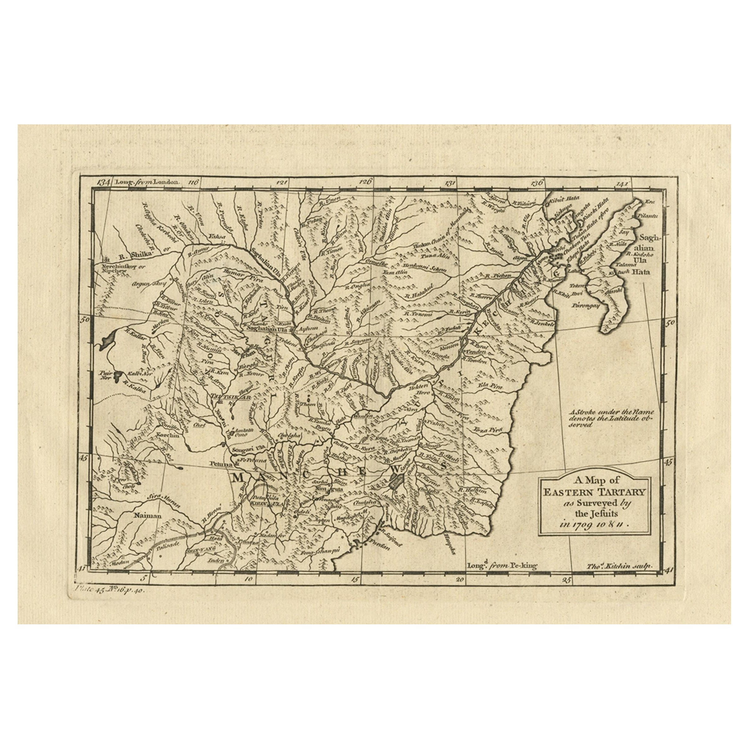
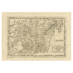
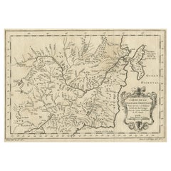
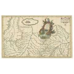
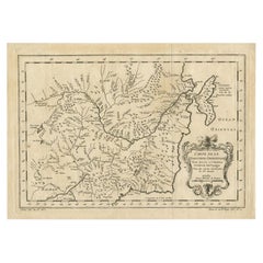
The antique map titled 'Carte de la Tartarie Orientale pour Servir a l'Histoire Generale des Voyages Tiree des Cartes Levees par les P.P. Jesuites' is an original old map that covers the eastern part of Tartary, including part of present-day Manchuria and Sakhalin Island. This map is particularly detailed in depicting river systems and geographic features. It was based primarily on Jesuit and English sources and was published in 1757 as part of 'Histoire Generale des Voyages.'
**Key Aspects of the Map:**
1. **Geographic Coverage**: The map focuses on the eastern part of Tartary, providing a detailed view of the region that includes present-day Manchuria and Sakhalin Island. It likely includes rivers, mountains, coastlines, and other geographical features.
2. **Cartographic Sources**: The map is based on information gathered from Jesuit sources and English maps, indicating a collaborative effort in mapping and exploration during the 18th century.
3. **River Systems**: The map's particular emphasis on river systems suggests the importance of waterways for navigation, trade, and transportation in the region.
4. **Historical Context**: Published in 1757, this map reflects the geographical knowledge and cartographic techniques of the time. It provides insights into the exploration and mapping of Eastern Tartary during the 18th century.
5. **'Histoire Generale des Voyages'**: The map originates from 'Histoire Generale des Voyages,' a significant work in the field of travel literature and geography. It was a compilation of travel accounts and maps from various explorers and travelers.
6. **Educational and Informative**: Antique maps like this one served educational and informative purposes, providing valuable geographic knowledge to readers and scholars of the era.
7. **Historical Mapping**: This map contributes to the historical record of how the region was represented and understood in the 18th century, making it a valuable resource for historical research.
8. **Collaborative Effort**: The involvement of Jesuit cartographers and the use of English sources highlight the collaborative nature of cartography and exploration during this period.
Overall, the 'Carte de la Tartarie Orientale' antique map is a significant artifact that offers insights into the cartographic and geographical knowledge of Eastern Tartary in the 18th century. It provides a window into the exploration and mapping efforts of the time and serves as a historical reference for researchers and historians interested in the region's past.
Jacques-Nicolas Bellin (1703 - 1772) was one of the most important cartographers of the 18th century. With a career spanning some 50 years, Bellin is best understood as geographe de cabinet and transitional mapmaker spanning the gap between 18th and early 19th century cartographic styles. His long career as Hydrographer and Ingénieur Hydrographe at the French Dépôt des cartes et plans de la Marine resulted in hundreds of high quality nautical charts of practically everywhere in the world. A true child of the Enlightenment Era, Bellin's work focuses on function and accuracy tending in the process to be less decorative than the earlier 17th and 18th century cartographic work. Unlike many of his contemporaries, Bellin was always careful to cite his references and his scholarly corpus consists of over 1400 articles on geography prepared for Diderot's Encyclopedie. Bellin, despite his extraordinary success, may not have enjoyed his work, which is described as "long, unpleasant, and hard." In addition to numerous maps and charts published during his lifetime, many of Bellin's maps were updated (or not) and published posthumously.
- Dimensions:Height: 9.34 in (23.7 cm)Width: 13.12 in (33.3 cm)Depth: 0.02 in (0.5 mm)
- Materials and Techniques:
- Period:
- Date of Manufacture:1757
- Condition:General age-related toning. Original folding lines. Minor wear and soiling, blank verso. Please study image carefully.
- Seller Location:Langweer, NL
- Reference Number:
About the Seller
5.0
Platinum Seller
These expertly vetted sellers are 1stDibs' most experienced sellers and are rated highest by our customers.
Established in 2009
1stDibs seller since 2017
1,928 sales on 1stDibs
Typical response time: <1 hour
- ShippingRetrieving quote...Ships From: Langweer, Netherlands
- Return PolicyA return for this item may be initiated within 14 days of delivery.
More From This SellerView All
- Antique Map of Eastern Tartary as Surveyed by the Jesuits, 1746By Thomas KitchinLocated in Langweer, NLAntique map titled 'A Map of Eastern Tartary as Surveyed by the Jesuits in 1709, 10 & 11'. The map covers much of the course of the Amur River or Heilong Jiang, the world's tenth lon...Category
Antique 18th Century Maps
MaterialsPaper
- Original Antique Map of Tartary 'Northern China & Far Eastern Russia', 1757Located in Langweer, NLAntique map titled 'Carte de la Tartarie Orientale (..)'. Original antique map of what is present day northern China and far eastern Russia. Centere...Category
Antique 1750s Maps
MaterialsPaper
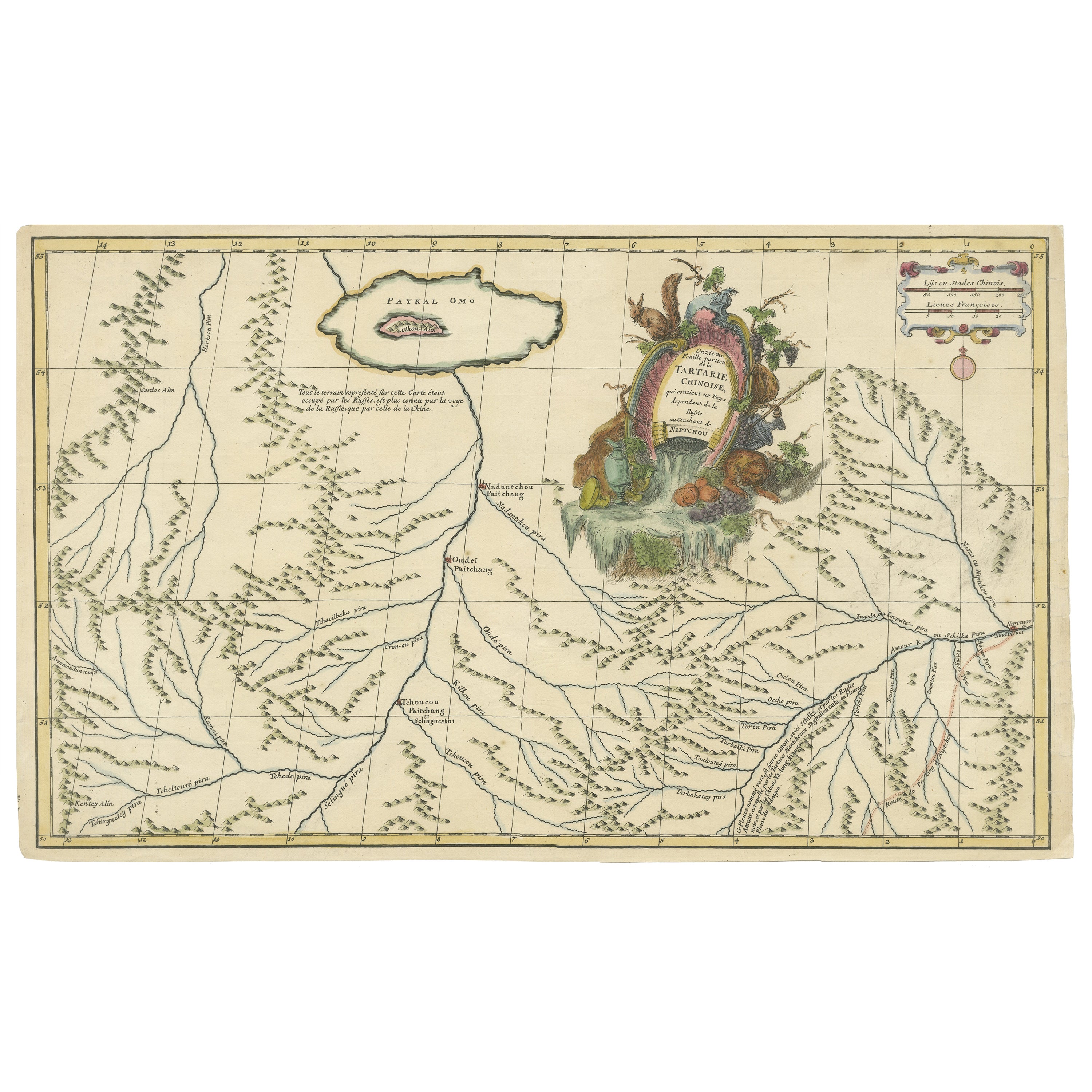
- Original Antique Engrving of Chinese Tartary in the 18th Century, 1737Located in Langweer, NLThe antique map titled " Ozieme feuille particuls de la Tartarie Chinoise, qui contient un pays dependant de la russie aucouchant de NIPTCHOU " translates to "Sixth sheet of parts of...Category
Antique 1730s Maps
MaterialsPaper
- Antique Map of Northern China and Eastern Russia by Bellin, 1757Located in Langweer, NLAntique map titled 'Carte de la Tartarie Orientale (..)'. Original antique map of what is present day northern China and far eastern Russia. Centered on...Category
Antique 18th Century Maps
MaterialsPaper
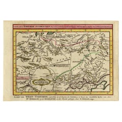
- Antique Map of Eastern Tartary and the Gobi Desert by Van Schley, 1758By Jakob van der SchleyLocated in Langweer, NLAntique map titled 'Carte de la Tartarie occidentale.' Original antique map of Eastern Tartary and the Gobi desert showing the silk road and the Great Wall of China. While these maps...Category
Antique 18th Century Maps
MaterialsPaper
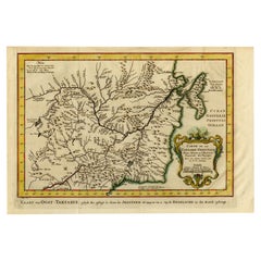
- Antique Map of Eastern Tartary, now the Primorsky Krai Area, Russia, 1758By Jakob van der SchleyLocated in Langweer, NLAntique map titled 'Carte de la Tartarie orientale.' A map of Eastern Tartary. East Tartary is an old names for the Manchu-inhabited territory extending from the River Amur to Sakhal...Category
Antique 18th Century Maps
MaterialsPaper
You May Also Like
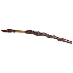
- Eastern Ship Rudder, Late 18th-Early 19th Century, Carved Wood and BrassLocated in Madrid, ESEastern ship rudder, late 18th-early 19th century. Carved wood and brass. English-influenced oriental ship rudder, made of brass and high quality carved...Category
Antique 19th Century Asian Other Nautical Objects
MaterialsBrass
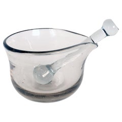
- An apothecary glass mortar and pestle, Italy 18th century.Located in Milan, ITApothecary glass mortar, fitted with glass pestle. Italy early 18th century.Category
Antique Early 18th Century Italian Scientific Instruments
MaterialsGlass
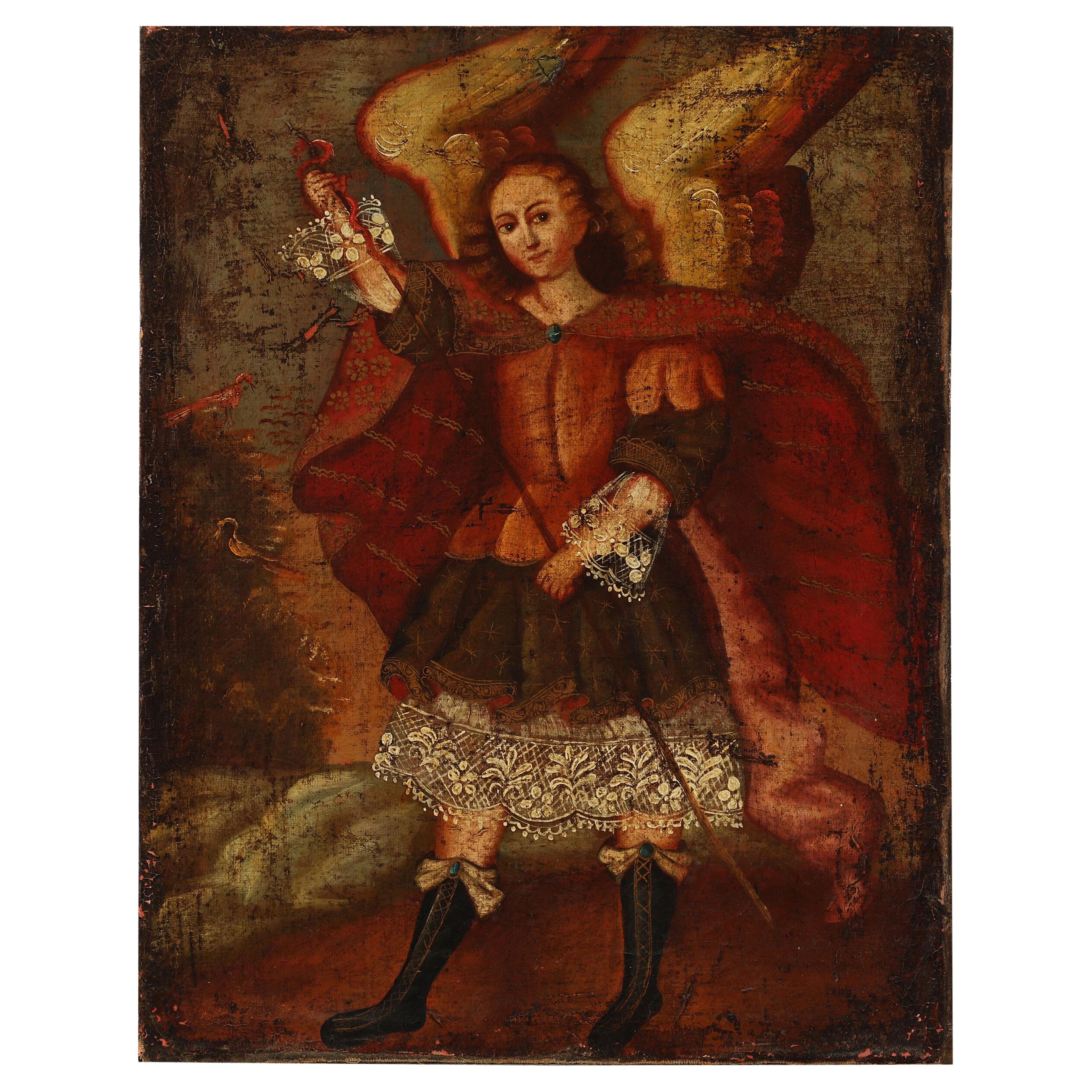
- Cuzco School, 18th Century an Angel, UnsignedLocated in Virum, DKCuzco school, 18th century: An angel. Unsigned. Oil on canvas. 51 × 40 cm. Unframed.Category
Antique Mid-18th Century Peruvian Paintings
MaterialsCanvas

- An extremely rare 18th century drawing of a DodoLocated in Amsterdam, NLAn extrmely rare drawing of a Dodo Second half 18th century Pen and ink, and watercolour on paper, H. 18 x W. 12.2 cm With text reading: “This bird was seen in Mauritius by Sir Th Herbert about 1589 – there are Remains of the bill + legs in the Museum at Oxford – but.– it is near 200 years since any specimen has been brought to England. The Draw(ing) is made from a Dutch Painting in the British Museum – (?) J. A. says that it is eaten but the flesh is oily + unpleasant –” “The Dodo...Category
Antique 18th Century British Drawings
MaterialsPaper
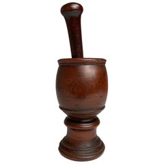
- 18th Century English Treen Yew Wood Mortar and PestleLocated in Stamford, CT18th century English treen mortar and pestle hand turned and carved from yew wood with the rich and warm patina that only comes with age and use. Beautifully carved by hand from a si...Category
Antique Mid-18th Century English Georgian Scientific Instruments
MaterialsYew
- Scandinavia & Portions of Eastern Europe: 18th Century Hand-Colored Homann MapBy Johann Baptist HomannLocated in Alamo, CAAn early 18th century hand-colored copper-plate map entitled "Regni Sueciae in omnes suas Subjacentes Provincias accurate divisi Tabula Generalis" by Johann Baptist Homann (1663-1724...Category
Antique Early 18th Century German Maps
MaterialsPaper

Recently Viewed
View AllMore Ways To Browse
Pierre Fran�ois Tardieu On Sale
Antique Maps Washington Dc
Union Pacific Map
Antique Bassett
Antique Map New Orleans
Antique Maps Of New Orleans
Taiwan Map
Antique Map Iceland
Antique Map Of Iceland
Antique Maps Singapore
Taiwan Antique Map
Antique Life Buoy
Antique Illinois Map
Vietnam Map
Vintage Bartholomew Maps
Vintage Bartholomews Maps
Antique Map Nova Scotia
Kansas Map