Items Similar to Antique Map of Eastern Tartary as Surveyed by the Jesuits, 1746

Want more images or videos?
Request additional images or videos from the seller
1 of 6
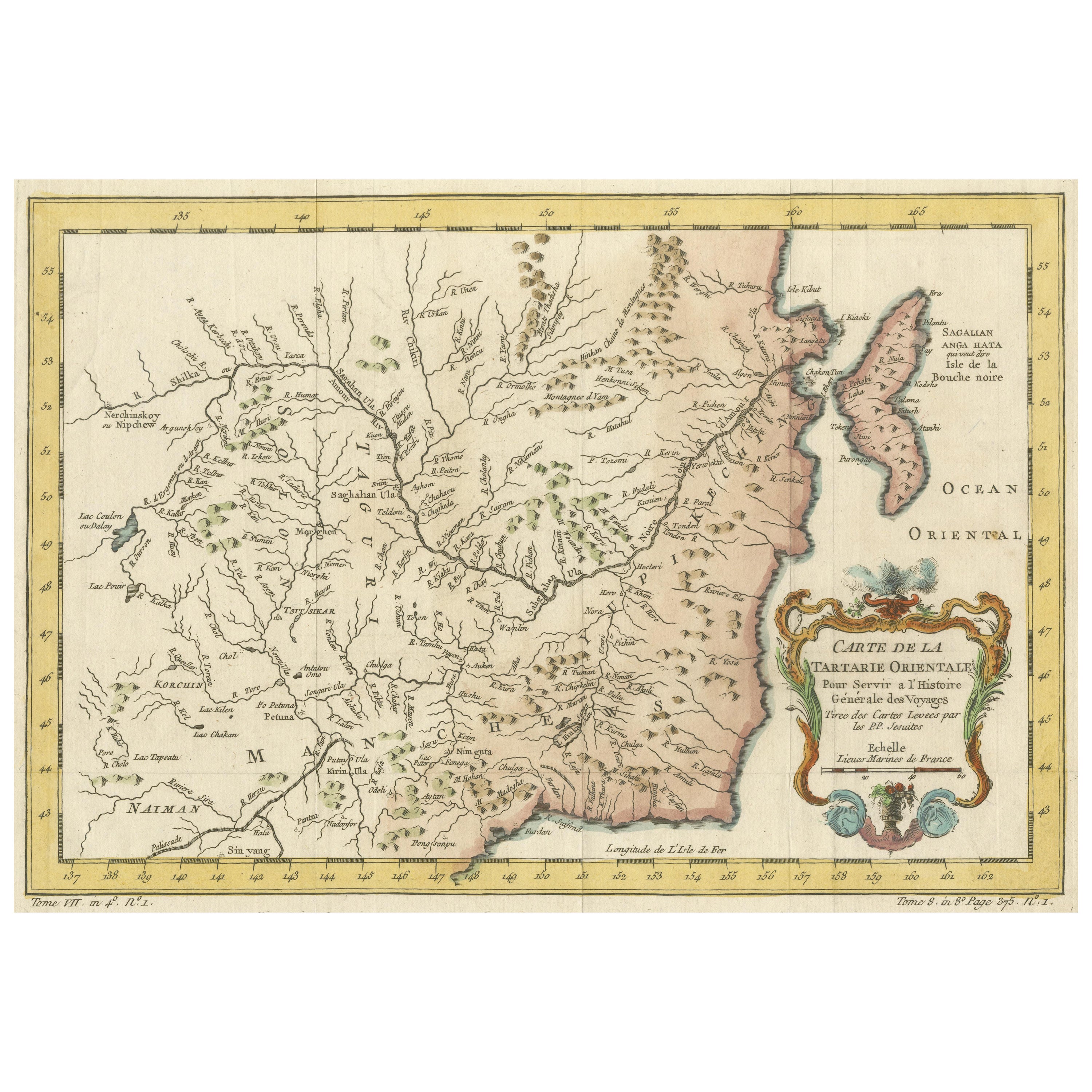
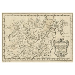
Antique Map of Eastern Tartary as Surveyed by the Jesuits, 1746
About the Item
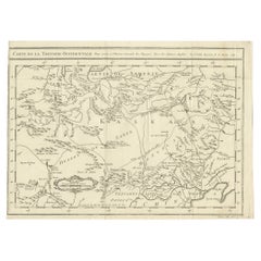
Antique map titled 'A Map of Eastern Tartary as Surveyed by the Jesuits in 1709, 10 & 11'. The map covers much of the course of the Amur River or Heilong Jiang, the world's tenth longest river, which today forms the border between the Russian Far East and Northeastern China (Inner Manchuria).
Artists and Engravers: Thomas Kitchin, from the Jesuits' survey. Provenance: ""A New General Collection of Voyages and Travels""; Printed for Thomas Astley, Published by His Majesty's Authority, London.
Condition: Excellent. Please study scan carefully.
Date: 1746
Overall size: 36.8 x 22.9 cm
Image size: 23.6 x 16.6 cm
We sell original antique maps to collectors, historians, educators and interior decorators all over the world. Our collection includes a wide range of authentic antique maps from the 16th to the 20th centuries. Buying and collecting antique maps is a tradition that goes back hundreds of years. Antique maps have proved a richly rewarding investment over the past decade, thanks to a growing appreciation of their unique historical appeal. Today the decorative qualities of antique maps are widely recognized by interior designers who appreciate their beauty and design flexibility. Depending on the individual map, presentation, and context, a rare or antique map can be modern, traditional, abstract, figurative, serious or whimsical. We offer a wide range of authentic antique maps for any budget.
- Creator:Thomas Kitchin (Artist)
- Dimensions:Height: 9.02 in (22.9 cm)Width: 14.49 in (36.8 cm)Depth: 0 in (0.01 mm)
- Materials and Techniques:
- Period:
- Date of Manufacture:1746
- Condition:
- Seller Location:Langweer, NL
- Reference Number:
About the Seller
5.0
Platinum Seller
These expertly vetted sellers are 1stDibs' most experienced sellers and are rated highest by our customers.
Established in 2009
1stDibs seller since 2017
1,928 sales on 1stDibs
Typical response time: <1 hour
- ShippingRetrieving quote...Ships From: Langweer, Netherlands
- Return PolicyA return for this item may be initiated within 14 days of delivery.
More From This SellerView All
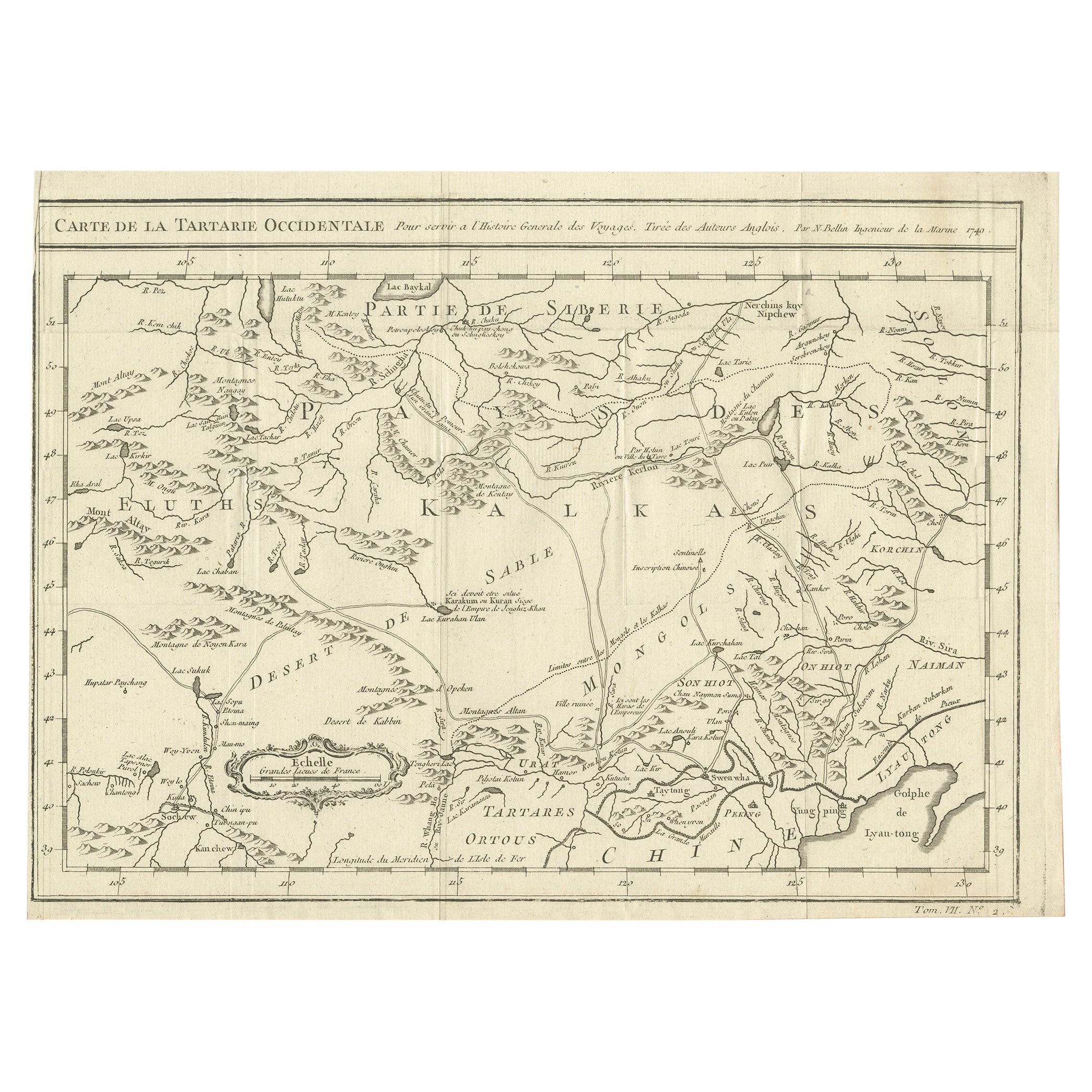
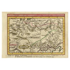
- Antique Map of Western Tartary, with Information from Kyrkov's SurveysLocated in Langweer, NLAntique map titled 'Carte de la Tartarie Occidentale'. This map covers western Tartary with a focus on the region of present-day Mongolia. This map includes information from Kyrkov's...Category
Antique Mid-18th Century Maps
MaterialsPaper
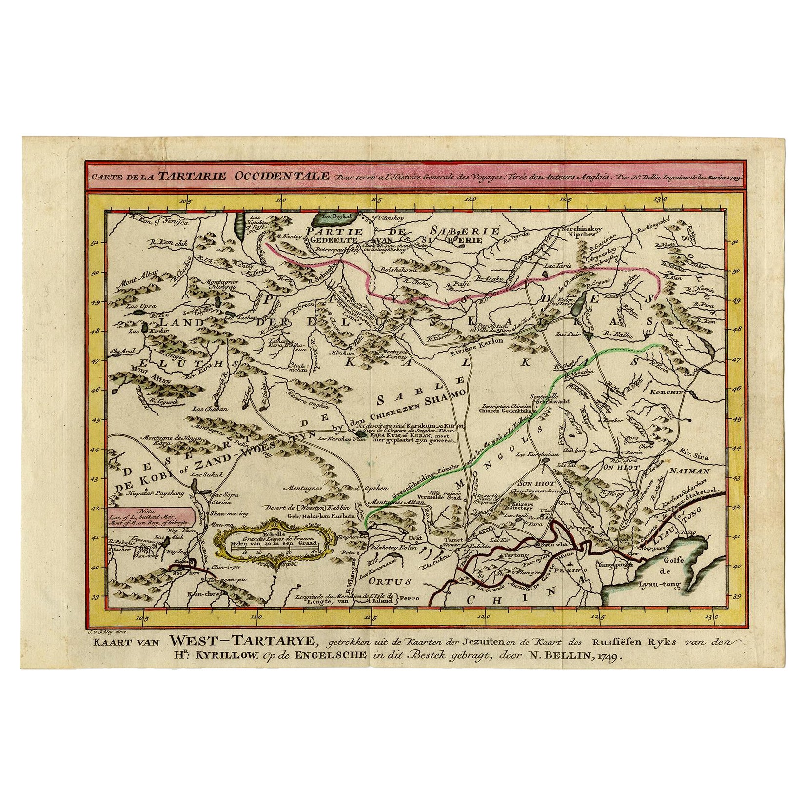
- Antique Map of Eastern Tartary and the Gobi Desert by Van Schley, 1758By Jakob van der SchleyLocated in Langweer, NLAntique map titled 'Carte de la Tartarie occidentale.' Original antique map of Eastern Tartary and the Gobi desert showing the silk road and the Great Wall of China. While these maps...Category
Antique 18th Century Maps
MaterialsPaper
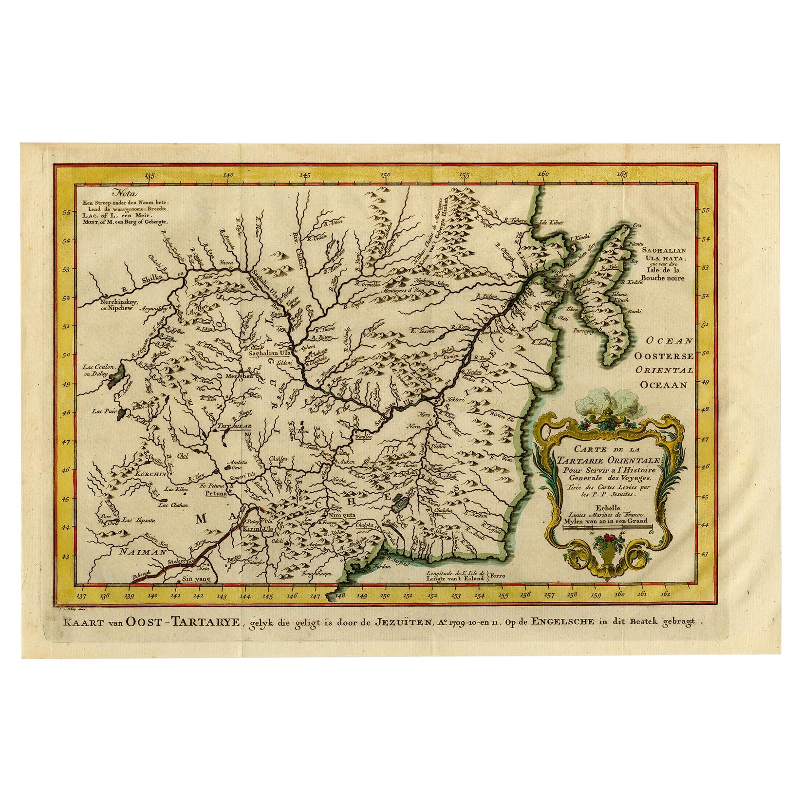
- Antique Map of Eastern Tartary, now the Primorsky Krai Area, Russia, 1758By Jakob van der SchleyLocated in Langweer, NLAntique map titled 'Carte de la Tartarie orientale.' A map of Eastern Tartary. East Tartary is an old names for the Manchu-inhabited territory extending from the River Amur to Sakhal...Category
Antique 18th Century Maps
MaterialsPaper
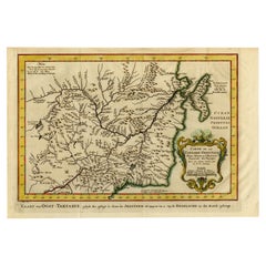
- Original Antique Map of Tartary 'Northern China & Far Eastern Russia', 1757Located in Langweer, NLAntique map titled 'Carte de la Tartarie Orientale (..)'. Original antique map of what is present day northern China and far eastern Russia. Centere...Category
Antique 1750s Maps
MaterialsPaper
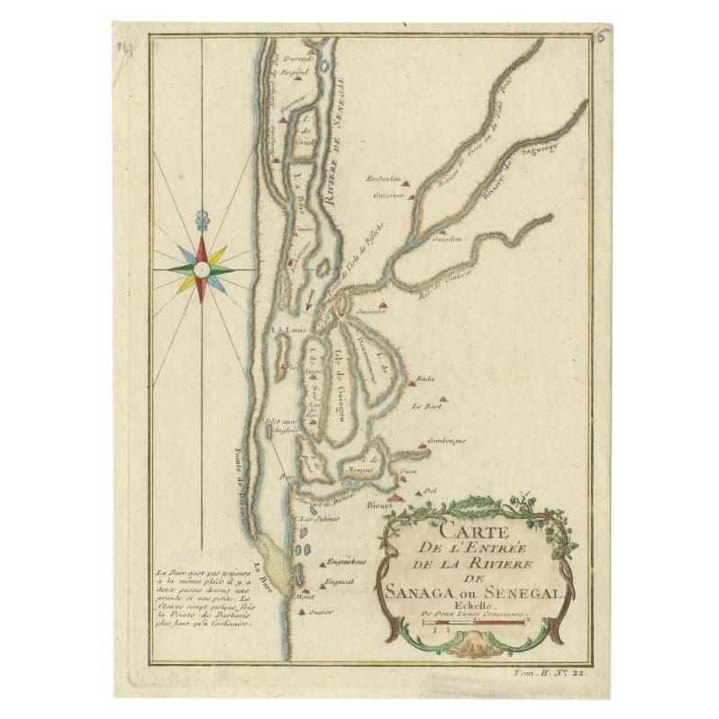
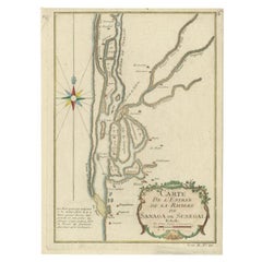
- Antique Map of The Senegal River by Bellin, 1746Located in Langweer, NLAntique map titled 'Carte de l'Entrée de la Rivière de Sanaga ou Senegal'. Map of the mouth of the Senegal River. This map originates from Prevost's 'Histoire Generale des Voyages'. ...Category
Antique 18th Century Maps
MaterialsPaper
- Charting Eastern Tartary: An 18th-Century Jesuit and English Collaboration, 1757Located in Langweer, NLThe antique map titled 'Carte de la Tartarie Orientale pour Servir a l'Histoire Generale des Voyages Tiree des Cartes Levees par les P.P. Jesuites' is an original old map that covers...Category
Antique Mid-18th Century Maps
MaterialsPaper

You May Also Like
- 1851 Map of "Independent Tartary", Ric. R018Located in Norton, MA1851 Map of Independent Tartary "Russia" Ric.r018 A highly decorative 1851 map of Independent Tartary by John Tallis and John Rapkin. Covers the regions between the Caspian Sea and Lake Bakquash and between Russia and Afghanistan. These include the ancient Silk Route kingdoms of Khiva, Tartaria, Kokand, and Bokhara. Today this region roughly includes Kazakhstan, Uzbekistan, Turkmenistan, Kyrgyzstan, and Tajikistan. This wonderful map offers a wealth of detail for anyone with an interest in the Central Asian portion of the ancient Silk Road. Identifies various caravan routes, deserts, wells, and stopping points, including the cities of Bokhara and Samarkand. Three vignettes by W. Bragg decorate the map, these including an image of Tartars on a Journey, a horseback Bride Chase, and a tartar camp site. Surrounded by a vine motif border. Engraved by J. Rapkin for John Tallis's 1851 Illustrated Atlas . Tartary Antique Map...Category
Antique 19th Century Unknown Maps
MaterialsPaper
- 1903 Antique National Publishing Road Map of New Jersey Geological SurveyLocated in Dayton, OH1903 antique New Jersey road map by The National Publishing Company of Boston Massachusettes, No 384. Index for New Jersey Census 1900, Population 1...Category
Antique Early 1900s Victorian Maps
MaterialsPaper
- 1861 Topographical Map of the District of Columbia, by Boschke, Antique MapLocated in Colorado Springs, COPresented is an original map of Albert Boschke's extremely sought-after "Topographical Map of the District of Columbia Surveyed in the Years 1856 ...Category
Antique 1860s American Historical Memorabilia
MaterialsPaper
- Antique 1844 J Calvin Smith JH Colton Midwest United States Survey Map 27"By J.H. ColtonLocated in Dayton, OHAntique framed black and white map of seven Midwestern American states. Guide Through Ohio, Michigan, Indiana, Illinois, Missouri, Wisco...Category
Antique 1840s Maps
MaterialsPaper
- Framed Original Land Map Survey of Tyler Park, Jersey City RailroadLocated in Lambertville, NJA framed and matted historical map of Tyler park jersey city New Jersey Railroad. The paper on canvas in later appropriate frame. Good condition with some creasing and age discolorat...Category
Antique 1870s American Posters
MaterialsCanvas, Glass, Wood
- 1856 U.S. Coast Survey Map of Chesapeake Bay and Delaware BayLocated in Colorado Springs, COPresented is U.S. Coast Survey nautical chart or maritime map of Chesapeake Bay and Delaware Bay from 1856. The map depicts the region from Susquehanna, Maryland to the northern Oute...Category
Antique 1850s American Maps
MaterialsPaper


Recently Viewed
View AllMore Ways To Browse
Eastern Antiques
Antique World Map Print
Antique Survey
Eastern Russia
Antique Thomas China
Chinese Antiques London
Chinese Hundred Antiques
Antique Map Border
Antique Surveying
Antique London Map Print
Survey Map
Antique China Map
Antique Map China
Antique Chinese Maps
Antique Russian Map
Far Eastern Antique
Chinese Antique Map
Antique Russian China