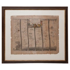
Antique London Map Print
5
to
33
272
172
260
171
152
64
53
44
35
35
31
26
24
22
19
15
14
14
12
10
10
9
9
8
7
7
7
6
6
6
6
6
5
5
5
5
5
5
4
4
3
3
3
3
2
2
1
12
11
8
7
7
Sort By
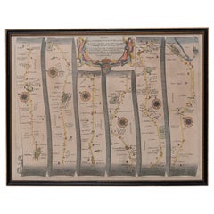
Road Map, John Ogilby, No 54, London, Yarmouth, Britannia
By John Ogilby
Located in BUNGAY, SUFFOLK
& Maldon). Of the sixth volume, on London, only the general map appeared in print, and that after Ogilby's
Category
1670s English Baroque Antique London Map Print
Materials
Paper
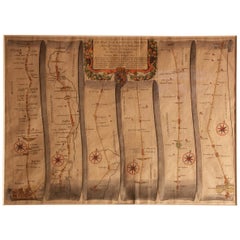
Road Map Britannia 1675/6 No 5 Road London to Barwick, London Stilton Grey Frame
By John Ogilby
Located in BUNGAY, SUFFOLK
sixth volume, on London, only the general map appeared in print, and that after Ogilby's death. In fact
Category
Late 17th Century British Charles II Antique London Map Print
Materials
Paper
H 22.84 in W 25.99 in D 0.4 in
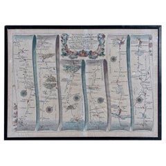
Map Road Strip Britannia Sheet 2 John Ogilby London Aberistwith Islip Bramyard
By John Ogilby
Located in BUNGAY, SUFFOLK
framer, print seller, Oxford. Annotated.
The second of 100 sheets of strip maps made for John Ogilby
Category
17th Century English Baroque Antique London Map Print
Materials
Paper
H 14.38 in W 19.3 in D 0.79 in
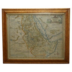
London 1744 Published Watercolour Antique Map of East Africa by Eman Bowen
Located in GB
We are delighted to offer for sale this New and Accurate Map of Nubia & Abissinia, together with
Category
1740s English George III Antique London Map Print
Materials
Paper
H 17.52 in W 21.07 in D 0.79 in
Road Map No43 London to Kings Lynn, Royston to Downham, John Ogilby, Britannia
By John Ogilby
Located in BUNGAY, SUFFOLK
). Of the sixth volume, on London, only the general map appeared in print, and that after Ogilby's death
Category
Late 17th Century British Charles II Antique London Map Print
Materials
Paper
H 20.48 in W 24.41 in D 0.4 in
Road Map John Ogilby London St David's Britannia No 15 Abingdon Monmouth Framed
By John Ogilby
Located in BUNGAY, SUFFOLK
). Of the sixth volume, on London, only the general map appeared in print, and that after Ogilby's death
Category
1670s English Baroque Antique London Map Print
Materials
Paper
H 20.48 in W 24.41 in D 0.6 in
Road Map Britannia No 32 the Road from London to Barnstable John Ogilby Framed
By John Ogilby
Located in BUNGAY, SUFFOLK
& Maldon). Of the sixth volume, on London, only the general map appeared in print, and that after Ogilby's
Category
Late 17th Century English Charles II Antique London Map Print
Materials
Paper
H 20.48 in W 24.41 in D 0.6 in
Road Map Britannia No 15 London to St Davids John Ogilby Brown Gilt Frame
By John Ogilby
Located in BUNGAY, SUFFOLK
). Of the sixth volume, on London, only the general map appeared in print, and that after Ogilby's death
Category
Late 17th Century British Charles II Antique London Map Print
Materials
Paper
H 22.05 in W 26.19 in D 0.6 in
Road Map Britannia No 25 London to the Lands End, John Ogilby Brown Gilded Frame
By John Ogilby
Located in BUNGAY, SUFFOLK
). Of the sixth volume, on London, only the general map appeared in print, and that after Ogilby's death
Category
Late 17th Century British Charles II Antique London Map Print
Materials
Paper
H 22.05 in W 26.19 in D 0.6 in
Framed 1838 Mexico & Gulf of Mexico Map
Located in Stamford, CT
Framed 1838 Mexico & Gulf of Mexico map. Printed by Fisher, Son & Co. of London in 1838. As found
Category
1830s English American Classical Antique London Map Print
Materials
Glass, Wood, Paper
Original Antique Map of England and Wales
Located in Langweer, NL
Improvements'. Original antique map of England and Wales. Printed by Alex Hogg, London for George Henry
Category
Late 18th Century Antique London Map Print
Materials
Paper
Antique Map of the Coromandel Peninsula, 1754
Located in Langweer, NL
Coromandel printed for the London Magazine.
Artists and Engravers: This map is not attributed, so it may
Category
18th Century Antique London Map Print
Materials
Paper
Antique Map of Russia by Tyrer, 1821
Located in Langweer, NL
Antique map titled 'Russia'. Beautiful antique map of Russia engraved by Tyrer. Artists and
Category
19th Century Antique London Map Print
Materials
Paper
Antique Map of Portugal by Moll, 1727
Located in Langweer, NL
Antique map Portugal titled 'Portugal Agreeable to Modern History'. Detailed map of Portugal
Category
18th Century Antique London Map Print
Materials
Paper
Antique Map of South Australia by Tallis, 1851
By Thomas Kitchin
Located in Langweer, NL
British map publisher. Born in the Midlands, Tallis came to London in the 1840s. Tallis began his London
Category
19th Century Antique London Map Print
Materials
Paper
Antique Map of South America by Tyrer, 1821
By Thomas Kitchin
Located in Langweer, NL
Antique map titled 'South America'. Beautiful antique map of South America engraved by Tyrer
Category
19th Century Antique London Map Print
Materials
Paper
Antique Map of South America by Kelly, 1835
Located in Langweer, NL
Antique map titled 'South America'. Old map of South America engraved by A. Findley. With
Category
19th Century Antique London Map Print
Materials
Paper
Antique Map of Northern Asia by Arrowsmith, 1834
Located in Langweer, NL
Antique map titled 'Northern Asia, from the Himalaya Mountains to the Arctic Ocean'. Large and
Category
19th Century Antique London Map Print
Materials
Paper
Antique Map of Northern India by Johnston, 1867
Located in Langweer, NL
Antique map titled 'India (Northern Sheet)'. Depicting Rajputana, Bombay, Nepal and more
Category
19th Century Antique London Map Print
Materials
Paper
Antique Map of the Caucasus by Seale, 1799
Located in Langweer, NL
Antique map titled 'Sarmatia'. Old map of the Caucasus with the Caspian and Black Sea. Originates
Category
18th Century Antique London Map Print
Materials
Paper
Antique Map of British America by Tallis 'c.1850'
Located in Langweer, NL
Antique map titled 'British America'. Decorative map of British America, with vignettes showing
Category
Mid-19th Century Antique London Map Print
Materials
Paper
Antique Map of West Canada by Tallis 'c.1850'
Located in Langweer, NL
Antique map titled 'West Canada'. Original antique map of West Canada, with decorative vignettes
Category
Mid-19th Century Antique London Map Print
Materials
Paper
Antique Map of South America by Conder, c.1775
Located in Langweer, NL
English map engraver and bookseller active in London during the late 17th and early 18th centuries
Category
18th Century Antique London Map Print
Materials
Paper
Antique Map of Northern India by Blackie & Son, 1860
Located in Langweer, NL
Antique map titled 'India'. Old map depicting northern India. This map originates from 'The
Category
19th Century Antique London Map Print
Materials
Paper
Antique Map of Part of the Korean Archipelago, 1798
Located in Langweer, NL
de Galaup La Perouse. Printed in London by G.G. & J. Robinson between 1798 and 1799.
Category
Late 18th Century Antique London Map Print
Materials
Paper
Antique Map of South America by Gordon, c.1745
Located in Langweer, NL
Antique map titled 'South America according to the latest observations'. Antique map of South
Category
18th Century Antique London Map Print
Materials
Paper
Antique Map of the Low Countries by Cary, 1813
Located in Langweer, NL
general map of the Low Countries published by the English cartographer John Cary (1755-1835). Printed on 4
Category
19th Century Antique London Map Print
Materials
Paper
Map Shropshire Joseph Ellis Robert Sayer Carington Bowles Framed
Located in BUNGAY, SUFFOLK
London and was apprenticed to Richard William Seale in 1749. He is best know to county map collectors for
Category
18th Century English Georgian Antique London Map Print
Materials
Paper
Antique Map of Southeast Asia by Walker, c.1845
Located in Langweer, NL
"Untitled map of southeast Asia. This map depicts India, Indonesia, Australia and surrounding
Category
19th Century Antique London Map Print
Materials
Paper
1633 Map Entitled "Beauvaisis Comitatus Belova Cium, Ric.0002
Located in Norton, MA
1633 map entitled
"Beauvaisis Comitatus Belova Cium,"
Hand Colored
Ric.0002
Description
Category
17th Century Dutch Antique London Map Print
Materials
Paper
Decorative Original Antique Map of Southern Germany, c.1730
Located in Langweer, NL
-two maps (..)' by H. Moll. Artists and Engravers: Herman Moll (1654 - 1732), was a London cartographer
Category
18th Century Antique London Map Print
Materials
Paper
Original Antique Map of the Cape Verde Islands, 1746
Located in Langweer, NL
Antique map titled 'Carte Des Isles Du Cap Verd.' Original antique map of the Cape Verde Islands
Category
18th Century Antique London Map Print
Materials
Paper
Antique Map of Portugal by P. Schenk, circa 1700
Located in Langweer, NL
specialize in the engraving and printing of maps and prints. He split his time between his Amsterdam shop and
Category
Early 18th Century Antique London Map Print
Materials
Paper
Antique Map of Germany by T. Kitchin, circa 1780
Located in Langweer, NL
Attractive map with decorative cartouche from "A New Geographical, Historical, and Commercial
Category
Late 18th Century Antique London Map Print
Materials
Paper
Antique Map of Russia in Asia by Tallis, c.1851
Located in Langweer, NL
skilled artisan. The maps were later reissued by the London Printing & Publishing Company, who left the
Category
19th Century Antique London Map Print
Materials
Paper
Original Antique Map of the Road from Andover to Crewkerne
Located in Langweer, NL
Antique map titled 'The Continuations of the Road from London to the Lands End'. Original antique
Category
Late 17th Century Antique London Map Print
Materials
Paper
Antique Map of the Cambrai Region by Pitt, circa 1680
Located in Langweer, NL
Cambrai region of France. This map originates from 'The English Atlas' by Moses Pitt. Moses Pitt, a London
Category
Late 17th Century Antique London Map Print
Materials
Paper
Antique Map of Spain and Portugal by Bowles, c.1780
Located in Langweer, NL
an anonymous artist. Thomas Bowles, born around 1712, was map publisher and seller in London. The
Category
18th Century Antique London Map Print
Materials
Paper
Antique Map of Part of Germany by Moll, c.1740
Located in Langweer, NL
Antique map Germany titled 'The North West Part of Germany; Containing ye Dominions of ye Arch: and
Category
18th Century Antique London Map Print
Materials
Paper
Antique Map of Part of South America by Archer, C.1860
Located in Langweer, NL
Antique map titled 'South America'. This antique map depicts the north-east of South America
Category
19th Century Antique London Map Print
Materials
Paper
Antique Map of Eastern Tartary as Surveyed by the Jesuits, 1746
By Thomas Kitchin
Located in Langweer, NL
Voyages and Travels""; Printed for Thomas Astley, Published by His Majesty's Authority, London
Category
18th Century Antique London Map Print
Materials
Paper
Two Sheet Map of the Principality of Wales Divided into Counties, 1804
Located in Langweer, NL
A well engraved and detailed large-scale map of Wales, printed on two sheets .
The map is
Category
Early 1800s Antique London Map Print
Materials
Paper
H 21.26 in W 25.2 in D 0.02 in
Map Road John Ogilby Britannia No 74 Ipswich to Norwich Cromer Framed
By John Ogilby
Located in BUNGAY, SUFFOLK
mapped (Kent, Middlesex & Essex; and Canterbury, Ipswich & Maldon). Of the sixth volume, on London, only
Category
1670s English Baroque Antique London Map Print
Materials
Paper
Road Map John Ogilby No 75 Kings Lyn Harwich, Britannia Framed Wallhanging
By John Ogilby
Located in BUNGAY, SUFFOLK
& Maldon). Of the sixth volume, on London, only the general map appeared in print, and that after Ogilby's
Category
1670s European Baroque Antique London Map Print
Materials
Paper
H 15.75 in W 19.69 in D 0.6 in
1863 "Lloyd's New Map of the United States, the Canadas, and New Brunswick"
Located in Colorado Springs, CO
. Lloyd had publishing centers in both New York and London and was a prolific printer of maps depicting
Category
1860s American Antique London Map Print
Materials
Linen, Wood, Paper
H 37 in W 49.5 in D 1 in
Captain Cook's Exploration of Tahiti 18th C. Hand-Colored Map by Bellin
By Jacques-Nicolas Bellin
Located in Alamo, CA
and of the Royal Society of London. Over a 50 year career, he produced a large number of maps of
Category
Mid-18th Century French Antique London Map Print
Materials
Paper
H 11.38 in W 17.5 in D 0.13 in
Map of Winter Harbour on Melville Island, Australia by Parry's Expedition, 1821
Located in Langweer, NL
Antique print titled 'Survey of Winter Harbour Melville Island, June 1820'.
Chart of the bay or
Category
1820s Antique London Map Print
Materials
Paper
H 10.6 in W 8.27 in D 0 in
Original Map of the Kingdom of Bohemia, with Silesia, Moravia and Lusatia, 1804
Located in Langweer, NL
. &c. 6th Ed. (..)' London, R. Laurie & J. Whittle, 1804. Map dated 1794.
Artists and Engravers
Category
Early 1800s Antique London Map Print
Materials
Paper
H 21.38 in W 27.37 in D 0 in
Antique Map of the Passage Between the Atlantic and Pacific Oceans, circa 1753
Located in Langweer, NL
Antique print, titled: 'Carte du Detroit de le Maire (…)' - This chart illustrates the important
Category
18th Century Antique London Map Print
Materials
Paper
H 9.61 in W 12.8 in D 0 in
Antique Copper Engraving of Folding Plan of London, Published in 1804
Located in Langweer, NL
This rare map comes originally from the publication: Modern London: Being the History and Present
Category
Early 1800s Antique London Map Print
Materials
Paper
Antique Map of Cities of the Province of Che-Kyang in China, 1738
Located in Langweer, NL
Antique print China titled 'Cities of the Province of Che-Kyang'. Old map depicting four walled
Category
18th Century Antique London Map Print
Materials
Paper
Antique Map of the Cities of the Qing Dynasty Provinces in China, 1738
Located in Langweer, NL
Antique print titled 'Cities of the Province of Kyang-si, Fo-kyen, Shan-Si & Yun-nan'. Old map
Category
18th Century Antique London Map Print
Materials
Paper
Miniature Terrestrial Globe Newton & Son London, Post 1833, Ante 1858
By Newton and Son
Located in Milano, IT
Miniature Terrestrial Globe
Newton & Son
London, post 1833, ante 1858
Paper, papier-mâché
Category
1840s English Early Victorian Antique London Map Print
Materials
Bronze
Map & Views of the Cape Verde Islands, in the Atlantic Ocean, West-Africa, 1775
Located in Langweer, NL
Africa. Printed from two copper plates, published for Robert Sayer, London.
Artists and Engravers
Category
1770s Antique London Map Print
Materials
Paper
H 21.46 in W 14.57 in D 0 in
Antique Map of France with a Nice Cartouche of a Distance Scale, c.1756
Located in Langweer, NL
printed maps for government and other official bodies and produced a wide range of commercial maps and
Category
18th Century Antique London Map Print
Materials
Paper
Decorative Ancient World Map with Large Parts of the World Still Unknown, c 1731
Located in Langweer, NL
Interesting ancient map of the world, based upon Strabo. The Southern tip of Africa is undiscovered
Category
1730s Antique London Map Print
Materials
Paper
H 9.45 in W 14.57 in D 0 in
Antique Map of the Cities of the Province of Quey-Chew by Basire, 1738
Located in Langweer, NL
Antique print titled 'Cities of the Province of Quey-Chew'. Old map depicting four walled cities of
Category
18th Century Antique London Map Print
Materials
Paper
Antique Map of the Cities of the Province of Shen-Si by Basire, 1738
Located in Langweer, NL
Antique print titled 'Cities of the Province of Shen-Si'. Old map depicting four walled cities of
Category
18th Century Antique London Map Print
Materials
Paper
Antique Map of the Cities of the Province of Hu-Quang by Basire, 1738
Located in Langweer, NL
Antique print titled 'Cities of the Province of Hu-Quang'. Old map depicting four walled cities of
Category
18th Century Antique London Map Print
Materials
Paper
Original Antique Map of the Peninsula of India with Part of Ceylon by Wyld, 1844
Located in Langweer, NL
**Dimensions:** Each sheet approximately 590 x 850 mm
This map, printed across two sizable sheets but joined
Category
Mid-18th Century Antique London Map Print
Materials
Paper
No Reserve
H 33.47 in W 23.23 in D 0 in
- 1
Get Updated with New Arrivals
Save "Antique London Map Print", and we’ll notify you when there are new listings in this category.
Antique London Map Print For Sale on 1stDibs
At 1stDibs, there are many versions of the ideal antique london map print for your home. Frequently made of paper, wood and animal skin, every antique london map print was constructed with great care. Whether you’re looking for an older or newer antique london map print, there are earlier versions available from the 18th Century and newer variations made as recently as the 20th Century. An antique london map print is a generally popular piece of furniture, but those created in Georgian, Victorian and Baroque styles are sought with frequency. A well-made antique london map print has long been a part of the offerings for many furniture designers and manufacturers, but those produced by Jacobus Houbraken, Thomas Kitchin and Ambrose Lewis Vago are consistently popular.
How Much is a Antique London Map Print?
Prices for an antique london map print start at $48 and top out at $135,000 with the average selling for $785.
