Items Similar to Antique Map of the Caucasus by Seale, 1799
Want more images or videos?
Request additional images or videos from the seller
1 of 5
Antique Map of the Caucasus by Seale, 1799
About the Item
Antique map titled 'Sarmatia'. Old map of the Caucasus with the Caspian and Black Sea. Originates from 'Geographia Antiqua (..)'. Artists and Engravers: Richard William Seale (1703-1762) was an English mapmaker and engraver from London. Richard Seale, his father, was a member of the Stationers Company, suggesting that printing and engraving must have been a family trade. Nevertheless, he was not taught by his father, but was apprenticed to Samuel Parker of Clerkenwell in 1719. Seale was quite active as an engraver and publisher from about 1740 until his death in 1762.
Artist: Richard William Seale (1703-1762) was an English mapmaker and engraver from London. Richard Seale, his father, was a member of the Stationers Company, suggesting that printing and engraving must have been a family trade. Nevertheless, he was not taught by his father, but was apprenticed to Samuel Parker of Clerkenwell in 1719. Seale was quite active as an engraver and publisher from about 1740 until his death in 1762.
Condition: Very good, general age-related toning. Please study image carefully.
Date: 1799
Overall size: 37.5 x 25 cm.
Image size: 0.001 x 30 x 20 cm.
Antique prints have long been appreciated for both their aesthetic and investment value. They were the product of engraved, etched or lithographed plates. These plates were handmade out of wood or metal, which required an incredible level of skill, patience and craftsmanship. Whether you have a house with Victorian furniture or more contemporary decor an old engraving can enhance your living space. We offer a wide range of authentic antique prints for any budget.
- Dimensions:Height: 9.85 in (25 cm)Width: 14.77 in (37.5 cm)Depth: 0 in (0.01 mm)
- Materials and Techniques:
- Period:
- Date of Manufacture:1799
- Condition:
- Seller Location:Langweer, NL
- Reference Number:
About the Seller
5.0
Platinum Seller
These expertly vetted sellers are 1stDibs' most experienced sellers and are rated highest by our customers.
Established in 2009
1stDibs seller since 2017
1,940 sales on 1stDibs
Typical response time: <1 hour
- ShippingRetrieving quote...Ships From: Langweer, Netherlands
- Return PolicyA return for this item may be initiated within 14 days of delivery.
More From This SellerView All
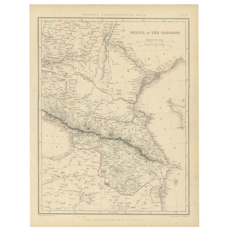
- Antique Map of Russia and the Caucasus by Sharpe, 1849Located in Langweer, NLAntique map titled 'Russia at the Caucasus'. Old map of Russia and the Caucasus, also shows part of the Black Sea and Caspian Sea. This map originates from 'Sharpe's Corresponding Atlas (..)' by J. Sharpe. Artists and Engravers: Published by Chapman and Hall...Category
Antique 19th Century Maps
MaterialsPaper
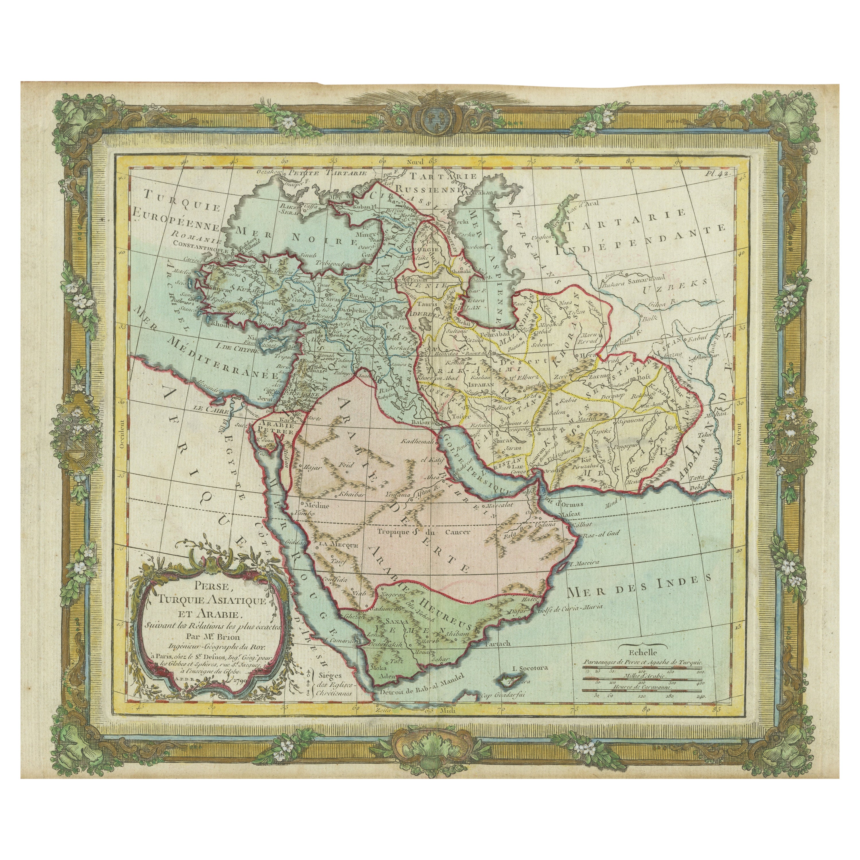
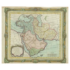
- Antique Map of the Middle East with a Large Arabia, 1799Located in Langweer, NLAntique map titled 'Perse, Turquie Asiatique et Arabie (..)'. Map of the Middle East with a large Arabia, extending from the Black Sea to the In...Category
Antique Late 18th Century Maps
MaterialsPaper
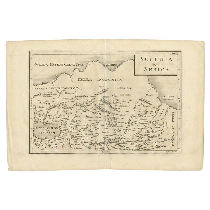
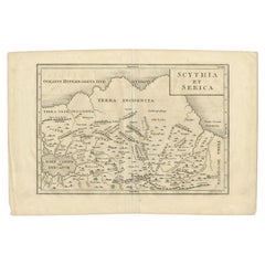
- Antique Map of the Region Between the Caspian and the Sea of China by Toms, 1799Located in Langweer, NLAntique map titled 'Scythia et Serica'. Old map of the region between the Caspian and the Sea of China. Originates from 'Geographia Antiqua (..)'. Artists and Engravers: Engraved ...Category
Antique 18th Century Maps
MaterialsPaper
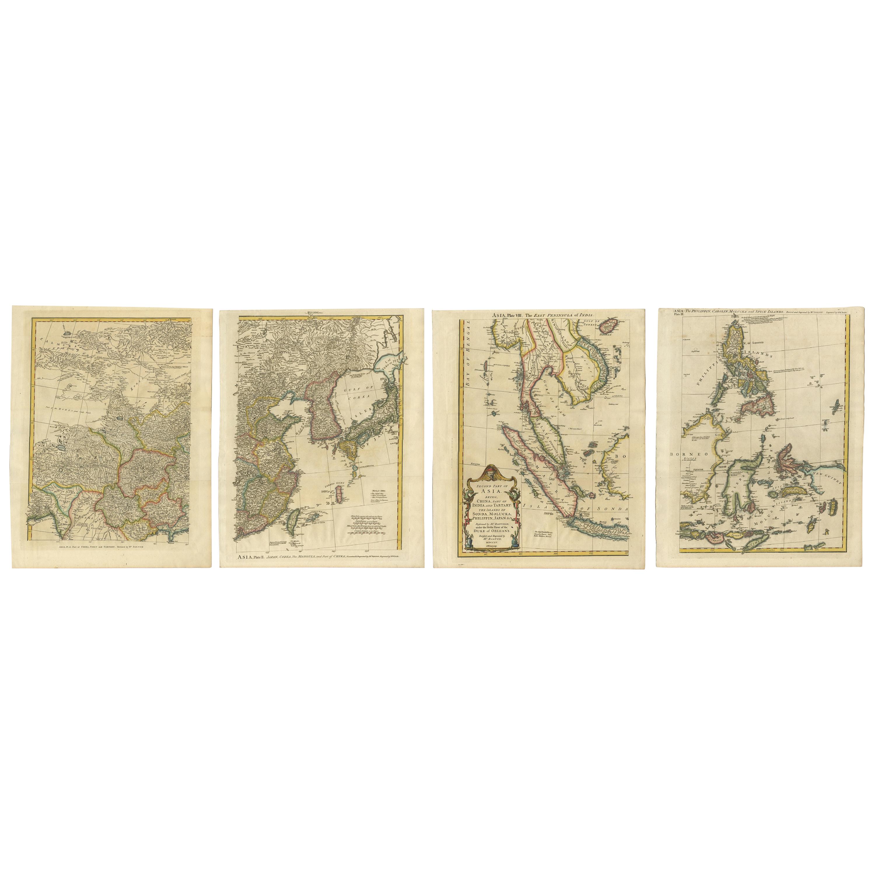
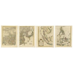
- Set of Four Original Antique Maps of Asia by Bolton & Seale, circa 1770Located in Langweer, NLSet of four antique maps of Asia: 1) Asia plate 6, Part of China, Tibet and Tartary 2) Asia plate 2, Japan, Corea, the Monguls and part of China 3) As...Category
Antique Late 18th Century Maps
MaterialsPaper
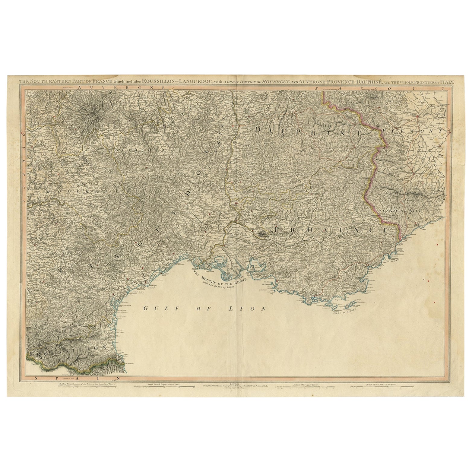
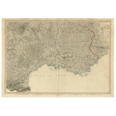
- Striking Large Format Antique Map of Southeastern France, 1799Located in Langweer, NLAntique map titled 'The South Eastern Part of France which includes Roussillon-Languedoc, with a Great Portion of Rouergue and Auvergne-Provence-Dauphine, and the Whole Frontier of Italy'. Striking large format map...Category
Antique 1790s Maps
MaterialsPaper
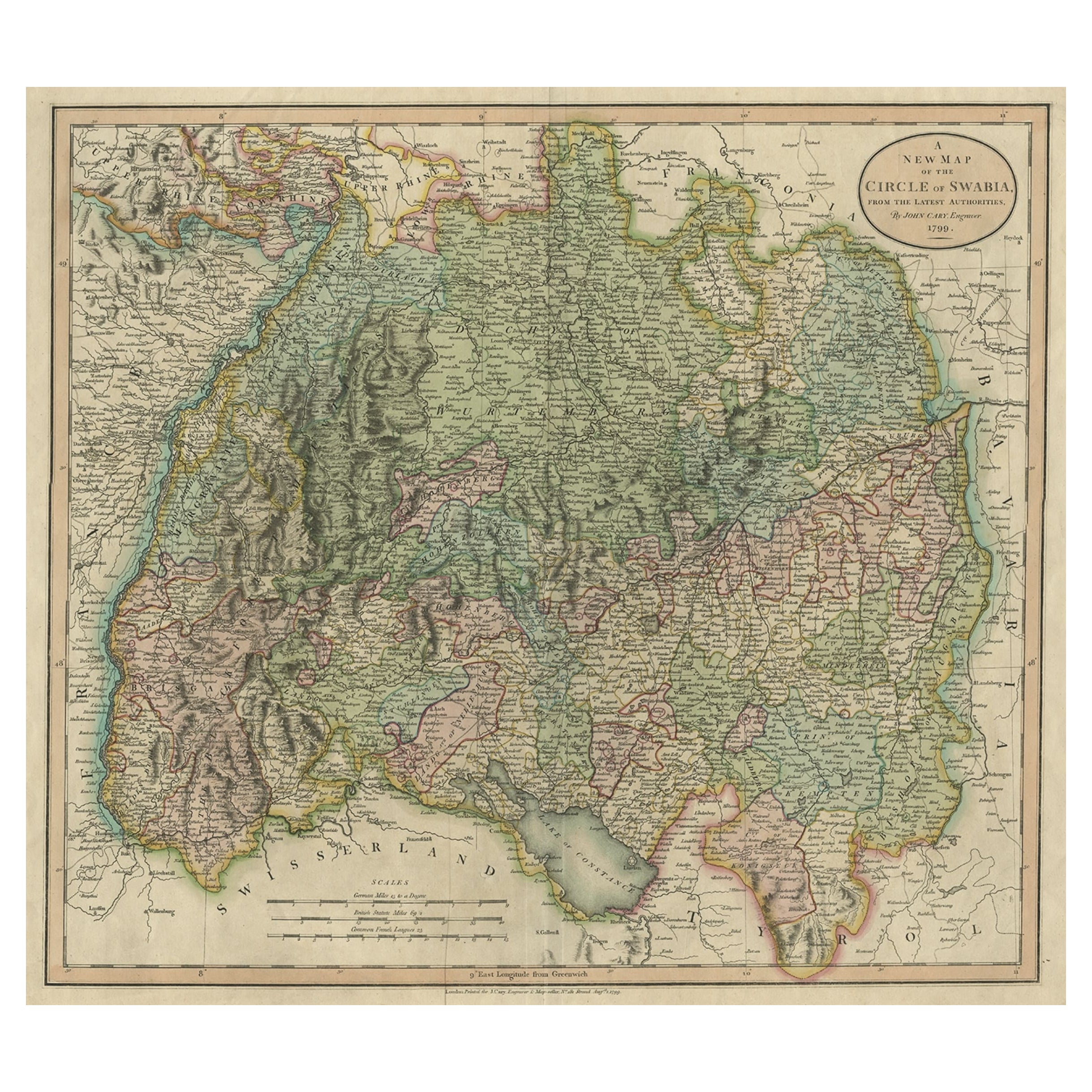
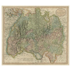
- Attractive Original Hand-Colored Map of the Swabia Region of Germany, 1799Located in Langweer, NLAntique map titled 'A New Map of the Circle of Swabia, from the Latest Authorities'. Attractive example of John Cary's 1799 map of the Swabia region of Germany. Covers from the U...Category
Antique 1790s Maps
MaterialsPaper

You May Also Like
- 1861 Topographical Map of the District of Columbia, by Boschke, Antique MapLocated in Colorado Springs, COPresented is an original map of Albert Boschke's extremely sought-after "Topographical Map of the District of Columbia Surveyed in the Years 1856 ...Category
Antique 1860s American Historical Memorabilia
MaterialsPaper
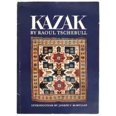
- Kazak Carpets of the Caucasus by Raoul TschebullLocated in valatie, NYKazak: Carpets of the Caucasus by Raoul Tschebull. Near Eastern Art Research Center, 1971. 1st Ed paperback. Illustrated with 23 color plates and 17 b/w. With an introduction by Jose...Category
Vintage 1970s American Books
MaterialsPaper
- Original Antique Map of The World by Thomas Clerk, 1817Located in St Annes, LancashireGreat map of The Eastern and Western Hemispheres On 2 sheets Copper-plate engraving Drawn and engraved by Thomas Clerk, Edinburgh. Published by Mackenzie And Dent, 1817 ...Category
Antique 1810s English Maps
MaterialsPaper
- 1907 Map of Colorado, Antique Topographical Map, by Louis NellLocated in Colorado Springs, COThis highly detailed pocket map is a topographical map of the state of Colorado by Louis Nell from 1907. The map "has been complied from all availabl...Category
Antique Early 1900s American Maps
MaterialsPaper
- Original Antique Map of The Netherlands, Engraved by Barlow, Dated 1807Located in St Annes, LancashireGreat map of Netherlands Copper-plate engraving by Barlow Published by Brightly & Kinnersly, Bungay, Suffolk. Dated 1807 Unframed.Category
Antique Early 1800s English Maps
MaterialsPaper
- Original Antique Map of the American State of Washington, 1889Located in St Annes, LancashireGreat map of Washington Drawn and Engraved by W. & A.K. Johnston Published By A & C Black, Edinburgh. Original colour Unframed.Category
Antique 1880s Scottish Victorian Maps
MaterialsPaper


Recently Viewed
View AllMore Ways To Browse
Antique Apprentice Furniture
Antique Apprentice
Victorian Sea Prints
Richard Parker
Caucasus Map
Antique 16th Century Plates
Antique Caribbean Furniture
17th Century Plate Set
Antique Rose Compass
Antique Map Paint
Israeli Antique
North America Antique Map
Antique Maps Of North America
Tree Bag
Survey Map
Ohio Antique
16th Century Scotland
New England Maps