Items Similar to Antique Map of Eastern Tartary and the Gobi Desert by Van Schley, 1758
Want more images or videos?
Request additional images or videos from the seller
1 of 5
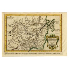
Antique Map of Eastern Tartary and the Gobi Desert by Van Schley, 1758
About the Item
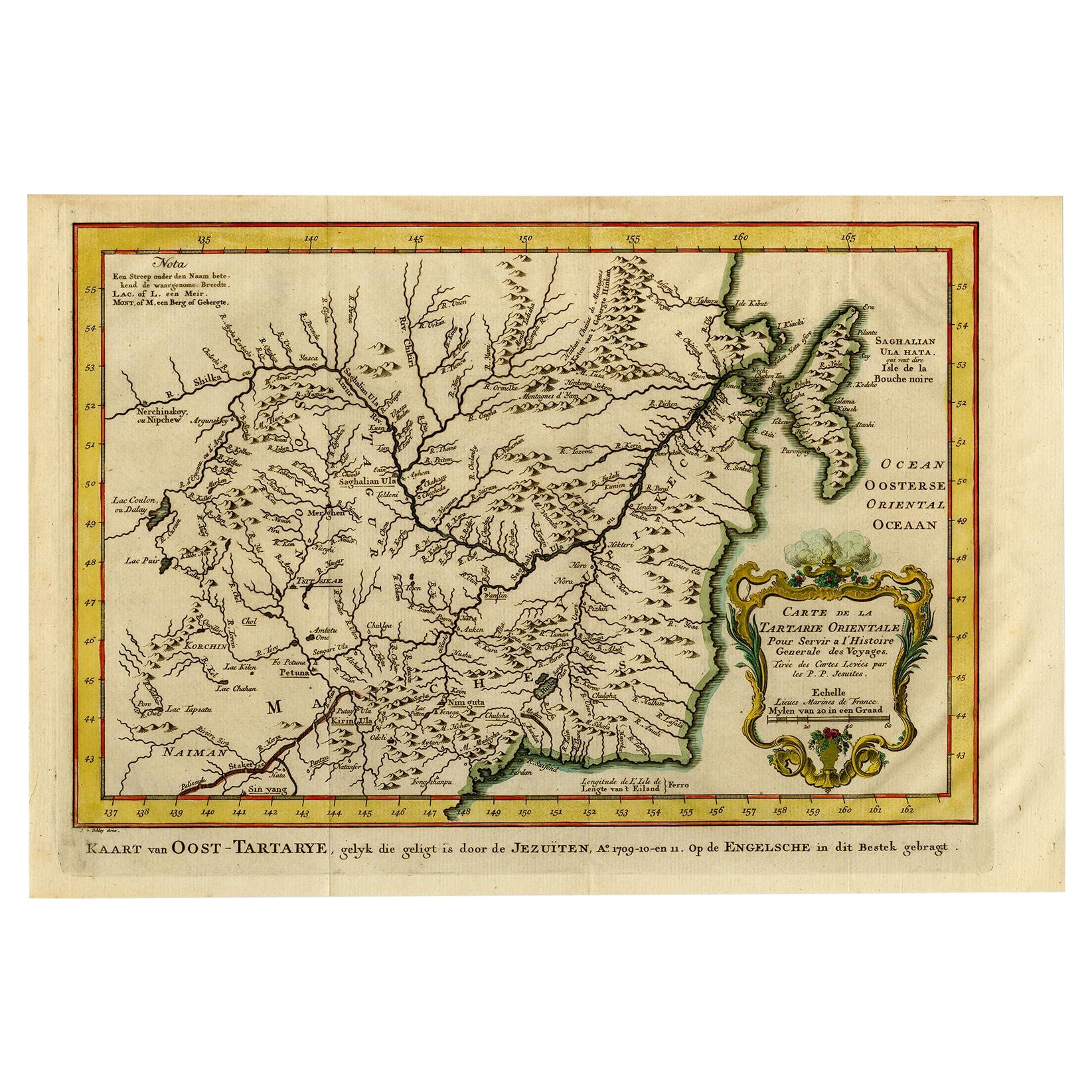
Antique map titled 'Carte de la Tartarie occidentale.' Original antique map of Eastern Tartary and the Gobi desert showing the silk road and the Great Wall of China. While these maps by Van Schley after Bellin were initially made for 'Histoire Generale des Voyages' (Paris 1746-1759), this is from the 1758 Dutch edition of that work published by Arkstee & Merkus.
Artists and Engravers: Made by 'Jakob van Schley' after 'Jacques Nicolas Bellin'. Jakob van der Schley (1715-1779) was a Dutch draughtsman and engraver, who studied under Bernard Picart. Jacques-Nicolas Bellin (1703-1772) was a French hydrographer, geographer and member of The Philosophes. His career, spanning over 50 years, caused an enormous outpt in maps, particular of maritime interest.
Condition: Very good, given age. Original folds, as issued. Later hand colouring. General age-related toning and/or occasional minor defects from handling. Please study image carefully.
Date: 1758
Overall size: 35 x 24.5 cm.
Image size: 31.8 x 23.8 cm.
- Creator:Jakob van der Schley (Artist)
- Dimensions:Height: 9.65 in (24.5 cm)Width: 13.78 in (35 cm)Depth: 0 in (0.01 mm)
- Materials and Techniques:
- Period:
- Date of Manufacture:1758
- Condition:
- Seller Location:Langweer, NL
- Reference Number:
About the Seller
5.0
Platinum Seller
These expertly vetted sellers are 1stDibs' most experienced sellers and are rated highest by our customers.
Established in 2009
1stDibs seller since 2017
1,922 sales on 1stDibs
Typical response time: <1 hour
- ShippingRetrieving quote...Ships From: Langweer, Netherlands
- Return PolicyA return for this item may be initiated within 14 days of delivery.
More From This SellerView All
- Antique Map of Eastern Tartary, now the Primorsky Krai Area, Russia, 1758By Jakob van der SchleyLocated in Langweer, NLAntique map titled 'Carte de la Tartarie orientale.' A map of Eastern Tartary. East Tartary is an old names for the Manchu-inhabited territory extending from the River Amur to Sakhal...Category
Antique 18th Century Maps
MaterialsPaper
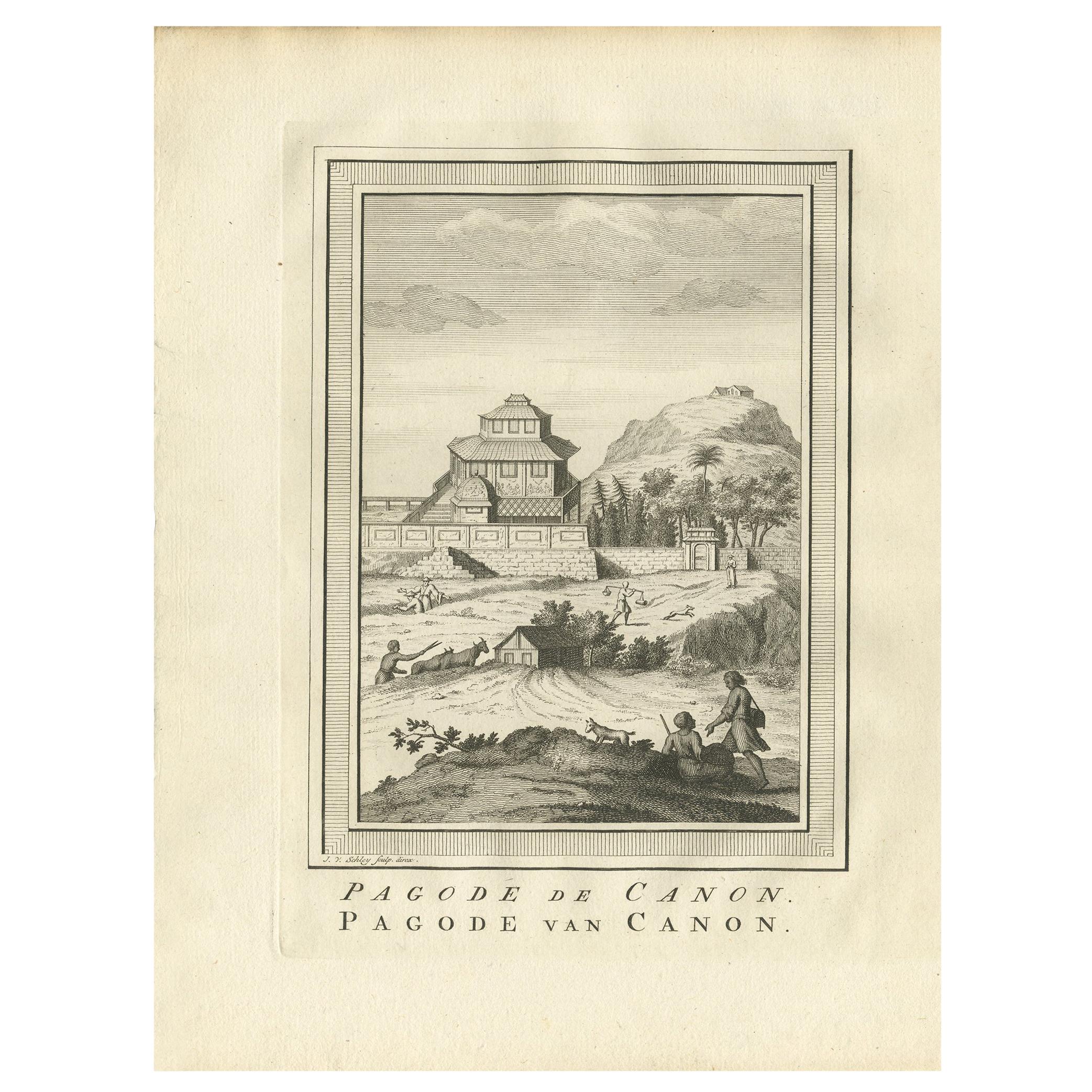
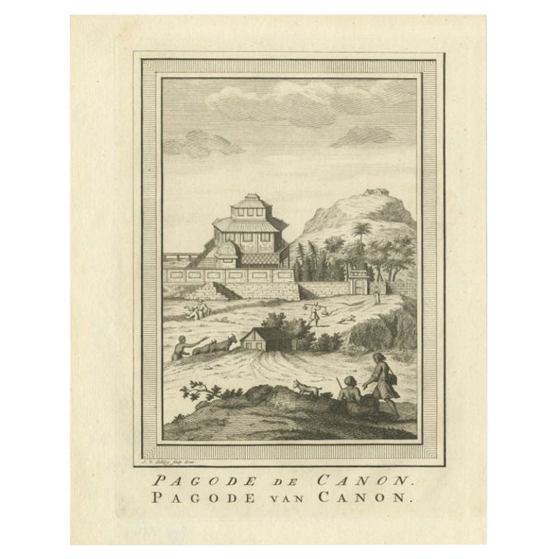
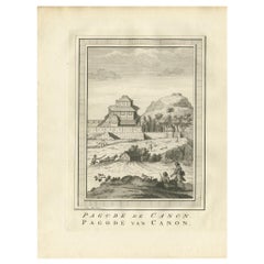
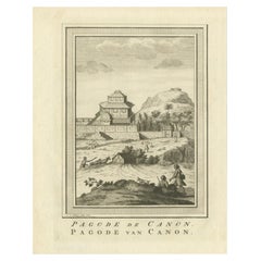
- Antique Print of the Canon Pagoda by Van Schley, '1758'By Jakob van der SchleyLocated in Langweer, NLAntique print titled 'Pagode de Canon - Pagode van Canon'. Old print depicting the pagoda of Canon, Japan. This print originates from 'Histoire générale des Voyages' by A. Prévost.Category
Antique Mid-18th Century Dutch Prints
MaterialsPaper
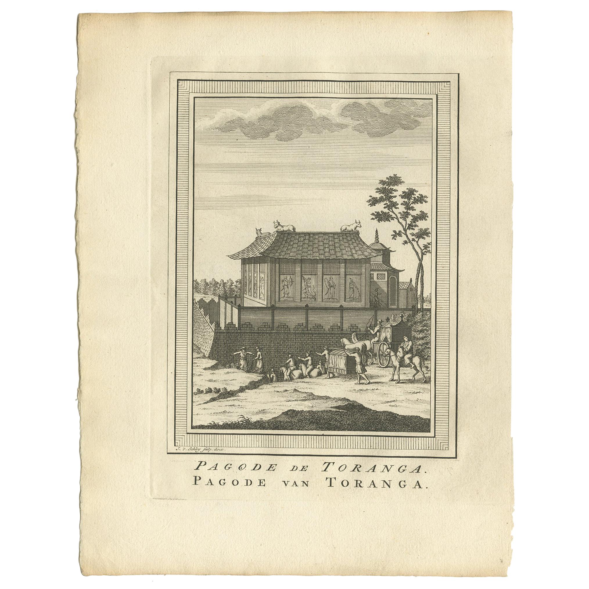
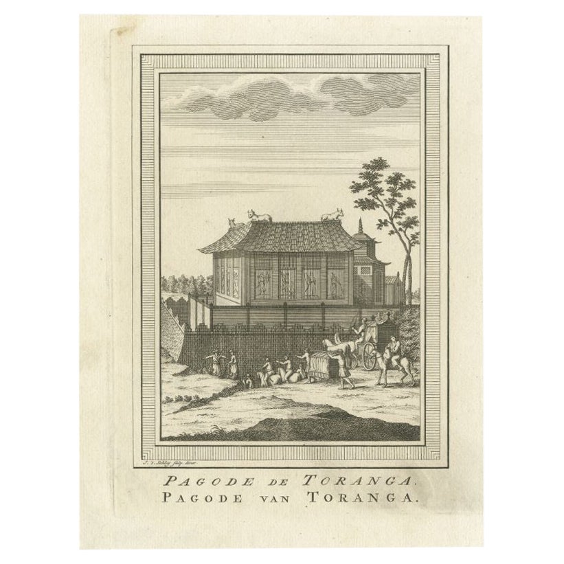
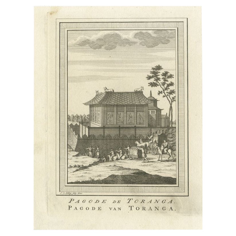
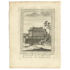
- Antique Print of the Toranga Pagoda by Van Schley, 1758By Jakob van der SchleyLocated in Langweer, NLAntique print titled 'Pagode de Toranga - Pagode van Toranga'. Old print depicting the pagoda of Toranga, Japan. This print originates from 'Histoire générale des Voyages' by A. Prév...Category
Antique Mid-18th Century Dutch Prints
MaterialsPaper
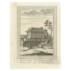
- Antique Print of the Pagoda of Toranga by Van Schley, 1758By Jakob van der SchleyLocated in Langweer, NLAntique print titled ‘Pagoda de Toranga - Pagode van Toranga‘. This print depicts the pagoda of Toranga, Japan. Originates from a Dutch edition of 'Histoire générale des voyages' by ...Category
Antique 18th Century Prints
MaterialsPaper
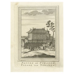
- Antique Print of the Pagoda of Toranga by Van Schley, 1758By Jakob van der SchleyLocated in Langweer, NLAntique print titled ‘Pagoda de Toranga - Pagode van Toranga‘. This print depicts the pagoda of Toranga, Japan. Originates from a Dutch edition of 'Histoire générale des voyages' by ...Category
Antique 18th Century Prints
MaterialsPaper
- Antique Print of the Pagoda of Kannon by Van Schley, 1758By Jakob van der SchleyLocated in Langweer, NLAntique print titled 'Pagode de Canon - Pagode van Canon'. This print depicts the pagoda of Kannon, Japan. Originates from a Dutch edition of 'Histoire générale des voyages' by Antoi...Category
Antique 18th Century Prints
MaterialsPaper
You May Also Like
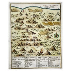
- Map of Indonesia, Semarang, Kartasoera, Soerabaya by SchleyBy Jakob van der SchleyLocated in Norwich, GB'Carte du Chemin entre Samarang et Cartasoera, kaart van den weg tusschen Samarang en Cartasoera' Map of the Road between Semarang and Kartasura by Van Schley. Published 1763. ...Category
Antique 1760s Indonesian Georgian Prints
MaterialsPaper
- Original Antique Map of The World by Thomas Clerk, 1817Located in St Annes, LancashireGreat map of The Eastern and Western Hemispheres On 2 sheets Copper-plate engraving Drawn and engraved by Thomas Clerk, Edinburgh. Published by Mackenzie And Dent, 1817 ...Category
Antique 1810s English Maps
MaterialsPaper
- Original Antique Map of The Netherlands, Engraved by Barlow, Dated 1807Located in St Annes, LancashireGreat map of Netherlands Copper-plate engraving by Barlow Published by Brightly & Kinnersly, Bungay, Suffolk. Dated 1807 Unframed.Category
Antique Early 1800s English Maps
MaterialsPaper
- Map of the Republic of GenoaLocated in New York, NYFramed antique hand-coloured map of the Republic of Genoa including the duchies of Mantua, Modena, and Parma. Europe, late 18th century. Dimension: 25...Category
Antique Late 18th Century European Maps
- Antique Map of Italy by Andriveau-Goujon, 1843By Andriveau-GoujonLocated in New York, NYAntique Map of Italy by Andriveau-Goujon, 1843. Map of Italy in two parts by Andriveau-Goujon for the Library of Prince Carini at Palazzo Carini i...Category
Antique 1840s French Maps
MaterialsLinen, Paper
- Antique Map of Principality of MonacoBy Antonio Vallardi EditoreLocated in Alessandria, PiemonteST/619 - "Old Geographical Atlas of Italy - Topographic map of ex-Principality of Monaco" - ediz Vallardi - Milano - A somewhat special edition ---Category
Antique Late 19th Century Italian Other Prints
MaterialsPaper