Map Monde Antique
3
to
19
148
16
111
93
52
32
15
14
12
10
10
8
6
5
5
4
3
2
2
2
2
2
2
2
2
1
1
1
1
1
1
1
1
28
2
1
1
1
Sort By
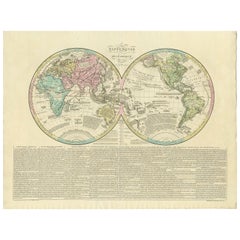
Antique World Map by Lesage, 1823
Located in Langweer, NL
Antique world map titled 'Mappe Monde Historique'. The map depicts both the Eastern and Western
Category
Early 19th Century Map Monde Antique
Materials
Paper
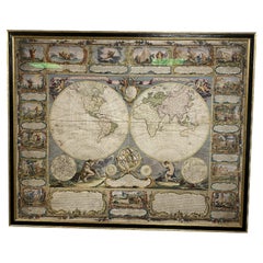
Colored wall map of the WORLD
By Chambon
Located in ZWIJNDRECHT, NL
“Mappe Monde, contenant les Parties Connues du Globe Terrestre”
CHAMBON, Gobert-Denis (France, 17
Category
Mid-18th Century French French Provincial Map Monde Antique
Materials
Wood, Paper
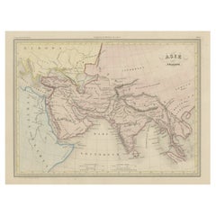
Original Antique Map of Ancient Asia, 1847
Located in Langweer, NL
Description: Antique map Asia titled 'Asie Ancienne'.
This is an original antique map of
Category
1840s Map Monde Antique
Materials
Paper
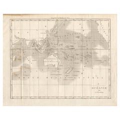
Antique Map of Oceania by Didot, 1836
Located in Langweer, NL
Antique map titled 'Oceanie par G.L.Dy. De Rienzi'. Map of the Oceania region, around Australia
Category
19th Century Map Monde Antique
Materials
Paper
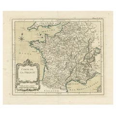
Antique Map of France with Decorative Title Cartouche
Located in Langweer, NL
Antique map titled 'Carte de la France'. Original old map of France. This map originates from 'Le
Category
Mid-18th Century Map Monde Antique
Materials
Paper
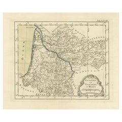
Antique Map of Guyenne, Gascony and Béarn, France
Located in Langweer, NL
Antique map titled 'Guyenne et Gascogne et Bearn'. Original old map of Guyenne (or Guienne
Category
Mid-18th Century Map Monde Antique
Materials
Paper
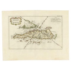
Antique Map of Sumatra by Bellin, 1764
Located in Langweer, NL
Antique map Sumatra titled 'Carte de l'Isle de Sumatra'. Old map of Sumatra, Malaysia and the
Category
18th Century Map Monde Antique
Materials
Paper
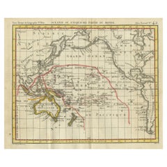
Antique Map of Oceania by Hérisson, 1816
Located in Langweer, NL
Antique map titled "Océanie ou cinquième partie du monde". This is an original antique map of
Category
19th Century Map Monde Antique
Materials
Paper
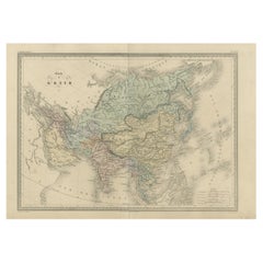
Antique Map of Asia by Malte-Brun, 1880
Located in Langweer, NL
Map Pl. 63 - 64: 'Carte de l'Asie.' This map shows Asia. This original antique map originates from
Category
19th Century Map Monde Antique
Materials
Paper
Antique Map of the World by D'Urville '1853'
Located in Langweer, NL
Antique map titled 'Voyage Autour du Monde'. Original map of the world. This map originates from
Category
Mid-19th Century Map Monde Antique
Materials
Paper
Antique Map of Novaya Zemlya by Bellin, 1758
Located in Langweer, NL
Antique map titled 'Partie de la Mer Glaciale Contenant la Nouvelle Zemle et le Pais des Samoiedes
Category
18th Century Map Monde Antique
Materials
Paper
Antique Map of European Russia with Picture Frame Border
Located in Langweer, NL
Antique map titled 'La Moscovie Septentrionale (..)'. Decorative example of van der Aa's map of the
Category
Early 18th Century Map Monde Antique
Materials
Paper
Antique Map of Boulogne-sur-Mer by Bellin '1764'
Located in Langweer, NL
Antique map titled 'Plan de la Ville de Boulogne'. Original antique map of Boulogne-sur-Mer, France
Category
Mid-18th Century Map Monde Antique
Materials
Paper
Antique Map of the Cocos or Keeling Islands, 1778
Located in Langweer, NL
Antique map titled 'Die Cocos Insel vom Capt. Wallis Bosawren. Die Verrather Islel von Capt. Wallis
Category
18th Century Map Monde Antique
Materials
Paper
Antique Detailed World Map Drawn on Mercator's Projection, 1700
Located in Langweer, NL
Antique world map titled 'Carte generale du monde, ou description du monde terrestre & Aquatique
Category
17th Century Map Monde Antique
Materials
Paper
Rare Small Antique Map of the Persian Empire, 1692
Located in Langweer, NL
cartouche and armorial shield. This map originates from 'L'Atlas en Abrege, ou Nouvelle Description du Monde
Category
17th Century Map Monde Antique
Materials
Paper
Antique Map of the Pacific Ocean by Rienzi, 1836
Located in Langweer, NL
Antique map titled 'Mélanésie'. Map of the Pacific ocean around Australia, including Java, Timor
Category
19th Century Map Monde Antique
Materials
Paper
Antique Map of Japan by A.M. Mallet, 1683
Located in Langweer, NL
A charming late 17th century French map with a very decorative title cartouche showing trumpet
Category
Late 17th Century Map Monde Antique
Materials
Paper
Original Antique Map of Oceania, the 5th Continent, 1816
Located in Langweer, NL
Antique map titled ‘Océanie ou cinquième partie du monde‘.
This is an original antique map of
Category
1810s Map Monde Antique
Materials
Paper
Rare Antique Map of the Moghul Empire, ca.1725
Located in Langweer, NL
Antique map titled 'Oost-Indize Voyagie door William Hawkins van Suratte gedaan na 't Hof van den
Category
1720s Map Monde Antique
Materials
Paper
Antique Map of the Holy Land with Picture Frame Border
Located in Langweer, NL
Antique map titled 'Terre Sainte Suivant les Nouvelles Observations (..)'. Original old map of the
Category
Early 18th Century Map Monde Antique
Materials
Paper
Antique World Map before the Voyages of Christopher Columbus, 1880
Located in Langweer, NL
Antique world map titled 'Monde Connu des Anciens'. Antique map of the World and continents before
Category
19th Century Map Monde Antique
Materials
Paper
Antique Map of India and Southeast Asia by Sanson '1654'
Located in Langweer, NL
Antique map titled 'Partie Meridionale de l'Inde'. Early map of India and Southeast Asia. The map
Category
Mid-17th Century Map Monde Antique
Materials
Paper
Antique Map of the Coast of France Between Brest and Bayonne
Located in Langweer, NL
Antique map titled 'Carte des Costes de France depuis Brest jusquá Bayone'. Original old map of the
Category
Mid-18th Century Map Monde Antique
Materials
Paper
Antique Map of the Gulf of Cambay, Gujarat, India, 1725
By Pieter Van Der Aa
Located in Langweer, NL
Antique map titled 'Le Golfe de Cambaye at la Rade de Suratt.' (The gulf of Cambay and the coast of
Category
18th Century Map Monde Antique
Materials
Paper
Original Antique Hand-colored World Map with or without Frame, '1696'
Located in Langweer, NL
Antique world map titled 'Mappe-Monde dressee sur les Observations de Mrs. de l'Academie Royale des
Category
Late 17th Century Map Monde Antique
Materials
Paper
H 28.75 in W 33.67 in D 1.58 in
Antique Map of Asia Minor Showing Turkey in Ancient Times, 1880
Located in Langweer, NL
Map Pl. 9: 'Asie Mineure.' This map shows Asia Minor / Turkey in ancient times. This original
Category
19th Century Map Monde Antique
Materials
Paper
Antique Map of of Bengal and the mouth of the Ganges River
Located in Langweer, NL
Antique map titled 'Carte du Bengale, avec la partie Septentrionale (..)'. Original antique map of
Category
Late 18th Century Map Monde Antique
Materials
Paper
Antique Map of the Maluku Islands by Van der Aa, 1725
By Pieter Van Der Aa
Located in Langweer, NL
Antique map titled 'Les Iles Moluques (..).' (The Moluccan Islands, Maluku, Moluccas, Spice Islands
Category
18th Century Map Monde Antique
Materials
Paper
Antique Map of Banten Bay on Java Island, Indonesia, c.1720
Located in Langweer, NL
Antique map titled 'La Rade de Bantam'. A small early 18th century black and white map of Banten
Category
18th Century Map Monde Antique
Materials
Paper
Antique Map of the Region of Boulogne-sur-Mer by Bellin '1764'
Located in Langweer, NL
Antique map titled 'Plan de Boulogne et des Environs'. Original antique map of the region of
Category
Mid-18th Century Map Monde Antique
Materials
Paper
Antique Map of the Rhineland and Alsace Region with Original Hand Coloring
Located in Langweer, NL
Antique map titled 'Palitinat du Rhein, Alsace, et partie de Souabe de Franconie (..)'. Double-page
Category
Mid-17th Century Map Monde Antique
Materials
Paper
H 16.93 in W 22.45 in D 0.02 in
Antique Map of the Island of Java by Van Der Aa, 1725
By Pieter Van Der Aa
Located in Langweer, NL
Antique map titled 'Map: 'L'Ile de Java'. (The island of Java.) This map shows the Indonesian
Category
18th Century Map Monde Antique
Materials
Paper
Antique Map of the Roadstead of Batavia by Van der Aa, 1725
By Pieter Van Der Aa
Located in Langweer, NL
Antique map titled 'La rade de Batavia'. (The roadstead of Batavia.) This map shows the roadstead
Category
18th Century Map Monde Antique
Materials
Paper
Antique Map of the Roadstead of Bantam by Van der Aa, 1725
By Pieter Van Der Aa
Located in Langweer, NL
Antique map titled 'La rade de Bantam'. (The roadstead of Bantam.) This map shows the Indonesian
Category
18th Century Map Monde Antique
Materials
Paper
Antique Map of the Mughal Empire by Van der Aa, C.1725
By Pieter Van Der Aa
Located in Langweer, NL
Antique map titled 'Royaume de Grand Mogol (..).' This map shows the extend of the Mughal Empire
Category
18th Century Map Monde Antique
Materials
Paper
Extremely Scarce Antique Map of The Island of Borneo, Indonesia, c. 1725
Located in Langweer, NL
Antique map titled 'L'Ile de Borneo Suivant les memoires des plus Celebres Navigateurs.'
A
Category
18th Century Map Monde Antique
Materials
Paper
H 10.44 in W 16.15 in D 0 in
Antique Miniature Map of the Old World and France by Mallet, circa 1683
Located in Langweer, NL
Antique map titled 'Planisphere du Monde - France'. Two miniature maps on one sheet. The upper map
Category
Late 17th Century Map Monde Antique
Materials
Paper
H 11.03 in W 8.86 in D 0.6 in
Old Map of the British Isles with the Faroes and Shetlands, Showing Cock Fights
Located in Langweer, NL
Antique map titled 'Les Isles Britaniques ou sont les Royaumes d'Angleterre (..)'. Original old map
Category
Early 18th Century Map Monde Antique
Materials
Paper
H 10.36 in W 14.57 in D 0.02 in
Extremely Rare Map of the East-Indies towards the South-East 'Indonesia', 1725
Located in Langweer, NL
Antique map titled 'La partie des Indes Orientales vers le Zud-Est, depuis Timor jusqu'a Midanao
Category
1720s Map Monde Antique
Materials
Paper
H 14.97 in W 19.3 in D 0 in
Rare Engraved Antique Map of India with Elephants in the Cartouche, c.1725
Located in Langweer, NL
elephants. This map originates from 'La galerie agreable du monde. Tome premier des Indes Orientales
Category
18th Century Map Monde Antique
Materials
Paper
H 19.1 in W 14.57 in D 0 in
Antique Map of the Region of Osaka and Hirado Island in Japan, 1725
By Pieter Van Der Aa
Located in Langweer, NL
, Nagasaki. This map originates from the very scarse: 'La Galerie Agreable du Monde (..). Tome premier des
Category
18th Century Map Monde Antique
Materials
Paper
Extremely Rare Map of The land of Eso or Hokkaido in Japan, 1725
Located in Langweer, NL
.
This plate originates from the very scarse: 'La Galerie Agreable du Monde (..). Tome premier des Indes
Category
18th Century Map Monde Antique
Materials
Paper
Antique Map of the Bay of Batavia by Van der Aa, c.1720
Located in Langweer, NL
Antique map titled 'La Rade de Batavia'. A small early 18th century black and white map of the Bay
Category
18th Century Map Monde Antique
Materials
Paper
Antique Map of the Islands of Banda, Indonesia from a Very Rare Edition, 1725
Located in Langweer, NL
Antique map titled 'Les Iles de Banda (..).' (The islands of Banda, Indonesia.)
Extremely rare
Category
1720s Map Monde Antique
Materials
Paper
H 14.97 in W 19.3 in D 0 in
Interesting Map of the Thousand Islands in the Bay of Batavia 'Jakarta', ca.1740
Located in Langweer, NL
de cartes et plans des quatre parties du Monde. Paris: Bellin, 1764, but again they are smaller. Map
Category
1740s Map Monde Antique
Materials
Paper
H 11.42 in W 8.27 in D 0 in
Very Decorative Original Antique Map of the World, Published in France in c.1780
By Rigobert Bonne
Located in Langweer, NL
Antique map titled 'L'Ancien Monde Et Le Nouveau en Deux Hemispheres' - Double hemisphere map of
Category
18th Century Map Monde Antique
Materials
Paper
H 10.24 in W 17.6 in D 0 in
Rare Antique Map with Timor and Nearby Islands Plus an Inset of Hawaii, 1825
Located in Langweer, NL
Antique map titled 'Essai sur la Geographie de l'Ile Timor.'
A map showing Timor and the
Category
1820s Map Monde Antique
Materials
Paper
H 13.39 in W 19.69 in D 0 in
Map Holy Land La Terre Sainte Engraved van Loon Published N de Fer 1703 French
Located in BUNGAY, SUFFOLK
Majeste Catoliq et de Monseigneur le Dauphin. Avec Privil du Roi 1703
Detailed map of the Holy Land
Category
Early 1700s French Louis XIV Map Monde Antique
Materials
Paper
H 11.03 in W 13.78 in D 0.4 in
Old Map of the island of Saint Christopher or St. Kitts in the Caribbean, c.1765
Located in Langweer, NL
Antique map titled 'Carte de l'Isle de Saint-Christophe'.
A detailed map of the island of Saint
Category
18th Century Map Monde Antique
Materials
Paper
H 10.24 in W 15.67 in D 0 in
Antique Chart of the Voyage of Captain Cook by Benard, 1780
Located in Langweer, NL
Antique map titled 'Carte des Découvertes faites dans la Mer Pacifique sur la Vaisse au de Roi, La
Category
18th Century Map Monde Antique
Materials
Paper
Old Engraving of the Track of the Resolution Captain Cook in the Pacific, 1780
Located in Langweer, NL
Antique map titled 'Carte des Découvertes faites dans la Mer Pacifique sur la Vaisse au de Roi, La
Category
18th Century Map Monde Antique
Materials
Paper
H 11.82 in W 15.36 in D 0 in
Antique Plan of Batavia, Capital of the Dutch East Indies, by Van Der Aa, 1725
By Pieter Van Der Aa
Located in Langweer, NL
Antique map titled 'Plan de Batavia'. (Plan of Batavia.) This plate shows a plan of the city of
Category
18th Century Map Monde Antique
Materials
Paper
H 14.97 in W 19.3 in D 0 in
View of the City Banten or Bantam Near the Western End of Java, Indonesia, c1725
Located in Langweer, NL
nautical vessels in the harbour. This print originates from the very scarse: La Galerie Agréable du Monde
Category
1720s Map Monde Antique
Materials
Paper
H 12.01 in W 16.15 in D 0 in
Bird's Eye View of Dabhol as Seen from the Sea, North of Goa, India, 1727
Located in Langweer, NL
on the coast.This plate originates from the very scarse: 'La Galerie Agreable du Monde (...). Tome
Category
1720s Map Monde Antique
Materials
Paper
Free Shipping
H 11.82 in W 16.15 in D 0 in
Rare Chine-collé Aquatint of Banyuwangi, East Java, Indonesia, 1835
Located in Langweer, NL
from the series 'Voyage autour du monde par les mers de l'Inde et de la Chine de la corvette de sa
Category
1830s Map Monde Antique
Materials
Paper
Print of Commander Laplace Received by a Cochinchinese Mandarin, c.1830
Located in Langweer, NL
and Malaysia, into the China Sea. Originates from the series 'Voyage autour du monde par les mers de
Category
1830s Map Monde Antique
Materials
Paper
Ubersichtskarte Des Mondes (Overview Map of the Moon), antique astronomy print
Located in Melbourne, Victoria
'Ubersichtskarte Des Mondes'
(Overview Map of the Moon)
German chromolithograph, circa 1895
Category
Late 19th Century Naturalistic Map Monde Antique
Materials
Lithograph
Planiglobii Terrestris Mappa Universalis / Mappe Monde
By Homann Heirs
Located in New York, NY
This map was printed from a copperplate engraving in 1746. The printed image size is 18.25 x 21.75
Category
18th Century Other Art Style Map Monde Antique
Materials
Engraving
H 20.13 in W 23.88 in D 0.94 in
Nouvelle Mappe Monde, dediee au progres de nos connoissances.
Located in New York, NY
A handsome and well-engraved world map constructed with the prime meridian through Paris. The
Category
18th Century Other Art Style Map Monde Antique
Materials
Watercolor, Engraving
H 20.75 in W 28.25 in D 0.94 in
- 1
Get Updated with New Arrivals
Save "Map Monde Antique", and we’ll notify you when there are new listings in this category.
Map Monde Antique For Sale on 1stDibs
Find many varieties of an authentic map monde antique available at 1stDibs. Frequently made of paper, copper and metal, every map monde antique was constructed with great care. There are many kinds of the map monde antique you’re looking for, from those produced as long ago as the 18th Century to those made as recently as the 20th Century. You’ll likely find more than one map monde antique that is appealing in its simplicity, but Pieter Van Der Aa, Jacques-Nicolas Bellin and J.B. Elwe produced versions that are worth a look.
How Much is a Map Monde Antique?
A map monde antique can differ in price owing to various characteristics — the average selling price 1stDibs is $476, while the lowest priced sells for $82 and the highest can go for as much as $42,146.
More Ways To Browse
P Renard
Carte Du Monde
Cambodia Antique Map
Pagoda House
Haiti Antique
Antique Map Vietnam
Pakistan Antique Map
J Mclaughlin
Giant Antique Map
Giant Antique Maps
Antique Chinese Watercolor Landscape
Persian Copper Plates
Laos Antique Map
Papua New Guinea Antique Map
De Clerck
Antique Doors Pakistan
Phillip Buller
Bien Map
