Items Similar to Antique Map of of Bengal and the mouth of the Ganges River


Want more images or videos?
Request additional images or videos from the seller
1 of 6
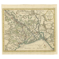
Antique Map of of Bengal and the mouth of the Ganges River
About the Item
Antique map titled 'Carte du Bengale, avec la partie Septentrionale (..)'. Original antique map of Bengal and the mouth of the Ganges river. This map originates from 'Histoire universelle depuis le commencement du monde jusqu'à présent (..)' published by Moutard, 1783.
- Dimensions:Height: 10.63 in (27 cm)Width: 15.36 in (39 cm)Depth: 0.02 in (0.5 mm)
- Materials and Techniques:
- Period:
- Date of Manufacture:1783
- Condition:General age-related toning. Original folding lines. Some defects in margins. Blank verso. Please study image carefully.
- Seller Location:Langweer, NL
- Reference Number:
About the Seller
5.0
Platinum Seller
These expertly vetted sellers are 1stDibs' most experienced sellers and are rated highest by our customers.
Established in 2009
1stDibs seller since 2017
1,933 sales on 1stDibs
Typical response time: <1 hour
- ShippingRetrieving quote...Ships From: Langweer, Netherlands
- Return PolicyA return for this item may be initiated within 14 days of delivery.
More From This SellerView All
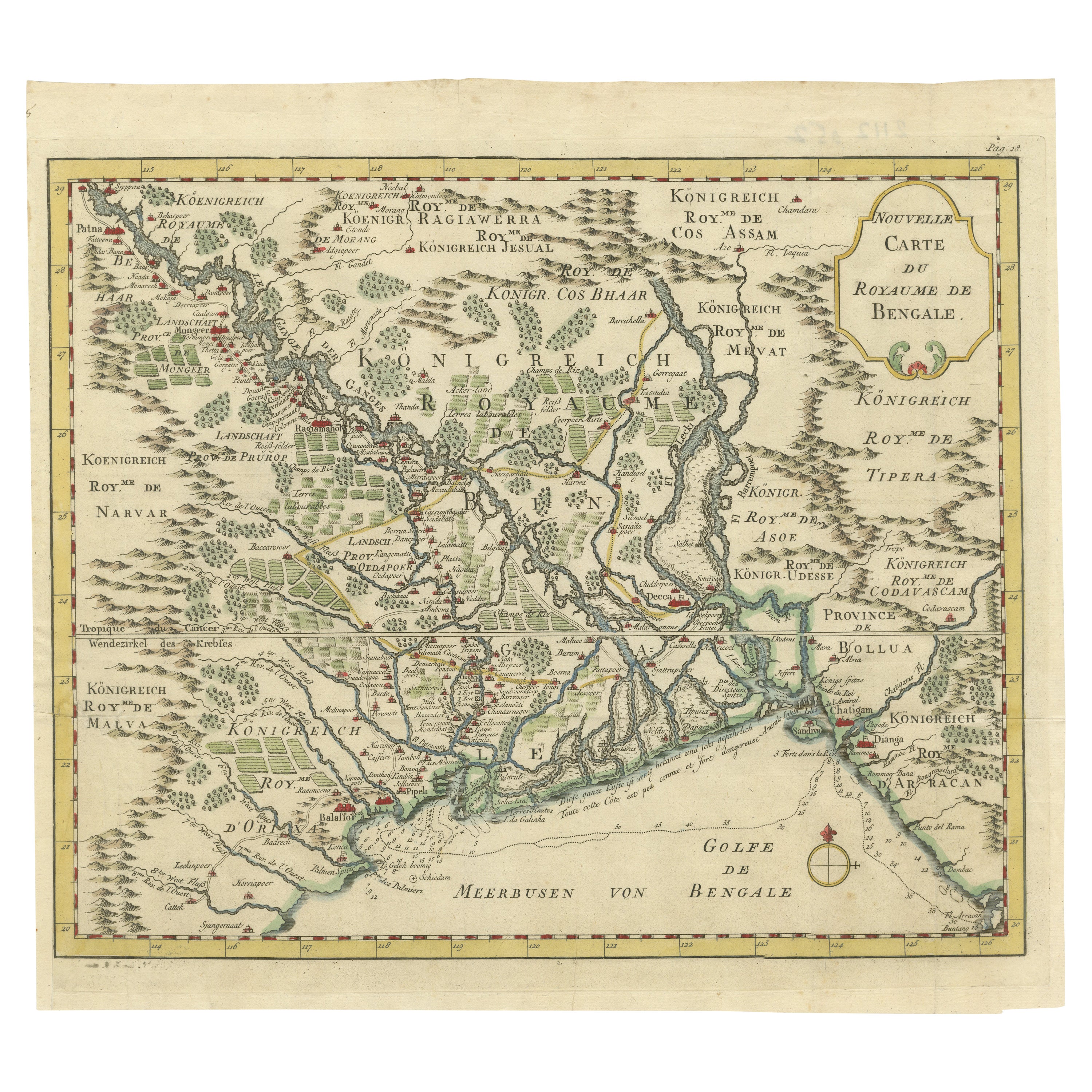
- Detailed Regional Map of the Gulf of Bengal and the Lower Ganges River, ca.1750Located in Langweer, NLTitle of this original and rare antique map: Nouvelle Carte Du Royaume De Bengale Mapmaker: Jacques-Nicolas Bellin (1703-1772). He was among the most important mapmakers of the eighteenth century. In 1721, at only the age of 18, he was appointed Hydrographer to the French Navy. In August 1741, he became the first Ingénieur de la Marine of the Dépôt des cartes...Category
Antique 1750s Maps
MaterialsPaper
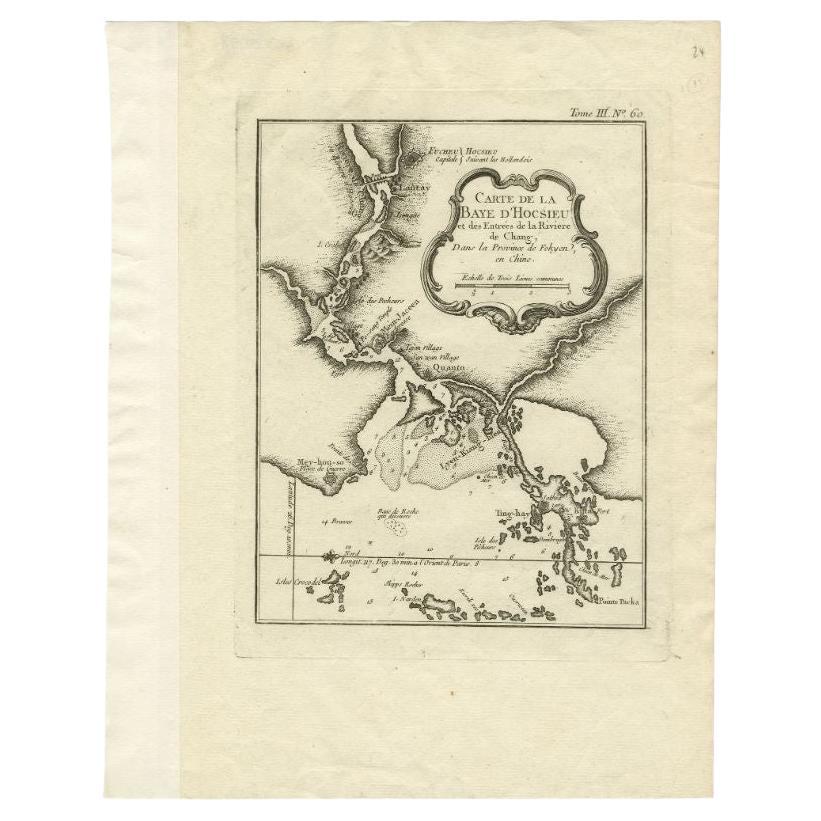
- Antique Map of the Mouth of the Chiang River by Bellin, 1764By Jacques-Nicolas BellinLocated in Langweer, NLAntique map titled ‘Carte de la Baye d'Hocsieu et des Entrees de la Riviere de Chang, Dans la Province de Fokyen en Chine’. This impressive map or sea chart d...Category
Antique 18th Century Maps
MaterialsPaper
- Antique Map of the Mouth of the Amu Darya River by Reclus, 1881Located in Langweer, NLAntique map titled 'Bouches de L'Amou - Daria'. Original antique map showing the river mouth of the Amu Darya river in Central Asia. This original old antiqu...Category
Antique 19th Century Maps
MaterialsPaper
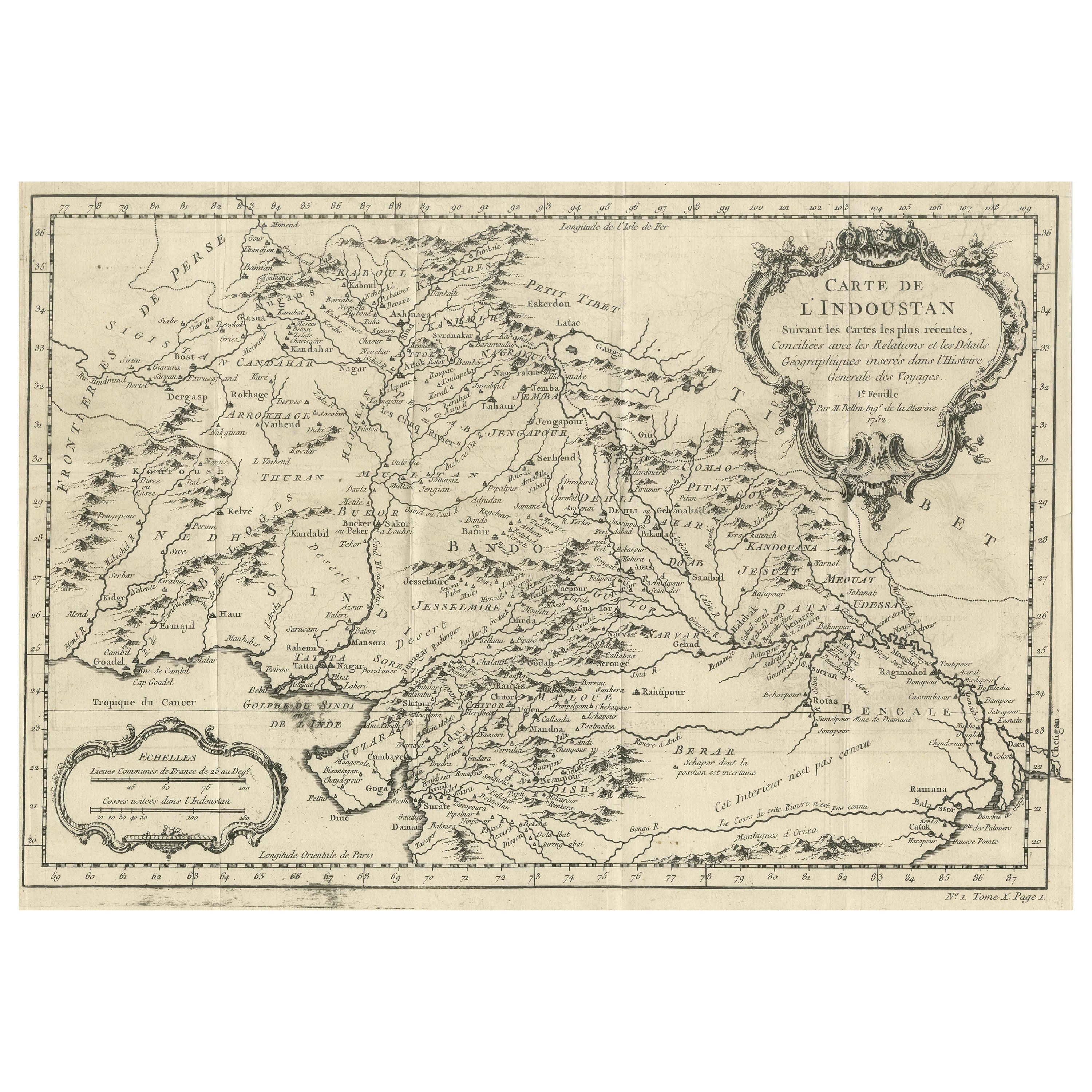
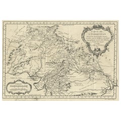
- Antique Map of part of India, the Ganges and HindustanLocated in Langweer, NLAntique map titled 'Carte de l'Indoustan'. Original antique map of part of India, the Ganges and Hindustan. This map originates from 'Histoire Generale Des Voyages' by Antoine Franco...Category
Antique Mid-18th Century Maps
MaterialsPaper
- Antique Map of the Mouth of the Yangtze River 'China' by J.N. Bellin, 1764Located in Langweer, NLThis detailed regional map of China is a historical cartographic work from the mid-18th century and is attributed to Antoine-François Prévost, a prominent French cartographer and geo...Category
Antique Mid-18th Century Maps
MaterialsPaper
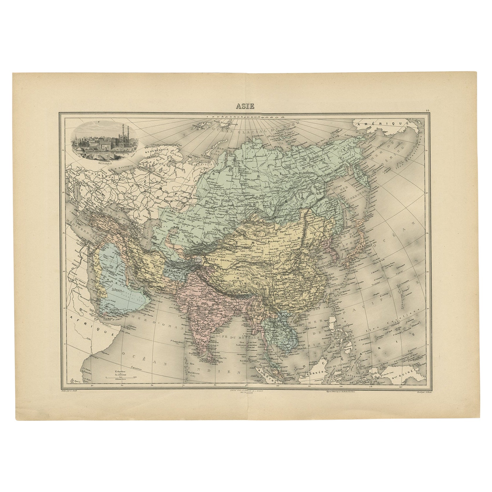
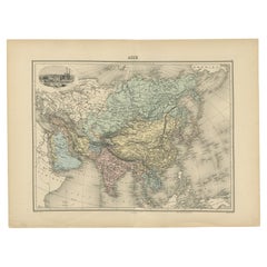
- Antique Map of Asia, Vignette of Benares 'Varanasi' Showing Ganges River, 1892Located in Langweer, NLAntique map titled 'Asie'. Color map of Asia. With decorative vignette of Benares (Varanasi) showing Ganges River. This map originates from 'Nouvel Atlas Illustre Geographie Universe...Category
Antique 19th Century Maps
MaterialsPaper


You May Also Like
- Map "Estuary- Mouth of the Thames"Located in Alessandria, PiemonteST/426 - Antique French Map of the estuary of the Thames, map dated 1769 - "Mape of the entrance of the Thames. Designed by filing of Navy cards fo...Category
Antique Mid-18th Century French Other Prints
MaterialsPaper
- Antique Oarsman's Map of the River Thames, English, Cartography, Published 1912Located in Hele, Devon, GBThis is an antique copy of The Oarsman's and Angler's Map of the River Thames - New Edition. An English, bound map book, published in English by Edward Stanford, London, this new edi...Category
Early 20th Century British Other Books
MaterialsPaper
- 1861 Topographical Map of the District of Columbia, by Boschke, Antique MapLocated in Colorado Springs, COPresented is an original map of Albert Boschke's extremely sought-after "Topographical Map of the District of Columbia Surveyed in the Years 1856 ...Category
Antique 1860s American Historical Memorabilia
MaterialsPaper
- Original Antique Map of the American State of Nevada, 1889Located in St Annes, LancashireGreat map of Nevada Drawn and Engraved by W. & A.K. Johnston Published By A & C Black, Edinburgh. Original colour Unframed.Category
Antique 1880s Scottish Victorian Maps
MaterialsPaper
- Original Antique Map of the American State of Oregon, 1889Located in St Annes, LancashireGreat map of Oregon Drawn and Engraved by W. & A.K. Johnston Published By A & C Black, Edinburgh. Original colour Unframed.Category
Antique 1880s Scottish Victorian Maps
MaterialsPaper
- Original Antique Map of the American State of Pennsylvania, 1889Located in St Annes, LancashireGreat map of Pennsylvania Drawn and Engraved by W. & A.K. Johnston Published By A & C Black, Edinburgh. Original colour Unframed. Repair to a minor tear on bottom edge.Category
Antique 1880s Scottish Victorian Maps
MaterialsPaper


Recently Viewed
View AllMore Ways To Browse
Atlas 42
Large Old Map
Map Collection
Antique Kiel Furniture
Collectible Barbies
Jackson Hole Map
Miles Johnston
Native American Mountie
Toledo Scale Company Antique
Vintage Marthas Vineyard Map
Charente Map
F Colton
Ian Maguire
Ithaca Antique Map
Rand McNally & Co. On Sale
Vintage Butcher Shop Posters
Antique Ornamental Map
Asian Centric World Map