Items Similar to Antique Paterson's Guide to Britain, English, Maps, Georgian, Published 1811
Want more images or videos?
Request additional images or videos from the seller
1 of 13
Antique Paterson's Guide to Britain, English, Maps, Georgian, Published 1811
About the Item
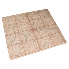
This is an antique copy of Paterson's New and Accurate guide to Direct & Principal Crossroads. An English, bound book of maps and descriptive tables, published in English by Longman, Hurst et al, this Georgian fifteenth edition dated 1811.
The full title is 'A New & Accurate Description of all the Direct and Principal Cross Roads in England & Wales, and part of the roads of Scotland.' Published under the authority of the Postmaster General by Messrs Longman, Hurts, Rees, Orme and Brown of London. Authored by Lieutenant-Colonel Daniel Paterson (1738 - 1825), Assistant Quartermaster General of His Majesty's Forces - at time of publishing, King George III.
Displays a delicate, lightly time worn appearance, and wonderfully intact considering the book is over 200 years old
Bound in a browned marble paper over board, the titling in gilt to the ribbed spine
Opens to a superb fold-out map of the British Isles, with table of county names
Descriptive tables annotate the distances and key stops upon given routes
Several further fold-out maps include detailed renditions of the English South Coast and Lake District
This is a wonderfully intact antique copy of Paterson's New and Accurate guide to Direct & Principal Crossroads. Containing a fascinating and comprehensive guide to travelling across Georgian Britain in detail via tables and illustrated maps. Perfect for the collector of travel guides or cartographic interest. Delivered ready to enjoy.
Dimensions:
Max Width: 12cm (4.75'')
Max Depth: 4cm (1.5'')
Max Height: 19cm (7.5'')
- Dimensions:Height: 7.49 in (19 cm)Width: 4.73 in (12 cm)Depth: 1.58 in (4 cm)
- Style:Georgian (Of the Period)
- Materials and Techniques:
- Place of Origin:
- Period:
- Date of Manufacture:Circa 1811
- Condition:Wear consistent with age and use. Presented in a lightly time-worn, intact antique condition.
- Seller Location:Hele, Devon, GB
- Reference Number:
About the Seller
5.0
Platinum Seller
These expertly vetted sellers are 1stDibs' most experienced sellers and are rated highest by our customers.
Established in 2005
1stDibs seller since 2017
835 sales on 1stDibs
Typical response time: 2 hours
- ShippingRetrieving quote...Ships From: Hele, Devon, United Kingdom
- Return PolicyA return for this item may be initiated within 14 days of delivery.
More From This SellerView All
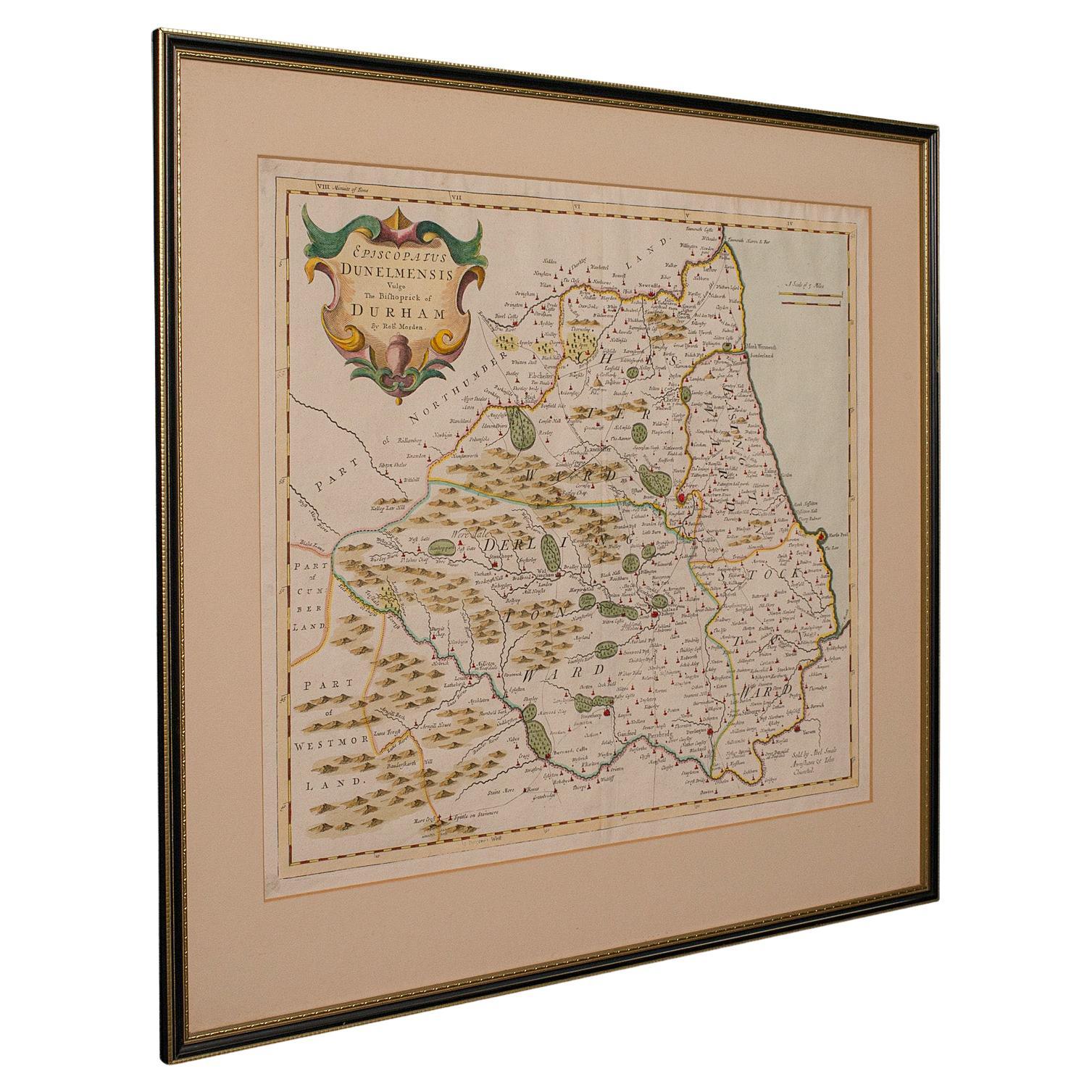
- Antique Lithography Map, Durham, English, Framed, Cartography, Early GeorgianLocated in Hele, Devon, GBThis is an antique lithography map of Durham. An English, framed engraving of cartographic interest, dating to the early 18th century and later, circa 1720. Superb lithography of Du...Category
Antique Early 18th Century British Georgian Maps
MaterialsWood
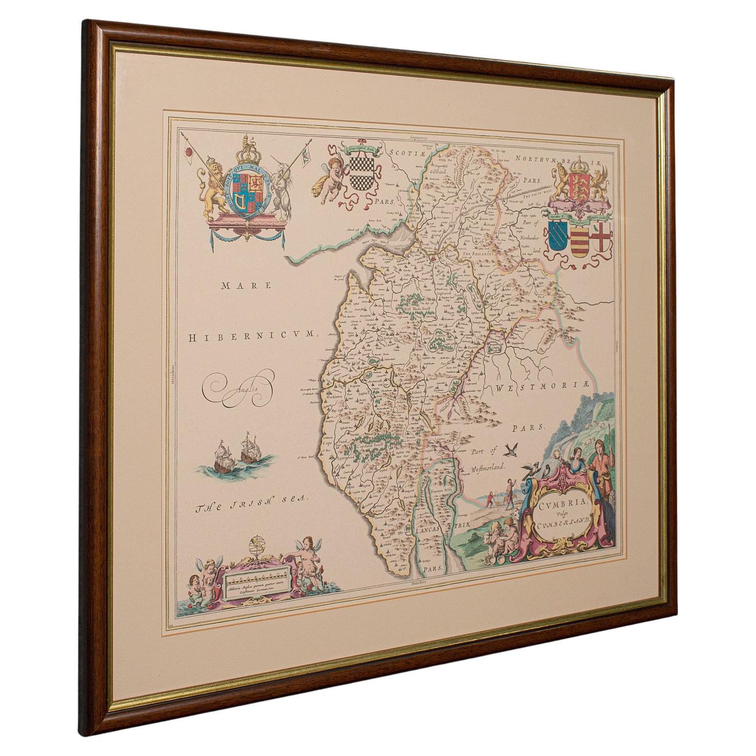
- Antique Lithography Map, Cumbria, English, Framed Cartography Interest, GeorgianLocated in Hele, Devon, GBThis is an antique lithography map of Cumbria. An English, framed engraving of cartographic interest, dating to the early 18th century and later. ...Category
Antique Early 18th Century British Georgian Maps
MaterialsWood
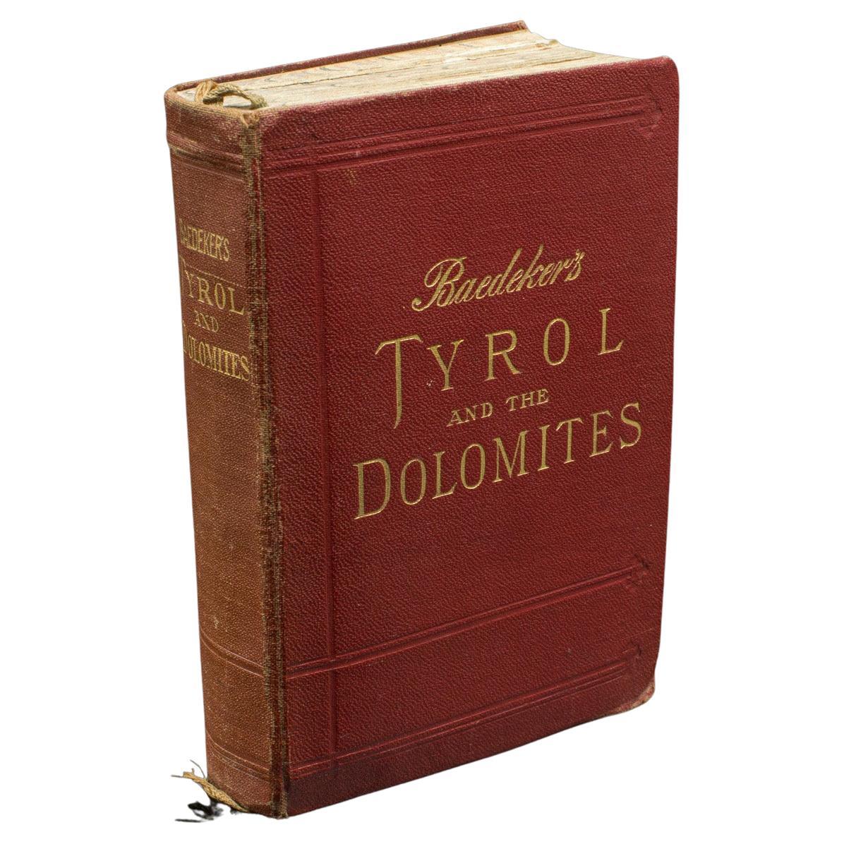
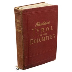
- Vintage Baedeker's Guide, Tyrol & Dolomites, English Language, Published 1927Located in Hele, Devon, GBThis is an vintage Baedeker's Guide to the Tyrol and the Dolomites. A German, bound travel book of 612 pages, published in English, dating to the early 20th century, circa 1927. Bae...Category
Vintage 1920s German Victorian Books
MaterialsPaper
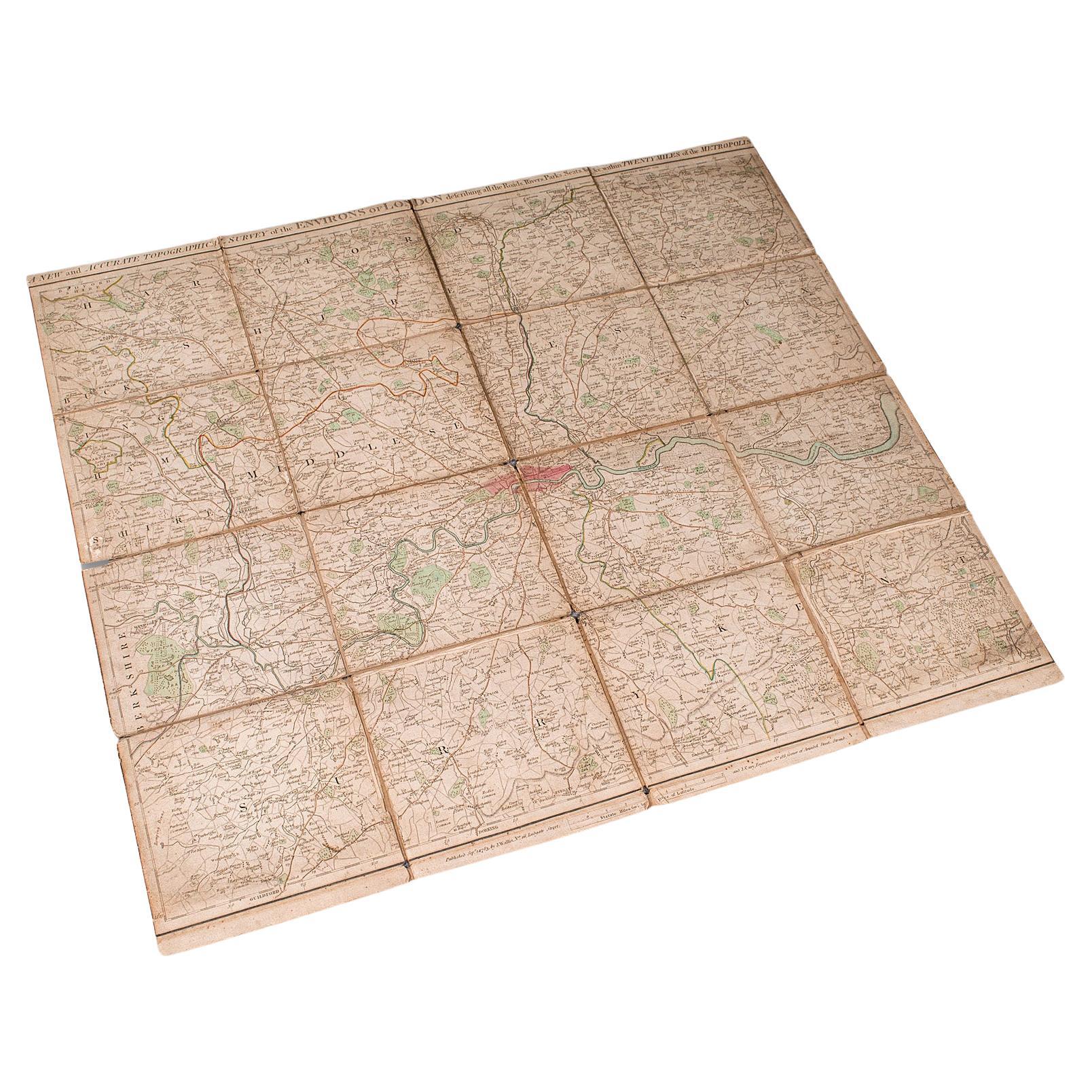
- Antique Folding London Map, English, Cartography, Historic, Georgian, Dated 1783Located in Hele, Devon, GBThis is an antique folding London map. An English, paper on linen cartographical study of the London metropolis and the surrounding area, published in the mid Georgian period, dated ...Category
Antique Late 18th Century British Georgian Maps
MaterialsLinen, Paper
- Antique Coaching Road Map, Devon, English, Regional Cartography, Georgian, 1720Located in Hele, Devon, GBThis is an antique coaching road map of Devon. An English, framed lithograph engraving of regional interest, dating to the early 18th century and later. Fascinating 18th century hig...Category
Antique Early 18th Century British Georgian Maps
MaterialsWood
- Antique Coaching Road Map, South Devon, English, Framed, Cartography, GeorgianLocated in Hele, Devon, GBThis is an antique coach road map of South Devon. An English, framed lithograph engraving of regional interest, dating to the early 18th century and later. Delightful early 18th cen...Category
Antique Early 18th Century British Georgian Maps
MaterialsWood


You May Also Like
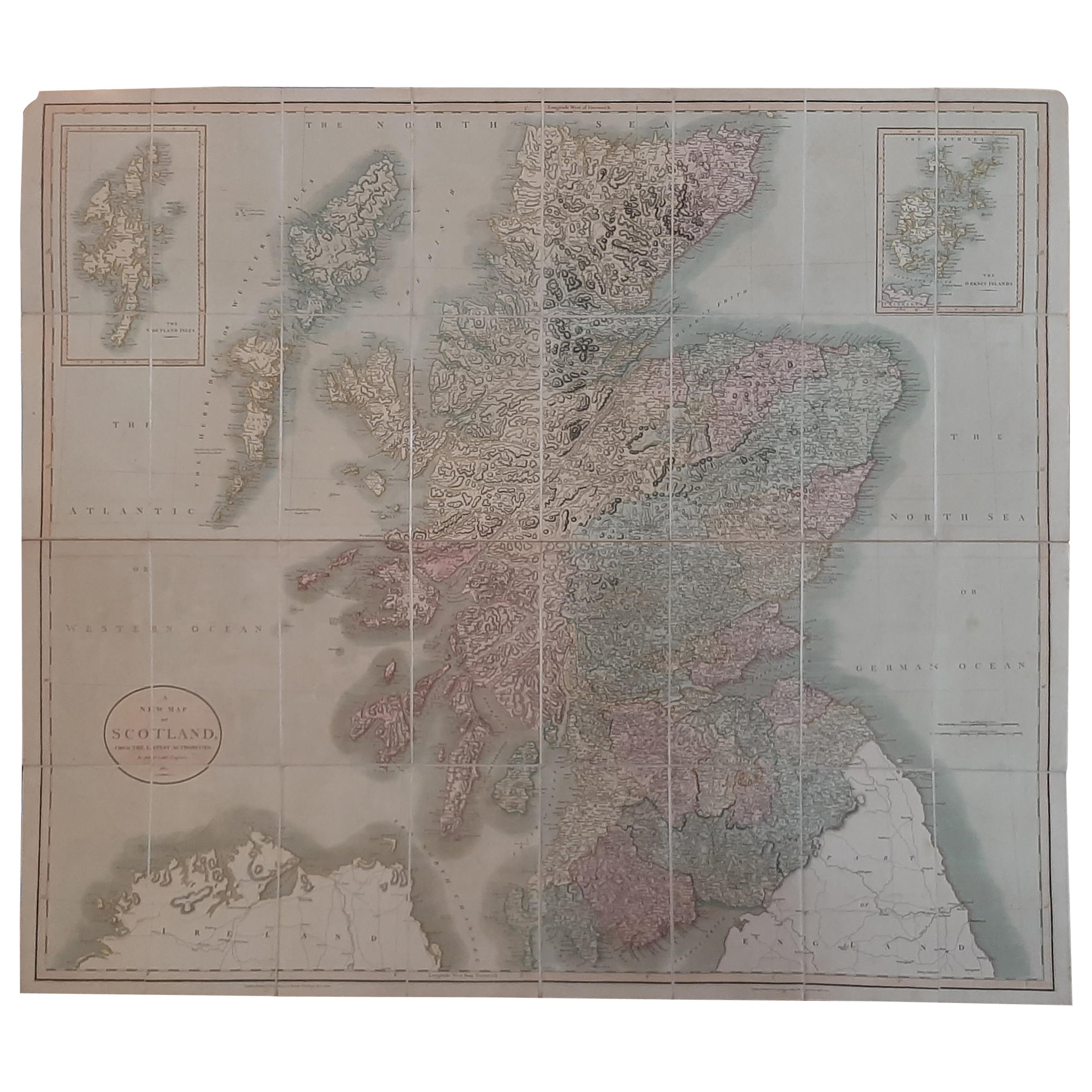
- Antique Map of Scotland by Cary, '1811'Located in Langweer, NLAntique map titled 'A New Map of Scotland from the Latest Authorities': **Title**: A New Map of Scotland from the Latest Authorities **Publisher**: J....Category
Antique Early 19th Century Maps
MaterialsLinen, Paper
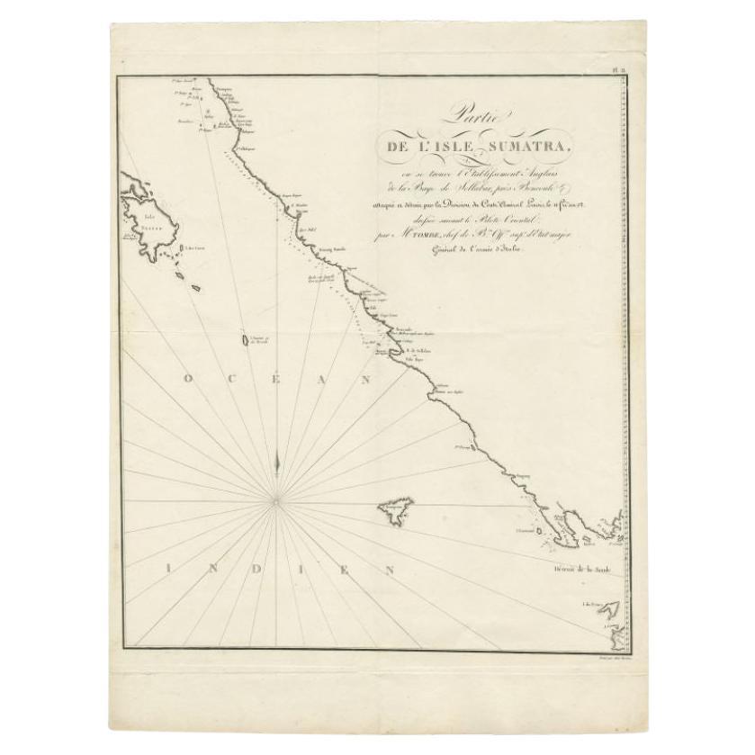
- Antique Map of Sumatra by Tardieu, 1811Located in Langweer, NLAntique map Sumatra titled 'Partie de l'Isle Sumatra'. Part of the Island of Sumatra, where the English settlement of the Bay of Sellabar near Bencoute can...Category
Antique 19th Century Maps
MaterialsPaper
- Antique Map of Franconia, a region of Germany, '1811'By John CaryLocated in Langweer, NLAntique map titled 'A New Map of the Circle of Franconia'. Detailed map of Franconia in Northwestern Germany. Covers from Upper Saxony south to Swabia, west to the Lower Rhine and we...Category
Antique Early 19th Century Maps
MaterialsPaper
- Antique Map of Bavaria and Salzburg by Cary, 1811By John CaryLocated in Langweer, NLAntique map titled 'A New Map of the Circle of Bavaria'. Antique map of Bavaria and Salzburg, Germany. Covers the Duchy of Bavaria and the mountainous A...Category
Antique Early 19th Century Maps
MaterialsPaper
- Antique Map Dedicated to British Merchants Trading to North America, ca.1746Located in Langweer, NLDescription: Antique map titled 'A New Chart of the Coast of New England, Nova Scotia, New France or Canada, with the islands of Newfoundland, Capte Breton, St John's (..)'. Map stre...Category
Antique 1740s Maps
MaterialsPaper
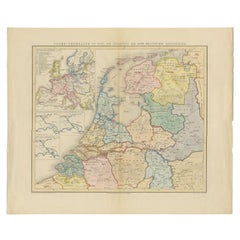
- Antique Map of the Netherlands in 1811 by Mees, 1858Located in Langweer, NLAntique map titled 'Noord-Nederland in 1811. De inlijving bij het Fransche Keizerrijk'. Map of the Netherlands in 1811. This map originates from 'Historische Atlas van Noord-Nederlan...Category
Antique 19th Century Maps
MaterialsPaper


Recently Viewed
View AllMore Ways To Browse
Vendome Press
Hohner Harmonica Vintage
Javier Senosiain
Jay Z Platinum Rolex
Jewelers Burlington
John Smibert
Jordan Dominos
Josh Allen
Julia Morgan
Les Montres Rolex
Louis Fratino
Louis Vuitton Hot Chocolate
Lucie Gomperz
Marcel Breuer Chair B 5
Melanie Turner
Montre Rolex Oyster Perpetual Date
Nickey Kehoe Club Chair
Phan Thao Nguyen