Items Similar to Antique Map of Bourbon, or Reunion, Colony of France


Want more images or videos?
Request additional images or videos from the seller
1 of 6
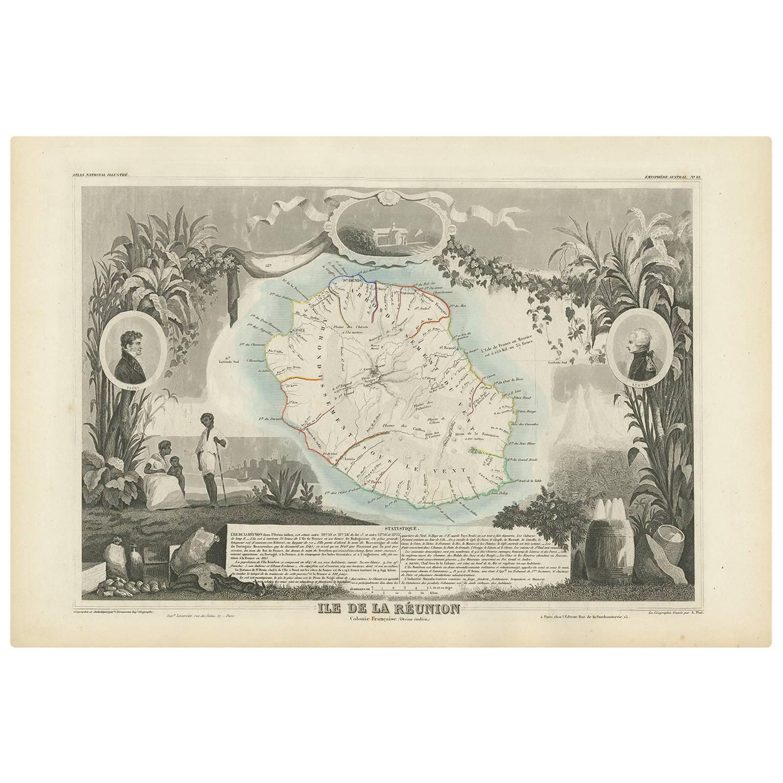
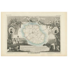
Antique Map of Bourbon, or Reunion, Colony of France
About the Item
Original antique map titled 'Ile de la Réunion'. This is a fascinating map of the French department of Ile. Bourbon or Reunion. Bourbon, or Reunion, is a volcanic island off the coast of Africa. It is one of France's few remaining colonies in the Indian Ocean. Reunion is known for its striking natural beauty and marvelous beaches. The whole is surrounded by elaborate decorative engravings designed to illustrate both the natural beauty and trade richness of the land. There is a short textual history of the regions depicted on both the left and right sides of the map. Published by V. Levasseu, circa 1859.
- Dimensions:Height: 14.38 in (36.5 cm)Width: 20.28 in (51.5 cm)Depth: 0.02 in (0.5 mm)
- Materials and Techniques:
- Period:
- Date of Manufacture:circa 1859
- Condition:Wear consistent with age and use. General age-related toning. Shows some wear and soiling, blank verso. Please study image carefully.
- Seller Location:Langweer, NL
- Reference Number:
About the Seller
5.0
Platinum Seller
These expertly vetted sellers are 1stDibs' most experienced sellers and are rated highest by our customers.
Established in 2009
1stDibs seller since 2017
1,933 sales on 1stDibs
Typical response time: <1 hour
- ShippingRetrieving quote...Ships From: Langweer, Netherlands
- Return PolicyA return for this item may be initiated within 14 days of delivery.
More From This SellerView All
- Antique Map of Bourbon/Reunion 'France' by V. Levasseur, 1854By Victor LevasseurLocated in Langweer, NLAntique map titled 'Ile de la Réunion'. Map of the French department of Ile. Bourbon or Reunion. Bourbon, or Reunion, is a volcanic island off the coast of Africa. It is one of Franc...Category
Antique Mid-19th Century Maps
MaterialsPaper
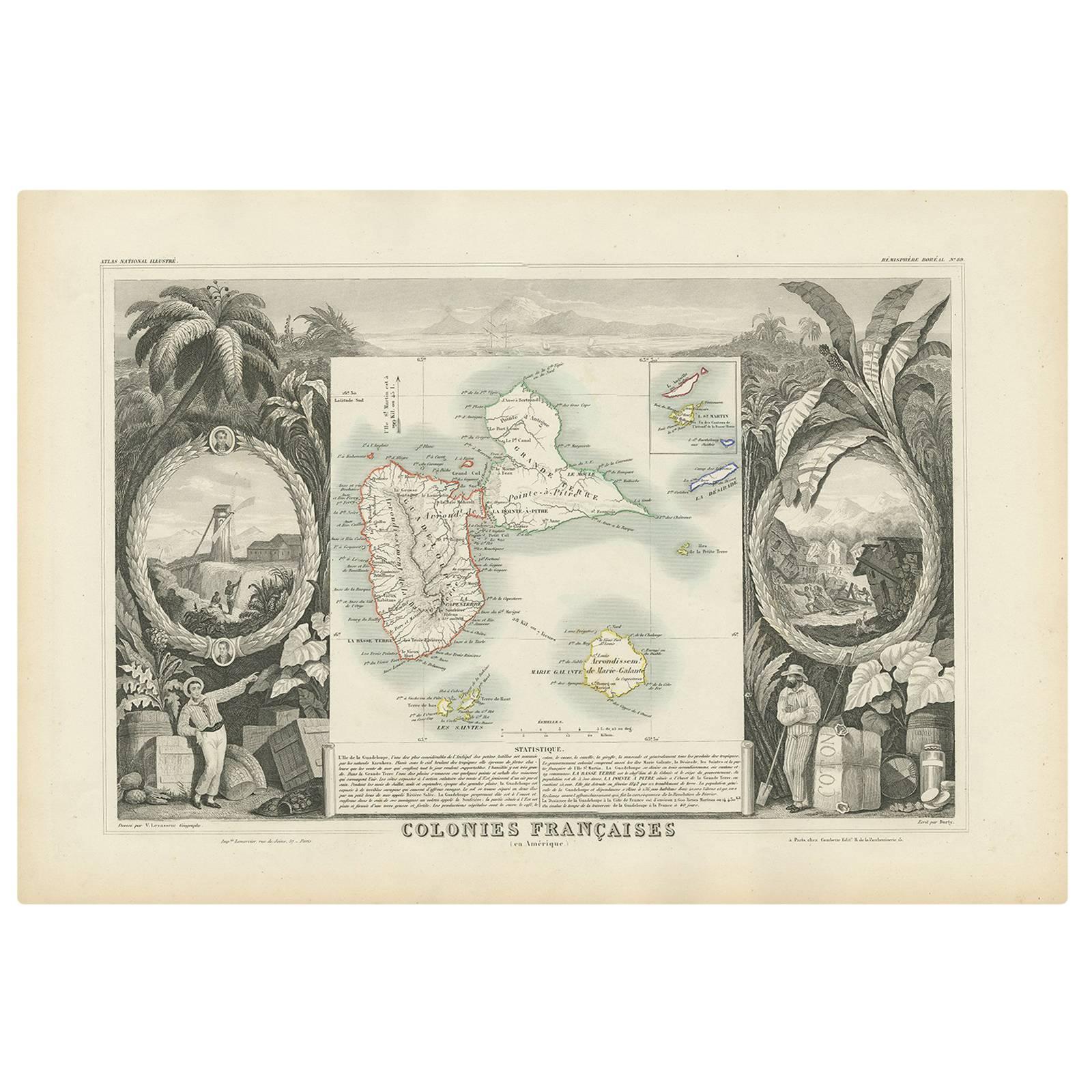
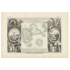
- Antique Map of the French Colony Guadeloupe by V. Levasseur, 1854By Victor LevasseurLocated in Langweer, NLAntique map titled 'Colonies Françaises (en Amerique). Detailed map of the island of Guadeloupe in the Caribbean Sea, with decorative frame containing views of the island. This map o...Category
Antique Mid-19th Century Maps
MaterialsPaper
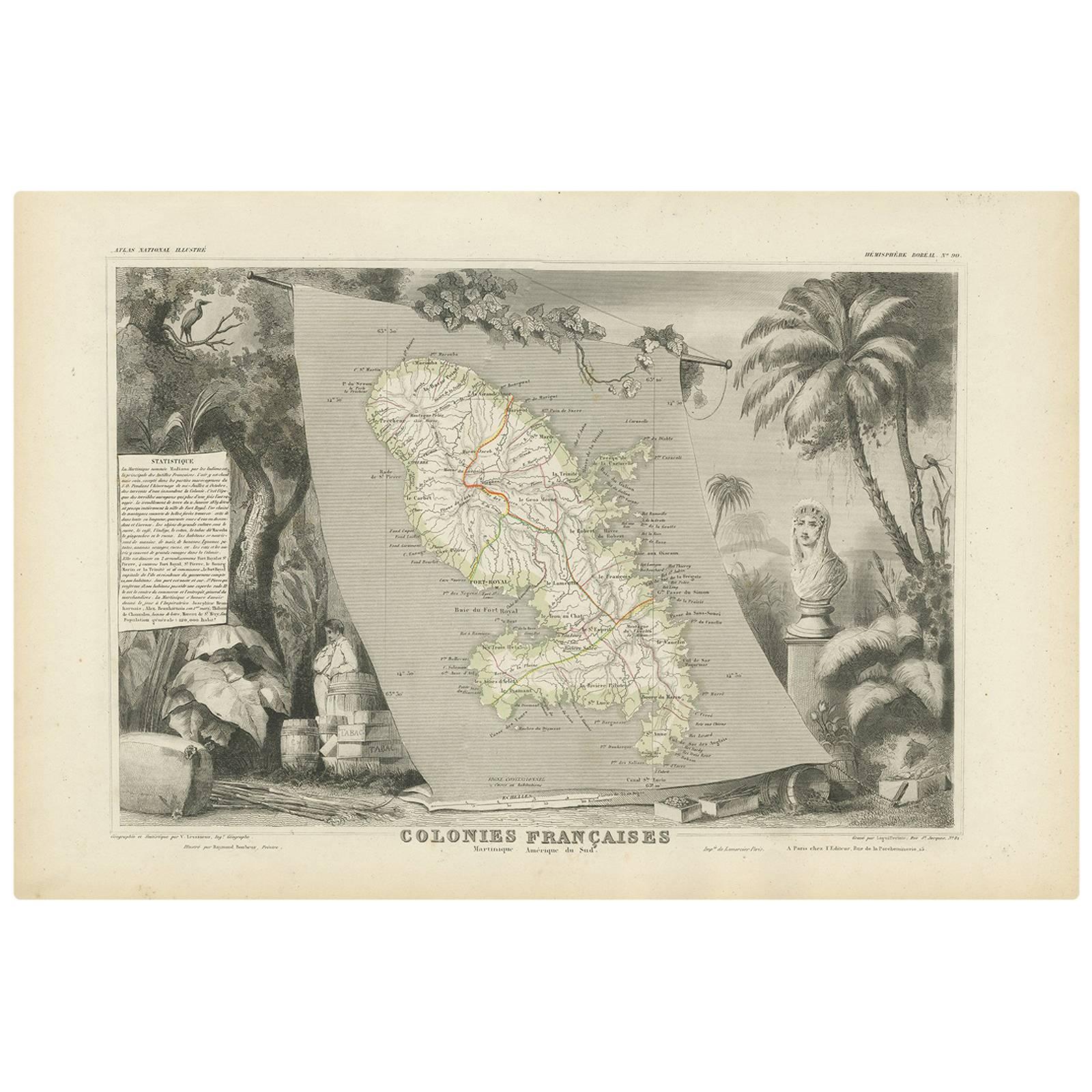
- Antique Map of the French Colony Martinique by V. Levasseur, 1854By Victor LevasseurLocated in Langweer, NLAntique map titled 'Colonies Françaises. Martinique, Amérique du Sud'. This map originates from ‘Atlas National de la France Illustré’. Published by A. Combette, Paris, 1854.Category
Antique Mid-19th Century Maps
MaterialsPaper
- Antique Map of the French Colony of Algeria by V. Levasseur, 1854By Victor LevasseurLocated in Langweer, NLAntique map titled 'Algérie, Colonie Francaise'. Shows the region divided into the administrative provinces of Oban, Alger, and Constantine. The map proper is surrounded by elaborate...Category
Antique Mid-19th Century Maps
MaterialsPaper
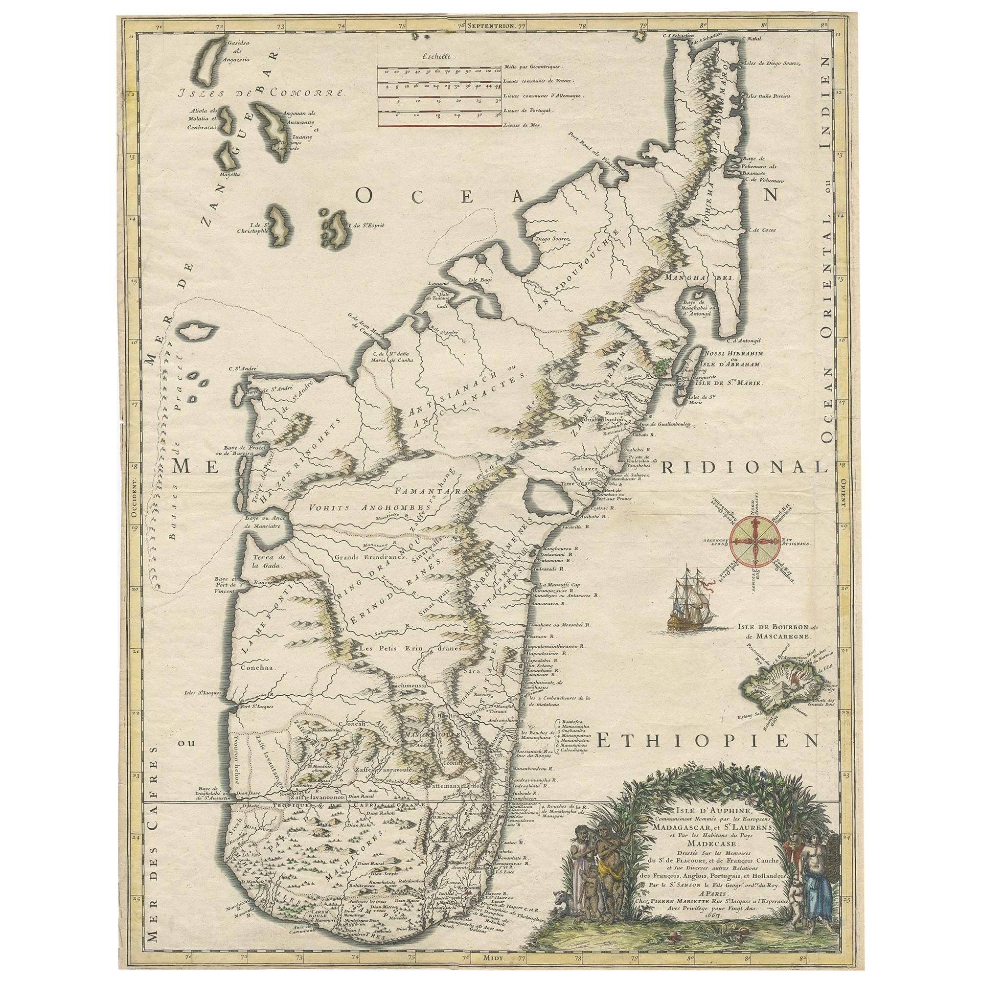
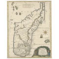
- Beautiful Antique Map of Madagascar, The Comoros Islands & Reunion Island, 1667Located in Langweer, NLAntique map titled 'Isle d'Auphine, communement Nommée par les Europeens Madagascar, et St. Laurens, et par les Habitans du pays Madecase'. Beautiful map of Madagascar...Category
Antique 1660s Maps
MaterialsPaper
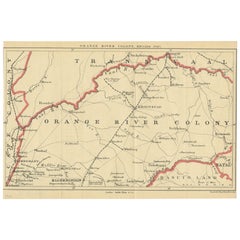
- Antique Map of the Orange River Colony in South Africa, 1901Located in Langweer, NLAntique map titled 'Orange River Colony, northern part'. Lithograph of the northern part of the Orange River Colony, Africa. The Orange River Colony was the British colony created af...Category
Early 20th Century Maps
MaterialsPaper


You May Also Like
- Original Antique Map of France, Arrowsmith, 1820Located in St Annes, LancashireGreat map of France Drawn under the direction of Arrowsmith. Copper-plate engraving. Published by Longman, Hurst, Rees, Orme and Brown, 1820 Unframed.Category
Antique 1820s English Maps
MaterialsPaper
- Antique Map of Principality of MonacoBy Antonio Vallardi EditoreLocated in Alessandria, PiemonteST/619 - "Old Geographical Atlas of Italy - Topographic map of ex-Principality of Monaco" - ediz Vallardi - Milano - A somewhat special edition ---Category
Antique Late 19th Century Italian Other Prints
MaterialsPaper
- Original Antique Map of France, Sherwood, Neely & Jones, Dated 1809Located in St Annes, LancashireGreat map of France Copper-plate engraving by Cooper Published by Sherwood, Neely & Jones. Dated 1809 Unframed.Category
Antique Early 1800s English Maps
MaterialsPaper
- Original Antique Map of Italy. C.1780Located in St Annes, LancashireGreat map of Italy Copper-plate engraving Published C.1780 Unframed.Category
Antique Early 1800s English Georgian Maps
MaterialsPaper

- Original Antique Map of Asia. C.1780Located in St Annes, LancashireGreat map of Asia Copper-plate engraving Published C.1780 Two small worm holes to right side of map Unframed.Category
Antique Early 1800s English Georgian Maps
MaterialsPaper

- Original Antique Map of India. C.1780Located in St Annes, LancashireGreat map of India Copper-plate engraving Published C.1780 Three small worm holes to right side of map and one bottom left corner Unframed.Category
Antique Early 1800s English Georgian Maps
MaterialsPaper


Recently Viewed
View AllMore Ways To Browse
V And A African
19th Century Map Of Africa
Antique Indian Maps
Ocean Beach Antique
Indian Ocean Antique Map
Colonies Map
Victorian Fence
Battle Maps
Russian Antique Plates
Floor Vase Wood
Map Print Set
Mariner Furniture
Antique World Globe Map
Antique Blackwood
Antique Furniture Missouri
Roman Map
Antique Marine Maps
Antique Indian Maps