Items Similar to Antique Map of Switzerland by Homann, 1753


Want more images or videos?
Request additional images or videos from the seller
1 of 5
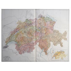
Antique Map of Switzerland by Homann, 1753
About the Item
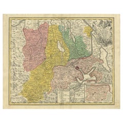
Antique map Switzerland titled 'Territorium Reipublicae liberae Helveticae Scaphusiensis (..)'. Regional map of Switzerland. Artists and Engravers: Homann Heirs was a German publishing firm that enjoyed a major place in the European map market throughout the eighteenth century. Founded in 1702 by Johann Baptist Homann, the business passed to his son, Christoph, upon Johann?s death in 1724. Christoph died in 1730, aged only 27, and the firm was inherited by subsequent Homann heirs. This altered the name of the company, which was known as Homann Erben, or Homann heirs. The firm continued in business until 1848.
Artist: Homann Heirs was a German publishing firm that enjoyed a major place in the European map market throughout the eighteenth century. Founded in 1702 by Johann Baptist Homann, the business passed to his son, Christoph, upon Johann?s death in 1724. Christoph died in 1730, aged only 27, and the firm was inherited by subsequent Homann heirs. This altered the name of the company, which was known as Homann Erben, or Homann heirs. The firm continued in business until 1848.
Condition: Very good, general age-related toning. Please study image carefully.
Date: 1753
Overall size: 59.5 x 49 cm.
Image size: 0.001 x 56 x 42 cm.
Antique prints have long been appreciated for both their aesthetic and investment value. They were the product of engraved, etched or lithographed plates. These plates were handmade out of wood or metal, which required an incredible level of skill, patience and craftsmanship. Whether you have a house with Victorian furniture or more contemporary decor an old engraving can enhance your living space. We offer a wide range of authentic antique prints for any budget.
- Dimensions:Height: 19.3 in (49 cm)Width: 23.43 in (59.5 cm)Depth: 0 in (0.01 mm)
- Materials and Techniques:
- Period:
- Date of Manufacture:1753
- Condition:
- Seller Location:Langweer, NL
- Reference Number:
About the Seller
5.0
Platinum Seller
These expertly vetted sellers are 1stDibs' most experienced sellers and are rated highest by our customers.
Established in 2009
1stDibs seller since 2017
1,933 sales on 1stDibs
Typical response time: <1 hour
- ShippingRetrieving quote...Ships From: Langweer, Netherlands
- Return PolicyA return for this item may be initiated within 14 days of delivery.
More From This SellerView All
- Antique Map of Switzerland by Homann Heirs, c.1732Located in Langweer, NLAntique map titled 'Potentissimae Helvetiorum Reipublicae (..)'. Beautiful detailed map of Switzerland, showing the 13 cantons. The large title cartouche showing 13 coat of arms of t...Category
Antique 18th Century Maps
MaterialsPaper
- Antique Map of Switzerland by J.B. Homann, 1751By Johann Baptist HomannLocated in Langweer, NLDecorative example of Homann's map of Switzerland, with decorative cartouche and the coat of arms of each of the 13 Cantons.Category
Antique Mid-18th Century Maps
MaterialsPaper
- Original Hand-Colored Antique Regional Map of Switzerland, 1753Located in Langweer, NLAntique map Switzerland titled 'Territorium Reipublicae liberae Helveticae Scaphusiensis (..)'. Regional map of Switzerland. Artists and En...Category
Antique 1750s Maps
MaterialsPaper
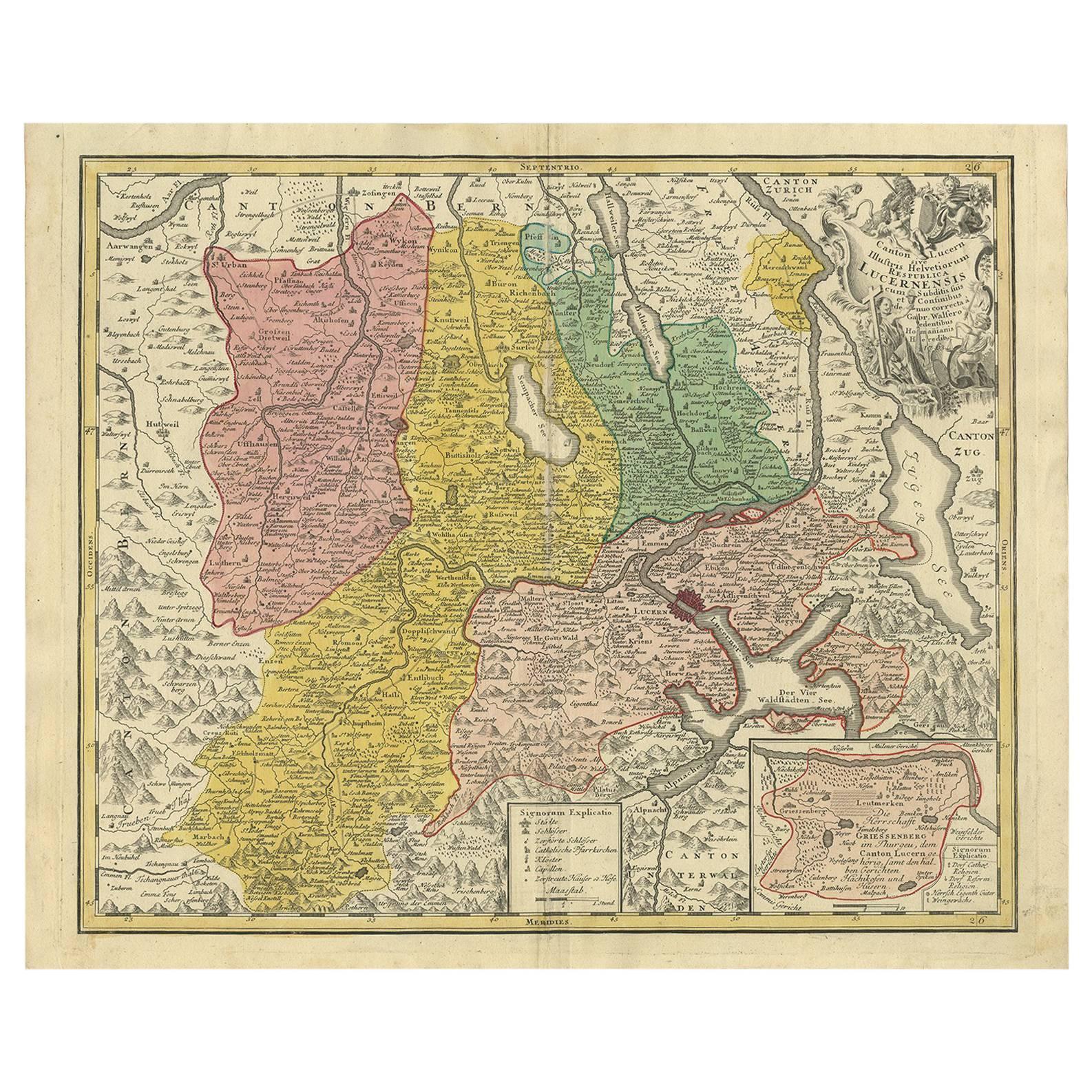
- Antique Map of the Kanton Luzerne 'Switzerland' by Homann Heirs, 1763Located in Langweer, NLAntique map titled 'Canton Lucern (..)'. Fine decorative copper plate engraved antique map of the Canton of Lucerne in Central Switzerland with pictorial cartouche in top right corne...Category
Antique Mid-18th Century Maps
MaterialsPaper
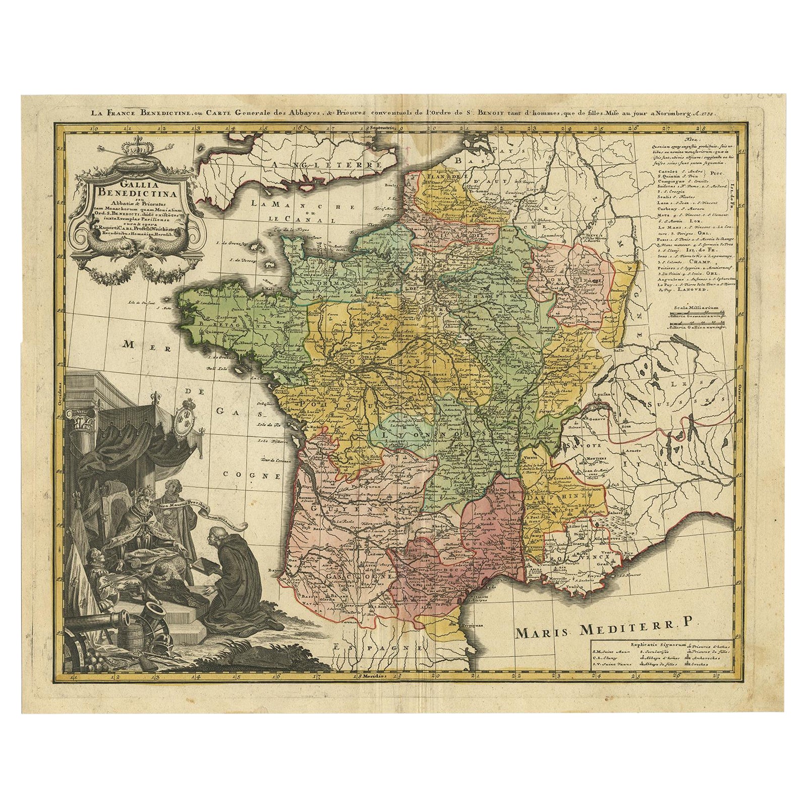
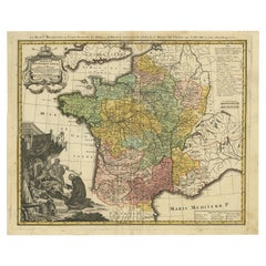
- Antique Map of France by Homann, 1738Located in Langweer, NLAntique map titled 'Gallia Benedictina seu Abbatiar & Prioratus tam Monachorum quam Monialium Ord. S. Benedict (..)'. Beautiful antique map of France...Category
Antique 18th Century Maps
MaterialsPaper
- Antique Map of Africa by Homann Heirs, '1804'Located in Langweer, NLAntique map titled 'Charte von Africa'. Large, original antique map of Africa by Franz Ludwig Güssefeld. Published by Homann Heirs, 1804.Category
Antique Early 19th Century Maps
MaterialsPaper


You May Also Like
- Sweden & Adjacent Portions of Scandinavia: A Hand-Colored 18th C. Map by HomannBy Johann Baptist HomannLocated in Alamo, CAThis hand-colored map of Sweden and adjacent portions of Scandinavia entitled "Regni Sueciae in Omnes suas Subjacentes Provincias accurate divisi Tabula Generalis" was created by Joh...Category
Antique 1720s German Maps
MaterialsPaper
- Scandinavia & Portions of Eastern Europe: 18th Century Hand-Colored Homann MapBy Johann Baptist HomannLocated in Alamo, CAAn early 18th century hand-colored copper-plate map entitled "Regni Sueciae in omnes suas Subjacentes Provincias accurate divisi Tabula Generalis" by Johann Baptist Homann (1663-1724...Category
Antique Early 18th Century German Maps
MaterialsPaper
- Hand-Colored 18th Century Homann Map of the Danube, Italy, Greece, CroatiaBy Johann Baptist HomannLocated in Alamo, CA"Fluviorum in Europa principis Danubii" is a hand colored map of the region about the Danube river created by Johann Baptist Homann (1663-1724) in his 'Atlas Novus Terrarum', publish...Category
Antique Early 18th Century German Maps
MaterialsPaper
- 18th Century Hand-Colored Homann Map of Germany, Including Frankfurt and BerlinBy Johann Baptist HomannLocated in Alamo, CAAn 18th century hand-colored map entitled "Tabula Marchionatus Brandenburgici et Ducatus Pomeraniae quae sunt Pars Septentrionalis Circuli Saxoniae Superioris" by Johann Baptist Homa...Category
Antique Early 18th Century German Maps
MaterialsPaper
- Large Original Vintage Map of Switzerland, circa 1920Located in St Annes, LancashireGreat map of Switzerland Original color. Good condition Published by Alexander Gross Unframed.Category
Vintage 1920s English Maps
MaterialsPaper
- 1861 Topographical Map of the District of Columbia, by Boschke, Antique MapLocated in Colorado Springs, COPresented is an original map of Albert Boschke's extremely sought-after "Topographical Map of the District of Columbia Surveyed in the Years 1856 ...Category
Antique 1860s American Historical Memorabilia
MaterialsPaper


Recently Viewed
View AllMore Ways To Browse
Swiss Antiques
Swiss Old Furniture
Swiss Metal Antique
Antique Swiss Wood
Antique German Decor
Old Maps Of Europe
Old Europe Map
Swiss Antiques And Collectables
Antique Map Switzerland
Antique Map Of Switzerland
Altered Antique Plates
Antique Map Paint
Israeli Antique
Tree Bag
Ohio Antique
16th Century Scotland
New England Maps
New England Map