Items Similar to Remarkable Antique Map of Central Africa by Scherer, c.1703

Want more images or videos?
Request additional images or videos from the seller
1 of 5
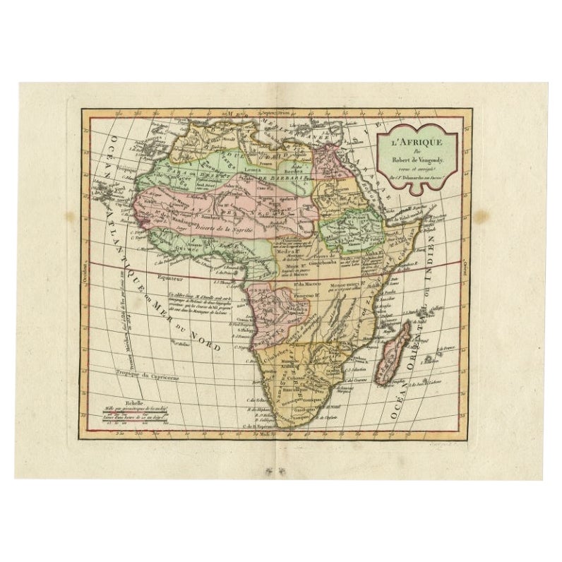
Remarkable Antique Map of Central Africa by Scherer, c.1703
About the Item
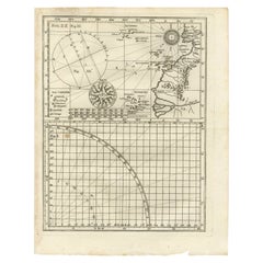
Untitled map of Central Africa depicting Tarodant, Lempta, Guber, Borno, Chaxumo, Tombut, Melegvete, Benin, S. Salvator, Zaire, Gondar, S. Helena and Mozambique. Printed for Scherer's 'Atlas Novus' (1702-1710).
Artists and Engravers: Heinrich Scherer (1628-1704) was a Professor of Hebrew, Mathematics and Ethics at the University of Dillingen until about 1680. Thereafter he obtained important positions as Official Tutor to the Royal Princes of Mantua and Bavaria. It was during his time in Munich as Tutor to the Princely house of Bavaria that his lifetime’s work as a cartographer received acclaim and recognition. Scherer’s world atlas, the Atlas Novus, first published in Munich between 1702 and 1710 and reissued in a second edition between 1730 and 1737, forms a singularly unusual, almost revolutionary work in terms of the development of European mapmaking at the beginning of the 18th Century.
Condition: Very good. Minor age-related toning. Please study image carefully.
Date: c.1703
Overall size: 39 x 27.3 cm.
Image size: 34.5 x 23 cm.
We sell original antique maps to collectors, historians, educators and interior decorators all over the world. Our collection includes a wide range of authentic antique maps from the 16th to the 20th centuries. Buying and collecting antique maps is a tradition that goes back hundreds of years. Antique maps have proved a richly rewarding investment over the past decade, thanks to a growing appreciation of their unique historical appeal. Today the decorative qualities of antique maps are widely recognized by interior designers who appreciate their beauty and design flexibility. Depending on the individual map, presentation, and context, a rare or antique map can be modern, traditional, abstract, figurative, serious or whimsical. We offer a wide range of authentic antique maps for any budget.
- Dimensions:Height: 10.75 in (27.3 cm)Width: 15.36 in (39 cm)Depth: 0 in (0.01 mm)
- Materials and Techniques:
- Period:
- Date of Manufacture:circa 1703
- Condition:
- Seller Location:Langweer, NL
- Reference Number:
About the Seller
5.0
Platinum Seller
These expertly vetted sellers are 1stDibs' most experienced sellers and are rated highest by our customers.
Established in 2009
1stDibs seller since 2017
1,922 sales on 1stDibs
Typical response time: <1 hour
- ShippingRetrieving quote...Ships From: Langweer, Netherlands
- Return PolicyA return for this item may be initiated within 14 days of delivery.
More From This SellerView All
- Remarkable Antique Map of West Europe by Scherer, circa 1703Located in Langweer, NLAntique map of Western Europe. Depicting Bergen, Stockholm, Dublin, Paris, Wien, Madrid, Rome, Sevilla, Palermo and Corintho. Printed for Scherer's 'Atlas Novus' (1702-1710). Artists...Category
Antique 18th Century Maps
MaterialsPaper
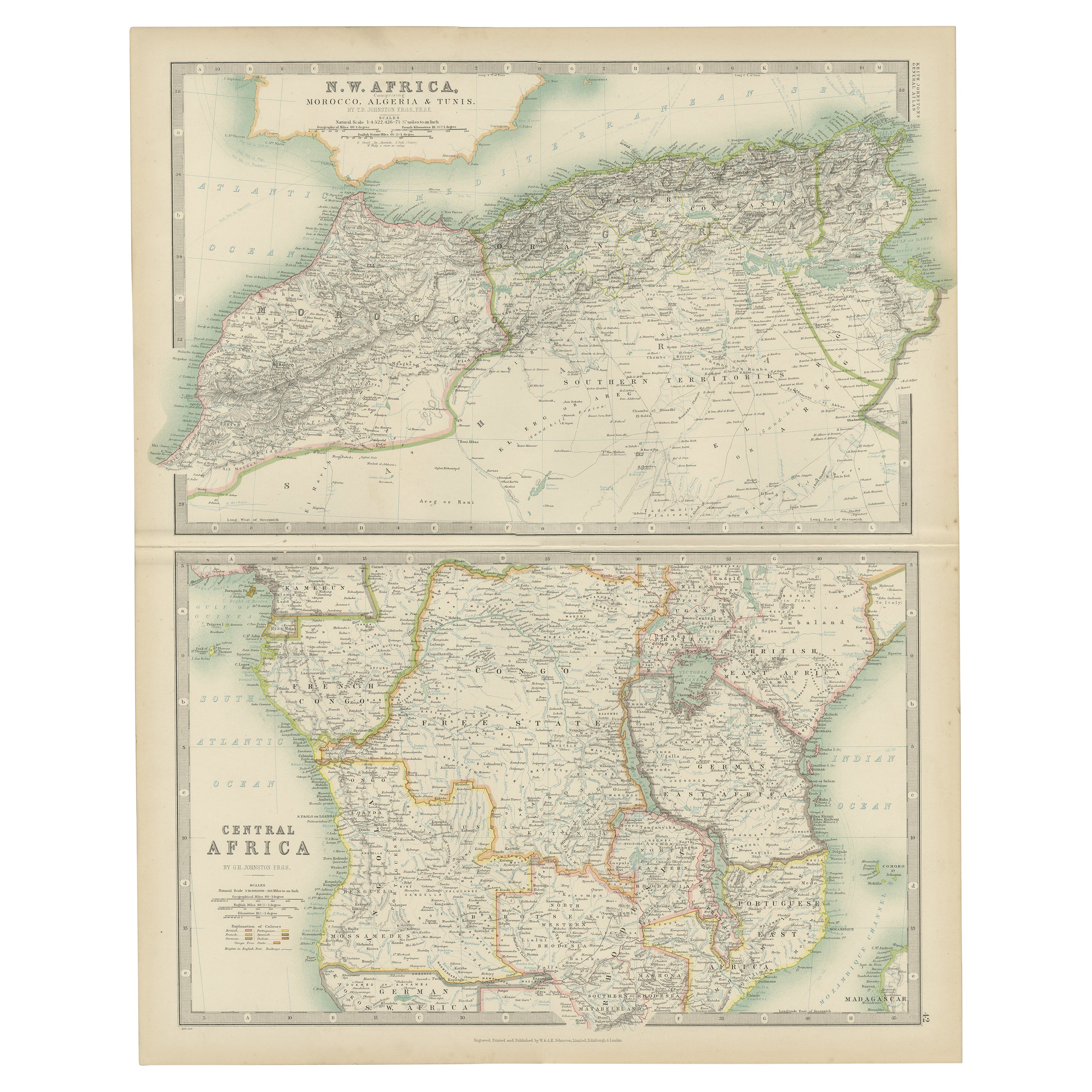
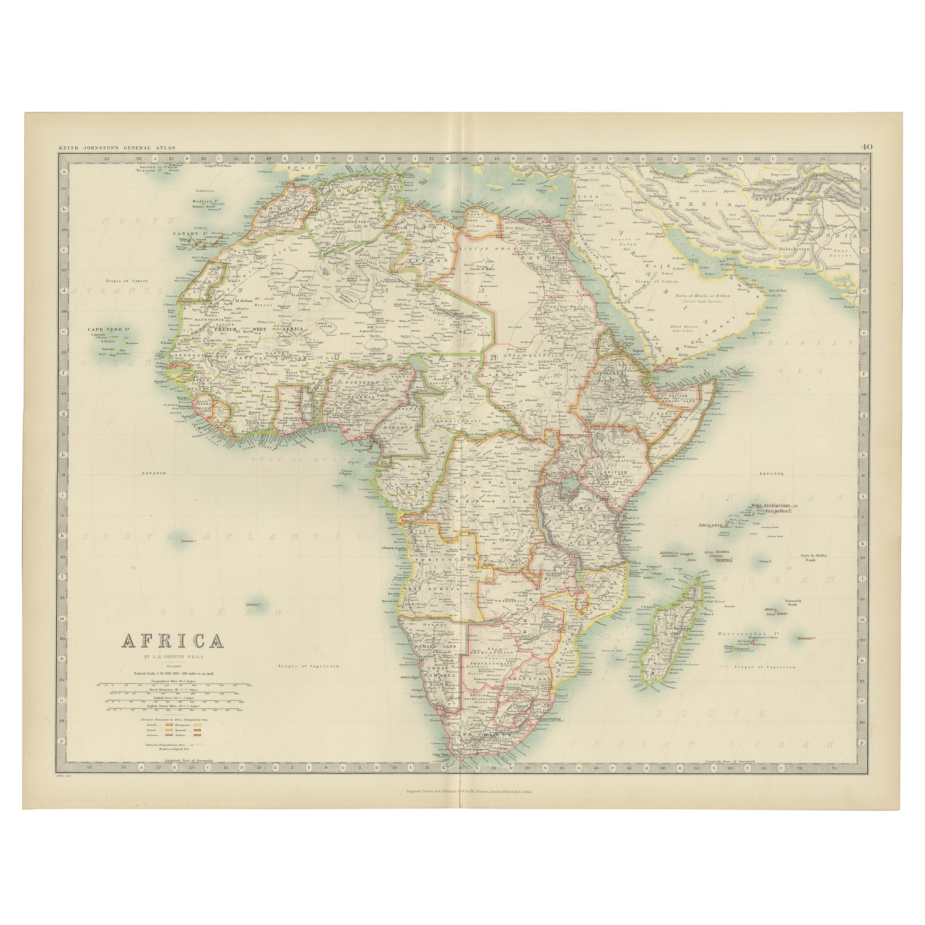
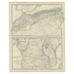
- Antique Map of N.W. Africa & Central Africa by Johnston (1909)Located in Langweer, NLAntique map titled 'N.W. Africa & Central Africa'. Original antique map of N.W. Africa & Central Africa. This map originates from the ‘Royal Atlas of Modern Geography’. Published by ...Category
Early 20th Century Maps
MaterialsPaper
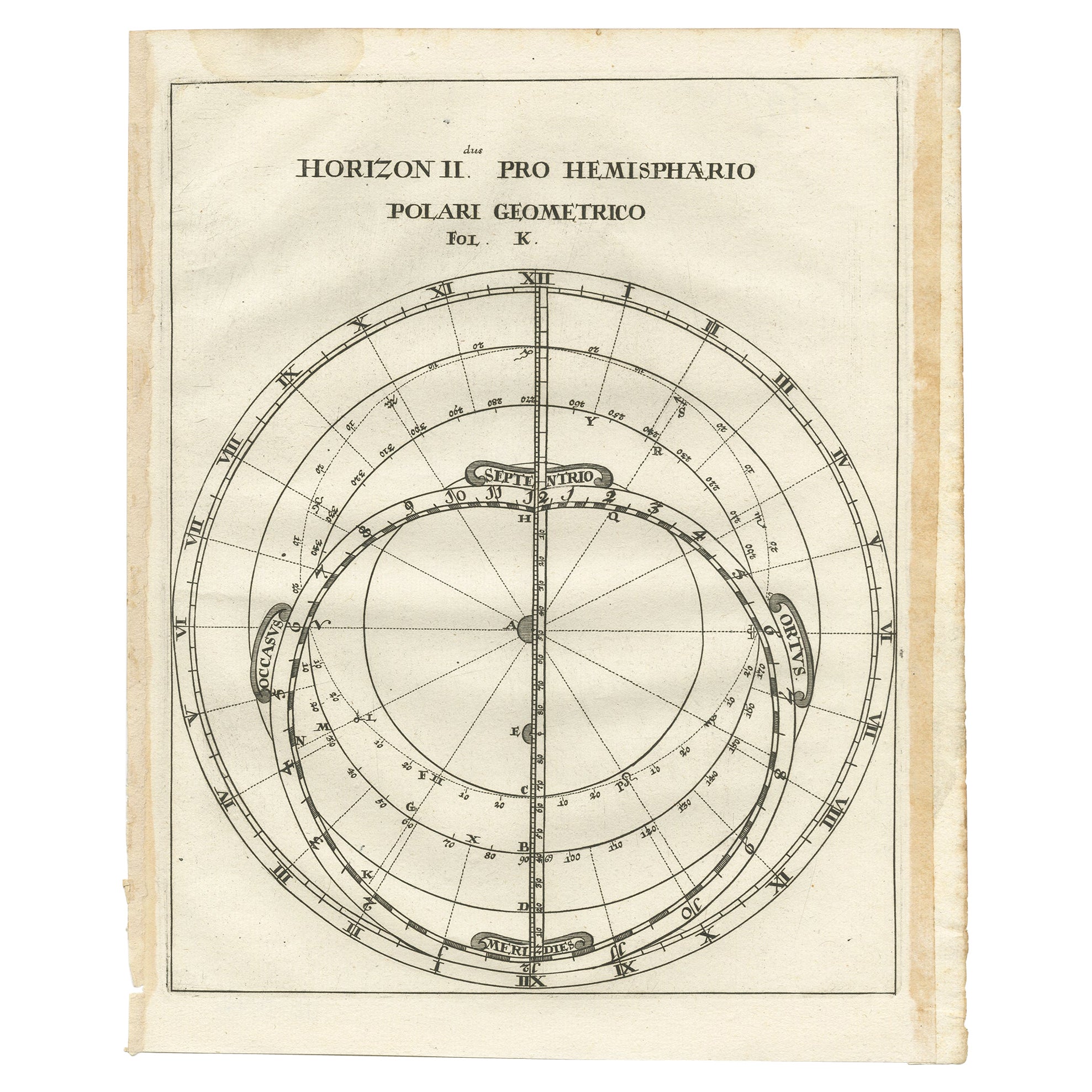
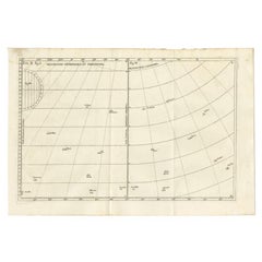
- Antique Map of a Hemisphere by Scherer, c.1703Located in Langweer, NLAntique map depiciting a horizon/hemisphere. Printed for Scherer's 'Atlas Novus' (1702-1710). Artists and Engravers: Heinrich Scherer (1628-1704) was a Professor of Hebrew, Mathematics and Ethics at the University of Dillingen until about 1680. Thereafter he obtained important positions as Official Tutor to the Royal Princes...Category
Antique 18th Century Maps
MaterialsPaper
- Intriguing Antique Map of Europe, Asia and Africa by Scherer, c.1703Located in Langweer, NLTwo maps on a single sheet showing Europe, Asia and Africa, each depicting nearly the same area. On close examination there are slight differences. Major cities are located. Printed ...Category
Antique 18th Century Maps
MaterialsPaper
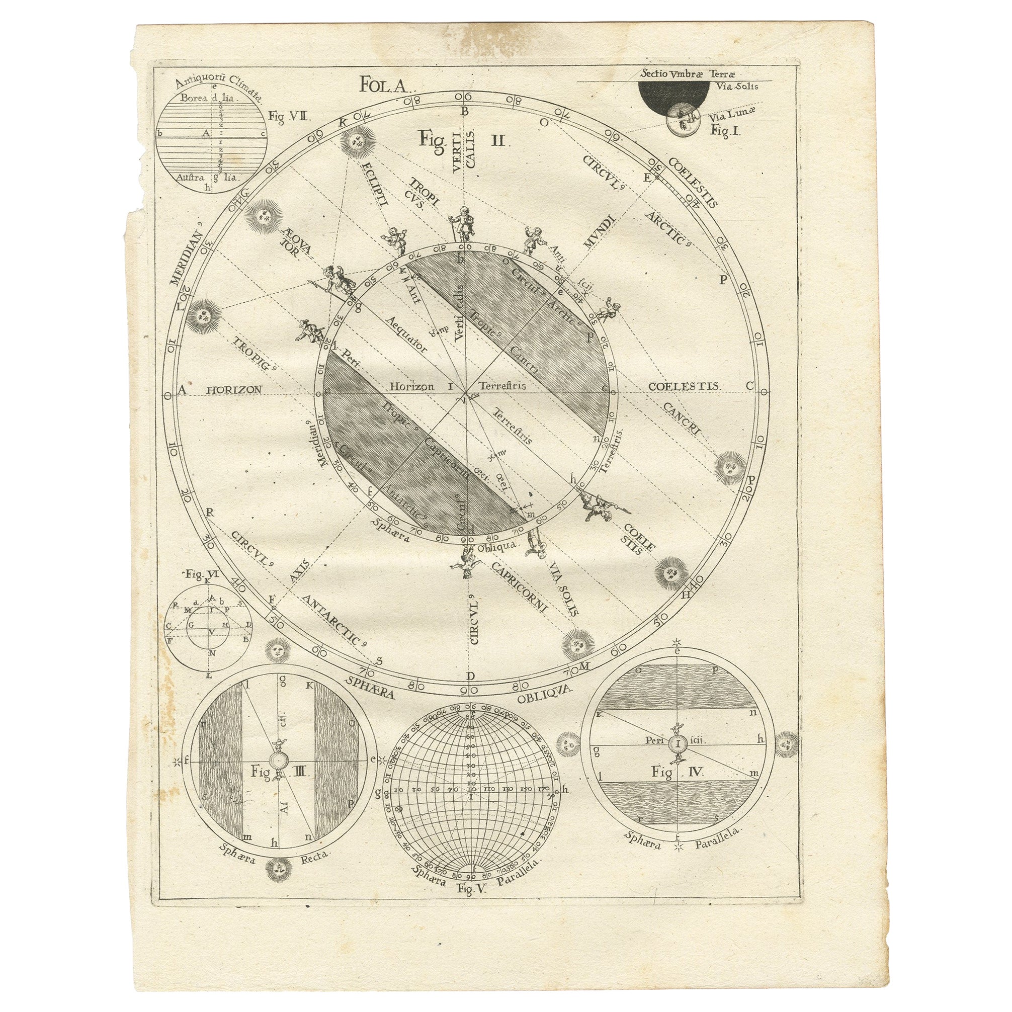
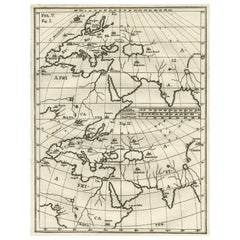
- Rare Antique Map of Part of Europe and Africa by Scherer, C.1703Located in Langweer, NLAntique map with two figures. The upper figures showing part of Europe and Africa. Below a chart. Printed for Scherer's 'Atlas Novus' (1702-1710). Artists and Engravers: Heinrich Sch...Category
Antique 18th Century Maps
MaterialsPaper
- Antique Map of part of Europe by Scherer, c.1703Located in Langweer, NLUntitled map of Europe depicting Calais, Münster, Paris, Lion, Prag, Wien, Berlin, Clermont and many other cities. Printed for Scherer's 'Atlas Novus' (1702-1710). Artists and Engrav...Category
Antique 18th Century Maps
MaterialsPaper

You May Also Like
- Original Antique Map of Central America / Florida, Arrowsmith, 1820Located in St Annes, LancashireGreat map of Central America. Drawn under the direction of Arrowsmith. Copper-plate engraving. Published by Longman, Hurst, Rees, Orme and Brown, 1820 Unframed.Category
Antique 1820s English Maps
MaterialsPaper
- Original Antique Map of South Africa, Arrowsmith, 1820Located in St Annes, LancashireGreat map of South Africa. Drawn under the direction of Arrowsmith. Copper-plate engraving. Published by Longman, Hurst, Rees, Orme and Br...Category
Antique 1820s English Maps
MaterialsPaper
- "Africae Accurata", a Hand-Colored 17th Century Map of Africa by VisscherBy Nicolaes Visscher IILocated in Alamo, CAAn 18th century hand-colored map of Africa entitled "Africae Accurata Tabula ex officina" by Nicolaes Visscher, published in Amsterdam in 1680. This beautiful, colorful and detailed map is embellished by eleven sailing ships, a whale, flying fish and multiple land animals. It includes the Mediterranean Sea and adjacent portions of Portugal, Spain, Italy, Greece and Asia Minor. The map perpetuates several long-standing errors, including the origin of the Nile River from two imaginary lakes in southern Africa, which are shown adjacent to the imaginary Lunae Montes (Mountains of the Moon...Category
Antique Late 17th Century Dutch Maps
MaterialsPaper
- 17th Century Hand-Colored Map of West Africa by Mercator/HondiusLocated in Alamo, CAA 17th century hand-colored map entitled "Guineae Nova Descriptio" by Gerard Mercator and Jodocus Hondius, published in their 'Atlas Minor' in Amsterdam in 1635. It is focused on the...Category
Antique Mid-17th Century Dutch Maps
MaterialsPaper
- Antique Map of Italy by Andriveau-Goujon, 1843By Andriveau-GoujonLocated in New York, NYAntique Map of Italy by Andriveau-Goujon, 1843. Map of Italy in two parts by Andriveau-Goujon for the Library of Prince Carini at Palazzo Carini i...Category
Antique 1840s French Maps
MaterialsLinen, Paper
- Antique Map of Principality of MonacoBy Antonio Vallardi EditoreLocated in Alessandria, PiemonteST/619 - "Old Geographical Atlas of Italy - Topographic map of ex-Principality of Monaco" - ediz Vallardi - Milano - A somewhat special edition ---Category
Antique Late 19th Century Italian Other Prints
MaterialsPaper


Recently Viewed
View AllMore Ways To Browse
Unusual Antique Collectables
Antique Prince And
Munich Antiques
20th Century Africa Collectibles
Antique World Map Print
18th Century African
Unusual African
Africa Map Antique
Antique Africa Maps
Antique African Maps
Antique Africa Map
Antique African Map
Africa Antique Map
Antique Maps Africa
Antique Map Africa
Antique Map Of Africa
Antique Maps Of Africa
Antique Bavaria