Items Similar to Antique Map of a Hemisphere by Scherer, c.1703

Want more images or videos?
Request additional images or videos from the seller
1 of 6
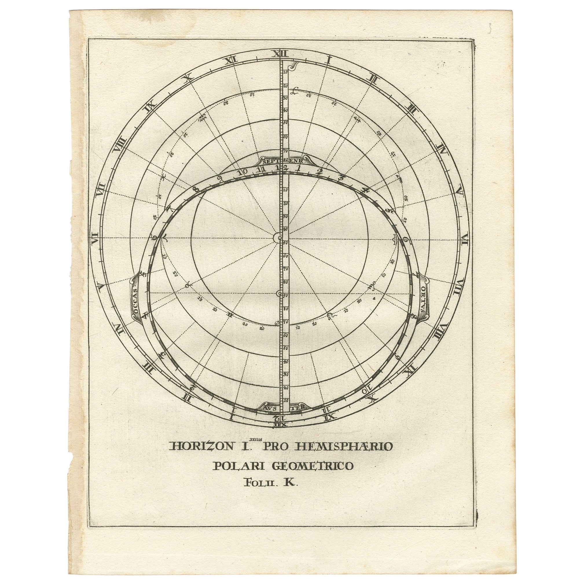
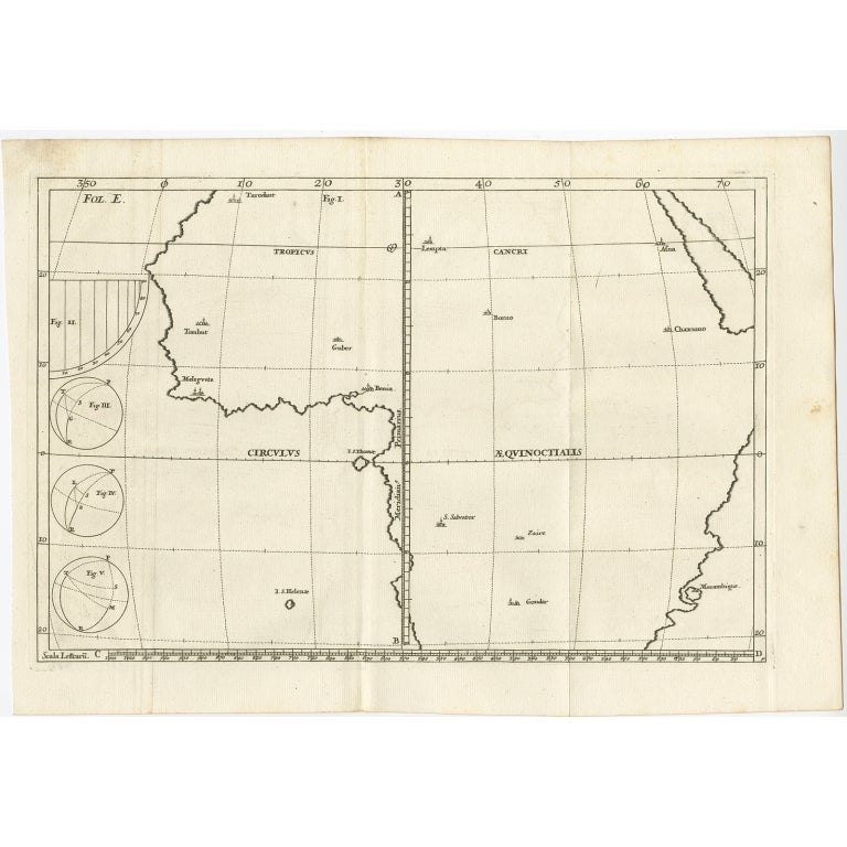
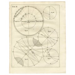
Antique Map of a Hemisphere by Scherer, c.1703
About the Item
Antique map depiciting a horizon/hemisphere. Printed for Scherer's 'Atlas Novus' (1702-1710).
Artists and Engravers: Heinrich Scherer (1628-1704) was a Professor of Hebrew, Mathematics and Ethics at the University of Dillingen until about 1680. Thereafter he obtained important positions as Official Tutor to the Royal Princes of Mantua and Bavaria. It was during his time in Munich as Tutor to the Princely house of Bavaria that his lifetime’s work as a cartographer received acclaim and recognition. Scherer’s world atlas, the Atlas Novus, first published in Munich between 1702 and 1710 and reissued in a second edition between 1730 and 1737, forms a singularly unusual, almost revolutionary work in terms of the development of European mapmaking at the beginning of the 18th Century.
Condition: Very good. General age-related toning. Please study image carefully.
Date: c.1703
Overall size: 21.5 x 26 cm.
Image size: 18.5 x 23 cm.
We sell original antique maps to collectors, historians, educators and interior decorators all over the world. Our collection includes a wide range of authentic antique maps from the 16th to the 20th centuries. Buying and collecting antique maps is a tradition that goes back hundreds of years. Antique maps have proved a richly rewarding investment over the past decade, thanks to a growing appreciation of their unique historical appeal. Today the decorative qualities of antique maps are widely recognized by interior designers who appreciate their beauty and design flexibility. Depending on the individual map, presentation, and context, a rare or antique map can be modern, traditional, abstract, figurative, serious or whimsical. We offer a wide range of authentic antique maps for any budget.
- Dimensions:Height: 10.24 in (26 cm)Width: 8.47 in (21.5 cm)Depth: 0 in (0.01 mm)
- Materials and Techniques:
- Period:
- Date of Manufacture:c.1703
- Condition:Condition: Very good. General age-related toning. Please study image carefully.
- Seller Location:Langweer, NL
- Reference Number:
About the Seller
5.0
Platinum Seller
These expertly vetted sellers are 1stDibs' most experienced sellers and are rated highest by our customers.
Established in 2009
1stDibs seller since 2017
1,916 sales on 1stDibs
Typical response time: <1 hour
- ShippingRetrieving quote...Ships From: Langweer, Netherlands
- Return PolicyA return for this item may be initiated within 14 days of delivery.
More From This SellerView All
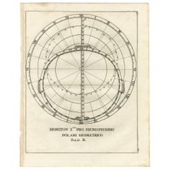
- Antique Map Depiciting a Horizon or Hemisphere c.1703Located in Langweer, NLAntique map depiciting a horizon/hemisphere. Printed for Scherer's 'Atlas Novus' (1702-1710). Artists and Engravers: Heinrich Scherer (1628-1704) was a Professor of Hebrew, Mathematics and Ethics at the University of Dillingen until about 1680. Thereafter he obtained important positions as Official Tutor to the Royal Princes...Category
Antique 18th Century Maps
MaterialsPaper
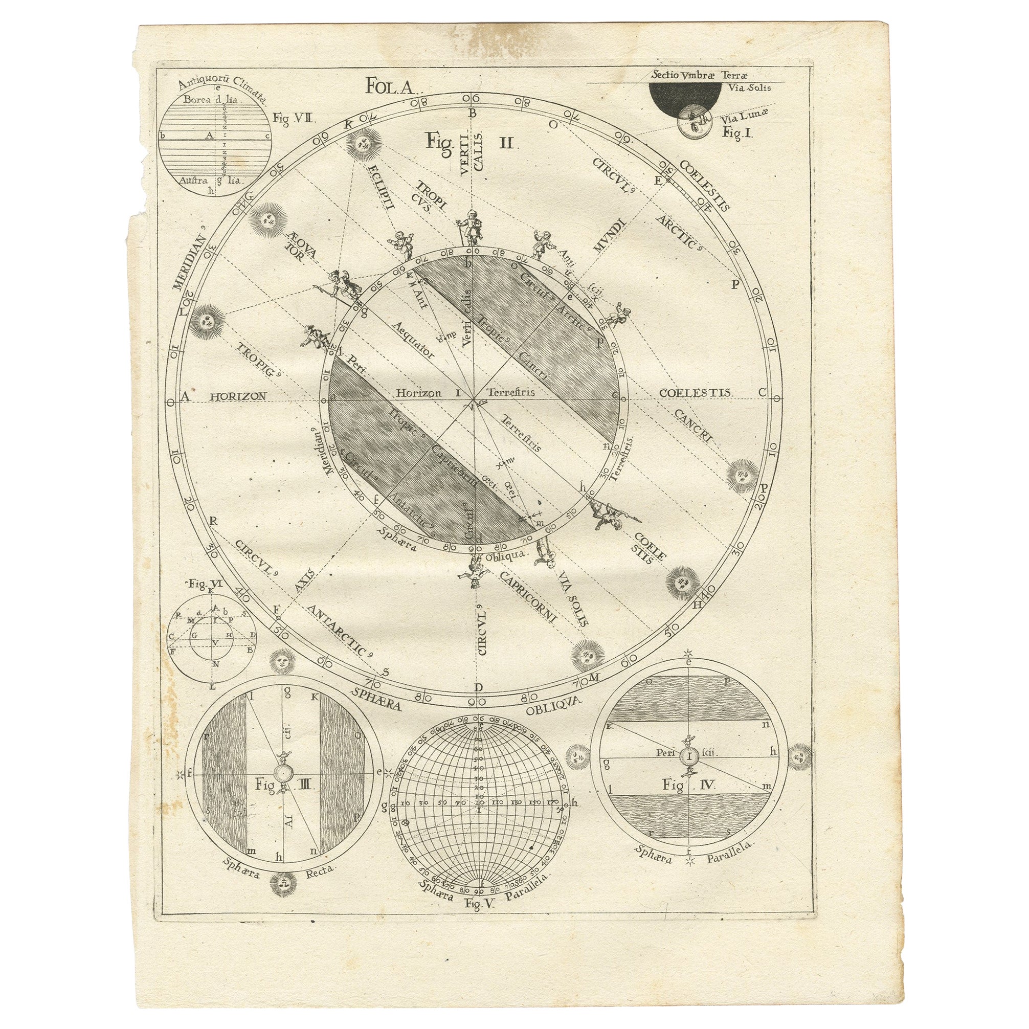
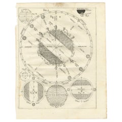
- Antique Map Illustrating Solar Eclipses by Scherer, C.1703Located in Langweer, NLAntique map of an hemisphere and several figures illustrating the position of the earth, moon and sun. Printed for Scherer's 'Atlas Novus' (1702-1710). Artists and Engravers: Heinrich Scherer (1628-1704) was a Professor of Hebrew, Mathematics and Ethics at the University of Dillingen until about 1680. Thereafter he obtained important positions as Official Tutor to the Royal Princes...Category
Antique 18th Century Maps
MaterialsPaper
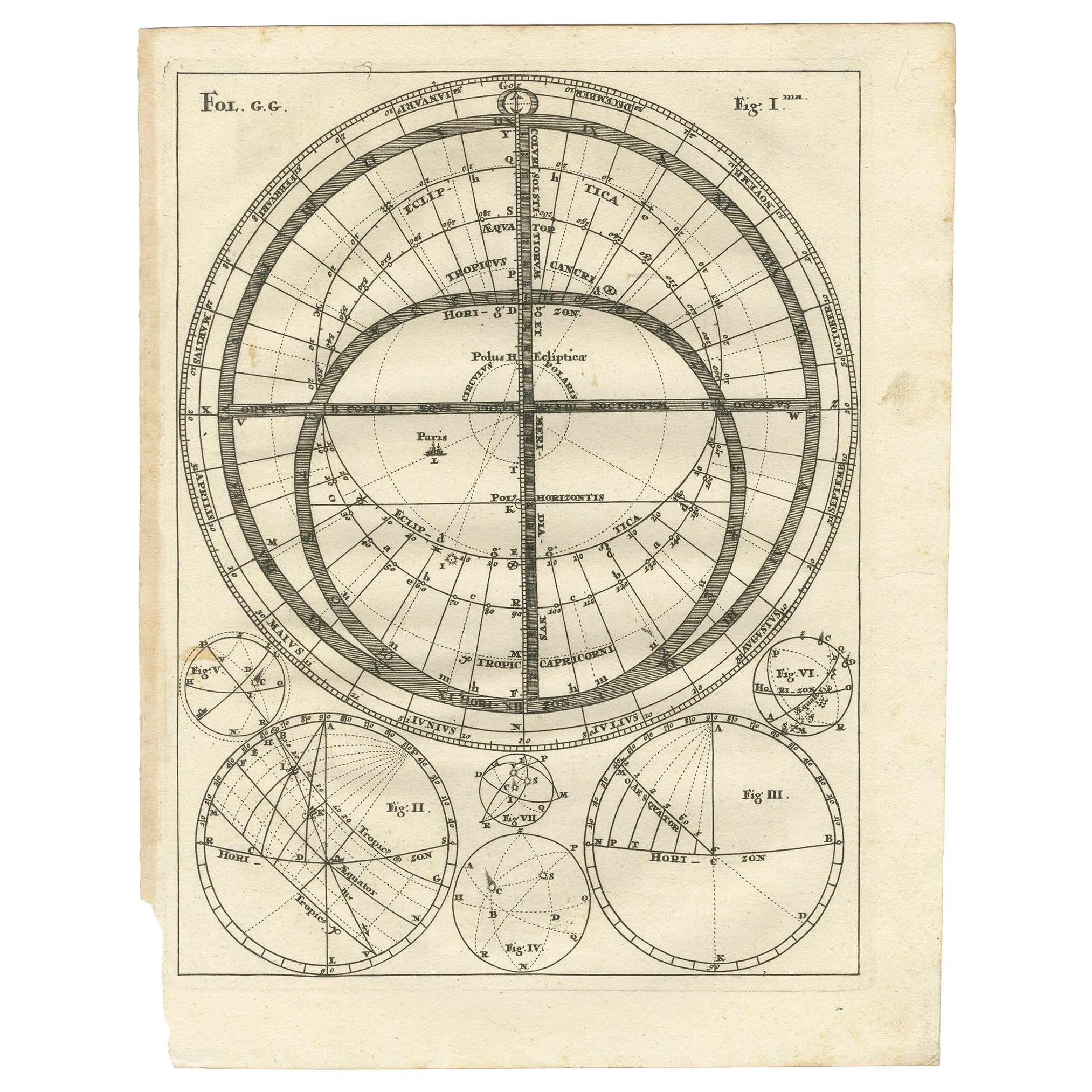
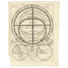
- Antique Print with Charts of Hemispheres by Scherer, c.1703Located in Langweer, NLVarious antique charts of hemispheres illustrating the positioning of the earth. Printed for Scherer's 'Atlas Novus' (1702-1710). Artists and Engravers: Heinrich Scherer (1628-1704) was a Professor of Hebrew, Mathematics and Ethics at the University of Dillingen until about 1680. Thereafter he obtained important positions as Official Tutor to the Royal Princes...Category
Antique 18th Century Prints
MaterialsPaper
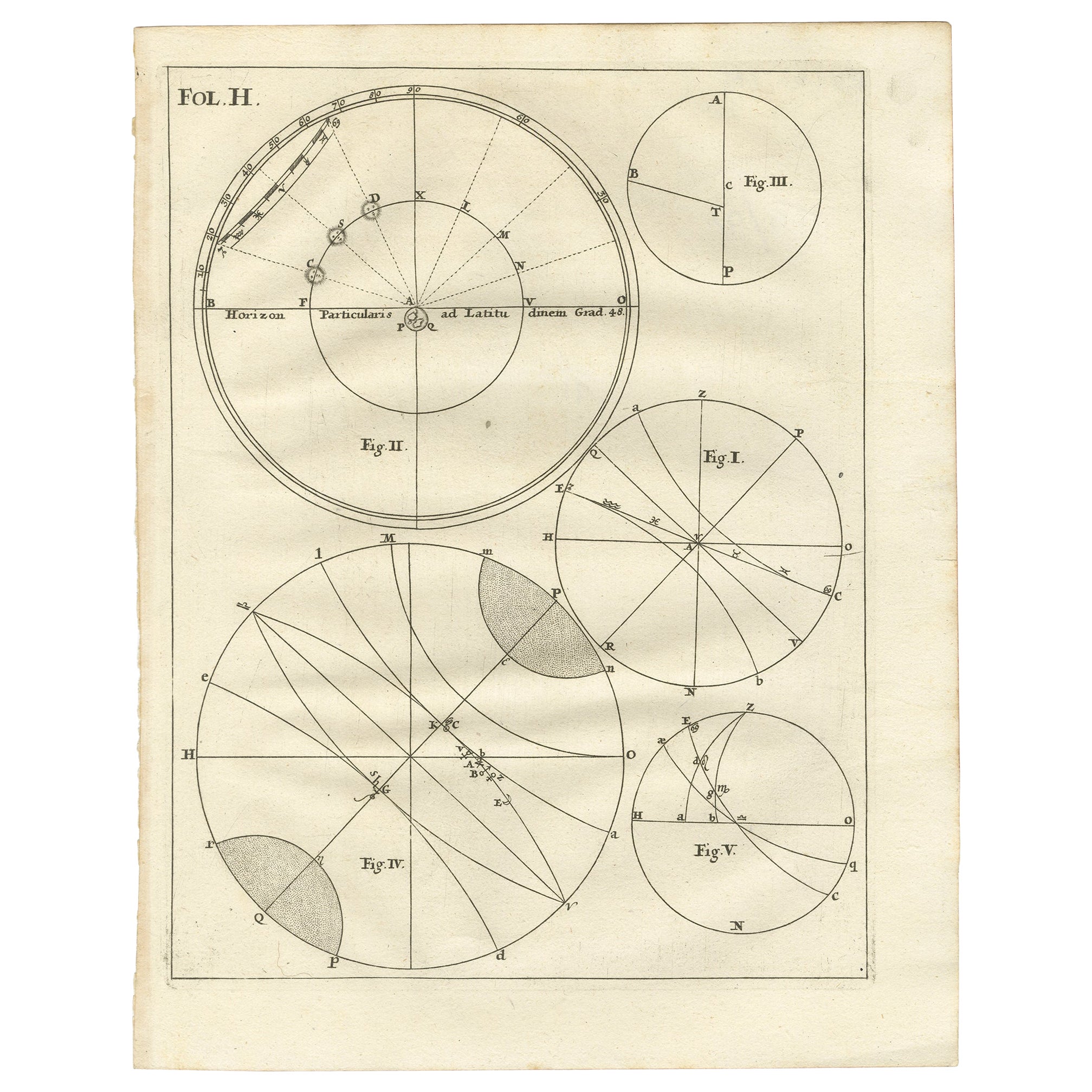
- Antique Print with Various Antique Figures of Hemispheres by Scherer, c.1703Located in Langweer, NLVarious antique figures of hemispheres illustrating the positioning of the earth. Printed for Scherer's 'Atlas Novus' (1702-1710). Artists and Engravers: Heinrich Scherer (1628-1704) was a Professor of Hebrew, Mathematics and Ethics at the University of Dillingen until about 1680. Thereafter he obtained important positions as Official Tutor to the Royal Princes...Category
Antique 18th Century Prints
MaterialsPaper
- Antique Map of part of Europe by Scherer, c.1703Located in Langweer, NLUntitled map of Europe depicting Calais, Münster, Paris, Lion, Prag, Wien, Berlin, Clermont and many other cities. Printed for Scherer's 'Atlas Novus' (1702-1710). Artists and Engrav...Category
Antique 18th Century Maps
MaterialsPaper
- Antique Map of the Eastern Hemisphere by Wyld, 1842Located in Langweer, NLAntique map titled 'Eastern Hemisphere'. Large map depicting the continents Europe, Asia, Afrika and Australia. Artists and Engravers: James Wyld (1812–1887) was a British geograph...Category
Antique 19th Century Maps
MaterialsPaper

You May Also Like
- Map Holy Land La Terre Sainte Engraved van Loon Published N de Fer 1703 FrenchLocated in BUNGAY, SUFFOLKLa Terre Sainte, The Holy Land, Tiree Des Memoires De M.De.La Rue. Par N. de Fer. Geographe de Sa Majeste Catoliq et de Monseigneur le Dauphin. Avec Privil du Roi 1703 Detailed map of the Holy Land from Nicholas de Fer's L'Atlas Curieux ou le Monde. East is oriented at the top. MAKER Nicolas de Fer 1646-1720 The French cartographer and engraver, Nicolas de Fer, was a master at creating maps that were works of art. The maps that he published were printed during the Baroque period when the decorative arts were characterized by ornate detail. De Fer’s detailed maps and atlases were valued more for their decorative content than their geographical accuracy. Nicolas de Fer was born in 1646. His father, Antoine de Fer, owned a mapmaking firm. At the age of twelve, Nicolas was apprenticed to a Parisian engraver named Louis Spirinx. The family business was starting to decline when his father died in 1673. Nicolas de Fer’s mother, Genevieve, took over the business after the death of her husband. In 1687 the business was passed on to Nicolas and the profits increased after he took over the firm. Nicolas de Fer was a prolific cartographer who produced atlases and hundreds of single maps. He eventually became the official geographer to King Louis XIV of France and King Philip V...Category
Antique Early 1700s French Louis XIV Maps
MaterialsPaper
- Original Antique Map of Indonesia, 1861Located in St Annes, LancashireGreat map of Indonesia Drawn and engraved by Edward Weller Original color Published in The Weekly Dispatch Atlas, 1861 Repairs to minor e...Category
Antique 1860s English Victorian Maps
MaterialsPaper

- Large Original Antique Map of Ireland by Sidney Hall, 1847Located in St Annes, LancashireGreat map of Ireland Drawn and engraved by Sidney Hall Steel engraving Original colour outline Published by A & C Black. 1847 Unframed Free shipping.Category
Antique 1840s Scottish Maps
MaterialsPaper
- Large Original Antique Map of Poland by Sidney Hall, 1847Located in St Annes, LancashireGreat map of Poland Drawn and engraved by Sidney Hall Steel engraving Original colour outline Published by A & C Black. 1847 Unframed ...Category
Antique 1840s Scottish Maps
MaterialsPaper
- Large Original Antique Map of Asia by Sidney Hall, 1847Located in St Annes, LancashireGreat map of Asia Drawn and engraved by Sidney Hall Steel engraving Original colour outline Published by A & C Black. 1847 Unframed Free shippingCategory
Antique 1840s Scottish Maps
MaterialsPaper
- Original Antique Map of Cyprus. Circa 1880Located in St Annes, LancashireGreat map of Cyprus Drawn and Engraved by R.Walker Published W.Mackenzie, London Original colour Unframed.Category
Antique 1880s English Maps
MaterialsPaper


Recently Viewed
View AllMore Ways To Browse
18th C Interior
Bavaria Antique
Antique Hebrew
Antique Bavaria
Antique Hemisphere Maps
Hebrew Antique
Hemisphere World Map
Heinrich Bavaria
Map Bavaria
Map Of Bavaria
Hand Painted Antique Map
Antique Furniture Depot
17th Century Scottish
Antique Road Maps
Antique Road Map
Antique Map Of Mexico
Antique Maps Of Mexico
Antique Style Atlas