18th Century European Maps
5
to
43
214
111
268
242
62
48
41
21
19
18
12
8
8
7
7
5
5
5
5
4
4
4
3
3
3
3
2
2
1
1
1
1
1
1
1
1
1
1
19
18
9
7
3
Sort By
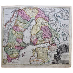
Scandinavia & Portions of Eastern Europe: 18th Century Hand-Colored Homann Map
By Johann Baptist Homann
Located in Alamo, CA
An early 18th century hand-colored copper-plate map entitled "Regni Sueciae in omnes suas
Category
Antique Early 18th Century German Maps
Materials
Paper
H 20.75 in W 23.5 in D 0.07 in
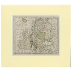
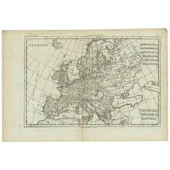
Antique Map of Europe by Krevelt '1786'
Located in Langweer, NL
Antique map titled 'Nieuwe Generale Kaart van Europa (..)'. Original antique map of Europe. This
Category
Antique Late 18th Century Maps
Materials
Paper
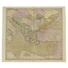
Antique Map of Turkey in Europe, c.1780
Located in Langweer, NL
Antique map titled 'Bowles's new pocket map of Turky in Europe divided into its Provinces'. Large
Category
Antique 18th Century Maps
Materials
Paper
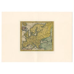
Antique Map of Europe by Hederichs, circa 1740
Located in Langweer, NL
Antique map titled 'Europa Christiani Orbis Domina'. Rare miniature map of Europe. This map
Category
Antique Mid-18th Century Maps
Materials
Paper
Antique Map of Europe by R. Bonne, 1780
Located in Langweer, NL
A fine example of Rigobert Bonne and Guilleme Raynal’s 1780 map of Europe. Drawn by R. Bonne for G
Category
Antique Late 18th Century Maps
Materials
Paper
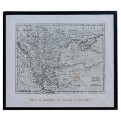
Map Turkey in Europe & Hungary Thomas Kitchin, 1783
Located in BUNGAY, SUFFOLK
Thomas Kitchen (1718 - 1784) : Map of Turkey in Europe & Hungary 1783
Visible sheet within the
Category
Antique 18th Century English Georgian Maps
Materials
Paper
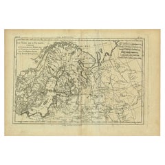
Antique Map of Northern Europe by Bonne, c.1780
Located in Langweer, NL
maps generally abandon such common 18th century decorative features such as hand coloring, elaborate
Category
Antique 18th Century Maps
Materials
Paper
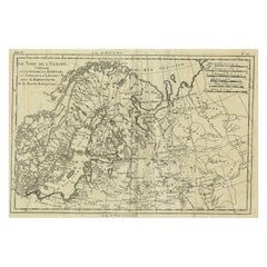
Antique Map of Northern Europe and European Russia, ca.1780
Located in Langweer, NL
maps generally abandon such common 18th century decorative features such as hand coloring, elaborate
Category
Antique 1780s Maps
Materials
Paper
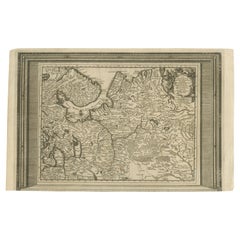
Antique Map of European Russia with Picture Frame Border
Located in Langweer, NL
Antique map titled 'La Moscovie Septentrionale (..)'. Decorative example of van der Aa's map of the
Category
Antique Early 18th Century Maps
Materials
Paper
French Antique Map of France and Western Europe, 1765
By G. A. Rizzi-zannoni
Located in Langweer, NL
France and western Europe. This map originates from 'Atlas Historique de la France Ancienne et Moderne
Category
Antique 18th Century Maps
Materials
Paper
Antique Map of European Russia by Tirion, c.1725
Located in Langweer, NL
te Amsterdam by Isaak Tirion'. Detailed map of European Russia.
Artists and Engravers: Isaak
Category
Antique 18th Century Maps
Materials
Paper
Antique Map of Europe by Keizer & de Lat, 1788
Located in Langweer, NL
Antique map titled 'Kaartje van Europa (..)'. Uncommon original antique map of Europe. This map
Category
Antique Late 18th Century Maps
Materials
Paper
South America: Hand-colored 18th Century Framed Map by Thomas Jefferys
By Thomas Jefferys
Located in Alamo, CA
This detailed hand-colored map of South America by Thomas Jefferys was published in London in 1750
Category
Antique Mid-18th Century English Maps
Materials
Paper
Remarkable Antique Map of West Europe by Scherer, circa 1703
Located in Langweer, NL
European mapmaking at the beginning of the 18th century.
Condition: Very good. Minor age-related toning
Category
Antique 18th Century Maps
Materials
Paper
Antique Map of Germany During the Mid-18th Century, Published in 1747
Located in Langweer, NL
Antique map Germany titled 'A New & Accurate Map of Germany'. It covers Germany during the mid-18th
Category
Antique 18th Century Maps
Materials
Paper
Large Antique Map of Europe, Showing the Empire of Charlemagne
Located in Langweer, NL
Antique map titled 'Imperium Caroli Magni (..)'. Large antique map of Europe, showing the Empire of
Category
Antique Late 18th Century Maps
Materials
Paper
Detailed Original Antique Map of Turkey in Europe, circa 1740
Located in Langweer, NL
Antique map Turkish Empire tilted 'Turky in Europe'. Beautiful, small antique map depicting modern
Category
Antique 18th Century Maps
Materials
Paper
Antique Map of Europe with Elaborate Title Cartouche, c.1750
Located in Langweer, NL
Antique map of Europe titled 'Europa Secundum legitimas Projectionis Stereographicae regulas et
Category
Antique 18th Century Maps
Materials
Paper
Antique Map of Turkey in Europe by Russell, circa 1795
Located in Langweer, NL
Antique map titled 'Turkey in Europe and Hungary'. Original map of Turkey in Europe. Covers present
Category
Antique Late 18th Century Maps
Materials
Paper
Antique Map of part of Europe by Scherer, c.1703
Located in Langweer, NL
revolutionary work in terms of the development of European mapmaking at the beginning of the 18th Century
Category
Antique 18th Century Maps
Materials
Paper
West Africa Entitled "Guinea Propria": An 18th Century Hand Colored Homann Map
By Johann Baptist Homann
Located in Alamo, CA
popular location for trade between Africa, Europe and the Americas in the 18th century.
The very
Category
Antique Mid-18th Century German Maps
Materials
Paper
H 20.5 in W 23.5 in D 0.13 in
18th Century Hand-Colored Homann Map of Germany, Including Frankfurt and Berlin
By Johann Baptist Homann
Located in Alamo, CA
An 18th century hand-colored map entitled "Tabula Marchionatus Brandenburgici et Ducatus Pomeraniae
Category
Antique Early 18th Century German Maps
Materials
Paper
H 20.25 in W 23.5 in D 0.07 in
Antique Map of European Trade in Asia by Pluche, 1742
Located in Langweer, NL
Map pag. 444: 'Le commerce des Europeens en Asie.' (The commerce / trade of the Europeans in Asia
Category
Antique 18th Century Maps
Materials
Paper
Antique Map of Western Europe and Spain by Scherer, circa 1703
Located in Langweer, NL
European mapmaking at the beginning of the 18th Century.
Condition: Very good. General age-related
Category
Antique 18th Century Maps
Materials
Paper
Hand-Colored 18th Century Homann Map of the Danube, Italy, Greece, Croatia
By Johann Baptist Homann
Located in Alamo, CA
the leading map publisher in Germany and an important entity in the European map market. In 1715
Category
Antique Early 18th Century German Maps
Materials
Paper
H 20 in W 23.88 in D 0.07 in
Antique Map of Russia in Europe by T. Kitchin, circa 1770
Located in Langweer, NL
interesting and attractive early 19th century map of Russia in Europe which was engraved by Thomas Kitchin
Category
Antique Late 18th Century Maps
Materials
Paper
Interesting Map of Great Britain and Northern Europe with various Illustrations
Located in Langweer, NL
Europe. The map shows Edwards' journeys between 1716-1730 to study his beloved birds and other natural
Category
Antique Mid-18th Century Maps
Materials
Paper
H 11.23 in W 8.9 in D 0.02 in
Antique Map of the Russian Empire in Europe by Vaugondy, 1750
Located in Langweer, NL
collection includes a wide range of authentic antique maps from the 16th to the 20th centuries. Buying and
Category
Antique 18th Century Maps
Materials
Paper
Rare Antique Bible Map of Southern Europe by A. Schut, 1743
Located in Langweer, NL
Antique map of the Mediterranean and a large part of Europe, illustrating the voyage of St. Paul to
Category
Antique Mid-18th Century Maps
Materials
Paper
Hand Colored 18th Century Homann Map of Austria Including Vienna and the Danube
By Johann Baptist Homann
Located in Alamo, CA
European map market. In 1715, Johann was named Imperial Geographer to the Holy Roman Empire by Charles VI
Category
Antique Early 18th Century German Maps
Materials
Paper
H 20.25 in W 23.63 in D 0.07 in
Intriguing Antique Map of Europe, Asia and Africa by Scherer, c.1703
Located in Langweer, NL
in terms of the development of European mapmaking at the beginning of the 18th Century.
Condition
Category
Antique 18th Century Maps
Materials
Paper
Finely Engraved Antique Map of Europe with inset of America, c.1745
By Guillaume De L'Isle
Located in Langweer, NL
influential Geographers of the early 18th century in France. Claude de L'Isle, born 1644, had four sons, of
Category
Antique 18th Century Maps
Materials
Paper
Hand-Colored 18th Century Homann Map of Denmark and Islands in the Baltic Sea
By Johann Baptist Homann
Located in Alamo, CA
An 18th century copper plate hand-colored map entitled "Insulae Danicae in Mari Balthico Sitae
Category
Antique Early 18th Century German Maps
Materials
Paper
H 20.25 in W 23.25 in D 0.07 in
Hand-Colored 18th Century Homann Map of the Black Sea, Turkey and Asia Minor
By Johann Baptist Homann
Located in Alamo, CA
An attractive original early 18th century hand-colored map of the Black Sea and Turkey entitled
Category
Antique Early 18th Century German Maps
Materials
Paper
H 20 in W 23.63 in D 0.07 in
Antique Map of North Europe and East Asia by Vaugondy, circa 1750
Located in Langweer, NL
Antique map titled 'Carte des parties nord et est de L'Asie'. Map of the Northern parts and East
Category
Antique Mid-18th Century Maps
The Kingdom of Naples and Southern Italy: A Hand-Colored 18th Century Homann Map
By Johann Baptist Homann
Located in Alamo, CA
and an important entity in the European map market. In 1715, Johann was named Imperial Geographer to
Category
Antique Early 18th Century German Maps
Materials
Paper
H 20 in W 23.88 in D 0.07 in
Rare Antique Map of Part of Europe and Africa by Scherer, C.1703
Located in Langweer, NL
the development of European mapmaking at the beginning of the 18th Century.
Condition: Very good
Category
Antique 18th Century Maps
Materials
Paper
Antique Map of Europe Stretching from Northern Africa to the Baltic Sea, 1719
Located in Langweer, NL
conquestes'. Original antique map of Europe stretching from northern Africa to the Baltic Sea. It shows the
Category
Antique 18th Century Maps
Materials
Paper
H 17.52 in W 20.28 in D 0 in
California, Alaska and Mexico: 18th Century Hand-Colored Map by de Vaugondy
By Didier Robert de Vaugondy
Located in Alamo, CA
This an 18th century hand-colored map of the western portions of North America entitled "Carte de
Category
Antique 1770s French Maps
Materials
Paper
H 13.75 in W 16.63 in D 0.13 in
Antique Map of the Northern Coast of Africa and Southern Europe, circa 1745
By Covens & Mortier
Located in Langweer, NL
Antique map titled 'In Notitiam Ecclesiasticam Africae Tabula Geographica'. Very decorative hand
Category
Antique Mid-18th Century Maps
Materials
Paper
H 21.07 in W 25.4 in D 0.02 in
Intriguing Antique Map of Europe, the Middle East and Africa by Scherer, c.1703
Located in Langweer, NL
Antique map depicting part of Africa, Europe and the Middle East. Also showing various cities in
Category
Antique 18th Century Maps
Materials
Paper
H 10.63 in W 8.27 in D 0 in
Antique Map of the British Isles and Part of Europe by Chatelain, c.1720
Located in Langweer, NL
Antique map titled 'Carte pour l'Intelligence de l'Histoire d'Angleterre (..)'. Decorative map
Category
Antique 18th Century Maps
Materials
Paper
H 16.93 in W 19.89 in D 0 in
Antique Carte de L'Inde Myanmar, Malaysia Vietnam Map of Asia the Chinese Empire
Located in Amsterdam, Noord Holland
Asia.
Additional information:
Type: Map
Country of Manufacturing: Europe
Period: 18th century Qing
Category
Antique 18th Century European Maps
Materials
Paper
H 12.09 in W 16.15 in D 0.04 in
Old Engraved Map of Hungary, European Balkan Countries, Greece and Crete, 1806
Located in Langweer, NL
Maison Delamarche map publishing firm in the late 18th century. A lawyer by trade Delamarche entered the
Category
Antique 19th Century Maps
Materials
Paper
H 15.08 in W 11.34 in D 0 in
Captain Cook's Exploration of Tahiti 18th C. Hand-Colored Map by Bellin
By Jacques-Nicolas Bellin
Located in Alamo, CA
This beautiful 18th century hand-colored copper plate engraved map is entitled "Carte de l'Isle de
Category
Antique Mid-18th Century French Maps
Materials
Paper
H 11.38 in W 17.5 in D 0.13 in
Antique Map Made After a Roman Papyrus Travel Map, Known as Peutinger Map, 1773
Located in Langweer, NL
map is a 13th-century parchment copy of a possible Roman original. It covers Europe (without the
Category
Antique 18th Century Maps
Materials
Paper
H 15.56 in W 18.51 in D 0 in
Framed 1731 Color Engraving, Map of Rotterdam by Matthaus Seutter, "Roterodami"
Located in Bridgeport, CT
"Roterodami". Seutter (1678-1757) was an important German 18th century map maker. Bird's eye view
Category
Antique 18th Century European Renaissance Maps
Materials
Glass, Wood, Paper
H 29.75 in W 32.75 in D 1 in
Map of the Republic of Genoa
Located in New York, NY
, and Parma.
Europe, late 18th century.
Dimension: 25.75 " W x 22.5" H x .75" D; sight 23.25" W x
Category
Antique Late 18th Century European Maps
Matthaus Seutter, Framed 1730 Color Engraving Map of "Belgium Fonderatum"
Located in Bridgeport, CT
Belgica". Figural decoration upper left. M. Seutter was a famed German mapmaker in the 18th c. There is a
Category
Antique 18th Century European Renaissance Maps
Materials
Brass
H 27.5 in W 31 in D 0.75 in
Antique Map of Friesland Also Know as the Peacock Map, C.1580
Located in Langweer, NL
a lot across Europe. He established a business in dealing with books and drawing maps. His first
Category
Antique 18th Century Maps
Materials
Paper
Antique French Map of Asia Including China Indoneseia India, 1783
Located in Amsterdam, Noord Holland
Very nice map of Asia. 1783 Dedie au Roy.
Additional information:
Country of Manufacturing: Europe
Category
Antique 18th Century European Maps
Materials
Paper
Super Rare Antique French Map of Chine and the Chinese Empire, 1780
Located in Amsterdam, Noord Holland
Made by Bonne.
Additional information:
Type: Map
Country of Manufacturing: Europe
Period: 18th century
Category
Antique 18th Century European Maps
Materials
Paper
Antique Map of Gambia, West Africa
Located in Langweer, NL
Antique map titled 'Carte du Cours de la Riviere de Gambra ou Gambie (..)'. Detailed map of Gambia
Category
Antique Mid-18th Century Maps
Materials
Paper
Antique Map of Celebes 'Sulawesi, Indonesia' by Bellin, ciarca 1755
By Jacques-Nicolas Bellin
Located in Langweer, NL
Antique map titled 'Carte de l'Isle Celebes ou Macassar'. Map of Celebes (Sulawesi, Indonesia
Category
Antique Mid-18th Century European Maps
Materials
Paper
Antique Map of Switzerland by Homann, 1753
Located in Langweer, NL
a major place in the European map market throughout the eighteenth century. Founded in 1702 by
Category
Antique 18th Century Maps
Materials
Paper
Antique Map of France by Homann, 1738
Located in Langweer, NL
Engravers: Homann Heirs was a German publishing firm that enjoyed a major place in the European map market
Category
Antique 18th Century Maps
Materials
Paper
Antique Map of Tartary and Northeast Asia by Bellin, circa 1750
By Jacques-Nicolas Bellin
Located in Langweer, NL
Antique map titled 'Carte de la Tartarie Occidentale'. Map of Tartary and northeast Asia, from Lake
Category
Antique Mid-18th Century European Maps
Materials
Paper
Antique Map of France by Bowen, c.1790
Located in Langweer, NL
the 20th centuries. Buying and collecting antique maps is a tradition that goes back hundreds of years
Category
Antique 18th Century Maps
Materials
Paper
Engraving of a Map of Florida, the Gulf Coast, Caribbean & Central America, 1728
Located in Langweer, NL
early 18th-century mapmaking.
The map showcases a meticulous and comprehensive depiction of Florida
Category
Antique Mid-18th Century European Maps
Materials
Paper
Free Shipping
H 24.61 in W 40.56 in D 0.02 in
Antique Map Depiciting a Horizon or Hemisphere c.1703
Located in Langweer, NL
the development of European mapmaking at the beginning of the 18th Century.
Condition: Very good
Category
Antique 18th Century Maps
Materials
Paper
- 1
Get Updated with New Arrivals
Save "18 Th Century European Maps", and we’ll notify you when there are new listings in this category.
18th Century European Maps For Sale on 1stDibs
At 1stDibs, there are several options of 18th century European maps available for sale. The range of distinct 18th century European maps — often made from paper, wood and fabric — can elevate any home. 18th century European maps have long been popular, with older editions for sale from the 18th Century and newer versions made as recently as the 21st Century. 18th century European maps made by mid-century modern designers — as well as those associated with Georgian — are very popular at 1stDibs. 18th century European maps have been a part of the life’s work for many furniture makers, but those produced by Johann Baptist Homann, Jacques-Nicolas Bellin and G. A. Rizzi-zannoni are consistently popular.
How Much are 18th Century European Maps?
The average selling price for at 1stDibs is $596, while they’re typically $58 on the low end and $425,000 highest priced.
