Items Similar to Colorful Detailed Antique Map of England and Wales (South Part), 1882


Want more images or videos?
Request additional images or videos from the seller
1 of 6
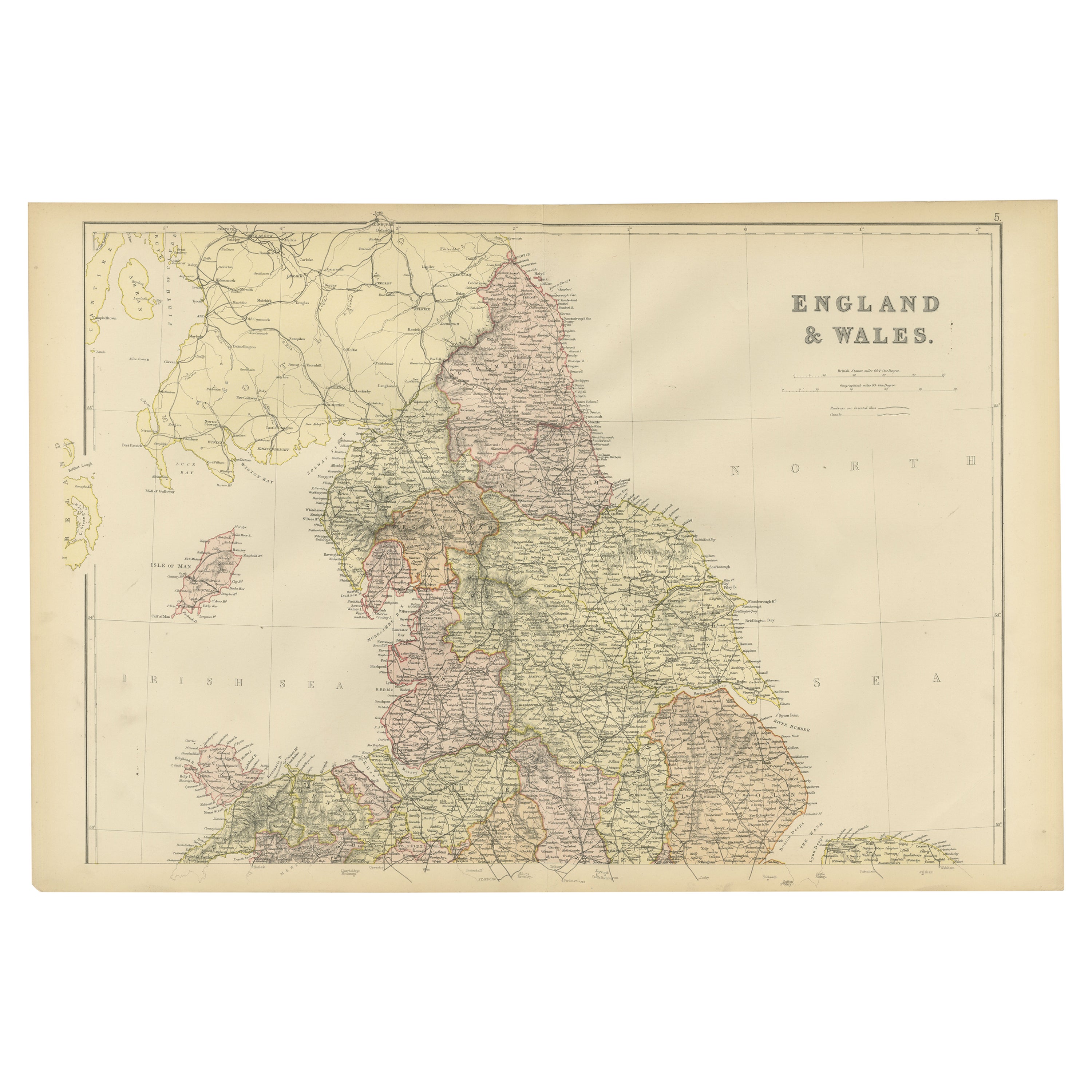
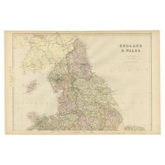
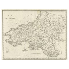
Colorful Detailed Antique Map of England and Wales (South Part), 1882
About the Item
Embark on a Journey Through the Southern Part of 'England and Wales' with this Exquisite Antique Map! This map provides a vivid portrayal of the captivating landscapes and cultural heritage of the southern regions of England and Wales and includes a small inset of the Isles of Scilly of the coast of Cornwall.
Delve into the intricate details meticulously etched onto this vintage masterpiece, capturing the essence of the southern territories. With remarkable precision, the map unfolds the geographical intricacies, towns, and natural splendor of these historic regions, offering a window into their rich historical tapestry.
Tailored for history connoisseurs, cartography devotees, and admirers of English and Welsh history, this map is a gateway to the past. Its portrayal of localities, rivers, and landmarks evokes the essence of these regions, encapsulating their distinctive allure and historical significance.
Whether displayed proudly in a collector's chamber, enhancing the ambiance of a home, or serving as an educational tool for enthusiasts and students, this map holds timeless fascination. Take a step back in time and immerse yourself in the landscapes of the southern part of England and Wales through the captivating lens of this remarkable antique map!
- Dimensions:Height: 14.97 in (38 cm)Width: 22.45 in (57 cm)Depth: 0 in (0.02 mm)
- Materials and Techniques:
- Period:
- Date of Manufacture:1882
- Condition:Good condition, folding line in the middle. The outer borders are slightly yellowish discolored due to age, but not the image. Very slight soil of a fingerprint from handling on lower left. This map is ideal for framing. Study the image carefully.
- Seller Location:Langweer, NL
- Reference Number:
About the Seller
5.0
Platinum Seller
These expertly vetted sellers are 1stDibs' most experienced sellers and are rated highest by our customers.
Established in 2009
1stDibs seller since 2017
1,916 sales on 1stDibs
Typical response time: <1 hour
- ShippingRetrieving quote...Ships From: Langweer, Netherlands
- Return PolicyA return for this item may be initiated within 14 days of delivery.
More From This SellerView All
- Colorful Detailed Antique Map of England and Wales, 1882Located in Langweer, NLExplore the Historic Splendor of 'England and Wales' with this Antique Map! Part of a distinguished collection, this map presents a captivating view of the enchanting landscapes, cit...Category
Antique 1880s Maps
MaterialsPaper
- Antique Map of England and Wales by Johnston, 1882Located in Langweer, NLAntique map titled 'England and Wales'. Old map of England and Wales, with an inset map of Scilly Islands. This map originates from 'The Royal Atlas of Modern Geography, Exhibiting, ...Category
Antique 19th Century Maps
MaterialsPaper
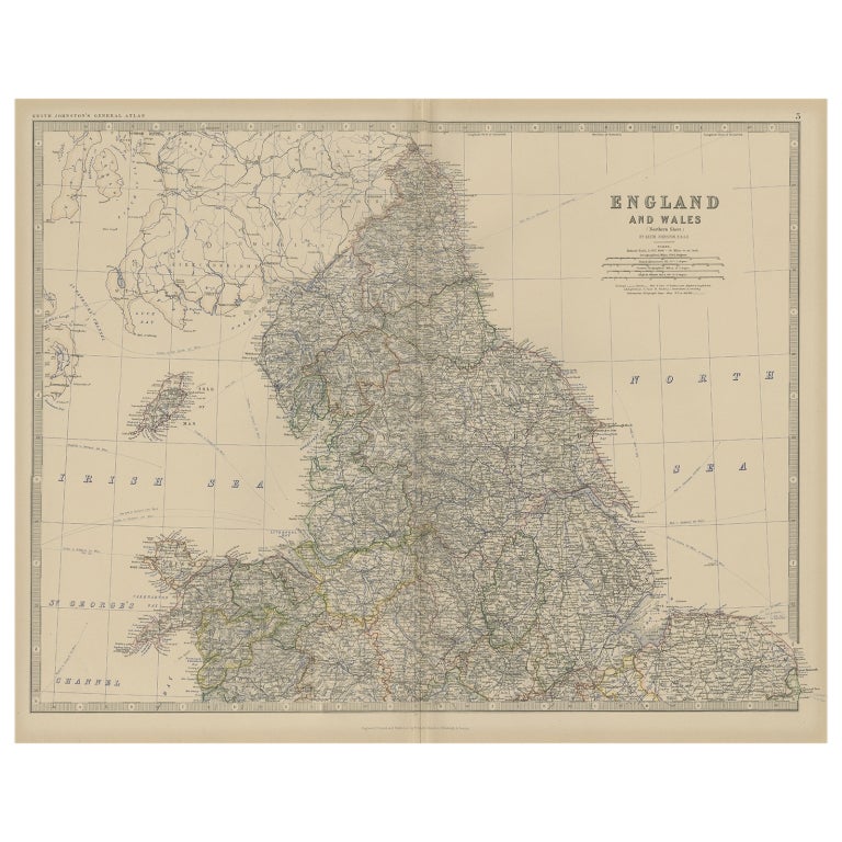
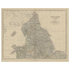
- Antique Map of, Northern England and Wales by Johnston, 1882Located in Langweer, NLAntique map titled 'England and Wales'. Old map of England and Wales. This map originates from 'The Royal Atlas of Modern Geography, Exhibiting, in a Series of Entirely Original an...Category
Antique 19th Century Maps
MaterialsPaper
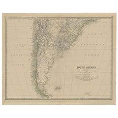
- Antique Map of South America, Southern Part, 1882Located in Langweer, NLAntique map titled 'South America'. Old map of South America. This map originates from 'The Royal Atlas of Modern Geography, Exhibiting, in a Series of Entirely Original and Authenti...Category
Antique 19th Century Maps
MaterialsPaper
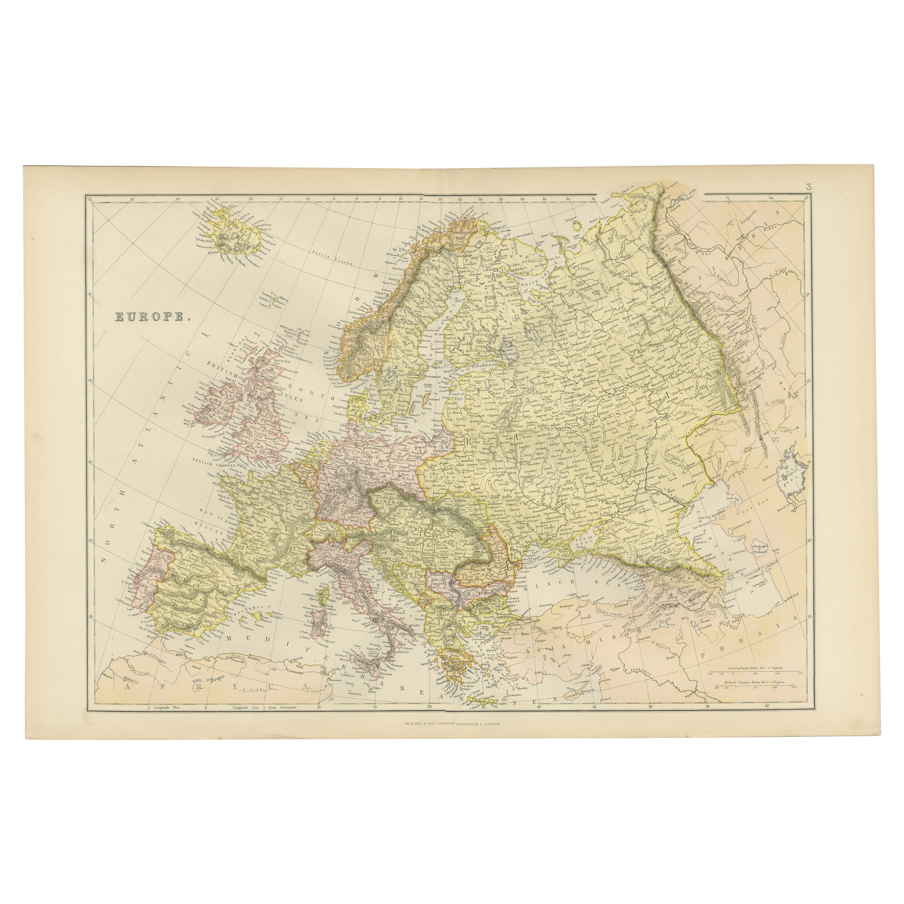
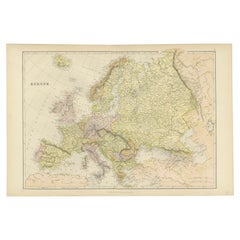
- Colorful Detailed Antique Map of Europe, Published in 1882Located in Langweer, NL"The Antique Map of Europe from 'The Comprehensive Atlas and Geography of the World,' published in 1882 by Blackie & Son, is a testament to meticulous cartography and scholarly preci...Category
Antique 1880s Maps
MaterialsPaper
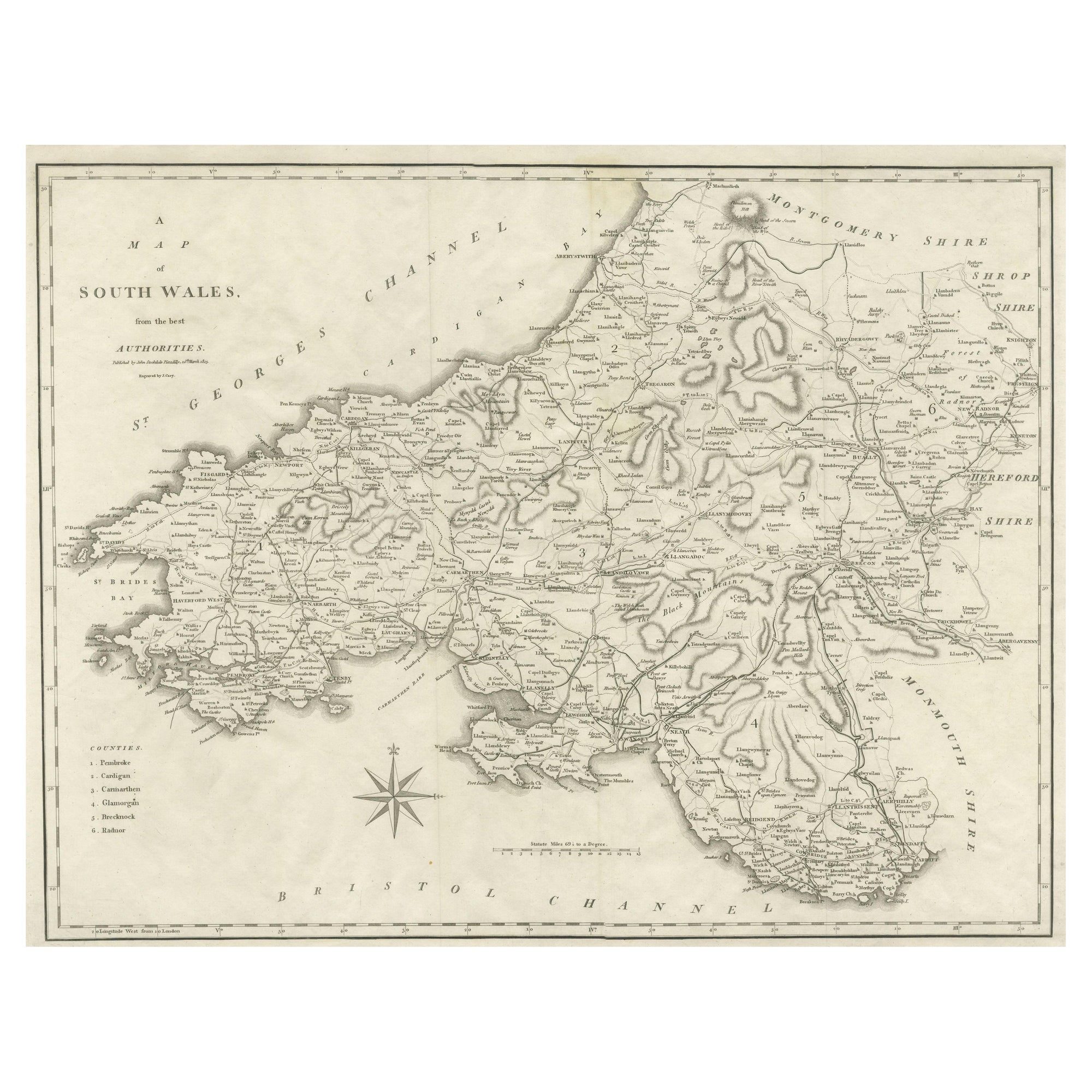
- Large Antique County Map of South Wales, EnglandLocated in Langweer, NLAntique map titled 'A Map of South Wales from the best Authorities'. Original old county map of South Wales, England. Engraved by John Cary. Originates from 'New British Atlas' by Jo...Category
Antique Early 19th Century Maps
MaterialsPaper

You May Also Like
- Large Original Vintage Map of New South Wales, Australia, circa 1920Located in St Annes, LancashireGreat map of New South Wales Original color. Good condition Published by Alexander Gross Unframed.Category
Vintage 1920s English Edwardian Maps
MaterialsPaper
- Original Antique Map of South America, circa 1830Located in St Annes, LancashireGreat map of South America Copper plate engraving Published by Butterworth, Livesey & Co., circa 1830 Unframed.Category
Antique Early 1800s English Other Maps
MaterialsPaper
- Original Antique Map of South Africa, Arrowsmith, 1820Located in St Annes, LancashireGreat map of South Africa. Drawn under the direction of Arrowsmith. Copper-plate engraving. Published by Longman, Hurst, Rees, Orme and Br...Category
Antique 1820s English Maps
MaterialsPaper
- Old Horizontal Map of EnglandBy TassoLocated in Alessandria, PiemonteST/520 - Old rare Italian map of England, dated 1826-1827 - by Girolamo Tasso, editor in Venise, for the atlas of M.r Le-Sage.Category
Antique Early 19th Century Italian Other Prints
MaterialsPaper
- Original Antique Map of South East Asia, Arrowsmith, 1820Located in St Annes, LancashireGreat map of South East Asia Drawn under the direction of Arrowsmith Copper-plate engraving Published by Longman, Hurst, Rees, Orme and Brown, 1820 Unframed.Category
Antique 1820s English Maps
MaterialsPaper
- Large Original Antique Map of South Carolina, USA, 1894By Rand McNally & Co.Located in St Annes, LancashireFabulous map of South Carolina Original color By Rand, McNally & Co. Published, 1894 Unframed Free shipping.Category
Antique 1890s American Maps
MaterialsPaper


Recently Viewed
View AllMore Ways To Browse
Rare Map Of Ireland
Antique European Map Prints
Carl Probst
Mid Century Maps
Levasseur A
Important Map
Asian Bassett
Clivia Ducatus Et Ravestein Dominium
18th Century European Maps
Vintage Nantucket Map
Vintage Nantucket Maps
Rand Mcnally Map Of California
Uruguay Antique Map
Derbyshire Antique Map
Antique Furniture Perth Australia
Tanzania Antique Map
Aigue Marine
Cincinnati Map