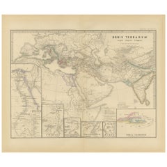
Items Similar to Black Sea in Antiquity: Pontus Euxinus Map, Published in 1880

Want more images or videos?
Request additional images or videos from the seller
1 of 7
Black Sea in Antiquity: Pontus Euxinus Map, Published in 1880
About the Item
This map, titled "PONTUS EUXINUS," depicts the Black Sea region, historically known as the Pontus Euxinus. The Black Sea was central to ancient trade routes and cultural exchange, bordered by several important ancient empires and peoples.
**Features of the map include:**
1. **Regional Focus**: It focuses on the area surrounding the Black Sea, including parts of modern-day Turkey, Russia, Ukraine, Georgia, Bulgaria, and Romania.
2. **Topography**: The map renders the region's complex topography with detailed depictions of mountain ranges, rivers, and the coastline.
3. **Settlements and Cities**: Various symbols and labels indicate the locations of ancient cities, settlements, and other significant sites.
4. **Political Divisions**: Different territories might be color-coded to show the various tribal or political entities that historically bordered the Black Sea.
5. **Insets**: Two inset maps are included:
- The upper left shows the Bosporus Thracius (the Strait of Istanbul), a crucial waterway connecting the Black Sea to the Sea of Marmara.
- The upper right features the Bosporus Cimmerius (the Strait of Kerch), connecting the Black Sea to the Sea of Azov.
6. **Annotations**: There are annotations and labels in Latin, which provide historical context, names of regions, and descriptions of the geographic features.
This map is a valuable historical document, capturing the geography of a region that was a crossroads of commerce, culture, and conflict in antiquity. The detailed cartography would have been especially useful for educational purposes in the late 19th century, when the map was likely published as part of the "Spruner-Menke Atlas Antiquus."
More about Pontus:
The historical region of Pontus is situated on the southern coast of the Black Sea, corresponding to the modern-day northeastern Turkish coast. Here are some key points about its history and significance:
1. **Ancient Kingdom**: In the Hellenistic period, after the fall of the Persian Empire, Pontus emerged as an independent kingdom. It was initially part of the Persian satrapy of Cappadocia and later achieved full independence under the Mithridatic dynasty, especially during the reign of Mithridates VI, also known as Mithridates the Great.
2. **Roman Conflict**: Mithridates VI expanded the kingdom significantly, which eventually led to conflict with Rome. The Mithridatic Wars were a series of three wars fought between Rome and the Kingdom of Pontus in the 1st century BC.
3. **Cultural Melting Pot**: The region was a melting pot of Greek, Persian, and indigenous cultures. Pontus was notably Hellenized, meaning that Greek cultural and linguistic influences were strong, but it also retained much of its Persian and local heritage.
4. **Geopolitical Importance**: Due to its location, Pontus controlled important trade routes and had access to rich resources, making it economically significant in the ancient world.
5. **Roman Province**: After the final defeat of Mithridates VI by Pompey, the region was incorporated into the Roman Empire as the province of Bithynia et Pontus, and later as the separate provinces of Pontus Polemoniacus and Pontus Galaticus.
6. **Byzantine Era**: In the Byzantine period, Pontus remained important due to its strategic location, serving as a buffer zone against invasions from the east and playing a role in trade routes between the Black Sea and the Mediterranean.
7. **Cultural Heritage**: Pontus was also a significant center for early Christianity. The region's mountainous terrain allowed for the establishment of monastic traditions that played a vital role in the spiritual and cultural life of the Byzantine Empire.
8. **Modern Significance**: Today, the historical legacy of Pontus is evident in the architectural ruins, linguistic traces, and cultural practices found in the northeastern region of Turkey.
In summary, Pontus was a region of great strategic, economic, and cultural importance throughout ancient and medieval history, serving as a crossroads between East and West and a bridge between various civilizations.
- Dimensions:Height: 15.56 in (39.5 cm)Width: 18.51 in (47 cm)Depth: 0 in (0.02 mm)
- Materials and Techniques:
- Period:
- Date of Manufacture:1880
- Condition:Good, given age. General age-related toning, especially around the edges. Vertical folding line as issued. Please study scan carefully.
- Seller Location:Langweer, NL
- Reference Number:
About the Seller
5.0
Platinum Seller
These expertly vetted sellers are 1stDibs' most experienced sellers and are rated highest by our customers.
Established in 2009
1stDibs seller since 2017
1,916 sales on 1stDibs
Typical response time: <1 hour
- ShippingRetrieving quote...Ships From: Langweer, Netherlands
- Return PolicyA return for this item may be initiated within 14 days of delivery.
More From This SellerView All
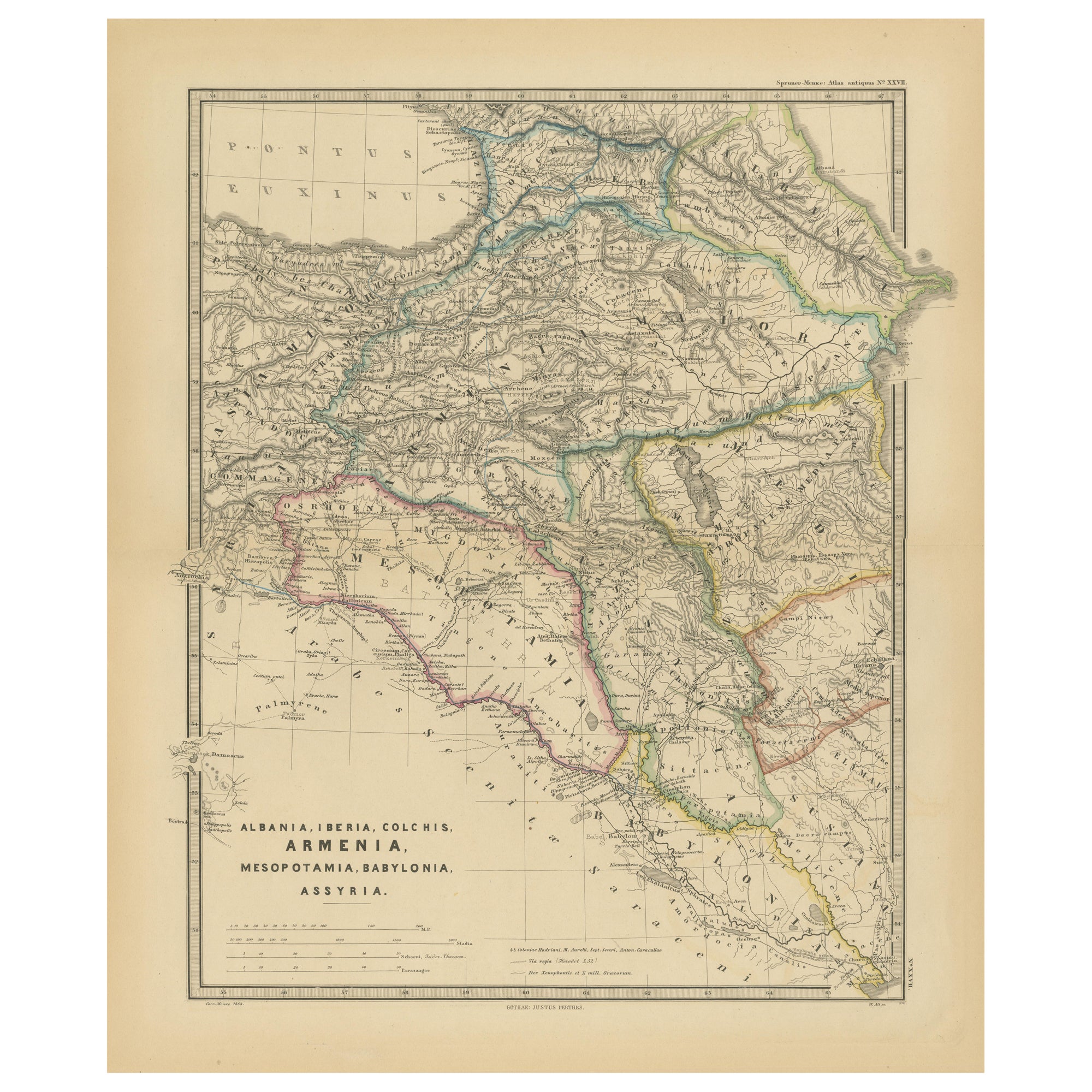
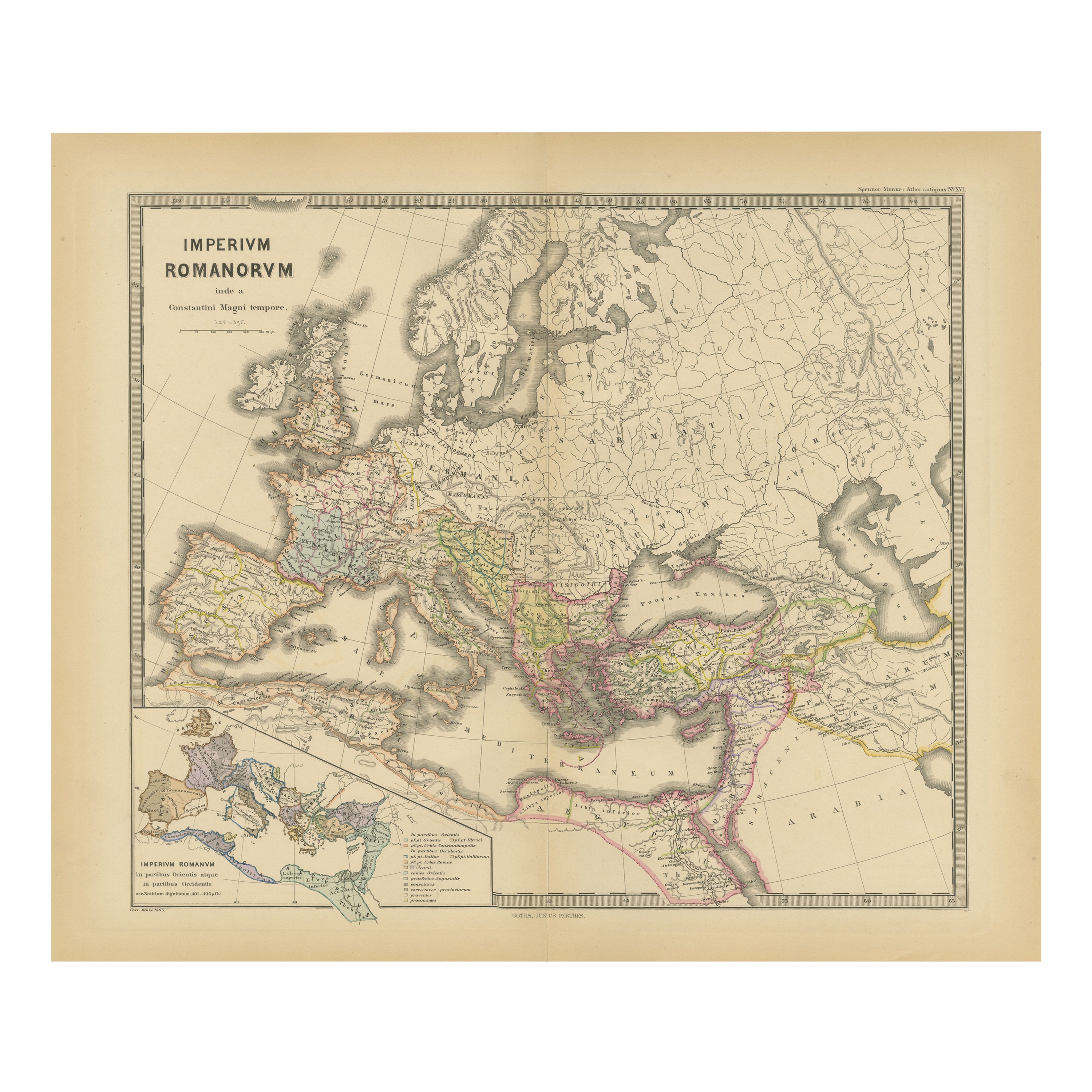
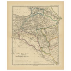
- Ancient Crossroads: Albania to Assyria in Antiquity, Published in 1880Located in Langweer, NLThe map titled "ALBANIA, IBERIA, COLCHIS, ARMENIA, MESOPOTAMIA, BABYLONIA, ASSYRIA" portrays the ancient regions that would encompass parts of modern-day Eastern Turkey, Armenia, Aze...Category
Antique 1880s Maps
MaterialsPaper
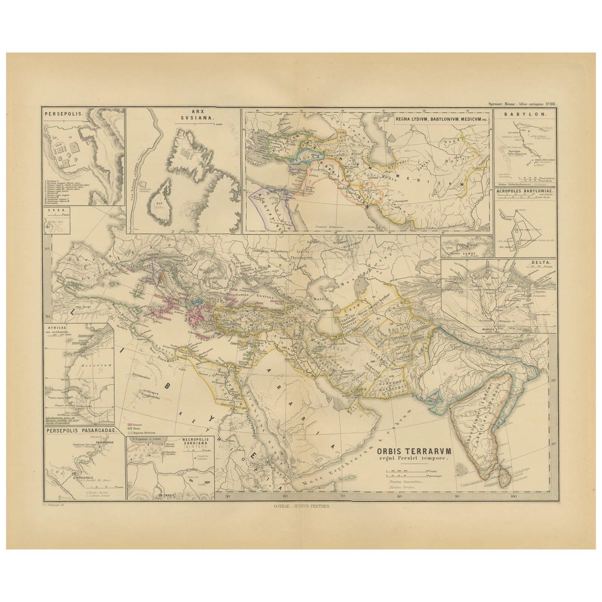
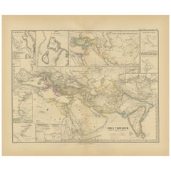
- Empires of Antiquity: The Persian Realm and Beyond Engraved, Published in 1880Located in Langweer, NLThe map is titled "ORBIS TERRARUM regni Persici tempore," which translates from Latin to "The World at the Time of the Persian Empire." This map is particularly interesting for sever...Category
Antique 1880s Maps
MaterialsPaper
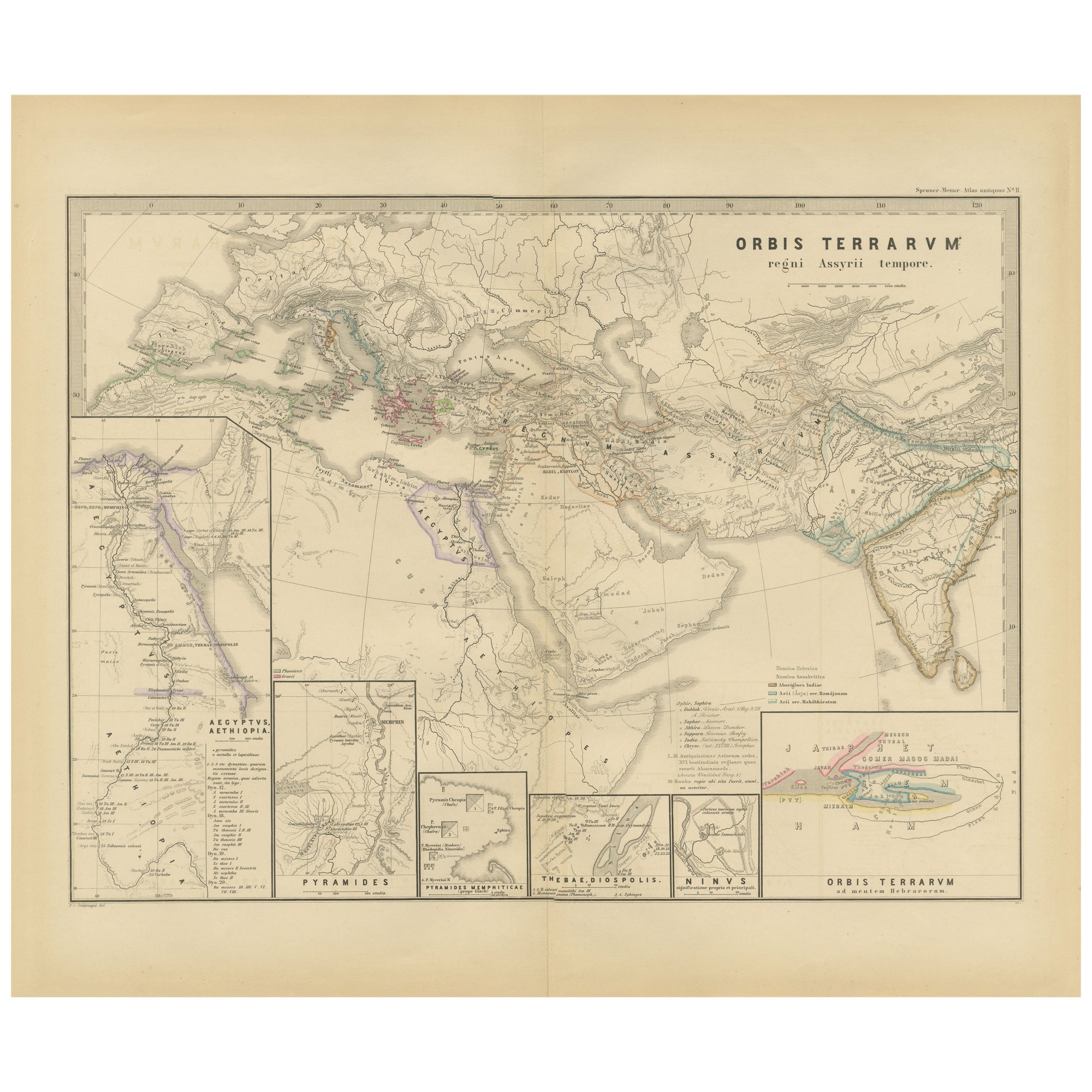
- The World in the Assyrian Empire's Era: A Historical Map, Published in 1880Located in Langweer, NLThis map from the "Spruner-Menke Atlas Antiquus" is titled "ORBIS TERRARVM regni Assyrii tempore," which translates to "The World at the Time of the Assyrian Kingdom." It depicts the...Category
Antique 1880s Maps
MaterialsPaper
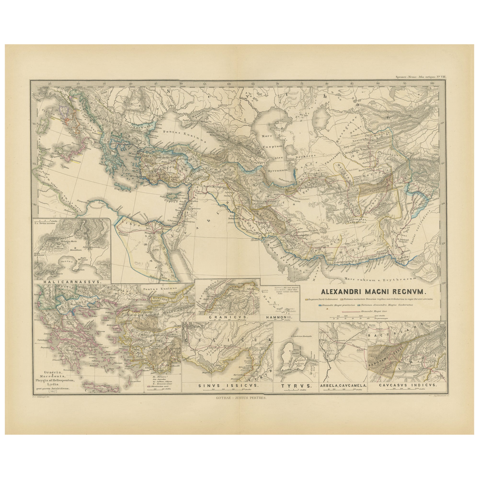
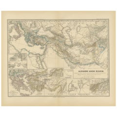
- Antique Map of The Kingdom of Alexander the Great, Published in 1880Located in Langweer, NLThe map is titled "ALEXANDRI MAGNI REGNUM," which translates to "The Kingdom of Alexander the Great." It depicts the vast territories conquered by Alexander the Great during his reig...Category
Antique 1880s Maps
MaterialsPaper
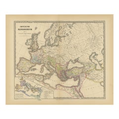
- Old Map of Mediterranean Powers: Pompey to Actium (66-31 BC), Published in 1880Located in Langweer, NLThis is a historical map that depicts the Mediterranean region during a specific timeframe in Roman history, from the return of Pompey the Great after his campaign in Asia Minor to t...Category
Antique 1880s Maps
MaterialsPaper
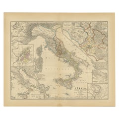
- Antique Map of Italy with Insets of Rome and Major Cities, Published in 1880Located in Langweer, NLThe map titled "ITALIA" depicts the Italian peninsula along with Sicily, Sardinia, and Corsica, labeled with regions such as "Etruria" and cities like "Roma" and "Syracuse". Insets h...Category
Antique 1880s Maps
MaterialsPaper
You May Also Like
- The Machine by K. G. Pontus Hulten (Book)Located in North Yorkshire, GBIn original pressed, painted and hinged aluminium covers with an image of MOMA and a yellow New York taxi cab at the front. This is the exhibition catalogue for an important exhibiti...Category
20th Century Books
MaterialsPaper

- Antique Lithography Map, Black Sea, English, Framed, Cartography, VictorianLocated in Hele, Devon, GBThis is an antique lithography map of the Black Sea region. An English, framed atlas engraving of cartographic interest by John Rapkin, dating to the early Victorian period and later...Category
Antique Mid-19th Century British Early Victorian Maps
MaterialsWood
- Antique Paterson's Guide to Britain, English, Maps, Georgian, Published 1811Located in Hele, Devon, GBThis is an antique copy of Paterson's New and Accurate guide to Direct & Principal Crossroads. An English, bound book of maps and descriptive tables, published in English by Longman,...Category
Antique Early 19th Century British Georgian Books
MaterialsPaper
- Original Antique Map of Cyprus. Circa 1880Located in St Annes, LancashireGreat map of Cyprus Drawn and Engraved by R.Walker Published W.Mackenzie, London Original colour Unframed.Category
Antique 1880s English Maps
MaterialsPaper
- Antique Oarsman's Map of the River Thames, English, Cartography, Published 1912Located in Hele, Devon, GBThis is an antique copy of The Oarsman's and Angler's Map of the River Thames - New Edition. An English, bound map book, published in English by Edward Stanford, London, this new edi...Category
Early 20th Century British Other Books
MaterialsPaper
- 1840 Map of the City of Washington Published by William M. MorrisonLocated in Colorado Springs, COThis map, printed in 1840, is a detailed representation of Washington, D.C. in the mid-19th century. The map shows block numbers, wards, and government buildings as well as details o...Category
Antique 1840s American Federal Maps
MaterialsPaper


