Items Similar to Old Map of Mediterranean Powers: Pompey to Actium (66-31 BC), Published in 1880

Want more images or videos?
Request additional images or videos from the seller
1 of 8
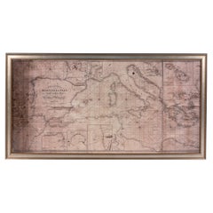
Old Map of Mediterranean Powers: Pompey to Actium (66-31 BC), Published in 1880
About the Item
This is a historical map that depicts the Mediterranean region during a specific timeframe in Roman history, from the return of Pompey the Great after his campaign in Asia Minor to the Battle of Actium, which was a decisive confrontation that led to the rise of Augustus and the establishment of the Roman Empire.
The phrase "MARE INTERNUM cum populis adiacentibus a Pompeii ex Asia reditu usque ad bellum Actiacum" can be translated from Latin to English as "The Mediterranean Sea with the adjacent peoples from Pompey's return from Asia to the Actium War."
This title indicates a map filled with rich historical context, detailing not only the geographical aspects of the Mediterranean basin but also the various peoples and political entities that interacted in this area during a very dynamic period of Roman history. The map shows the extent of Roman influence and its interactions with other cultures and states of the period, potentially including the territories of client kings, Roman provinces, and the lands of the Roman Republic's adversaries. This would be an important educational tool for understanding the late Republican period of Rome, illustrating the complex relationships and events leading up to the imperial era.
More details about the Actium War:
The War of Actium, from 32 to 30 BC, marked the end of the Roman Republic and was the culmination of the power struggle between Mark Antony, allied with Cleopatra of Egypt, and Octavian. When Octavian swayed the Roman Senate to declare war on Cleopatra, Antony sided with her, prompting a sizeable portion of the Senate to defect to his cause. The conflict peaked at the Battle of Actium, where Octavian's forces achieved a decisive victory, leading to Antony and Cleopatra's retreat and subsequent suicides in Alexandria. This conflict showcased vast armies comprising battle-hardened veterans, many of whom had served under Julius Caesar. The aftermath saw Octavian establish peace after a century of civil wars, ushering in the Pax Romana. In 27 BC, Octavian was named Augustus by the Senate and became the first emperor, transitioning Rome from a Republic to an Empire.
- Dimensions:Height: 15.56 in (39.5 cm)Width: 18.51 in (47 cm)Depth: 0 in (0.02 mm)
- Materials and Techniques:
- Period:
- Date of Manufacture:1880
- Condition:Good, given age. General age-related toning, especially around the edges. Vertical folding line as issued. Please study scan carefully.
- Seller Location:Langweer, NL
- Reference Number:
About the Seller
5.0
Platinum Seller
These expertly vetted sellers are 1stDibs' most experienced sellers and are rated highest by our customers.
Established in 2009
1stDibs seller since 2017
1,919 sales on 1stDibs
Typical response time: <1 hour
- ShippingRetrieving quote...Ships From: Langweer, Netherlands
- Return PolicyA return for this item may be initiated within 14 days of delivery.
More From This SellerView All
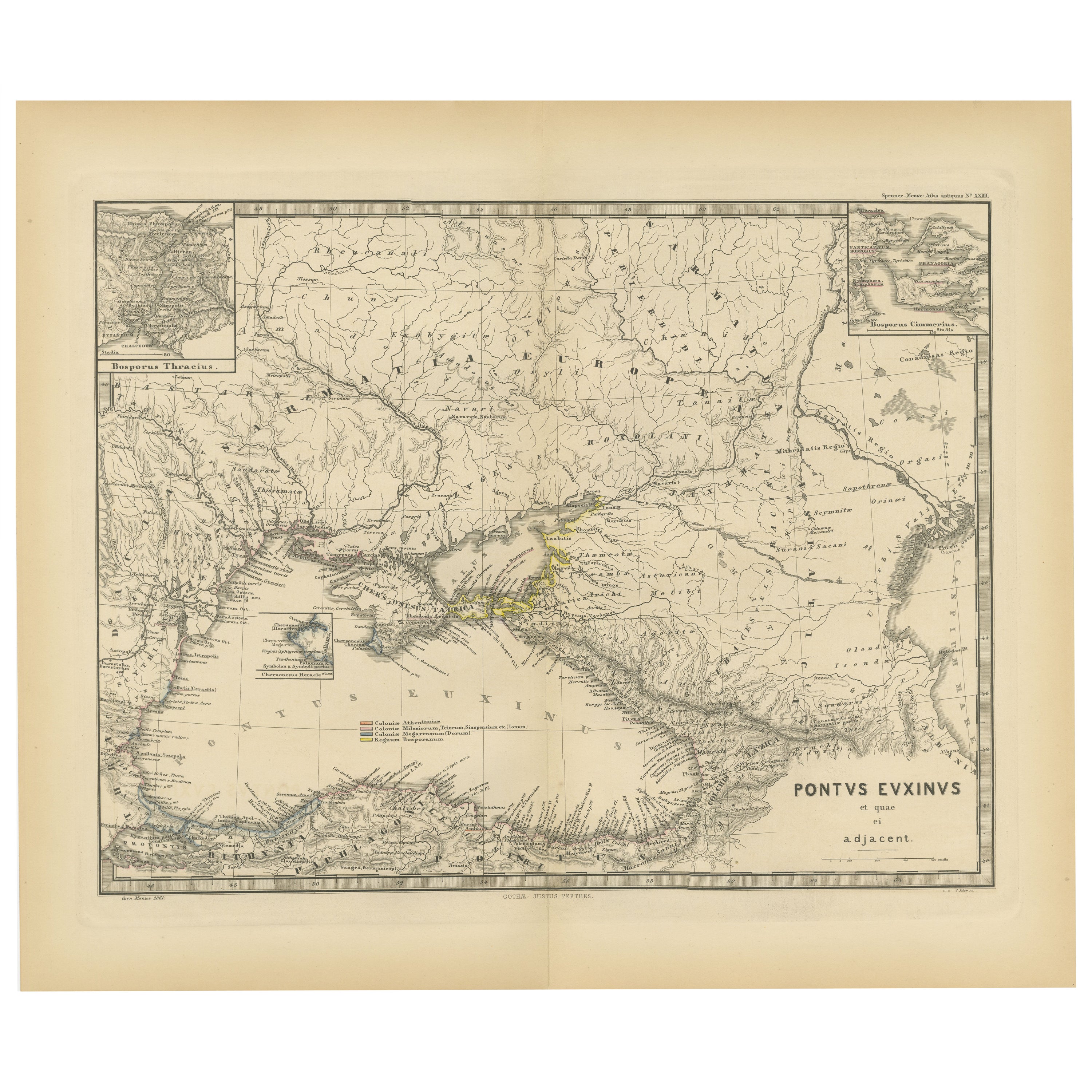
- Black Sea in Antiquity: Pontus Euxinus Map, Published in 1880Located in Langweer, NLThis map, titled "PONTUS EUXINUS," depicts the Black Sea region, historically known as the Pontus Euxinus. The Black Sea was central to ancient trade routes and cultural exchange, bo...Category
Antique 1880s Maps
MaterialsPaper
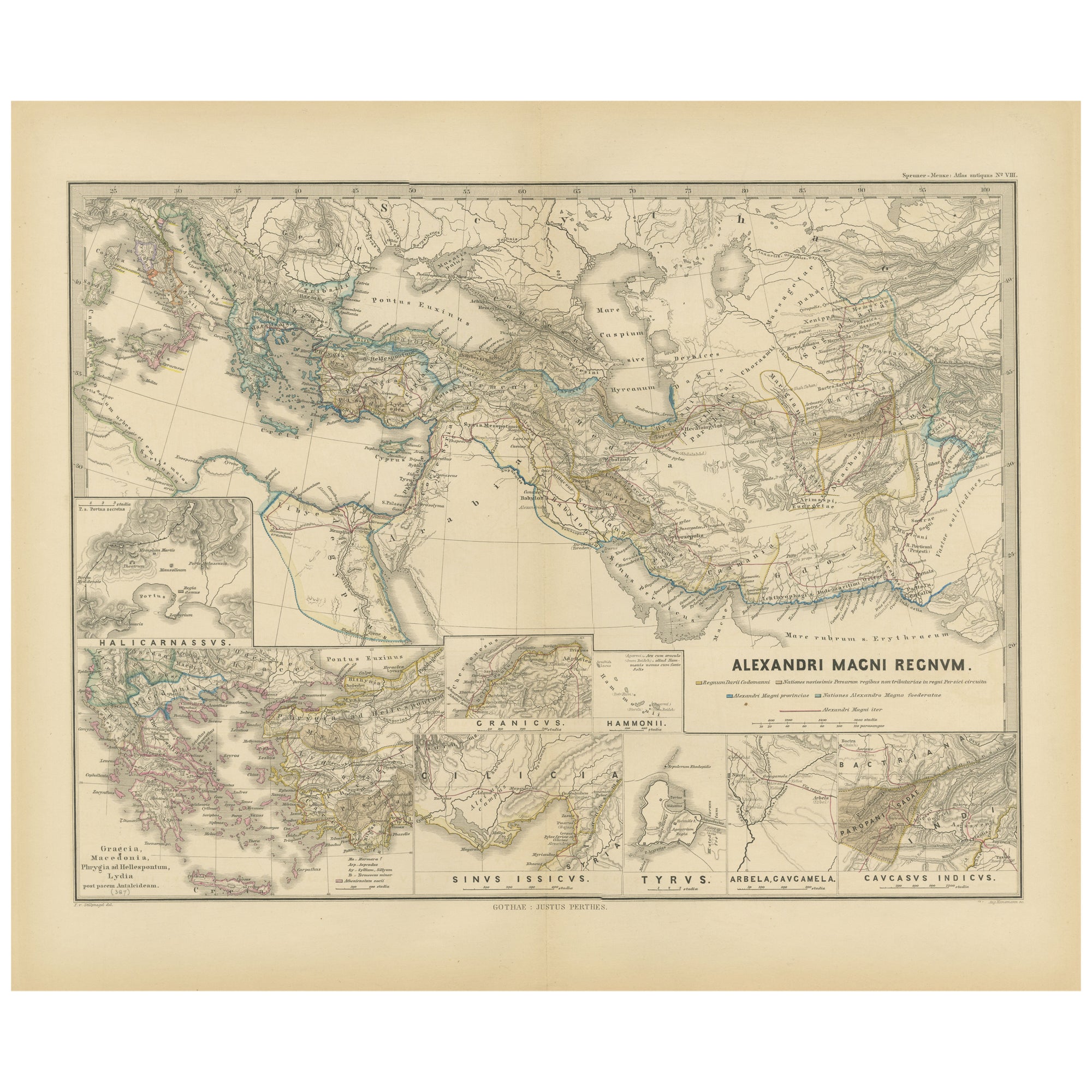
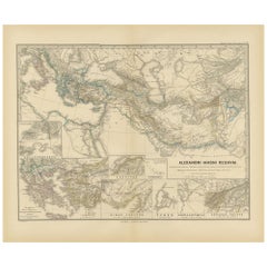
- Antique Map of The Kingdom of Alexander the Great, Published in 1880Located in Langweer, NLThe map is titled "ALEXANDRI MAGNI REGNUM," which translates to "The Kingdom of Alexander the Great." It depicts the vast territories conquered by Alexander the Great during his reig...Category
Antique 1880s Maps
MaterialsPaper
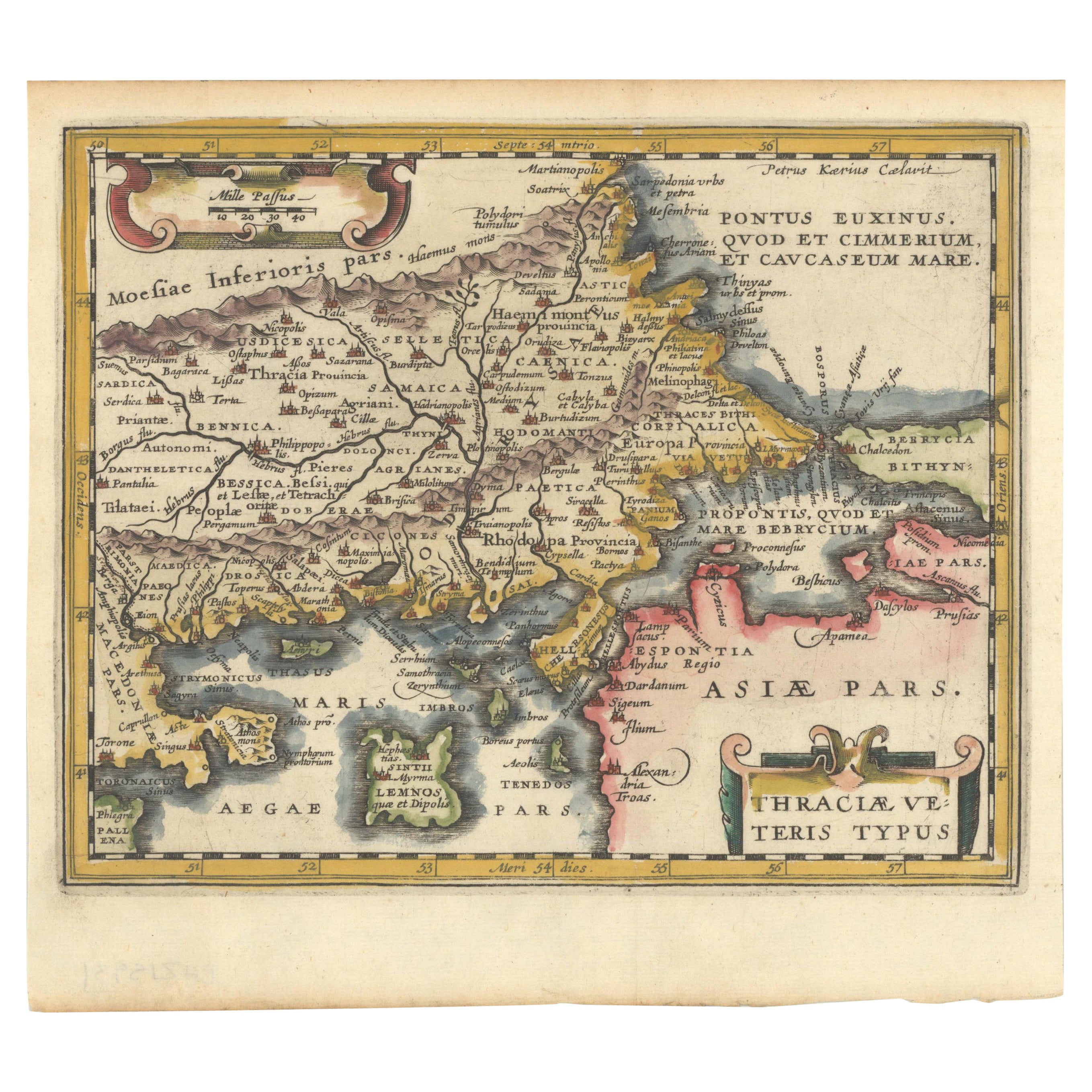
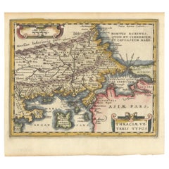
- Original Old Map of Northeastern Greece & Northwestern Turkey, Published in 1661Located in Langweer, NLThis small map was engraved by Petrus Kaerius and is based on Ortelius' map of the same title. It covers the ancient region of Thrace, present-day European Turkey and part of Greece....Category
Antique 1660s Maps
MaterialsPaper
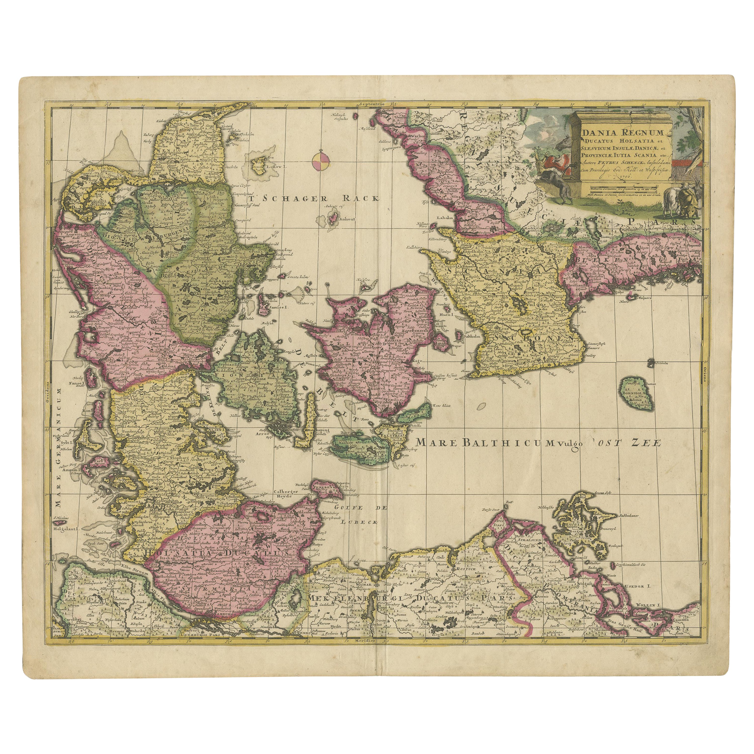
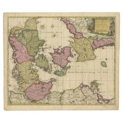
- Early 18th Century Map of Denmark in Old Coloring, Published in 1706Located in Langweer, NLDenmark. Schenk (Petrus), Dania Regnum Ducatus Holsatia. et Slesvicum Insulae Danicae et Provinciae Jutia Scania etc. Amsterdam, 1706, engraved reticulated map on thick paper with co...Category
Antique Early 1700s Maps
MaterialsPaper
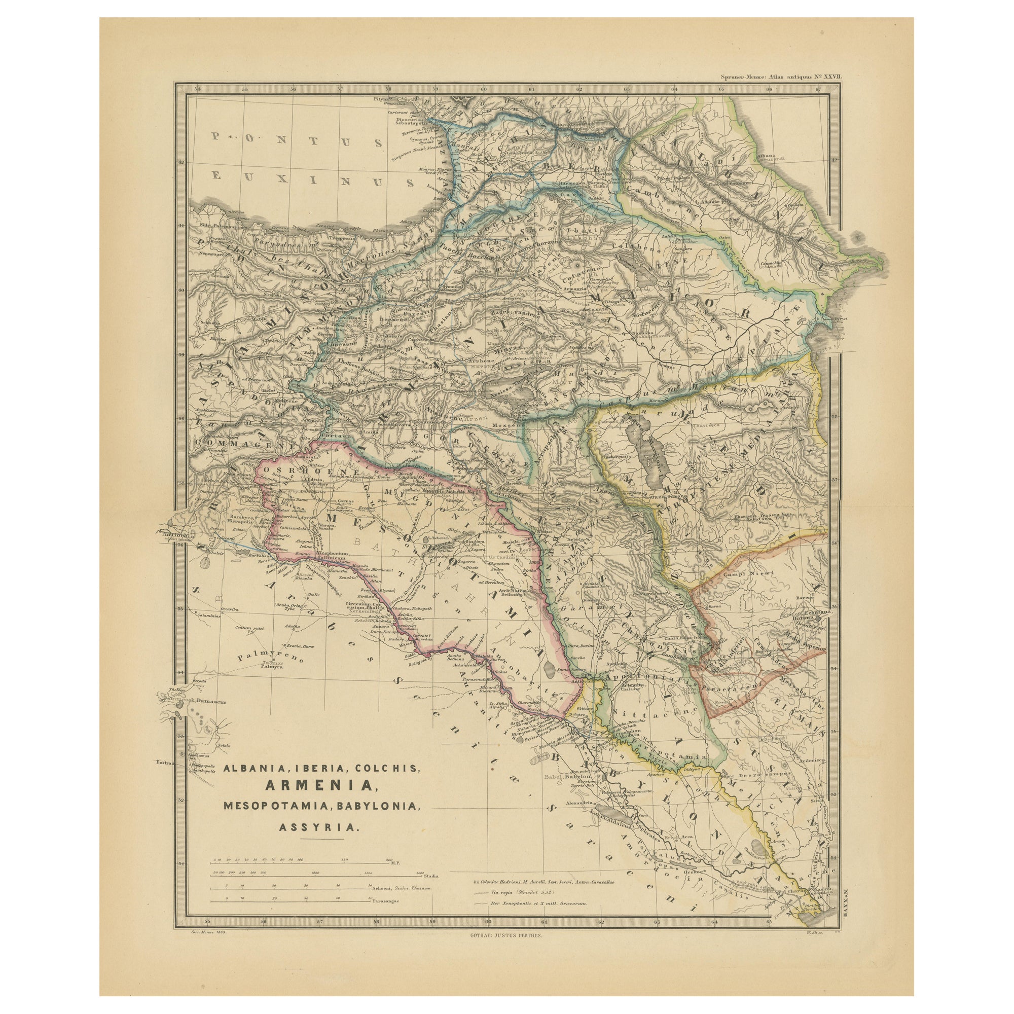
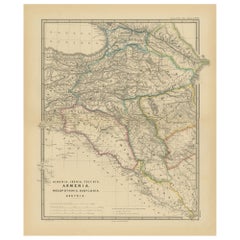
- Ancient Crossroads: Albania to Assyria in Antiquity, Published in 1880Located in Langweer, NLThe map titled "ALBANIA, IBERIA, COLCHIS, ARMENIA, MESOPOTAMIA, BABYLONIA, ASSYRIA" portrays the ancient regions that would encompass parts of modern-day Eastern Turkey, Armenia, Aze...Category
Antique 1880s Maps
MaterialsPaper
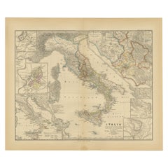
- Antique Map of Italy with Insets of Rome and Major Cities, Published in 1880Located in Langweer, NLThe map titled "ITALIA" depicts the Italian peninsula along with Sicily, Sardinia, and Corsica, labeled with regions such as "Etruria" and cities like "Roma" and "Syracuse". Insets h...Category
Antique 1880s Maps
MaterialsPaper

You May Also Like
- Large Framed Map of the MediterraneanLocated in New York, NYLarge map/chart chart of The Mediterranean and the Grecian Archipelago showing Italy, Sardinia, Corsica, part of France, etc. in a black frame.Category
20th Century French Mid-Century Modern Maps
- Antique Paterson's Guide to Britain, English, Maps, Georgian, Published 1811Located in Hele, Devon, GBThis is an antique copy of Paterson's New and Accurate guide to Direct & Principal Crossroads. An English, bound book of maps and descriptive tables, published in English by Longman,...Category
Antique Early 19th Century British Georgian Books
MaterialsPaper
- 1880s Map of The Italian Alps from Milan to Lake GardaLocated in Roma, ITGeographical Map of the Profile and Elevation of the Italian Alps from Milano to Lake Garda. The map features the name of each peak and key cities including Monza, Brescia and Bergam...Category
Antique 1880s Italian Maps
MaterialsParchment Paper
- Old Nautical Map of CorsicaLocated in Alessandria, PiemonteST/556/1 - Old map of Corsica isle, surveyed by Captain Hell, of the French Royal Navy in 1824, engraved and published on 1874, with additions and corre...Category
Antique Early 19th Century English Other Prints
MaterialsPaper
- Old Horizontal Map of EnglandBy TassoLocated in Alessandria, PiemonteST/520 - Old rare Italian map of England, dated 1826-1827 - by Girolamo Tasso, editor in Venise, for the atlas of M.r Le-Sage.Category
Antique Early 19th Century Italian Other Prints
MaterialsPaper
- 1840 Map of the City of Washington Published by William M. MorrisonLocated in Colorado Springs, COThis map, printed in 1840, is a detailed representation of Washington, D.C. in the mid-19th century. The map shows block numbers, wards, and government buildings as well as details o...Category
Antique 1840s American Federal Maps
MaterialsPaper