Items Similar to Original Old Map of the Environs of Batavia in the Dutch East Indies (Indonesia)

Want more images or videos?
Request additional images or videos from the seller
1 of 6
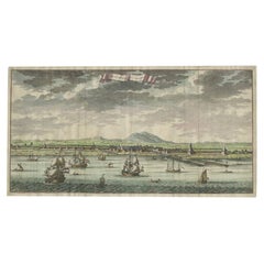
Original Old Map of the Environs of Batavia in the Dutch East Indies (Indonesia)
About the Item
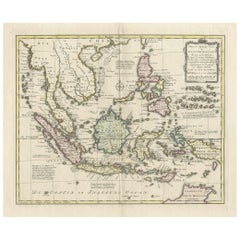
Antique map titled 'Carte des Environs de Batavia'. Map of the environs of Batavia (now Jakarta), Indonesia. This print originates from volume 8 of 'Histoire générale des voyages'. Published by Didot, 1750.
- Dimensions:Height: 9.85 in (25 cm)Width: 15.16 in (38.5 cm)Depth: 0.02 in (0.5 mm)
- Materials and Techniques:
- Period:
- Date of Manufacture:1750
- Condition:Original folding lines. General age-related toning, blank verso. Small hole outside image. Please study images carefully.
- Seller Location:Langweer, NL
- Reference Number:
About the Seller
5.0
Platinum Seller
These expertly vetted sellers are 1stDibs' most experienced sellers and are rated highest by our customers.
Established in 2009
1stDibs seller since 2017
1,919 sales on 1stDibs
Typical response time: <1 hour
- ShippingRetrieving quote...Ships From: Langweer, Netherlands
- Return PolicyA return for this item may be initiated within 14 days of delivery.
More From This SellerView All
- Antique Map of Batavia, Dutch East Indies, Nowadays Jakarta, Indonesia, ca.1669Located in Langweer, NLAntique map titled 'Ware afbeeldinge wegens het Casteel ende Stadt Batavia gelegen opt groot Eylant Java Anno 1679. Plan de la Ville et du Chateau de Batavia en l'Isle de Iava. 1679....Category
Antique 1660s Maps
MaterialsPaper
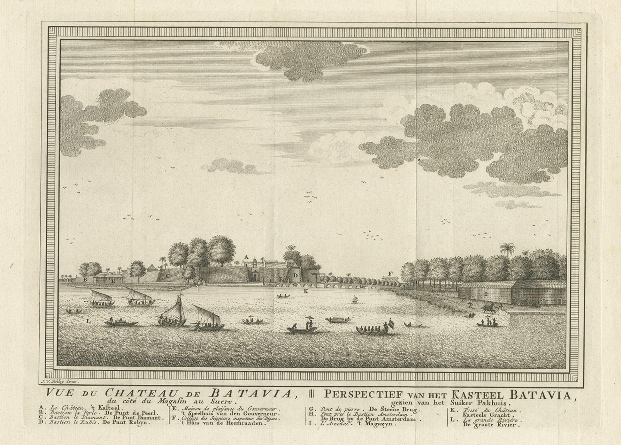
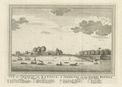
- Antique Print of Capital Batavia in the Dutch East Indies 'Indonesia', C.1752Located in Langweer, NLAntique print Indonesia titled 'Vue Du Chateau De Batavia - Perspectief van het kasteel Batavia'. View of the Castle of Batavia, seen from the sugar warehouse. Originates from Antoin...Category
Antique 18th Century Prints
MaterialsPaper
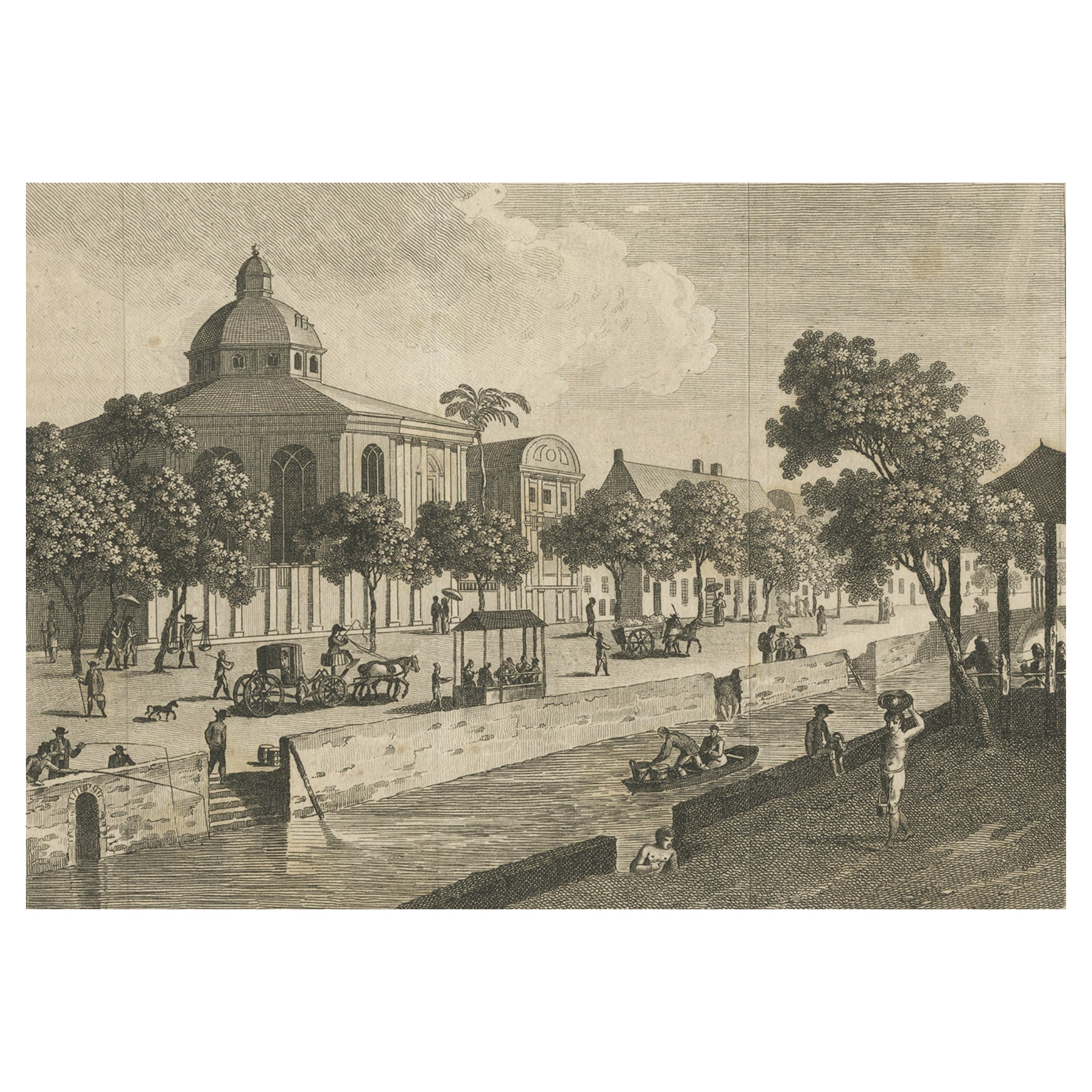
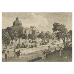
- Antique Print of Batavia, Capital of the Dutch East Indies 'Indonesia', c.1820Located in Langweer, NLAntique print titled 'Ansicht einer Strasse in Batavia'. Old print with a view on a street in Batavia (Jakarta), Indonesia. Source unknown, to be determined. Artists and Engraver...Category
Antique 19th Century Prints
MaterialsPaper
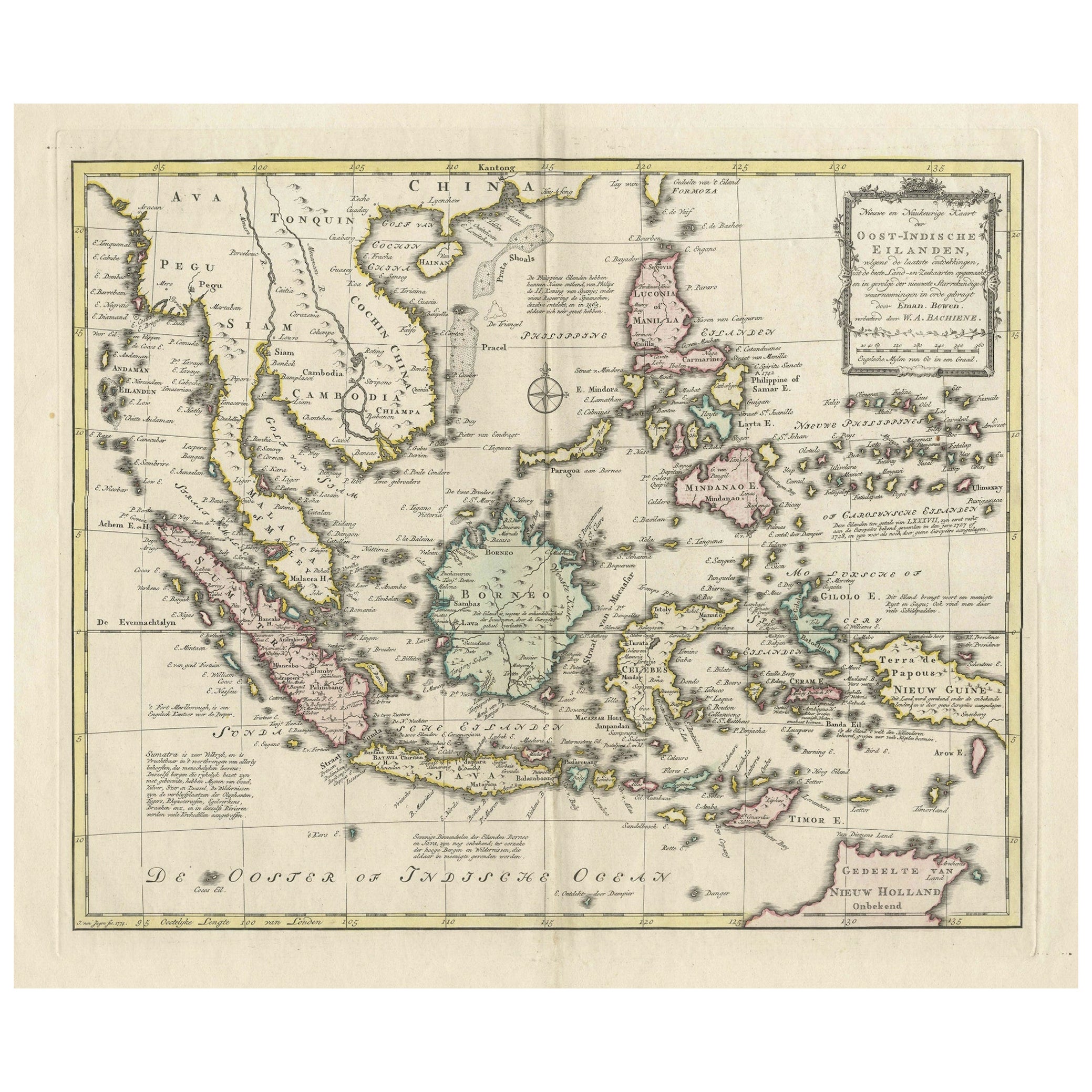
- Rare Antique Map of the Dutch East Indies 'Indonesia', 1774Located in Langweer, NLRare decorative engraved map of the Dutch East Indies, or nowadays Indonesia. Title (in old Dutch): NIEUWE EN NAUKEURIGE KAART DER OOST-INDISCHE ...Category
Antique 1770s Maps
MaterialsPaper
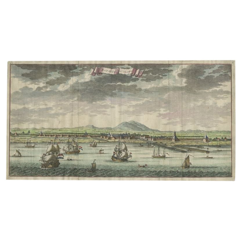
- Antique Print of Batavia, Capital of the Dutch East Indies or Indonesia, '1726'Located in Langweer, NLAntique print Indonesia titled 'Batavia in 't Verschiet'. Large panoramic view on Batavia, present day Jakarta, Indonesia. Originates from 'Oud en Nieuw Oost-Indiën (..)' by François...Category
Antique 18th Century Prints
MaterialsPaper
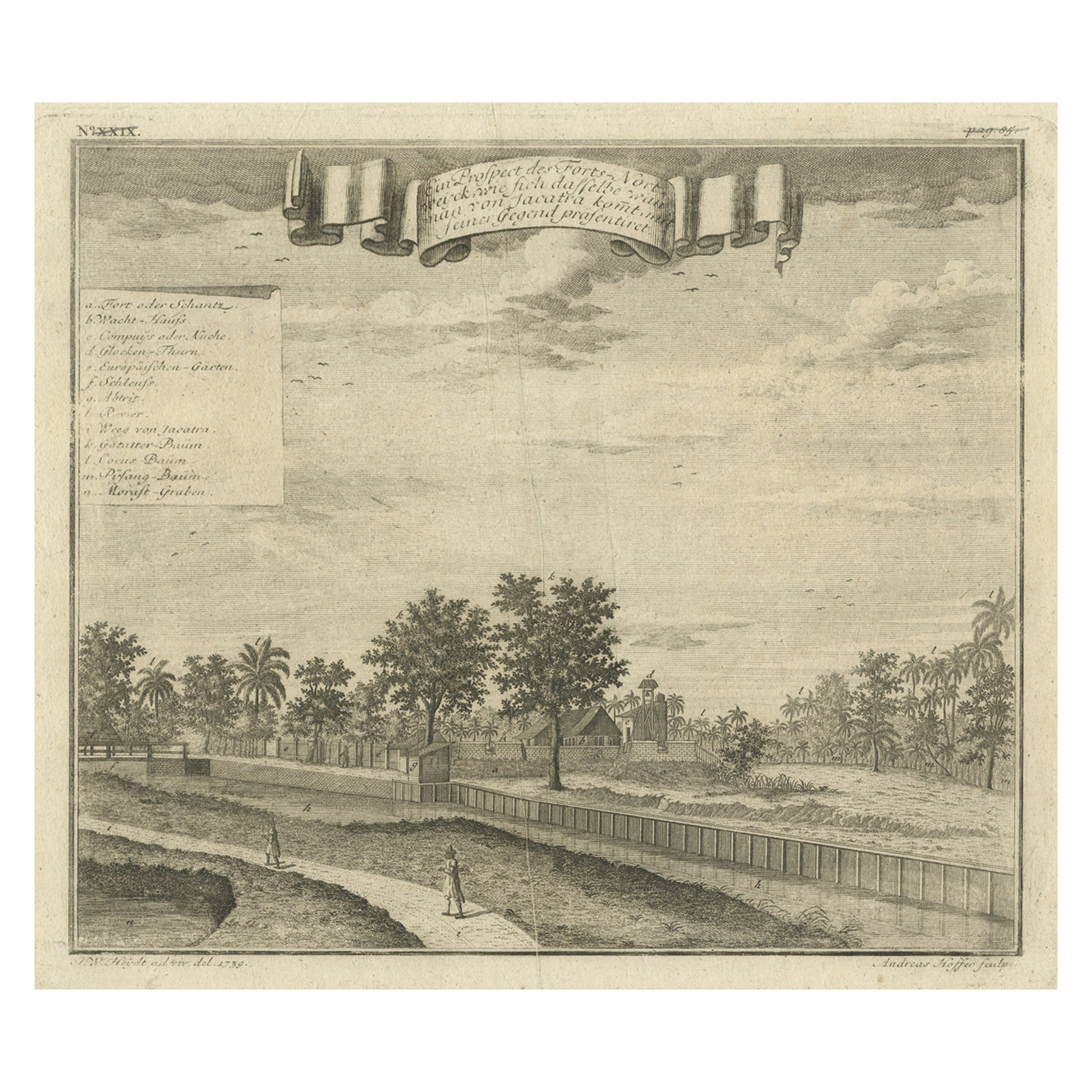
- Old Antique Print of Fort Noordwijk, Batavia in the Dutch East Indies, 1739Located in Langweer, NLAntique print titled 'Ein Prospect des Forts Nortweijck, wie sich dasselbe wan man von Jacatra komt, mit seiner Gegend präsentiret'. Old print of Fort Noordwijk, Batavia (Jakarta). This print originates from from 'Allerneuester Geographische- und Topographischer Schau-platz, von Africa und Ost-Indien'. Artists and Engravers: Johann Wolfgang Heydt, a German artist who worked for the Dutch East India...Category
Antique 1730s Maps
MaterialsPaper

You May Also Like
- Original Antique Map of South East Asia, Arrowsmith, 1820Located in St Annes, LancashireGreat map of South East Asia Drawn under the direction of Arrowsmith Copper-plate engraving Published by Longman, Hurst, Rees, Orme and Brown, 1820 Unframed.Category
Antique 1820s English Maps
MaterialsPaper
- Antique Map of Paris, "Carte Routiere des Environs de Paris" 1841Located in Colorado Springs, COThis beautiful hand-colored road map of Paris was published in 1841. The map shows Paris and the surrounding area in a folding pocket map. Organized and detailed for travelers, this ...Category
Antique 1840s French Maps
MaterialsPaper
- Original Antique Map of South East Asia by Becker, circa 1840Located in St Annes, LancashireGreat map of South East Asia Steel engraving with original color outline Engraved by Becker Published by Virtue, circa 1840. Unframed.Category
Antique 1840s English Other Maps
MaterialsPaper
- Original Antique Map of South East Asia by Thomas Clerk, 1817Located in St Annes, LancashireGreat map of South East Asia Copper-plate engraving Drawn and engraved by Thomas Clerk, Edinburgh. Published by Mackenzie And Dent, 1817 Unframed.Category
Antique 1810s English Maps
MaterialsPaper
- Old Nautical Map of CorsicaLocated in Alessandria, PiemonteST/556/1 - Old map of Corsica isle, surveyed by Captain Hell, of the French Royal Navy in 1824, engraved and published on 1874, with additions and corre...Category
Antique Early 19th Century English Other Prints
MaterialsPaper
- Old Horizontal Map of EnglandBy TassoLocated in Alessandria, PiemonteST/520 - Old rare Italian map of England, dated 1826-1827 - by Girolamo Tasso, editor in Venise, for the atlas of M.r Le-Sage.Category
Antique Early 19th Century Italian Other Prints
MaterialsPaper


Recently Viewed
View AllMore Ways To Browse
Antique Old Maps
Old Antique Maps
Holland Map
Dutch Map
Antique Map Of Holland
East Indies Furniture
East Indies
Indonesian Dutch
Dutch Indonesia
18th Century Indonesia
18th Century Indonesian
Dutch Indies
Dutch East Indies
Indonesia Map
Antique Map Indonesia
Antique Maps Indonesia
Indonesia Jakarta
Batavia Furniture