Antique Map Of Holland
28
to
218
1,381
132
1,288
738
504
215
176
168
119
104
50
46
34
31
31
26
26
24
23
21
20
20
19
17
17
16
16
16
15
14
14
14
12
10
8
7
6
6
5
5
5
5
3
2
2
2
2
2
1
1
1
70
23
21
17
13
Sort By
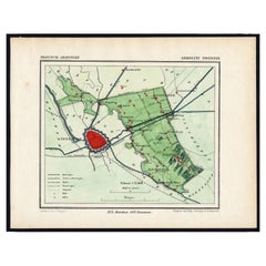
Rare Map of Dutch Municipality Noorddijk Near Groningen, 1865
Located in Langweer, NL
Groningen: Gemeente Engelbert, Middelbert, Noorddijk. These scarse detailed maps of Dutch Towns
Category
19th Century Antique Map Of Holland
Materials
Paper
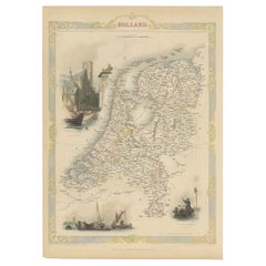
Antique Map of Holland with Colorful Vignettes, 1851
Located in Langweer, NL
Antique map titled 'Holland'.
Decorative map of Holland. Includes vignettes of Rotterdam, Dutch
Category
19th Century Antique Map Of Holland
Materials
Paper
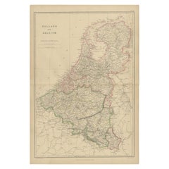
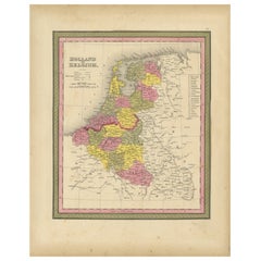
1859 Vintage Map of Holland and Belgium: Blackie's Imperial Geographic Insight
Located in Langweer, NL
The "Antique Map of Holland and Belgium" from 'The Imperial Atlas of Modern Geography', published
Category
Mid-19th Century Antique Map Of Holland
Materials
Paper
H 21.26 in W 14.57 in D 0.02 in
Antique Map of Holland and Belgium by Lowry, '1852'
Located in Langweer, NL
Antique map titled 'Holland and Belgium'. Original map of the Netherlands and Belgium. This map
Category
Mid-19th Century Antique Map Of Holland
Materials
Paper
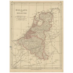
Antique Nicely Colored Map of Holland and Belgium, 1846
Located in Langweer, NL
Antique map titled 'Holland and Belgium'. Old map of the Netherlands and Belgium. This map
Category
19th Century Antique Map Of Holland
Materials
Paper
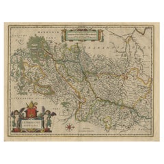
Antique Map of Dutch & Belgium Provinces Limburg, Namen and Ardennes, ca.1635
Located in Langweer, NL
Antique print, titled: 'Leodiensis Dioecesis.'
Detailed map including the Dutch and Belgium
Category
1630s Antique Map Of Holland
Materials
Paper
H 19.97 in W 23.51 in D 0 in
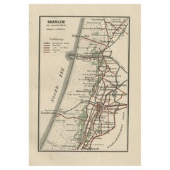
Antique Map of Dutch Cities Haarlem, Zandvoort, Bloemendaal, Wijk aan Zee, 1884
Located in Langweer, NL
Antique map titled 'Haarlem en Omstreken'. Old map of the region of Haarlem also including cities
Category
19th Century Antique Map Of Holland
Materials
Paper
H 10.48 in W 7.05 in D 0 in
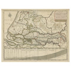
Detailed Map of Dutch Rivers, with the Rhine, Maas, de Merwe en de Lek, C.1750
Located in Langweer, NL
, door de Provincien van Gelderland, Holland en Utrecht'.
Detailed map of the center of the
Category
1750s Antique Map Of Holland
Materials
Paper
H 16.15 in W 20.48 in D 0 in
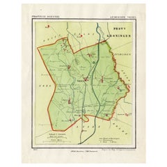
Antique Map of the Township of Vries in the Dutch Province of Drenthe, 1865
Located in Langweer, NL
Drenthe: Gemeente Vries, Bunne, Donderen, Tijnaarloo, Zeijen. These scarse detailed maps of Dutch
Category
19th Century Antique Map Of Holland
Materials
Paper
H 9.85 in W 7.49 in D 0 in
Original Antique Map of the Township of Uithuizermeeden, the Netherlands, 1862
Located in Langweer, NL
maps of Dutch Towns originate from the 'Gemeente atlas van de Provincie Groningen in 62 kaarten.' by C
Category
19th Century Antique Map Of Holland
Materials
Paper
H 7.49 in W 9.85 in D 0 in
Original Antique Map of the Township of Winschoten in The Netherlands, 1862
Located in Langweer, NL
Groningen: Gemeente Winschoten-St. Vitus Holt. These scarse detailed maps of Dutch Towns originate
Category
19th Century Antique Map Of Holland
Materials
Paper
H 7.29 in W 9.85 in D 0 in
Antique Map of the Township of Zuidhorn in The Netherlands, 1862
Located in Langweer, NL
Groningen: Gemeente Noordhorn-Zuidhorn. These scarse detailed maps of Dutch Towns originate from
Category
19th Century Antique Map Of Holland
Materials
Paper
Antique Map of the Netherlands and Belgium by Keizer & De Lat, 1788
Located in Langweer, NL
Holland and Belgium. This map originates from 'Nieuwe Natuur- Geschied- en Handelkundige Zak- en Reisatlas
Category
18th Century Antique Map Of Holland
Materials
Paper
Original Antique Map of Township Ulrum in Groningen, The Netherlands, 1862
Located in Langweer, NL
Groningen: Gemeente Houwerzijl-Niekerk-Vierhuizen-Ulrum-Zoutkamp. These scarse detailed maps of
Category
19th Century Antique Map Of Holland
Materials
Paper
H 9.65 in W 7.49 in D 0 in
Original Antique Map of the township of Warffum in The Netherlands, 1862
Located in Langweer, NL
Groningen: Gemeente Rottumeroog-Warffum. These scarse detailed maps of Dutch Towns originate from
Category
19th Century Antique Map Of Holland
Materials
Paper
Antique Map of the Township of Winsum, Groningen in The Netherlands, 1862
Located in Langweer, NL
Groningen: Gemeente Obergum-Winsum. These scarse detailed maps of Dutch Towns originate from the
Category
19th Century Antique Map Of Holland
Materials
Paper
Antique Map of the Township of Het Zandt in The Netherlands, 1862
Located in Langweer, NL
Groningen: Gemeente Het Zandt. These scarse detailed maps of Dutch Towns originate from the
Category
19th Century Antique Map Of Holland
Materials
Paper
Antique Map of the Region of Winschoten, Groningen in The Netherlands, 1862
Located in Langweer, NL
Groningen: Gemeente Arrondisement Winschoten. These scarse detailed maps of Dutch Towns originate
Category
19th Century Antique Map Of Holland
Materials
Paper
H 9.85 in W 7.49 in D 0 in
Antique Map of the Township of Marum in Groningen, The Netherlands, 1862
Located in Langweer, NL
Groningen: Gemeente Marum-Noordwijk-NuiS. These scarse detailed maps of Dutch Towns originate from
Category
19th Century Antique Map Of Holland
Materials
Paper
Antique Map of the Township of Hoogkerk in Groningen, The Netherlands, 1862
Located in Langweer, NL
Groningen: Gemeente Dorkwerd-Hoogkerk-Leegkerk-Vinkhuizen. These scarse detailed maps of Dutch
Category
19th Century Antique Map Of Holland
Materials
Paper
H 9.45 in W 7.49 in D 0 in
Antique Map of the Township of Meeden in Groningen, the Netherlands, 1862
Located in Langweer, NL
Groningen: Gemeente Meeden. These scarse detailed maps of Dutch Towns originate from the 'Gemeente
Category
19th Century Antique Map Of Holland
Materials
Paper
Antique Map of the Township of Muntendam in Groningen, the Netherlands, 1862
Located in Langweer, NL
Groningen: Gemeente Muntendam. These scarse detailed maps of Dutch Towns originate from the
Category
19th Century Antique Map Of Holland
Materials
Paper
H 7.3 in W 9.8 in D 0.001 in
Antique Map of the Township of Coevorden in The Netherlands, 1865
Located in Langweer, NL
Drenthe - Gemeente Coevorden, Padhuis, Wijnhars. These scarse detailed maps of Dutch Towns
Category
19th Century Antique Map Of Holland
Materials
Paper
Antique Map of the Township of Dwingelo in The Netherlands, 1865
Located in Langweer, NL
Drenthe: Gemeente Dwingelo, Eemster, Lhee. These scarse detailed maps of Dutch Towns originate from
Category
19th Century Antique Map Of Holland
Materials
Paper
Antique Map of the Township of Gasselte in The Netherlands, 1865
Located in Langweer, NL
Drenthe: Gemeente Gasselte, Gasseltternijeveen. These scarse detailed maps of Dutch Towns originate
Category
19th Century Antique Map Of Holland
Materials
Paper
Antique Map of the Township of Anloo in the Netherlands, 1865
Located in Langweer, NL
Drenthe - Gemeente Anloo, Eext, Gasteren, Annen, Schipborg. These scarse detailed maps of Dutch
Category
19th Century Antique Map Of Holland
Materials
Paper
Antique Map of the Township of Nijeveen in The Netherlands, 1865
Located in Langweer, NL
Drenthe: Gemeente Nijeveen, Kolderveen. These scarse detailed maps of Dutch Towns originate from
Category
19th Century Antique Map Of Holland
Materials
Paper
Antique Map of the Township of Gieten in the Netherlands, 1865
Located in Langweer, NL
Drenthe: Gemeente Gieten, Gieterveen, De Hilte. These scarse detailed maps of Dutch Towns originate
Category
19th Century Antique Map Of Holland
Materials
Paper
Antique Map of the Township of Sleen in the Netherlands, 1865
Located in Langweer, NL
Drenthe: Gemeente Sleen, Emmerzand, Venoord. These scarse detailed maps of Dutch Towns originate
Category
19th Century Antique Map Of Holland
Materials
Paper
Antique Map of the Township of Oosterhesselen in the Netherlands, 1865
Located in Langweer, NL
Drenthe: Gemeente Oosterhesselen, Zwinderen. These scarse detailed maps of Dutch Towns originate
Category
19th Century Antique Map Of Holland
Materials
Paper
Antique Map of the City of Assen in The Netherlands, 1865
Located in Langweer, NL
Drenthe - Gemeente Assen. (no 2, Stad). These scarse detailed maps of Dutch Towns originate from
Category
19th Century Antique Map Of Holland
Materials
Paper
Antique Map of the Township of Odoorn in the Netherlands, 1865
Located in Langweer, NL
Drenthe: Gemeente Odoorn, Exlo, Valthe. These scarse detailed maps of Dutch Towns originate from
Category
19th Century Antique Map Of Holland
Materials
Paper
Antique Map of the Township of Havelte in The Netherlands, 1865
Located in Langweer, NL
Drenthe: Gemeente Havelte, Wapserveen, Uffelte. These scarse detailed maps of Dutch Towns originate
Category
19th Century Antique Map Of Holland
Materials
Paper
Antique Map of the Township of Rolde, Drenthe, the Netherlands, 1865
Located in Langweer, NL
Drenthe: Gemeente Rolde, Balloo, Grolloo, Schoonlo. These scarse detailed maps of Dutch Towns
Category
19th Century Antique Map Of Holland
Materials
Paper
Antique Map of the Township of Zweelo in the Netherlands, 1865
Located in Langweer, NL
Drenthe: Gemeente Zweelo, Weesup, Meppen, Benneveld. These scarse detailed maps of Dutch Towns
Category
19th Century Antique Map Of Holland
Materials
Paper
Antique Map of Ijlst , Friesland in the Netherlands, 1865
Located in Langweer, NL
Friesland: Gemeente IjJlst. These scarse detailed maps of Dutch Towns originate from the 'Gemeente
Category
19th Century Antique Map Of Holland
Materials
Paper
Dutch Municipality of Wedde in Groningen, Fehse, 1862
Located in Langweer, NL
These scarse detailed maps of Dutch Towns originate from the 'Gemeente atlas van de Provincie
Category
19th Century Antique Map Of Holland
Materials
Paper
Dutch Municipality of Bedum in Groningen, Fehse, 1862
Located in Langweer, NL
These scarse detailed maps of Dutch Towns originate from the 'Gemeente atlas van de Provincie
Category
19th Century Antique Map Of Holland
Materials
Paper
Original Antique Map of the Township of Borger in The Netherlands, 1865
Located in Langweer, NL
Drenthe - Gemeente Borger, Drouwen, Buinene, Westdorp. These scarse detailed maps of Dutch Towns
Category
19th Century Antique Map Of Holland
Materials
Paper
Original Antique Map of the Township of Beilen in the Netherlands, 1865
Located in Langweer, NL
Drenthe - Gemeente Beilen. Hijken, Beilen, Spier, Wijsthoorn. These scarse detailed maps of Dutch
Category
19th Century Antique Map Of Holland
Materials
Paper
Antique Map of the Township of Diever, Drenthe in The Netherlands, 1865
Located in Langweer, NL
Drenthe: Gemeente Diever, Veenhuizen, Aendiever, Wittelte. These scarse detailed maps of Dutch
Category
19th Century Antique Map Of Holland
Materials
Paper
Antique Map of the Township of Emmen, Drenthe in The Netherlands, 1865
Located in Langweer, NL
Drenthe: Gemeente Emmen, Roswinkel, Werdinge, Zuidbarge. These scarse detailed maps of Dutch Towns
Category
19th Century Antique Map Of Holland
Materials
Paper
Antique Map of the Township of Dalen, Schoonebeek in The Netherlands, 1865
Located in Langweer, NL
Drenthe - Gemeente Dalen, Schoonebeek. These scarse detailed maps of Dutch Towns originate from the
Category
19th Century Antique Map Of Holland
Materials
Paper
H 7.68 in W 9.85 in D 0 in
Antique Map of the Township of Eelde in Drenthe, The Netherlands, 1865
Located in Langweer, NL
Drenthe: Gemeente Eelde. These scarse detailed maps of Dutch Towns originate from the 'Gemeente
Category
19th Century Antique Map Of Holland
Materials
Paper
Antique Map of the Township of Roden, Drenthe, in the Netherlands, 1865
Located in Langweer, NL
Netherlands was published from 1865-1870 and included all towns in the Dutch province of Drenthe. These maps
Category
19th Century Antique Map Of Holland
Materials
Paper
Antique Map of the Township of Peize, Drenthe in the Netherlands, 1865
Located in Langweer, NL
Drenthe: Gemeente Peize, Peizerwolde, de Horst. These scarse detailed maps of Dutch Towns originate
Category
19th Century Antique Map Of Holland
Materials
Paper
Antique Map of the Township of Norg in Drenthe, the Netherlands, 1865
Located in Langweer, NL
Drenthe: Gemeente Norg, Fen, Langeloo, Veenhuizen, Norgervaart. These scarse detailed maps of Dutch
Category
19th Century Antique Map Of Holland
Materials
Paper
Antique Map of the Township of Westerbork, Drenthe in the Netherlands, 1865
Located in Langweer, NL
Drenthe: Gemeente Westerbork, Elp, Zwiggelte, Orvelte. These scarse detailed maps of Dutch Towns
Category
19th Century Antique Map Of Holland
Materials
Paper
H 9.65 in W 7.68 in D 0 in
Antique Map of the Township of Smilde, Drenthe in the Netherlands, 1865
Located in Langweer, NL
Drenthe: Gemeente Smilde, Bovensmilde, Hoogersmilde. These scarse detailed maps of Dutch Towns
Category
19th Century Antique Map Of Holland
Materials
Paper
Antique Map of the Township of Zuidlaren, Drenthe in the Netherlands, 1865
Located in Langweer, NL
Drenthe: Gemeente Zuidlaren, Midlaren, Plankersloot. These scarse detailed maps of Dutch Towns
Category
19th Century Antique Map Of Holland
Materials
Paper
H 7.49 in W 9.06 in D 0 in
Antique Map of the Township of Vledder, Drenthe in the Netherlands, 1865
Located in Langweer, NL
Drenthe: Gemeente Vledder, Doldersum, Nijensleek. These scarse detailed maps of Dutch Towns
Category
19th Century Antique Map Of Holland
Materials
Paper
Antique Map of the Township of Franeker in Friesland, the Netherlands, 1865
Located in Langweer, NL
Friesland: Gemeente Franeker. These scarse detailed maps of Dutch Towns originate from the
Category
19th Century Antique Map Of Holland
Materials
Paper
H 7.49 in W 9.85 in D 0 in
Antique Map of the Township of Ruinen, Drenthe in the Netherlands, circa 1865
Located in Langweer, NL
Drenthe: Gemeente Ruinen, Ansen, Bultinge, Oostering. These scarse detailed maps of Dutch Towns
Category
19th Century Antique Map Of Holland
Materials
Paper
H 7.09 in W 8.86 in D 0 in
Antique Map of the Township of De Wijk, Drenthe in the Netherlands, 1865
Located in Langweer, NL
Drenthe: Gemeente De Wijk, Broekhuizen, Koekange. These scarse detailed maps of Dutch Towns
Category
19th Century Antique Map Of Holland
Materials
Paper
Antique Map of The Province of Drenthe in the Northern Netherlands, 1865
Located in Langweer, NL
scarse detailed maps of Dutch Towns originate from the 'Gemeente-atlas' of Jacob Kuyper. This atlas of
Category
19th Century Antique Map Of Holland
Materials
Paper
Antique Map of Leeuwarden and Surroundings, in Friesland, the Netherlands, 1865
Located in Langweer, NL
Friesland: Gemeente Leeuwarden. These scarse detailed maps of Dutch Towns originate from the
Category
19th Century Antique Map Of Holland
Materials
Paper
H 7.49 in W 9.85 in D 0 in
Dutch Municipality of Oldekerk in Groningen, The Netherlands, 1865
Located in Langweer, NL
Groningen: Gemeente Niekerk, Oldekerk.
These scarse detailed maps of Dutch Towns originate from
Category
19th Century Antique Map Of Holland
Materials
Paper
Dutch Municipality of Uithuizermeeden in Groningen, Kuyper, 1865
Located in Langweer, NL
detailed maps of Dutch Towns originate from the 'Gemeente-atlas' of Jacob Kuyper. This atlas of all towns
Category
19th Century Antique Map Of Holland
Materials
Paper
Dutch Municipality of Wildervank in Grongingen, Kuyper, 1865
Located in Langweer, NL
Groningen: Gemeente Nieuw Stadskanaal, Wildervank. These scarse detailed maps of Dutch Towns
Category
19th Century Antique Map Of Holland
Materials
Paper
Dutch Municipality of Scheemda in Groningen, Kuyper, 1865
Located in Langweer, NL
Netherlands was published from 1865-1870 and included all towns in the Dutch province of Groningen. These maps
Category
19th Century Antique Map Of Holland
Materials
Paper
- 1
- ...
Get Updated with New Arrivals
Save "Antique Map Of Holland", and we’ll notify you when there are new listings in this category.
Antique Map Of Holland For Sale on 1stDibs
Find many varieties of an authentic antique map of holland available at 1stDibs. An antique map of holland — often made from paper — can elevate any home. There are many kinds of the antique map of holland you’re looking for, from those produced as long ago as the 18th Century to those made as recently as the 19th Century. Coenraet Decker and Nicolaes Visscher II each produced at least one beautiful antique map of holland that is worth considering.
How Much is a Antique Map Of Holland?
Prices for an antique map of holland start at $111 and top out at $7,067 with the average selling for $355.
