Items Similar to Dutch Municipality of Uithuizermeeden in Groningen, Kuyper, 1865
Want more images or videos?
Request additional images or videos from the seller
1 of 5
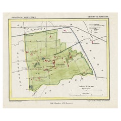
Dutch Municipality of Uithuizermeeden in Groningen, Kuyper, 1865
About the Item
Groningen: Gemeente Oldenzijl, Oosternieland, de Roode School, Uithuizermeeden. These scarse detailed maps of Dutch Towns originate from the 'Gemeente-atlas' of Jacob Kuyper. This atlas of all towns in the Netherlands was published from 1865-1870 and included all towns in the Dutch province of Groningen. These maps are also known as a Kuyper kaart or Kuyper kaartjes from Groningen.
Artists and Engravers: Author: Jacob Kuyper: He was one of the most important of the Dutch atlas editors of the second half of the 19th century. He is particularly known for the ""Gemeente Atlas"", with 1210 plans of all the towns and villages in the Netherlands.
Technic: Lithograph with later handcolouring. We also carry the original border coloured maps.
Condition: Fine; occasional foxing as visible on the scans; sheet irregularly cut, not affecting image.
Date: 1865
Overall size: 8.7 x 7.1 inch
Image size: 0.001 x 7.9 x 5.9 inch
We sell original antique maps to collectors, historians, educators and interior decorators all over the world. Our collection includes a wide range of authentic antique maps from the 16th to the 20th centuries. Buying and collecting antique maps is a tradition that goes back hundreds of years. Antique maps have proved a richly rewarding investment over the past decade, thanks to a growing appreciation of their unique historical appeal. Today the decorative qualities of antique maps are widely recognized by interior designers who appreciate their beauty and design flexibility. Depending on the individual map, presentation, and context, a rare or antique map can be modern, traditional, abstract, figurative, serious or whimsical. We offer a wide range of authentic antique maps for any budget.
- Dimensions:Height: 7.1 in (18.04 cm)Width: 8.7 in (22.1 cm)Depth: 0.001 in (0.03 mm)
- Materials and Techniques:
- Period:
- Date of Manufacture:1865
- Condition:
- Seller Location:Langweer, NL
- Reference Number:
About the Seller
5.0
Platinum Seller
These expertly vetted sellers are 1stDibs' most experienced sellers and are rated highest by our customers.
Established in 2009
1stDibs seller since 2017
1,916 sales on 1stDibs
Typical response time: <1 hour
- ShippingRetrieving quote...Ships From: Langweer, Netherlands
- Return PolicyA return for this item may be initiated within 14 days of delivery.
More From This SellerView All
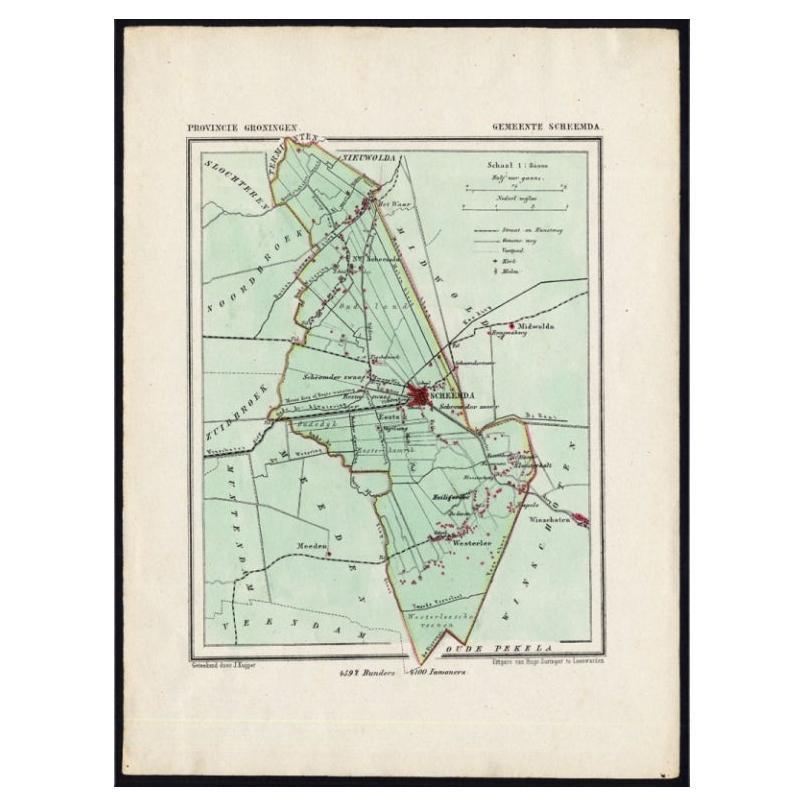
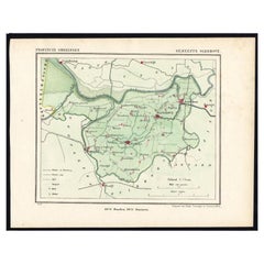
- Dutch Municipality of Scheemda in Groningen, Kuyper, 1865Located in Langweer, NLGroningen: Gemeente Heiligerlee, Scheemda, Nieuw Scheemda, Westerlee. These scarse detailed maps of Dutch Towns originate from the 'Gemeente-atlas' of Jacob Kuyper. This atlas of all...Category
Antique 19th Century Maps
MaterialsPaper
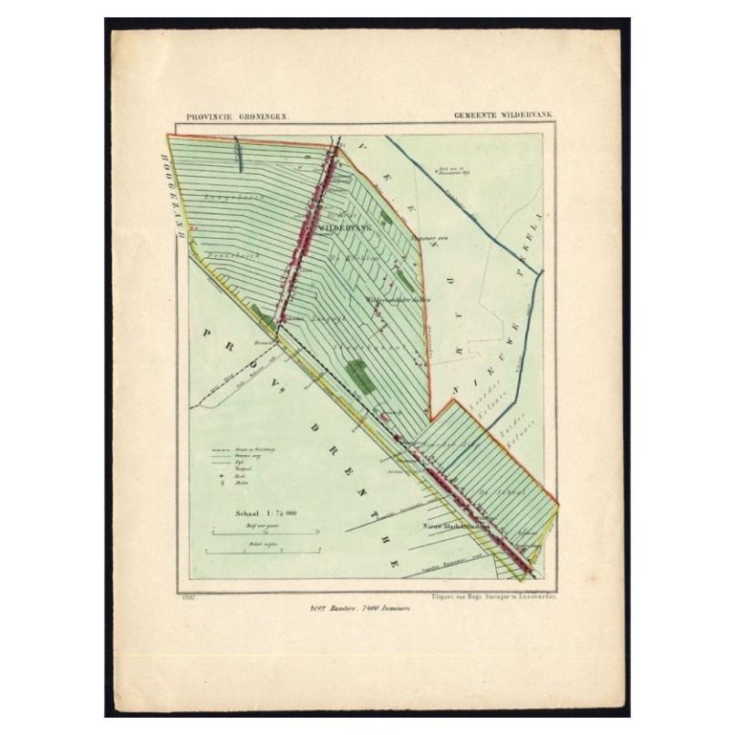
- Dutch Municipality of Wildervank in Grongingen, Kuyper, 1865Located in Langweer, NLGroningen: Gemeente Nieuw Stadskanaal, Wildervank. These scarse detailed maps of Dutch Towns originate from the 'Gemeente-atlas' of Jacob Kuyper. This atlas of all towns in the Nethe...Category
Antique 19th Century Maps
MaterialsPaper
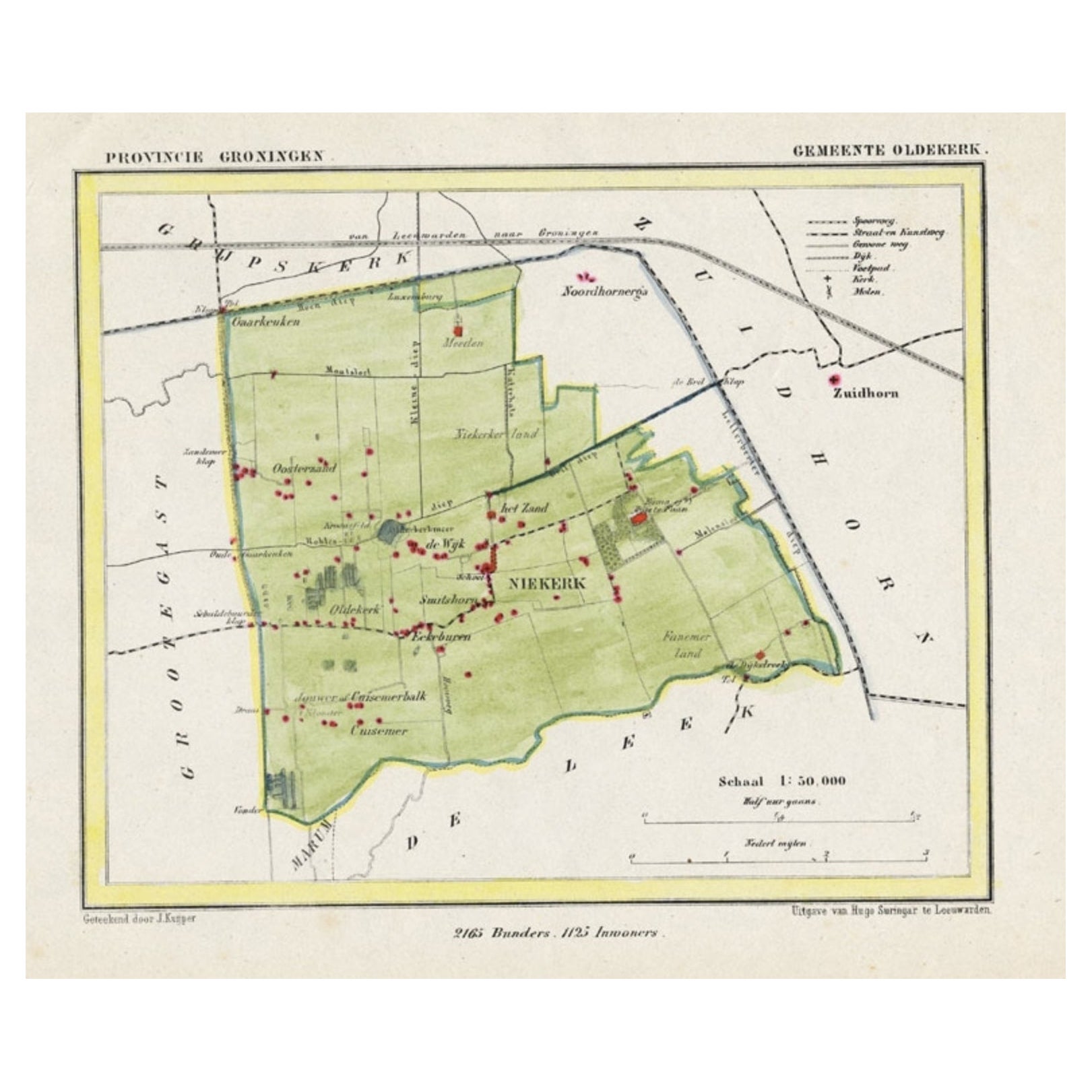
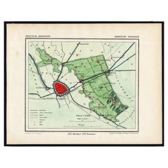
- Dutch Municipality of Oldekerk in Groningen, The Netherlands, 1865Located in Langweer, NLGroningen: Gemeente Niekerk, Oldekerk. These scarse detailed maps of Dutch Towns originate from the 'Gemeente-atlas' of Jacob Kuyper. This atlas of all towns in the Netherlands w...Category
Antique 19th Century Maps
MaterialsPaper
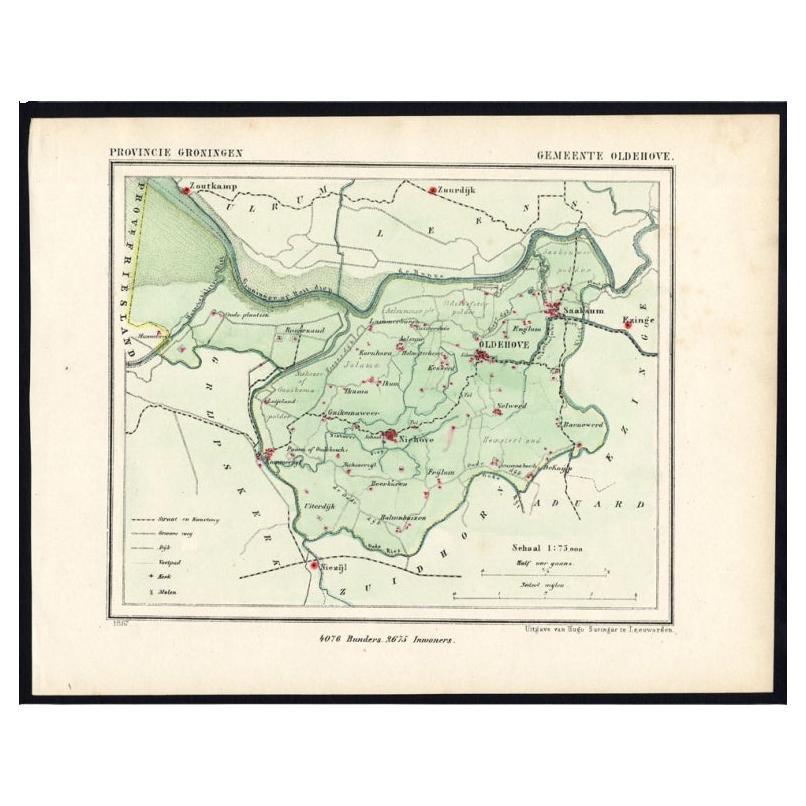
- Dutch Municipality of the Gemeente Oldehove in Grongingen, Kuyper, 1865Located in Langweer, NLGroningen: Gemeente Kommerzijl, Oldehove, Niehove, Saaksum. These scarse detailed maps of Dutch Towns originate from the 'Gemeente-atlas' of Jacob Kuyper. This atlas of all towns in ...Category
Antique 19th Century Maps
MaterialsPaper
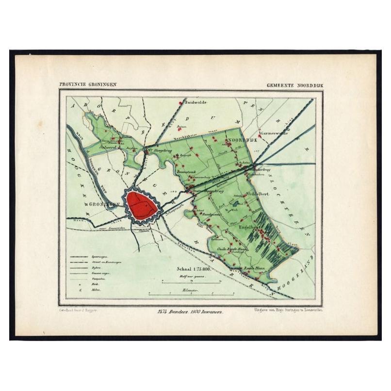
- Rare Map of Dutch Municipality Noorddijk Near Groningen, 1865Located in Langweer, NLGroningen: Gemeente Engelbert, Middelbert, Noorddijk. These scarse detailed maps of Dutch Towns originate from the 'Gemeente-atlas' of Jacob Kuyper. This atlas of all towns in the Ne...Category
Antique 19th Century Maps
MaterialsPaper
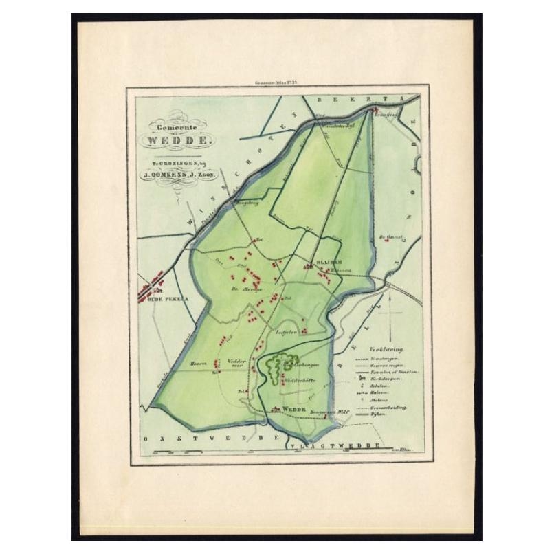
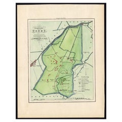
- Dutch Municipality of Wedde in Groningen, Fehse, 1862Located in Langweer, NLThese scarse detailed maps of Dutch Towns originate from the 'Gemeente atlas van de Provincie Groningen in 62 kaarten.' by C. Fehse. This atlas of all towns in Groningen, the Netherl...Category
Antique 19th Century Maps
MaterialsPaper
You May Also Like
- 1865 Chart of the Islands of MadeiraLocated in Norwell, MARare James Imray chart from 1865 titled "Chart of the Islands of Madeira, Porto Santo and Dezerea" drawn from the survey made by Captain Ate Vidal Royal Navy, London. Published by Ja...Category
Antique 1860s European Maps
MaterialsPaper
- Charles DICKENS, Our Mutual Friend, 1865 A PERFECT SET IN THE ORIGINAL 19 PARTSLocated in Hillsborough, NJAUTHOR: DICKENS, Charles. TITLE: Our Mutual Friend. (20 Parts in 19). PUBLISHER: London: Chapman and Hall, 1865. DESCRIPTION: FIRST EDITION A PERFECT SET IN THE ORIGINAL 19 PARTS. first issue of text with "pricipal" for "principal" in part 14, illustrated by Marcus Stone, original pictorial blue paper wrappers. CONDITION: A completely unsophisticated set with none of the spines being rebacked, some wear to the head and foot of spines, chipping to a few corners, internally clean and bright...Category
Antique 1860s British Books
MaterialsPaper
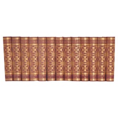
- Set of 13 Dutch EncyclopediasLocated in Baton Rouge, LAA collection of thirteen volumes of a Catholic encyclopedia by Dutch author N. V. Uitgeversmij. This set is leather bound with gold tooling stamped with the title and respective volu...Category
20th Century Dutch Other Books
MaterialsLeather, Paper
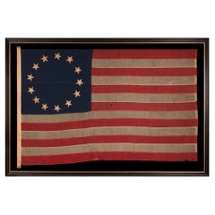
- 13 Star Antique American Flag in the Betsy Ross Pattern, ca 1861-1865Located in York County, PA13 star antique American flag in the Betsy Ross pattern, one of just three examples that I have encountered that pre-date the 1890’s; an extraordinary find, civil war period (1861-1865) or just after, extremely large among its counterparts of all periods in this design: Exceptional, early, American national flag, with 13 stars arranged in the circular wreath pattern most often attributed to Betsy Ross. Since there was no official configuration for the stars of the American flag until 1912, when our nation received its 47th and 48th states, the design, before that time, was left to the whims of the maker. This led to an almost unimaginable spectrum of star arrangements on the American flag during the 18th and 19th centuries. Even within the 13 star count, alone, there are at least 80 known patterns—more than the average person would even think possible. 13 star flags have been made throughout American history, from at least June 14th, 1777, when the first Flag Act was passed by Congress, until the present. They have been continuously produced for reasons both patriotic and utilitarian. Because this was the original number of stars on the American flag, representing the 13 colonies, it was appropriate for any device made in conjunction with celebrations or notions of American independence. 13 star flags were thus displayed at patriotic events, including, but certainly not limited to, such occasions as Lafayette’s final visit, in 1825-26, the nation’s centennial in 1876, and longstanding celebrations of Independence Day. From at least 1840 onward, 13 star flags were produced for presidential campaigns, drawing a parallel between the past and present struggles for freedom, and were carried by soldiers, during the Mexican and Civil Wars, for the same purpose. Throughout history, and even today, they are boldly displayed at every presidential inauguration. 13 star flags were flown by American ships both private and federal. The U.S. Navy used 13 stars on the ensigns made for small boats, because they wished the stars to be more easily discernable at a distance. Private ships often copied Navy practice, and when commercial flag makers first began to produce flags with pieced-and-sewn construction, in small sizes, in large quantity, they frequently employed the 13 star count. Flags in the Betsy Ross design are widely admired, due to the longstanding popularity of the Ross family myth. While many Americans learned in grammar school that Betsy Ross made and designed our first flag, and that the stars appeared in a circular fashion, there is, unfortunately, no way to prove the claim. No colonial examples have survived with this pattern of stars. In fact, while arranging the stars in a single circle seems quite logical, among the various choices that might come to mind, early American flags with this star pattern are curiously absent. One of the interesting misconceptions about 13 star flags is that the Betsy Ross pattern, even if not the original design, must have been common in early America. Logic would suggest this, given the frequency with which it appears in modern times, but this isn’t actually the case. In fact, the pattern is seldom encountered anywhere until much later. In more than 30 years of buying and selling early Americana, and over 20 years of extensive focus on the American flag specifically, through aggressively buying, researching, evaluating, restoring, and curating exhibitions, I have thus far encountered just three examples of Betsy Ross pattern flags that I can confidently date prior to the 1890's. No one knows what the first flag looked like. While there is no precise reason that the Betsy Ross design could not have been the first, one of the best arguments against it, is illustrated by the simple fact that so many 13 star flags exist without it. If the Ross configuration was the original, it stands to reason that the pattern would have been reproduced with at least some degree of frequency. Research conducted by the National Museum of American History notes that the story of Betsy Ross making the very first American flag for General George Washington, in the company of George Ross and Robert Morris, entered into American consciousness about the time of the 1876 centennial. The tale was immensely popular among an American public eager for stories about the Revolution and its heroes. The first documentation of it appeared shortly beforehand, in 1870, in a paper written by Betsy’s grandson, William Canby, for the Pennsylvania Historical Society. At the time, Canby made no mention of how the flag was designed, save for the fact that it had 5-pointed stars, per his grandmother’s suggestion. Because no earlier documentation supports the story, most flag scholars feel it was a grand hoax, fabricated by Canby for his own interests. Nothing survives in the collective writings of the three men, for example, nor in records of their words and deeds, which are fairly extensive. As with most things, reality is perhaps somewhere in the middle ground, with some of the details based on fact and some on fiction, made up, misinterpreted, or imagined from family accounts. The first time that a star configuration gets attached to the Ross story appears to have occurred during the last decade of the 19th century. In 1892, Charles Weisgerber painted a nine-by-twelve-foot rendition of the fabled meeting between Betsy and George Washington, in which there is a flag with a circular wreath. Shortly afterwards, in 1898, Betsy’s granddaughter and great-granddaughter began to make flags in the East Wing of Independence Hall in Philadelphia, selling them to tourists while disseminating the family folk tale. In that same year, Weisgerber and a “group of concerned citizens” sought to preserve Betsy’s former Philadelphia residence at 239 Arch Street, where she lived at the time the flag would have been sewed. Weisgerber moved his family into the house and immediately opened to the public the room in which Betsy was said to have worked her magic. Ten-cent memberships were sold to fund renovations and donors received a small calendar, to which a cotton 13 star Betsy Ross pattern parade flag was affixed. The effects of these events caused the Ross legend to stick and the story, with the corresponding flag design, has appeared ever since in more places than one could ever hope to count. The stars of this particular flag are made of cotton, hand-sewn, and double-appliquéd (applied to both sides). The canton and stripes of the flag are made of wool bunting that has been pieced and joined with treadle stitching. There is a sailcloth canvas binding along the hoist, with two brass grommets, one each at the extreme top and bottom. Along this, on the obverse, near the bottom, are two, unusual characters, embroidered with brown thread. These may be letter “I’s,” possibly forming a the Roman Numeral “II.” They are followed by an inscription, in blue ink, that appears to read “A. N. Smith.” The first character is stylized, and may alternatively be a “D,” “H,” or perhaps a “J.” Note how the binding is extended beyond the top and bottom-most points. Though quite unusual, this is sometimes encountered in early examples. The folding of the wool bunting back onto itself, with the binding stitched so that part of the fold is exposed, tends to be an early characteristic. Common in Civil war flags...Category
Antique 1860s American Political and Patriotic Memorabilia
MaterialsCotton
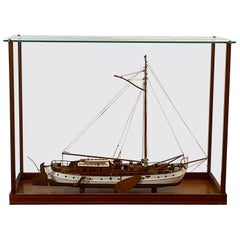
- Scale Model of a Dutch Lee BoarderLocated in Norwell, MAVery fine scale model of a Dutch Lee boarder. With mahogany deck and cabin, launch, spars, grab rails, etc. Details include rope coils, stove pipes, skylights, winch, chain, anchors,...Category
Vintage 1960s North American Models and Miniatures
MaterialsWood
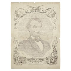
- 1865 Emancipation Proclamation with Abraham Lincoln Portrait, Antique EngravingLocated in Colorado Springs, COPresented is an elaborate engraved broadside presentation of both the preliminary and final Emancipation Proclamations, dated September 22, 1...Category
Antique 1860s American Historical Memorabilia
MaterialsPaper

Recently Viewed
View AllMore Ways To Browse
Late 20th Century Dutch
Dutch 16th Century Furniture
Dutch School Antique
Antique School Map
Antique School Maps
Map Globe
Globe Map
Framed Antique Map
Jacques Antiques
Africa Map
Map Of Africa
Large Metal Cross
Maps Of Africa
Antique German Map
Antique German Maps
Antique Map Germany
Antique Maps Germany
Antique Collectable Market