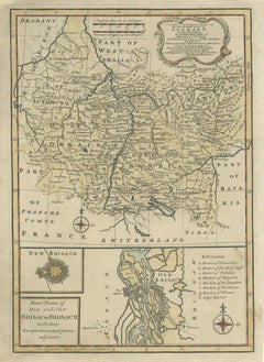
Antique Map Germany
21
to
169
828
165
718
369
265
247
121
80
73
68
66
59
58
46
46
27
25
24
20
20
18
15
15
14
14
13
12
12
10
10
10
9
9
9
7
7
7
5
5
5
5
4
4
4
4
3
3
3
2
2
1
30
28
25
19
15
Sort By
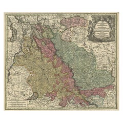
Old Map of the Rhine & German Cities Incl Düsseldorf, Bonn, Köln, Etc., c.1730
Located in Langweer, NL
Antique map Germany titled 'Mappa Geographica continens Archiepiscopatum et Electoratum Coloniensem
Category
1730s Antique Map Germany
Materials
Paper
H 20.67 in W 24.02 in D 0 in
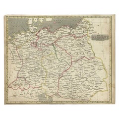
Antique Map of Germany by Walker, 1820
By R. Walker
Located in Langweer, NL
Antique map Germany titled 'Map of Germany as defined by the Peace of Paris'. Detailed antique map
Category
19th Century Antique Map Germany
Materials
Paper
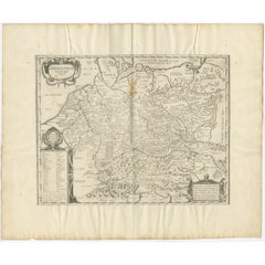
Antique Map of Germany of German in Roman Times, c.1660
Located in Langweer, NL
Antique map Germany titled 'Germaniae Veteris Typus'. Antique map probably by Blaeu or based on an
Category
17th Century Antique Map Germany
Materials
Paper
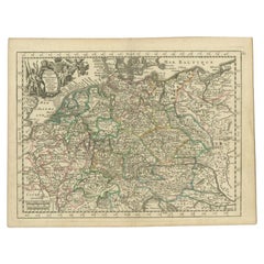
Antique Map of the German Empire by Le Rouge, 1743
Located in Langweer, NL
Antique map Germany titled 'L'Empire d'Allemagne dedie a Monseigneur Amelot (..)'. Antique map of
Category
18th Century Antique Map Germany
Materials
Paper
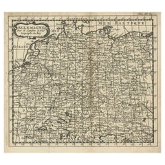
French Antique Miniature Map of Germany and Surrounding Countries, 1721
Located in Langweer, NL
Antique map Germany titled 'Allemagne Par N. Sanson le Fils Geographe du Roy'. Minitaure map of
Category
18th Century Antique Map Germany
Materials
Paper
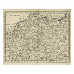
Antique Copper Engraved Map of Germany in the Early 18th Century, c.1740
Located in Langweer, NL
Antique map Germany titled 'Allemagne'.
Rare miniature map of Germany and surroundings. Also
Category
18th Century Antique Map Germany
Materials
Paper
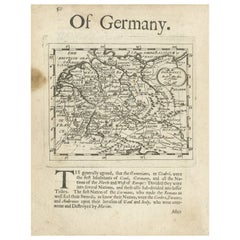
Rare Antique Map of Germany with English Text, c.1690
Located in Langweer, NL
Antique map Germany titled 'Germani by Robt. Morden'. Rare antique map of Germany. Originates from
Category
17th Century Antique Map Germany
Materials
Paper
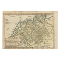
Antique Map of Part of Germany by Moll, c.1740
Located in Langweer, NL
Antique map Germany titled 'The North West Part of Germany; Containing ye Dominions of ye Arch: and
Category
18th Century Antique Map Germany
Materials
Paper
Antique Map of South West Germany with an Inset of Brisac or Brisach, France
Located in Langweer, NL
Antique map Germany titled 'A New and Accurate Map of the South West part of Germany. Comprehending
Category
18th Century Antique Map Germany
Materials
Paper
H 15.36 in W 10.24 in D 0 in
Antique Map of the German Empire by De Leth, 1749
Located in Langweer, NL
Antique map Germany titled 'L'Empire d'Allemagne divisé en ses dix cercles et Autres Estats
Category
18th Century Antique Map Germany
Materials
Paper
Antique Map of Germany During the Mid-18th Century, Published in 1747
Located in Langweer, NL
Antique map Germany titled 'A New & Accurate Map of Germany'. It covers Germany during the mid-18th
Category
18th Century Antique Map Germany
Materials
Paper
Antique Map of Holstein, Germany
Located in Langweer, NL
Antique map titled 'Holsatia Ducatus'. Original old map of Holstein, Germany. By Petrus Kaerius
Category
Mid-17th Century Antique Map Germany
Materials
Paper
Antique Map of Saxony, Germany
Located in Langweer, NL
Original antique map titled 'Circulus Saxoniae Superioris'. Original antique map of Saxony, Germany
Category
Early 18th Century Antique Map Germany
Materials
Paper
German Antique Map of Oceania, 1895
Located in Langweer, NL
/ map originates from 1885-1907 editions of a famous German encyclopedia: 'Meyers grosses Konversations
Category
19th Century Antique Map Germany
Materials
Paper
Decorative Antique Map of Germany, 1846
Located in Langweer, NL
Antique map titled 'Germany'. Old map of Germany.
This map originates from 'A New Universal
Category
1840s Antique Map Germany
Materials
Paper
Antique Map centered on Nuremberg, Germany
Located in Langweer, NL
Antique map titled 'Territorium Norimbergense'. Beautiful map centered on Nuremberg, Germany. With
Category
Mid-17th Century Antique Map Germany
Materials
Paper
Antique German Hartleben's Volks Atlas Book World Maps
Located in Seguin, TX
Antique circa 1900 A. Hartleben's Volks-Atlas. Published by A. Hartleben's, Germany. Folio
Category
Early 20th Century German Aesthetic Movement Antique Map Germany
Materials
Paper
Antique Map of Upper Bavaria, Germany
Located in Langweer, NL
Antique map titled 'Bavariae pars superior cum insertis et adjacentibus regionibus non solum in
Category
Late 17th Century Antique Map Germany
Materials
Paper
Large Antique Map of the German Empire
Located in Langweer, NL
Antique map titled 'A Map of Germany (..)'. Large antique map of the German Empire, highly detailed
Category
Late 18th Century Antique Map Germany
Materials
Paper
Antique Map of Germany including surrounding countries
Located in Langweer, NL
Antique map titled 'Tabula Germaniae'. Orginal antique map of Germany by Claes Jansz. Visscher
Category
Mid-17th Century Antique Map Germany
Materials
Paper
Antique Map of Germany by Johnston '1909'
Located in Langweer, NL
Antique map titled 'Empire of Germany'. Original antique map of Germany. With inset maps of
Category
Early 20th Century Antique Map Germany
Materials
Paper
Antique Map of Germany and Central Europe
Located in Langweer, NL
Königreichen und Provincien'. Original antique map of Germany covering the central part of Europe with Germany
Category
Late 17th Century Antique Map Germany
Materials
Paper
Antique Map of Germany by Balbi '1847'
Located in Langweer, NL
Antique map titled 'Allemagne'. Original antique map of Germany. This map originates from 'Abrégé
Category
Mid-19th Century Antique Map Germany
Materials
Paper
Antique Hand-colored Map of Brandenburg, Germany
Located in Langweer, NL
Antique map titled 'Marchionatus Brandenburgicus'. Original antique map of Brandenburg, with
Category
Mid-17th Century Antique Map Germany
Materials
Paper
Antique Map of Germany by Clouet, 1787
Located in Langweer, NL
Antique map titled 'L'Allemagne'. Antique map of Germany. Originates from 'Geographie moderne avec
Category
Late 18th Century Antique Map Germany
Materials
Paper
Antique Map of the Niederrhein region, Germany
Located in Langweer, NL
Antique map titled 'Circulus Electorum Rheni sive Rhenanus Inferior (..)'. Original antique map of
Category
Late 17th Century Antique Map Germany
Materials
Paper
German Antique Map of Australia, Meyers, 1885
Located in Langweer, NL
original old antique print / plate / map originates from 1885-1907 editions of a famous German encyclopedia
Category
19th Century Antique Map Germany
Materials
Paper
Antique Map of Germany by Lapie, 1842
Located in Langweer, NL
Antique map titled 'Carte de la Germanie Ancienne'. Map of Germany. This map originates from 'Atlas
Category
Mid-19th Century Antique Map Germany
Materials
Paper
Antique Map of the Region near Cologne, Germany
Located in Langweer, NL
Antique map titled 'Carte de la Belgique d'après Ferraris'. Original antique map of the region near
Category
Mid-19th Century Antique Map Germany
Materials
Paper
Small Original Antique Map of Upper Saxony, Germany
Located in Langweer, NL
Antique map titled 'Saxonia Superior'. Small original antique map of Upper Saxony, Germany. Upper
Category
Early 17th Century Antique Map Germany
Materials
Paper
Antique Map of the Westphalia region of Germany
Located in Langweer, NL
Antique map titled 'Circulus Westphaliae (..)'. Original old map of the Westphalia region, Germany
Category
Late 17th Century Antique Map Germany
Materials
Paper
Antique Map of the Duchy of Westphalia, Germany
Located in Langweer, NL
Original antique map titled 'Westphalia Ducatus'. Fine map of the Duchy of Westphalia, Germany. The
Category
Mid-17th Century Antique Map Germany
Materials
Paper
Antique Map of German Colonies by Meyer, 1895
Located in Langweer, NL
Antique map titled 'Deutsche Kolonien.' Lithographed map of the German Colonies. German East-Africa
Category
19th Century Antique Map Germany
Materials
Paper
Antique Map of the Region of Oldenburg, Germany
By Willem Blaeu
Located in Langweer, NL
Antique map titled 'Oldenburg Comitatus'. Detailed old map of Oldenburg, Germany. The map also
Category
Mid-17th Century Antique Map Germany
Materials
Paper
Antique Map of Germany by Hederichs 'circa 1740'
Located in Langweer, NL
Antique map titled 'Germania'. Rare miniature map of Germany and surroundings. This map covers the
Category
Mid-18th Century Antique Map Germany
Materials
Paper
Antique Map of the Archdiocese of Cologne, Germany
Located in Langweer, NL
Antique map titled 'Archevesche et Eslectorat de Cologne avec ses Enclaves'. Original old map of
Category
Late 17th Century Antique Map Germany
Materials
Paper
Antique Map of Bavaria with many details, Germany
Located in Langweer, NL
-significant part of Germany. The map stretches south to Innsbruck and north to Amberg. Also shown are Munich
Category
Late 17th Century Antique Map Germany
Materials
Paper
Antique Map of The German Empire (West Sheet), 1882
Located in Langweer, NL
Transport yourself to the heart of history with an original Antique Map of The German Empire (west
Category
1880s Antique Map Germany
Materials
Paper
Antique Map of The German Empire (East Sheet), 1882
Located in Langweer, NL
Step into history with an authentic Antique Map of The German Empire (East Sheet) from the esteemed
Category
1880s Antique Map Germany
Materials
Paper
Antique Map of the Rhine centered on Cologne, Germany
Located in Langweer, NL
Rhine river, centered on Cologne, Germany. The Rhine River cuts across this map from south of Bonn
Category
Early 18th Century Antique Map Germany
Materials
Paper
Antique Map of the Nassau Region in Western Germany
Located in Langweer, NL
Germany between Koblenz, Hadamar, Giessen, Frankfurt and Mainz. The map is filled with information of
Category
Early 18th Century Antique Map Germany
Materials
Paper
Antique Map of the German Empire by Johnston, '1909'
Located in Langweer, NL
Antique map titled 'Empire of Germany'. Original antique map of the German Empire. With inset maps
Category
Early 20th Century Antique Map Germany
Materials
Paper
Antique Map of Prussia and Germany by Johnson, 1872
Located in Langweer, NL
Antique map titled 'Johnson's Prussia and Germany (..)'. Original map of Prussia and Germany, with
Category
Late 19th Century Antique Map Germany
Materials
Paper
Detailed Antique Map of the Lower Rhine region, Germany
Located in Langweer, NL
Antique map titled 'S.R.I. Circulus Rhanus Inferior sive Electorum Rheni (..)'. Detailed map of the
Category
Mid-18th Century Antique Map Germany
Materials
Paper
Antique Map of present-day North-Rhine Westphalia, Germany
Located in Langweer, NL
map of Germany showing the region bounded by the Maas River in the west and to part of Westphalia in
Category
Mid-18th Century Antique Map Germany
Materials
Paper
Antique Map of Germany and Switzerland by Lowry, '1852'
Located in Langweer, NL
Antique map titled 'Germany and Switzerland'. Four individual sheets of Germany and Switzerland
Category
Mid-19th Century Antique Map Germany
Materials
Paper
Old German Map of the Austrian Empire, ca.1870
Located in Langweer, NL
Antique map titled 'Kaiserthum Österreich'.
Old map of the Austrian Empire. This map originates
Category
1870s Antique Map Germany
Materials
Paper
Antique Map of the German Empire by Levasseur, '1875'
Located in Langweer, NL
Antique map titled 'Carte générale de l'Europe Centrale (..)'. Large map of the German Empire. This
Category
Late 19th Century Antique Map Germany
Materials
Paper
Antique Map of Germany by J.B. Elwe, 1792
Located in Langweer, NL
Antique map titled 'Germanie vulgo Duitschland (..)'. Decorative map of Germany with Silesia
Category
Late 18th Century Antique Map Germany
Materials
Paper
German Antique Map of the Indian Oceaan, Meyers, 1895
Located in Langweer, NL
This attractive original old antique print / plate / map originates from 1885-1907 editions of a
Category
19th Century Antique Map Germany
Materials
Paper
Antique Map of the German Empire by Johnston, 1882
By Alexander Keith Johnston
Located in Langweer, NL
Antique map titled 'Empire of Germany'. Old map of the German Empire with an inset map of Berlin
Category
19th Century Antique Map Germany
Materials
Paper
Antique Map of Franconia, a region of Germany, '1811'
By John Cary
Located in Langweer, NL
Antique map titled 'A New Map of the Circle of Franconia'. Detailed map of Franconia in
Category
Early 19th Century Antique Map Germany
Materials
Paper
Antique Map of the German Empire by Migeon, 1880
Located in Langweer, NL
Antique map titled 'Empire d'Allemagne'. Old map of Germany. With decorative vignette of Mainz
Category
19th Century Antique Map Germany
Materials
Paper
German Antique Map of Australia and Polynesia, c.1870
Located in Langweer, NL
Antique map titled 'Inseln des Grossen Oceans, Australien und Polynesien'. Old map of Australia and
Category
19th Century Antique Map Germany
Materials
Paper
Antique Map of Germany by T. Kitchin, circa 1770
Located in Langweer, NL
Antique map titled 'An Accurate Map of Germany (..) '. Drawn from the best Authorities by T.Kitchin
Category
Mid-18th Century Antique Map Germany
Materials
Paper
Antique Map of Germany by French Cartographer Lapie, 1842
Located in Langweer, NL
Antique map titled 'Carte d'Allemagne (..)'. Map of Germany. This map originates from 'Atlas
Category
19th Century Antique Map Germany
Materials
Paper
Decorative Original Antique Map of Southern Germany, c.1730
Located in Langweer, NL
"Antique map titled 'The South West Part of Germany. Containing ye Dominions of the Archbishops and
Category
18th Century Antique Map Germany
Materials
Paper
Antique Map of Northern Germany by Petri, c.1873
Located in Langweer, NL
Antique map titled 'Noord-Duitschland'. Old map depicting northern Germany. This map originates
Category
19th Century Antique Map Germany
Materials
Paper
Antique Map of Lower Saxony in Germany, c.1740
Located in Langweer, NL
Antique map titled 'Nieuwe Kaart van de Neder Saxise Kreits (..).' Attractive detailed map showing
Category
18th Century Antique Map Germany
Materials
Paper
Antique Map of Northern Germany by Wyld, c.1840
Located in Langweer, NL
, Hamburg and Lubeck Conformably with the Treaty of Paris'. Scarce regional map of Northern Germany filled
Category
19th Century Antique Map Germany
Materials
Paper
- 1
- ...
Get Updated with New Arrivals
Save "Antique Map Germany", and we’ll notify you when there are new listings in this category.
Antique Map Germany For Sale on 1stDibs
At 1stDibs, there are many versions of the ideal antique map Germany for your home. An antique map Germany — often made from paper, wood and glass — can elevate any home. There are many kinds of the antique map Germany you’re looking for, from those produced as long ago as the 18th Century to those made as recently as the 20th Century. When you’re browsing for the right antique map Germany, those designed in Art Nouveau, Georgian and Art Deco styles are of considerable interest. A well-made antique map Germany has long been a part of the offerings for many furniture designers and manufacturers, but those produced by Johann Baptist Homann, Matthew Seutter and Georg Braun and Frans Hogenberg are consistently popular.
How Much is a Antique Map Germany?
An antique map Germany can differ in price owing to various characteristics — the average selling price 1stDibs is $650, while the lowest priced sells for $72 and the highest can go for as much as $72,269.
