Items Similar to Old German Map of the Austrian Empire, ca.1870
Want more images or videos?
Request additional images or videos from the seller
1 of 6
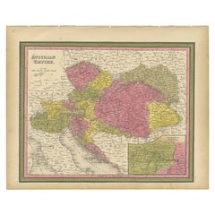
Old German Map of the Austrian Empire, ca.1870
About the Item
Antique map titled 'Kaiserthum Österreich'.
Old map of the Austrian Empire. This map originates from 'H. Kiepert's Kleiner Atlas der Neueren Geographie für Schule und Haus'.
Artists and Engravers: Kiepert, Heinrich (1818-1899), was a German geographer, and the son of a wealthy businessman.
- Dimensions:Height: 13.78 in (35 cm)Width: 17.64 in (44.8 cm)Depth: 0 in (0.02 mm)
- Materials and Techniques:
- Period:
- Date of Manufacture:circa 1870
- Condition:Condition: Good, general age-related toning. Split on folding line, please study image carefully.
- Seller Location:Langweer, NL
- Reference Number:
About the Seller
5.0
Platinum Seller
These expertly vetted sellers are 1stDibs' most experienced sellers and are rated highest by our customers.
Established in 2009
1stDibs seller since 2017
1,938 sales on 1stDibs
Typical response time: <1 hour
- ShippingRetrieving quote...Ships From: Langweer, Netherlands
- Return PolicyA return for this item may be initiated within 14 days of delivery.
More From This SellerView All
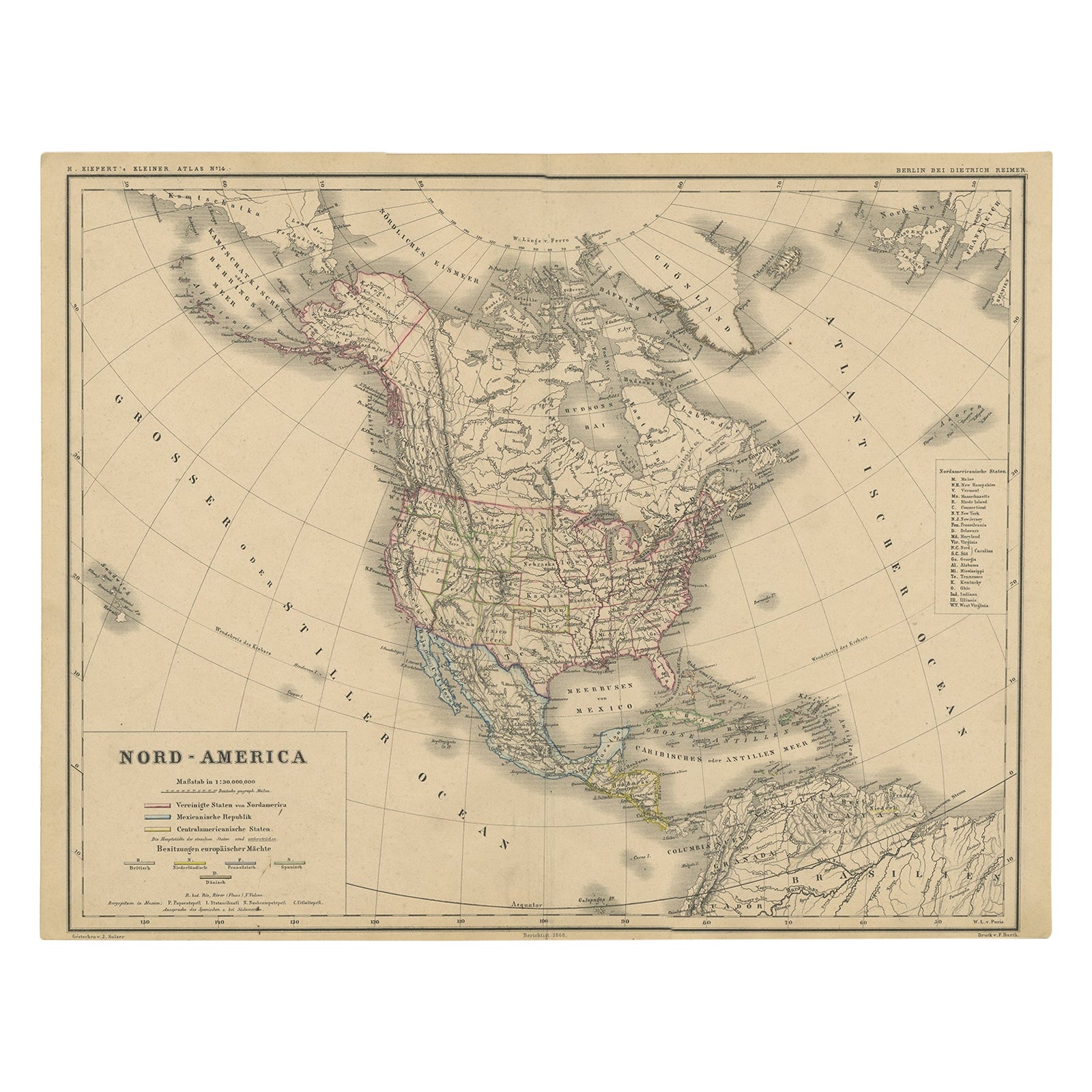
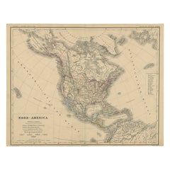
- Old Original Antique German Map of North America, ca.1870Located in Langweer, NLAntique map titled 'Nord-America'. Old map of North America. This map originates from 'H. Kiepert's Kleiner Atlas der Neueren Geographie für Schule und Haus'. Artists and Engrave...Category
Antique 1870s Maps
MaterialsPaper
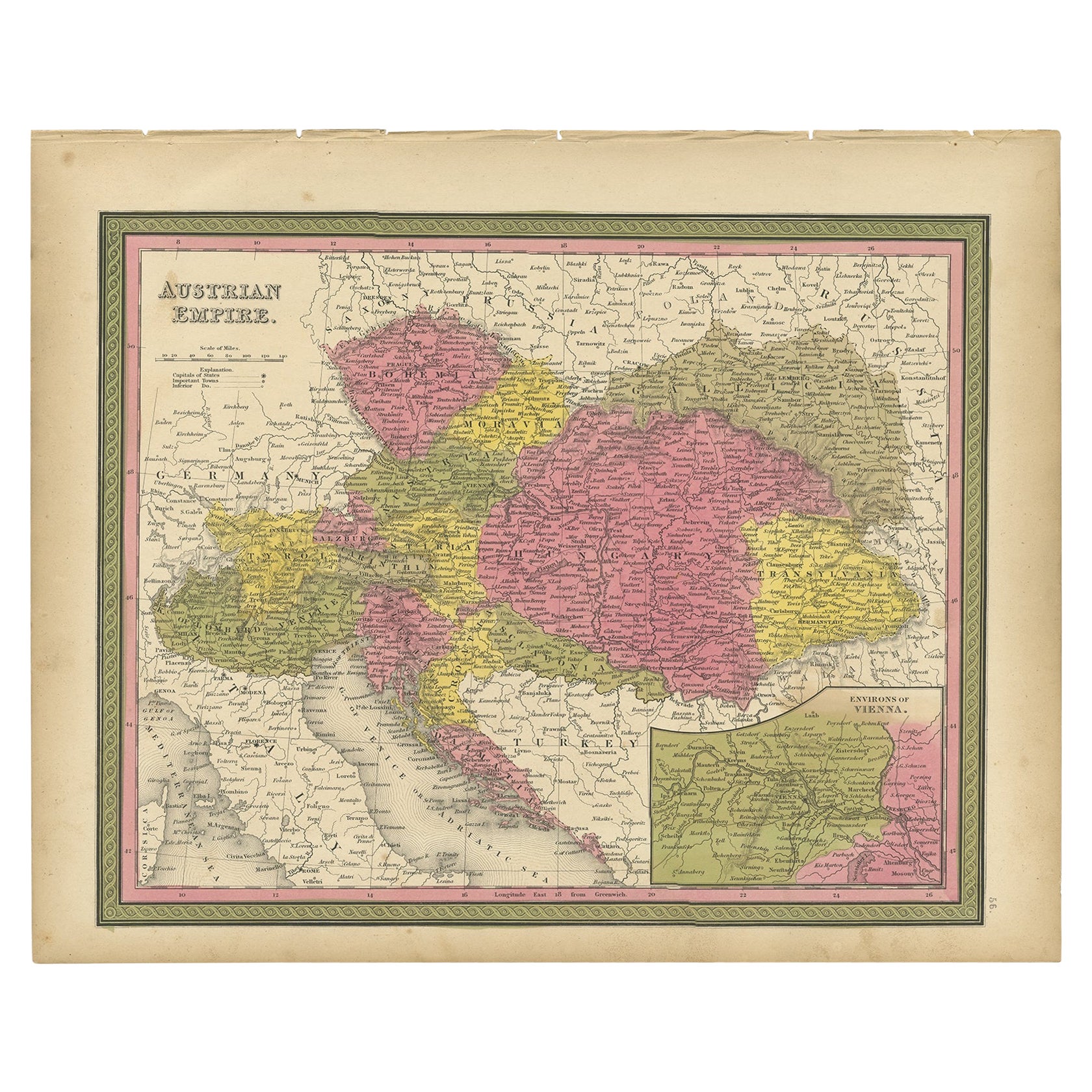
- Colourful Old Map of the Austrian Empire, with an Inset Map of Vienna, 1846Located in Langweer, NLAntique map titled 'Austrian Empire'. Old map of the Austrian Empire, with an inset map of Vienna. This map originates from 'A New Universal Atlas Co...Category
Antique 1840s Maps
MaterialsPaper
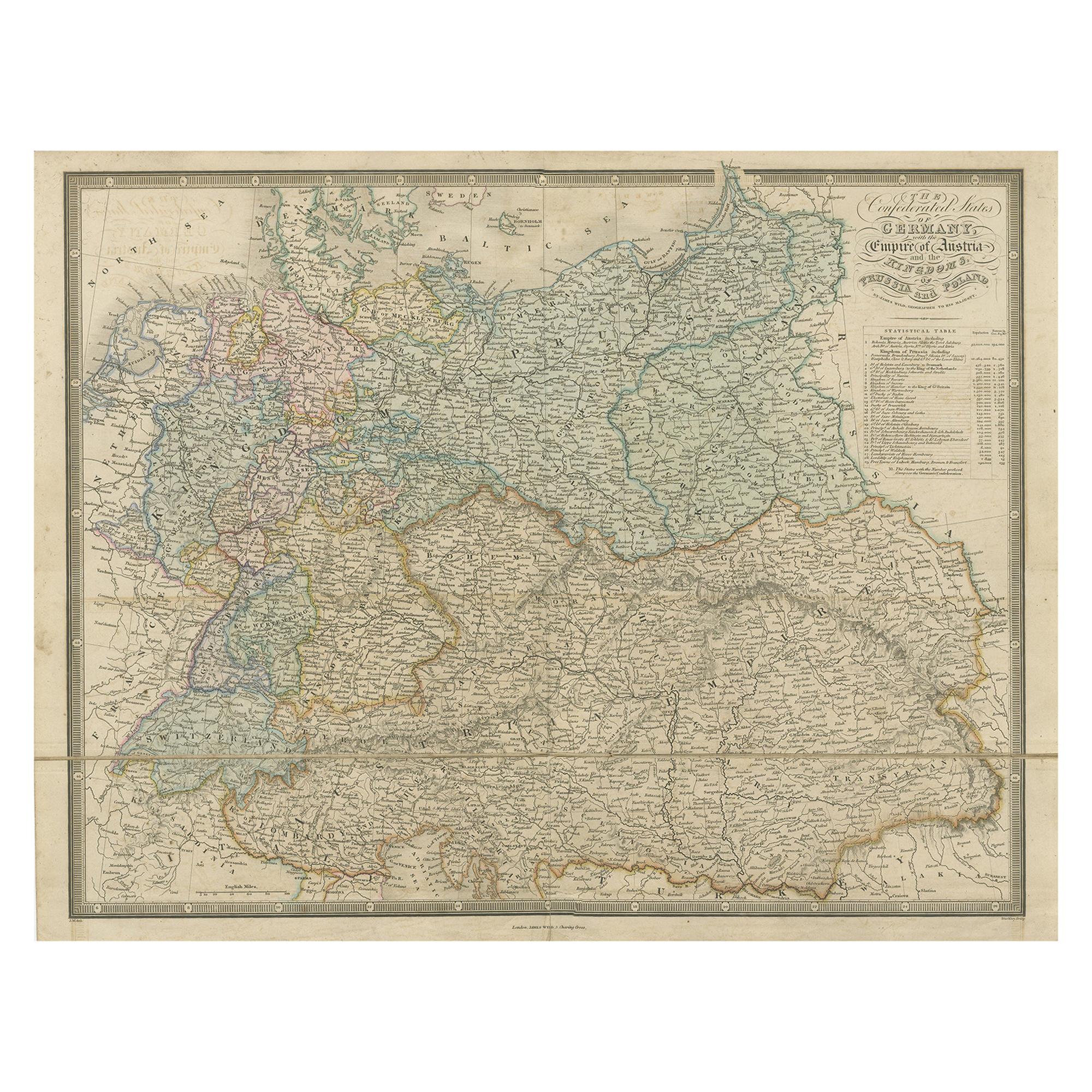
- Antique Map of Germany with the Empire of Austria by Wyld '1845'Located in Langweer, NLAntique map titled 'The Confederated States of Germany with the Empire of Austria, and The Kingdoms of Prussia and Poland'. Original antique map of ...Category
Antique Mid-19th Century Maps
MaterialsPaper
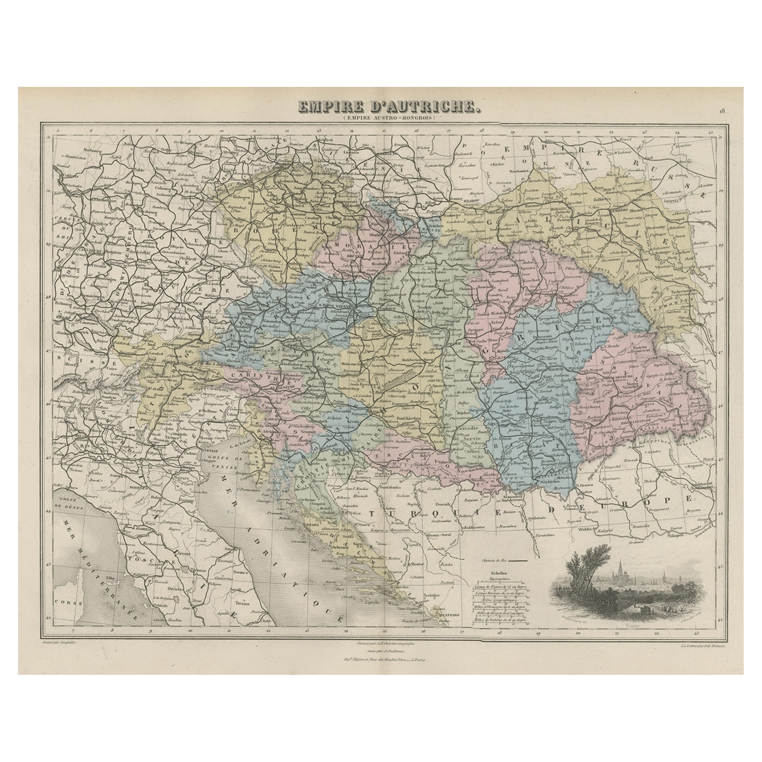
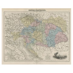
- Old Map of the Austrian Empire with Decorative Vignette of Vienna, 1880Located in Langweer, NLAntique map titled 'Empire d'Autriche'. Old map of the Austrian Empire. With decorative vignette with a view of Vienna. This map originates from 'Géographie Universelle Atlas-Mig...Category
Antique 1880s Maps
MaterialsPaper
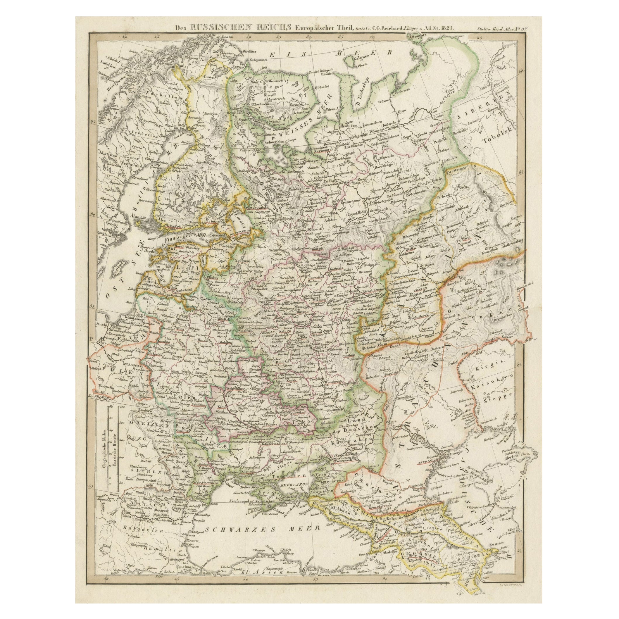
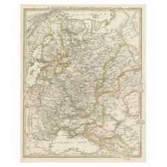
- Original Antique German Map of the Russian Empire in Europe, ca.1825Located in Langweer, NLAntique map titled 'Des Russischen Reichs - Europäische Theil'. Original antique map of the Russian Empire in Europe. This map originates from 'Stielers Handatlas'. Published circa...Category
Antique 1820s Maps
MaterialsPaper
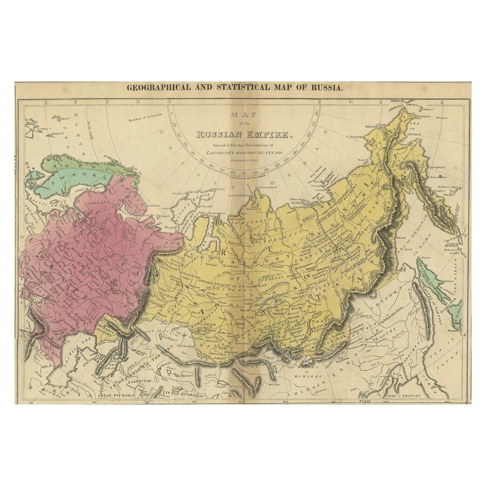
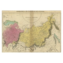
- Old Map of the Russian Empire, with English Language Text, Ca.1820Located in Langweer, NLAntique map titled 'Geographical, Statistical and Historical Map of Russia'. Old map of the Russian Empire, encompassed on three sides by English language text. Originates from L...Category
Antique 1820s Maps
MaterialsPaper

You May Also Like
- Set of 4 Antique Geographical Maps French-German War 1870-71Located in Casale Monferrato, ITElegant late 19th century set of four antique geographical maps relating to the positioning of the armies in the Franco-German War 1870-71. A...Category
Antique 1890s Italian Maps
MaterialsPaper
- Large Original Antique Map of The World, Fullarton, C.1870Located in St Annes, LancashireGreat map of the World. Showing both hemispheres From the celebrated Royal Illustrated Atlas Lithograph. Original color. Published by Fullarton, Edinburgh, C.1870 Unframed. Rep...Category
Antique 1870s Scottish Maps
MaterialsPaper
- Large Original Antique Map of The Pacific Ocean, Fullarton, C.1870Located in St Annes, LancashireGreat map of The Pacific Ocean From the celebrated Royal Illustrated Atlas Lithograph by Swanston. Original color. Published by Fullarton,...Category
Antique 1870s Scottish Maps
MaterialsPaper
- Old Nautical Map of CorsicaLocated in Alessandria, PiemonteST/556/1 - Old map of Corsica isle, surveyed by Captain Hell, of the French Royal Navy in 1824, engraved and published on 1874, with additions and corre...Category
Antique Early 19th Century English Other Prints
MaterialsPaper
- Old Horizontal Map of EnglandBy TassoLocated in Alessandria, PiemonteST/520 - Old rare Italian map of England, dated 1826-1827 - by Girolamo Tasso, editor in Venise, for the atlas of M.r Le-Sage.Category
Antique Early 19th Century Italian Other Prints
MaterialsPaper
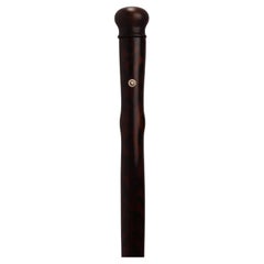
- Rare system walking stick, the flute. Austria 1870.Located in Milan, ITVery rare gadget-System walking stick: stick with the function of a music instrument, a flute. Painted fruitwood shaft, wooden handle. Inside the shaft is hollow, and holes and keys ...Category
Antique Late 19th Century Austrian Musical Instruments
MaterialsBrass, Iron


Recently Viewed
View AllMore Ways To Browse
1870 German
German Empire Furniture
German Empire
Austrian Empire
Empire Austria
Austrian And German Antique Furniture
General Empire
Map Austria
Map Of Austria
Antique Map German Empire
Antique Map Of Austria
Map Austrian Empire
Antique Admiral
Map Of Italy Antique
Antique Map Of Italy
Heir Antiques
Route Map
Marine 18th Century