Items Similar to Original Antique German Map of the Russian Empire in Europe, ca.1825


Want more images or videos?
Request additional images or videos from the seller
1 of 5
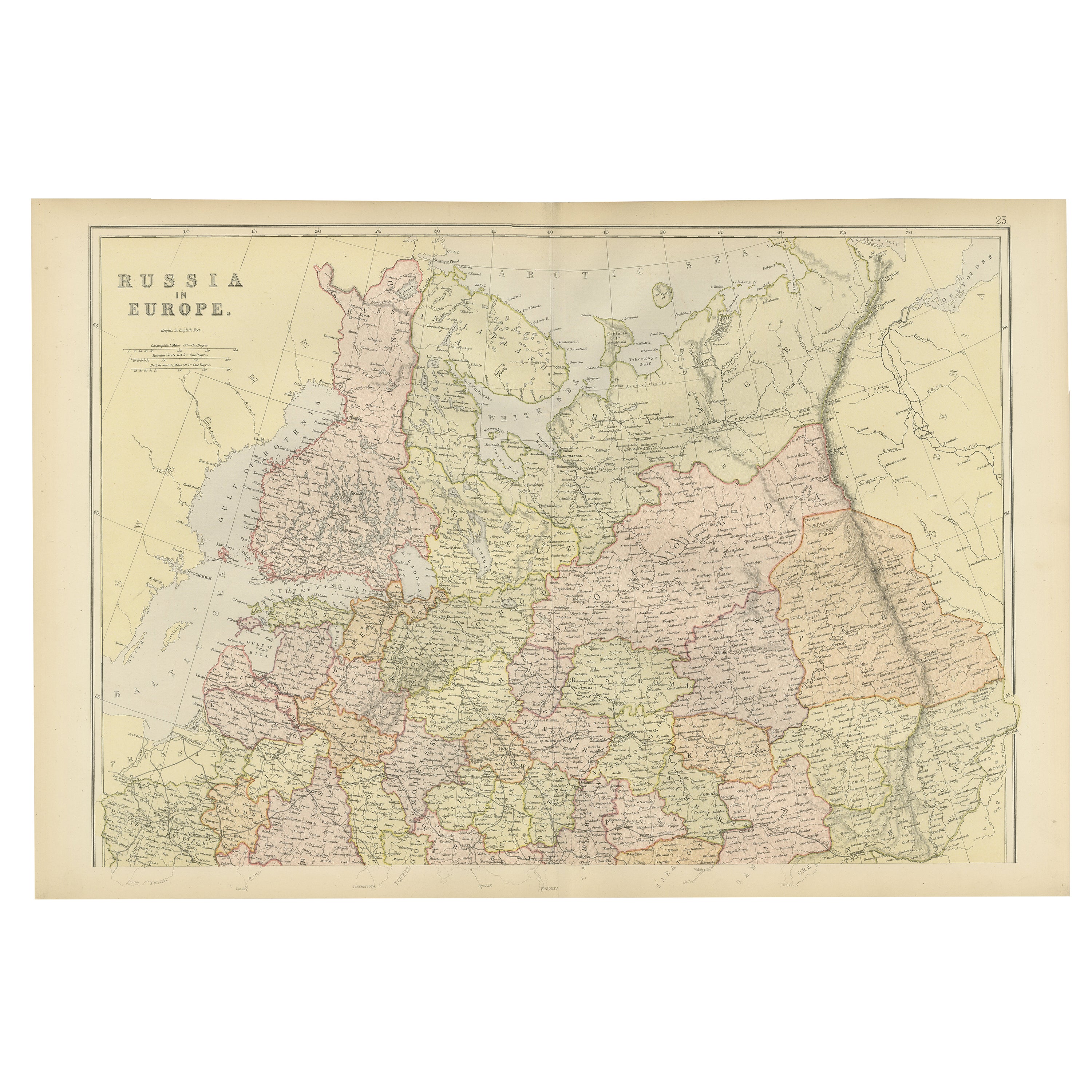
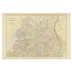
Original Antique German Map of the Russian Empire in Europe, ca.1825
About the Item
Antique map titled 'Des Russischen Reichs - Europäische Theil'.
Original antique map of the Russian Empire in Europe. This map originates from 'Stielers Handatlas'. Published circa 1825.
Artists and Engravers: Stielers Handatlas (after Adolf Stieler, 1775–1836), formally titled Hand-Atlas über alle Theile der Erde und über das Weltgebäude (Handy atlas of all parts of the world and of the universe), was the leading German world atlas of the last three decades of the 19th and the first half of the 20th century.
- Dimensions:Height: 12.37 in (31.4 cm)Width: 14.18 in (36 cm)Depth: 0 in (0.02 mm)
- Materials and Techniques:
- Period:
- Date of Manufacture:circa 1825
- Condition:Wear consistent with age and use. Condition: Good, general age-related toning. Original folding line. Blank verso. Please study image carefully.
- Seller Location:Langweer, NL
- Reference Number:
About the Seller
5.0
Platinum Seller
These expertly vetted sellers are 1stDibs' most experienced sellers and are rated highest by our customers.
Established in 2009
1stDibs seller since 2017
1,922 sales on 1stDibs
Typical response time: <1 hour
- ShippingRetrieving quote...Ships From: Langweer, Netherlands
- Return PolicyA return for this item may be initiated within 14 days of delivery.
More From This SellerView All
- Antique Map of the Russian Empire in Europe, ca.1780Located in Langweer, NLDescription: Antique map titled 'Bowles's New Pocket Map of the Russian Empire in Europe, Comprehending the West Part of the Empire in Asia' Large and detai...Category
Antique 1780s Maps
MaterialsPaper
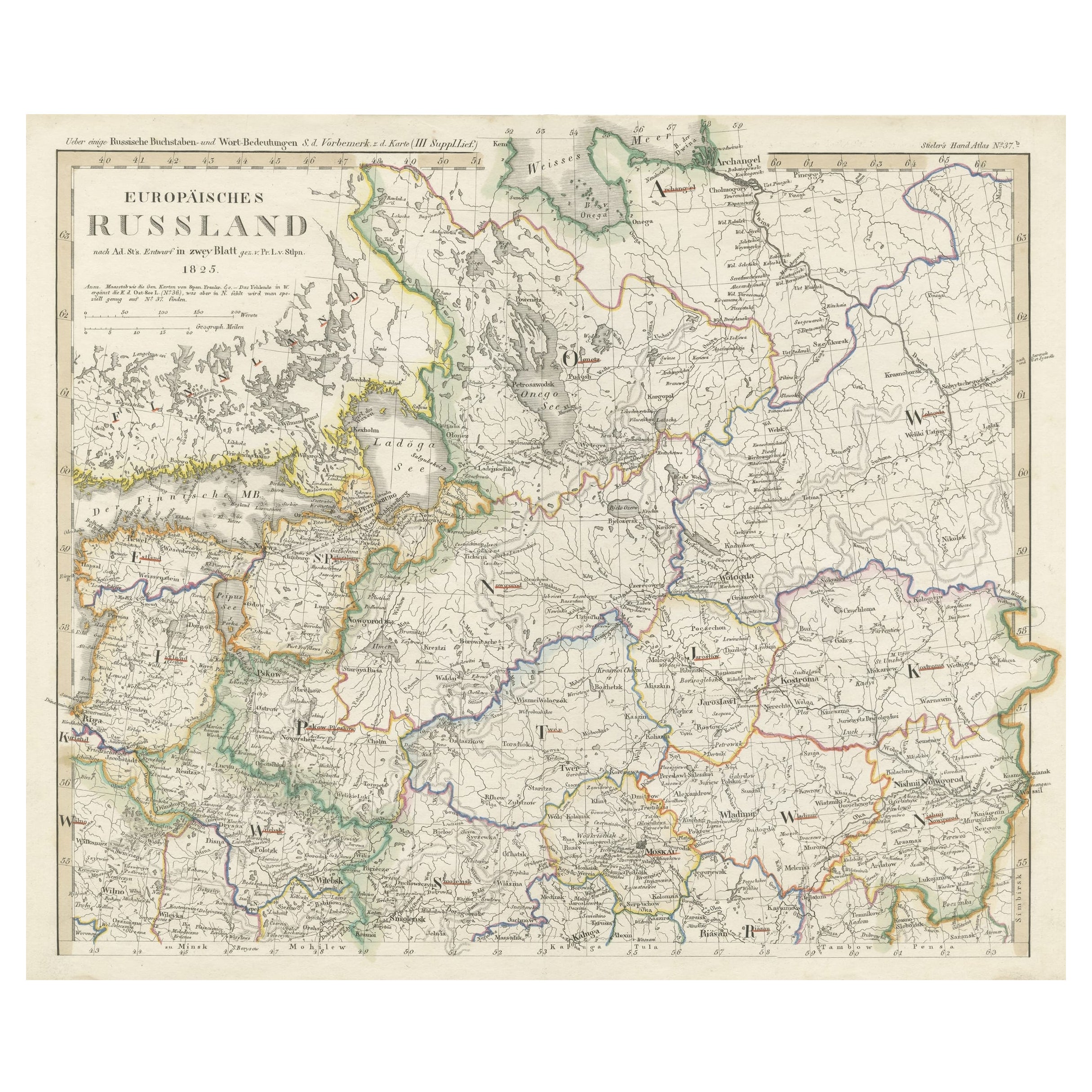
- Antique Map of Russia in Europe on Two Sheets from an Old German Atlas, Ca.1825Located in Langweer, NLDescription: Antique map titled 'Europäisches Russland'. Two individuel sheets, joined together they depict Russia in Europe. These maps originate from 'Stielers Handatlas'. Publis...Category
Antique 1820s Maps
MaterialsPaper
- Antique Map of the Russian Empire in Europe by Vaugondy, 1750Located in Langweer, NLAntique map titled 'Partie Occidentale de l'Empire de Russie (..)'. Detailed map of the western part of Russia, extending south to the Caspian and east to Irkurkoy and Ilimskoy. A...Category
Antique 18th Century Maps
MaterialsPaper
- Original Antique Map of Russia in Europe, 1882Located in Langweer, NLEmbark on an enthralling journey with an original Antique Map of European Russia from the esteemed 'Comprehensive Atlas and Geography of the World,' meticulously crafted in 1882. Thi...Category
Antique 1880s Maps
MaterialsPaper
- Original Antique Engraved Map of the Russian Empire, 1778Located in Langweer, NLDescription: Antique map titled 'A New and Correct Map of the Russian Empire'. Original antique map of the Russian Empire. This map originates from Moore's 'New and Complete Coll...Category
Antique 1770s Maps
MaterialsPaper
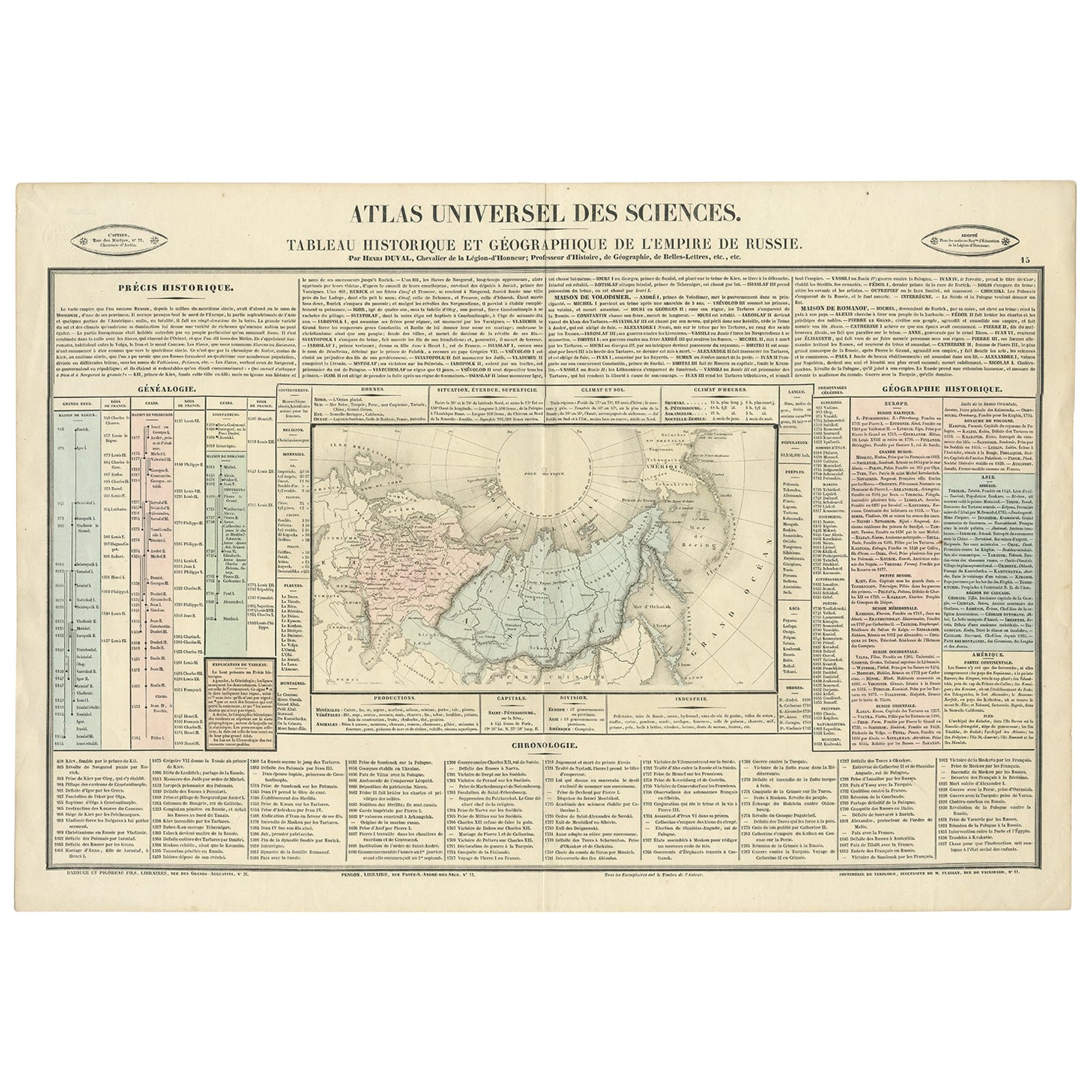
- Original French Antique Map of the Russian Empire, 1837Located in Langweer, NLAntique map titled 'Tableau Historique et Géographique de L'Empire de Russie'. Original antique map of the Russian Empire will detailed written information about the chronology, ...Category
Antique 1830s Maps
MaterialsPaper


You May Also Like
- Original Antique Map of Russia By Arrowsmith. 1820Located in St Annes, LancashireGreat map of Russia Drawn under the direction of Arrowsmith Copper-plate engraving Published by Longman, Hurst, Rees, Orme and Brown, 1820 Unframed.Category
Antique 1820s English Maps
MaterialsPaper
- 1814 Map of "Russian Empire" Ric.r032Located in Norton, MA1814 Map of "Russian Empire" Ric.r032 Russian Empire. Description: This is an 1814 John Thomson map of the Russian Empire. The map depicts the region from the Baltic Sea, Prussia, and Sweden to the Aleutian Islands and from the Arctic Ocean to the Yellow River. Highly detailed, myriad cities, towns, and villages are labeled throughout, including St. Petersburg, Moscow, Minsk, Kiev, and Kharkov. Rivers and mountain ranges are also identified, as are islands and numerous locations along the coastlines. It is important to note that the long-disputed sea between Korea and Japan is identified as the 'Sea of Japan. Historical Context: In 1815, Tsarist Russia emerged from the Napoleonic Wars economically insolvent and politically fearful of the Revolutionary fervor that had just swept through Europe. In order to shore up Russia's economic position, the Tsars began an aggressive series of expansions into the Caucuses and Central Asia that would vastly increase the landmass of the Russian Empire. Publication History Thomson maps are known for their stunning color, awe inspiring size, and magnificent detail. Thomson's work, including this map, represents some of the finest cartographic art...Category
Antique 19th Century Unknown Maps
MaterialsPaper
- 1853 Map of "Russia in Europe Including Poland" Ric.r016Located in Norton, MADescription Russia in Europe incl. Poland by J Wyld c.1853 Hand coloured steel engraving Dimension: Paper: 25 cm W x 33 cm H ; Sight: 22 cm W x 28 cm H Condition: Good ...Category
Antique 19th Century Unknown Maps
MaterialsPaper
- 1849 Map of "Europaische Russland", 'Meyer Map of European Russia', Ric. R017Located in Norton, MA1849 Map of "Europaische Russland" ( Meyer Map of European Russia) Ric.r017 A lovely map of European Russia dating to 1849 by Joseph Meyer. It covers the European portions of...Category
Antique 19th Century Unknown Maps
MaterialsPaper
- Large Original Antique Map of Europe by Sidney Hall, 1847Located in St Annes, LancashireGreat map of Europe Drawn and engraved by Sidney Hall Steel engraving Original colour outline Published by A & C Black. 1847 Unframed Free shipping.Category
Antique 1840s Scottish Maps
MaterialsPaper
- Large1852 Map "Russian Empire" Ric.r0011Located in Norton, MALarge 1852 map "Russian Empire" George Phillips & Son 1852 Ric.r0011 Dimension: Paper: 67 cm W x 52 cm H ; Sight: 60cm W x 50 cm H Condition: Good Condition with aged tonin...Category
Antique 19th Century Unknown Maps
MaterialsPaper


Recently Viewed
View AllMore Ways To Browse
Antique In Europe
Russia Empire
1820 Europe Furniture
German Empire Furniture
German Empire
Russian Empire Furniture
1836 Antiques
Map Russia
Russian Map
Map Of Russia
Maps Of Russia
General Empire
Antique Russian Empire
Antique Russian Map
Antique Map Russia
Antique Map Of Russia
Antique Maps Of Russia
Antique Map German Empire