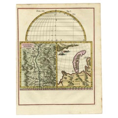
Alsace Map
to
6
36
5
17
15
14
11
9
7
6
5
5
5
2
2
2
2
1
1
1
1
1
1
1
1
1
5
3
1
1
Sort By
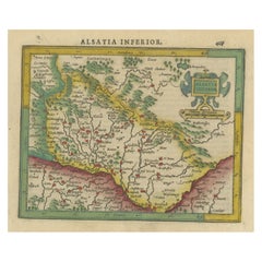
Small Original Antique Map of the Lower Alsace region, Germany
Located in Langweer, NL
Antique map titled 'Alsatia Inferior'. Small original antique map of the Lower Alsace region
Category
Antique Early 17th Century Maps
Materials
Paper
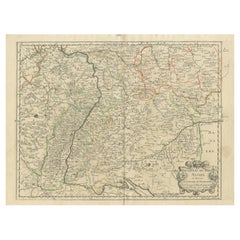
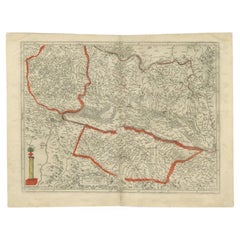
Antique Map of the Rhineland and Alsace Region with Original Hand Coloring
Located in Langweer, NL
Antique map titled 'Palitinat du Rhein, Alsace, et partie de Souabe de Franconie (..)'. Double-page
Category
Antique Mid-17th Century Maps
Materials
Paper
H 16.93 in W 22.45 in D 0.02 in
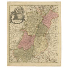
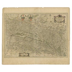
Antique Map of the Alsace Region of France by Schenk 'circa 1700'
Located in Langweer, NL
Antique map titled 'Superioris atque Inferioris Alsatiae'. Beautiful map of the Alsace region, from
Category
Antique Early 18th Century Maps
Materials
Paper
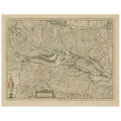
Old Map of the Alsace 'Elzas' Region with Lotharingen 'Lorraine', France, c1650
Located in Langweer, NL
Antique map titled 'Alsatia superior cum Suntgoia et Brisgoia'.
Old map of the Alsace (or Elzas
Category
Antique 1650s Maps
Materials
Paper
H 19.69 in W 23.04 in D 0 in
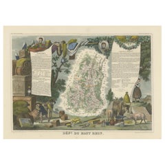
1852 Map of Haut-Rhin: An Illustrated Gateway to Alsace's Viticultural Splendors
Located in Langweer, NL
This original hand-colored map is from the "Atlas National Illustré," a work by Victor Levasseur, a
Category
Antique 1850s Maps
Materials
Paper
H 14.18 in W 20.75 in D 0 in
Antique Map of the Alsace Region of France by Hondius, c.1630
Located in Langweer, NL
Antique map titled 'Alsatia Superior (..)'. Original antique map of the Alsace (Elzas) region of
Category
Antique 17th Century Maps
Materials
Paper
Antique Map of the Alsace Region of France by Janssonius, c.1650
Located in Langweer, NL
Antique map titled 'Utriusquae Alsatiae Superioris Ac Inferioris Nova Tabula'. Map of the Alsace
Category
Antique 17th Century Maps
Materials
Paper
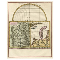
Remarkable Map of the Alsace Region and Nova Zembla, Russia, ca.1700
Located in Langweer, NL
Antique map titled 'Chorographia Alsatiae.'
Map of the Alsace region and Nova Zembla, printed
Category
Antique Early 1700s Maps
Materials
Paper
Antique Map of the Alsace region and Nova Zembla by Scherer, c.1700
Located in Langweer, NL
Antique map titled 'Chorographia Alsatiae.' Map of the Alsace region and Nova Zembla, printed for
Category
Antique 18th Century Maps
Materials
Paper
Map of the Alsace, France Incl the Rhine from Phillipsburg to South Basle, c1650
Located in Langweer, NL
Antique map titled 'Utriusquae Alsatiae Superioris Ac Inferioris Nova Tabula'.
Map of the
Category
Antique 1650s Maps
Materials
Paper
H 19.69 in W 23.23 in D 0 in
Antique Map of the Lower Alsace Region of France by Mapmaker Hondius, c.1630
Located in Langweer, NL
Antique map titled 'Alsatia Inferior'. Original antique map of the northern Alsace (Elzas) region
Category
Antique 17th Century Maps
Materials
Paper
H 16.34 in W 21.26 in D 0 in
Jacques Liozu's 1951 illustrated map of Alsace and Lorraine in France
By Jacques Liozu
Located in PARIS, FR
Jacques Liozu's 1951 illustrated map of Alsace and Lorraine is a remarkable work of cartography
Category
1950s Prints and Multiples
Materials
Paper, Lithograph
Original Antique Bird's-Eye View of Colmar, Alsace, France, 1552
Located in Langweer, NL
bird's-eye view of Colmar, Alsace, France. This map originates from 'La Cosmographie Universelle' by S
Category
Antique 16th Century Maps
Materials
Paper
Antique Map of Meurthe ‘France’ by V. Levasseur, 1854
Located in Langweer, NL
Lorraine and the Alsace-Lorraine wine region. This map originates from ‘Atlas National de la France
Category
Antique Mid-19th Century Maps
Materials
Paper
Antique Map of The German Empire (West Sheet), 1882
Located in Langweer, NL
Transport yourself to the heart of history with an original Antique Map of The German Empire (west
Category
Antique 1880s Maps
Materials
Paper
Antique Map of Meuse ‘France’ by V. Levasseur, 1854
Located in Langweer, NL
Antique map titled 'Dépt. de la Meuse'. Map of the French department of Meuse, France. This area
Category
Antique Mid-19th Century Maps
Materials
Paper
Decorative Original Antique Map of Southern Germany, c.1730
Located in Langweer, NL
"Antique map titled 'The South West Part of Germany. Containing ye Dominions of the Archbishops and
Category
Antique 18th Century Maps
Materials
Paper
Antique Map of France in Provinces, with Inset of Paris
Located in Langweer, NL
Antique map titled 'France par Provinces'. Original antique map of France in Provinces. It covers
Category
Antique Mid-19th Century Maps
Materials
Paper
Antique Map of the Rhine-Palatinate by Janssonius, circa 1630
Located in Langweer, NL
Antique map titled 'Nova Descriptio Palatinatus Rheni'. Detailed map of the Rhine-Palatinate, a
Category
Antique Mid-17th Century Maps
Materials
Paper
Antique Map of Bas-Rhin ‘France’ by V. Levasseur, 1854
By Victor Levasseur
Located in Langweer, NL
Antique map titled 'Dépt. du Bas Rhin'. Map of the French department of Bas-Rhin, France. Part of
Category
Antique Mid-19th Century Maps
Materials
Paper
Antique Map of Haut-Rhin, France by V. Levasseur, 1854
By Victor Levasseur
Located in Langweer, NL
Antique map titled 'Dépt. du Haut Rhin'. Map of the French department of Haut-Rhin, France. This
Category
Antique Mid-19th Century Maps
Materials
Paper
Antique Map of South West Germany with an Inset of Brisac or Brisach, France
Located in Langweer, NL
, Franconia, Swabia, Alsace, Lorrain etc'. This map covers the southwestern parts of Germany along with parts
Category
Antique 18th Century Maps
Materials
Paper
H 15.36 in W 10.24 in D 0 in
Original Vintage Poster Les Vignobles d'Alsace Vineyards French Wine Map Rhine
Located in London, GB
Wine Information Centre Colmar France. The poster features a colourful decorative map of the Alsace
Category
Vintage 1950s French Posters
Materials
Paper
H 38.98 in W 24.02 in D 0.04 in
Original Vintage Poster Vignobles De France Vineyards Vins D'Alsace Wine Map Art
Located in London, GB
map of the Alsace region marking the river Rhine and the vineyards with bunches of grapes surrounded
Category
Vintage 1950s French Posters
Materials
Paper
H 26.78 in W 33.27 in D 0.04 in
Original Vins du Sud-Ouest vintage French wine map poster
Located in Spokane, WA
Original Les Vignobles de France , Vins du Sud-Quest French vintage wine map poster. Horizontal
Category
Late 20th Century American Modern Landscape Prints
Materials
Lithograph
H 27 in W 36.5 in D 0.04 in
Haut Rhin, France. Antique map of a French department, 1856
By Victor Levasseur
Located in Melbourne, Victoria
Atlas National Illustre.
This mountainous area is part of the Alsace wine region and is known for its
Category
19th Century Naturalistic Landscape Prints
Materials
Engraving
Bas Rhin, France. Antique map of a French department, 1856
By Victor Levasseur
Located in Melbourne, Victoria
Atlas National Illustre.
Part of the Alsace wine region surrounding Strasbourg. This mountainous area
Category
19th Century Naturalistic Landscape Prints
Materials
Engraving
Original Vintage Poster Les Vignobles De France Vineyards Wine Map Cockerel Logo
Located in London, GB
Production Metropolitaine featuring a colourful pictorial map design showing a line of dancing wine growers
Category
Vintage 1960s French Posters
Materials
Paper
H 38.19 in W 24.81 in D 0.04 in
French 18th-19th Century Copper Overlaid Relief Medallion of Antoine Lavoisier
Located in Los Angeles, CA
a geological survey of Alsace-Lorraine in June 1767. In 1764 he read his first paper to the French
Category
Antique Early 1800s French Directoire Figurative Sculptures
Materials
Copper
H 49 in W 31 in D 18.75 in
Original Vintage Poster Les Vignobles d'Alsace Vineyards French Wine Map Rhine
Located in London, GB
Wine Information Centre Colmar France. The poster features a colourful decorative map of the Alsace
Category
1950s More Prints
Materials
Paper
Original Vintage Poster Vignobles De France Vineyards Vins D'Alsace Wine Map Art
Located in London, GB
map of the Alsace region marking the river Rhine and the vineyards with bunches of grapes surrounded
Category
1950s More Prints
Materials
Paper
Original Vintage Poster Les Vignobles De France Vineyards Wine Map Cockerel Logo
Located in London, GB
Production Metropolitaine featuring a colourful pictorial map design showing a line of dancing wine growers
Category
1960s More Prints
Materials
Paper
Original Antique WWI Poster Map War Is The National Industry Of Prussia Octopus
Located in London, GB
Original antique World War One map poster portraying Prussia as an octopus stretching its tentacles
Category
Vintage 1910s French Posters
Materials
Paper
H 23.82 in W 31.5 in D 0.04 in
Antique Map of the Region of Basel by Janssonius '1657'
By Johannes Janssonius
Located in Langweer, NL
, with part of Alsace and northern Burgundy and the Black Forest of Germany. This map originates from
Category
Antique Mid-17th Century Maps
Materials
Paper
Antique Map of Bas-Rhin ‘France’ by V. Levasseur, 1854
By Victor Levasseur
Located in Langweer, NL
Antique map titled 'Dépt. du Bas Rhin'. Map of the French department of Bas-Rhin, France. Part of
Category
Antique Mid-19th Century Maps
Original Vintage Poster Les Vignobles De France Wine Region Map French Vineyards
Located in London, GB
map of France showing the major wine producing regions marked in green with smaller detailed maps in
Category
Vintage 1960s French Posters
Materials
Paper
H 31.5 in W 45.28 in D 0.04 in
Original Vintage Drink Poster French Wine Les Vignobles De France Vineyards Map
Located in London, GB
Production Metropolitaine featuring a colourful pictorial map design showing a line of dancing wine growers
Category
Vintage 1960s French Posters
Materials
Paper
H 38.19 in W 24.81 in D 0.04 in
"Paris Street Scene, " Charles Cobelle, Colorful Naive French Landscape
By Charles Cobelle
Located in New York, NY
in Alsace-Lorraine, France. He is considered the last link to the great tradition of the Open Line
Category
Mid-20th Century Expressionist Landscape Paintings
Materials
Canvas, Oil
"Palais Garnier, Paris, " Charles Cobelle, Colorful Naive French Landscape
By Charles Cobelle
Located in New York, NY
–1994) was a modern French master of painting, lithography and a fine muralist, who was born in Alsace
Category
Mid-20th Century Expressionist Landscape Paintings
Materials
Canvas, Oil
"Coastal Beach, France, " Charles Cobelle, Colorful Naive French Landscape
By Charles Cobelle
Located in New York, NY
in Alsace-Lorraine, France. He is considered the last link to the great tradition of the Open Line
Category
Mid-20th Century Expressionist Landscape Paintings
Materials
Canvas, Oil
Original Vintage Poster Les Vignobles De France Wine Region Map French Vineyards
Located in London, GB
map of France showing the major wine producing regions marked in green with smaller detailed maps in
Category
1960s More Prints
Materials
Paper
Original Vintage Drink Poster French Wine Les Vignobles De France Vineyards Map
Located in London, GB
Production Metropolitaine featuring a colourful pictorial map design showing a line of dancing wine growers
Category
1960s More Prints
Materials
Paper
Original Antique WWI Poster Map War Is The National Industry Of Prussia Octopus
Located in London, GB
Original antique World War One map poster portraying Prussia as an octopus stretching its tentacles
Category
1910s More Prints
Materials
Paper
Get Updated with New Arrivals
Save "Alsace Map", and we’ll notify you when there are new listings in this category.
Alsace Map For Sale on 1stDibs
At 1stDibs, there are many versions of the ideal alsace map for your home. Each alsace map for sale was constructed with extraordinary care, often using paper. Whether you’re looking for an older or newer alsace map, there are earlier versions available from the 18th Century and newer variations made as recently as the 20th Century.
How Much is a Alsace Map?
The average selling price for a alsace map at 1stDibs is $493, while they’re typically $157 on the low end and $1,492 for the highest priced.
More Ways To Browse
Classical Sculpture Mercury Busts
17 Century Wood Bust
11c Black Jacket
Lead Pig
Bust Down Iced
Physics Instruments
Tinned Copper Jar
Vintage Algerie
Jar Diamond Ring
Roussillon Provence
Sell Old Class Rings
Victor Levasseur On Sale
Milk Bottle Print
Venus Busy
Antique Laboratory Scales
Milk Glass Bottle Vintage
Soda King
Air King Jet
