Items Similar to Antique Map of the Rhine-Palatinate by Janssonius, circa 1630


Want more images or videos?
Request additional images or videos from the seller
1 of 5
Antique Map of the Rhine-Palatinate by Janssonius, circa 1630
About the Item
Antique map titled 'Nova Descriptio Palatinatus Rheni'. Detailed map of the Rhine-Palatinate, a state of Germany located in the west of the country. The map tracks the course of the Rhine from the Alsace Region to Frankfurt and Bungen. Some of the major cities located include Darmstate, Worms, Heidelberg, and Pforzheim. Published by J. Janssonius.
- Dimensions:Height: 16.34 in (41.5 cm)Width: 21.26 in (54 cm)Depth: 0.02 in (0.5 mm)
- Materials and Techniques:
- Period:Mid-17th Century
- Date of Manufacture:circa 1630
- Condition:Original/contemporary hand coloring. General age-related toning, folding line flattened. German text on verso, please study image carefully.
- Seller Location:Langweer, NL
- Reference Number:
About the Seller
5.0
Platinum Seller
These expertly vetted sellers are 1stDibs' most experienced sellers and are rated highest by our customers.
Established in 2009
1stDibs seller since 2017
1,932 sales on 1stDibs
Typical response time: <1 hour
- ShippingRetrieving quote...Ships From: Langweer, Netherlands
- Return PolicyA return for this item may be initiated within 14 days of delivery.
More From This SellerView All
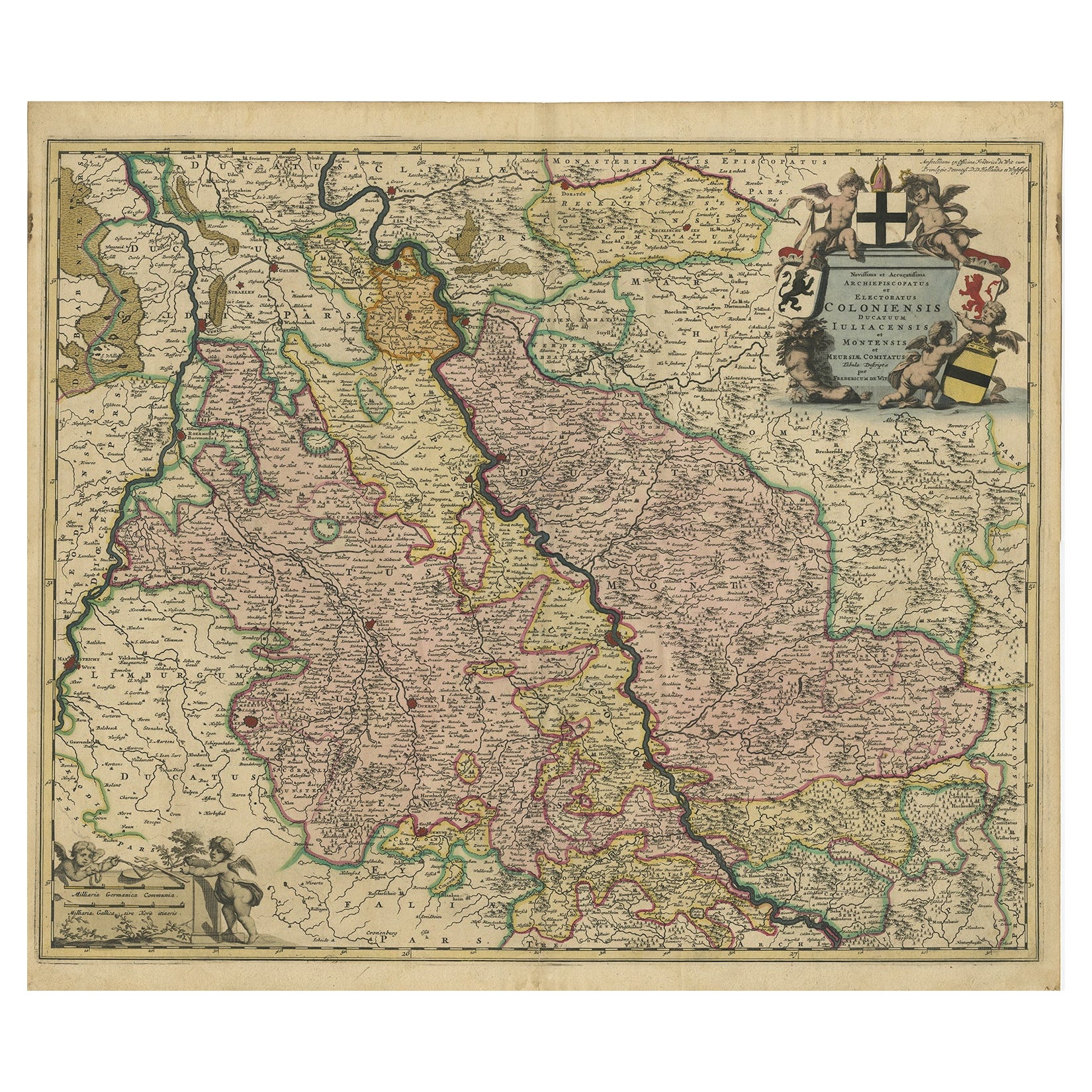
- Rhine Splendor: Antique Map of the Lower Rhine Region, circa 1680Located in Langweer, NLThe antique map titled 'Novissima et Accuratissima Archiepiscopatus et Electoratus Coloniensis Ducatuum Iuliancensis et Montensis et Meursiae Comitatus' is a handsome and detailed ma...Category
Antique 1680s Maps
MaterialsPaper
- Antique Map of the Vermandois Region by Janssonius, circa 1650By Johannes JanssoniusLocated in Langweer, NLAntique map titled 'Vermandois'. Old map of the Vermandois region, France. Vermandois was a French County that appeared in the Merovingian period. Its na...Category
Antique Mid-17th Century Maps
MaterialsPaper
- Antique Map of the Region of Beauvais by Hondius, circa 1630Located in Langweer, NLAntique map titled 'Beauvaisis - Comitatus Belovacium'. Old map of the region of Beauvais, France. This map originates from a composite atlas and is signed by J. Hondius.Category
Antique Mid-17th Century Maps
MaterialsPaper
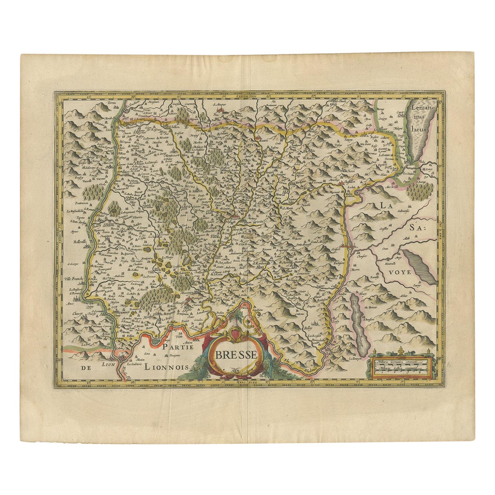
- Antique Map of the Region of Bresse by Hondius, circa 1630Located in Langweer, NLAntique map titled 'Bresse'. Old map of the former region of Bresse, France. It is located in the regions of Auvergne-Rhône-Alpes and Bourgogne-Franche-Comté of eastern France. This ...Category
Antique Mid-17th Century Maps
MaterialsPaper
- Antique Map of the Region of Lyon by Hondius, circa 1630Located in Langweer, NLAntique map titled 'Lionnois, Forest et Beauiolois'. Old map of the former region of Lyon, Vienne, Bresse, Rohan and the Rhône River. This map originates f...Category
Antique Mid-17th Century Maps
MaterialsPaper
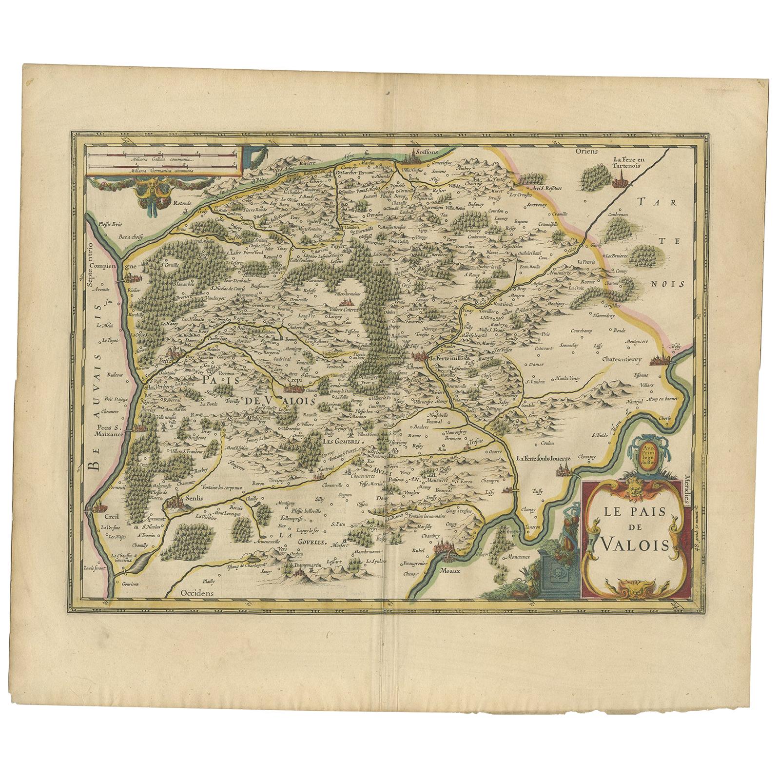
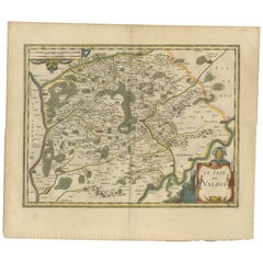
- Antique Map of the Region of Valois by Hondius, circa 1630Located in Langweer, NLAntique map titled 'Le Pais de Valois'. Old map of the historic region of Valois, France. It corresponds to the southeastern quarter of the modern département of Oise, with an adjace...Category
Antique Mid-17th Century Maps
MaterialsPaper


You May Also Like
- Germany West of the Rhine: A Hand-colored 18th Century Map by de WitBy Frederick de WitLocated in Alamo, CAThis original 18th century hand-colored map of the county of Moers, Germany entitled "Illustrissimo Celsissmo Principi GUILIELMO HENRICO D.G. Arausionum Principi Domino suo Clementis...Category
Antique Early 18th Century Dutch Maps
MaterialsPaper
- Antique 1630 Colored Belgium Map Flandria Gallica Flanders Henricus HondiusLocated in Dayton, OH"Antique hand colored map of Flanders, Belgium, circa 1630, engraved by Henricus Hondius. “Henricus Hondius II (1597 – 16 August 1651) was a Dutch eng...Category
Antique Early 17th Century Renaissance Maps
MaterialsPaper
- 17th Century Hand-Colored Map of a Region in West Germany by JanssoniusBy Johannes JanssoniusLocated in Alamo, CAThis attractive highly detailed 17th century original hand-colored map is entitled "Archiepiscopatus Maghdeburgensis et Anhaltinus Ducatus cum terris adjacentibus". It was published ...Category
Antique Mid-17th Century Dutch Maps
MaterialsPaper
- Original Antique Map of Belgium by Tallis, Circa 1850Located in St Annes, LancashireGreat map of Belgium Steel engraving Many lovely vignettes Published by London Printing & Publishing Co. ( Formerly Tallis ), C.1850 Origin...Category
Antique 1850s English Maps
MaterialsPaper
- Prussia, Poland, N. Germany, Etc: A Hand-colored 17th Century Map by JanssoniusBy Johannes JanssoniusLocated in Alamo, CAThis is an attractive hand-colored copperplate engraved 17th century map of Prussia entitled "Prussia Accurate Descripta a Gasparo Henneberg Erlichensi", published in Amsterdam by Joannes Janssonius in 1664. This very detailed map from the golden age of Dutch cartography includes present-day Poland, Latvia, Lithuania, Estonia and portions of Germany. This highly detailed map is embellished by three ornate pink, red, mint green and gold...Category
Antique Mid-17th Century Dutch Maps
MaterialsPaper
- Original Antique Map of The World by Thomas Clerk, 1817Located in St Annes, LancashireGreat map of The Eastern and Western Hemispheres On 2 sheets Copper-plate engraving Drawn and engraved by Thomas Clerk, Edinburgh. Published by Mackenzie And Dent, 1817 ...Category
Antique 1810s English Maps
MaterialsPaper


Recently Viewed
View AllMore Ways To Browse
Antique State Maps
West German Antiques
West Nova
Frankfurt Map
Alsace Map
Original Antique World Map
Map Of United States
Antique German Collectible
Authentic Antique Maps
The United States Map
Map France
Map Of The United States
Antiques From Scotland
France Antique Map
Antique Map France
Antique French Maps
Antique French Map
Antique Maps France