Frankfurt Map

2
to
7
46
28
53
35
19
12
10
9
8
5
5
4
4
4
3
3
3
3
3
2
2
2
2
2
1
1
1
1
1
1
1
1
1
1
1
1
6
5
4
3
3
Sort By
18th Century Hand-Colored Homann Map of Germany, Including Frankfurt and Berlin
By Johann Baptist Homann
Located in Alamo, CA
An 18th century hand-colored map entitled "Tabula Marchionatus Brandenburgici et Ducatus Pomeraniae
Category

Antique Early 18th Century German Maps

Materials

Paper

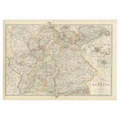
Antique Map of Germany by Johnston '1909'
Located in Langweer, NL
Frankfurt and Munich. This map originates from the ‘Royal Atlas of Modern Geography’. Published by W. & A.K
Category

Early 20th Century Maps

Materials

Paper

Antique Map of Germany by Johnston '1909'
Free Shipping
H 19.49 in W 28.15 in D 0.02 in
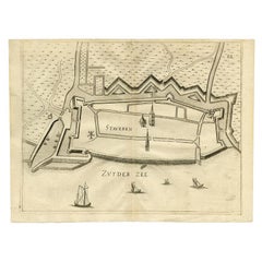
Antique Map of Stavoren by Priorato, 1673
Located in Langweer, NL
Netherlands. This map orginates from 'Teatro del Belgio (..)', published in Frankfurt am Main in 1673 by
Category

Antique 17th Century Maps

Materials

Paper

Antique Map of Stavoren by Priorato, 1673
H 13.51 in W 18.12 in D 0 in
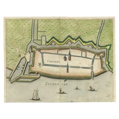
Antique Map of Stavoren by Priorato, 1673
Located in Langweer, NL
Netherlands. This map orginates from 'Teatro del Belgio (..)', published in Frankfurt am Main in 1673 by
Category

Antique 17th Century Maps

Materials

Paper

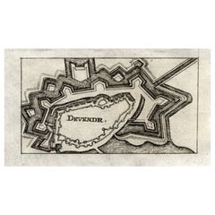
Antique Map of Deventer in the Netherlands, 1691
Located in Langweer, NL
.', published by C. Riegel, Frankfurt, Leipzig, 1691. Artists and Engravers: Published by Christoff Riegel
Category

Antique 17th Century Maps

Materials

Paper

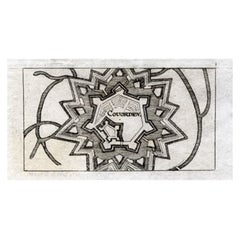
Antique Map of Coevorden in the Netherlands, 1691
Located in Langweer, NL
.', published by C. Riegel, Frankfurt, Leipzig, 1691. Artists and Engravers: Published by Christoff Riegel
Category

Antique 17th Century Maps

Materials

Paper

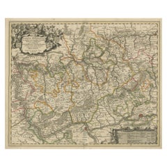
Antique Map of the Nassau Region in Western Germany
Located in Langweer, NL
Germany between Koblenz, Hadamar, Giessen, Frankfurt and Mainz. The map is filled with information of
Category

Antique Early 18th Century Maps

Materials

Paper

Antique Map of the Nassau Region in Western Germany
No Reserve
H 20.67 in W 24.1 in D 0.02 in
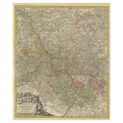
Detailed Antique Map of the Lower Rhine region, Germany
Located in Langweer, NL
Antique map titled 'S.R.I. Circulus Rhanus Inferior sive Electorum Rheni (..)'. Detailed map of the
Category

Antique Mid-18th Century Maps

Materials

Paper

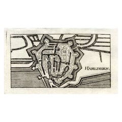
Antique Map of Harlingen, Harbour City in the Netherlands, 1691
Located in Langweer, NL
. Riegel, Frankfurt, Leipzig, 1691. Artists and Engravers: Published by Christoff Riegel (?-1714), the
Category

Antique 17th Century Maps

Materials

Paper

Antique Map of the Rhine-Palatinate by Janssonius, circa 1630
Located in Langweer, NL
Antique map titled 'Nova Descriptio Palatinatus Rheni'. Detailed map of the Rhine-Palatinate, a
Category

Antique Mid-17th Century Maps

Materials

Paper

Italian Parchment Map of the City of Lucca Dated 1640
By Matthäus Merian the Elder
Located in Roma, IT
An antique map of the Tuscan city of Lucca engraved for The 'Itinerarium Italiæ Nov-antiquæ' by
Category

Antique 1640s Italian Maps

Materials

Parchment Paper, Paper

Italian Parchment Map of the City of Pisa Dated, 1640
By Matthäus Merian the Elder
Located in Roma, IT
An antique map of the Tuscan city of Pisa engraved for The 'Itinerarium Italiæ Nov-antiquæ' by
Category

Antique 1640s Italian Maps

Materials

Paper

Antique Map of the City of Leeuwarden by Priorato, 1673
Located in Langweer, NL
Antique map titled 'Leverden'. This map depicts the city of Leeuwarden (Friesland, The Netherlands
Category

Antique 17th Century Maps

Materials

Paper

Antique Map of the City of Harlingen by Merian, c.1655
Located in Langweer, NL
Antique map titled 'Harlingen'. Original antique map of the city of Harlingen, Friesland, the
Category

Antique 17th Century Maps

Materials

Paper

Antique Map of the City of Verdun by Merian, c.1650
Located in Langweer, NL
Antique map titled 'Verdun'. Orginal antique map of Verdun, a small city in the Meuse department in
Category

Antique 17th Century Maps

Materials

Paper

1859 Detailed Map of North West Germany with Bavaria Inset - Blackie's Atlas
Located in Langweer, NL
The "Antique Map of North West Germany" with an inset map of Bavaria is a distinguished piece from
Category

Antique Mid-19th Century Maps

Materials

Paper

Hand-Colored Antique Map of part of Germany by M. Seutter, c. 1730
By Matthew Seutter
Located in Langweer, NL
Antique map titled 'Mappa Circuli Rhenani Superioris (..). Original map with hand coloring of part
Category

Antique Mid-18th Century Maps

Materials

Paper

Antique Map of Silesia, Southwest Poland and a City View of Wroclaw, c 1720
By Johann Baptist Homann
Located in Langweer, NL
Antique map titled 'Superioris et Inferioris ducatus Silesiae (..)'. Detailed map of Silesia by
Category

Antique Early 18th Century Maps

Materials

Paper

Old Map of Ancient Times covering Egypt Towards Arabia and India to Java, c.1660
Located in Langweer, NL
Description: Antique map titled 'Erythraei Sive Rubri Maris Periplus olim ab arriano descriptus
Category

Antique 1660s Maps

Materials

Paper

Original Antique Engraving of a Sea Chart of the Western Mediterranean, ca.1650
Located in Langweer, NL
Antique map titled 'Pascaerte van 't westlyckste deel vande Middelandsche-Zee (..)'. Sea chart of
Category

Antique 1650s Maps

Materials

Paper

Original Antique Bird's Eye View Plan of Hoorn, The Netherlands by Blaeu, c.1700
Located in Langweer, NL
produced his first maps in 1616 of France and Italy. In 1623 Janssonius owned a bookstore in Frankfurt am
Category

Antique Early 1700s Maps

Materials

Paper

Large Panoramic View of Eisenerz, an Old Mining Town in Styria, Austria, c.1650
Located in Langweer, NL
-born engraver who worked in Frankfurt for most of his career, where he also ran a publishing house. He
Category

Antique 1650s Maps

Materials

Paper

Original Copper Engraving of Koroni or Corone, Greece, ca.1690
Located in Langweer, NL
Meyer in Zurich. 1619 he went to Frankfurt where he worked for the publisher Johann Theodor de Bry
Category

Antique 1690s Maps

Materials

Paper

Map of Wittemberg and Frankfurt- by G. Braun and F. Hogenberg - 16th Century
By Franz Hogenberg
Located in Roma, IT
This Map of Wittemberg and Frankfurt (ancient names: Wittenburga - Francfordiensis) is an original
Category

16th Century Modern Figurative Prints

Materials

Etching

1813 Joh. W. Von Goethe & Alex. Von Humboldt; Comparative View of Mountains
Located in Norwich, GB
that would flourish throughout the remainder of the 19th century. This map is extremely scarce. It
Category

Antique 1810s Biedermeier Prints

Materials

Paper

1750 Schaffhausen, Seutter, Large and Detailed Map Switzerland
By Matthew Seutter
Located in Norwich, GB
referred to as the “German Vasari,” Joachim von Sandrart, born in Frankfurt, trained first as a printmaker
Category

Antique 1670s Italian Baroque Prints

Materials

Paper

Maps Red 17-5 - Geometric Original Colorful Oil Painting with Texture
By Petra Rös-Nickel
Located in Los Angeles, CA
Wiesbaden, Germany Affordable Art Fair Battersea, UK Discovery Art Fair, Frankfurt, Germany First Art Fair
Category

21st Century and Contemporary Abstract Abstract Paintings

Materials

Canvas, Mixed Media, Oil

Antique Bird's-Eye View of the City of Naples in Italy
Located in Langweer, NL
but eventually settled in Frankfurt; he was trained as an engraver. He married Maria Magdalena de Bry
Category

Antique Mid-17th Century Prints

Materials

Paper

Original Antique Bird's-Eye View of the City of Genoa
Located in Langweer, NL
eventually settled in Frankfurt; he was trained as an engraver. He married Maria Magdalena de Bry, daughter
Category

Antique Mid-17th Century Prints

Materials

Paper

Rare Hand Colored "Cabane Des Hold" - 1st Ed "Description de l’Univers" C. 1683
By Alain Manesson Mallet
Located in Soquel, CA
publication which contains maps of all parts of the then-known world (both ancient and modern), star maps
Category

1680s Realist Landscape Prints

Materials

Paper, Ink, Gouache

1657 Hoopoe, Bee-Eaters, Passerines, Matt. Merian, Folio Hand Coloured Engraving
Located in Norwich, GB
Frankfurt for most of his career, where he also ran a publishing house. Born in Basel, Merian learned
Category

Antique Early 1700s German Baroque Prints

Materials

Paper

Merian, Butterflies, Moths, Folio, Hand Coloured Engraving
Located in Norwich, GB
Frankfurt for most of his career, where he also ran a publishing house. Born in Basel, Merian learned the
Category

Antique Early 1700s German Baroque Prints

Materials

Paper

Vicinity of Flemington
By Julius Bien
Located in Florham Park, NJ
. Chromolithography. New York, 1883 - 1889 17 maps. 34” x 25” Paper Size. A lithographer and map engraver, Bien
Category

Late 19th Century Academic Prints and Multiples

Materials

Lithograph

Bergen, Hudson, and Essex
By Julius Bien
Located in Florham Park, NJ
. Chromolithography. New York, 1883 - 1889 17 maps. 34” x 25” Paper Size. A lithographer and map engraver, Bien
Category

Late 19th Century Academic Prints and Multiples

Materials

Lithograph

Egg Harbor and Vicinity (New Jersey)
By Julius Bien
Located in Florham Park, NJ
. Chromolithography. New York, 1883 - 1889 17 maps. 34” x 25” Paper Size. A lithographer and map engraver, Bien
Category

Late 19th Century Academic Prints and Multiples

Materials

Lithograph

Monmouth Shore
By Julius Bien
Located in Florham Park, NJ
. Chromolithography. New York, 1883 - 1889 34” x 25” Paper Size. A lithographer and map engraver, Bien arrived
Category

Late 19th Century Academic Prints and Multiples

Materials

Lithograph

November 2021 - geometric abstraction, accompanied by numbered artist signed COA
By Sarah Morris
Located in New York, NY
from multinational corporations, to transportation networks and maps, GPS technology and even lunar
Category

2010s Contemporary Abstract Prints

Materials

Lithograph, Paper, Ink, Offset

Rare Palestine Antique Hebrew Judaica Yahrzeit Synagogue Sign Memorial Plaque
Located in Surfside, FL
family, the brothers had been sent to Frankfurt, Germany in 1890 to study lithography. Upon returning to
Category

Early 20th Century Aesthetic Movement More Art

Materials

Lithograph

Baron Rais d'Eisenberg, Hand-Colored Equestrian Engraving c. 1747, "Le Brillant"
By Eisenberg
Located in Morristown, NJ
the coronation of the Emperor Charles V at Frankfurt in 1711, then spent some time in England, but was
Category

Antique 1740s German Rococo Drawings

Materials

Plexiglass, Wood, Paint, Paper

Ecce Homo Plate X
By Werner Drewes
Located in Fairlawn, OH
exhibited in Frankfurt. With the rise of Nazism abstract artists found it increasingly difficult to sell
Category

1920s Bauhaus Nude Prints

Materials

Woodcut

Ecce Homo VII
By Werner Drewes
Located in Fairlawn, OH
exhibited in Frankfurt. With the rise of Nazism abstract artists found it increasingly difficult to sell
Category

1920s Expressionist Abstract Prints

Materials

Woodcut

Plate 15. Watermelon on the Vine with Arcahia Moth.
By Maria Sibylla Merian
Located in Florham Park, NJ
) Amsterdam, 1705 Hand-colored engravings. Born in Frankfurt, Germany, then a free imperial city of the
Category

Early 18th Century Academic Prints and Multiples

Materials

Watercolor, Engraving

Plate IX. Palissade. (Butterfly)
By Maria Sibylla Merian
Located in Florham Park, NJ
) Amsterdam, 1705 Hand-colored engravings. Born in Frankfurt, Germany, then a free imperial city of the
Category

18th Century and Earlier Academic Animal Prints

Moths with Pupa on Holly
By Maria Sibylla Merian
Located in Florham Park, NJ
) Amsterdam, 1705 Hand-colored engravings. Born in Frankfurt, Germany, then a free imperial city of the
Category

Early 1700s Academic Prints and Multiples

Materials

Lithograph

White Grapes.
By Maria Sibylla Merian
Located in Florham Park, NJ
Hand-colored engravings. Born in Frankfurt, Germany, then a free imperial city of the Holy Roman
Category

18th Century and Earlier Academic Prints and Multiples

Materials

Archival Paper, Archival Tape, Handmade Paper, Laid Paper, Plexiglass, R...

White Grapes.
White Grapes.
H 25 in W 21.5 in D 1.25 in
Purple Grapes.
By Maria Sibylla Merian
Located in Florham Park, NJ
Hand-colored engravings. Born in Frankfurt, Germany, then a free imperial city of the Holy Roman
Category

18th Century and Earlier Academic Prints and Multiples

Materials

Watercolor, Archival Paper, Archival Tape, Gesso, Handmade Paper, Laid P...

Purple Grapes.
Purple Grapes.
H 25 in W 21.5 in D 1.25 in
Ducatus Gelriae pars prima quae est Neomagensis.
By Johannes Janssonius
Located in Zeeland, Noord-Brabant
maps in 1616 of France and Italy. In 1623 Janssonius owned a bookstore in Frankfurt am Main, later also
Category

Mid-17th Century More Prints

Materials

Engraving, Etching

Trasisalania vulgo Overyssel.
Located in Zeeland, Noord-Brabant
of Jodocus Hondius. He produced his first maps in 1616 of France and Italy. In 1623 Janssonius owned
Category

Mid-17th Century More Prints

Materials

Engraving, Etching

Ducatus Gelriae pars quarta quae est Arnhemiensis, sive Velavia.
By Johannes Janssonius
Located in Zeeland, Noord-Brabant
Hondius. He produced his first maps in 1616 of France and Italy. In 1623 Janssonius owned a bookstore in
Category

Mid-17th Century More Prints

Materials

Engraving, Etching

Tabula Castelli ad Sandflitam, qua simul inundati agri, alluviones, [...].
By Johannes Janssonius
Located in Zeeland, Noord-Brabant
This print is showing the map of the mouth of the Schelde river with: the Westerschelde, Hulst
Category

Mid-17th Century More Prints

Materials

Engraving, Etching

'Vestigii del Theatro che fu edificato da Augusto […].
By Aegidius Sadeler
Located in Zeeland, Noord-Brabant
Frankfurt am Main) and Rafael I (1560/61 Antwerp - 1628 or 1632). Another Sadeler, Marcus or Marco, was a
Category

Early 1600s Landscape Prints

Materials

Engraving

Vestigii del Monumento over mole d'Adriano […].
By Aegidius Sadeler
Located in Zeeland, Noord-Brabant
Brussels or possibly Venice),[3] Aegidius I (c. 1555 Brussels - c. 1609 Frankfurt am Main) and Rafael I
Category

Early 1600s Landscape Prints

Materials

Engraving

Dedication page.
By Aegidius Sadeler II
Located in Zeeland, Noord-Brabant
Frankfurt am Main) and Rafael I (1560/61 Antwerp - 1628 or 1632). Another Sadeler, Marcus or Marco, was a
Category

Early 1600s Figurative Prints

Materials

Engraving

Typus Orbis Terrarum, Antique Map 1667
By Matthäus Merian the Younger
Located in Soquel, CA
Hand-colored twin hemisphere map of the world by Matthaus Merian. From Gottfried's "Historische
Category

17th Century Landscape Prints

Materials

Printer's Ink, Watercolor, Rag Paper

"The Greatest New York" Panoramic Chromolithograph, circa 1911
Located in Colorado Springs, CO
American lithographic printer and map engraver. He studied at the Academy of Fine Arts in Kassel and at the
Category

Early 20th Century American Prints

Common or Spectacled Caiman and South American or False Coral Snake
By Maria Sibylla Merian
Located in Florham Park, NJ
) Amsterdam, 1705 Hand-colored engravings. Born in Frankfurt, Germany, then a free imperial city of the
Category

18th Century and Earlier Academic Prints and Multiples

Materials

Archival Paper, Archival Tape, Engraving, Handmade Paper, Plexiglass, Ra...

Stock Exchange. 2002, oil on canvas, 180x150 cm
Located in Riga, LV
Bastejs, Miami, USA 2015 Idea Fix. Rietumu Banka Art Gallery, Riga, Latvia IMAGO MUNDI. MAP OF THE
Category

Early 2000s Contemporary Figurative Paintings

Materials

Canvas, Oil

Antique Map of Germany by Tallis, 1851
Located in Langweer, NL
Antique map titled 'Germany'. Map of Germany. Showing vignettes of the Palace at Saxe Gotha
Category

Antique Mid-19th Century Maps

Materials

Paper

Antique Map of Germany by Tallis, 1851
H 14.57 in W 10.63 in D 0.02 in
Antique Map of Solothurn 'Switzerland' by M. Merian, circa 1650
Located in Langweer, NL
Antique map titled 'Soloturum'. This map originates from Merian's 'Topographia Helvetiae
Category

Antique Mid-17th Century Maps

Materials

Paper

Antique Map of Bern 'Switzerland' by M. Merian, circa 1650
Located in Langweer, NL
Antique map titled 'Bern die Hauptstadt in Nüchtland (..)'. This map originates from Merian's
Category

Antique Mid-17th Century Maps

Materials

Paper

  • 1
Get Updated with New Arrivals
Save "Frankfurt Map", and we’ll notify you when there are new listings in this category.