Items Similar to Antique Map of the City of Verdun by Merian, c.1650
Want more images or videos?
Request additional images or videos from the seller
1 of 5
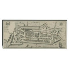
Antique Map of the City of Verdun by Merian, c.1650
About the Item
Antique map titled 'Verdun'. Orginal antique map of Verdun, a small city in the Meuse department in Grand Est in northeastern France. This map originates from 'Topographia Germaniae' by Merian.
Artists and Engravers: Matthäus Merian was a Swiss-born engraver who worked in Frankfurt for most of his career, where he also ran a publishing house. With Martin Zeiler (1589–1661), a German geographer, and later (circa 1640) with his own son, Matthäus Merian (der Jüngere, i.e. ""the Younger"" or ""Jr."") (1621–1687), he produced a series of Topographia.
Condition: Fair, age-related toning. Image trimmed, missing small part of the left margin. Minor wear, blank verso. Please study image carefully.
Date: c.1650
Overall size: 17 x 13 cm.
We sell original antique maps to collectors, historians, educators and interior decorators all over the world. Our collection includes a wide range of authentic antique maps from the 16th to the 20th centuries. Buying and collecting antique maps is a tradition that goes back hundreds of years. Antique maps have proved a richly rewarding investment over the past decade, thanks to a growing appreciation of their unique historical appeal. Today the decorative qualities of antique maps are widely recognized by interior designers who appreciate their beauty and design flexibility. Depending on the individual map, presentation, and context, a rare or antique map can be modern, traditional, abstract, figurative, serious or whimsical. We offer a wide range of authentic antique maps for any budget.
- Dimensions:Height: 5.12 in (13 cm)Width: 6.7 in (17 cm)Depth: 0 in (0.01 mm)
- Materials and Techniques:
- Period:
- Date of Manufacture:circa 1650
- Condition:
- Seller Location:Langweer, NL
- Reference Number:
About the Seller
5.0
Platinum Seller
These expertly vetted sellers are 1stDibs' most experienced sellers and are rated highest by our customers.
Established in 2009
1stDibs seller since 2017
1,919 sales on 1stDibs
Typical response time: <1 hour
- ShippingRetrieving quote...Ships From: Langweer, Netherlands
- Return PolicyA return for this item may be initiated within 14 days of delivery.
More From This SellerView All
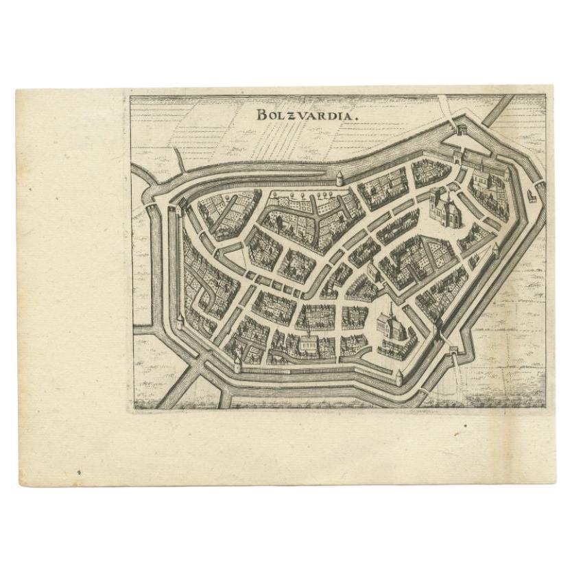
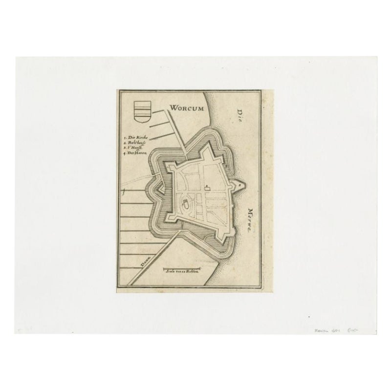
- Antique Map of the City of Bolsward by Merian, c.1650Located in Langweer, NLAntique map titled 'Bolzvardia'. Old map of the city of Bolsward, Friesland. This map was published with two other maps on one sheet (Hindeloopen and Stavoren). Artists and Engravers...Category
Antique 17th Century Maps
MaterialsPaper
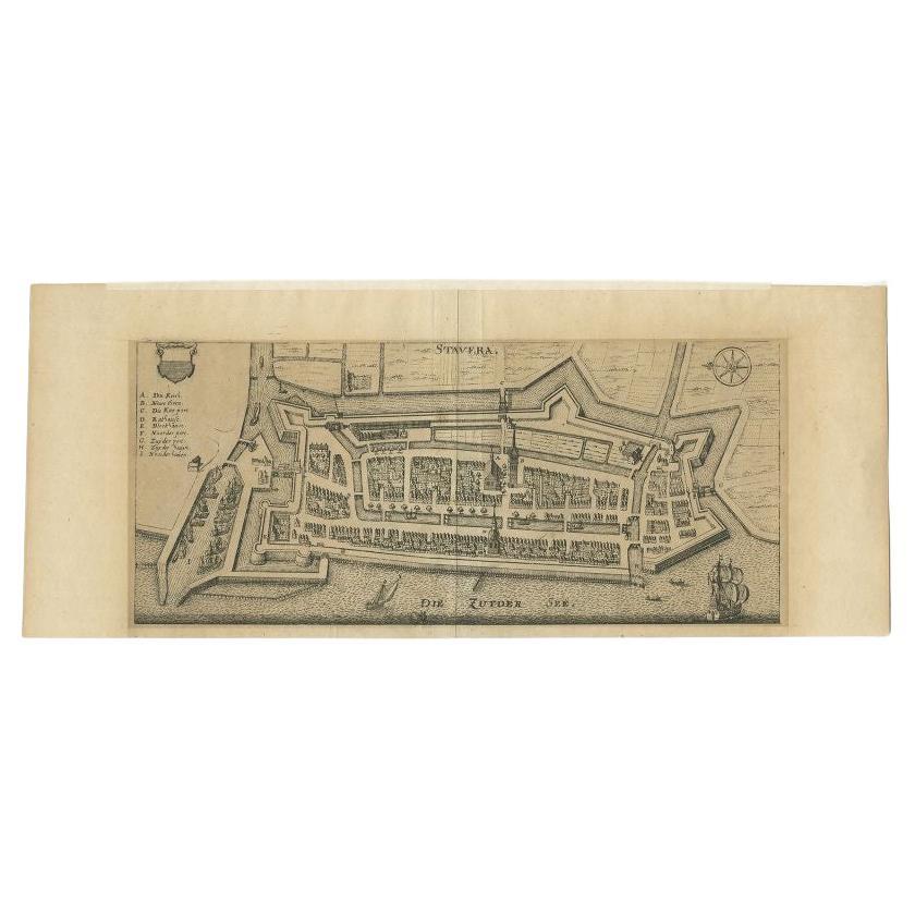
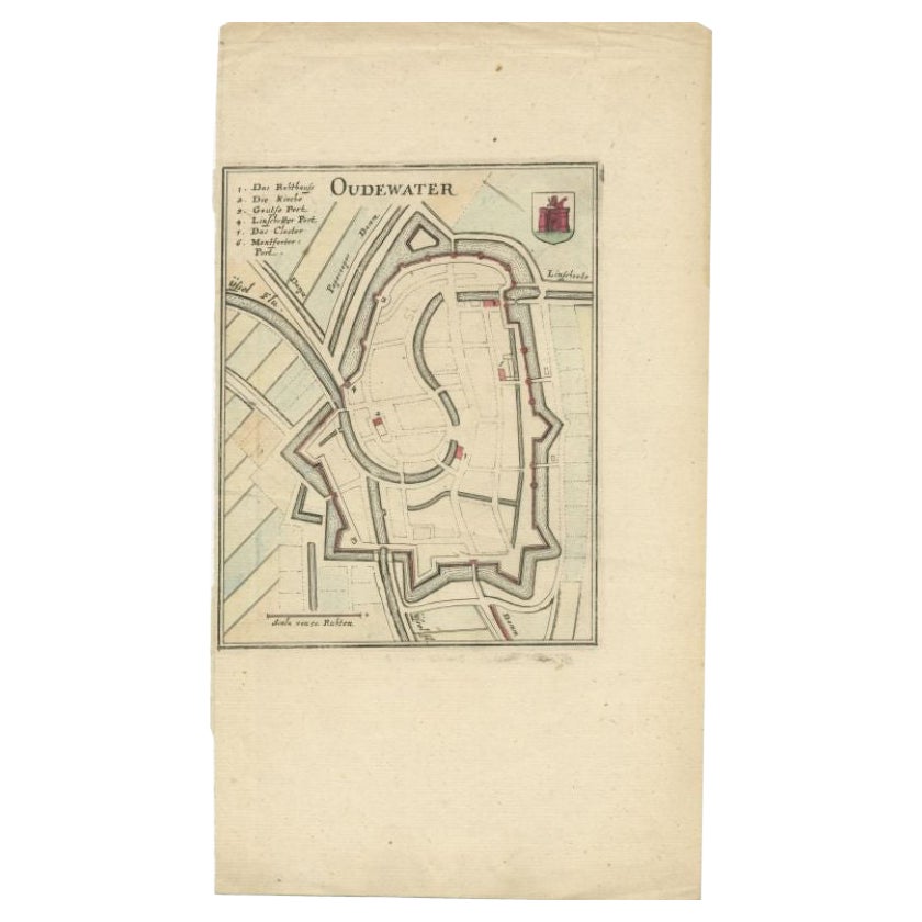
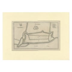
- Antique Map of Stavoren by Merian, c.1650Located in Langweer, NLAntique map titled 'Stavera'. Map of the city of Stavoren, Friesland. With German legend. Trimmed, originally published on one sheet with a map of Bolsward and Hindeloopen. Artists a...Category
Antique 17th Century Maps
MaterialsPaper
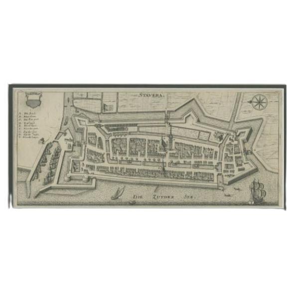
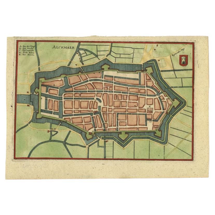
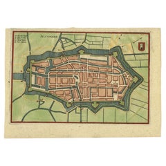
- Antique Map of the City of Alkmaar by Merian, c.1659Located in Langweer, NLAntique map titled 'Alckmaer'. Old map of the city of Alkmaar, the Netherlands. This print originates from 'Topographia Germaniae Inferioris (..)'. Artists and Engravers: Caspar Meri...Category
Antique 17th Century Maps
MaterialsPaper
- Antique Map of the City of Stavoren by Merian, 1659Located in Langweer, NLAntique map titled 'Staveren'. Original antique map of the city of Stavoren, Friesland, the Netherlands. This map originates from 'Topographia Germania Inferioris' by C. Merian. Publ...Category
Antique 17th Century Maps
MaterialsPaper
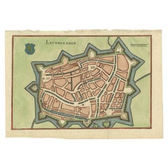
- Antique Map of the City of Leeuwarden by Merian, 1659Located in Langweer, NLAntique map titled 'Leurwaerden'. This print depicts the city of Leeuwarden (Friesland, The Netherlands). This print originates from 'Topographia Germaniae Inferioris (..)' by C. Mer...Category
Antique 17th Century Maps
MaterialsPaper
You May Also Like
- 1840 Map of the City of Washington Published by William M. MorrisonLocated in Colorado Springs, COThis map, printed in 1840, is a detailed representation of Washington, D.C. in the mid-19th century. The map shows block numbers, wards, and government buildings as well as details o...Category
Antique 1840s American Federal Maps
MaterialsPaper
- 1861 Topographical Map of the District of Columbia, by Boschke, Antique MapLocated in Colorado Springs, COPresented is an original map of Albert Boschke's extremely sought-after "Topographical Map of the District of Columbia Surveyed in the Years 1856 ...Category
Antique 1860s American Historical Memorabilia
MaterialsPaper
- Antique Map of American Cities, Vignette of New York City, circa 1920Located in St Annes, LancashireGreat maps of American Cities Unframed Original color By John Bartholomew and Co. Edinburgh Geographical Institute Published, circa 1920Category
Vintage 1920s British Maps
MaterialsPaper
- Original Antique Map / City Plan of Brussels by Tallis, circa 1850Located in St Annes, LancashireGreat map of Brussels. Steel engraving. Published by London Printing & Publishing Co. (Formerly Tallis), C.1850 Free shipping.Category
Antique 1850s English Maps
MaterialsPaper
- Italian Parchment Map of the City of Pisa Dated, 1640By Matthäus Merian the ElderLocated in Roma, ITAn antique map of the Tuscan city of Pisa engraved for The 'Itinerarium Italiæ Nov-antiquæ' by Matthäus Merian the Elder and printed in 1640....Category
Antique 1640s Italian Maps
MaterialsPaper
- Italian Parchment Map of the City of Lucca Dated 1640By Matthäus Merian the ElderLocated in Roma, ITAn antique map of the Tuscan city of Lucca engraved for The 'Itinerarium Italiæ Nov-antiquæ' by Matthäus Merian the Elder and printed in 1640...Category
Antique 1640s Italian Maps
MaterialsParchment Paper, Paper


Recently Viewed
View AllMore Ways To Browse
French 17th C Furniture
Antique Map Series
Antique Map Switzerland
Antique Map Of Switzerland
Frankfurt Map
Compass Antique Map
Antique Compass Map
Antique Russian Wood Furniture
Antique Russian Wood
Antique Map Britain
Antique Map China
Antique China Map
Antique Chinese Maps
Antique Britain Map
Large Antique Map Of The World
Antique Maps Of China
Compass 18th Century
18th Century Compass