Antique French Maps
45
to
287
1,671
442
1,283
782
759
410
312
220
162
119
102
102
98
94
94
65
60
47
46
35
34
33
31
29
27
25
24
22
20
20
18
18
18
18
17
16
15
13
13
12
12
12
11
11
10
8
8
5
5
3
2
1
143
56
49
16
15
Sort By
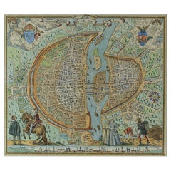
French Map of Paris, Musuem Carnavalet Rossingol University Map, 1576
Located in Gardena, CA
French Map of Paris, Musuem Carnavalet Rossingol University Map, 1576.
Map of Paris, France
Category
16th Century French Antique French Maps
Materials
Paper
Super Rare Antique French Map of Chine and the Chinese Empire, 1780
Located in Amsterdam, Noord Holland
Super Rare Antique French Map of Chine and the Chinese Empire, 1780
Very nice map of Asia. 1780
Category
18th Century European Antique French Maps
Materials
Paper
Antique Decorative French Map of Java, Indonesia, 1718
Located in Langweer, NL
Antique map of Java titled 'Carte de l'Ile de Java: Partie Occidentale, Partie Orientale, Dressee
Category
18th Century Antique French Maps
Materials
Paper
Antique French Map of Java, Indonesia by Chatelain, '1719'
Located in Langweer, NL
Antique map titled 'Carte de l'Ile de Java: Partie Occidentale, Partie Orientale, Dressee tout
Category
Early 18th Century Antique French Maps
Materials
Paper
Antique French Map of Asia Including China Indoneseia India, 1783
Located in Amsterdam, Noord Holland
Very nice map of Asia. 1783 Dedie au Roy.
Additional information:
Country of Manufacturing: Europe
Category
18th Century European Antique French Maps
Materials
Paper
Decorative Hand-Colored French Map of the English Channel, 1827
Located in Langweer, NL
Antique map titled 'Carte et Coupe du Canal de la Manche'. Original antique map of the English
Category
Mid-19th Century Antique French Maps
Materials
Paper
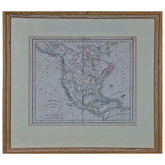
America "Amérique Septentrionale": A 19th Century French Map by Delamarche
By Maison Delamarche 1
Located in Alamo, CA
This framed mid 19th century map of North America entitled "Amérique Septentrionale" by Felix
Category
Mid-19th Century American Other Antique French Maps
Materials
Paper
H 20 in W 22.63 in D 0.88 in
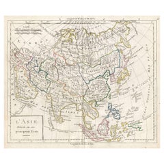
Antique French Map of Asia with Original Border Colouring, c.1785
Located in Langweer, NL
Antique map titled 'L'Asie divisee en ses principaux Etats.' (Map of Asia and its principal states
Category
18th Century Antique French Maps
Materials
Paper
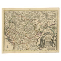
Antique French Map of Hungary with Decorative Title Cartouche, c.1730
Located in Langweer, NL
Antique map titled 'La Hongrie suivant les Nouvelles Observations (..)'. Antique map of Hungary
Category
18th Century Antique French Maps
Materials
Paper
Hand-Colored French Map, Carte des Etats Unis, Par Bonne, Late 18th Century
By Rigobert Bonne
Located in Chappaqua, NY
Hand-colored French map, Carte de la Partie Nord, des Etats Unis, de l'Amérique Septentrionale
Category
Late 18th Century French Louis XVI Antique French Maps
Materials
Paper
H 16.5 in W 20.13 in D 1 in
1812 United States Map, by Pierre Tardieu, Antique French Map Depicting the U.S.
By Pierre François Tardieu
Located in Colorado Springs, CO
French and English. This extremely detailed map not only depicts the mountainous regions of the
Category
1810s French Antique French Maps
Materials
Paper
H 43.5 in W 48 in D 2.25 in
Antique French Map of the Pacific Ocean with Australia and Polynesia, 1806
Located in Langweer, NL
Antique map titled 'Australasie et Polynesie'. Old map of Oceania and the Pacific Ocean. Originates
Category
19th Century Antique French Maps
Materials
Paper
H 8.08 in W 9.65 in D 0 in
1850 Old French Map Depicting the Entire Earth's Surface Divided into Two Parts
Located in Milan, IT
two hemispheres or globes, the map deals with the earth in general. Detailed explanation in French
Category
Mid-19th Century French Antique French Maps
Materials
Glass, Wood, Paper
H 18.31 in W 27.45 in D 0.79 in
1850 Old French Map Depicting the Entire Earth's Surface Divided into Two Parts
Located in Milan, IT
Geographical map depicting the entire earth’s surface divided into two parts that correspond to the
Category
Mid-19th Century French Antique French Maps
Materials
Glass, Wood, Paper
H 18.19 in W 25.87 in D 0.79 in
1850 Old French Map Depicting the Entire Earth's Surface Divided into Two Parts
Located in Milan, IT
Map depicting the entire earth's surface divided into two parts corresponding to the two
Category
Mid-19th Century French Antique French Maps
Materials
Glass, Wood, Paper
H 18.51 in W 27.76 in D 0.79 in
1850 Old French Map Depicting the Entire Earth's Surface Divided into Two Parts
Located in Milan, IT
Geographical map depicting the entire earth's surface divided into two parts that correspond to the
Category
Mid-19th Century French Antique French Maps
Materials
Glass, Wood, Paper
H 18.51 in W 25.99 in D 0.79 in
18th Century French Map and City View of Joppe/Jaffa 'Tel Aviv' by Sanson
By Nicolas Sanson
Located in Alamo, CA
historical treatises. His maps came to the attention of Cardinal Richelieu and then King Louis XIII of France
Category
Early 18th Century French Antique French Maps
Materials
Paper
H 18.88 in W 23 in D 1.13 in
L'Isle de France map
By Cornelis Danckerts II
Located in Wilton Manors, FL
Gouvernement general de l'Isle de France : ou sont la France, le Valois, Soissonnois, le Beauvaisis
Category
17th Century Antique French Maps
Materials
Laid Paper, Engraving
Antique Map of France by Lapie, 1842
Located in Langweer, NL
Antique map titled 'Carte de France'. Map of France. This map originates from 'Atlas universel de
Category
Mid-19th Century Antique French Maps
Materials
Paper
Nice Decorative Black and White Small Antique Map of Europe, 'circa 1834'
Located in Langweer, NL
Antique French map titled 'Europe par A.H. Dufour'. Uncommon map of Europe.
Published by or after
Category
Mid-19th Century Antique French Maps
Materials
Paper
H 8.08 in W 10.24 in D 0.02 in
Antique Map of Japan by A.M. Mallet, 1683
Located in Langweer, NL
A charming late 17th century French map with a very decorative title cartouche showing trumpet
Category
Late 17th Century Antique French Maps
Materials
Paper
Antique Map of Europe in the Middle Ages by Malte-Brun, 1850
Located in Langweer, NL
Antique map titled 'Géographie du Moyen Age principalement au IXe Siècle'. Early French map of
Category
19th Century Antique French Maps
Materials
Paper
Scarce Antique Map of South America
Located in Langweer, NL
a prolific French map engraver and geographer. The Tardieu family, based in Paris, was well known
Category
Early 19th Century Antique French Maps
Materials
Paper
Antique Map of Brazil Extending South to the Mouth of the Rio de la Plata
Located in Langweer, NL
(1784-1869), also known to sign his works as PF Tardieu, was a prolific French map engraver and
Category
Early 19th Century Antique French Maps
Materials
Paper
H 23.31 in W 17.33 in D 0.02 in
Antique Engraved Map of Italy in Roman Times, ca.1730
Located in Langweer, NL
for colouring and/or framing.
Guillaume Delisle (1675-1726) was a French map maker who continually
Category
1730s Antique French Maps
Materials
Paper
French Geographical, Statistical and Historical Map of Pensylvania, 1825
Located in Langweer, NL
1825 French Map of Pennsylvania, with a List of Prominent Rivers, Descriptions of Mountains, Climate
Category
1820s Antique French Maps
Materials
Paper
H 20.08 in W 25.99 in D 0 in
Superb, Large Map of British India, Chinese Empire, Indochina, Malaysia, 1860
Located in Langweer, NL
. Jacques, Paris, Dyonnet engraved numerous maps for many of the most prominent 19th French cartographic
Category
1860s Antique French Maps
Materials
Paper
H 22.8 in W 31.07 in D 0 in
Map of the Holy Land Divided into 12 Tribes, the Travels of Jesus Christ, 1700
Located in Langweer, NL
granted a privilege to publish French maps in Dutch lands. In 1693 he released the first and accompanying
Category
Early 1700s Antique French Maps
Materials
Paper
H 17.72 in W 20.28 in D 0 in
1800s French Map of the World in Two Hemispheres - Le Dictionnaire Géographique
Located in Montréal, CA
Language: French
Coloured: Black and White
Condition: The print is in excellent condition.
Category
Early 19th Century French Antique French Maps
Materials
Paper
H 8 in W 14.83 in D 0.13 in
Old Engraving of Batavia 'Jakarta, Indonesia' with Map and Harbour View, 1750
Located in Langweer, NL
Antique map titled 'Carte des environs de Batavia '. French map of the Batavia area (Jakarta) in
Category
1750s Antique French Maps
Materials
Paper
H 11.82 in W 15.75 in D 0 in
Antique Map of the Middle East by Mortier, 1700
Located in Langweer, NL
French maps in Dutch lands. In 1693 he released the first and accompanying volume of the Neptune Francois
Category
18th Century Antique French Maps
Materials
Paper
1850 Old French Map Depicting the Entire Earth's Surface Divided into Two Parts
Located in Milan, IT
Geographical map depicting the entire earth's surface divided into two parts that correspond to the
Category
Mid-19th Century French Antique French Maps
Materials
Glass, Wood, Paper
H 18.51 in W 27.76 in D 0.79 in
Antique Detailed World Map Drawn on Mercator's Projection, 1700
Located in Langweer, NL
. He was born in Leiden. In 1690 he was granted a privilege to publish French maps in Dutch lands. In
Category
17th Century Antique French Maps
Materials
Paper
18th Century French Map and City View of Joppe/Jaffa (Tel Aviv) by Sanson
By Nicholas Sanson d'Abbeville
Located in Alamo, CA
approximately three hundred maps and is credited with initiating the golden age of French Cartography.
Category
Early 1700s Antique French Maps
Materials
Engraving
H 18.88 in W 23 in D 1.13 in
Original Copper Engraved Map of France
Located in Langweer, NL
Antique map titled 'New and Accurate Map of France from the latest improvements'. Original copper
Category
Late 18th Century Antique French Maps
Materials
Paper
Antique Political Map of France, 1880
By J. Migeon
Located in Langweer, NL
Antique map titled 'France Féodale'. Old map of France with a decorative vignette of Castle de
Category
19th Century Antique French Maps
Materials
Paper
Original Antique Map of Normandy, France
Located in Langweer, NL
Antique map titled 'Carte de Normandie (..)'. Attractive map of Normandy, France. it depicts the
Category
Mid-18th Century Antique French Maps
Materials
Paper
Old Map of the French Department of Loiret, France
By Victor Levasseur
Located in Langweer, NL
Antique map titled 'Dépt. du Loiret'. Map of the French department of Loiret, France. Surrounding
Category
Mid-19th Century Antique French Maps
Materials
Paper
Old Map of the French Department of Cantal, France
By Victor Levasseur
Located in Langweer, NL
Antique map titled 'Dépt. du Cantal'. Map of the French department of Cantal, France. This area of
Category
Mid-19th Century Antique French Maps
Materials
Paper
Old Map of the French department of Ariège, France
By Victor Levasseur
Located in Langweer, NL
Antique map titled 'Dépt. de l'Ariège'. Map of the French department of Ariege, France. This area
Category
Mid-19th Century Antique French Maps
Materials
Paper
Old Map of the French department of Tarn, France
By Victor Levasseur
Located in Langweer, NL
Antique map titled 'Dépt. du Tarn'. Map of the French department of Tarn, France. This area
Category
Mid-19th Century Antique French Maps
Materials
Paper
Old Map of the French Department of Nièvre, France
By Victor Levasseur
Located in Langweer, NL
Antique map titled 'Dept. de la Nièvre'. Map of the French department of Nievre, France. Part of
Category
Mid-19th Century Antique French Maps
Materials
Paper
Old Map of the French department of Creuse, France
By Victor Levasseur
Located in Langweer, NL
Antique map titled 'Dépt. de la Creuse'. Map of the French department of Creuse, France. This
Category
Mid-19th Century Antique French Maps
Materials
Paper
Old Map of the French Department of Ardèche, France
By Victor Levasseur
Located in Langweer, NL
Antique map titled 'Dépt. de l'Ardèche'. Map of the Department of Ardèche, France. This region is
Category
Mid-19th Century Antique French Maps
Materials
Paper
Old Map of the French Department of Indre, France
By Victor Levasseur
Located in Langweer, NL
Antique map titled 'Dept. de l'Indre'. Map of the French department of Indre, France. Part of the
Category
Mid-19th Century Antique French Maps
Materials
Paper
French Antique Map of France and Western Europe, 1765
By G. A. Rizzi-zannoni
Located in Langweer, NL
France and western Europe. This map originates from 'Atlas Historique de la France Ancienne et Moderne
Category
18th Century Antique French Maps
Materials
Paper
Antique Map of France by Johnston (1909)
Located in Langweer, NL
Antique map titled 'France'. Original antique map of France. With inset maps of France in provinces
Category
Early 20th Century Antique French Maps
Materials
Paper
Antique Map of France by Balbi '1847'
Located in Langweer, NL
Antique map titled 'France'. Original antique map of France. This map originates from 'Abrégé de
Category
Mid-19th Century Antique French Maps
Materials
Paper
Antique Map of France by Lowry, '1852'
Located in Langweer, NL
Antique map titled 'France in Provinces'. Original map of France. This map originates from 'Lowry's
Category
Mid-19th Century Antique French Maps
Materials
Paper
Antique Map of France by Migeon, 1880
Located in Langweer, NL
Antique map titled 'France Physique'. Old map of France. This map originates from 'Géographie
Category
19th Century Antique French Maps
Materials
Paper
Antique Map of France by Zannoni, 1765
Located in Langweer, NL
Antique map titled 'La France divisée en ses LVIII Provinces (..)'. Beautiful old map of France
Category
18th Century Antique French Maps
Materials
Paper
Antique Map of France by Faden '1792'
Located in Langweer, NL
Antique map titled 'France divided into Metropolitan Circles (..)'. Large, original antique map of
Category
Late 18th Century Antique French Maps
Materials
Paper
Antique Map of France by Lapie, 1842
Located in Langweer, NL
Antique map titled 'Carte des Gaules'. Map of France. This map originates from 'Atlas universel de
Category
Mid-19th Century Antique French Maps
Materials
Paper
Antique Map of France with Inset Map of the Island of Corsica, 1820
Located in Langweer, NL
Antique map titled 'France in Departments'. Old map of France, with small inset map of the island
Category
19th Century Antique French Maps
Materials
Paper
Original Antique Map of France, Arrowsmith, 1820
Located in St Annes, Lancashire
Great map of France
Drawn under the direction of Arrowsmith.
Copper-plate engraving
Category
1820s English Antique French Maps
Materials
Paper
Antique Map of Cher in France, 1854
By Victor Levasseur
Located in Langweer, NL
Antique map titled 'Dépt. des Bses. Pyrénées'. Map of the French department of Basses Pyrenees
Category
Mid-19th Century Antique French Maps
Materials
Paper
Antique Map of France by Faden, 1792
Located in Langweer, NL
Antique map titled 'France divided into Metropolitan Circles (..)'. Large, original antique map of
Category
18th Century Antique French Maps
Materials
Paper
Decorative Original Antique Map of Normandy, France
Located in Langweer, NL
Original antique map titled 'Ducato D'Normandie Scala di Miglia d'Italia'. Very decorative map of
Category
Late 17th Century Antique French Maps
Materials
Paper
Antique Map of France by Cluver, 1685
Located in Langweer, NL
Antique map titled 'Galliae Veteris Descriptio.' Charming miniature map of France from the pocket
Category
17th Century Antique French Maps
Materials
Paper
Antique Map of France by Homann, 1738
Located in Langweer, NL
. S. Benedict (..)'. Beautiful antique map of France with the provinces of the Order of Saint Benedict
Category
18th Century Antique French Maps
Materials
Paper
- 1
- ...
Get Updated with New Arrivals
Save "Antique French Maps", and we’ll notify you when there are new listings in this category.
Antique French Maps For Sale on 1stDibs
Find a variety of antique French maps available on 1stDibs. Frequently made of paper, wood and glass, all antique French maps available were constructed with great care. There are all kinds of antique French maps available, from those produced as long ago as the 18th Century to those made as recently as the 20th Century. Antique French maps made by Louis XVI designers — as well as those associated with Neoclassical — are very popular at 1stDibs. Many antique French maps are appealing in their simplicity, but Victor Levasseur, G. A. Rizzi-zannoni and Nicolas Sanson produced popular antique French maps that are worth a look.
How Much are Antique French Maps?
Antique French maps can differ in price owing to various characteristics — the average selling price at 1stDibs is $454, while the lowest priced sells for $65 and the highest can go for as much as $51,160.
Questions About Antique French Maps
- 1stDibs ExpertApril 5, 2022Check the clock for a manufacturer’s mark or label. Once you have this, you should be able to look up the clock’s brand to see if it is French in origin. A clock is considered antique once it is 100 years old. A professional can also help verify the origin of your clock. Shop an array of expertly vetted antique clocks on 1stDibs.
More Ways To Browse
Antique Map Burgundy
Wall Uni
Pinot Noir
Venezuela Antique Map
Map Of Washington Dc
Washington Dc Map
Washington Dc Maps
Greenland Map
South Carolina Map
Map Of South Carolina
South Carolina Maps
Hermes Watch History
Rene Descartes
Antique Map By Coronelli
Antique Arizona Map
Republic Of Texas Map
Holy Water Sink
Arizona Map
