Items Similar to Map of the Alsace, France Incl the Rhine from Phillipsburg to South Basle, c1650
Want more images or videos?
Request additional images or videos from the seller
1 of 6
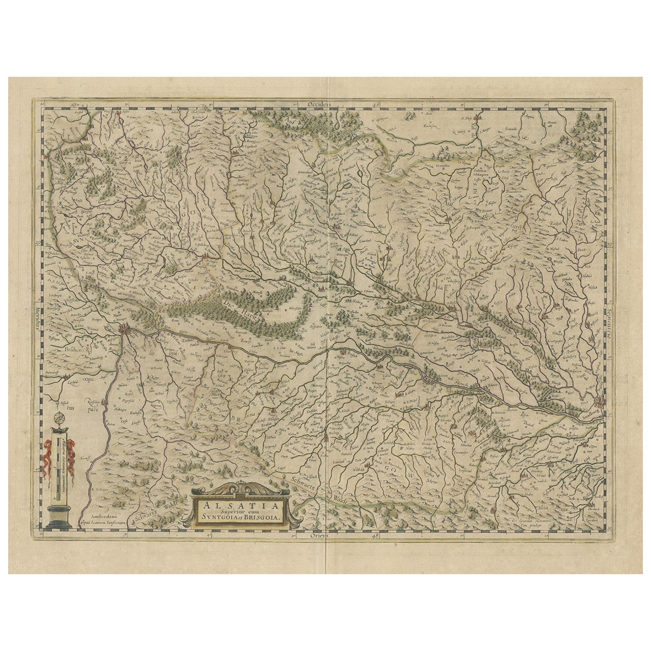
Map of the Alsace, France Incl the Rhine from Phillipsburg to South Basle, c1650
About the Item
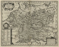
Antique map titled 'Utriusquae Alsatiae Superioris Ac Inferioris Nova Tabula'.
Map of the Alsace region (France) including the Rhine from Phillipsburg to south of Basle. Two decorative cartouches and two coats of arms.
Artists and Engravers: Johannes Janssonius (Jansson), ( 1588- 1664) Amsterdam was born in Arnhem, the son of Jan Janszoon the Elder,a publisher and bookseller.
- Dimensions:Height: 19.69 in (50 cm)Width: 23.23 in (59 cm)Depth: 0 in (0.02 mm)
- Materials and Techniques:
- Period:1650-1659
- Date of Manufacture:circa 1650
- Condition:Wear consistent with age and use. Minor losses. Condition: Fair, age-related toning. Tear at both lower left and right corner, some smaller marginal tears. Original, contemporary hand coloring. Dutch text on verso. Please study image carefully.
- Seller Location:Langweer, NL
- Reference Number:
About the Seller
5.0
Platinum Seller
These expertly vetted sellers are 1stDibs' most experienced sellers and are rated highest by our customers.
Established in 2009
1stDibs seller since 2017
1,928 sales on 1stDibs
Typical response time: <1 hour
- ShippingRetrieving quote...Ships From: Langweer, Netherlands
- Return PolicyA return for this item may be initiated within 14 days of delivery.
More From This SellerView All
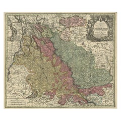
- Old Map of the Alsace 'Elzas' Region with Lotharingen 'Lorraine', France, c1650Located in Langweer, NLAntique map titled 'Alsatia superior cum Suntgoia et Brisgoia'. Old map of the Alsace (or Elzas) region with Lotharingen (Lorraine), Strassburg, Freiburg, Basel etc. Source unkno...Category
Antique 1650s Maps
MaterialsPaper
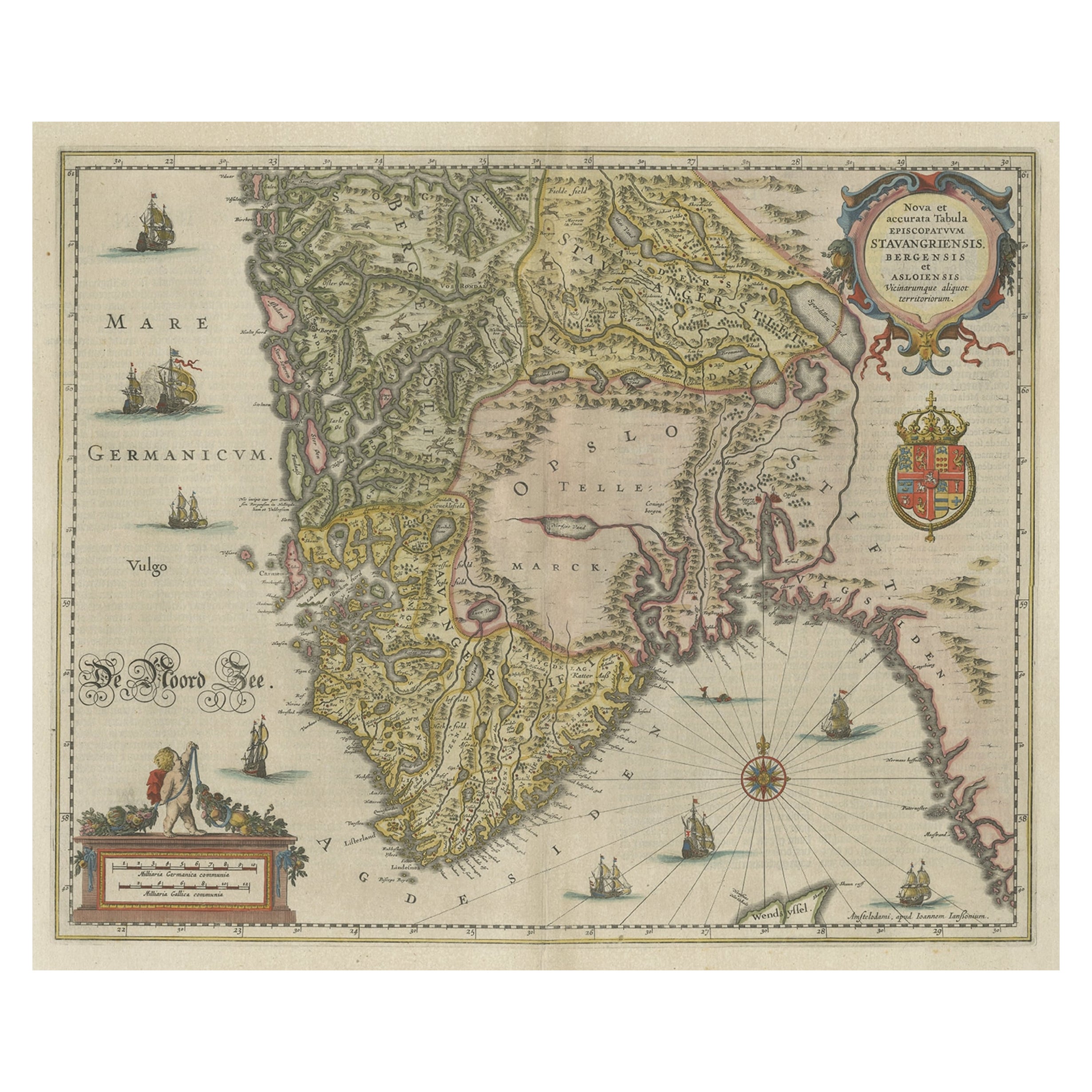
- Old Map of The Southern Part of Norway, Covering the Region Around Bergen, c1650Located in Langweer, NLAntique map titled 'Nova et Accurata Tabula Episcopatuum Stavangriensis et Asloiensis'. Old map of the southern part of Norway, it covers the region around Bergen. Decorated with...Category
Antique 1650s Maps
MaterialsPaper
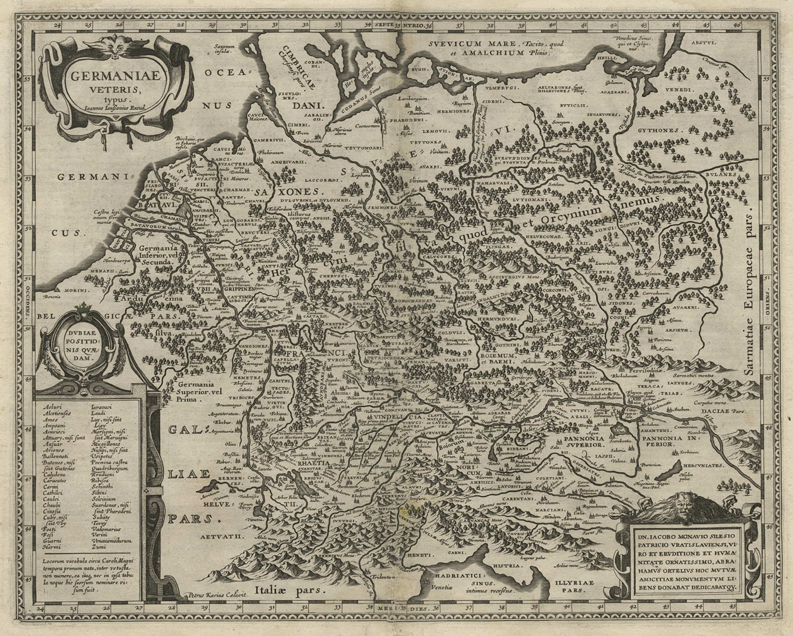
- Original Rare Antique Map of the Ancient German Empire in Northern Europe, c1650Located in Langweer, NLAntique map titled 'Germaniae Veteris typus.' Map of the ancient German Empire in Northern Europe, based upon an earlier map by Ortelius. Extends fr...Category
Antique 1650s Maps
MaterialsPaper
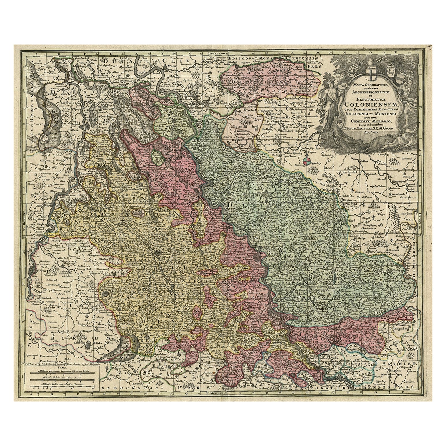
- Old Map of the Rhine & German Cities Incl Düsseldorf, Bonn, Köln, Etc., c.1730Located in Langweer, NLAntique map Germany titled 'Mappa Geographica continens Archiepiscopatum et Electoratum Coloniensem (..)'. This antique map depicts the Rhine r...Category
Antique 1730s Maps
MaterialsPaper
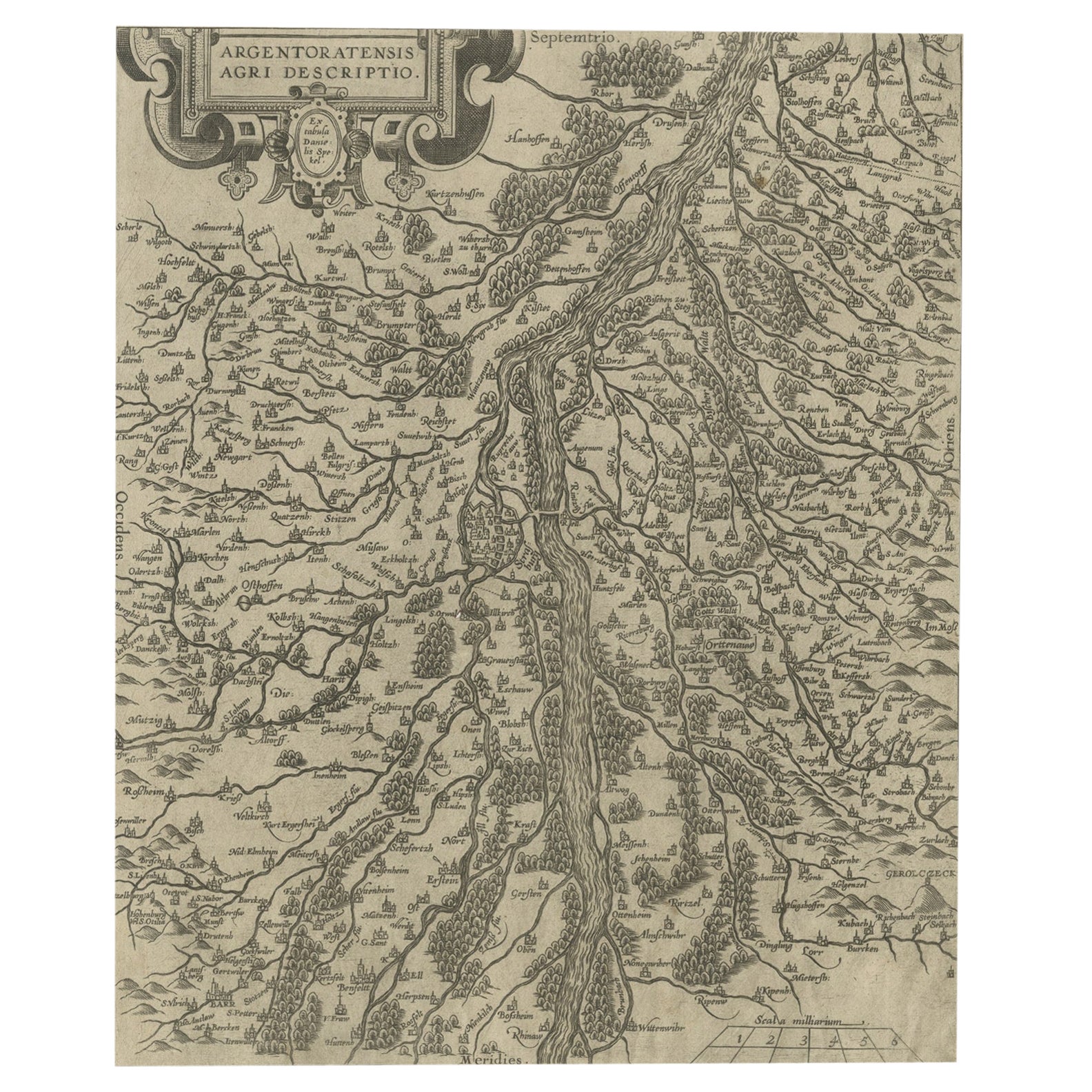
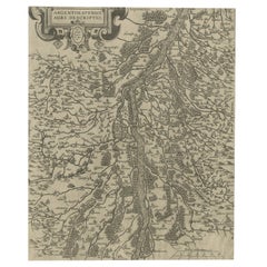
- Original Antique Map of the Rhine, South and North of Strasbourg, Germany, 1608Located in Langweer, NLAntique map titled 'Argentoratensis agri descriptio'. Original antique map of the Rhine, both south and north of Strasbourg, based on Daniel Specklin's three-sheet map of the Elz...Category
Antique Early 1600s Maps
MaterialsPaper
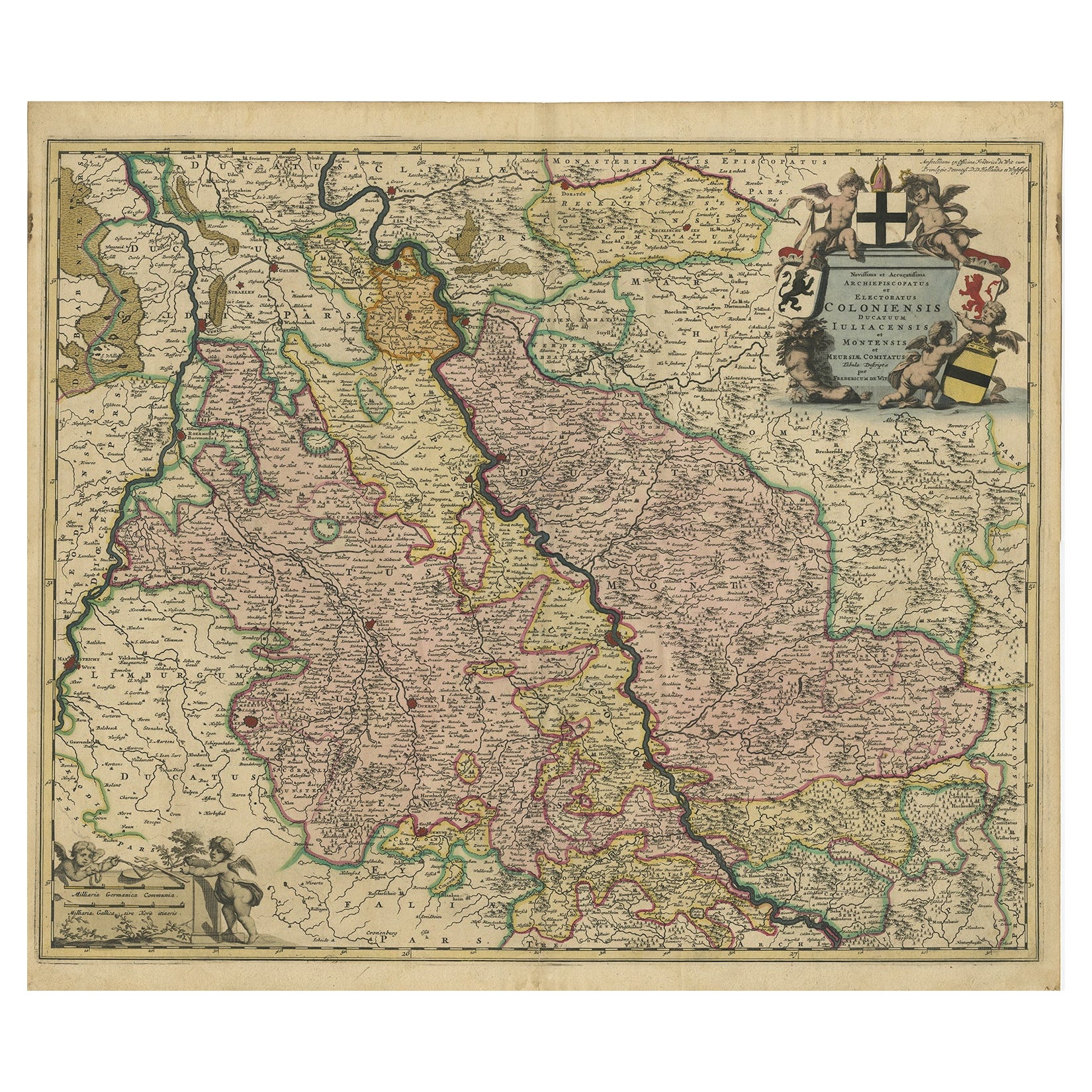
- Rhine Splendor: Antique Map of the Lower Rhine Region, circa 1680Located in Langweer, NLThe antique map titled 'Novissima et Accuratissima Archiepiscopatus et Electoratus Coloniensis Ducatuum Iuliancensis et Montensis et Meursiae Comitatus' is a handsome and detailed ma...Category
Antique 1680s Maps
MaterialsPaper
You May Also Like
- Germany West of the Rhine: A Hand-colored 18th Century Map by de WitBy Frederick de WitLocated in Alamo, CAThis original 18th century hand-colored map of the county of Moers, Germany entitled "Illustrissimo Celsissmo Principi GUILIELMO HENRICO D.G. Arausionum Principi Domino suo Clementis...Category
Antique Early 18th Century Dutch Maps
MaterialsPaper
- Vintage "View of the Center of Paris Taken from the Air" Lithograph MapLocated in San Diego, CAA very stylish "View of the Center of Paris Taken from the Air" lithograph map published by the Paris Ministry of Tourism, circa early 1950s. The piece measures 27" x 43" and shows...Category
20th Century French Mid-Century Modern Prints
MaterialsPaper
- Original Antique Map of South America, circa 1830Located in St Annes, LancashireGreat map of South America Copper plate engraving Published by Butterworth, Livesey & Co., circa 1830 Unframed.Category
Antique Early 1800s English Other Maps
MaterialsPaper
- Original Antique Map of South Africa, Arrowsmith, 1820Located in St Annes, LancashireGreat map of South Africa. Drawn under the direction of Arrowsmith. Copper-plate engraving. Published by Longman, Hurst, Rees, Orme and Br...Category
Antique 1820s English Maps
MaterialsPaper
- New Map of North America from the Latest Discoveries, 1763Located in Philadelphia, PAA fine antique 18th century map of the North American seaboard. Entitled "A New Map of North America from the Latest Discoveries 1763". By the Cartographer/Engraver - John Spil...Category
Antique Mid-18th Century English Georgian Maps
MaterialsPaper
- Original Antique Map of South East Asia, Arrowsmith, 1820Located in St Annes, LancashireGreat map of South East Asia Drawn under the direction of Arrowsmith Copper-plate engraving Published by Longman, Hurst, Rees, Orme and Brown, 1820 Unframed.Category
Antique 1820s English Maps
MaterialsPaper


