Items Similar to Old Map of the Rhine & German Cities Incl Düsseldorf, Bonn, Köln, Etc., c.1730

Want more images or videos?
Request additional images or videos from the seller
1 of 5
Old Map of the Rhine & German Cities Incl Düsseldorf, Bonn, Köln, Etc., c.1730
About the Item
Antique map Germany titled 'Mappa Geographica continens Archiepiscopatum et Electoratum Coloniensem (..)'.
This antique map depicts the Rhine river and many German cities including Düsseldorf, Bonn, Köln, Duisburg and more.
Artists and Engravers: Mattias Seutter (1678-1756) was an engraver, globe-maker and map publisher from Augsburg. He was a pupil of J.B. Homann in Nuremberg.
- Dimensions:Height: 20.67 in (52.5 cm)Width: 24.02 in (61 cm)Depth: 0 in (0.02 mm)
- Materials and Techniques:
- Period:1730-1739
- Date of Manufacture:circa 1730
- Condition:Wear consistent with age and use. Condition: Very good, general age-related toning. Please study image carefully.
- Seller Location:Langweer, NL
- Reference Number:
About the Seller
5.0
Platinum Seller
These expertly vetted sellers are 1stDibs' most experienced sellers and are rated highest by our customers.
Established in 2009
1stDibs seller since 2017
1,938 sales on 1stDibs
Typical response time: <1 hour
- ShippingRetrieving quote...Ships From: Langweer, Netherlands
- Return PolicyA return for this item may be initiated within 14 days of delivery.
More From This SellerView All
- Antique Map of Flanders, France Incl the Cities Lille, Tournai, Douai, c.1730Located in Langweer, NLAntique map titled 'Flandriae comitatus pars Australis'. Decorative antique map of the southern portion of Flanders, France. It shows the cities of Lille (Rijsel), Douai, Tournai (Do...Category
Antique 18th Century Maps
MaterialsPaper
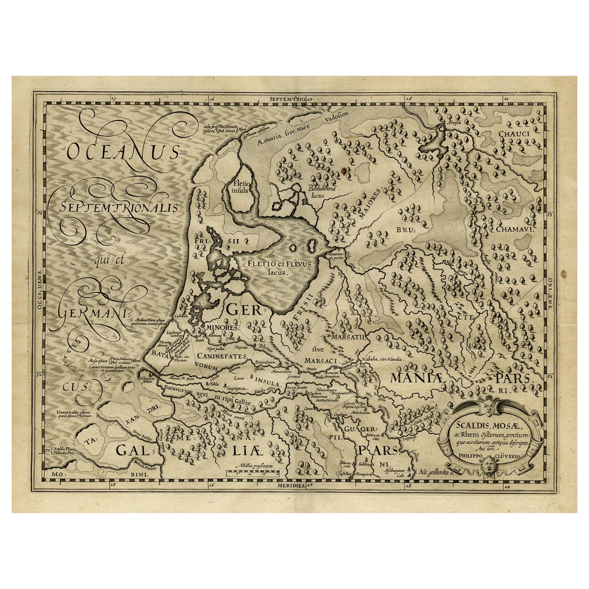
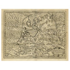
- Antique Latin Map of the Netherlands & Germany, Incl Roman Forts, Etc., 1631Located in Langweer, NLAntique map titled 'Scaldis Mosae, ac Rheni Ostiorum, gentiumque accolarum antiqua descriptio.' A Latin map of the Netherlands and Germany, showing all the major rivers as well a...Category
Antique 1630s Maps
MaterialsPaper
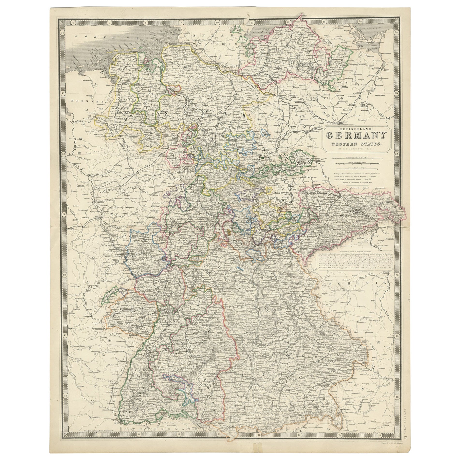
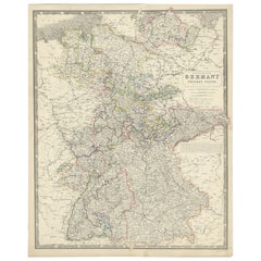
- Map of West Germany Incl Regions Wurtemberg, Bavaria, Hanover, Etc, c.1850Located in Langweer, NLAntique map titled '(Deutschland) Germany, Western States'. Map of West Germany depicting many regions including Wurtemberg, Bavaria, Hanover and others. This map originates from...Category
Antique 1850s Maps
MaterialsPaper
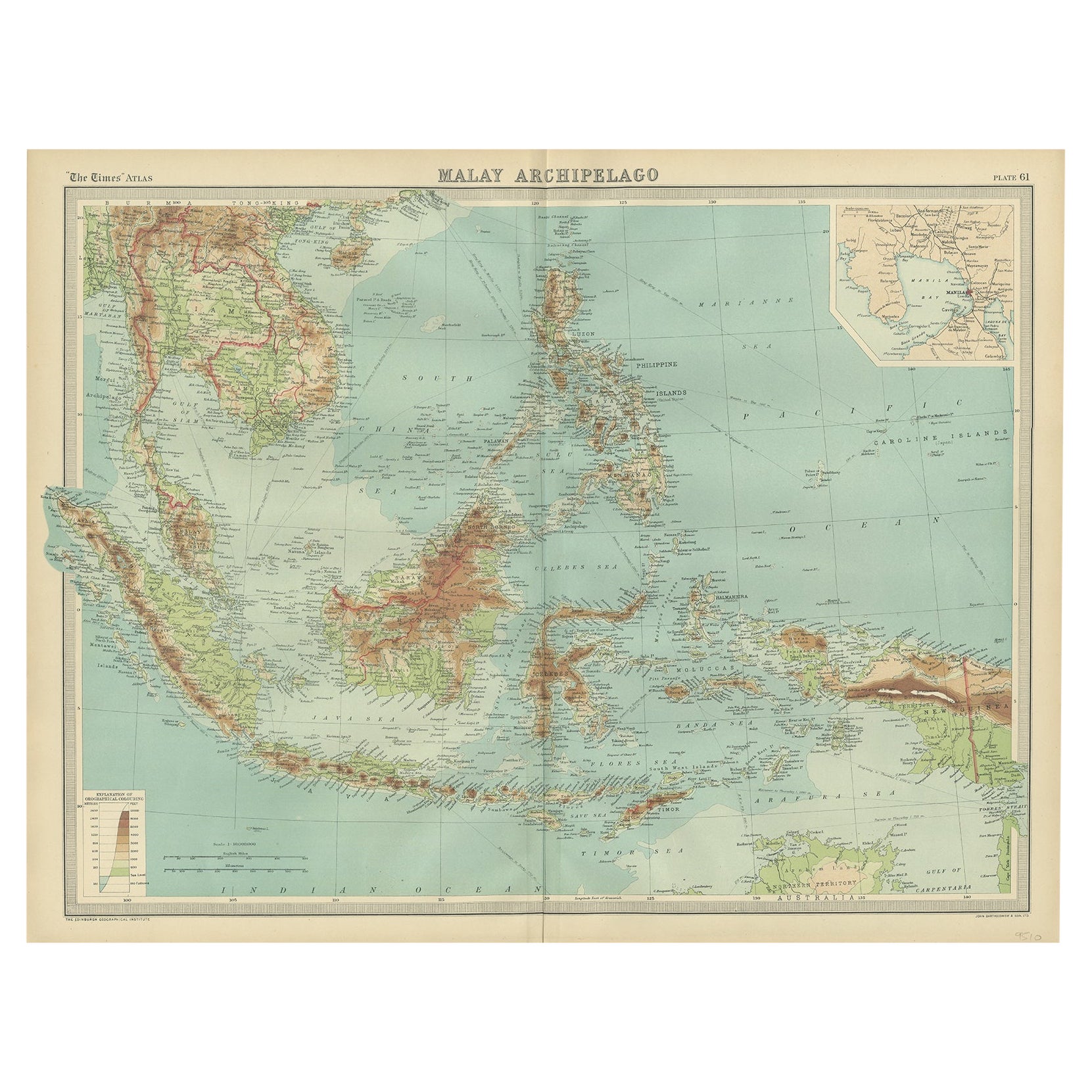
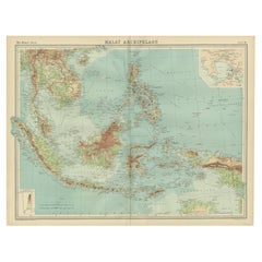
- Old Map of South East Asia Showing the Malay Archipelago, incl Borneo etc, 1922Located in Langweer, NLAntique map of South East Asia titled 'Malay Archipelago'. Old map of South East Asia depicting the Malay Archipelago including Sumatra, Java...Category
Vintage 1920s Maps
MaterialsPaper
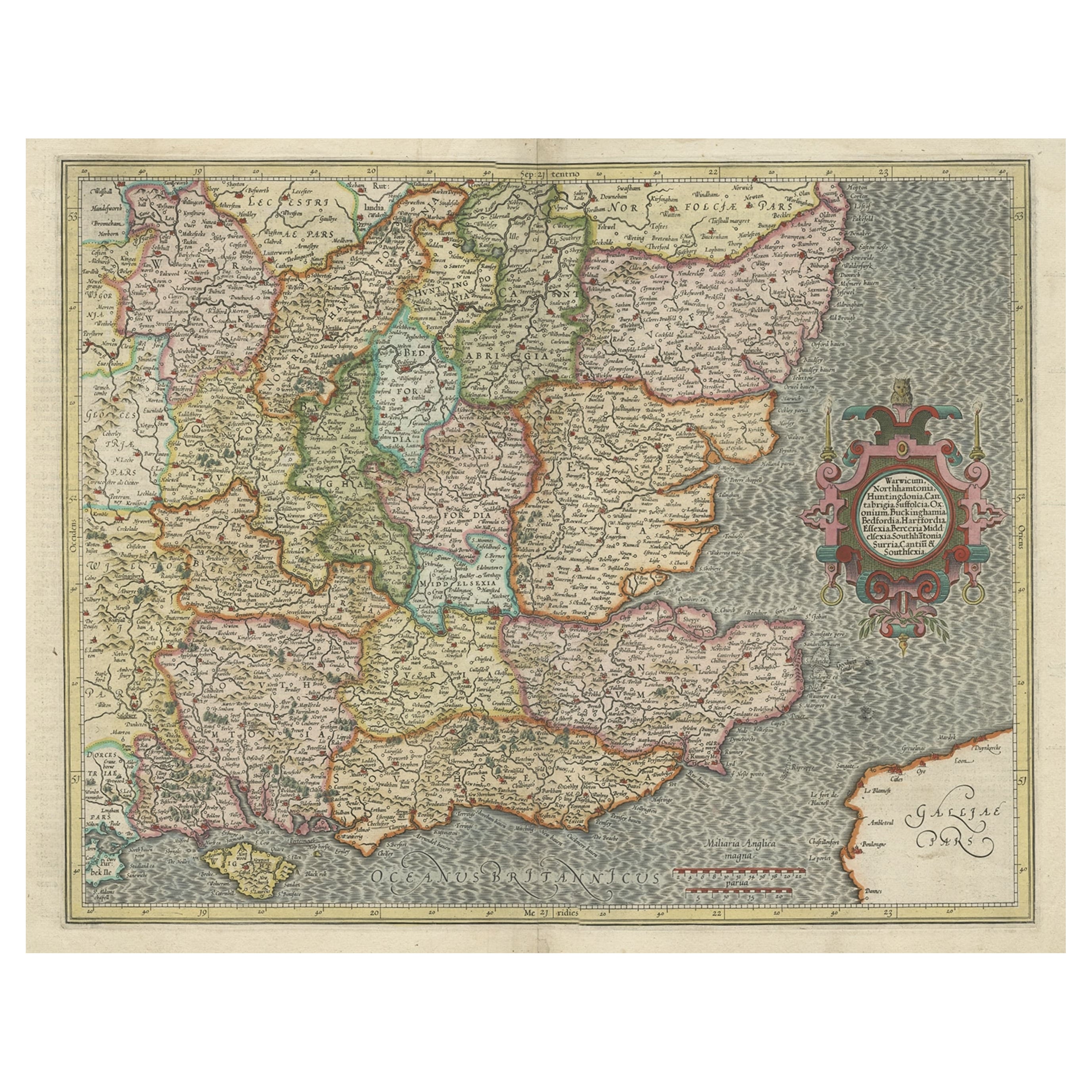
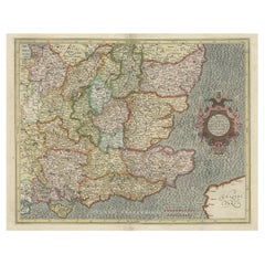
- Original Old Map of South East England Incl London, Oxford, Cambridge, Etc, 1633Located in Langweer, NLAntique map titled 'Warwicum, Northhamtonia, Huntingdonia, Cantabrigia, Suffolcia, Oxonium, Buckinghamia, Befordia, Harfordia, Essexia, Berceria, Middlesexia, Southhatonia, Surria, Catiu & Southsexia'. Old map of south east England. Includes London, Salisbury, Oxford, Cambridge, Leicester and Norwich and the Isle of Wight. Originates from the 1633 German edition of the Mercator-Hondius Atlas Major, published by Henricus Hondius and Jan Jansson under the title: 'Atlas: das ist Abbildung der gantzen Welt, mit allen darin begriffenen Laendern und Provintzen: sonderlich von Teutschland, Franckreich, Niderland, Ost und West Indien: mit Beschreibung der selben.' Artists and engravers: Gerard Mercator (1512 - 1594) originally a student of philosophy was one of the most renowned cosmographers and geographers of the 16th century, as well as an accomplished scientific instrument maker. He is most famous for introducing Mercators Projection, a system which allowed navigators to plot the same constant compass bearing on a flat map.Category
Antique 1630s Maps
MaterialsPaper
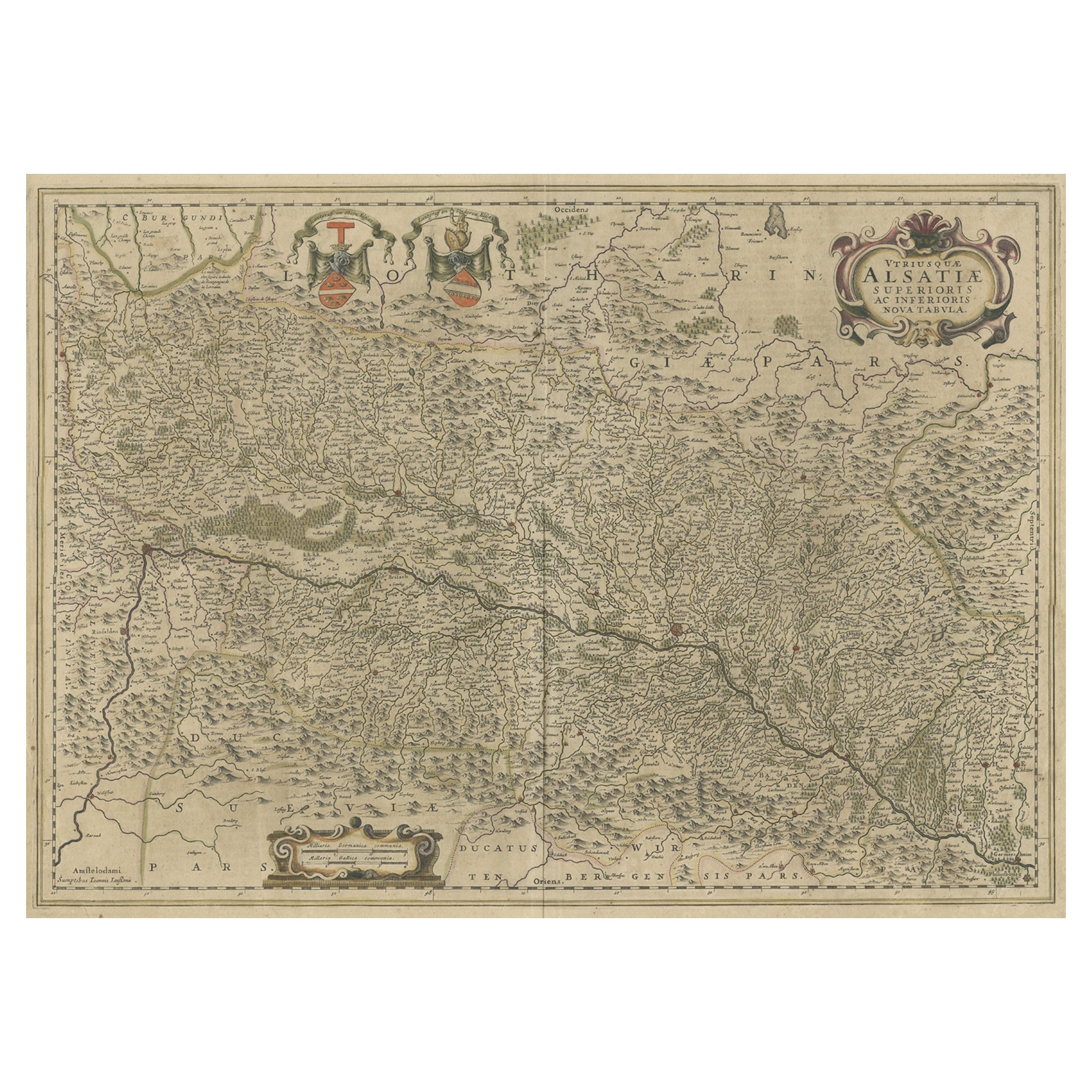
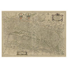
- Map of the Alsace, France Incl the Rhine from Phillipsburg to South Basle, c1650Located in Langweer, NLAntique map titled 'Utriusquae Alsatiae Superioris Ac Inferioris Nova Tabula'. Map of the Alsace region (France) including the Rhine from Phillipsburg to south of Basle. Two deco...Category
Antique 1650s Maps
MaterialsPaper
You May Also Like
- Germany West of the Rhine: A Hand-colored 18th Century Map by de WitBy Frederick de WitLocated in Alamo, CAThis original 18th century hand-colored map of the county of Moers, Germany entitled "Illustrissimo Celsissmo Principi GUILIELMO HENRICO D.G. Arausionum Principi Domino suo Clementis...Category
Antique Early 18th Century Dutch Maps
MaterialsPaper
- Prussia, Poland, N. Germany, Etc: A Hand-colored 17th Century Map by JanssoniusBy Johannes JanssoniusLocated in Alamo, CAThis is an attractive hand-colored copperplate engraved 17th century map of Prussia entitled "Prussia Accurate Descripta a Gasparo Henneberg Erlichensi", published in Amsterdam by Joannes Janssonius in 1664. This very detailed map from the golden age of Dutch cartography includes present-day Poland, Latvia, Lithuania, Estonia and portions of Germany. This highly detailed map is embellished by three ornate pink, red, mint green and gold...Category
Antique Mid-17th Century Dutch Maps
MaterialsPaper
- Old Nautical Map of CorsicaLocated in Alessandria, PiemonteST/556/1 - Old map of Corsica isle, surveyed by Captain Hell, of the French Royal Navy in 1824, engraved and published on 1874, with additions and corre...Category
Antique Early 19th Century English Other Prints
MaterialsPaper
- Old Horizontal Map of EnglandBy TassoLocated in Alessandria, PiemonteST/520 - Old rare Italian map of England, dated 1826-1827 - by Girolamo Tasso, editor in Venise, for the atlas of M.r Le-Sage.Category
Antique Early 19th Century Italian Other Prints
MaterialsPaper
- City View of Nuremberg, Germany: An 18th Century Hand-Colored Map by M. SeutterBy Matthew SeutterLocated in Alamo, CAAn 18th century hand-colored city view of Nuremburg, Germany entitled "Geometrischer Grundris der des Heiligen Römischen Reichs Freyen Stadt Nürnberg" by Matthaus Seutter from his "A...Category
Antique Mid-18th Century German Maps
MaterialsPaper
- Catalogue of Engraved Views, Plans, Etc., Of New York City, 1st EdLocated in valatie, NYA catalogue of engraved views, plans, etc., Of New York City, (The Collection of Percy R. Pyne II). Privately Printed by The De Vinne Press, New York, 1912. Limited to 100 copies. Gr...Category
Early 20th Century American Books
MaterialsPaper


Recently Viewed
View AllMore Ways To Browse
Old Antique Globes
Rhine River
Wood Carvings Of Ships
Compass Rose
Classroom Furniture Used
Fine Antique Maps
Orbis Map
17th Century World Map
Book Of Antique Maps
18th Century Southern Antiques
Antique French Globe
South African Antique Furniture
Antique Furniture South Africa
Antique Map Border
Compass Map
Africa Antique Map
Antique Map Africa
Antique Map Of Africa