Items Similar to Map of West Germany Incl Regions Wurtemberg, Bavaria, Hanover, Etc, c.1850

Want more images or videos?
Request additional images or videos from the seller
1 of 6
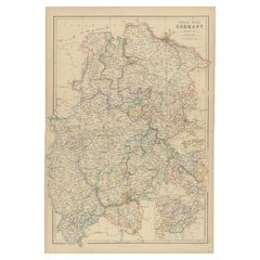
Map of West Germany Incl Regions Wurtemberg, Bavaria, Hanover, Etc, c.1850
About the Item
Antique map titled '(Deutschland) Germany, Western States'.
Map of West Germany depicting many regions including Wurtemberg, Bavaria, Hanover and others. This map originates from 'National Atlas of General Geography (...).', by W.& A.K. Johnston.
Artists and Engravers: Alexander Keith Johnston LLD (1804-1871) was a Scottish geographer. He was a pupil of the Edinburgh engraver and mapmaker, James Kirkwood. In 1826, he joined his brother William (who would become Sir William Johnston, Lord Provost of Edinburgh) in a printing and engraving business, forming the well-known cartographical firm of W. and A. K. Johnston.
- Dimensions:Height: 24.81 in (63 cm)Width: 20.28 in (51.5 cm)Depth: 0 in (0.02 mm)
- Materials and Techniques:
- Period:
- Date of Manufacture:circa 1850
- Condition:Repaired: Condition: Good, general age-related toning. Few small tears and repairs. Please study image carefully. Condition: Good, general age-related toning. Few small tears and repairs. Please study image carefully.
- Seller Location:Langweer, NL
- Reference Number:
About the Seller
5.0
Platinum Seller
These expertly vetted sellers are 1stDibs' most experienced sellers and are rated highest by our customers.
Established in 2009
1stDibs seller since 2017
1,933 sales on 1stDibs
Typical response time: <1 hour
- ShippingRetrieving quote...Ships From: Langweer, Netherlands
- Return PolicyA return for this item may be initiated within 14 days of delivery.
More From This SellerView All
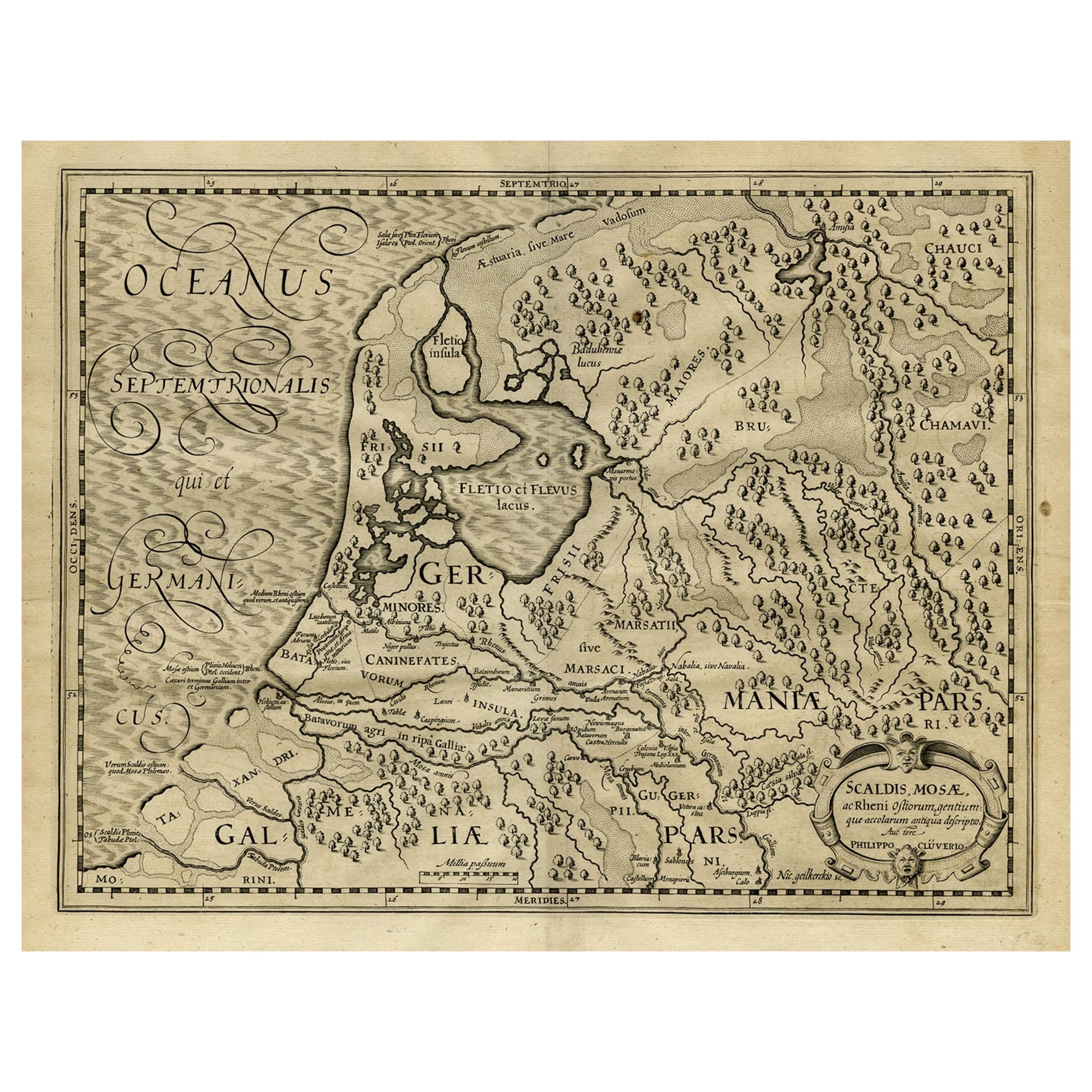
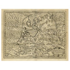
- Antique Latin Map of the Netherlands & Germany, Incl Roman Forts, Etc., 1631Located in Langweer, NLAntique map titled 'Scaldis Mosae, ac Rheni Ostiorum, gentiumque accolarum antiqua descriptio.' A Latin map of the Netherlands and Germany, showing all the major rivers as well a...Category
Antique 1630s Maps
MaterialsPaper
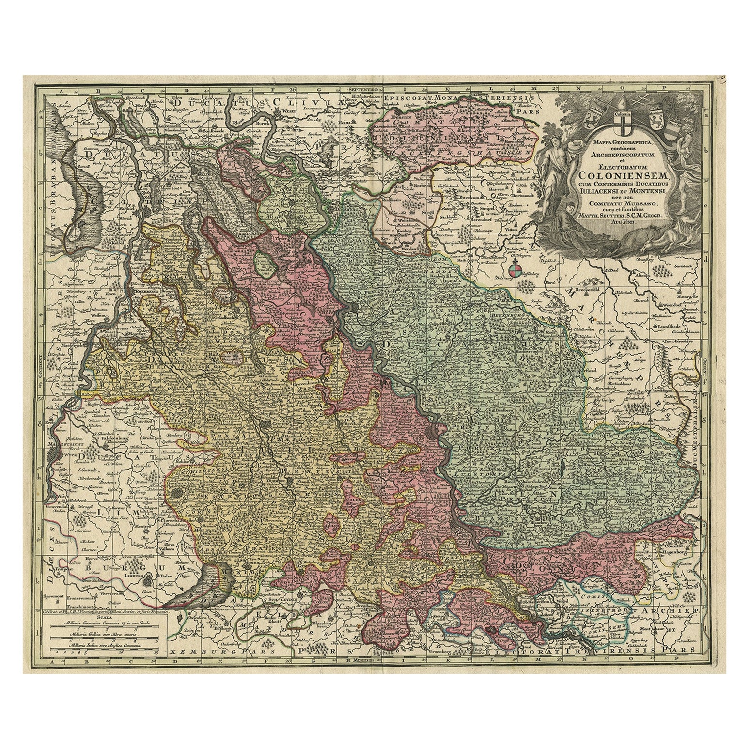
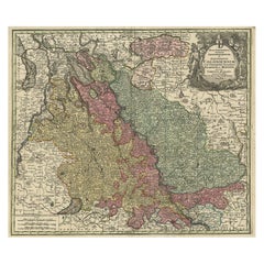
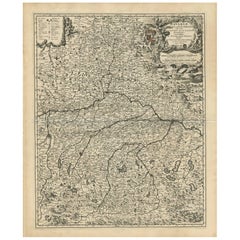
- Old Map of the Rhine & German Cities Incl Düsseldorf, Bonn, Köln, Etc., c.1730Located in Langweer, NLAntique map Germany titled 'Mappa Geographica continens Archiepiscopatum et Electoratum Coloniensem (..)'. This antique map depicts the Rhine r...Category
Antique 1730s Maps
MaterialsPaper
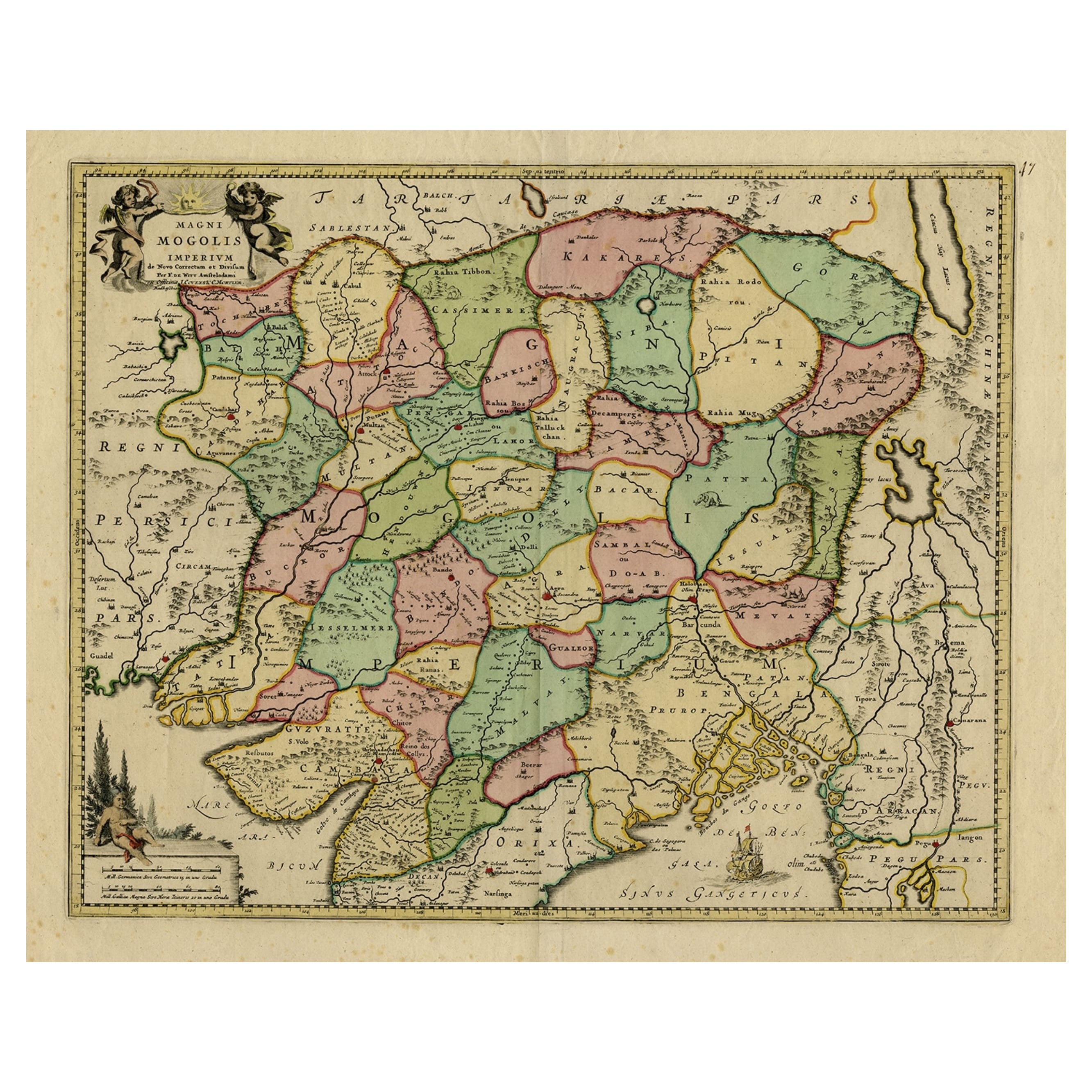
- Map of Northern India & Surrounding Regions, incl Kabul, Candahar & Bhutan, 1710Located in Langweer, NLAntique map titled 'Magni Mogolis Imperium de Novo Correctum et Divisum Per F. de Witt Amstelodami.' Map of Northern India and surrounding regions. This includes Kabul and Candah...Category
Antique 1710s Maps
MaterialsPaper
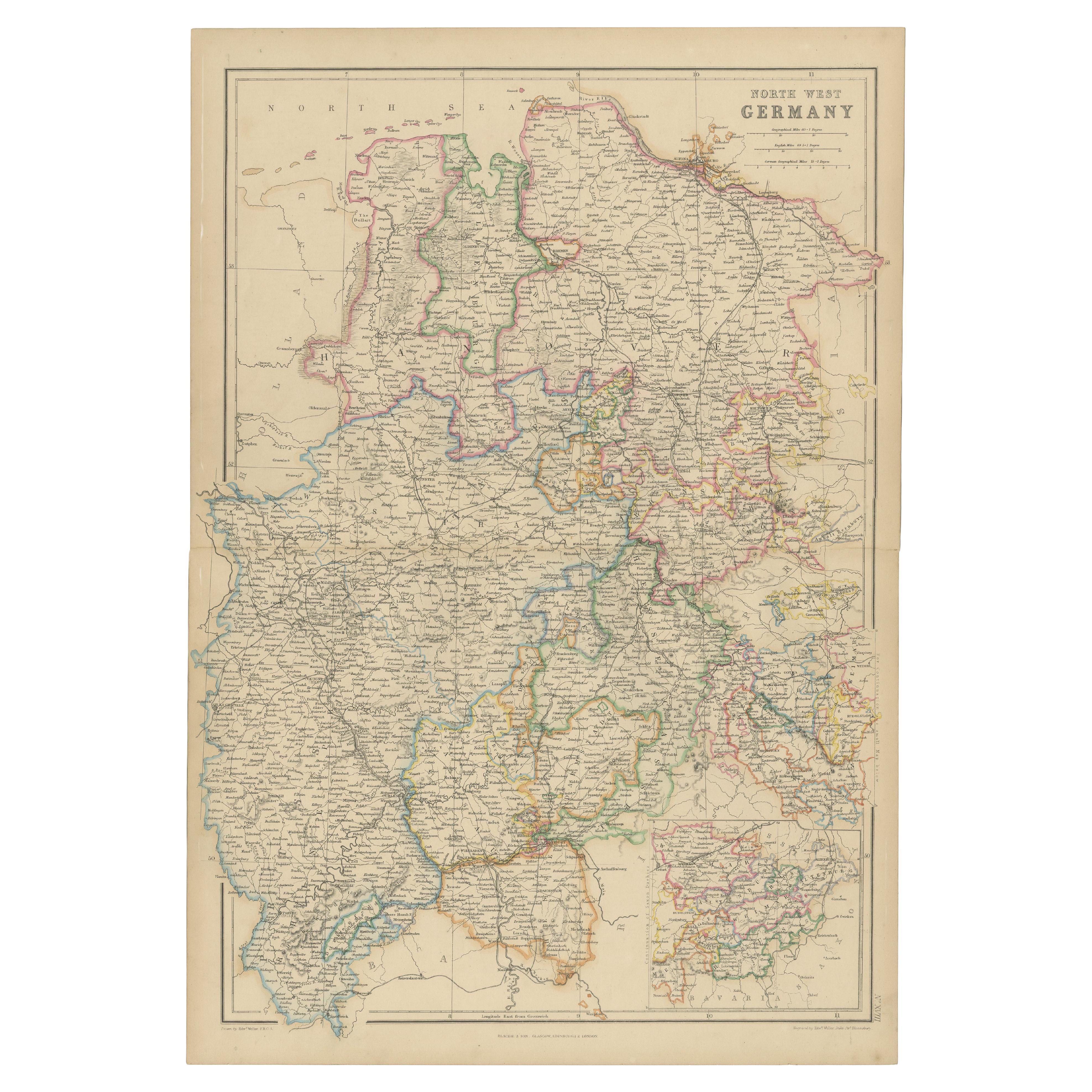
- 1859 Detailed Map of North West Germany with Bavaria Inset - Blackie's AtlasLocated in Langweer, NLThe "Antique Map of North West Germany" with an inset map of Bavaria is a distinguished piece from 'The Imperial Atlas of Modern Geography', published i...Category
Antique Mid-19th Century Maps
MaterialsPaper
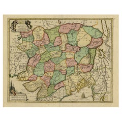
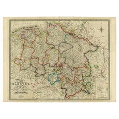
- Northern Germany incl Hanover, Oldenburg, Lippe, Bremen, Hamburg & Lubeck, 1854Located in Langweer, NLAntique map titled 'Map of the Kingdom of Hanover, with the Grand Duchy of Oldenburg, the principalities of Lippe Detmold and Schauenburg Lippe (..)'. Map of Northern Germany inc...Category
Antique 1850s Maps
MaterialsPaper
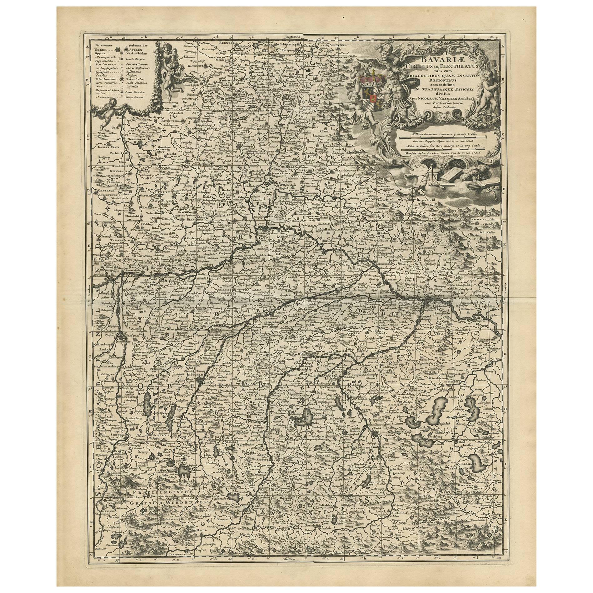
- Antique Map of Bavaria with many details, GermanyLocated in Langweer, NLAntique map titled 'Bavariae Circulus atq Electoratus tam cum Adiacentibus quam insertis Regionibus (..)'. Dutch map of Bavaria, showing the many cities, towns, and other features of...Category
Antique Late 17th Century Maps
MaterialsPaper
You May Also Like
- Prussia, Poland, N. Germany, Etc: A Hand-colored 17th Century Map by JanssoniusBy Johannes JanssoniusLocated in Alamo, CAThis is an attractive hand-colored copperplate engraved 17th century map of Prussia entitled "Prussia Accurate Descripta a Gasparo Henneberg Erlichensi", published in Amsterdam by Joannes Janssonius in 1664. This very detailed map from the golden age of Dutch cartography includes present-day Poland, Latvia, Lithuania, Estonia and portions of Germany. This highly detailed map is embellished by three ornate pink, red, mint green and gold...Category
Antique Mid-17th Century Dutch Maps
MaterialsPaper
- 17th Century Hand-Colored Map of a Region in West Germany by JanssoniusBy Johannes JanssoniusLocated in Alamo, CAThis attractive highly detailed 17th century original hand-colored map is entitled "Archiepiscopatus Maghdeburgensis et Anhaltinus Ducatus cum terris adjacentibus". It was published ...Category
Antique Mid-17th Century Dutch Maps
MaterialsPaper
- Germany West of the Rhine: A Hand-colored 18th Century Map by de WitBy Frederick de WitLocated in Alamo, CAThis original 18th century hand-colored map of the county of Moers, Germany entitled "Illustrissimo Celsissmo Principi GUILIELMO HENRICO D.G. Arausionum Principi Domino suo Clementis...Category
Antique Early 18th Century Dutch Maps
MaterialsPaper
- Original Antique Map of Belgium by Tallis, Circa 1850Located in St Annes, LancashireGreat map of Belgium Steel engraving Many lovely vignettes Published by London Printing & Publishing Co. ( Formerly Tallis ), C.1850 Origin...Category
Antique 1850s English Maps
MaterialsPaper
- Original Antique Map / City Plan of Brussels by Tallis, circa 1850Located in St Annes, LancashireGreat map of Brussels. Steel engraving. Published by London Printing & Publishing Co. (Formerly Tallis), C.1850 Free shipping.Category
Antique 1850s English Maps
MaterialsPaper
- 17th Century Hand-Colored Map of West Africa by Mercator/HondiusLocated in Alamo, CAA 17th century hand-colored map entitled "Guineae Nova Descriptio" by Gerard Mercator and Jodocus Hondius, published in their 'Atlas Minor' in Amsterdam in 1635. It is focused on the...Category
Antique Mid-17th Century Dutch Maps
MaterialsPaper


Recently Viewed
View AllMore Ways To Browse
Antique Cartography
Bavaria Antique
Alexander James
Antique Scottish Maps
Antique Map Scotland
Antique Maps Scotland
Scotland Antique Map
Antique Scotland Map
Map Edinburgh
Scottish Lord
Hanover Furniture
Antique Map Edinburgh
Antique Map Of Edinburgh
West German Antiques
Hanover Used Furniture
Antique Bavaria
Alexander Keiths
Johnston James