Items Similar to Northern Germany incl Hanover, Oldenburg, Lippe, Bremen, Hamburg & Lubeck, 1854
Want more images or videos?
Request additional images or videos from the seller
1 of 5
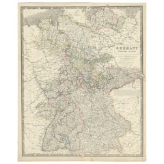
Northern Germany incl Hanover, Oldenburg, Lippe, Bremen, Hamburg & Lubeck, 1854
About the Item
Antique map titled 'Map of the Kingdom of Hanover, with the Grand Duchy of Oldenburg, the principalities of Lippe Detmold and Schauenburg Lippe (..)'.
Map of Northern Germany including Hanover, Oldenburg, Lippe, Bremen, Hamburg and Lubeck. From James Wyld's 'A New General Atlas of Modern Geography.', published by James Wyld. Geographer to Her Majesty Charing Cross East. 1854.
Artists and Engravers: Cartographer: James Wyld. James Wyld (1812-1887) was a British publisher and cartographer. His greatest geographical achievement was Wyld's Great Globe, exhibited in Leicester Square between 1851 and 1862. The globe, sixty feet high and lighted with gas, was at that point the largest ever constructed. He was geographer to Queen Victoria and H.R.H. Prince Albert.
Condition: Good, given age. Original middle fold, as issued. Contemporary hand coloring. General age-related toning and/or occasional minor defects from handling. Please study scan carefully.
- Dimensions:Height: 22.96 in (58.3 cm)Width: 29.65 in (75.3 cm)Depth: 0 in (0.02 mm)
- Materials and Techniques:
- Period:
- Date of Manufacture:1854
- Condition:
- Seller Location:Langweer, NL
- Reference Number:
About the Seller
5.0
Platinum Seller
These expertly vetted sellers are 1stDibs' most experienced sellers and are rated highest by our customers.
Established in 2009
1stDibs seller since 2017
1,916 sales on 1stDibs
Typical response time: <1 hour
- ShippingRetrieving quote...Ships From: Langweer, Netherlands
- Return PolicyA return for this item may be initiated within 14 days of delivery.
More From This SellerView All
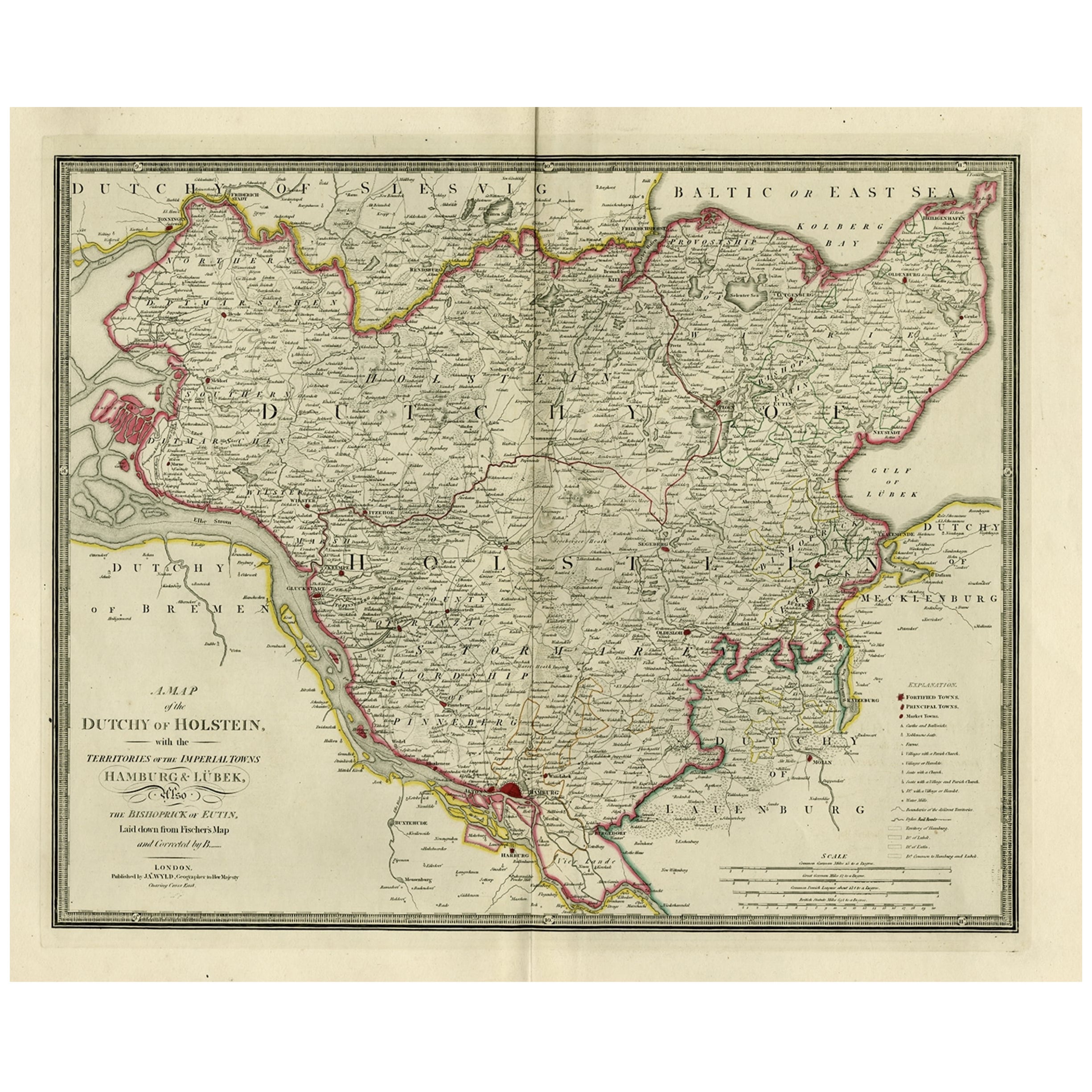
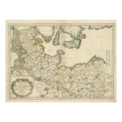
- Old Map of Holstein with the Imperial Towns Hamburg & Lubeck, Germany, 1854Located in Langweer, NLAntique map titled 'Map of the Duchy of Holstein with the territories of the Imperial Towns Hamburg & Lubeck (..) Based on a map by Fischer.' Map of the Duchy of Holstein. From Jam...Category
Antique 1850s Maps
MaterialsPaper
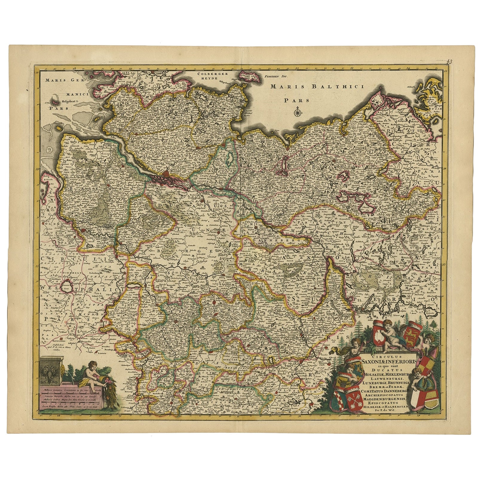
- Large Map of Germany with Berlin, Bremen, Hamburg, Osnabruck & Magdeburg, c.1680Located in Langweer, NLAntique map titled 'Circulus Saxoniae Inferioris in quo sunt Ducatus holsatiae, Meklenburg, Lauwenburgi, Luneburgi, Brunsuigi, Bremae et Ferdae (..)'. Large and detailed map fill...Category
Antique 1680s Maps
MaterialsPaper
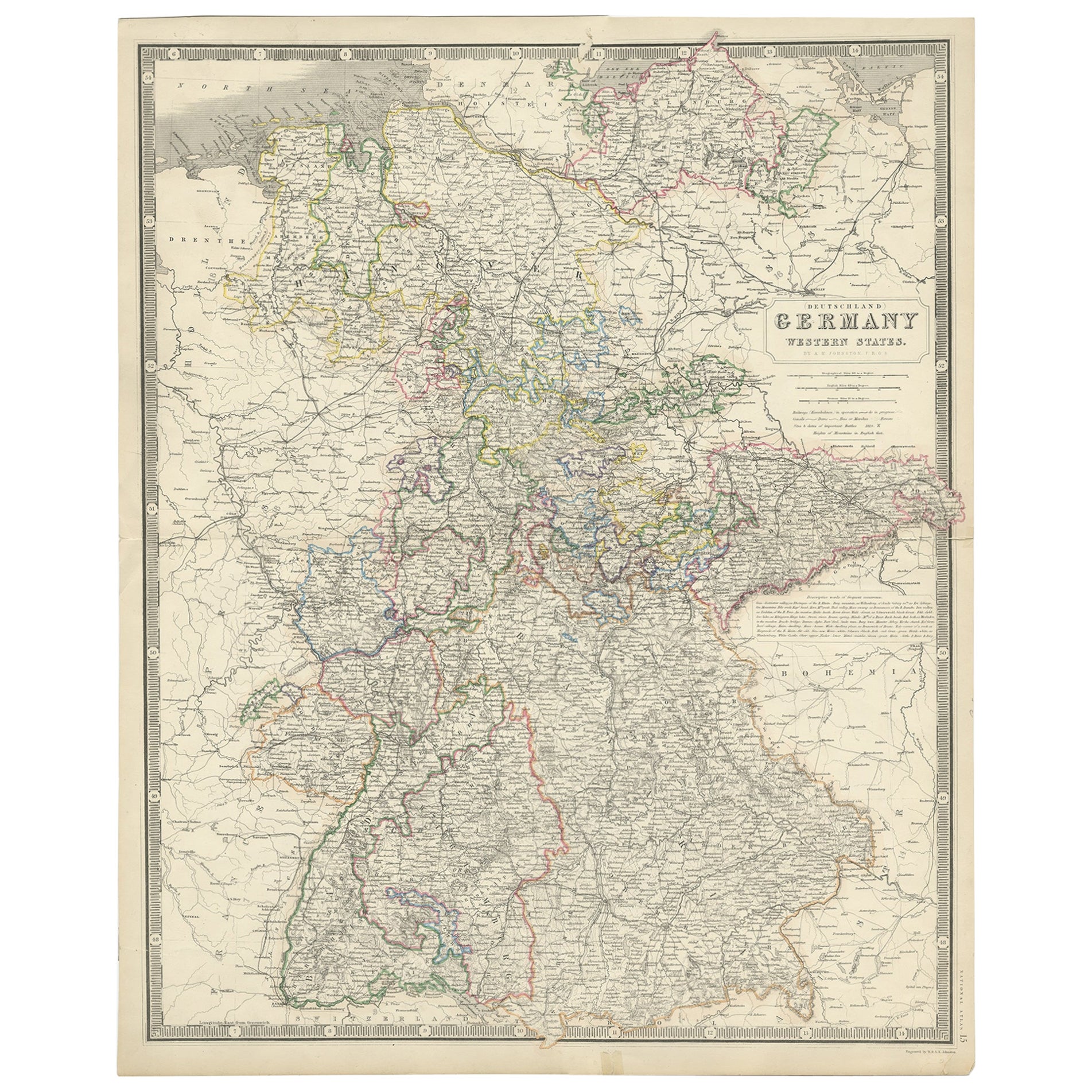
- Map of West Germany Incl Regions Wurtemberg, Bavaria, Hanover, Etc, c.1850Located in Langweer, NLAntique map titled '(Deutschland) Germany, Western States'. Map of West Germany depicting many regions including Wurtemberg, Bavaria, Hanover and others. This map originates from...Category
Antique 1850s Maps
MaterialsPaper
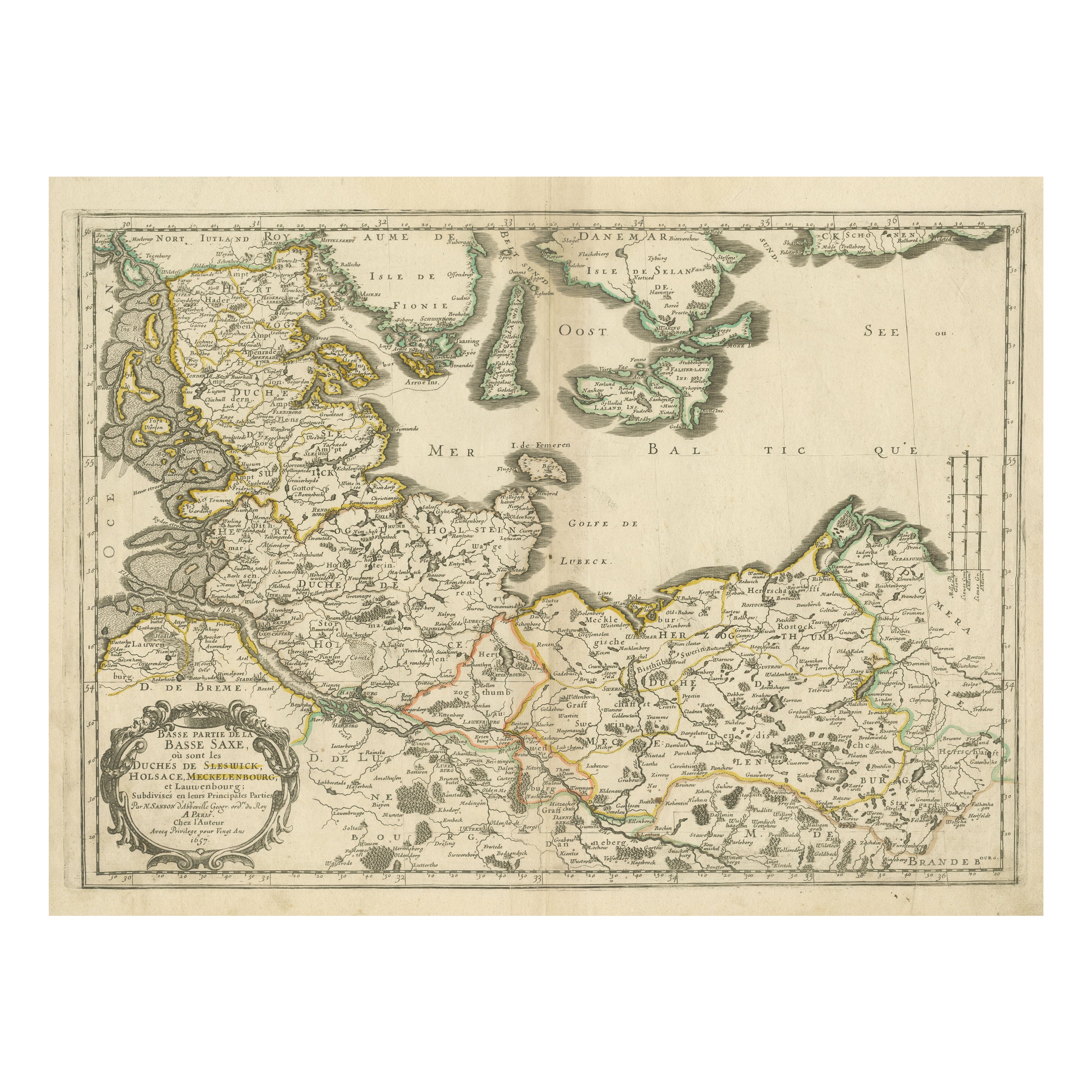
- Antique Map of Northern Germany, Including Schleswig-Holstein and HamburgLocated in Langweer, NLAntique map titled 'Basse Partie de la Basse Saxe ou sont les Duchés de Sleswick, Holsace, Meckelenbourg et Lauvenbourg (..)'. Original old map of northern Germany, including Schlesw...Category
Antique Mid-17th Century Maps
MaterialsPaper
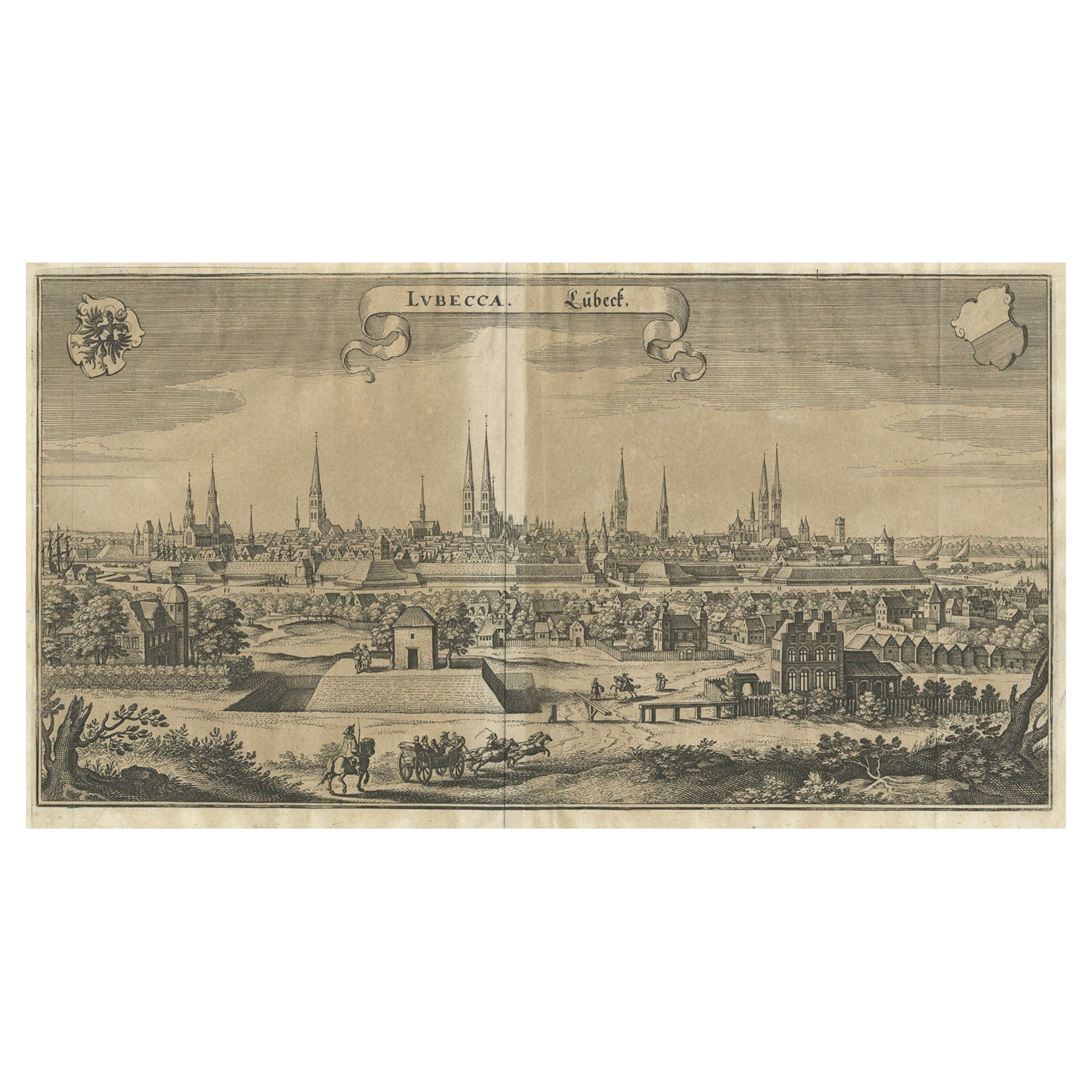
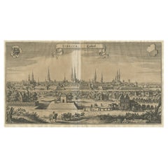
- Antique Print of Hanseatic City of Lübeck in Northern Germany by Merian, c.1650Located in Langweer, NLAntique print titled 'Lubecca, Lübeck'. A bird's eye view of Lubeck, the northern German city in Schleswig-Holstein. This print originates from 'Topographia Saxoniae Inferioris'. Ar...Category
Antique 17th Century Prints
MaterialsPaper
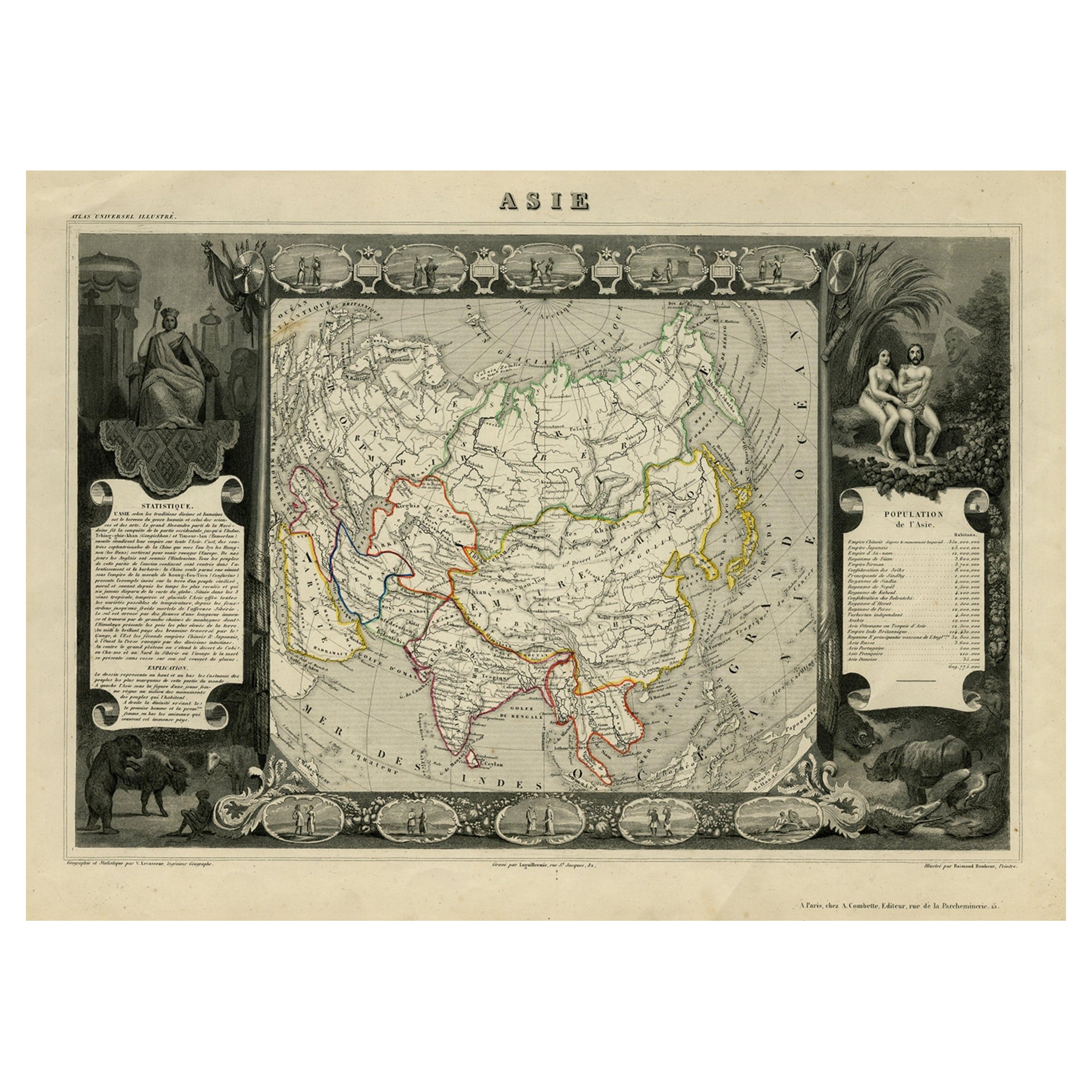
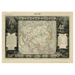
- Nicely Decorated Antique Map of Asia, incl Population Figures, 1854Located in Langweer, NLAntique map titled 'Asie'. Map of the main Asian continent. The decorated border shows various images, as well as two blocks of statistical text on the continent, including populatio...Category
Antique 19th Century Maps
MaterialsPaper
You May Also Like
- Northern Scotland: A 16th Century Hand-colored Map by MercatorBy Gerard MercatorLocated in Alamo, CAA framed hand-colored 16th century map of Northern Scotland by Gerard Mercator entitled "Scotiae pars Septentrionalis", published in Amsterdam in 1636. It is a highly detailed map of the northern part of Scotland, with the northwest Highlands and the cities Inverness and Aberdeen, as well as the Orkney Islands and the Hebrides. There is a decorative title cartouche in the upper left corner. The map is presented in an antiqued brown wood...Category
Antique 16th Century Dutch Maps
MaterialsPaper
- Northern Scotland: A 17th Century Hand-colored Map by MercatorBy Gerard MercatorLocated in Alamo, CAThis is a framed hand-colored 17th century map of Northern Scotland by Gerard Mercator entitled "Scotiae pars Septentrionalis", published in Amsterdam in 1636. It is a highly detailed map of the northern part of Scotland, with the northwest Highlands and the cities Inverness and Aberdeen, as well as the Orkney Islands and the Hebrides. There is a decorative title cartouche in the upper left corner. The map is presented in an antiqued brown wood...Category
Antique 1630s Dutch Maps
MaterialsPaper
- Prussia, Poland, N. Germany, Etc: A Hand-colored 17th Century Map by JanssoniusBy Johannes JanssoniusLocated in Alamo, CAThis is an attractive hand-colored copperplate engraved 17th century map of Prussia entitled "Prussia Accurate Descripta a Gasparo Henneberg Erlichensi", published in Amsterdam by Joannes Janssonius in 1664. This very detailed map from the golden age of Dutch cartography includes present-day Poland, Latvia, Lithuania, Estonia and portions of Germany. This highly detailed map is embellished by three ornate pink, red, mint green and gold...Category
Antique Mid-17th Century Dutch Maps
MaterialsPaper
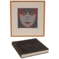
- Roger Pfund "Weight and See" Art Book and Silk Screen, Germany, 1993Located in Amsterdam, NL"Weight and See" is the monumental monograph by Swiss graphic artist Roger Pfund, printed by Teunen & Teunen in Geisenheim, Germany in 1993. Complimented by a beautiful wooden framed...Category
Late 20th Century German Mid-Century Modern Books
MaterialsWood, Paper
- 17th Century Hand-Colored Map of a Region in West Germany by JanssoniusBy Johannes JanssoniusLocated in Alamo, CAThis attractive highly detailed 17th century original hand-colored map is entitled "Archiepiscopatus Maghdeburgensis et Anhaltinus Ducatus cum terris adjacentibus". It was published ...Category
Antique Mid-17th Century Dutch Maps
MaterialsPaper
- 18th Century Hand-Colored Homann Map of Germany, Including Frankfurt and BerlinBy Johann Baptist HomannLocated in Alamo, CAAn 18th century hand-colored map entitled "Tabula Marchionatus Brandenburgici et Ducatus Pomeraniae quae sunt Pars Septentrionalis Circuli Saxoniae Superioris" by Johann Baptist Homa...Category
Antique Early 18th Century German Maps
MaterialsPaper


Recently Viewed
View AllMore Ways To Browse
Great Northern
German Furniture Hamburg
Antique Light Globes
Antique Gas Light
Antique Prince Albert
H Gasser
Victoria Cross
Great Britain Maps
Used Furniture Leicester
Antique Furniture Prince Albert
Hanover Furniture
Leicester Antique
Hanover Used Furniture
East German Light
Atlas Globe
Antique Char
Map Of Great Britain
Gas Globe