Items Similar to Antique Map of Germany and Central Europe
Want more images or videos?
Request additional images or videos from the seller
1 of 6
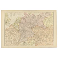
Antique Map of Germany and Central Europe
About the Item
Antique map titled 'S. Imperium Romano-Germanicum oder Teutschland mit seinen angrantzenden Königreichen und Provincien'. Original antique map of Germany covering the central part of Europe with Germany in the center and the Netherlands in west. With one cartouche containing cherubs and coat of arms. Published by N. Visscher, circa 1690.
The Visscher family were art and map dealers in Amsterdam during the 17th century. Funded by C. J. Visscher (1587-1652), the business was continued by his son and grandson both named Nicolas. Nicolas Visscher I was born 1618 in Wenns, Austria. He died 1679 in Linz. After the death of Nicolas II, his widow passed the business to Pieter Schenk.
- Dimensions:Height: 20.67 in (52.5 cm)Width: 24.22 in (61.5 cm)Depth: 0.02 in (0.5 mm)
- Materials and Techniques:
- Period:Late 17th Century
- Date of Manufacture:c.1690
- Condition:Repaired. Original/contemporary hand coloring. Original folding line, with repairs. Shows some wear and soiling. Blank verso. Please study image carefully.
- Seller Location:Langweer, NL
- Reference Number:
About the Seller
5.0
Platinum Seller
These expertly vetted sellers are 1stDibs' most experienced sellers and are rated highest by our customers.
Established in 2009
1stDibs seller since 2017
1,916 sales on 1stDibs
Typical response time: <1 hour
- ShippingRetrieving quote...Ships From: Langweer, Netherlands
- Return PolicyA return for this item may be initiated within 14 days of delivery.
More From This SellerView All
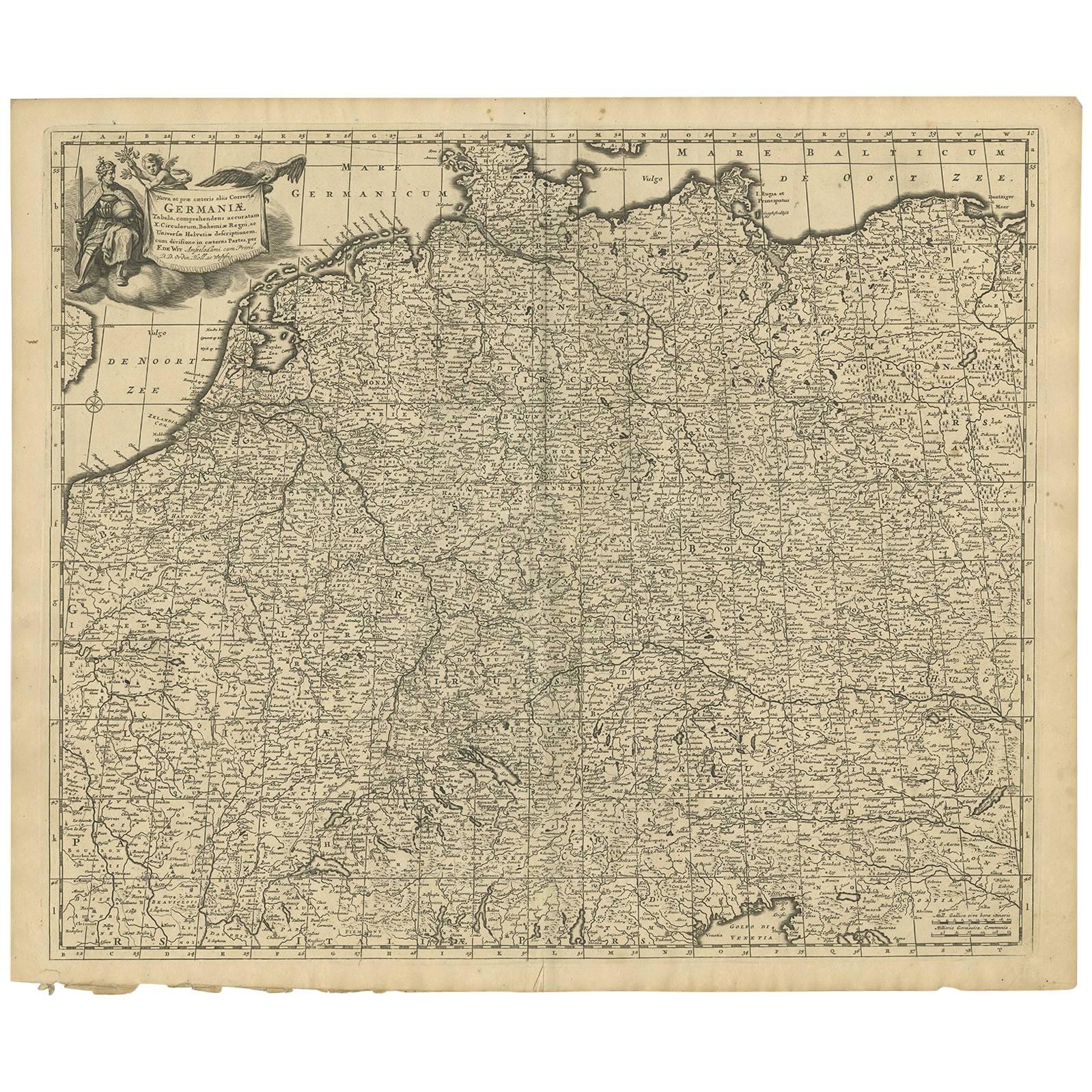
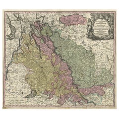
- Antique Map of Central Europe "Centered on Germany" by F. de Wit, circa 1680Located in Langweer, NLA very detailed map of central Europe, centered on Germany. It extends from Belgium and The Netherlands through Pomerania in the north, and from eastern France to Croatia in the sout...Category
Antique Late 17th Century Maps
MaterialsPaper
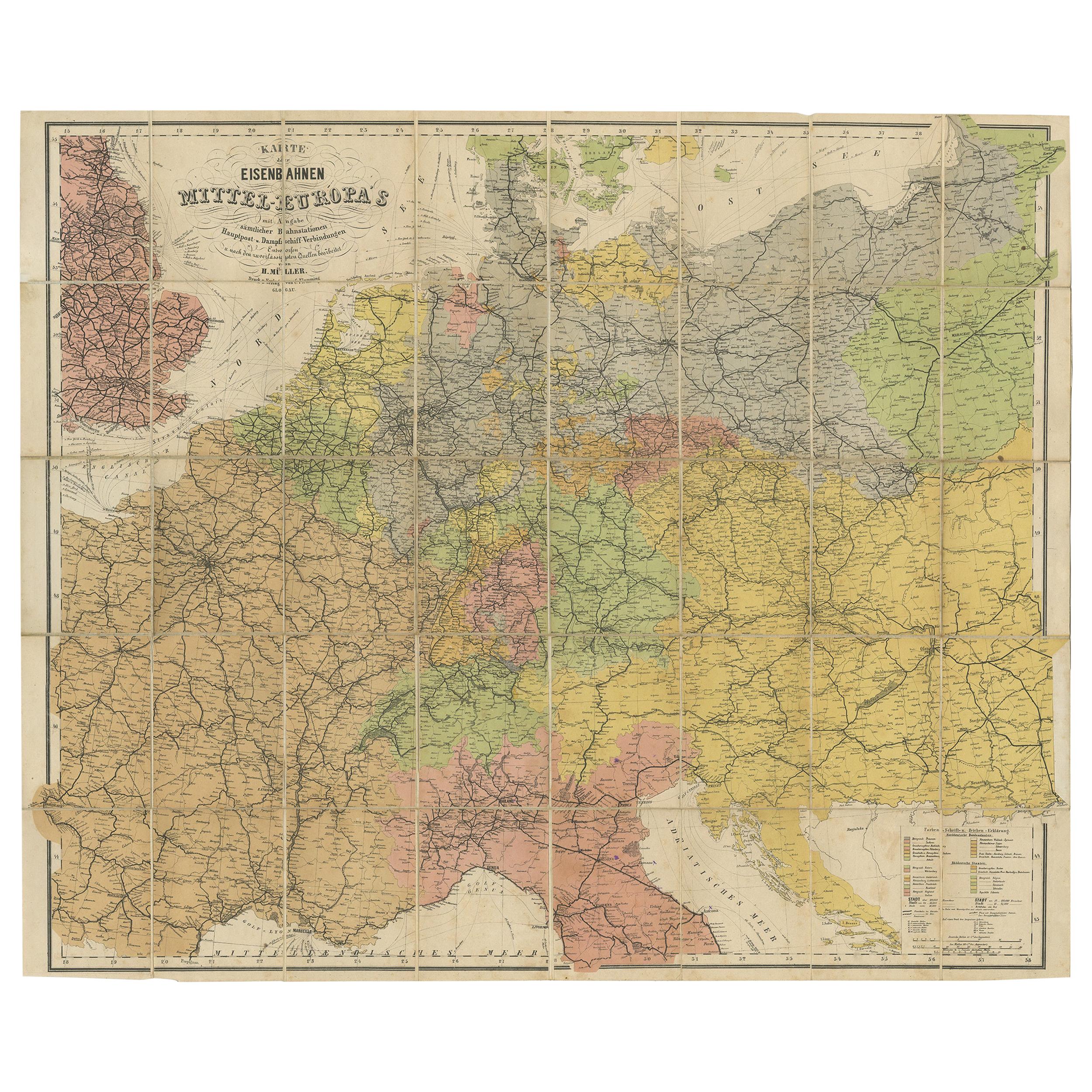
- Antique Railway Folding Map of Central Europe by Müller, 1870Located in Langweer, NLAntique map titled 'Karte der Eisenbahnen Mittel-Europa's (..)'. Railway folding map of Central Europe. Published by Carl Flemming, 1870.Category
Antique Late 19th Century Maps
MaterialsPaper
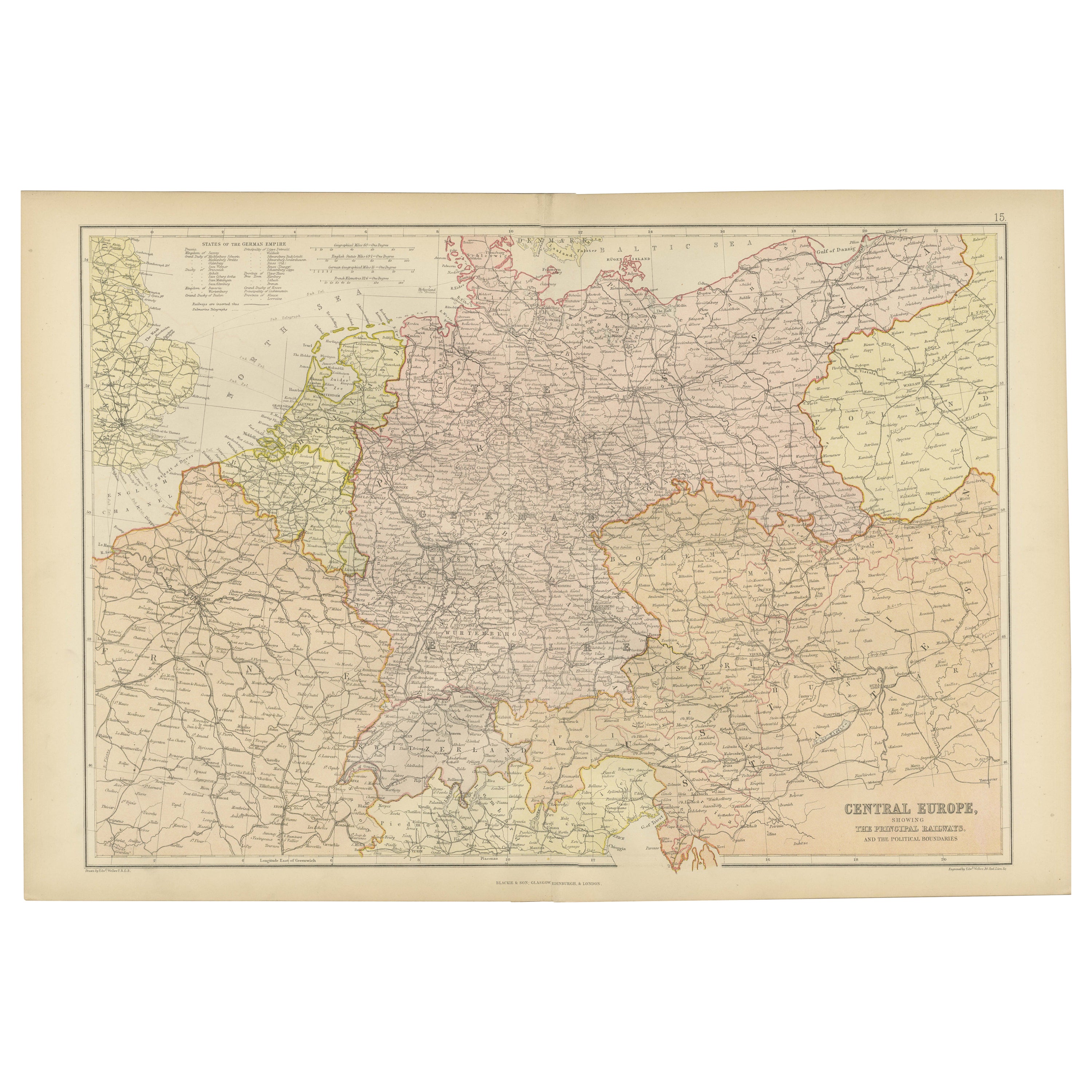
- Antique Map of Central Europe Showing The Railways and The Political BounderiesLocated in Langweer, NLExplore the Heart of Europe with the 'Central Europe' Map, Featuring Principal Railways and Political Boundaries! This map offers a captivating view of the dynamic landscapes and pol...Category
Antique 1880s Maps
MaterialsPaper
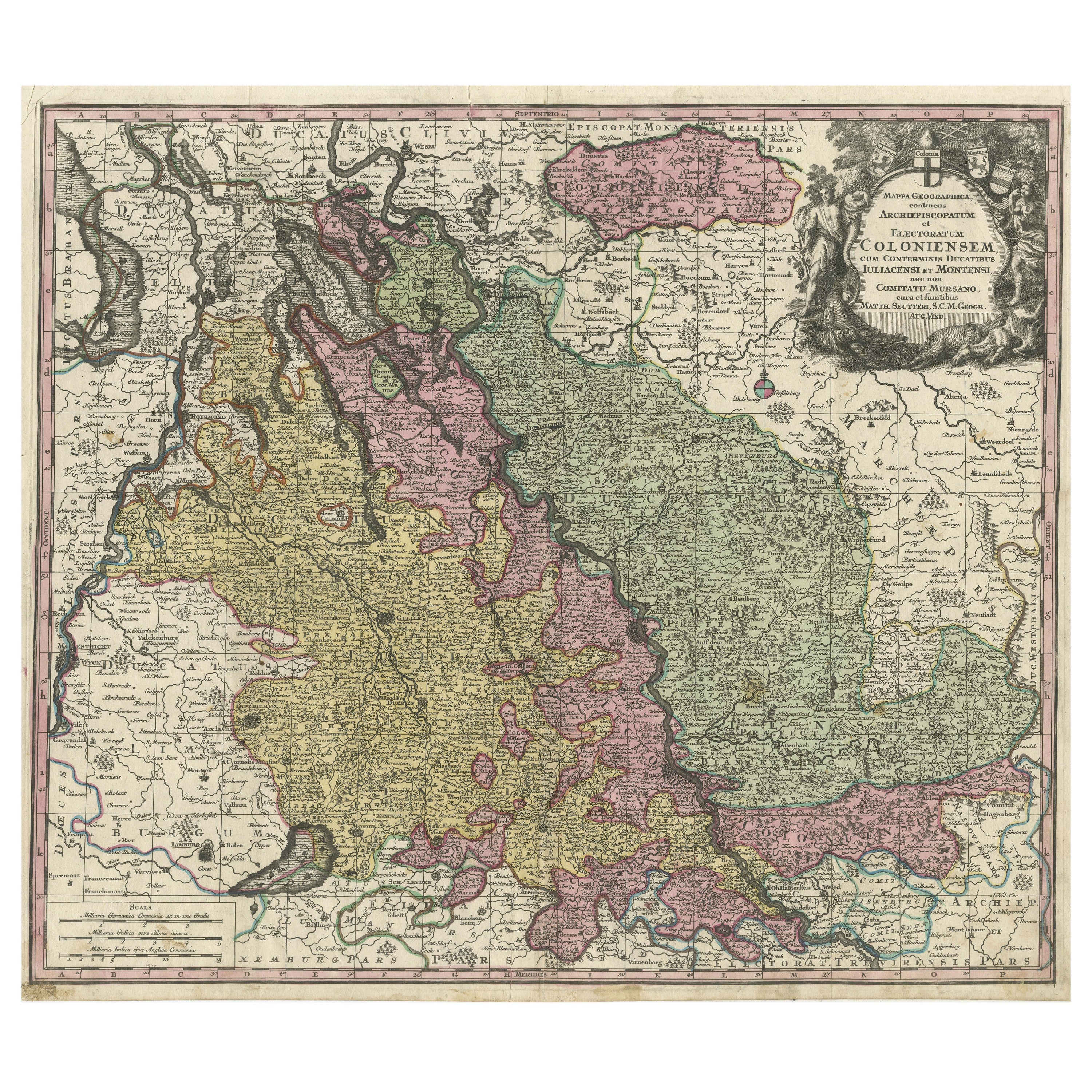
- Antique Map of both sides of the Central Rhine River, GermanyLocated in Langweer, NLAntique map titled 'Mappa Geographica continens Archiepiscopatum et Electoratum Coloniensem (..)'. Decorative map of region on either side of the Central Rhine River, showing Dusseld...Category
Antique Mid-18th Century Maps
MaterialsPaper
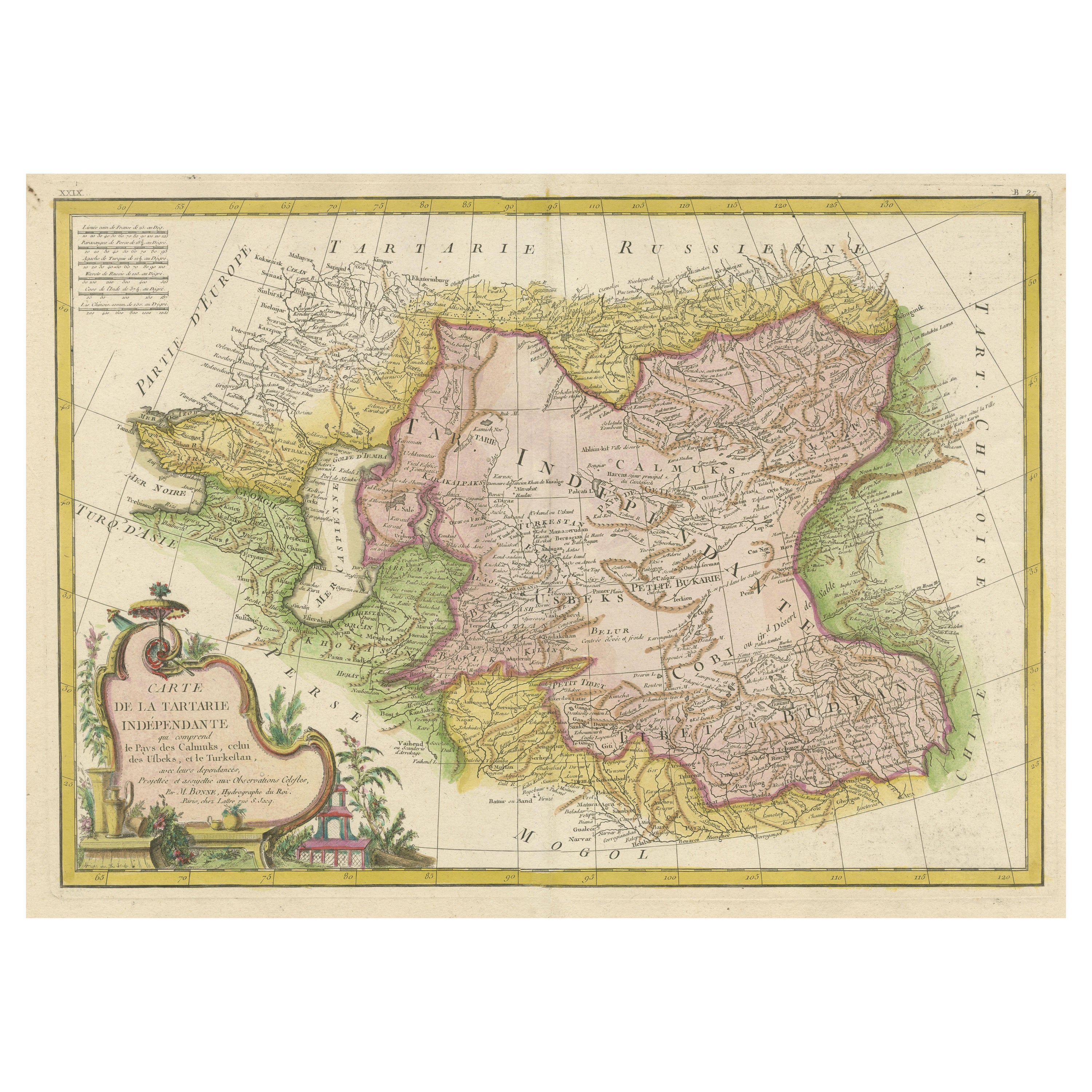
- Decorative Antique Map of Central AsiaLocated in Langweer, NLAntique map titled 'Carte de la Tartarie Indépendante (..)'. Decorative map of Central Asia (Tartary). Covers from the Black Sea south to China, north to Russia, and south to Persia ...Category
Antique Late 18th Century Maps
MaterialsPaper
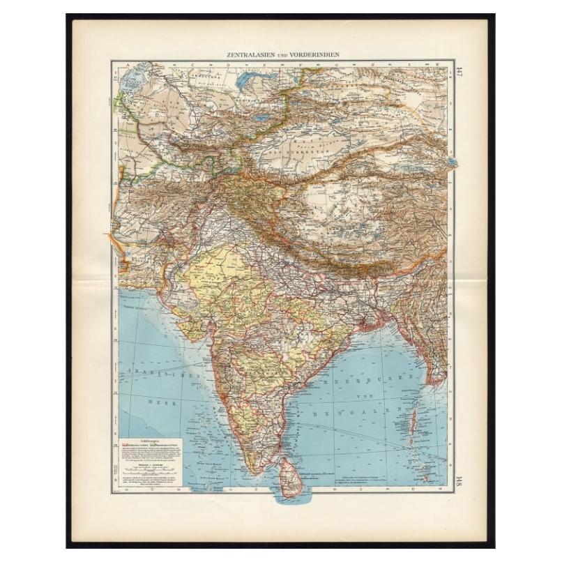
- Antique Map of Central Asia and India, 1904Located in Langweer, NLAntique map titled 'Zentralasien und Vorderindien'. Map of Central Asia and India. This large antique map is taken from; 'Andrees Allgemeiner Handatlas in 126 Haupt-Und 139 Nebenkart...Category
20th Century Maps
MaterialsPaper

You May Also Like
- Original Antique Map of Europe, Arrowsmith, 1820Located in St Annes, LancashireGreat map of Europe Drawn under the direction of Arrowsmith. Copper-plate engraving. Published by Longman, Hurst, Rees, Orme and Brown, 1820 ...Category
Antique 1820s English Maps
MaterialsPaper
- Antique Hand Colored Framed Map of EuropeLocated in West Palm Beach, FLAntique reproduction copied from an edition dated 1595 by Ortelius.Category
Antique Late 19th Century Maps
- Original Antique Map of Central America / Florida, Arrowsmith, 1820Located in St Annes, LancashireGreat map of Central America. Drawn under the direction of Arrowsmith. Copper-plate engraving. Published by Longman, Hurst, Rees, Orme and Brown, 1820 Unframed.Category
Antique 1820s English Maps
MaterialsPaper
- Antique Puzzle of Colored Cardboard Depicting World Map, Europe and FranceLocated in Milan, ITEducational puzzle of colored cardboard composed of three folders depicting world map, Europe and France. The world map in addition to the territorial map of the continents depicts t...Category
Antique 1850s French Games
MaterialsPaper
- 1899 Poole Brothers Antique Railroad Map of the Illinois Central RailroadLocated in Colorado Springs, COThis is an 1899 railroad map of the Illinois Central and Yazoo and Mississippi Valley Railroads, published by the Poole Brothers. The map focuses on the continuous United States from the Atlantic to the Pacific Oceans, the Gulf of Mexico, and the Antilles. Remarkably detailed, the rail routes of the Illinois Central RR are marked in red, which each stop labeled. Major stops are overprinted in red, bold letters, with the short rail distances to New York listed above the stop and short rail distances to New Orleans listed below the name. In addition to the Illinois Central network, numerous different rail lines are illustrated and the company running that line is noted along with many stops along each route. Sea routes from New Orleans to locations in Central America, the Caribbean, and Europe are marked and labeled with destination and distance, along with routes originating from Havana. Inset at bottom left is a map of Cuba; an inset map of Puerto Rico...Category
Antique 1890s American Maps
MaterialsPaper
- 1950s Central European Metal and Wooden ScooterLocated in High Point, NCStep back in time with this authentic 1950s Central European Metal and Wooden Scooter, a whimsical piece that captures the playful spirit of yesteryears. Its sturdy construction features a combination of robust metal and solid wood, telling the tale of a bygone era where durability met simplicity in design. The scooter boasts original painted wheels with charming patina, and a spring mechanism that speaks to the ingenuity of mid 20th-century leisure inventions. Perfect as a unique decorative item in a vintage-themed space or as a conversation piece in an eclectic collection, this scooter is a nostalgic nod to the simple joys of childhood. It stands not just as a relic of the past but as an ode to the timeless appeal of classic toys.Category
Mid-20th Century European Historical Memorabilia
MaterialsMetal


Recently Viewed
View AllMore Ways To Browse
Map Of Charlevoix
Antique Map Of Shanghai
Britton And Rey Lithograph
Map Of German
Map Of The Netherlands
Italian Maps
Antique Old World Maps
St Thomas Cross
Antique Map Copenhagen
Antique Detroit Map
Antique Map Of Detroit
Ethiopia Antique Map
Maps Balkans
Antique Maine Map
Antique Maine Maps
Antique Map Louisiana
Maps Oregon
Antique Louisiana Map