Items Similar to Antique Map of present-day North-Rhine Westphalia, Germany
Want more images or videos?
Request additional images or videos from the seller
1 of 6
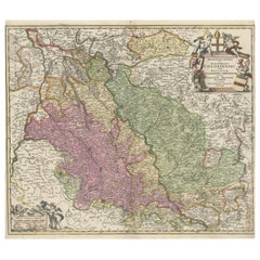
Antique Map of present-day North-Rhine Westphalia, Germany
About the Item
Antique map titled 'Nova et Accurata Ducatus Cliviae et Comitatus Marchiae (..)'. Detailed regional map of Germany showing the region bounded by the Maas River in the west and to part of Westphalia in the East. The map is centered on the Rhine region from Cologne to Arnheim, and showing Cleef, Nidwesel, Rheinbergen, Duisberg, Dusseldorf, Munster, etc. Nice decorative cartouche. Published by M. Seutter.
Matthäus Seutter (1678-1757) was a prominent German mapmaker in the mid-eighteenth century. Initially apprenticed to a brewer, he trained as an engraver under Johann Baptist Homann in Nuremburg before setting up shop in his native Augsburg. In 1727 he was granted the title Imperial Geographer. His most famous work is Atlas Novus Sive Tabulae Geographicae, published in two volumes ca. 1730, although the majority of his maps are based on earlier work by other cartographers like the Homanns, Delisles, and de Fer.
- Dimensions:Height: 21.66 in (55 cm)Width: 25.52 in (64.8 cm)Depth: 0.02 in (0.5 mm)
- Materials and Techniques:
- Period:
- Date of Manufacture:c.1750
- Condition:Repaired: Professional restorations on both bottom corners. General age-related toning. Shows some wear and soiling. Original folding line with large split, but still attached. Professional restorations on both bottom corners. Few small defects in margins. Blank verso. Please study image carefully.
- Seller Location:Langweer, NL
- Reference Number:
About the Seller
5.0
Platinum Seller
These expertly vetted sellers are 1stDibs' most experienced sellers and are rated highest by our customers.
Established in 2009
1stDibs seller since 2017
1,928 sales on 1stDibs
Typical response time: <1 hour
- ShippingRetrieving quote...Ships From: Langweer, Netherlands
- Return PolicyA return for this item may be initiated within 14 days of delivery.
More From This SellerView All
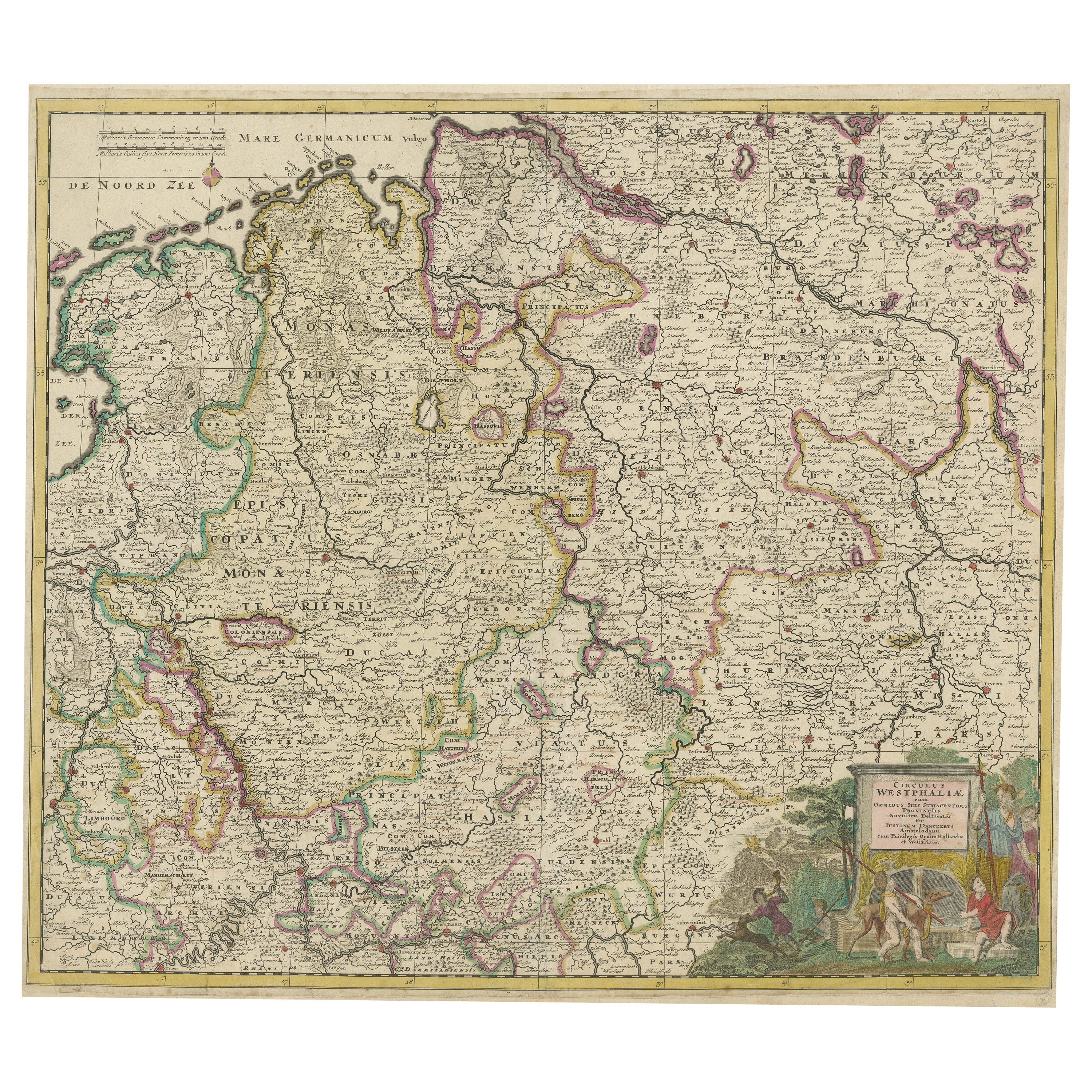
- Antique Map of the Westphalia region of GermanyLocated in Langweer, NLAntique map titled 'Circulus Westphaliae (..)'. Original old map of the Westphalia region, Germany. Published by Justus Danckerts, circa 1696. Justus Danckerts I (11 November 1635 ...Category
Antique Late 17th Century Maps
MaterialsPaper
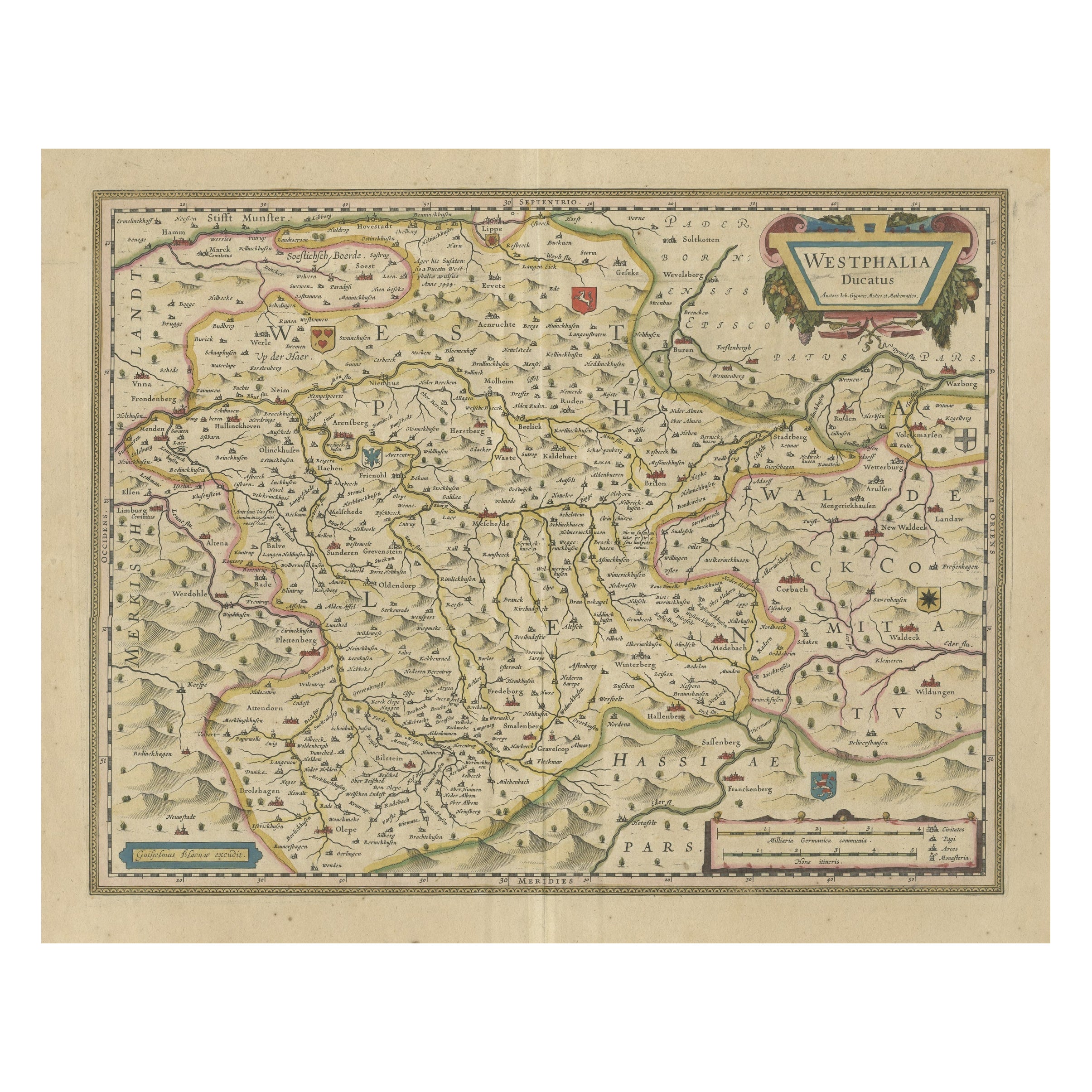
- Antique Map of the Duchy of Westphalia, GermanyLocated in Langweer, NLOriginal antique map titled 'Westphalia Ducatus'. Fine map of the Duchy of Westphalia, Germany. The map is centered on Meschede and includes Arensberg, Beelick, and Brilon. Published...Category
Antique Mid-17th Century Maps
MaterialsPaper
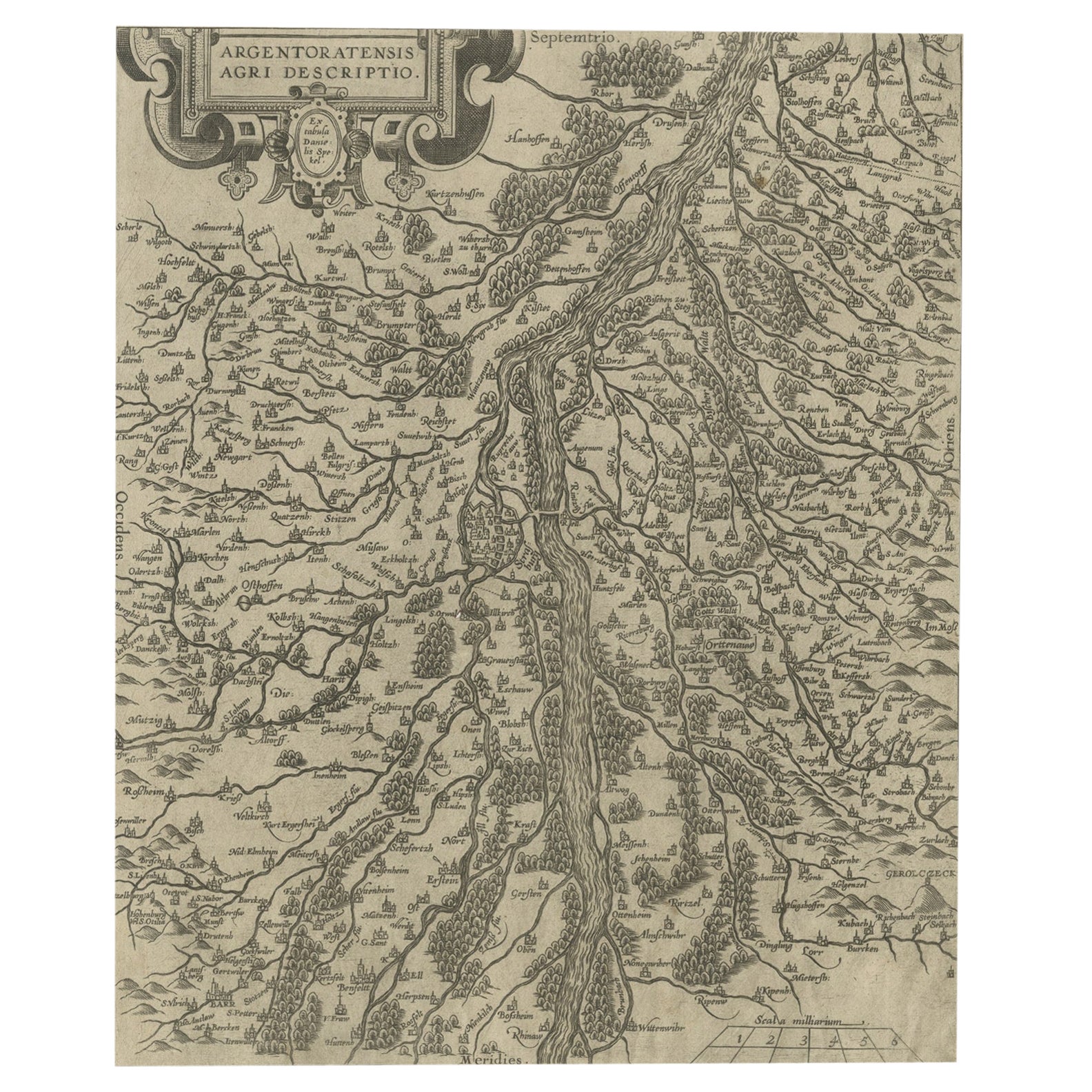
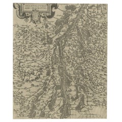
- Original Antique Map of the Rhine, South and North of Strasbourg, Germany, 1608Located in Langweer, NLAntique map titled 'Argentoratensis agri descriptio'. Original antique map of the Rhine, both south and north of Strasbourg, based on Daniel Specklin's three-sheet map of the Elz...Category
Antique Early 1600s Maps
MaterialsPaper
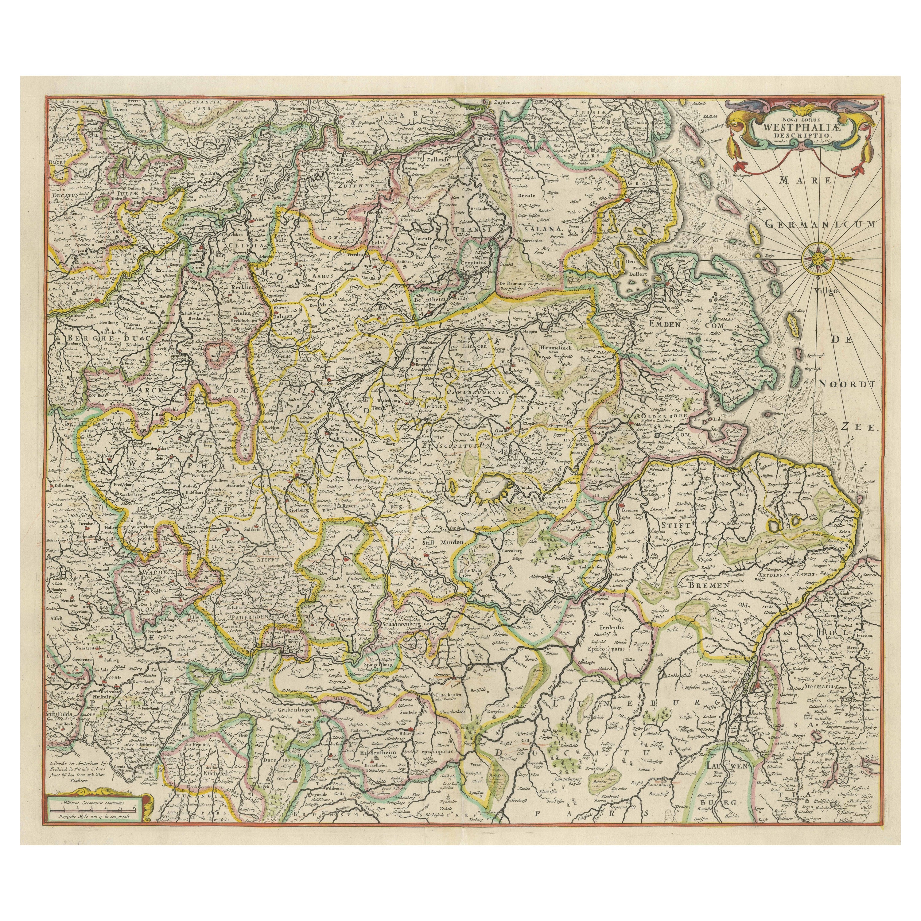
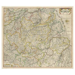
- Antique Map of Westphalia, West OrientationLocated in Langweer, NLAntique map titled 'Nova totius Westphaliae Descriptio'. Detailed map of Westphalia, Northern Germany. Oriented to the west. The area shown extends from Ha...Category
Antique Late 17th Century Maps
MaterialsPaper
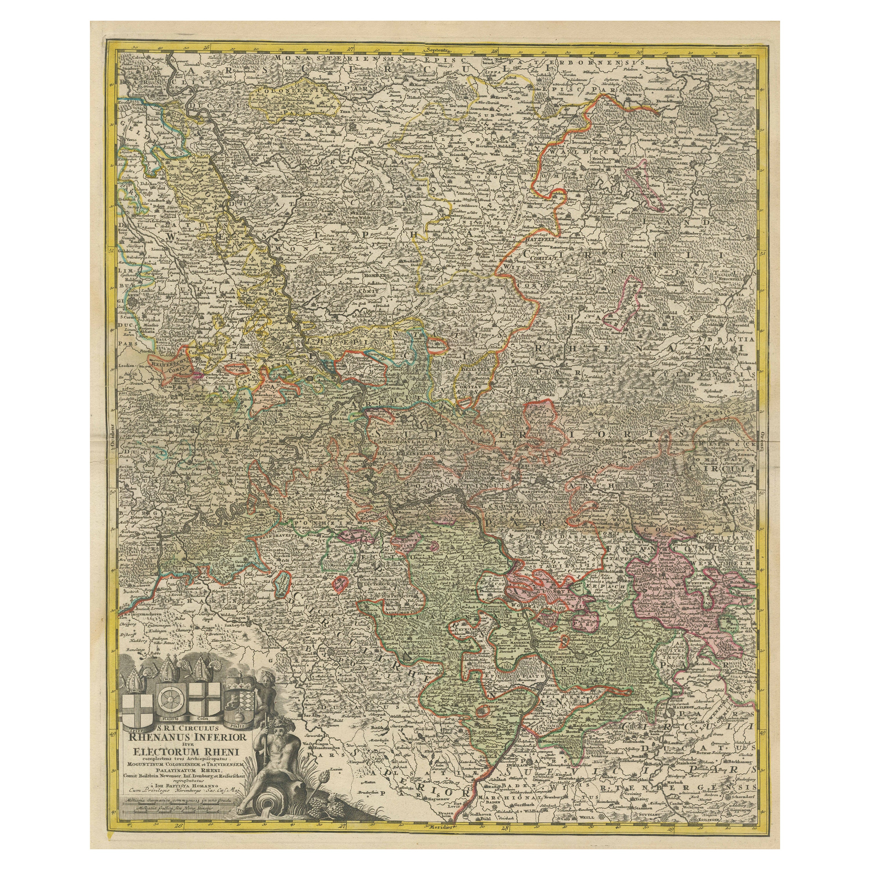
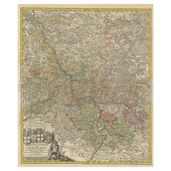
- Detailed Antique Map of the Lower Rhine region, GermanyLocated in Langweer, NLAntique map titled 'S.R.I. Circulus Rhanus Inferior sive Electorum Rheni (..)'. Detailed map of the Lower Rhine region, Germany. The title cartouche in the upper left quadrant featur...Category
Antique Mid-18th Century Maps
MaterialsPaper
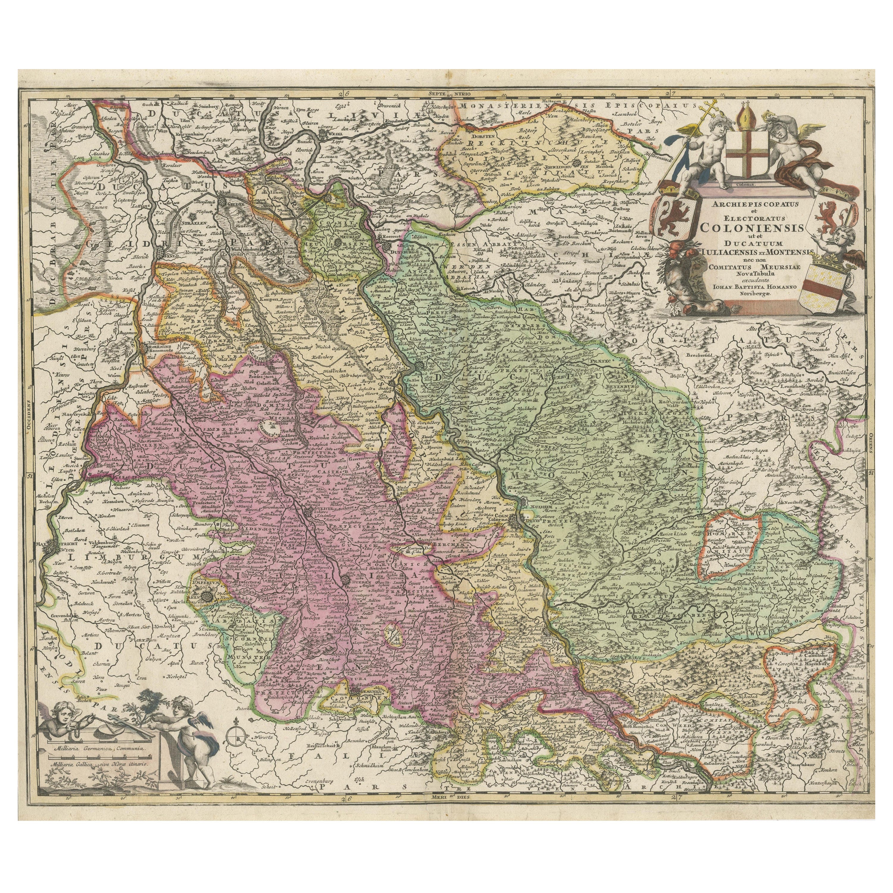
- Antique Map of the Rhine centered on Cologne, GermanyLocated in Langweer, NLAntique map titled 'Archiepsiscopatus et Electoratus Coloniensis (..)'. Original antique map of the Rhine river, centered on Cologne, Germany. The Rhine River cuts across this map fr...Category
Antique Early 18th Century Maps
MaterialsPaper
You May Also Like
- Large Antique 1859 Map of North AmericaLocated in Sag Harbor, NYThis Map was made by Augustus Mitchell in 1859 It is in amazing condition for being 163 years old. This price is for the rolled up easy to ship version of this piece. I will be Frami...Category
Antique Mid-19th Century American Maps
MaterialsCanvas, Paper

- Germany West of the Rhine: A Hand-colored 18th Century Map by de WitBy Frederick de WitLocated in Alamo, CAThis original 18th century hand-colored map of the county of Moers, Germany entitled "Illustrissimo Celsissmo Principi GUILIELMO HENRICO D.G. Arausionum Principi Domino suo Clementis...Category
Antique Early 18th Century Dutch Maps
MaterialsPaper
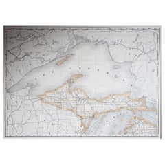
- Large Original Antique Map of Michigan 'North', USA, 1894By Rand McNally & Co.Located in St Annes, LancashireFabulous map of Michigan North. Original color. By Rand, McNally & Co. Published, 1894. Unframed. Free shipping.Category
Antique 1890s American Maps
MaterialsPaper
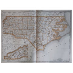
- Large Original Antique Map of North Carolina, USA, 1894By Rand McNally & Co.Located in St Annes, LancashireFabulous map of North Carolina Original color By Rand, McNally & Co. Published, 1894 Unframed Free shipping.Category
Antique 1890s American Maps
MaterialsPaper
- 1864 Map of North America, Antique Hand-Colored Map, by Adolphe Hippolyte DufourLocated in Colorado Springs, COOffered is a map of North America entitled Amerique du Nord from 1864. This rare, separately published wall map was produced by Adolphe Hippolyte Dufour. This map includes vibrant an...Category
Antique 1860s French Maps
MaterialsPaper
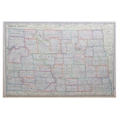
- Large Original Antique Map of North Dakota, USA, circa 1900Located in St Annes, LancashireFabulous map of North Dakota Original color Engraved and printed by the George F. Cram Company, Indianapolis. Published, circa 1900 Unframed Free shi...Category
Antique 1890s American Maps
MaterialsPaper


Recently Viewed
View AllMore Ways To Browse
Atlas Indu
Staffordshire Antique Map
Staffordshire Map
Antique Furniture Manitoba
Yugoslavia Map
Antique Maps Surrey
Antique Maps Of Puerto Rico
Cheshire Antique Map
Auge En Pierre
Montreal Map
Aigue Marine
Antique Furniture Perth Australia
Antique Maps Perth
Antique Route 66
Moldova Antique Map
Barbados Map
H Chatelain 1719
Nova Hollandia